
The best small hill towns inside a national park in Abruzzo
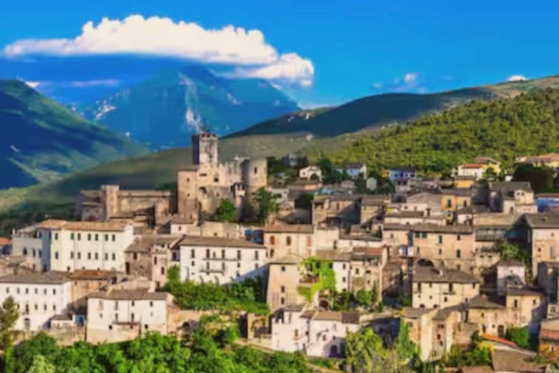
Abruzzo builds upwards. Villages of grey and honey limestone sit on spurs above valleys of oak and beech, with the Gran Sasso and the Maiella behind them holding snow into late spring. The food follows the altitude: lamb grilled over embers, pecorino from flocks still moved between pastures, saffron from the Navelli plain, and dried pasta made in valleys where the water and the mountain air have shaped the trade for generations. Autumn brings truffles, chestnuts and mushrooms to the roadside stalls, and by winter the higher hamlets go quiet and woodsmoke settles between the houses. Much of this region lies inside protected land, so the wolf, the chamois and the Marsican brown bear share the map with the vineyards.
Most visitors to Abruzzo's parks head straight for Pescasseroli and the valley of the Sangro in the Parco Nazionale d'Abruzzo, Lazio e Molise, or up to Campo Imperatore for the plateau photograph and the cable car. Both deserve their reputation. Both also fill in August and at every winter weekend, when the car parks overflow and the trailheads take on the character of a bus station. The bear-watching circuit around the Sangro is now a fixture of Italian nature tourism, which is good for the bears and less good for the silence.
The parks are large, and the same limestone, the same lamb and the same footpaths carry on well past the places with the queues. On the northern flanks of the Gran Sasso and along the eastern gorges of the Maiella, small hill towns sit inside park boundaries with a bar, a Romanesque church and a road that stops climbing at the last house. Fewer people go, and the walking starts at the edge of the village rather than an hour's drive away. These are the ones worth the detour.
Of the 73 communes we have mapped in Abruzzo, 14 qualify as hill towns inside a national park: each is an inland hill settlement, and each sits inside a national park. This list is the small ones, 10 in all, ordered smallest first. The smallest, Ofena, has 420 residents.
Two more lists worth reading alongside this one: The prettiest small villages inside a national park in Abruzzo and The best hill towns in the province of L'Aquila.
Why visit Ofena
Ofena lies fifty kilometers inland from Pescara, in a basin closed to the south by the Gran Sasso wall. The Vestini, an Italic people, held their city of Aufinum here before Rome, and the basin sat on the Via Claudia Nova.
Archaeological remains from that period include large buildings, mosaics and tombs. The walled medieval village grew inside the same basin, its streets, baronial palazzo and eighteenth-century Palazzo Cataldi Madonna set against the older ground of the earlier settlement beneath them.
The heat that the wall traps against the basin floor, the same heat that gave the place its name, is what has kept vines on these slopes since among the earliest recorded plantings of the region's grape, and it is what still draws a wine estate to work the amphitheater at the foot of the glacier above the town. Basin, wall, and vine slope are one and the same geography, read three different ways.
What to see in Ofena
- Centro storico. Compact walled medieval village inside its original perimeter, with the baronial palazzo at the centre and late medieval houses along narrow stone streets. Home today to the 420 remaining residents.
- Chiesa di San Nicola di Bari. Parish church in the centro storico, the religious anchor of the medieval settlement, rebuilt over several centuries.
- Convento di San Francesco. Franciscan convent at the edge of the village, with the Monastero dei Cappuccini further out, both marking the early modern religious life of the basin.
How to get to Ofena
Pescara is roughly 60 minutes away by road.
Our tip
April through October is the working window for the vineyards, but the Forno's heat makes July and August punishing in the basin itself. May, June, September and October are the comfortable months, with the Gran Sasso wall snow-tipped against the green slopes below. Harvest runs late September into October and brings the small population back into the streets.
Why visit Roccacasale
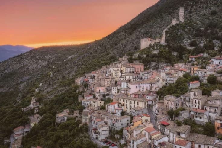
Roccacasale sits at 450 meters, overlooking the Peligna valley and the town of Sulmona below. The settlement coalesced as a defensive borgo on the slopes directly under a rocca built before the year 1000 to guard the entrance to the Sangro valley and the Cinquemiglia plain against Saracen and Byzantine raids.
In 1318 part of the territory passed to Giacomo Cantelmo. The Cantelmo family held the castle through the Renaissance, then in the late sixteenth century it passed to the barons whose name it still carries.
In 1803, in the wake of the Napoleonic wars, the French army destroyed it. The terraced houses of the borgo and the hilltop ruin above them still trace that original relationship, defended village below, stronghold above, unchanged in plan since the medieval period.
The commune lies inside the Maiella National Park, its territory reaching from the valley floor up the ridge toward hermitage sites once occupied by a hermit pope. What remains is a settlement whose whole layout, from the walled church to the terraces to the shattered walls on the hill, still reads as a single defensive idea built to watch two valleys at once.
What to see in Roccacasale
- Castello De Sanctis. Ruins standing directly above the borgo, reachable by the path climbing from the terraced houses to the hilltop where the walls still crown the slope.
- Chiesa di Sant'Michele Arcangelo. Parish church inside the ancient walls, consecrated 1579, with a baroque interior restored in the nineteenth century.
- Borgo medievale. Stone houses arranged on terraces directly below the ruined castle, original medieval plan preserved.
How to get to Roccacasale
There is a railway station in the town, so you can arrive without a car and never need one while you are here. Pescara is roughly 52 minutes away by road.
Our tip
April through June and September through October are the best windows. The Morrone trails open in late spring and the slopes above the village hold wildflowers through June. October brings the Peligna valley harvest and clear light on the castle ruins.
Why visit Capestrano
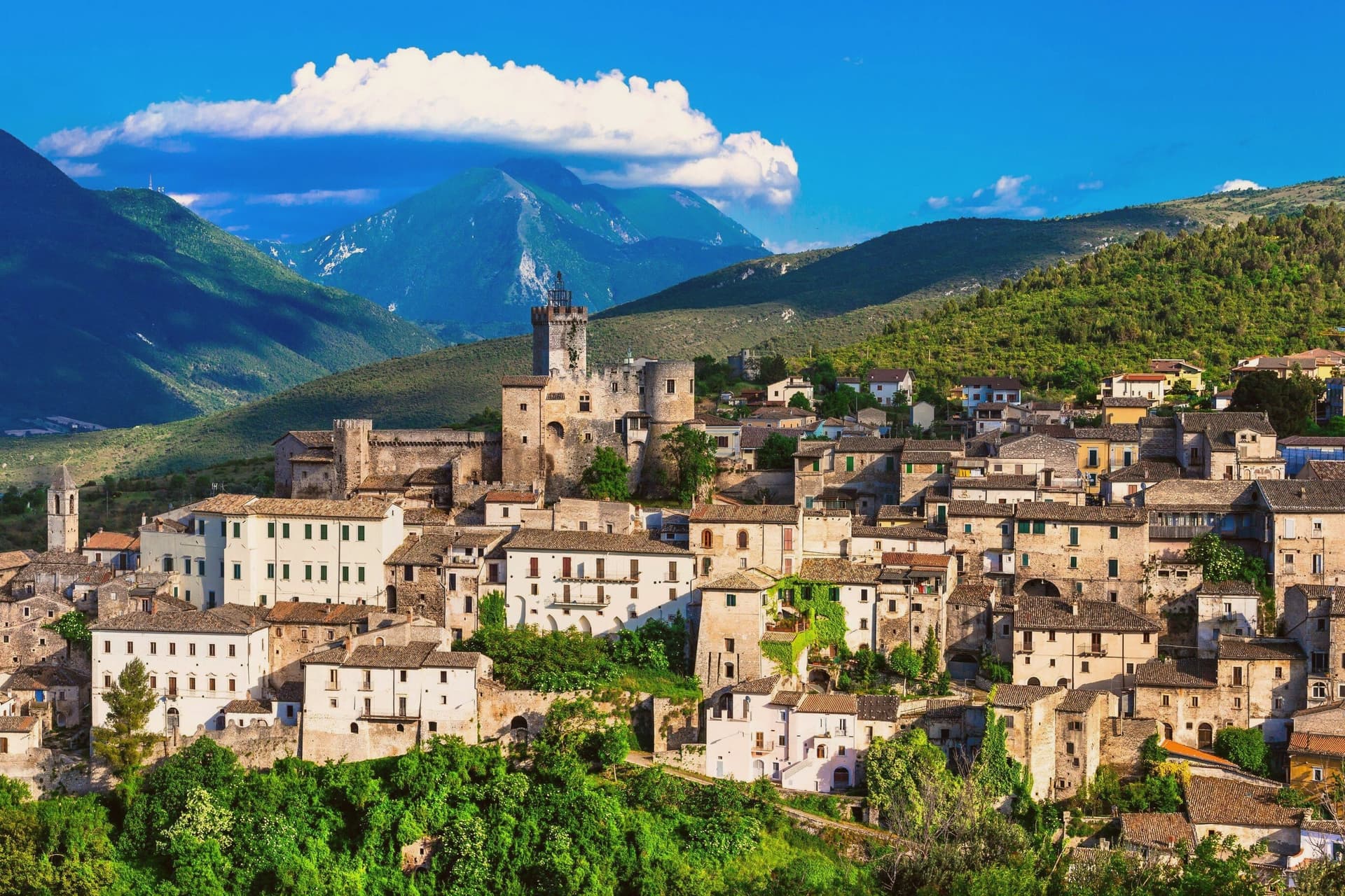
Capestrano sits at 465 meters on a hill above the Tirino river valley, eight hundred residents inside the borders of the Gran Sasso National Park. In September 1934 a farmer working a field at nearby Cinturelli unearthed a 2.1-meter limestone statue of a helmeted warrior, now identified as a 6th-century BC depiction of an early Italic king of the Vestini tribe, sculpted by Aninis.
The Warrior of Capestrano was moved to the National Archaeological Museum of the Abruzzi in Chieti, and the discovery triggered excavations that produced thirty-three tombs and a companion piece known as the Lady of Capestrano. The town itself is dominated by the Castello Piccolomini, built in the 13th century by the Medici and later passed to the Piccolomini family.
Below the town, the springs of the Tirino feed one of the cleanest short rivers in Italy. The Abbey of San Pietro ad Oratorium stands four kilometers away, a 9th-century foundation rebuilt by the Lombards.
What to see in Capestrano
- Castello Piccolomini. 13th-century castle on the hill next to the Tirino river, later owned by the Medici and the Piccolomini families.
- Abbazia di San Pietro ad Oratorium. Lombard-era abbey four kilometers from town, founded in the 8th century and rebuilt with characteristic stone masonry.
- Sito di Cinturelli. Field where the Warrior of Capestrano was unearthed in 1934, alongside thirty-three Italic tombs and the Lady of Capestrano statue.
How to get to Capestrano
Pescara is roughly 50 minutes away by road.
Our tip
April through June is the green season in Capestrano, when the Tirino runs fast and the almond trees in the valley flower early. September and October are dry and gold, the months for walking the abbey ruins and the field at Cinturelli where the Warrior was found. July and August are hot in the valley below 500 meters, though the town itself stays cooler than Pescara on the coast.
Why visit Pretoro
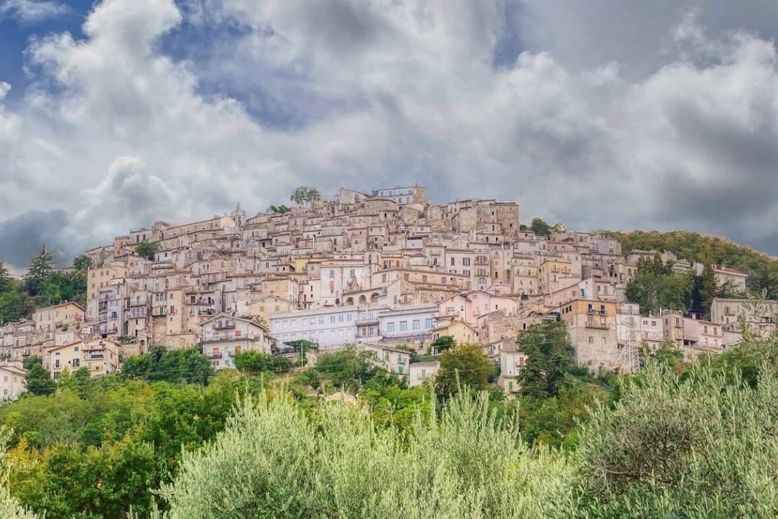
The Maiella is the limestone massif that dominates Chieti province, and Pretoro holds its eastern flank, the houses tiered in narrow stone rows up the hillside rather than spread along it. The village sits inside the Maiella National Park itself, so the wolf enclosure above town and the trails west toward the Blockhaus and Maielletta refuge are not add-ons to the place but part of its ground.
Beech forest covers the slopes above the houses, and that forest is the reason both the timber trade and the wolves ended up here: the trees fed generations of lathe and spindle work on the street below, and the same cover, higher up, gave the wildlife area a place to keep rescued animals in something like their own terrain. The patronal festival draws the two threads together, since its wolf story is acted out in the same streets where the workshops still stand.
What the village amounts to is a single hillside where a forest economy and a forest predator have been worked into daily and annual life rather than kept apart.
What to see in Pretoro
- Centro storico. Steep medieval village stacked on the hillside, narrow lanes between stone houses, listed among the Borghi più belli d'Italia.
- Area Faunistica del Lupo Appenninico. Enclosure at 750 meters above town, three hectares of beech, hosts up to six rescued Apennine wolves behind fencing.
- Chiesa di San Nicola di Bari. Parish church dating to the late Middle Ages, restored in the eighteenth century, holds the statue of San Domenico used in Lu Lope.
How to get to Pretoro
Pescara is roughly 49 minutes away by road.
Our tip
April through October is the season for Pretoro. The wolf enclosure stays open all year but is most accessible from spring to autumn, when trails into the upper Maiella connect from the village. The first Sunday of May brings Lu Lope and the largest crowd.
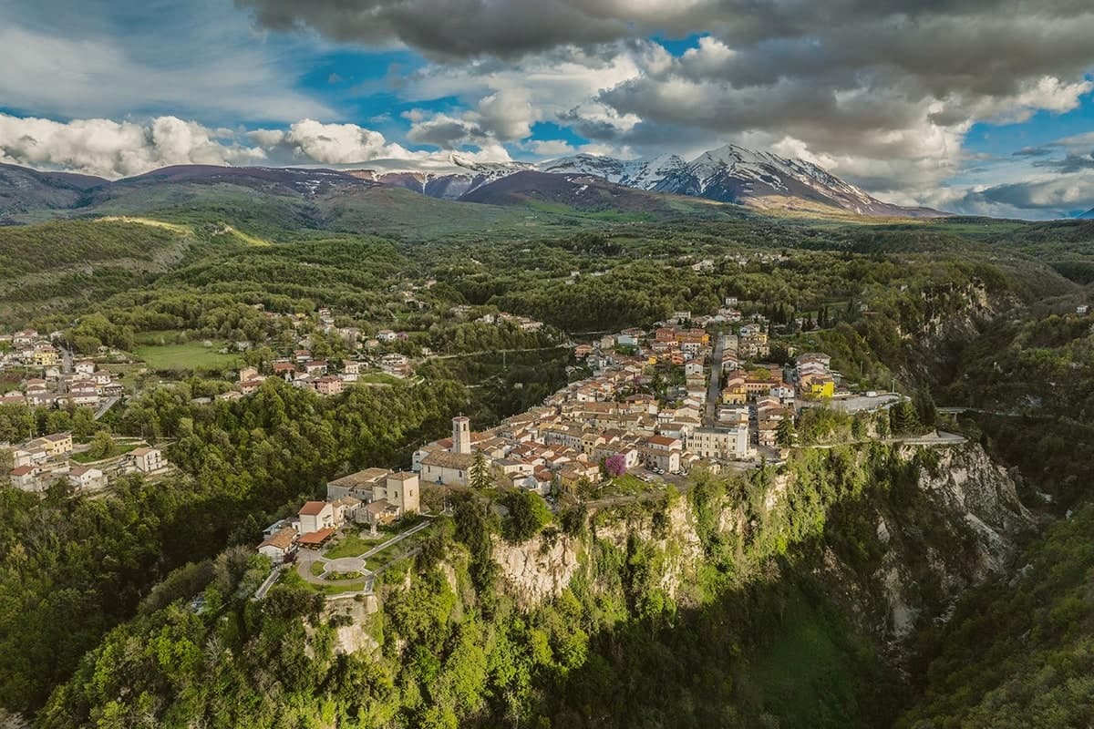
Why visit Roccamorice
Roccamorice sits at 520 meters on the western flank of the Majella massif, inside the boundaries of the national park. The village was founded around the year 1000 and stayed small, its fortunes shaped less by the settlement itself than by the limestone around it, where the rock has been hollowed into retreats since before the 11th century.
A hermit spent two years in one of them before his election as Pope, and the larger of the two hermitages, cut partly into a cliff face, was another of his retreats during the same years on the Majella. The trails to both hermitages start in the village, so the town functions as the low point from which the mountain is entered rather than a destination in itself.
That relation is repeated every August 25, when a statue is carried down from the rock to the parish church and, presumably, back again: the village receives what the mountain holds. The abdication that followed, an event Dante placed in his Inferno, is the one moment when a hermit's retreat from the world became a subject of it.
What to see in Roccamorice
- Eremo di San Bartolomeo in Legio. Pre-11th-century rock-cut hermitage at 700 meters under a 50-meter cliff, restored in 1250 by the future Pope Celestine V.
- Eremo di Santo Spirito a Majella. Larger hermitage partly cut into the limestone, reached by the same trails that climb from the village into the massif.
- Chiesa di Sant'Antonio Abate. Parish church of the village, end point of the August 25 procession carrying the statue of the hermitage's patron saint down from the rock.
How to get to Roccamorice
Pescara is roughly 60 minutes away by road.
Our tip
April through June and September through October are the months for the hermitage trails, when the limestone is dry and the upper Majella is accessible. July and August can be hot below 800 meters, though the higher hermitages stay cool in the rock. The August 25 procession of San Bartolomeo from the hermitage to the parish church is the village's main gathering.
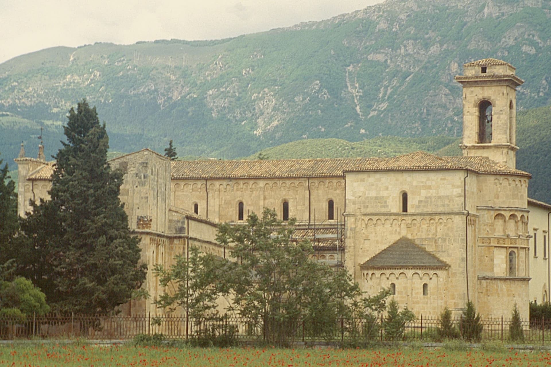
Why visit Corfinio
Corfinio is a village of fewer than a thousand people on the floor of the Peligna valley at 346 meters, surrounded by the Maiella to the east and the Morrone to the north. Underneath it lies Corfinium, the city the Italic socii chose in 91 BC as the capital of their revolt against Rome.
They renamed it Italica, struck silver coins with the legend ITALIA, built a new forum, and were defeated within four years. The Romans demoted the place; the bishopric of Valva eventually replaced it in the Middle Ages.
What remains above ground is the Basilica Valvense di San Pelino, an eleventh-century Romanesque church just outside the present village, with a separate twelfth-century oratory of Sant'Alessandro built on the cemetery where Pelino was martyred in the fourth century. The archaeological museum holds the coins and the inscriptions.
Corfinio sits inside the Maiella National Park.
What to see in Corfinio
- Basilica Valvense di San Pelino. Eleventh-century Romanesque cathedral renovated by Bishop Trasmondo between 1075 and 1102, one of the finest in Abruzzo.
- Oratorio di Sant'Alessandro. Twelfth-century chapel adjoining the basilica, built on the early Christian cemetery where Saint Pelino was martyred in the fourth century.
- Area archeologica di Corfinium. Remains of the Italic and Roman city that served as the Social War capital under the name Italica, including forum traces and necropolis.
How to get to Corfinio
Pescara is roughly 47 minutes away by road.
Our tip
April through June is when the Peligna valley is at its best, the slopes green and the air still cool enough for archaeological walks. September and October are the second window, with cooler days and grape harvest in the surrounding farms. July and August can push past thirty-five degrees on the valley floor; the basilica stays cool, the open digs do not.
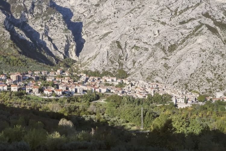
Why visit Fara San Martino
The name is Lombard: Fara meant a settled clan, and San Martino was added for the Benedictine abbey walled into the gorge above the village. The town sits on the eastern slopes of the Majella, the borgo built on the slope below the rock and the gorge cutting up behind it into the Valle Santo Spirito, which rises toward Monte Amaro.
Upper valley and lower town are joined by the same water: the Verde emerges from the karst springs at the gorge's foot and has run the pasta mills along the river since the nineteenth century, Delverde arriving in 1967 and Cocco still shipping from the same valley today. A geography this narrow, a river this cold, and a name carried by a Lombard clan and a buried abbey: the town reads as a single system where the rock, the water and the work in the valley below are the same story told from different ends.
What to see in Fara San Martino
- Gole di San Martino. Walking from the borgo into the gorge takes ten minutes and drops the temperature by five degrees, the rock walls closing to the two-meter slot at the narrowest point.
- Monastero di San Martino in Valle. Abbey ruins walled into the gorge above the village, buried by the 1818 flood and dug out again from 2009 onward.
- Valle Santo Spirito. Long Apennine valley rising from the gorge toward Monte Amaro, the second-highest peak in the central Apennines.
How to get to Fara San Martino
Pescara is roughly 144 minutes away by road.
Our tip
May through September is when the gorge and the high valley above it are walkable. The Verde water keeps the air five degrees cooler than the plain even in July, so summer hikes are bearable. October is gold and quiet, with the first dry-pasta drying racks visible in mill courtyards.
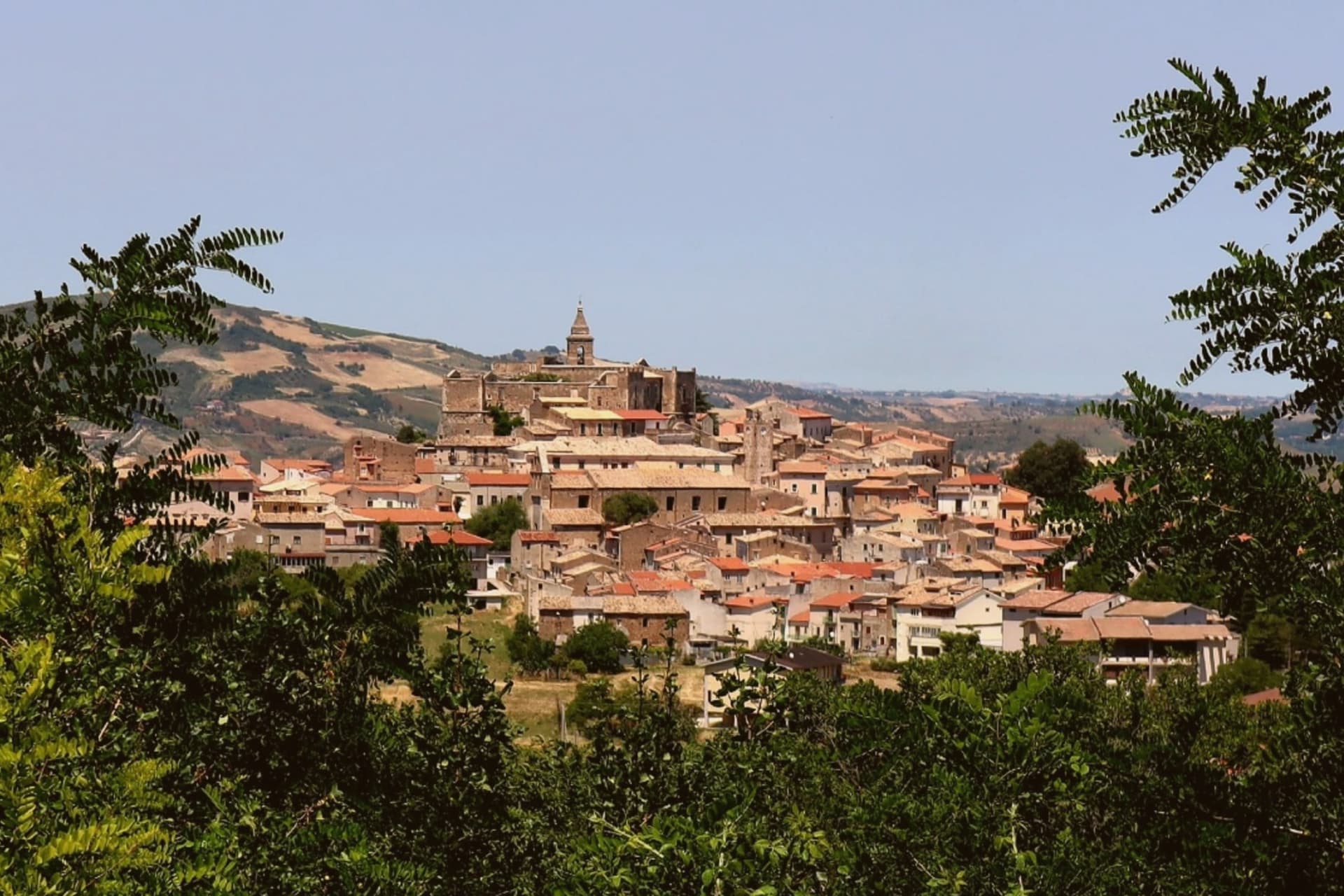
Why visit Tocco da Casauria
Tocco sits on a hill at 356 meters between the Pescara river and the Arolle stream, with the Maiella massif behind it. The town was founded around 872 under the authority of the abbey nearby, established in fulfilment of a vow made during an imprisonment in Benevento.
The abbey held the relics of Pope Clement I. The town was simply Tocco until 1861, when da Casauria was added to honour the abbey it grew up beside.
The centro storico is dominated by the Caracciolo Castle, rebuilt in Renaissance style after the 1456 earthquake, while the lower slopes toward the Pescara valley carry olive groves and Montepulciano vines, the produce that earned the town its place among the Città dell'Olio and Città del Vino. Centerba, the high-proof liqueur made from a hundred Maiella herbs, has been distilled here since the mid-19th century by the Toro family.
What holds the town together is the relationship between the abbey below and the settlement on the hill: a monastic foundation that gave the place its name, its early authority, and, centuries later, its liqueur trade and vineyards grew up in the valley it once governed.
What to see in Tocco da Casauria
- Abbazia di San Clemente a Casauria. A national monument since 1894, standing just outside the commune in Castiglione. Founded by Louis II, its bronze doors and their 72 panels remain the reason to make the detour.
- Castello Caracciolo. Built between 1187 and 1220 under Frederick II, destroyed by the 1456 earthquake and rebuilt in Renaissance style, dominating the centro storico.
- Chiesa di Sant'Eustachio. Main church of Tocco, built in the 18th century and named for the town's patron, with the statue of the saint inside.
How to get to Tocco da Casauria
There is a railway station in the town, so you can arrive without a car and never need one while you are here. Pescara is roughly 47 minutes away by road.
Our tip
April through October works best in Tocco. The hill catches breeze off the Maiella even in July, and the olive harvest in October fills the lower terraces with activity. Spring opens the abbey grounds and the Pescara valley vineyards.
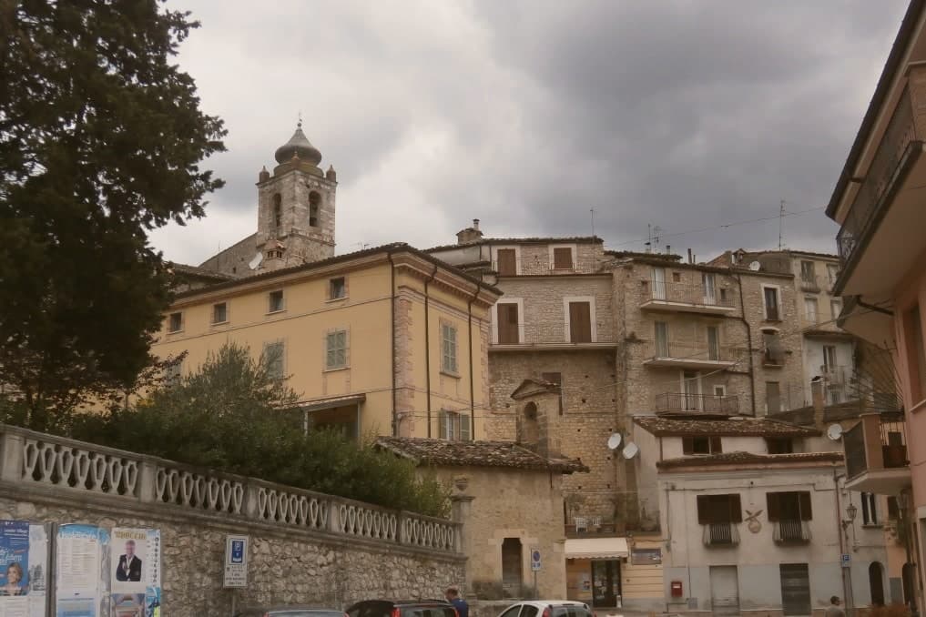
Why visit Isola del Gran Sasso d'Italia
The commune sits in the Mavone river valley, with the southern wall of the Gran Sasso massif rising directly behind it and the territory climbing from the valley floor to Monte Corno. The convent below the peaks is traditionally said to have been founded by Francis of Assisi around 1215.
Passionists arrived in 1847, and the young Gabriele Possenti reached the retreat in 1859 and died there in 1862 at 24. He was canonized in 1920.
The town itself is small, a settlement in the shadow of the rock rather than a destination built up around itself. Its two draws sit at opposite ends of the same valley system: the retreat where a young Passionist lived and died, and the summit trails that begin where the valley narrows.
The pilgrims come for the saint, the climbers for the rock, and the town's whole geography is arranged around that single climb from river to peak.
What to see in Isola del Gran Sasso d'Italia
- Santuario di San Gabriele dell'Addolorata. A 1970 concrete-and-glass church seating six thousand stands on the site of an older convent at the foot of the massif, the scale of the building matched by the crowds it absorbs each year.
- Convento dei Passionisti. The 13th-century convent traditionally attributed to Saint Francis, where Gabriele Possenti died in 1862 and where the Passionist community has been based since 1847.
- Corno Grande. The rock face and its trails are approached from the valley below, with Corno Piccolo rising alongside it as the pair mark the skyline above the sanctuary.
How to get to Isola del Gran Sasso d'Italia
Pescara is roughly 80 minutes away by road.
Our tip
April through October is the open season for the high trails on the Gran Sasso, with July and August the busiest months at the sanctuary and on the summit ridges. The August 27 feast of San Gabriele draws the largest crowds of the year. May, June, September and October are the months for walking the Corno Grande approaches without the heat or the foot traffic.
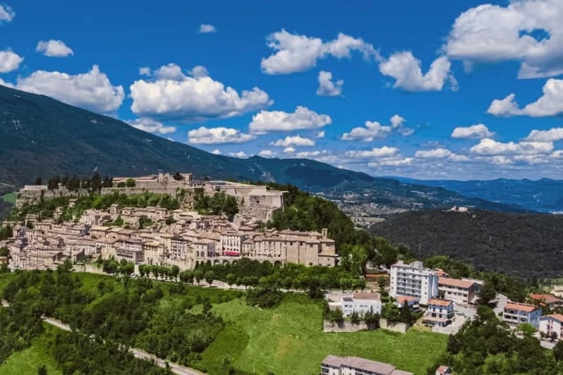
Why visit Civitella del Tronto
Civitella del Tronto sits at 589 meters on a long limestone ridge above the Tronto valley, on the old border between the Papal States and the Kingdom of the Two Sicilies. The Fortezza that runs the spine of the town is the largest fortress in Italy and the second-largest in Europe after the Hohensalzburg at Salzburg, 500 meters long, 45 meters wide, 25,000 square meters of walls, courtyards, and casemates.
It is the reason people come. In 1860 and 1861 the Piedmontese army laid siege to it for five months.
The Bourbon garrison capitulated on 20 March 1861, three days after the Kingdom of Italy had already been proclaimed in Turin. Civitella was the last Bourbon flag still flying.
The centro storico below the fortress narrows into the Ruetta, said to be one of the narrowest streets in Italy at 38 centimeters at its tightest. The town sits inside the Gran Sasso and Monti della Laga National Park.
What to see in Civitella del Tronto
- Fortezza di Civitella del Tronto. The largest fortress in Italy at 25,000 square meters, last stand of the Bourbon Kingdom of the Two Sicilies in March 1861.
- La Ruetta. Reputedly one of the narrowest streets in Italy, 38 centimeters at its tightest, threading the centro storico below the fortress.
- Chiesa di San Lorenzo. Sixteenth-century parish church inside the walls, with a Renaissance façade and altars salvaged after the 1861 siege.
How to get to Civitella del Tronto
Pescara is roughly 72 minutes away by road.
Our tip
April through June and September through October are the months to climb the ridge. The light is clear, the fortress walls hold warmth into the evening, and the chestnut woods on the Laga side are at their best in October. July and August work, but the stone surfaces of the fortress heat up under direct sun and the climb from the lower town is a slog by midday.
More from Anywhere Italy
 The prettiest small villages inside a national park in Abruzzo
- The best hill towns in the province of L'Aquila
- The best towns you can reach by train that sit inside a national park in Abruzzo
- The best small hill towns you can reach by train in Abruzzo
 The prettiest villages inside a national park within 90 minutes of Pescara
- The 6 best hill towns in the province of Chieti