
The prettiest small villages inside a national park in Abruzzo
Abruzzo keeps more protected mountain than any region in Italy, and the villages inside those boundaries are built from the rock around them: pale limestone, grey Gran Sasso stone, roofs of overlapping tiles pitched against snow that lies from late autumn well into spring. Walk up through beech forest in October and the whole slope turns copper before the first hard frost. The food follows the altitude, mutton cooked slowly with wild herbs, lentils and chickpeas from the high plains, pecorino aged in cellars cut into the hillside, saffron from the Navelli plateau. Chamois graze above the treeline, and the Marsican brown bear and Apennine wolf still range the valleys, which is why the parks exist at all.
The reliable route in is L'Aquila, then a run out to Rocca Calascio for the ruined castle on its ridge, a photograph that has done the rounds of every feed and film location list for years. Campo Imperatore fills its car parks on summer weekends, and the road up from Assergi carries coaches. It is a fine thing to see, and it is where almost everyone stops.
The parks are far larger than the famous viewpoint. The same limestone, the same beech woods and the same mountain kitchens continue south through the Maiella and the Sirente, and east under the Gran Sasso, and the villages there are smaller and quieter, the sort of places where the bar opens onto a square with a fountain and little else. Each of the towns here has passed the national assessment of Italy's most beautiful villages, and each sits inside a national park boundary. Fewer people go, and the walking starts at the edge of the houses.
Of the 73 communes we have mapped in Abruzzo, 12 qualify as prettiest villages inside a national park: each has passed the national assessment of Italy's most beautiful villages, and each sits inside a national park. This list is the small ones, 10 in all, ordered smallest first. The smallest, Santo Stefano di Sessanio, has 114 residents.
If you are still choosing, we have also written The prettiest villages inside a national park within 90 minutes of Pescara and The 10 prettiest small villages in the province of L'Aquila.
Santo Stefano di Sessanio
Why visit Santo Stefano di Sessanio
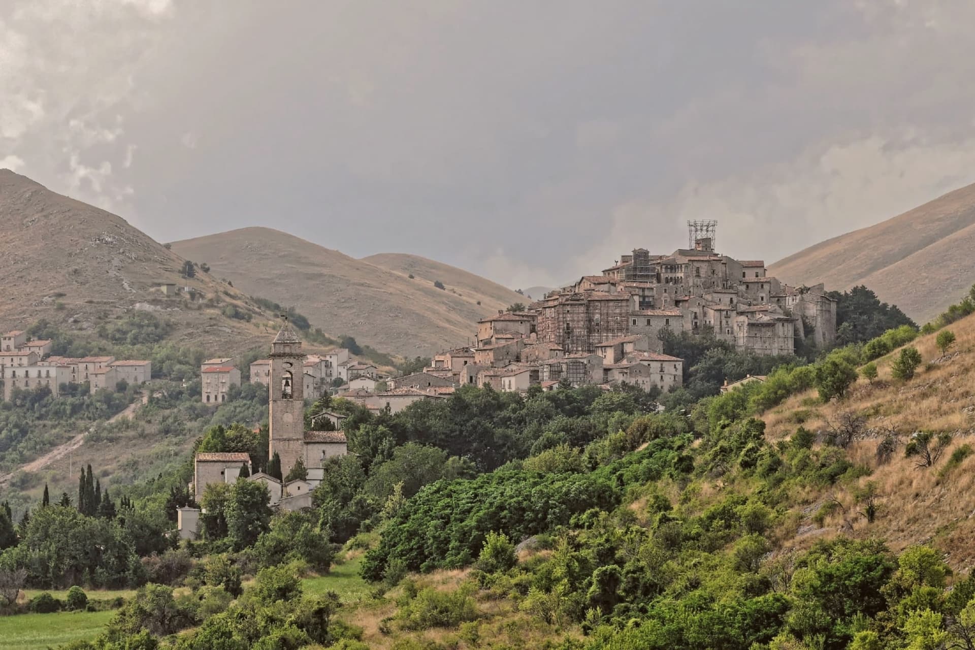
One hundred and fourteen people live in the commune, on the southern rim of the plateau inside the Gran Sasso e Monti della Laga National Park. The village belonged to the Medici from 1579 to 1743, who ran the saffron and wool trades that gave the place its early wealth and left their mark in the gate and the tower built under their rule.
By the late twentieth century most of the houses stood empty. In 1999 the Italian-Swedish entrepreneur Daniele Kihlgren began buying the ruined buildings, one at a time, restoring them rather than replacing them, which is why the stone, the lime plaster, and the timber inside are original.
The upper village and its scattered rooms are the direct result of that decision: there was no single building large enough to house a hotel, so the hotel became the village itself. What Santo Stefano offers now is that reversal, a settlement nearly emptied by the late twentieth century, rebuilt not by adding to it but by restoring what was already there, house by house, and still being rebuilt today in the tower rising again on its old footprint.
What to see in Santo Stefano di Sessanio
- Torre Medicea (ruderi). The tower's stump stands on its original footprint, scaffolded, the reconstruction visible in progress against the rest of the village skyline.
- Borgo medievale e Sextantio. Rooms are scattered through the restored houses of the village rather than gathered under one roof, so staying here means walking the lanes between stone walls and timber to reach them.
- Palazzo delle Logge. A Renaissance loggia looks over the village square and the gate built under the same Florentine administration, its arches the clearest surviving mark of that rule.
How to get to Santo Stefano di Sessanio
Pescara is roughly 109 minutes away by road.
Our tip
June through September is the high season for Santo Stefano. Days at 1,250 meters rarely cross twenty-five degrees, the wool and lentil fields on Campo Imperatore turn green and gold, and the trails up to the plateau are open. December through March brings snow, the Campo Imperatore plateau is one of the cross-country ski centers of the central Apennines, and the Sextantio rooms hold their candle-lit appeal best on long winter evenings. Lentil Festival falls in September.
Pietracamela
Why visit Pietracamela
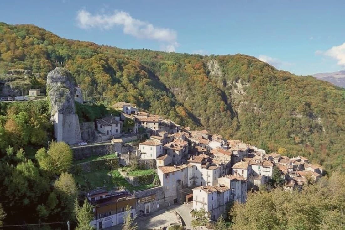
The village was founded in the twelfth century by populations fleeing coastal raids for the inaccessible upper Rio Arno valley. Its name comes from the Preta, the camel-humped rock above the houses.
The Gran Sasso, central Italy's highest range, defines the place: the historic core sits packed against the slope below the peak, while the road above climbs to Prati di Tivo, the frazione that turns into a ski station and the gateway to the cableway onto the massif. By the 1930s the climbing club founded in the village had opened the first grade VI routes on the east face and the Torrione Cambi.
Today the village empties in winter except for the climbers and skiers heading up that same road. What began as a refuge in an inaccessible valley became, seven centuries later, a base camp for the range that towers over it.
What to see in Pietracamela
- Centro storico. Tightly packed stone houses on the slope, twelfth-century medieval plan preserved, listed among the Borghi più belli d'Italia.
- Corno Piccolo. Sheer rock peak rising 2,655 meters directly above the village, the historic training ground of the Aquilotti climbing club.
- Prati di Tivo. Ski station at 1,450 meters, frazione of Pietracamela, gateway to the cableway up the Gran Sasso massif.
How to get to Pietracamela
Pescara is roughly 92 minutes away by road.
Our tip
December through March brings snow to Prati di Tivo and turns the cableway into the access point for ski mountaineering on Corno Grande. The village itself stays cold. June through September is the climbing and hiking season, with most Aquilotti routes accessible from late June.
Castel del Monte
Why visit Castel del Monte
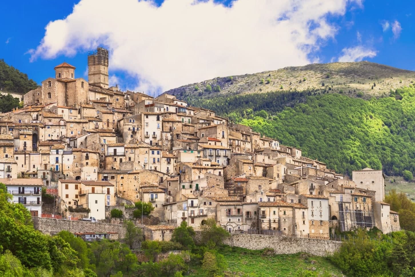
The village sits in the Gran Sasso e Monti della Laga National Park, on the southern slope of Monte Bolza, with Rocca Calascio facing it across the valley and Campo Imperatore stretching north. It descends from the pre-Roman Vestini; finds from an 11th-century BC necropolis lie in the valley below, long before any wool trade or Medici buyer arrived.
The upper village, its stone core threaded with tunnels and vaulted passages, once housed the shepherds who drove flocks south to Puglia and returned to a cluster of churches built for their safekeeping and their thanks. That world ended in the 1850s, and the population emptied with it: 431 people remain where a wool trade once drew merchants from the Medici's own city.
What is left is performed rather than lived at scale, in the symbolic transhumance and in the August gathering that briefly fills the same streets and tunnels the shepherds once used. The place now runs on memory of the trade that built it, kept alive one night a year and in a cheese still made from spring pastures.
What to see in Castel del Monte
- Chiesa Matrice di San Marco. Baroque interior; holds the patron-saint statue carried through the village in the August procession.
- Chiesa di San Donato Fuori le Mura. Romanesque church just outside the medieval walls, among the oldest religious buildings in the village, with a small square in front used for festivals.
- Chiesa della Madonna del Suffragio (dei Pastori). Devotional centre of the transhumance, hung with ex-votos left by herders for safe return from Puglia.
How to get to Castel del Monte
Pescara is roughly 90 minutes away by road.
Our tip
June through September is when Castel del Monte runs at full strength. Campo Imperatore opens for hiking, the Canestrato cheese makers receive visitors, and La Notte delle Streghe in mid-August packs every alley with thousands of people. December through March is the second season for skiers heading to Campo Imperatore and Prati di Tivo, with the village in deep snow. Rassegna degli Ovini di Campo Imperatore falls in August.
Pretoro
Why visit Pretoro
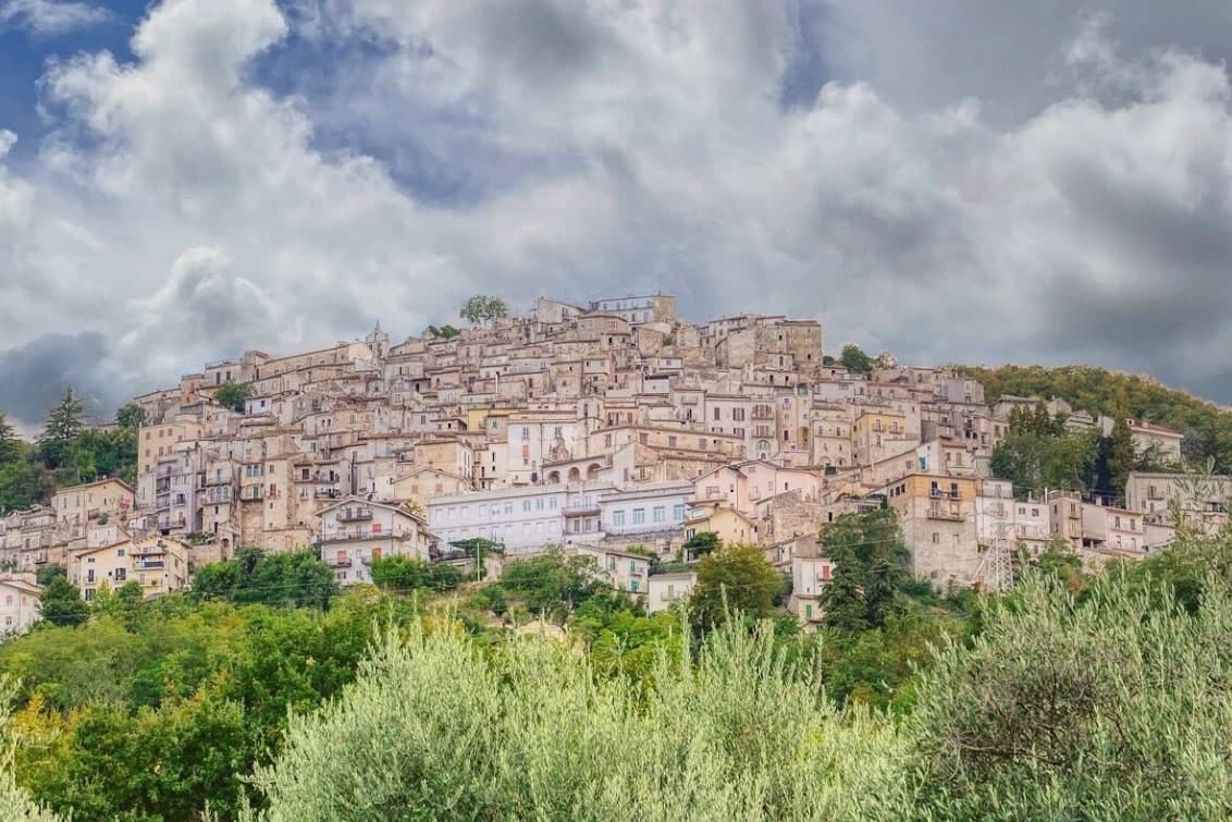
The Maiella is the limestone massif that dominates Chieti province, and Pretoro holds its eastern flank, the houses tiered in narrow stone rows up the hillside rather than spread along it. The village sits inside the Maiella National Park itself, so the wolf enclosure above town and the trails west toward the Blockhaus and Maielletta refuge are not add-ons to the place but part of its ground.
Beech forest covers the slopes above the houses, and that forest is the reason both the timber trade and the wolves ended up here: the trees fed generations of lathe and spindle work on the street below, and the same cover, higher up, gave the wildlife area a place to keep rescued animals in something like their own terrain. The patronal festival draws the two threads together, since its wolf story is acted out in the same streets where the workshops still stand.
What the village amounts to is a single hillside where a forest economy and a forest predator have been worked into daily and annual life rather than kept apart.
What to see in Pretoro
- Centro storico. Steep medieval village stacked on the hillside, narrow lanes between stone houses, listed among the Borghi più belli d'Italia.
- Area Faunistica del Lupo Appenninico. Enclosure at 750 meters above town, three hectares of beech, hosts up to six rescued Apennine wolves behind fencing.
- Chiesa di San Nicola di Bari. Parish church dating to the late Middle Ages, restored in the eighteenth century, holds the statue of San Domenico used in Lu Lope.
How to get to Pretoro
Pescara is roughly 49 minutes away by road.
Our tip
April through October is the season for Pretoro. The wolf enclosure stays open all year but is most accessible from spring to autumn, when trails into the upper Maiella connect from the village. The first Sunday of May brings Lu Lope and the largest crowd.
Pescocostanzo
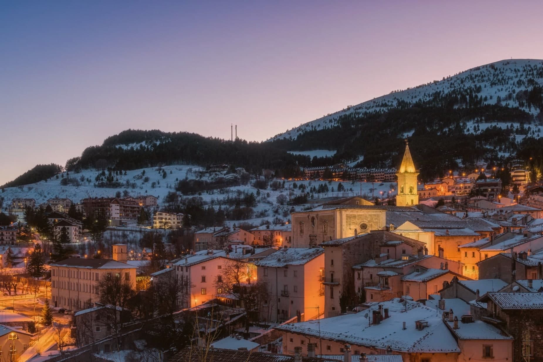
Why visit Pescocostanzo
Pescocostanzo sits at 1,395 meters at the southern edge of the Quarto Grande plateau, the high karst basin above the Sangro valley. The town was reshaped between 1456 and the eighteenth century under the Capua family and a generation of Lombard masons who arrived to build for them.
The plan is unusually regular for a mountain commune: a grid of stone houses oriented to the wind, surrounded by woods and pasture. The Collegiata di Santa Maria del Colle, restructured by Cosimo Fanzago in the seventeenth century, is one of the rare five-nave churches in Abruzzo.
Its wrought iron Chapel of the Sacrament gate, made by Sante di Rocco between 1699 and 1707, is the masterpiece of local ironwork. Bobbin lace, merletto al tombolo, is still made here.
The Museo del Merletto a Tombolo inside Palazzo Fanzago shows the technique and the patterns. Filigree gold, carved wood, and lace are still sold on the Corso Roma.
What to see in Pescocostanzo
- Collegiata di Santa Maria del Colle. Five-nave church begun in the late Middle Ages and remodeled by Cosimo Fanzago in the seventeenth century.
- Museo del Merletto a Tombolo. Inside Palazzo Fanzago, displays the local bobbin lace tradition with patterns, tools, and live demonstrations.
- Palazzo Fanzago. Designed by the baroque architect Cosimo Fanzago in 1624, the seat of the lace museum and civic offices.
How to get to Pescocostanzo
Pescara is roughly 84 minutes away by road.
Our tip
December through March brings snow and the ski season, with the Monte Calvario lifts linking to the Alto Sangro system at Roccaraso and Rivisondoli twenty minutes away. June through September is the second season. At 1,395 meters Pescocostanzo rarely crosses twenty-two degrees even in August, and the Bosco di Sant'Antonio offers beech-shaded walks.
Pacentro
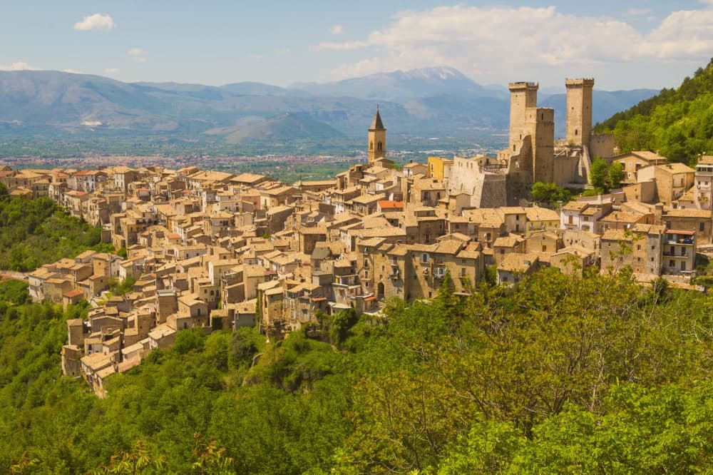
Why visit Pacentro
Pacentro sits at 650 meters on a hill spur in the Peligna valley, eight kilometers from Sulmona and inside the Maiella National Park. The Castello Caldora, with its three surviving square towers, dominates the village from the Colle Castello above.
The site has held a castle since the eleventh century; the structure visible today was begun by the Caldora-Cantelmo family in the late fourteenth century and bought by the comune in 1957 and restored. On the first Sunday of September, the Corsa degli Zingari sends barefoot runners down a rocky slope from Monte Ardinghi into the village in honor of the Madonna di Loreto.
The race is documented since the fifteenth century. The other thing people come for is the Ciccone house.
Madonna's paternal grandparents, Gaetano Ciccone and Michelina Di Iulio, emigrated from Pacentro in 1919. The pop singer visited in 2013.
What to see in Pacentro
- Castello Caldora-Cantelmo. Late fourteenth-century fortress on the Colle Castello, three of its four corner towers still standing, restored after 1957.
- Borgo medievale. Stone houses arranged on terraces below the castle, listed among the Borghi più belli d'Italia, preserved in its medieval plan.
- Chiesa di Santa Maria Maggiore. Sixteenth-century parish church with a baroque interior, holding the Madonna di Loreto honored in the September race.
How to get to Pacentro
Pescara is roughly 69 minutes away by road.
Our tip
May through October is when Pacentro opens. The first Sunday of September brings the Corsa degli Zingari and the biggest crowd of the year, with runners descending barefoot from Monte Ardinghi and the village in procession by evening. July and August can be warm in the valley but the elevation keeps Pacentro itself cooler than Sulmona below.
Pettorano sul Gizio
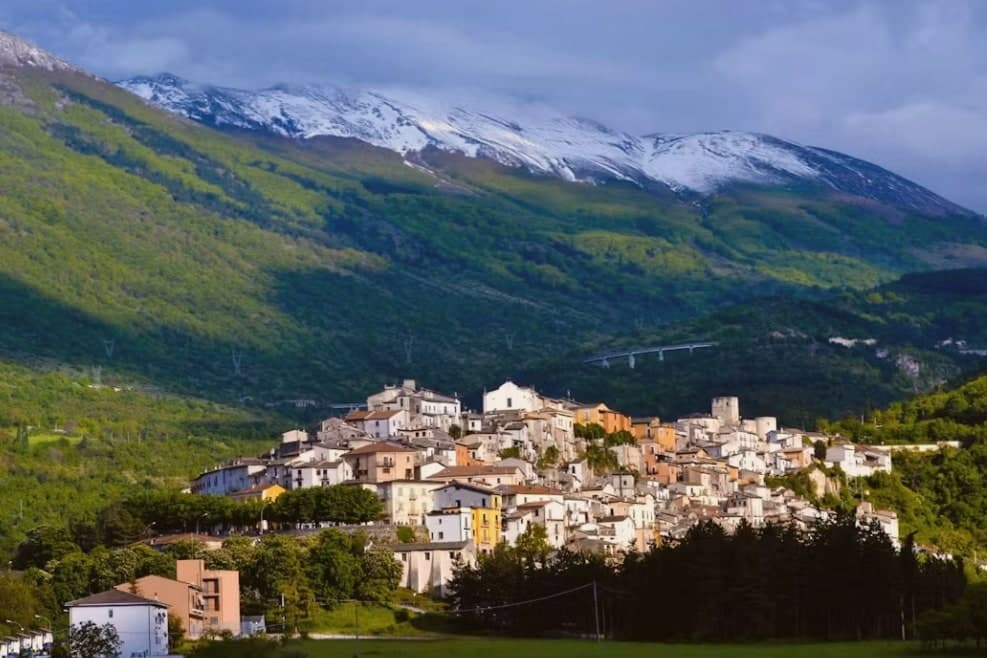
Why visit Pettorano sul Gizio
Pettorano sits at 656 meters on a hill above the Gizio river, at the southern entrance of the Valle Peligna, at the foot of the Maiella. The Castello Cantelmo, a pentagonal stone tower built in the 11th century and held by the Cantelmo family from 1310 to the mid-1700s, dominates the village from above.
The 16th and 17th centuries left palazzi behind: Palazzo Croce, Palazzo Gravina, Palazzo Vitto-Massei. The Church of San Nicola outside the walls is documented in 1112.
Today the commune sits inside the Riserva Naturale Monte Genzana, and the castle, restored between 1992 and 1998, hosts exhibitions and the reserve's visitor centre. The Marsican brown bear passes through these woods.
Pettorano is a Borghi più belli d'Italia and one of the Comuni Virtuosi, the network of municipalities that signed up to specific environmental commitments. The population has held steady around 1,300 while neighbouring villages shrank.
What to see in Pettorano sul Gizio
- Castello Cantelmo. Pentagonal 11th-century fortress above the Gizio, seat of the Cantelmo family from 1310 to the mid-18th century, restored as exhibition space.
- Chiesa di San Nicola. Small church outside the medieval walls, already documented in 1112, the oldest religious building in the commune.
- Chiesa di Sant'Antonio Abate. Patron-saint church inside the centro storico, repeatedly rebuilt after earthquakes, with traces of earlier medieval structure.
How to get to Pettorano sul Gizio
Pescara is roughly 70 minutes away by road.
Our tip
May through October is when Pettorano works best. The high valley stays cool even in August, the Monte Genzana trails are open, and the castle exhibition season runs through autumn. June and September are the most reliable, with warm days and cold evenings.
Scanno

Why visit Scanno
Scanno sits in the Sagittario valley, ringed by the Majella foothills and the Marsicano massif. The lake lies three kilometers down the valley from the town, at a lower elevation, so the walk between them moves from stone alleys to open water framed by the same slopes that produced it: a landslide off the mountain dammed the Tasso river and left the basin behind.
The town's isolation, closed in by the surrounding massifs, is what let the older costume and its headdress survive into the era of the camera, and it is what drew photographers to record it rather than something they invented. The goldsmiths' filigree, made in the same stone streets the women walked, belongs to the same thread: a village shaped by its enclosure in the mountains, still making by hand what it has always made.
What to see in Scanno
- Lago di Scanno. Seen from above, the water reads as a clean heart shape against the valley walls.
- Centro storico. Stone-alley medieval centre where the black costume, with its folded headdress some historians trace to Balkan or Eastern origins, is still worn by older women against limewashed walls.
- Chiesa di Santa Maria della Valle. Parish church first documented in the eleventh century, rebuilt in the seventeenth, with a Renaissance portal and Baroque interior.
How to get to Scanno
Pescara is roughly 80 minutes away by road.
Our tip
June through September is the summer window: trails open in the national park, the lake holds a Blue Flag for swimming, and the centro fills with photographers chasing the Giacomelli setups. December through March is the second season for snow, with skiing on Monte Rotondo and Passo Godi nearby. April, May, October and November are quiet, with many family-run hotels closed and the lake side restaurants shuttered.
Caramanico Terme
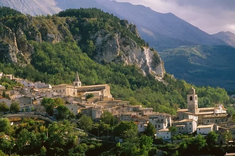
Why visit Caramanico Terme
The name carries the Lombard arimannia, a settled clan of the late Middle Ages, and the town grew under the D'Aquino family in the fourteenth and fifteenth centuries, when the main religious buildings went up. Terme was added to the name in 1960, recognising what had been known and used since at least 1576, when the first chemical analyses of the local waters were recorded.
The village sits between Monte Morrone and the Majella, with the historic core on the hilltop above and the spa lower down, closer to the meeting of the two rivers. The abbey stands apart from both, five kilometers out, a separate outpost from the town it belongs to.
What holds the place together is the water: a medieval settlement, a fourteenth-century noble family's building program, and a twentieth-century name change all trace back to the same springs that first drew analysis in 1576.
What to see in Caramanico Terme
- Abbazia di San Tommaso Becket. Romanesque, standing unfinished since work stopped, the walls left mid-build over the older pieve beneath. The distance from the centre keeps it apart from the rest of the town's sights, reached on its own.
- Chiesa di Santa Maria Maggiore. Fifteenth-century church with a Gothic exterior and an ogival portal showing the Coronation of the Virgin dated 1476.
- Terme di Caramanico. The spa complex built around the two springs, with treatment programs for respiratory, ENT, skin and joint conditions organized across the site today.
How to get to Caramanico Terme
Pescara is roughly 61 minutes away by road.
Our tip
The thermal baths run all year and pull a steady winter cure clientele. April through June and September into November are the best hiking months in the Orfento, with cool morning air through the beech wood and the river running fast. July and August are warm in the village but cool in the gorge; the spa's indoor pools are the summer escape. Mercato Settimanale Di Caramanico Terme falls in October.
Civitella del Tronto
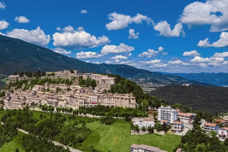
Why visit Civitella del Tronto
Civitella del Tronto sits at 589 meters on a long limestone ridge above the Tronto valley, on the old border between the Papal States and the Kingdom of the Two Sicilies. The Fortezza that runs the spine of the town is the largest fortress in Italy and the second-largest in Europe after the Hohensalzburg at Salzburg, 500 meters long, 45 meters wide, 25,000 square meters of walls, courtyards, and casemates.
It is the reason people come. In 1860 and 1861 the Piedmontese army laid siege to it for five months.
The Bourbon garrison capitulated on 20 March 1861, three days after the Kingdom of Italy had already been proclaimed in Turin. Civitella was the last Bourbon flag still flying.
The centro storico below the fortress narrows into the Ruetta, said to be one of the narrowest streets in Italy at 38 centimeters at its tightest. The town sits inside the Gran Sasso and Monti della Laga National Park.
What to see in Civitella del Tronto
- Fortezza di Civitella del Tronto. The largest fortress in Italy at 25,000 square meters, last stand of the Bourbon Kingdom of the Two Sicilies in March 1861.
- La Ruetta. Reputedly one of the narrowest streets in Italy, 38 centimeters at its tightest, threading the centro storico below the fortress.
- Chiesa di San Lorenzo. Sixteenth-century parish church inside the walls, with a Renaissance façade and altars salvaged after the 1861 siege.
How to get to Civitella del Tronto
Pescara is roughly 72 minutes away by road.
Our tip
April through June and September through October are the months to climb the ridge. The light is clear, the fortress walls hold warmth into the evening, and the chestnut woods on the Laga side are at their best in October. July and August work, but the stone surfaces of the fortress heat up under direct sun and the climb from the lower town is a slog by midday.
More from Anywhere Italy
- The prettiest villages inside a national park within 90 minutes of Pescara
- The 10 prettiest small villages in the province of L'Aquila
 The best mountain towns inside a national park within 90 minutes of Pescara
- The prettiest small villages that eat well within 90 minutes of Pescara
- The prettiest villages that eat well in Abruzzo
 The best small hill towns inside a national park in Abruzzo