
The 6 best hill towns in the province of Chieti
The hills behind the Chieti coast rise fast, and the towns on them are built of the local limestone, pale grey turning gold in late afternoon. This is Maiella country: beech woods on the upper slopes, sheep tracks, spring water cold enough to make pasta drying an industry. The food follows the terrain, with lamb cooked over wood, ventricina cured in the hill air, pallotte cacio e ova, and pasta shapes that belong to single valleys. Autumn is the season that pays best, when the vines below the ridges turn and the porchetta vans set up in the piazzas.
Most travellers in Abruzzo aim for the coast or for the Parco Nazionale d'Abruzzo further inland, and in August the trabocchi restaurants along the shore south of Ortona are booked out weeks ahead. Ortona itself absorbs the day trips, the war cemetery, the castle above the harbour, the passeggiata. It is a reasonable use of a day, but it is the same day everyone else is having, and the hills above are entirely visible from the car park.
The same limestone continues west, and the road keeps climbing into the province's interior, where the towns sit on spurs above river gorges and the Maiella closes off the horizon. Fewer people go, partly because the driving is slow and partly because nothing here announces itself from the motorway. These are the smaller places: hill settlements with their old quarters intact, ironwork and knife-making traditions, pasta mills fed by karst springs, and Sunday lunches that run long because there is nowhere in particular to be afterwards.
Of the 12 communes we have mapped in the province of Chieti, 6 qualify as hill towns: each is an inland hill settlement built on ground too steep to spread. The smallest, Pretoro, has 856 residents.
Elsewhere in the catalogue: The best hill towns you can reach by train in Abruzzo and The best small hill towns inside a national park in Abruzzo.
Pretoro
Why visit Pretoro
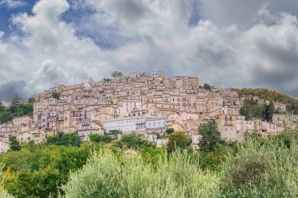
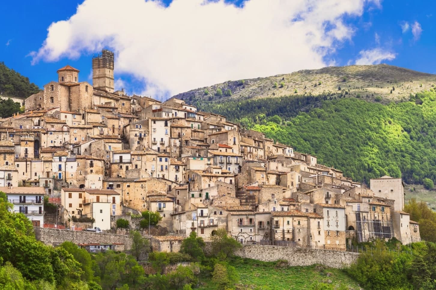
The Maiella is the limestone massif that dominates Chieti province, and Pretoro holds its eastern flank, the houses tiered in narrow stone rows up the hillside rather than spread along it. The village sits inside the Maiella National Park itself, so the wolf enclosure above town and the trails west toward the Blockhaus and Maielletta refuge are not add-ons to the place but part of its ground.
Beech forest covers the slopes above the houses, and that forest is the reason both the timber trade and the wolves ended up here: the trees fed generations of lathe and spindle work on the street below, and the same cover, higher up, gave the wildlife area a place to keep rescued animals in something like their own terrain. The patronal festival draws the two threads together, since its wolf story is acted out in the same streets where the workshops still stand.
What the village amounts to is a single hillside where a forest economy and a forest predator have been worked into daily and annual life rather than kept apart.
What to see in Pretoro
- Centro storico. Steep medieval village stacked on the hillside, narrow lanes between stone houses, listed among the Borghi più belli d'Italia.
- Area Faunistica del Lupo Appenninico. Enclosure at 750 meters above town, three hectares of beech, hosts up to six rescued Apennine wolves behind fencing.
- Chiesa di San Nicola di Bari. Parish church dating to the late Middle Ages, restored in the eighteenth century, holds the statue of San Domenico used in Lu Lope.
How to get to Pretoro
Pescara is roughly 49 minutes away by road.
Our tip
April through October is the season for Pretoro. The wolf enclosure stays open all year but is most accessible from spring to autumn, when trails into the upper Maiella connect from the village. The first Sunday of May brings Lu Lope and the largest crowd.
Fara San Martino
Why visit Fara San Martino
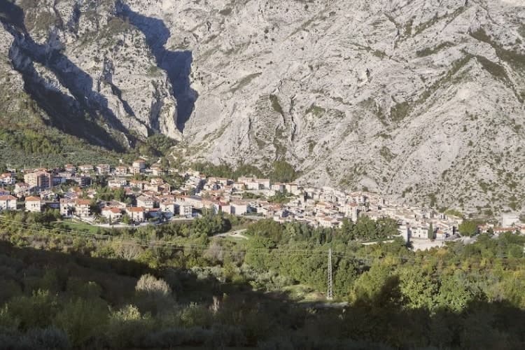
The name is Lombard: Fara meant a settled clan, and San Martino was added for the Benedictine abbey walled into the gorge above the village. The town sits on the eastern slopes of the Majella, the borgo built on the slope below the rock and the gorge cutting up behind it into the Valle Santo Spirito, which rises toward Monte Amaro.
Upper valley and lower town are joined by the same water: the Verde emerges from the karst springs at the gorge's foot and has run the pasta mills along the river since the nineteenth century, Delverde arriving in 1967 and Cocco still shipping from the same valley today. A geography this narrow, a river this cold, and a name carried by a Lombard clan and a buried abbey: the town reads as a single system where the rock, the water and the work in the valley below are the same story told from different ends.
What to see in Fara San Martino
- Gole di San Martino. Walking from the borgo into the gorge takes ten minutes and drops the temperature by five degrees, the rock walls closing to the two-meter slot at the narrowest point.
- Monastero di San Martino in Valle. Abbey ruins walled into the gorge above the village, buried by the 1818 flood and dug out again from 2009 onward.
- Valle Santo Spirito. Long Apennine valley rising from the gorge toward Monte Amaro, the second-highest peak in the central Apennines.
How to get to Fara San Martino
Pescara is roughly 144 minutes away by road.
Our tip
May through September is when the gorge and the high valley above it are walkable. The Verde water keeps the air five degrees cooler than the plain even in July, so summer hikes are bearable. October is gold and quiet, with the first dry-pasta drying racks visible in mill courtyards.
Archi
Why visit Archi
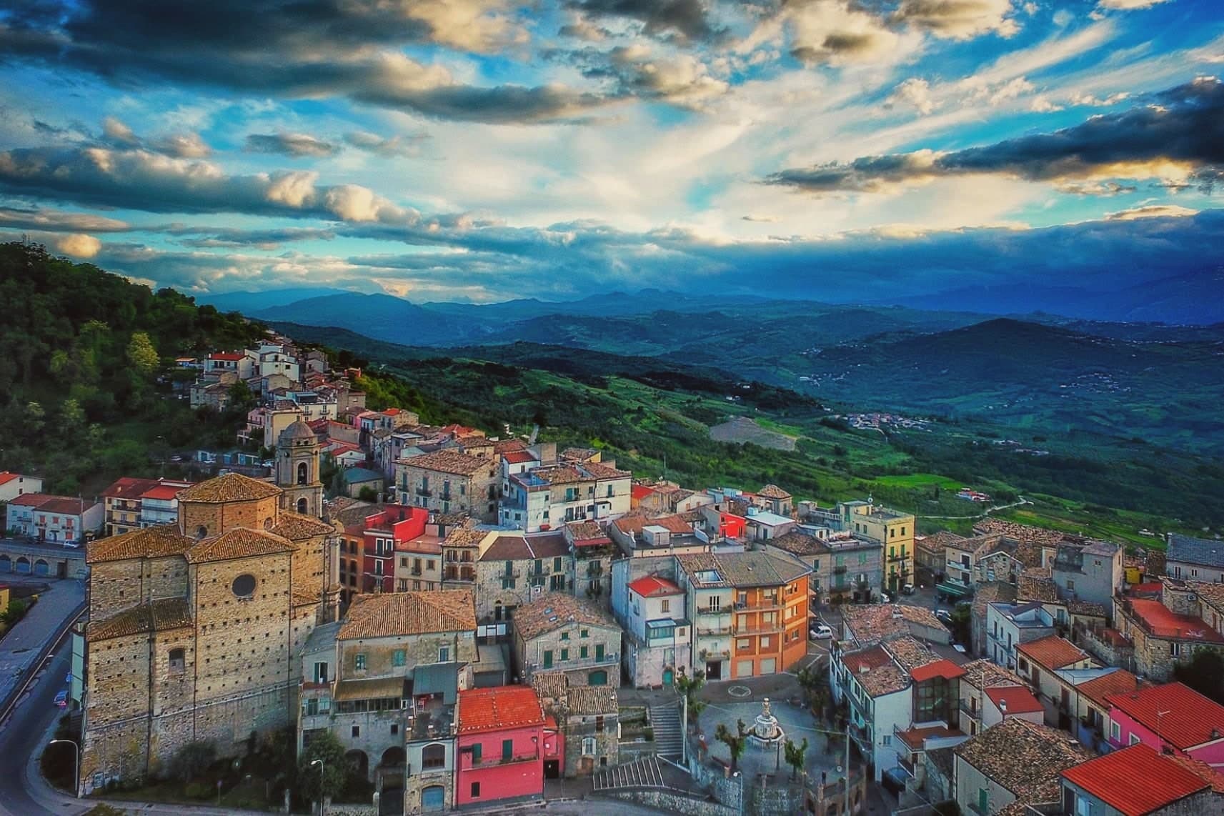
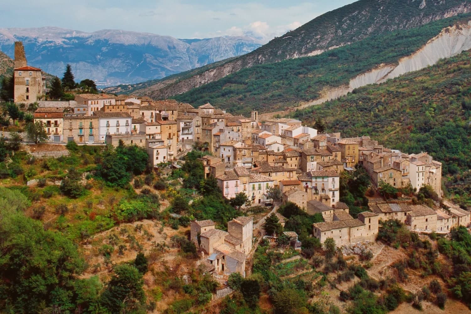
Archi sits at 492 meters on a rocky spur between the Val di Sangro and the Valle dell'Aventino, the geography that earned it the nickname Terrazza sul Sangro. The fortified borough is documented from the eleventh century, and the rocky position made it a stronghold of the Kingdom of Naples until the sixteenth century, held in turn by the del Balzo, Cantelmo, Colonna and Carafa families.
The medieval walls and ruins of the fifteenth-century castle, destroyed in the last war, are still visible at the spur's edge. Seventeenth and eighteenth-century palazzi line the streets between them.
The slopes below produce extra-virgin olive oil and summer truffles: Archi held its first Summer Truffle Trade Show in July 2013, and the network designation followed. Standing on the eastern edge of the centro storico, the view runs uninterrupted down both valleys to the Majella massif rising behind.
What to see in Archi
- Ruderi del Castello. Castle ruins reconstructed in the fifteenth century and destroyed in the Second World War, at the eastern tip of the rocky spur.
- Mura medievali. Sections of medieval city walls preserved along the perimeter of the centro storico, marking the fortified borough's original line.
- Palazzi storici. Seventeenth and eighteenth-century civil architecture along the main streets, the residences of fief-holding families and notables.
How to get to Archi
There is a railway station in the town, so you can arrive without a car and never need one while you are here. Pescara is roughly 58 minutes away by road.
Our tip
April through October is the working calendar. The summer truffle festival lands in July, with degustations under the medieval walls. September and October bring olive harvest and the slopes turn silver-green.
Crecchio
Why visit Crecchio
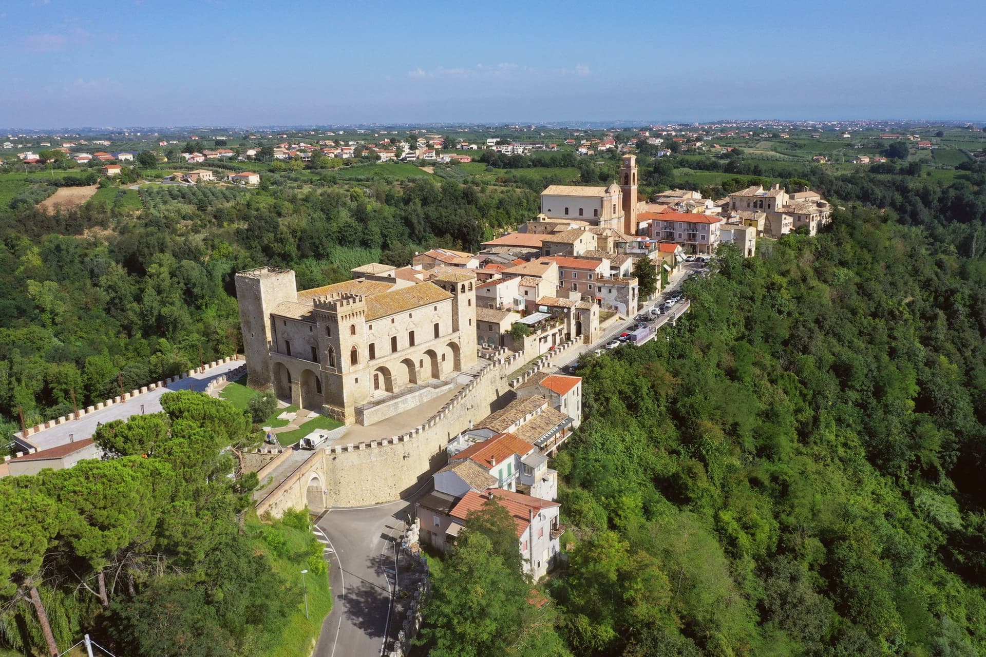
Crecchio is a hill town at 209 meters in the band of low ridges that runs from the Adriatic coast inland to the foothills of the Maiella. The Castello Ducale at its center is the reason it appears in textbooks.
On the night of 9 September 1943, after the armistice with the Allies was announced, King Vittorio Emanuele III, Queen Elena, and Crown Prince Umberto fled Rome and stopped at the De Riseis castle for a single night before reaching the port of Ortona and sailing for Brindisi. For those hours Crecchio was effectively the capital of Italy.
The castle was bombed by the Allies later in the war and reconstructed afterward, respecting its original Lombard, Norman, and Aragonese stratification. It now houses the Museo Archeologico dell'Abruzzo Bizantino e Altomedievale, which collects sixth- and seventh-century material from the surrounding territory.
What to see in Crecchio
- Castello Ducale De Riseis-D'Aragona. Lombard core from the eighth century, Norman and Aragonese reworkings, four corner towers, host to the fleeing royal family on 9 September 1943.
- Museo Archeologico dell'Abruzzo Bizantino e Altomedievale. Inside the castle, displays Lombard and Byzantine grave goods, ceramics, and weapons from the sixth and seventh centuries.
- Centro storico. Medieval walled core preserved around the castle, narrow lanes and stone houses descending toward the open valley.
How to get to Crecchio
There is a railway station in the town, so you can arrive without a car and never need one while you are here. Pescara is roughly 40 minutes away by road.
Our tip
April through June and September through October are the months that work. The hill catches breezes off the Adriatic twenty kilometers east, vineyards are green or coloring, and the castle terrace is comfortable late into the day. July and August are hot, with afternoon temperatures pushing thirty-five degrees on the valley floor below, though Crecchio's elevation gives some relief.
Casoli
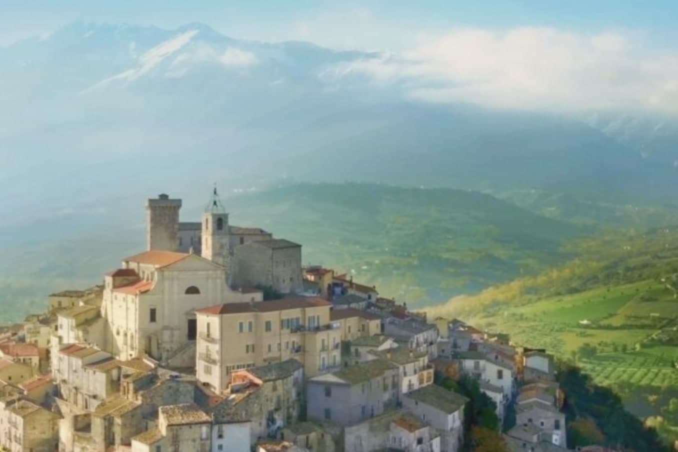
Why visit Casoli
Casoli occupies a steep isolated hill on the eastern flank of the Maiella, above the Aventino, a tributary of the Sangro. The tower at the summit was raised in the 12th century as a refuge for the inhabitants of the Roman town of Cluviae, when Saracens raided up the valley.
Around it grew the Castello Ducale, passed in turn from the Orsini in the 14th and 15th centuries to the Colonna, Carafa, Crispano and Filomarino, and finally to the d'Aquino, who became Dukes of Casoli in 1645. In 1900 the castle passed to a lawyer and parliamentarian from a local family, who hosted Gabriele D'Annunzio there along with Francesco Paolo Tosti, Francesco Paolo Michetti, Edoardo Scarfoglio, Matilde Serao and Guglielmo Marconi, in a gathering of artists and intellectuals around 1900-1910.
The castle was sold to the municipality in 1982. Outside the town, the Aventino was dammed in 1958 to form Lago di Casoli.
The town's shape still traces this history: a defensive tower grown into a ducal seat, a steep medieval core climbing toward it, and a river valley below that has been fought over, painted, written about and, eventually, dammed.
What to see in Casoli
- Castello Ducale (Masciantonio). 12th-century Norman pentagonal tower expanded by the Orsini, national monument since 1928, remodeled into a gathering place under Pasquale Masciantonio around 1900.
- Chiesa di Santa Maria Maggiore. Main parish church adjacent to the castle, with a Romanesque bell tower and Renaissance interior decoration, hosting the patron-saint feast.
- Centro storico. Steep medieval core climbing to the castle, with palazzi of the noble families who held the duchy and views east to the Adriatic on clear days.
How to get to Casoli
Pescara is roughly 59 minutes away by road.
Our tip
April through October is the productive window for Casoli. Spring is when the olive groves below the castle flower and the Maiella above stays snow-capped. May, June, and September are the most comfortable months. Festival delle Pallotte Cace e Ove a Casoli falls in June.
Guardiagrele
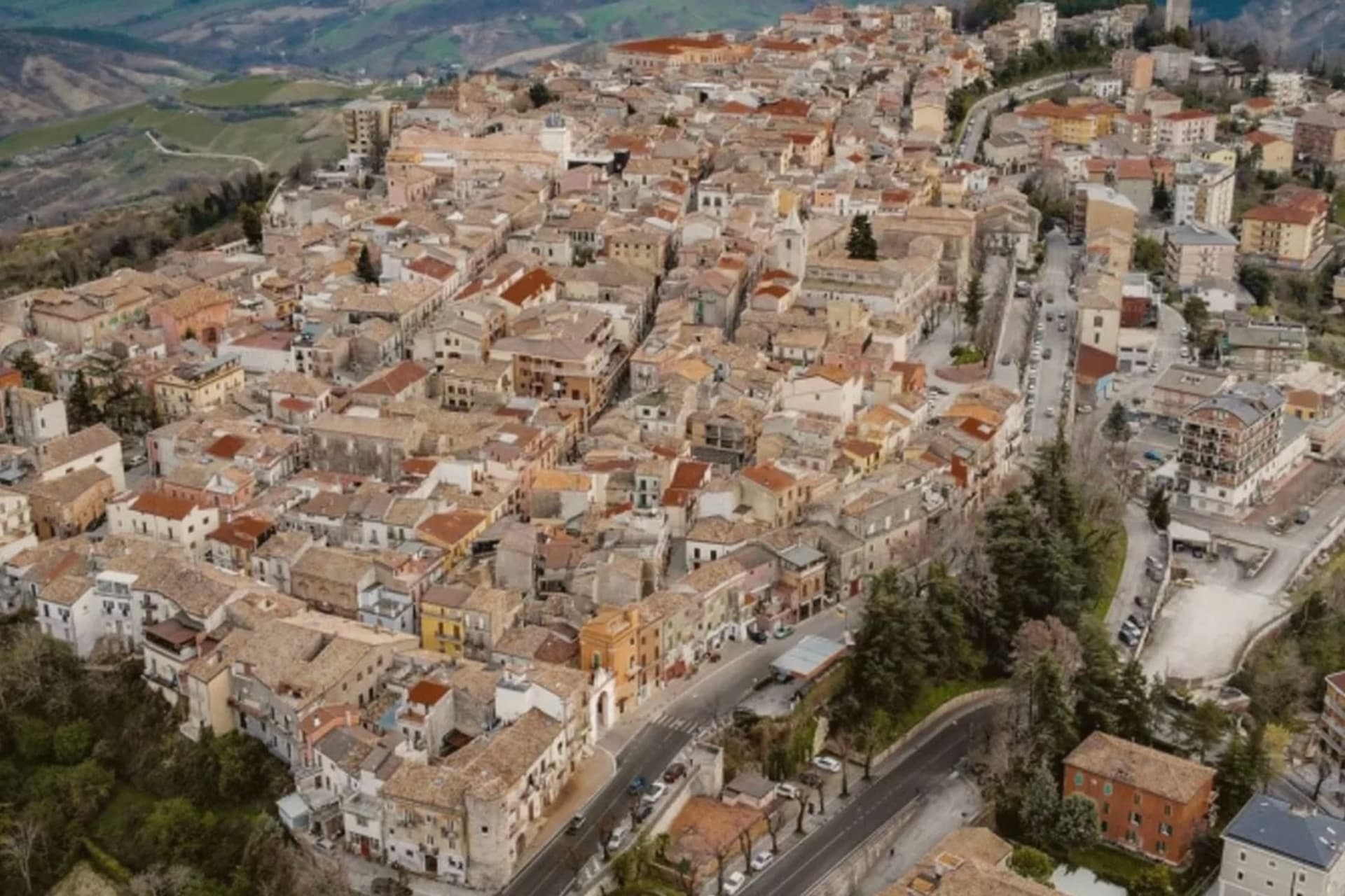
Why visit Guardiagrele
Guardiagrele sits at 576 meters on the eastern Majella foothills, thirty kilometers from Pescara. Gabriele D'Annunzio called it the terrazza d'Abruzzo for the views over the mountains and valleys from its piazzas.
Documented in an eleventh-century papal bull as a villa named Grele, the town grew through the fourteenth and fifteenth centuries as a stronghold of the Kingdom of Naples, with permission from the king to mint coins. It produced the late medieval goldsmith Nicola Gallucci, known as Nicola da Guardiagrele (c.1385-c.1462), trained on Gothic and Tuscan models including Lorenzo Ghiberti, who left work in cathedrals across Abruzzo.
The collegiate church of Santa Maria Maggiore, built at the start of the thirteenth century outside the walls and absorbed into the town in the centuries after, carries a fifteenth-century portal with a Coronation of the Virgin lunette by Nicola, now in the Duomo museum. Wrought-iron, copper and gold work still operate from workshops in the centro storico.
What to see in Guardiagrele
- Collegiata di Santa Maria Maggiore. Thirteenth-century collegiate church with a massive bell tower, fifteenth-century portal, and the Nicola da Guardiagrele Coronation lunette in its museum.
- Museo del Duomo. Cathedral museum holding Nicola da Guardiagrele's marble lunette, his goldwork, and liturgical objects from the surrounding Majella churches.
- Botteghe del rame e del ferro battuto. Active copper and wrought-iron workshops in the centro storico, the surviving craft tradition that produced Nicola Gallucci in the late fourteenth century.
How to get to Guardiagrele
There is a railway station in the town, so you can arrive without a car and never need one while you are here. Pescara is roughly 48 minutes away by road.
Our tip
April through October is the open season. May and September are the best months on the terrazza, with the Majella valleys in clear light and the copper workshops at full pace. July and August are warm but the elevation keeps the centro storico cooler than the coast.
More from Anywhere Italy
 The best hill towns you can reach by train in Abruzzo
 The best small hill towns inside a national park in Abruzzo
- The best small hill towns you can reach by train in Abruzzo
 The prettiest villages inside a national park within 90 minutes of Pescara
 The prettiest villages you can reach by train within 90 minutes of Pescara
 The 8 best hill towns that eat well within 90 minutes of Pescara