The 10 prettiest hidden villages in Veneto
Veneto builds in trachyte, river cobble and pale Vicenza stone, and the difference shows village by village. In the hills behind Treviso, vines run in rows to the edge of the houses and the wine in the bar is Prosecco poured flat and cold. Further west the Euganean cones rise out of the plain, volcanic, planted with olives and jujube trees, and further north the valleys narrow and the roofs turn to slate under the Dolomite walls. Autumn is the season that rewards all of it: radicchio from Treviso, chestnuts, the Bassano bean, fog in the mornings on the plain, and hotel prices at their lowest.
Almost everyone who comes to the region goes to Venice, and Venice deserves the traffic it gets and cannot absorb it. Verona takes the overflow, then Padua for the Scrovegni frescoes and Lake Garda's southern shore for the beach clubs. The result is a region read entirely through its cities, in queues, on day trips timed around a train back to a hotel near the station. Most visitors never reach the parts of Veneto where the land does the work.
The same hills, the same wine and the same stone continue well past the famous names. The Prosecco slopes climb into villages of arcaded squares and abbey cloisters; the Adige gorge north of Verona holds the Valpolicella cellars; the walled towns of the southern plain still have their brick circuits intact, and the Cordevole valley runs up towards Marmolada. These are the smaller places, all of them assessed and admitted by the national association of Italy's most beautiful villages, and fewer people go.
Of the 41 communes we have mapped in Veneto, 11 qualify as prettiest villages: each has passed the assessment of the national association of Italy's most beautiful villages. This list is the hidden ones, 10 in all, ordered smallest first. The smallest, Portobuffolè, has 742 residents.
If you are still choosing, we have also written The prettiest small villages in Veneto and The 9 best hidden hill towns in Veneto.
Portobuffolè
Why visit Portobuffolè
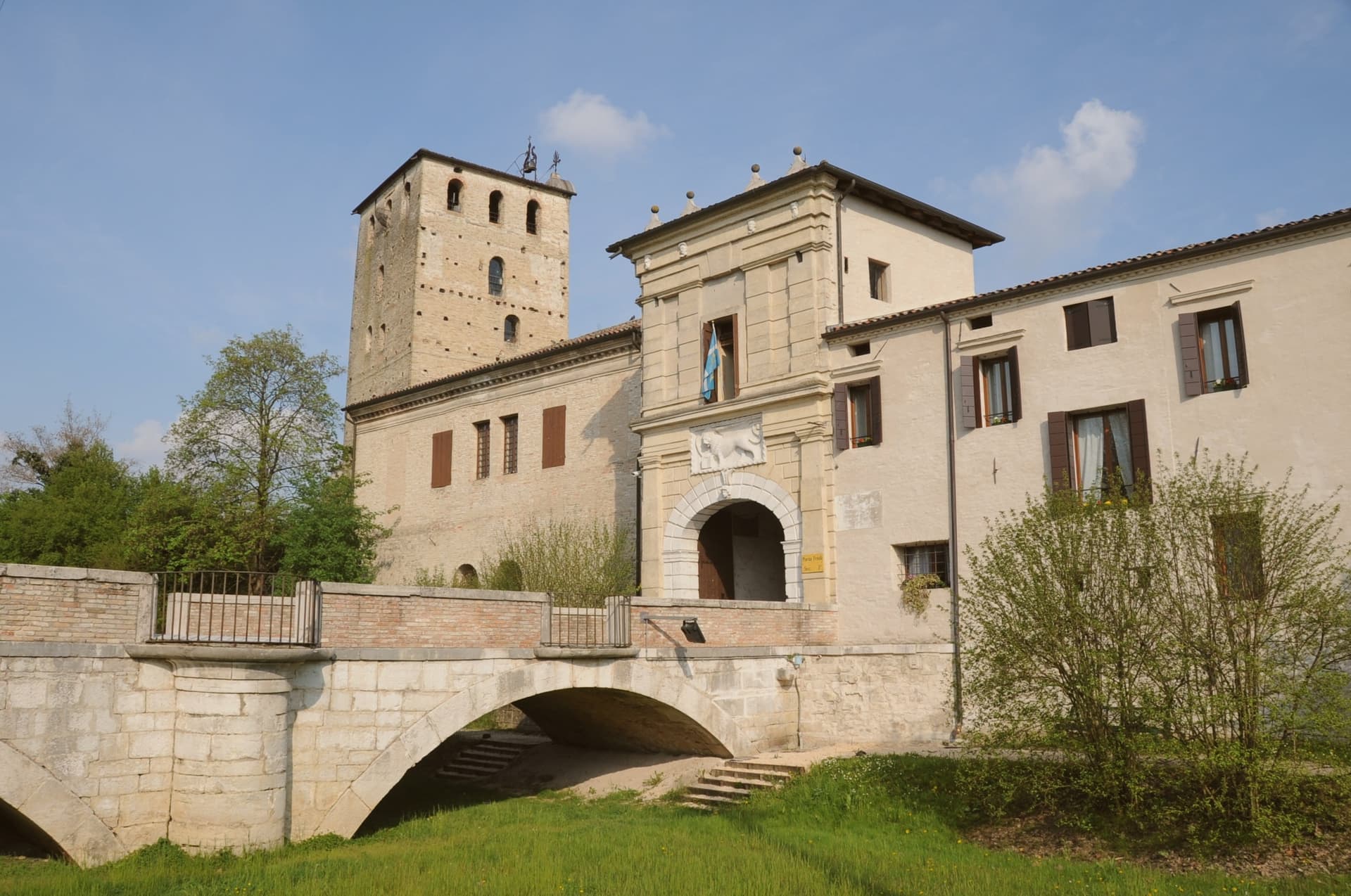
Portobuffolè sits at 10 meters on both banks of the Livenza, fifty kilometers northeast of Venice, the river dividing the commune in two and giving it its medieval port function. The Roman trading post Septimum de Liquentia stood on the same ground.
The medieval port grew under the da Camino lords in the late thirteenth century and passed through the Carrara, the patriarchs of Aquileia and the bishops of Ceneda before Venice took it in 1339, governing through rectors who held court in the town's arcaded loggia until 1797. The centro storico keeps this layered history in built form: a single main square, brick house facades from the thirteenth century, a former synagogue rebuilt around its original walls into the town's church, and the fourteenth-century home of a poet remembered by Dante now serving as museum and library.
A Roman crossing, a river port under successive overlords, a Jewish community whose synagogue became a Catholic duomo, and a noblewoman's house that outlasted them all: the smallest commune in its province holds a larger history than its size would suggest.
What to see in Portobuffolè
- Casa Gaia da Camino. Fourteenth-century residence of the poet Gaia da Camino cited by Dante in Purgatorio XVI, now a small museum with frescoes and the civic library.
- Duomo dei Santi Pietro e Paolo. Former synagogue reconsecrated as a Catholic church in 1559, with a Madonna altarpiece by Francesco da Milano and an organ with over four hundred tin pipes.
- Centro storico. Medieval river-port plan with a single main square, the Loggia Comunale, the Monte di Pietà and houses with thirteenth-century brick facades.
How to get to Portobuffolè
Venezia is roughly 63 minutes away by road.
Our tip
April through June and September through October are the months Portobuffolè works for. The Livenza runs full in spring, the centro is walkable in two directions, and the antiques fair, the Mostra del Mercatino dell'Antiquariato, fills the main square on the first Sunday of every month from March through December. July and August bring Po Valley heat past thirty-two degrees and the lungolivenza shadows fill from midday.
Rocca Pietore
Why visit Rocca Pietore
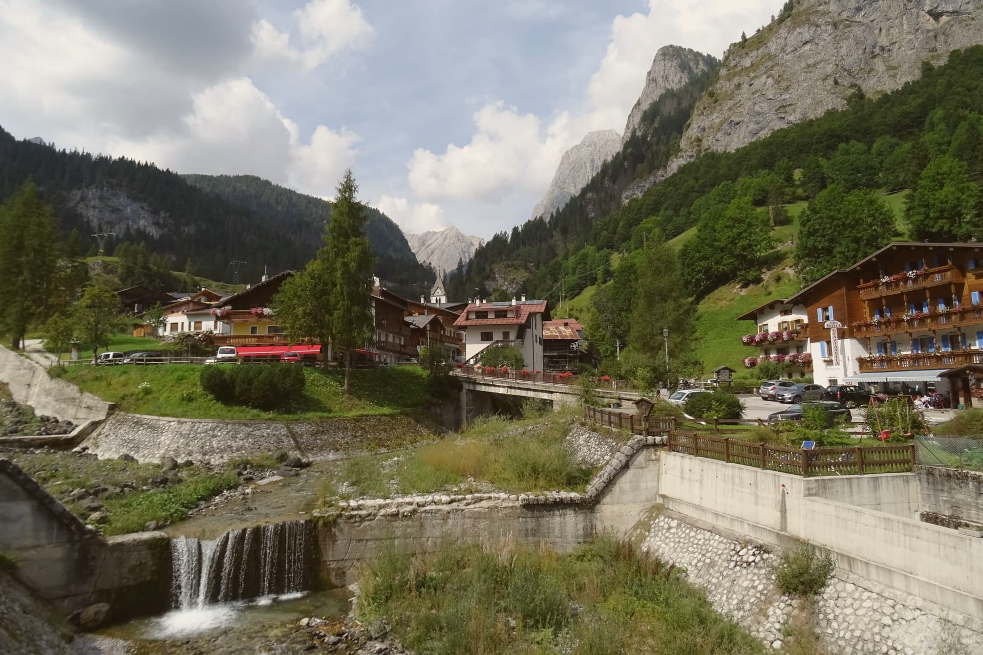
The Val Pettorina is the upper Agordino valley, running west from Belluno to the foot of the mountain the commune shares with Trentino. Rocca Pietore sits in it at 1,143 meters, a borgo that began as a Lombard military outpost before becoming, for nearly four centuries, the seat of a small republic under the County of Tyrol and the bishopric of Brixen, until Napoleon dissolved it.
The frazione of Sottoguda, higher up the valley at 1,250 meters, carries its own recognition as one of the Borghi più belli d'Italia, and the commune has held the Bandiera Arancione since 2018. The gorge that separates the village from Malga Ciapela has needed rebuilding twice this century, first after damage in 2018 and again in 2020, reopening only in stages from 2023.
The parish church stands on the rock above the borgo, the seat from which the old Tyrolean republic governed. What emerges is a valley shaped as much by repeated damage and repair as by the mountain looming over it: a small governing center under foreign rule for centuries, a gorge that keeps having to be rebuilt, and a glacier reached only by the single cable car that climbs above it all.
What to see in Rocca Pietore
- Marmolada. Peak shared with Trentino, its glacier reached by cable car from Malga Ciapela to Punta Rocca at 3,269 meters, the only way up onto the ice.
- Serrai di Sottoguda. The gorge path runs between the village and Malga Ciapela, hemmed by rock on both sides, closed for years of repair after Storm Vaia before reopening to walkers.
- Sottoguda. Frazione at 1,250 meters joined to the Borghi più belli d'Italia in 2016, with the fifteenth-century Church of Saints Fabian, Sebastian and Roch.
How to get to Rocca Pietore
Bolzano is roughly 91 minutes away by road.
Our tip
December through March is the working season: the Marmolada glacier opens for skiing, the Bellunese run drops twelve kilometers from Punta Rocca to Malga Ciapela, and hotels in the village fill. June through September is the second season, walking the reopened Serrai, hiking on the Marmolada and the Padon ridge across the Fedaia, and visiting the First World War positions near the glacier. April, May, October and November are quiet.
Arquà Petrarca
Why visit Arquà Petrarca
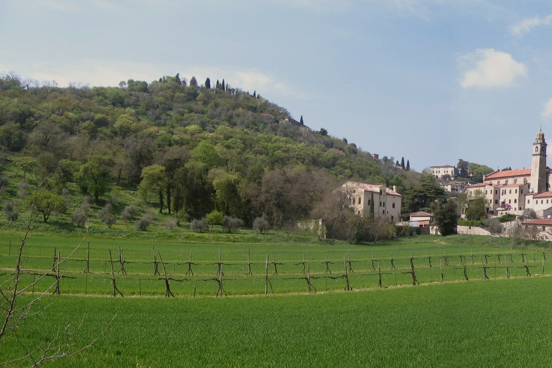
Arquà sits between Monte Ventolone and Monte Castello, in the Euganean Hills south of Padova. The name dates to medieval records; the suffix Petrarca was added in 1868, after the Veneto's annexation to the Kingdom of Italy, as a public homage to the poet who chose to die here.
Francesco Petrarca arrived in 1370 and lived in a thirteenth-century house he renovated himself across two stories, the Casa del Petrarca, now a museum with frescoes from the fifteenth and sixteenth centuries. He died at his desk on the night of 18-19 July 1374.
His tomb, an ark in red Verona marble inspired by Roman sarcophagi, was placed in the churchyard of Santa Maria Assunta in 1380 and reset in 1965. The village kept its medieval layout: two piazzas linked by a stepped path, the Casa above and the church and tomb below.
The hills around it grow Colli Euganei DOC wine, olives, and the giuggiole that go into the local liqueur Brodo di Giuggiole.
What to see in Arquà Petrarca
- Casa di Francesco Petrarca. The poet's thirteenth-century house, renovated by him on two floors and now a museum with frescoes added by later owners in the fifteenth and sixteenth centuries.
- Tomba di Petrarca. Sarcophagus in red Verona marble in the churchyard of Santa Maria Assunta, placed in 1380, six years after the poet's death.
- Chiesa di Santa Maria Assunta. Parish church first documented in 1026, enlarged through the centuries, with frescoes of the Venetian-Byzantine school up to the fifteenth century.
How to get to Arquà Petrarca
There is a railway station in the town, so you can arrive without a car and never need one while you are here. Padova is roughly 28 minutes away by road.
Our tip
April through June and September through October are the months Arquà is built for. The hills are green in spring and gold in autumn; the slope from Piazza Roma down to the church is comfortable walking weather. July and August push past thirty degrees and the village empties between two and six, though Padova day-trippers still arrive in the late afternoon.
Cison di Valmarino
Why visit Cison di Valmarino
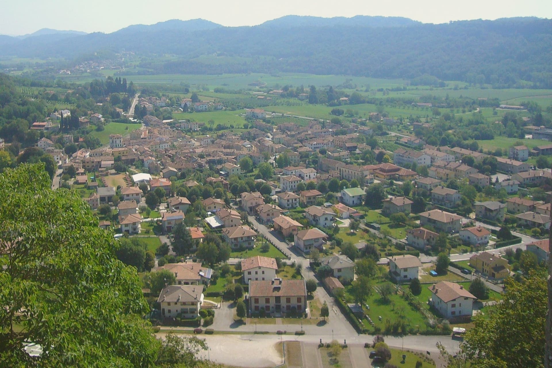
Cison di Valmarino sits at 261 meters at the foot of CastelBrando, the medieval fortress that rises 370 meters above the village on a dolomite spur. The castle is one of the largest in Europe, with origins as a Roman watch post on the Via Claudia Augusta and an unbroken occupation that runs through the Da Camino, the Brandolini, and into the present-day hotel and conference complex that opened in the 1990s.
The borgo below kept the layout the Brandolini gave it after they took the fief from Venice in 1436. Via XXIV Maggio runs through stone houses with arched portals; Piazza Roma holds the eighteenth-century Loggia.
The municipal territory carries four institutional signals at once, the maximum cluster in the eastern Prosecco hills, and the parish church of Santa Maria Assunta anchors the upper village. The Artigianato Vivo fair fills the streets for ten days each August, with around three hundred craft stalls drawing fifty thousand visitors and ranking among the largest artisanal events in Veneto.
What to see in Cison di Valmarino
- CastelBrando. Medieval fortress on a dolomite rock at 370 meters above the village, with Roman foundations and continuous occupation, now hotel and conference center.
- Piazza Roma. Main square of the borgo with the eighteenth-century Loggia and the Palazzo Barbi, the historic seat of municipal administration.
- Chiesa di Santa Maria Assunta. Parish church in the upper village, rebuilt in the eighteenth century on an earlier medieval structure, with frescoes from the Tiepolo school.
How to get to Cison di Valmarino
Venezia is roughly 79 minutes away by road.
Our tip
April through October is the working window. April and May fill the hills with green and the Prosecco vineyards with flowering vines; September and October bring harvest and the gold light the Rive di Rolle hamlet has built its reputation on. The Artigianato Vivo runs the second and third weeks of August, with around 300 stalls along Via XXIV Maggio and parking for the surrounding villages used to capacity.
Follina
Why visit Follina
Follina sits at 191 meters where a stream cuts out of the Treviso Prealps into the upper Prosecco hills, sixty-five kilometers northwest of Padova. The name comes from follare, to full wool, and the Sanavalle stream powered fulling mills here from antiquity through the nineteenth century.
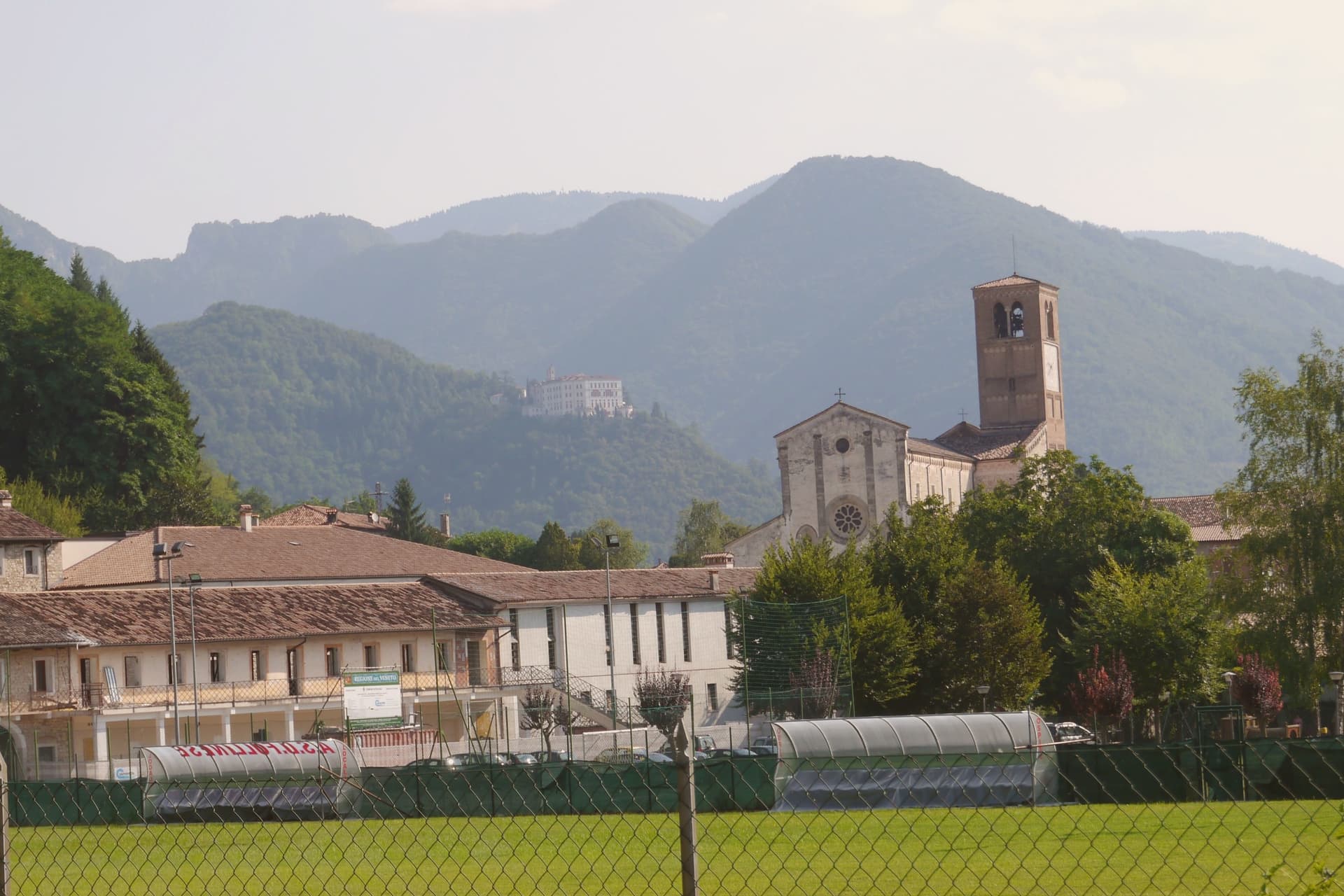
A monastic complex existed before the Cistercians arrived in the mid-twelfth century, likely a Benedictine house dependent on San Fermo di Verona. The Cistercians built the Abbey of Santa Maria from 1170; the cloister was completed in 1268.
The abbey is now a minor basilica and parish seat, a national monument since 1921, with frescoes of the Veneto-Byzantine school in the chapter house and a thirteenth-century stone Madonna inside the church. The Brandolini family, lords of nearby Cison di Valmarino, used Follina as a textile center through the Venetian period.
The borgo carries five institutional signals at once. The frazione of Pedeguarda holds the older parish church; the centro of Follina runs along the abbey wall and the stream that powered the mills.
What to see in Follina
- Abbazia di Santa Maria. Cistercian abbey built from 1170, with the cloister completed in 1268, raised to minor basilica and a national monument since 1921.
- Chiostro dell'Abbazia. Cistercian cloister of 1268, with twin colonnettes, sculpted capitals and a central well, intact in its medieval form.
- Sala del Capitolo. Abbey chapter house with frescoes of the Veneto-Byzantine school from the late thirteenth and early fourteenth centuries.
How to get to Follina
Venezia is roughly 73 minutes away by road.
Our tip
April through October is the working season. April and May bring the abbey gardens into bloom and the Prosecco hills into green; September and October bring harvest and the gold light the Rive belt is built on. July and August push into the low thirties and the centro empties in the afternoon, though the cloister stays cool.
Malcesine
Why visit Malcesine
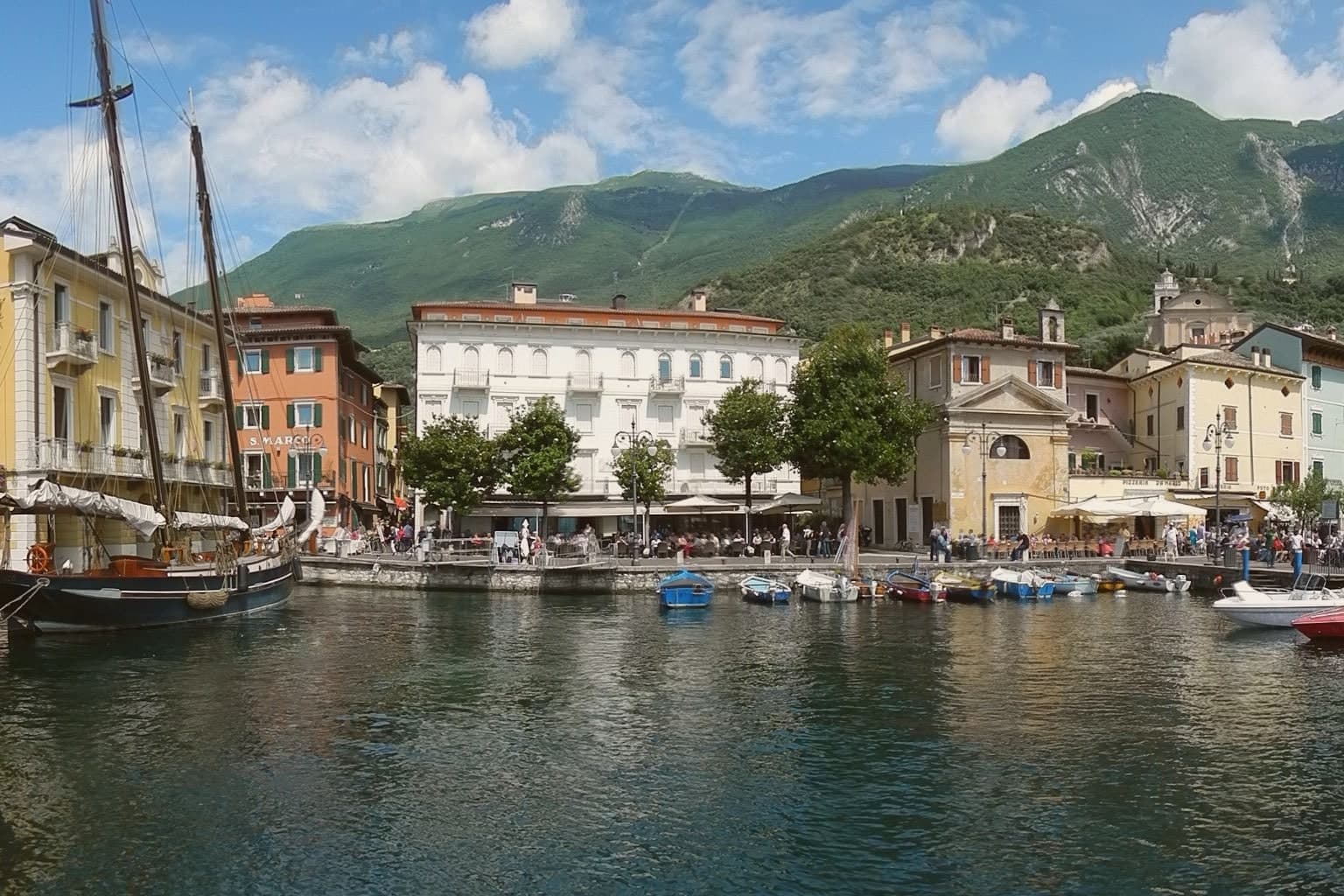
Malcesine sits at 89 meters on the eastern shore of Lake Garda, forty kilometers northwest of Verona and immediately south of Trentino-Alto Adige. The town strings together five lakeside frazioni between Navene and Cassone, pinched between the water and the slopes of Monte Baldo, which rises to 2,218 meters behind the rooftops.
The Castello Scaligero, built by the della Scala family of Verona in the thirteenth century around an older white-stone keep, is the defining building. On 14 September 1786 Johann Wolfgang Goethe was questioned in front of it on suspicion of being an Austrian spy after drawing sketches; he later devoted several pages to the episode in Italienische Reise.
The Monte Baldo cable car, opened in 1962 and rebuilt with rotating cabins in 2002, lifts walkers and paragliders to 1,750 meters in ten minutes. Olive groves along the lower slopes carry the Garda DOP olive oil designation.
What to see in Malcesine
- Castello Scaligero. Thirteenth-century Scaliger fortress on a rock above the lake, with an older white-stone keep, the rooms where Goethe was held briefly in 1786 and a museum on Monte Baldo flora.
- Palazzo dei Capitani. Fifteenth-century Venetian palazzo on the lakefront, residence of the Captains of the Lake during the Republic of Venice, with a lakeside loggia and gardens.
- Monte Baldo. 2,218-meter ridge behind the town, reached by a two-stage cable car with rotating cabins; the summit is a botanical reserve known since the sixteenth century as Hortus Europae.
How to get to Malcesine
Trento is roughly 65 minutes away by road.
Our tip
April through June and September through October are the months Malcesine is built for. The cable car runs to Monte Baldo through clear spring and autumn air, the windsurfers fill Val di Sogno when the Ora picks up at midday, and the centro storico is busy but walkable. July and August push past thirty degrees on the lake and the village queues for the cable car from eight in the morning; many German and Austrian families have rented apartments here for generations.
Asolo
Why visit Asolo
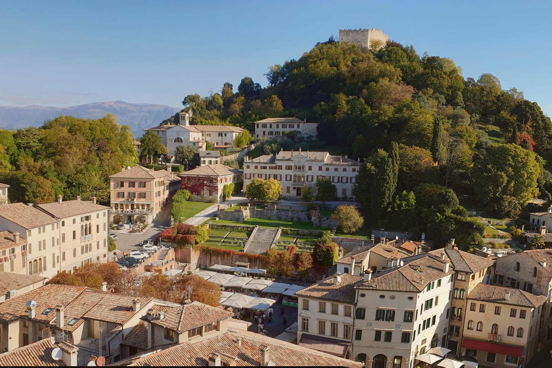
Asolo perches at 205 meters on a ridge between the Asolan hills and the Veneto plain, forty kilometers north of Padova. Pliny knew it as Acelum.
The Ezzelini family held it in the early Middle Ages; the Rocca on the hill above town dates from the late twelfth and early thirteenth centuries and was restored in 2020 after a 2016 storm damaged the walls. The defining episode came in 1489, when the Republic of Venice gave Asolo as a fiefdom to Caterina Cornaro, the deposed Queen of Cyprus, in exchange for her island.
She kept a court here for twenty years until the League of Cambrai sacked the town in 1509. Her circle included Gentile Bellini, the humanist Pietro Bembo and the poet Andrea Navagero.
Robert Browning wintered in a villa here from 1838 onward, and the actress Eleonora Duse retired to Asolo and is buried in the local cemetery. The town carries six institutional signals at once.
What to see in Asolo
- Rocca di Asolo. Late twelfth and early thirteenth-century fortress on the hill above the town, restored in 2020 with €300,000 in ministry funding.
- Castello di Caterina Cornaro. Medieval castle in the town, court of the Queen of Cyprus from 1489 to 1509, now home to the Eleonora Duse theater.
- Duomo di Asolo. Cathedral rebuilt in 1747 with an Assunta altarpiece by Lorenzo Lotto, standing on the foundations of a Roman bath complex.
How to get to Asolo
Vicenza is roughly 57 minutes away by road.
Our tip
April through June and September through October are the right months. The ridge stays a few degrees cooler than the plain, and the views north to Monte Grappa are clearest in spring and autumn. July and August are warm and busy; weekend traffic from Venice and Padova fills the Piazza Garibaldi car park by ten.
Montagnana
Why visit Montagnana
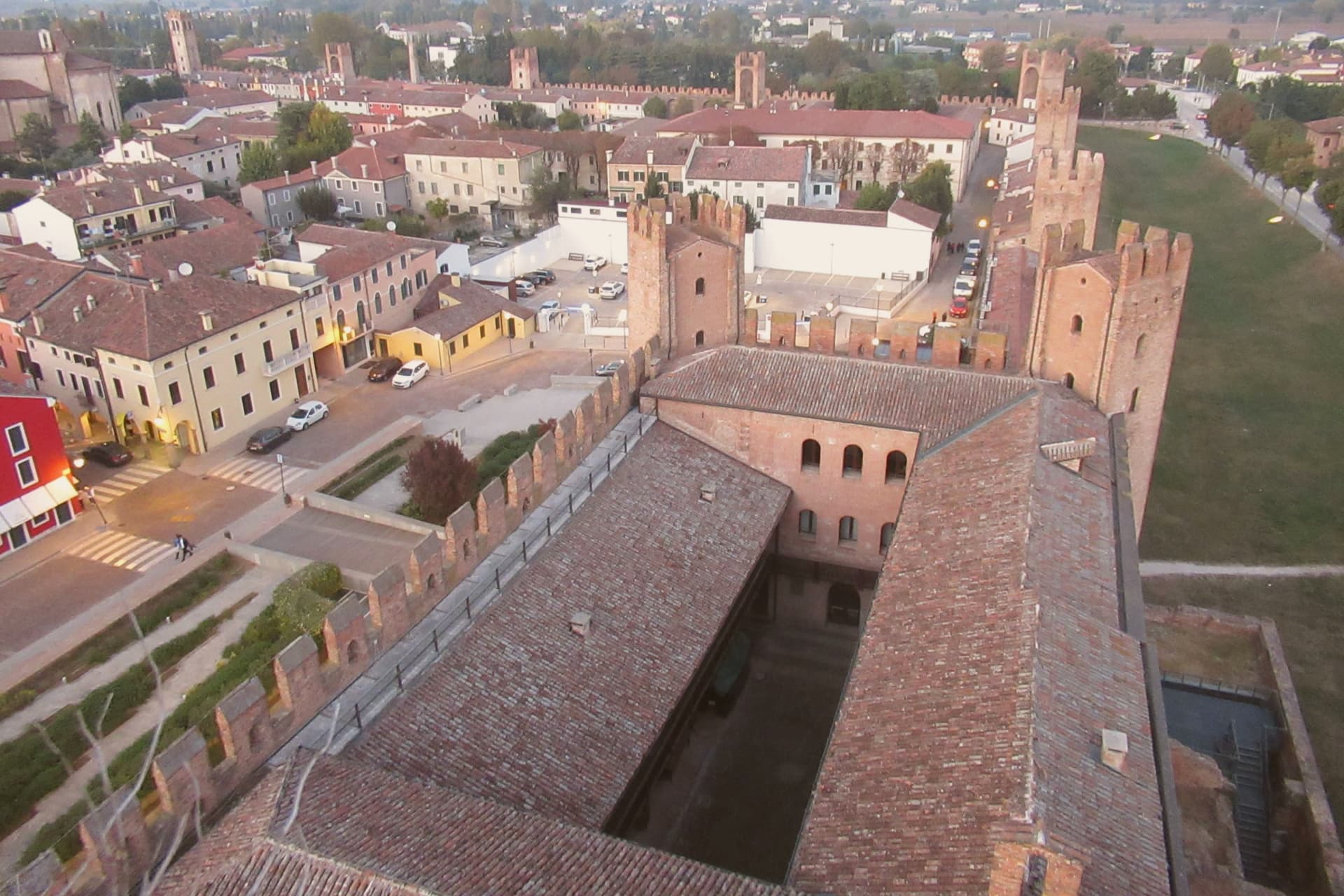
Montagnana sits at 16 meters on the lower Padova plain, thirty-five kilometers southwest of Padova, on the watershed between the Adige and the Bacchiglione. The wall ring is unbroken enough that the town's whole plan still reads as the fortification that produced it: the castle anchors the eastern gate, the rocca anchors the western one, and the road to Verona runs between them through what was once contested ground between Ezzelino's garrison and the Carraresi who came after.
Inside the walls, the center holds the Duomo and the two flanking palazzi around Piazza Maggiore, while the villa built for the cardinal stands deliberately outside the gate, a country house that still shows its face to the town. The May festival now fills the same ground the walls were built to defend, the modern economy of the place staged inside its medieval perimeter.
What to see in Montagnana
- Cinta muraria. Six to eight meters high and ninety-six centimeters thick, the rampart carries a continuous parapet walk, so the towers can be counted from above rather than just from the road.
- Castello di San Zeno. Fortress at the eastern gate, built by Ezzelino III da Romano in 1242, with the Mastio tower 38 meters high and a civic museum inside.
- Rocca degli Alberi. Western gate fortress built by the Carraresi between 1360 and 1362, with a moat and double drawbridge defending the road to Verona.
How to get to Montagnana
There is a railway station in the town, so you can arrive without a car and never need one while you are here. Vicenza is roughly 47 minutes away by road.
Our tip
April through June and September through October are the right months for Montagnana. The lower Padova plain runs cool and clear in those windows, and the parapet walk on the walls gives the best views when the haze lifts. The Festa del Prosciutto Veneto DOP runs across two weekends in mid-May, the largest event of the year, with tastings and tours of the curing houses.
Sant'Ambrogio di Valpolicella
Why visit Sant'Ambrogio di Valpolicella
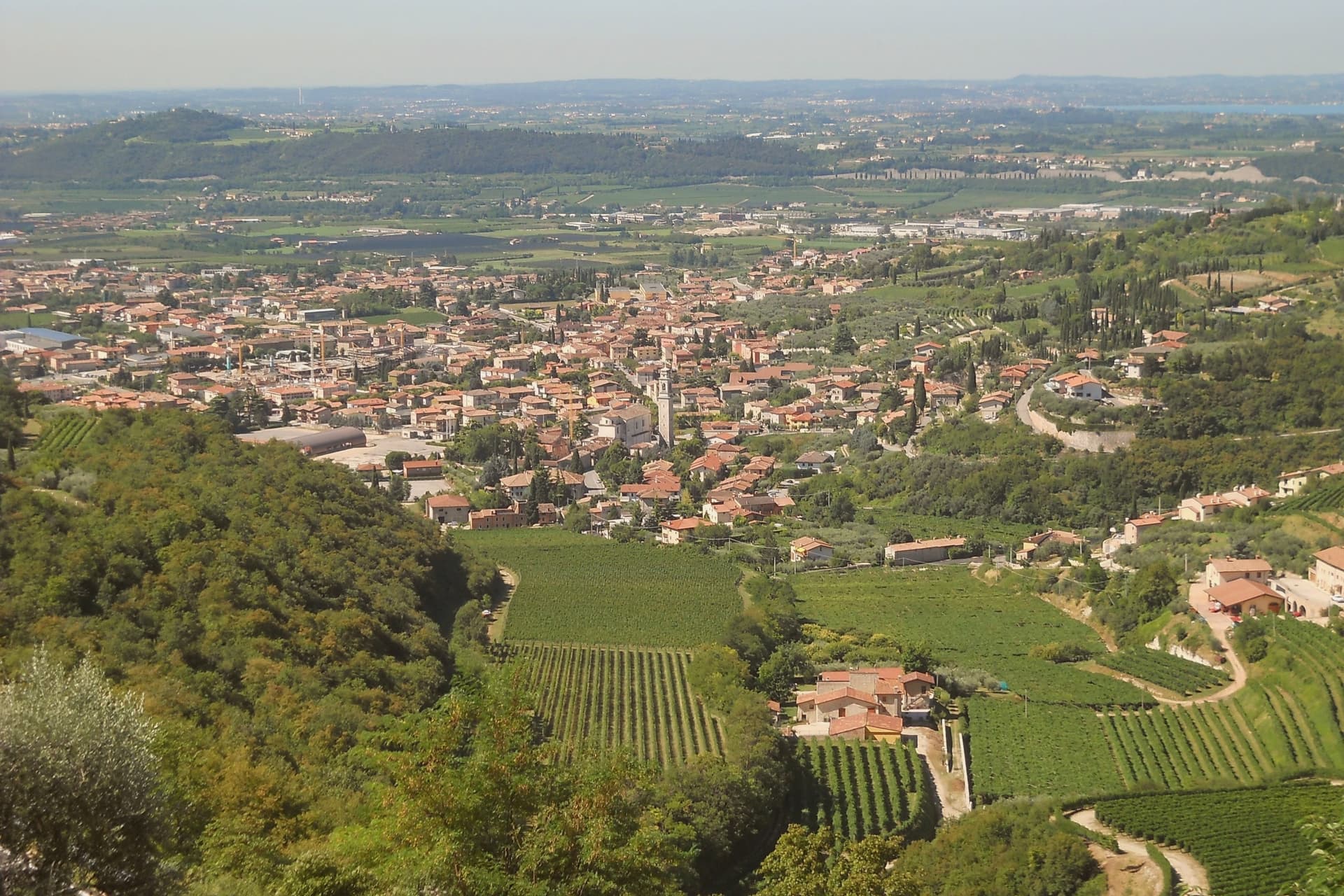
Sant'Ambrogio di Valpolicella sits at 174 meters in the heart of the Valpolicella DOC, fifteen kilometers northwest of Verona, on the rolling hills that close the eastern shore of Lake Garda. The commune groups five frazioni around the main village: Domegliara, Gargagnago, Monte, Ponton and the ridge settlement above them.
Gargagnago sits at the foot of the hills, its cellars closest to the valley floor; the ridge frazione occupies the higher limestone ground, reached by a climb steep enough to have earned the church its nickname. Between them the Serego Alighieri estate has worked the same parcels since Pietro Alighieri, son of Dante the poet who had followed his father into exile in Verona, bought the property in 1353, and the family still grows Corvina, Rondinella and Molinara there, with the Vaio Armaron Amarone counted among the appellation's cru benchmarks.
The pattern of the commune is one of a valley economy and a hill economy sharing a single administrative roof: wine pressed and aged below, an older, stiller settlement kept above it, with the quarries that once supplied Verona still worked on the slopes that join the two.
What to see in Sant'Ambrogio di Valpolicella
- Pieve di San Giorgio Ingannapoltron. Romanesque parish church whose ciborium columns carry an inscription naming the master builder Orso and his disciples Juventino and Juviano.
- San Giorgio di Valpolicella. Frazione on the limestone ridge above the valley, in the Borghi più belli d'Italia network, nicknamed Ingannapoltron for the steep climb up to it.
- Villa Serego Alighieri. Estate still owned by the Alighieri descendants; produces Vaio Armaron Amarone from Corvina, Rondinella and Molinara grown on the same parcels the family has worked.
How to get to Sant'Ambrogio di Valpolicella
There is a railway station in the town, so you can arrive without a car and never need one while you are here. Verona is roughly 34 minutes away by road.
Our tip
April through June and September through October are the months for Valpolicella. The vineyards green up in spring, harvest runs from mid-September into October, and the appassimento drying begins in the cellars while the leaves turn. July and August push past thirty degrees in the valley and the village empties between two and six in the afternoon; cellar visits move to morning slots.
Borgo Valbelluna
Why visit Borgo Valbelluna
The comune took shape on 30 January 2019, when Mel, Trichiana and Lentiai, three separate comuni in the lower Belluno province, were merged into one administrative body. The reasoning was the standard one for inland Veneto towns in the Piave valley: depopulation and the economics of scale.
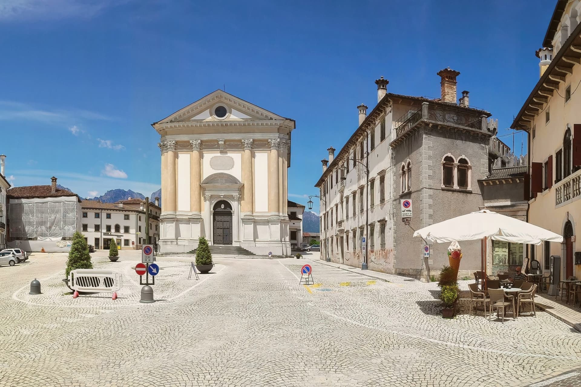
What the fusion produced is a comune with no single old centre, three former towns held together by a name invented in 2019. Mel supplies what identity the new comune has.
It sits at 350 metres in the gentle pre-Dolomite hills, 18 km southwest of Belluno, and the Veneto Republic governed here from 1404 to 1797, laying down the urban fabric that still stands. The Albrizzi, a family of Venetian nobility, held the local fief and made Mel their administrative seat, which is why the piazza reads as Venetian rather than purely local.
Trichiana and Lentiai contribute their own fragments to the comune: a forested ridge 5 km west of Mel carries an 11th-century castle with intact tower and walls and the legend of the Zumelle twin sisters, now a museum and wedding venue, and a 7th-4th century BC pre-Roman cemetery near Mel holds more than 400 tombs, the most important pre-Roman Venetic site in the upper Veneto. Lentiai in turn holds a Romanesque parish church with a Renaissance altarpiece inside it, a combination distinctive enough to be one of the upper Veneto's more unusual pairings.
The wider comune is recognised as a Bandiera Arancione by the Touring Club. Geography does more to hold the place together than history does.
The Piave, a river bound up with Italian wartime memory, runs through the valley, and the former Italian-Austrian front line sat 5 km south of here. The Dolomiti Bellunesi National Park lies 20 km north, and the Valbelluna route continues from there into the upper Cordevole and Agordo valleys and on to the Pelmo and Civetta massifs, so the comune functions as a threshold between the flatter Piave valley and the mountains to the north rather than a destination in itself.
Food follows the same pre-Alpine pattern: pastin, schiz, polenta and venison, with Soligo and Vincheto whites, and the Festa di San Donato marking the local calendar each October. Put together, this is a comune whose administrative unity is recent and functional, while its actual centre of gravity, visual, cultural and historical, remains fixed on Mel.
What to see in Borgo Valbelluna
- Mel centro storico (BPB) — Piazza Papa Luciani. The piazza itself: warm-orange Belluno limestone underfoot and on every façade, the Palazzo delle Contesse and the Loggia Veneziana standing alongside the Chiesa Arcipretale. It functions as the visual and cultural anchor for the whole merged comune, the one point all three former towns orient around.
- Castello di Zumelle. The tower and walls stand intact on their forested ridge 5 km west of Mel. The site carries the twin-sisters legend and is worked today as a museum and a venue for medieval-themed weddings.
- Necropoli Paleoveneta di Mel. The tombs themselves, more than 400 of them, with finds distributed between the local museum and Belluno's. What survives is the physical record: grave goods and cemetery layout rather than any single monument.
How to get to Borgo Valbelluna
Venezia is roughly 94 minutes away by road.
Our tip
Borgo Valbelluna is best May through September — the pre-Alpine summer is pleasantly cool at 367m altitude. The Festa di San Donato (second Sunday October) is the year's main civic event. October-November brings the chestnut + selvaggina season.