The prettiest small villages in Veneto
Veneto changes material as you move inland. In the Colli Euganei the walls are volcanic trachyte, grey-violet and warm underfoot, with fig trees and olives on the slopes and jujube fruit turned into a sweet liqueur each autumn. Further north the Prosecco hills rise in ridges above Valdobbiadene, and beyond them the Piave and the Cordevole cut up towards the Dolomites, where villages are built of stone at the base and larch above, with hay barns still standing at the edge of the pasture. Spring brings asparagus and radicchio to the plain, autumn brings mushrooms, game and the smell of woodsmoke in the valleys.
Almost everyone who comes to the region goes to Venice, and Venice absorbs the pressure of the whole Veneto. The Grand Canal, the Rialto and Piazza San Marco run at capacity from Easter until late October, and the day-trip crowds arriving from the cruise terminal and from Mestre by train compress into a few hundred metres of pavement. Verona takes the overflow, particularly during the opera season in the Arena. Both are worth the visit; neither is quiet.
The hills, the vines, the walls and the mountains carry on well past those two cities, and fewer people follow them. This list stays with the smaller places: a medieval village behind its ring of walls on the Euganean slopes, a Cistercian abbey town in the Prosecco hills, a lakeside castle village under Monte Baldo, a river settlement in the flat land towards Friuli, and a mountain comune high in the Cordevole valley beneath Marmolada. Each has passed the assessment of the national association of Italy's most beautiful villages, which is a matter of fabric and upkeep rather than photogenic luck.
Of the 41 communes we have mapped in Veneto, 11 qualify as prettiest villages: each has passed the assessment of the national association of Italy's most beautiful villages. This list is the small ones, 6 in all, ordered smallest first. The smallest, Portobuffolè, has 742 residents.
Elsewhere in the catalogue: The 10 prettiest hidden villages in Veneto and The 7 best small towns that eat well in Veneto.
Portobuffolè
Why visit Portobuffolè
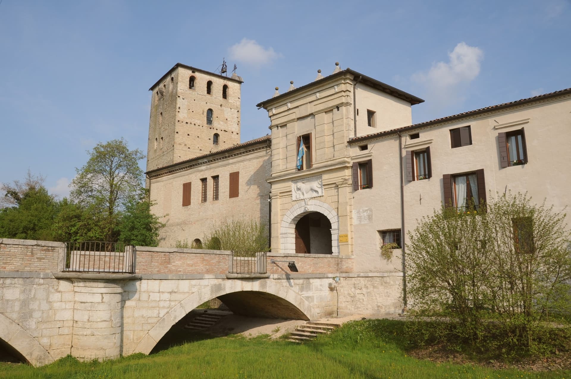
Portobuffolè sits at 10 meters on both banks of the Livenza, fifty kilometers northeast of Venice, the river dividing the commune in two and giving it its medieval port function. The Roman trading post Septimum de Liquentia stood on the same ground.
The medieval port grew under the da Camino lords in the late thirteenth century and passed through the Carrara, the patriarchs of Aquileia and the bishops of Ceneda before Venice took it in 1339, governing through rectors who held court in the town's arcaded loggia until 1797. The centro storico keeps this layered history in built form: a single main square, brick house facades from the thirteenth century, a former synagogue rebuilt around its original walls into the town's church, and the fourteenth-century home of a poet remembered by Dante now serving as museum and library.
A Roman crossing, a river port under successive overlords, a Jewish community whose synagogue became a Catholic duomo, and a noblewoman's house that outlasted them all: the smallest commune in its province holds a larger history than its size would suggest.
What to see in Portobuffolè
- Casa Gaia da Camino. Fourteenth-century residence of the poet Gaia da Camino cited by Dante in Purgatorio XVI, now a small museum with frescoes and the civic library.
- Duomo dei Santi Pietro e Paolo. Former synagogue reconsecrated as a Catholic church in 1559, with a Madonna altarpiece by Francesco da Milano and an organ with over four hundred tin pipes.
- Centro storico. Medieval river-port plan with a single main square, the Loggia Comunale, the Monte di Pietà and houses with thirteenth-century brick facades.
How to get to Portobuffolè
Venezia is roughly 63 minutes away by road.
Our tip
April through June and September through October are the months Portobuffolè works for. The Livenza runs full in spring, the centro is walkable in two directions, and the antiques fair, the Mostra del Mercatino dell'Antiquariato, fills the main square on the first Sunday of every month from March through December. July and August bring Po Valley heat past thirty-two degrees and the lungolivenza shadows fill from midday.
Rocca Pietore
Why visit Rocca Pietore
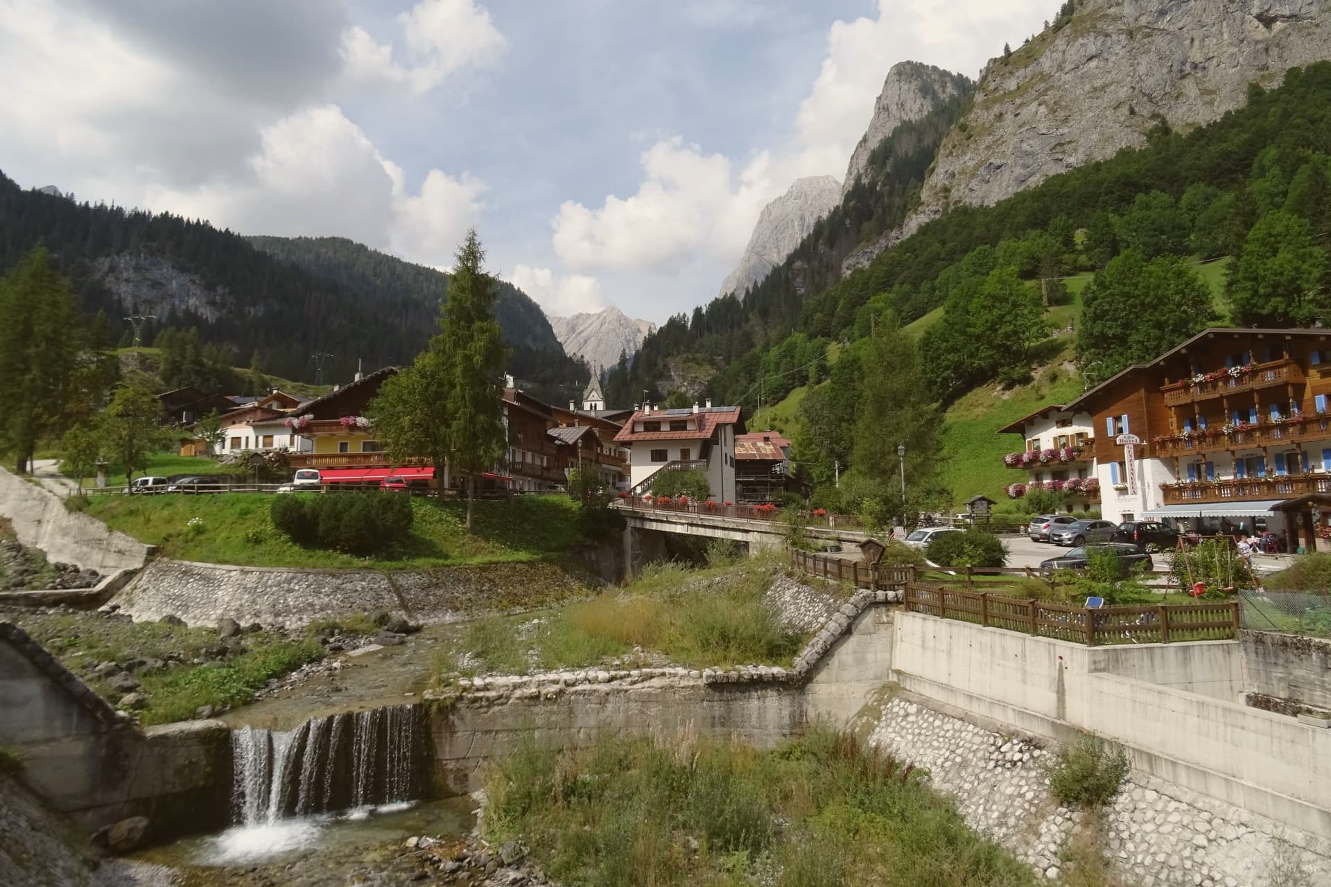
The Val Pettorina is the upper Agordino valley, running west from Belluno to the foot of the mountain the commune shares with Trentino. Rocca Pietore sits in it at 1,143 meters, a borgo that began as a Lombard military outpost before becoming, for nearly four centuries, the seat of a small republic under the County of Tyrol and the bishopric of Brixen, until Napoleon dissolved it.
The frazione of Sottoguda, higher up the valley at 1,250 meters, carries its own recognition as one of the Borghi più belli d'Italia, and the commune has held the Bandiera Arancione since 2018. The gorge that separates the village from Malga Ciapela has needed rebuilding twice this century, first after damage in 2018 and again in 2020, reopening only in stages from 2023.
The parish church stands on the rock above the borgo, the seat from which the old Tyrolean republic governed. What emerges is a valley shaped as much by repeated damage and repair as by the mountain looming over it: a small governing center under foreign rule for centuries, a gorge that keeps having to be rebuilt, and a glacier reached only by the single cable car that climbs above it all.
What to see in Rocca Pietore
- Marmolada. Peak shared with Trentino, its glacier reached by cable car from Malga Ciapela to Punta Rocca at 3,269 meters, the only way up onto the ice.
- Serrai di Sottoguda. The gorge path runs between the village and Malga Ciapela, hemmed by rock on both sides, closed for years of repair after Storm Vaia before reopening to walkers.
- Sottoguda. Frazione at 1,250 meters joined to the Borghi più belli d'Italia in 2016, with the fifteenth-century Church of Saints Fabian, Sebastian and Roch.
How to get to Rocca Pietore
Bolzano is roughly 91 minutes away by road.
Our tip
December through March is the working season: the Marmolada glacier opens for skiing, the Bellunese run drops twelve kilometers from Punta Rocca to Malga Ciapela, and hotels in the village fill. June through September is the second season, walking the reopened Serrai, hiking on the Marmolada and the Padon ridge across the Fedaia, and visiting the First World War positions near the glacier. April, May, October and November are quiet.
Arquà Petrarca
Why visit Arquà Petrarca
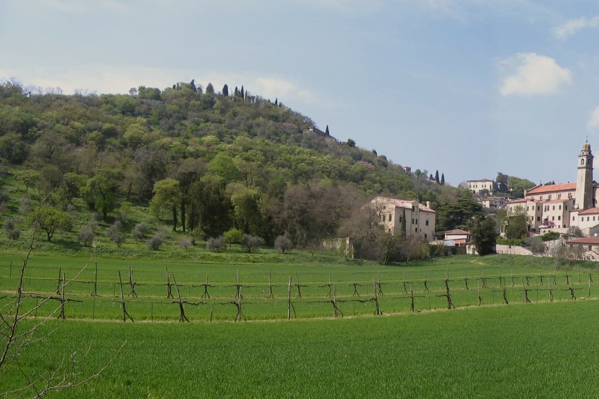
Arquà sits between Monte Ventolone and Monte Castello, in the Euganean Hills south of Padova. The name dates to medieval records; the suffix Petrarca was added in 1868, after the Veneto's annexation to the Kingdom of Italy, as a public homage to the poet who chose to die here.
Francesco Petrarca arrived in 1370 and lived in a thirteenth-century house he renovated himself across two stories, the Casa del Petrarca, now a museum with frescoes from the fifteenth and sixteenth centuries. He died at his desk on the night of 18-19 July 1374.
His tomb, an ark in red Verona marble inspired by Roman sarcophagi, was placed in the churchyard of Santa Maria Assunta in 1380 and reset in 1965. The village kept its medieval layout: two piazzas linked by a stepped path, the Casa above and the church and tomb below.
The hills around it grow Colli Euganei DOC wine, olives, and the giuggiole that go into the local liqueur Brodo di Giuggiole.
What to see in Arquà Petrarca
- Casa di Francesco Petrarca. The poet's thirteenth-century house, renovated by him on two floors and now a museum with frescoes added by later owners in the fifteenth and sixteenth centuries.
- Tomba di Petrarca. Sarcophagus in red Verona marble in the churchyard of Santa Maria Assunta, placed in 1380, six years after the poet's death.
- Chiesa di Santa Maria Assunta. Parish church first documented in 1026, enlarged through the centuries, with frescoes of the Venetian-Byzantine school up to the fifteenth century.
How to get to Arquà Petrarca
There is a railway station in the town, so you can arrive without a car and never need one while you are here. Padova is roughly 28 minutes away by road.
Our tip
April through June and September through October are the months Arquà is built for. The hills are green in spring and gold in autumn; the slope from Piazza Roma down to the church is comfortable walking weather. July and August push past thirty degrees and the village empties between two and six, though Padova day-trippers still arrive in the late afternoon.
Cison di Valmarino
Why visit Cison di Valmarino
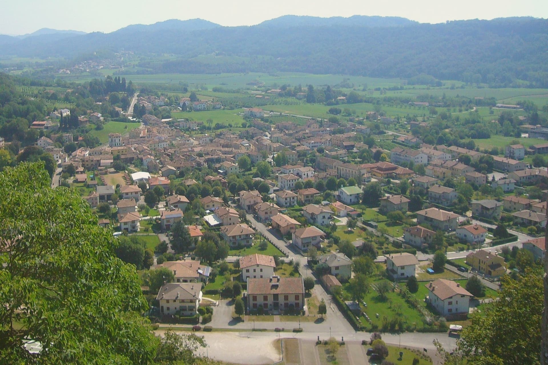
Cison di Valmarino sits at 261 meters at the foot of CastelBrando, the medieval fortress that rises 370 meters above the village on a dolomite spur. The castle is one of the largest in Europe, with origins as a Roman watch post on the Via Claudia Augusta and an unbroken occupation that runs through the Da Camino, the Brandolini, and into the present-day hotel and conference complex that opened in the 1990s.
The borgo below kept the layout the Brandolini gave it after they took the fief from Venice in 1436. Via XXIV Maggio runs through stone houses with arched portals; Piazza Roma holds the eighteenth-century Loggia.
The municipal territory carries four institutional signals at once, the maximum cluster in the eastern Prosecco hills, and the parish church of Santa Maria Assunta anchors the upper village. The Artigianato Vivo fair fills the streets for ten days each August, with around three hundred craft stalls drawing fifty thousand visitors and ranking among the largest artisanal events in Veneto.
What to see in Cison di Valmarino
- CastelBrando. Medieval fortress on a dolomite rock at 370 meters above the village, with Roman foundations and continuous occupation, now hotel and conference center.
- Piazza Roma. Main square of the borgo with the eighteenth-century Loggia and the Palazzo Barbi, the historic seat of municipal administration.
- Chiesa di Santa Maria Assunta. Parish church in the upper village, rebuilt in the eighteenth century on an earlier medieval structure, with frescoes from the Tiepolo school.
How to get to Cison di Valmarino
Venezia is roughly 79 minutes away by road.
Our tip
April through October is the working window. April and May fill the hills with green and the Prosecco vineyards with flowering vines; September and October bring harvest and the gold light the Rive di Rolle hamlet has built its reputation on. The Artigianato Vivo runs the second and third weeks of August, with around 300 stalls along Via XXIV Maggio and parking for the surrounding villages used to capacity.
Follina
Why visit Follina
Follina sits at 191 meters where a stream cuts out of the Treviso Prealps into the upper Prosecco hills, sixty-five kilometers northwest of Padova. The name comes from follare, to full wool, and the Sanavalle stream powered fulling mills here from antiquity through the nineteenth century.
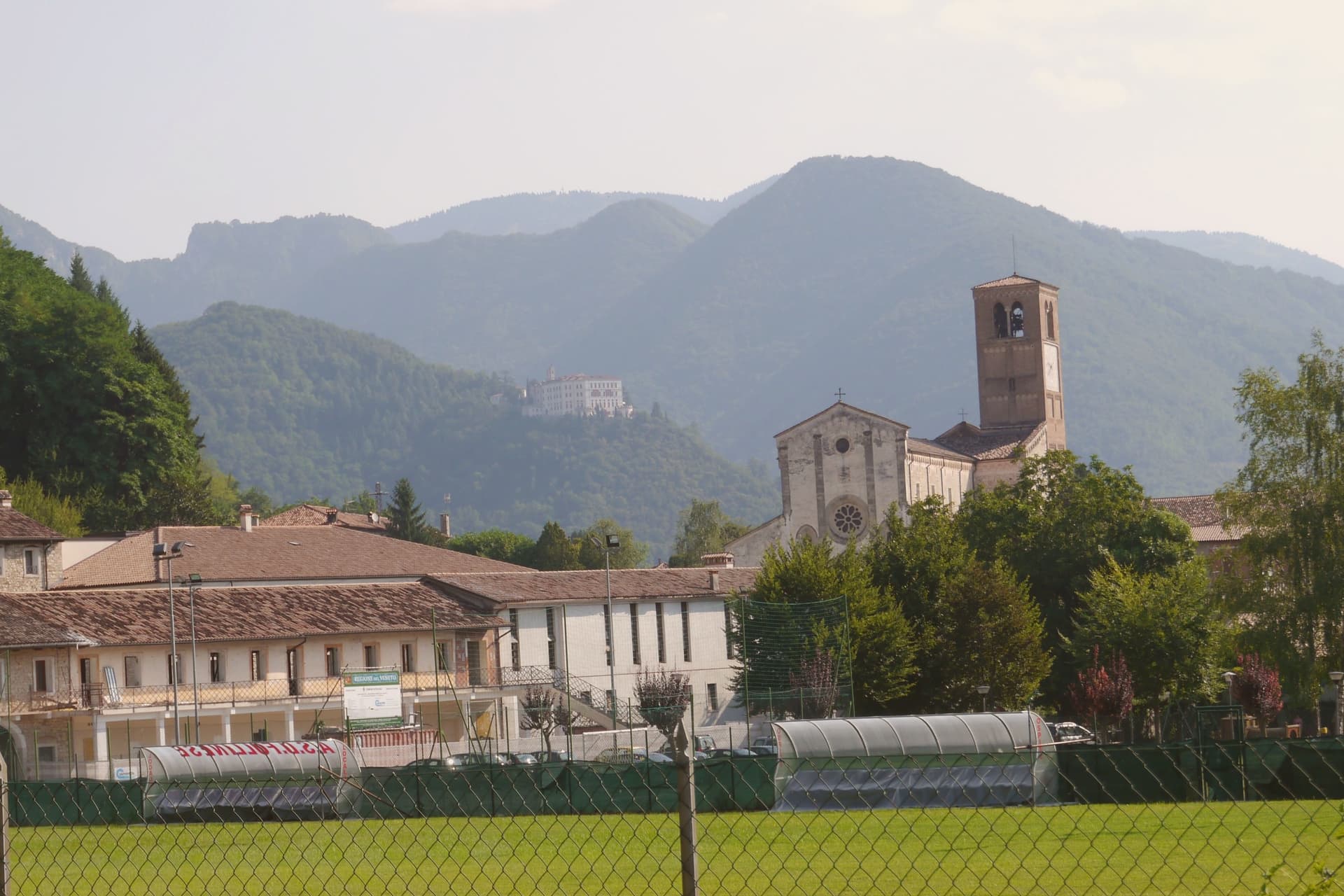
A monastic complex existed before the Cistercians arrived in the mid-twelfth century, likely a Benedictine house dependent on San Fermo di Verona. The Cistercians built the Abbey of Santa Maria from 1170; the cloister was completed in 1268.
The abbey is now a minor basilica and parish seat, a national monument since 1921, with frescoes of the Veneto-Byzantine school in the chapter house and a thirteenth-century stone Madonna inside the church. The Brandolini family, lords of nearby Cison di Valmarino, used Follina as a textile center through the Venetian period.
The borgo carries five institutional signals at once. The frazione of Pedeguarda holds the older parish church; the centro of Follina runs along the abbey wall and the stream that powered the mills.
What to see in Follina
- Abbazia di Santa Maria. Cistercian abbey built from 1170, with the cloister completed in 1268, raised to minor basilica and a national monument since 1921.
- Chiostro dell'Abbazia. Cistercian cloister of 1268, with twin colonnettes, sculpted capitals and a central well, intact in its medieval form.
- Sala del Capitolo. Abbey chapter house with frescoes of the Veneto-Byzantine school from the late thirteenth and early fourteenth centuries.
How to get to Follina
Venezia is roughly 73 minutes away by road.
Our tip
April through October is the working season. April and May bring the abbey gardens into bloom and the Prosecco hills into green; September and October bring harvest and the gold light the Rive belt is built on. July and August push into the low thirties and the centro empties in the afternoon, though the cloister stays cool.
Malcesine
Why visit Malcesine
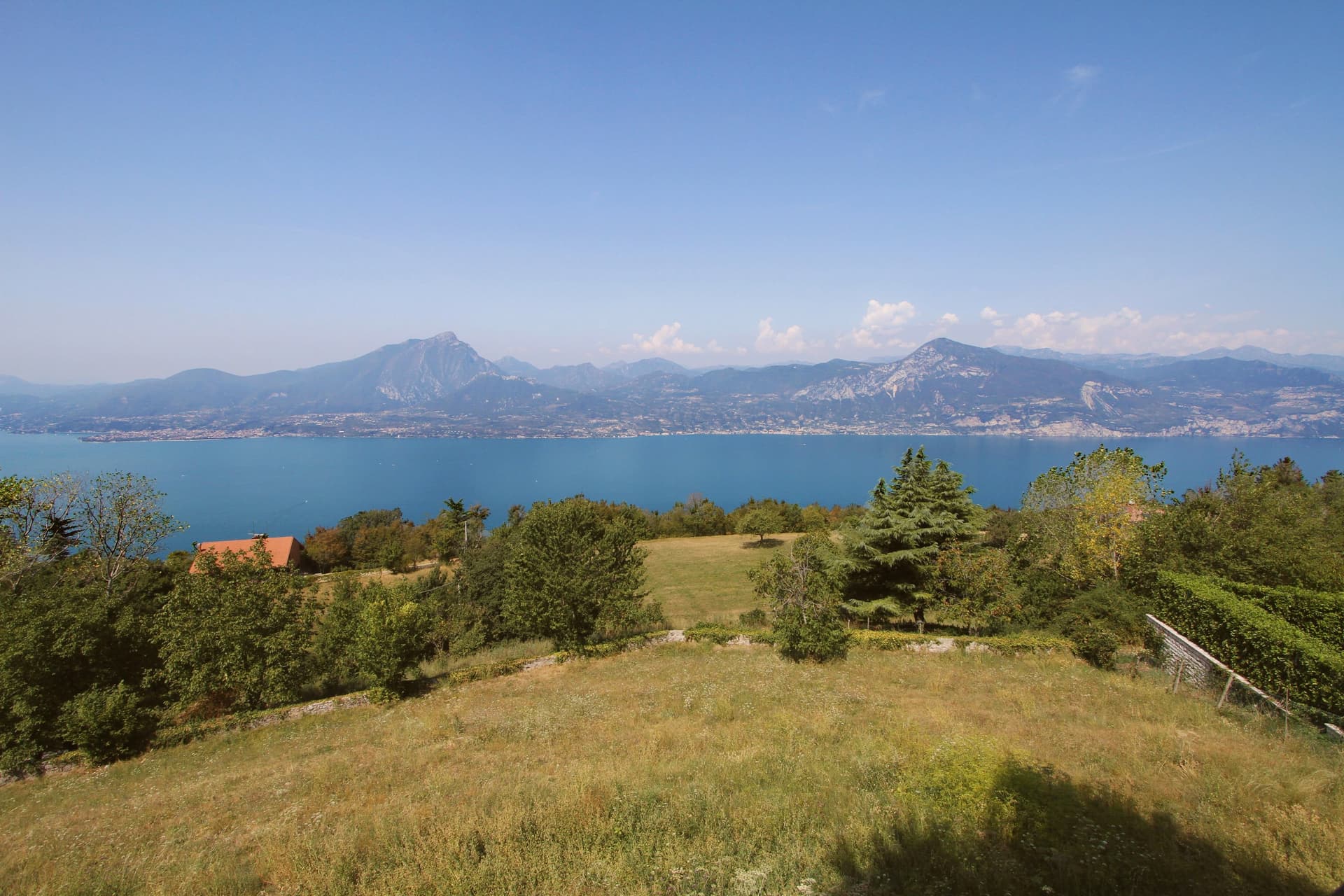
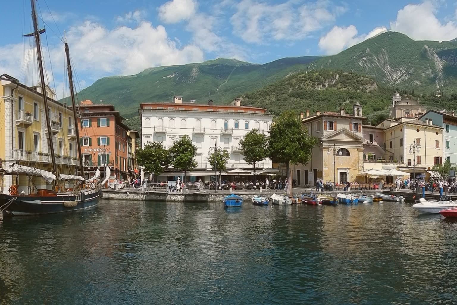
Malcesine sits at 89 meters on the eastern shore of Lake Garda, forty kilometers northwest of Verona and immediately south of Trentino-Alto Adige. The town strings together five lakeside frazioni between Navene and Cassone, pinched between the water and the slopes of Monte Baldo, which rises to 2,218 meters behind the rooftops.
The Castello Scaligero, built by the della Scala family of Verona in the thirteenth century around an older white-stone keep, is the defining building. On 14 September 1786 Johann Wolfgang Goethe was questioned in front of it on suspicion of being an Austrian spy after drawing sketches; he later devoted several pages to the episode in Italienische Reise.
The Monte Baldo cable car, opened in 1962 and rebuilt with rotating cabins in 2002, lifts walkers and paragliders to 1,750 meters in ten minutes. Olive groves along the lower slopes carry the Garda DOP olive oil designation.
What to see in Malcesine
- Castello Scaligero. Thirteenth-century Scaliger fortress on a rock above the lake, with an older white-stone keep, the rooms where Goethe was held briefly in 1786 and a museum on Monte Baldo flora.
- Palazzo dei Capitani. Fifteenth-century Venetian palazzo on the lakefront, residence of the Captains of the Lake during the Republic of Venice, with a lakeside loggia and gardens.
- Monte Baldo. 2,218-meter ridge behind the town, reached by a two-stage cable car with rotating cabins; the summit is a botanical reserve known since the sixteenth century as Hortus Europae.
How to get to Malcesine
Trento is roughly 65 minutes away by road.
Our tip
April through June and September through October are the months Malcesine is built for. The cable car runs to Monte Baldo through clear spring and autumn air, the windsurfers fill Val di Sogno when the Ora picks up at midday, and the centro storico is busy but walkable. July and August push past thirty degrees on the lake and the village queues for the cable car from eight in the morning; many German and Austrian families have rented apartments here for generations.