
Veneto · Venezia
Chioggia
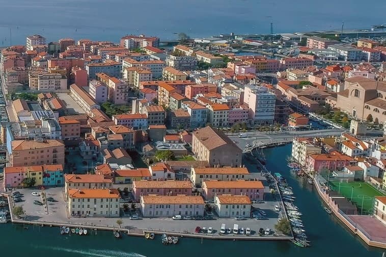
Italy's second fishing port, on an island at the south end of the Venetian Lagoon, called Little Venice for its canal.
- Best time
- May–Sep
- By car
- 46 min from Venice
- By train
- Station in the comune
- Population
- 47,630
Known for
FISHING PORT
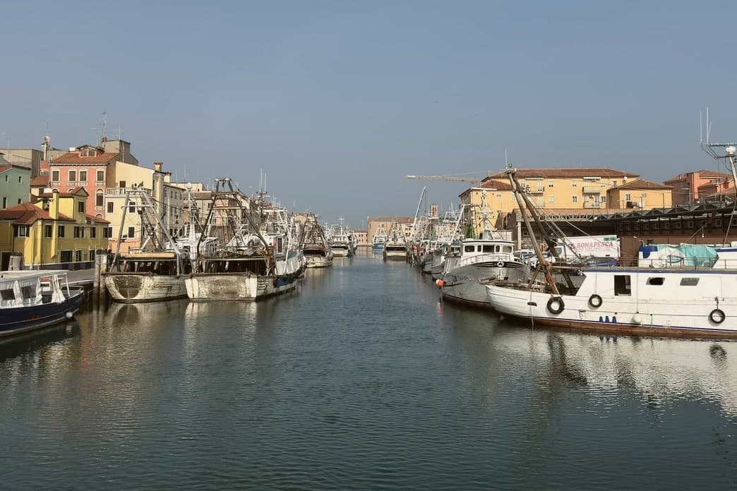
Italy's second fishing port after Mazara del Vallo, with the wholesale market on Canale Vena operating before dawn six days a week.
WAR OF CHIOGGIA
The 1378-81 naval war ended here with Venice's victory over Genoa and reduced Chioggia to a fishing and salt port for four centuries.
SOTTOMARINA
Eight kilometers of fine sand on the lagoon's outer barrier, Bandiera Blu beach since 2005 and the summer outlet for the inland Veneto.
When to visit
Best · May–Sep
- J8°
- F11°
- M14°
- A17°
- M22°
- J27°
- J30°
- A29°
- S25°
- O20°
- N13°
- D9°
- Best
- Hot or crowded
- Quiet
- Mostly closed
Daytime averages, 2020–2024. The sea is warmest in August at 27° and coldest in February at 9°. Weather data by Open-Meteo.com.
The festa: Felice e Fortunato, 11 June
Why come
Chioggia sits on a small island at the southern entrance to the Venetian Lagoon, twenty-five kilometers south of Venice and connected to the mainland and to its frazione Sottomarina by causeways. The Romans knew it as Clodia. By the eleventh and twelfth centuries it had grown into a salt-producing port and became a free commune in 1110.
The naval war that carries the town's name ran through 1378-81 and ended Genoese rivalry with Venice, leaving Chioggia under the Serenissima for the next four centuries. The defeat reduced the town to fishing, salt and limited Adriatic trade. The fleet never left.
The street plan is a herringbone of calli running off the town's single straight spine, with three canals threading between them and the bridges that gave the town its Little Venice nickname. Inland lies the historic island itself; across the causeway sits Sottomarina, the beach frazione facing the open Adriatic where the lagoon town has none. What Chioggia lost at sea it kept at the dock: a working port still built around the same trade that outlasted the war which was supposed to end it.
The Sunday letter
Chioggia is on our list. Its letter is still to come.
We are writing about all 1,000 of these towns, one at a time, in a free letter every Sunday: the photo, the food, the festa. That is our mission. Sign up and you will be there when Chioggia comes up. By Peter & Sophia, from Pietrasanta.
Read on
Chioggia in our articles
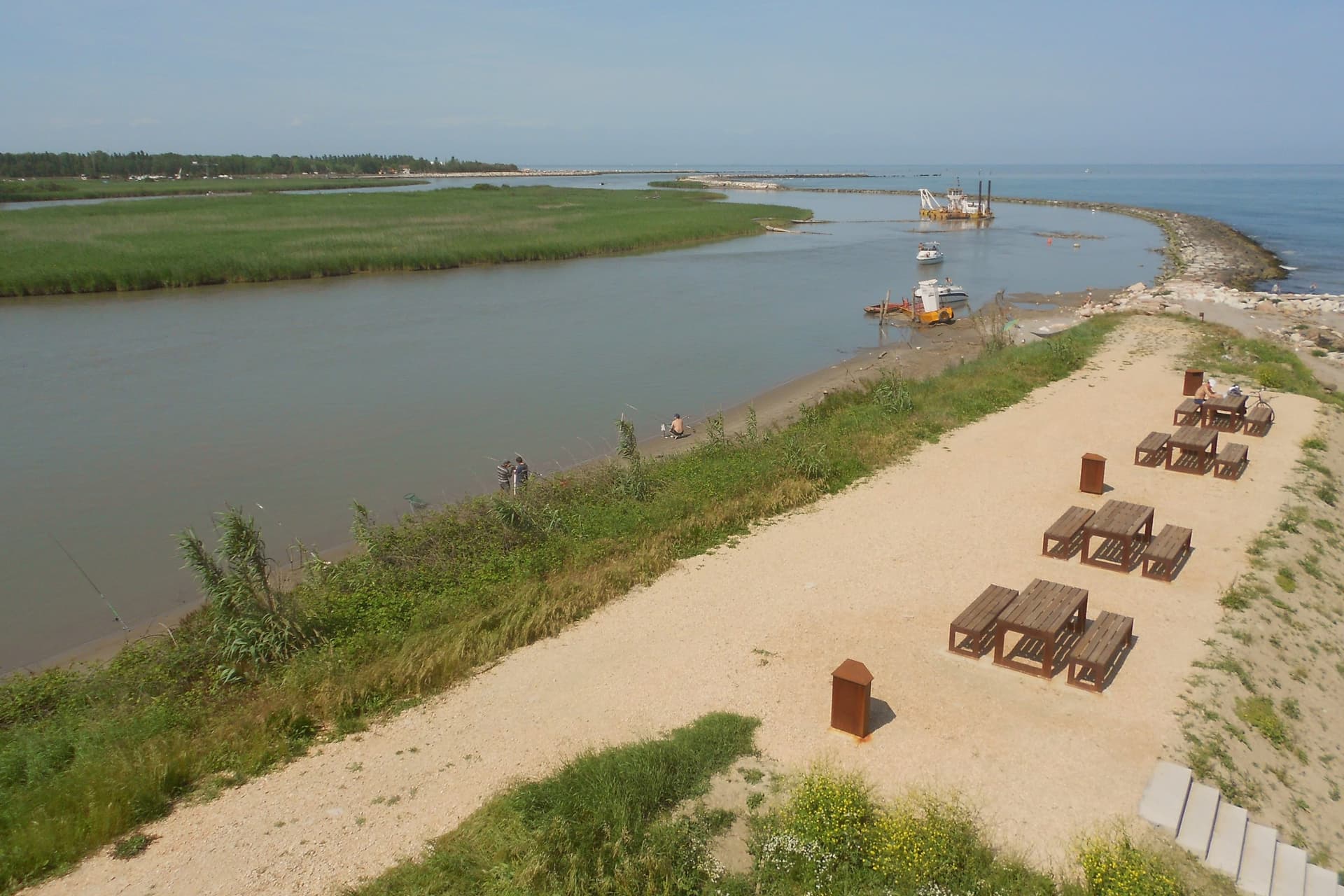
 The best coastal towns within two hours of Padua6 towns, Chioggia among them.
 The best coastal towns within two hours of Udine6 towns, Chioggia among them.
 The best coastal towns within two hours of Venice6 towns, Chioggia among them.
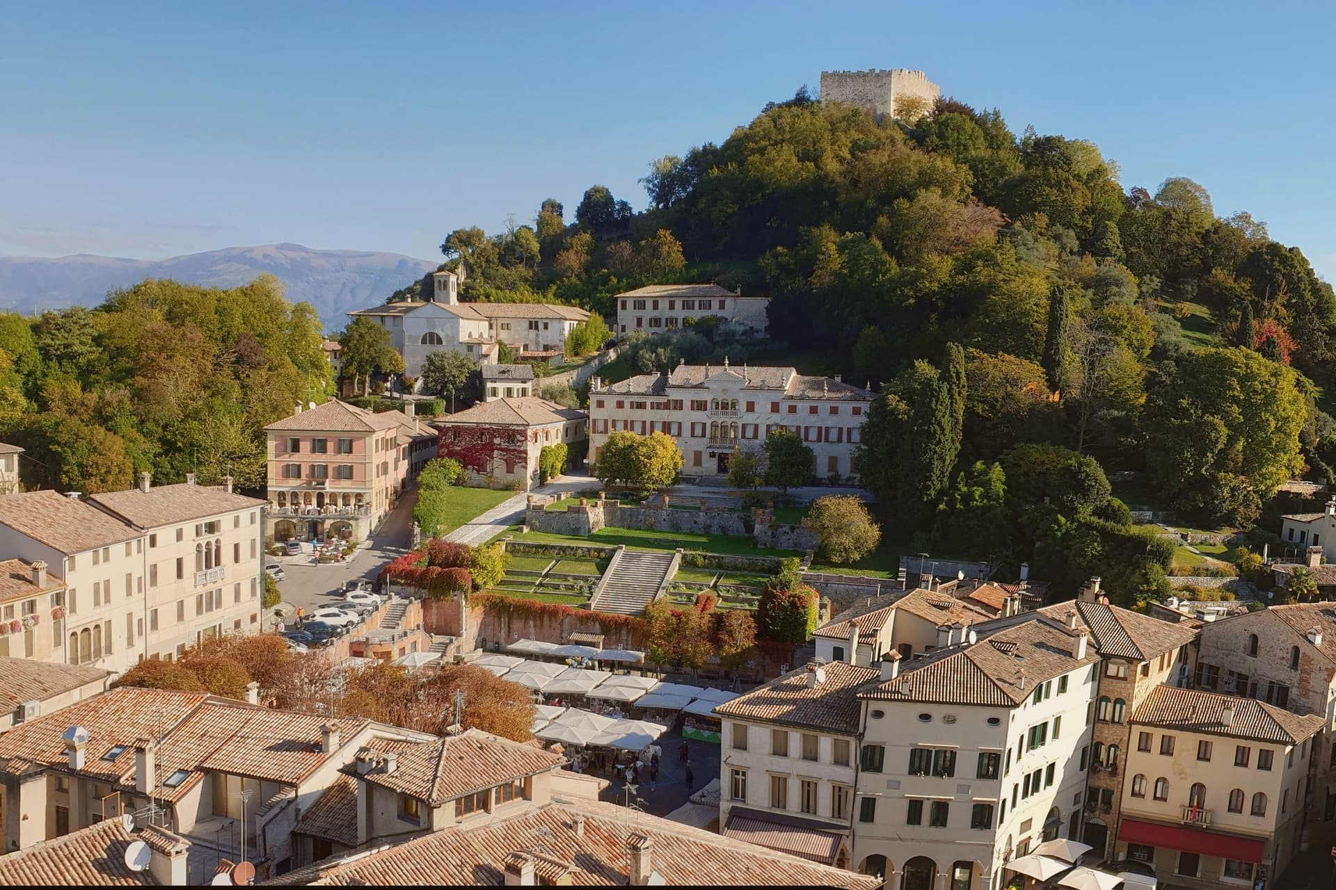 The best towns that eat well within an hour of Padua6 towns, Chioggia among them.
How to get there
From Venice (TSF), about 1h 10m by car.
Bologna (BLQ) is about 1h 45m away.
By car from the centre of Padua 49 minutes or Verona 1h 36m.
There is a railway station in the comune, so you can arrive without a car.
Coming from Venice, Verona or Bologna?
Coming by train into Venezia Santa Lucia? Chioggia is about 46 minutes away by road.
What to see
Cattedrale di Santa Maria Assunta
Cathedral founded in the eleventh century, raised to episcopal seat in 1110, rebuilt from 1623 to designs by Baldassare Longhena.
Canale Vena
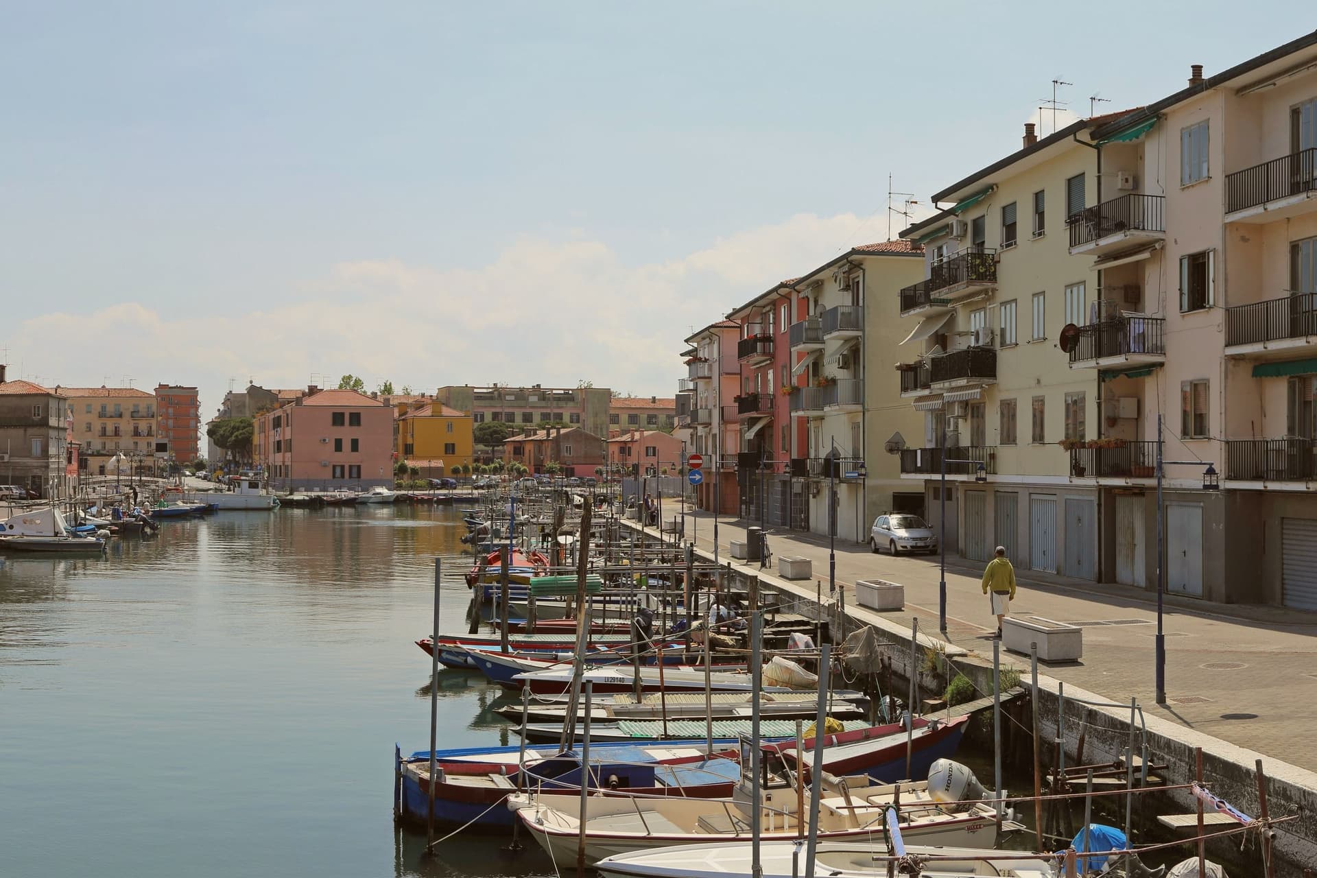
Main canal of the centro storico, lined with fishing boats and crossed by nine bridges including the seventeenth-century Ponte Vigo.
Mercato del Pesce
Wholesale fish market on the canal, open before dawn six days a week, the operating center of the Adriatic fleet.
Corso del Popolo
The single straight street that runs the length of the island, from Piazzetta Vigo to the cathedral, the spine of the herringbone street plan.
Sottomarina
Eight-kilometer beach on the lagoon's outer barrier, with sixty hotels and seventeen campgrounds, the seaside frazione of Chioggia since 1933.
Torre di Sant'Andrea
Romanesque bell tower next to the Chiesa di Sant'Andrea, with a clock mechanism documented since 1386, among the oldest still working in Europe.
The slow-trip planner
Building a trip? Find where Chioggia fits in a slow Italy circuit.
Answer five questions. We will shape a geographically coherent slow trip from the 1,000 Italian towns most travelers skip. Yours to save and share.
We recommend
Where to eat
Not our picks, but places the guides put their name to: a Michelin star, a Gambero Rosso fork, a Slow Food snail, a Michelin Key for the hotels. Worth a table, a counter, or a night when you pass through.
El GatoRistorante
El Gato carries a spot in the Michelin Guide.
Living here
- Population 47,630
- In-betweeni
- Pharmacy in town
- High school within a 30-minute drive
- Train station in the comune
- Nearest airport Venice, 1 h 10 min drive
- Regional capital Venezia, 46 min drive
Common questions
- What is Chioggia known for?
- Italy's second fishing port, on an island at the south end of the Venetian Lagoon, called Little Venice for its canal.
- Where is Chioggia?
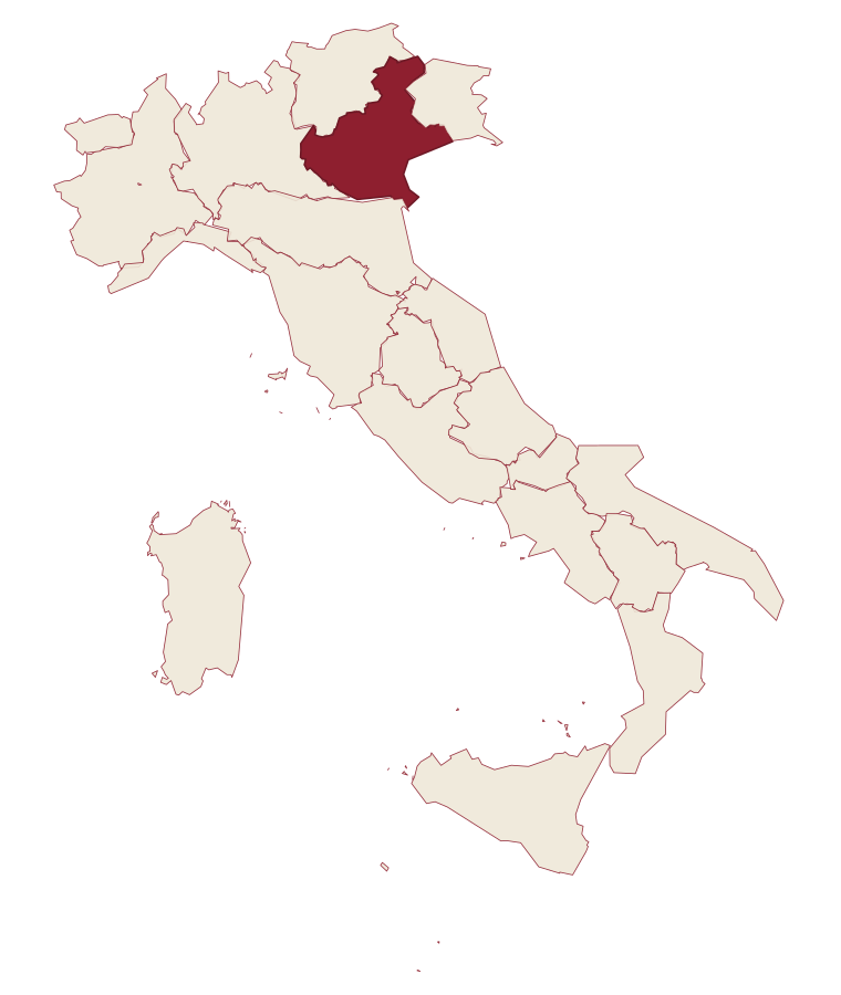
- Chioggia is a comune in the province of Venezia, in Veneto, at 2 meters above sea level.
- What is the nearest airport to Chioggia?
- Venice (TSF), about 1h 10m by car.
- Can you get to Chioggia without a car?
- Yes. There is a railway station in the comune, so you can arrive by train.
- How long is the drive from Padua to Chioggia?
- About 49 minutes by car.
- When is the best time to visit Chioggia?
- Best in May–Sep. July is the warmest month, averaging 30 degrees, and May the wettest, with about 13 rain days.
- Is there a sagra or a festival in Chioggia?
- The town keeps its patron saint's day: Felice e Fortunato, 11 June.
- Which other towns are like Chioggia?
- Monopoli, Roseto degli Abruzzi and Gallipoli.
- How many people live in Chioggia?
- 47,630 at the 2023 count.
Tags & datadesignations · numbers · sources
Recognised as
The numbers
- Elevation: 2 m
- Population: 47,630
- Surface area: 187.91 km²
These figures were compiled from public directories: ISTAT, OpenStreetMap and Wikidata, and from the official listings of the guides named on this page. Town details change; verify with official sources before you travel.
Similar
Towns like Chioggia
Monopoli
Province: Bari
both on the Adriatic coast · both over 10,000 people
Roseto degli Abruzzi
Province: Teramo
both on the Adriatic coast · both over 10,000 people
Gallipoli
Province: Lecce
both on the Adriatic coast · both over 10,000 people
Polignano a Mare
Province: Bari
both on the Adriatic coast · both over 10,000 people
Pineto
Province: Teramo
both on the Adriatic coast · both over 10,000 people
Carovigno
Province: Brindisi
both on the Adriatic coast · both over 10,000 people
🟦 Bandiera Blu
More Bandiera Blu towns
Alba Adriatica
Province: Teramo
The northernmost of the Teramo coast's seven sisters, a 1956 spin-off from Tortoreto with a fine-sand beach known as the Spiaggia d'Argento.
Fossacesia
Province: Chieti
A hill town above the Costa dei Trabocchi whose Benedictine abbey, San Giovanni in Venere, stands on the site of a Roman temple and looks straight down the coast.
Giulianova
Province: Teramo
Coastal town split between hilltop Paese at 68 meters and the Lido below, one rebuilt as a Renaissance ideal city, the other grown around a working fishing fleet.
Ortona
Province: Chieti
A working Adriatic port under an Aragonese castle, where the cathedral holds relics venerated as those of the apostle Thomas and the ridge above the harbour was fought over street by street in December 1943.
Pineto
Province: Teramo
A planned twentieth-century beach town named for D'Annunzio's poem, with the sixteenth-century Cerrano tower anchoring Abruzzo's first marine protected area.