
Veneto · Belluno
Rocca Pietore
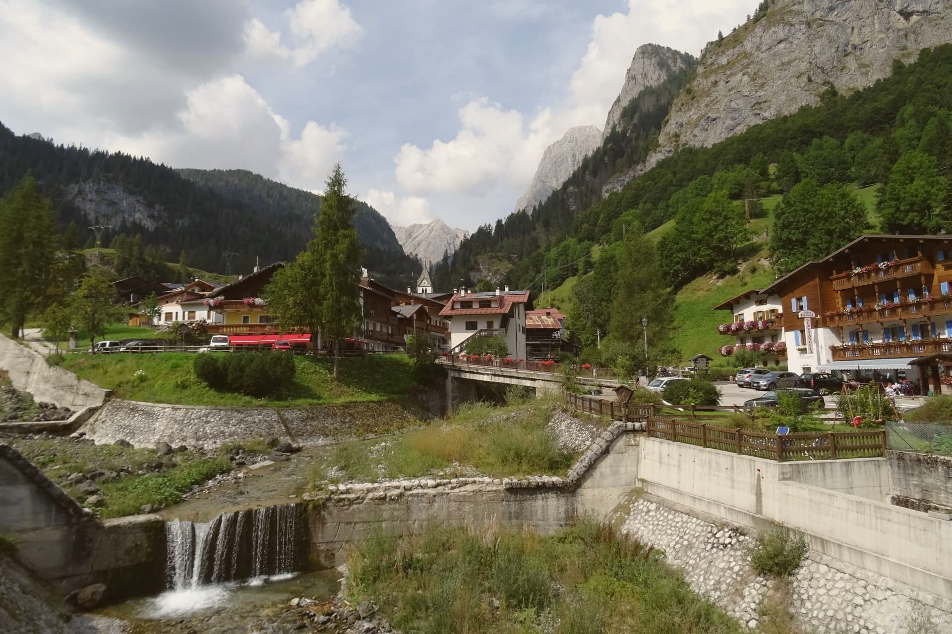
An Agordino borgo at 1,143 meters under the Marmolada, where the Pettorina cuts a two-kilometer gorge through 100-meter rock walls.
- Best time
- Jun–Sep, Dec–Mar
- By car
- 1 h 31 min from Bolzano
- Population
- 1,149
Known for
MARMOLADA
The 3,343-meter queen of the Dolomites, with the glacier and Punta Rocca cable car on the commune's territory.
SERRAI DI SOTTOGUDA
Two-kilometer gorge of the Pettorina torrent, walls over 100 meters high, destroyed by Storm Vaia and rebuilt in stages from 2023.
MAGNIFICA COMUNITÀ
Small republic under the County of Tyrol and the Brixen bishopric for four centuries, dissolved by Napoleon.
When to visit
Best · Jun–Sep, Dec–Mar
- J4°
- F6°
- M7°
- A10°
- M15°
- J20°
- J23°
- A22°
- S18°
- O14°
- N9°
- D4°
- Best
- Hot or crowded
- Quiet
- Mostly closed
Daytime averages, 2020–2024. Weather data by Open-Meteo.com.
The festa: Maria Maddalena, 22 July
Why come
The Val Pettorina is the upper Agordino valley, running west from Belluno to the foot of the mountain the commune shares with Trentino. Rocca Pietore sits in it at 1,143 meters, a borgo that began as a Lombard military outpost before becoming, for nearly four centuries, the seat of a small republic under the County of Tyrol and the bishopric of Brixen, until Napoleon dissolved it. The frazione of Sottoguda, higher up the valley at 1,250 meters, carries its own recognition as one of the Borghi più belli d'Italia, and the commune has held the Bandiera Arancione since 2018.
The gorge that separates the village from Malga Ciapela has needed rebuilding twice this century, first after damage in 2018 and again in 2020, reopening only in stages from 2023. The parish church stands on the rock above the borgo, the seat from which the old Tyrolean republic governed. What emerges is a valley shaped as much by repeated damage and repair as by the mountain looming over it: a small governing center under foreign rule for centuries, a gorge that keeps having to be rebuilt, and a glacier reached only by the single cable car that climbs above it all.
The Sunday letter
Rocca Pietore is on our list. Its letter is still to come.
We are writing about all 1,000 of these towns, one at a time, in a free letter every Sunday: the photo, the food, the festa. That is our mission. Sign up and you will be there when Rocca Pietore comes up. By Peter & Sophia, from Pietrasanta.
Read on
Rocca Pietore in our articles
How to get there
From Venice (TSF), about 2h 8m by car.
Verona (VRN) is about 3h 13m away.
By car from the centre of Bolzano 1h 31m or Trento 2 hours.
What to see
Marmolada
Peak shared with Trentino, its glacier reached by cable car from Malga Ciapela to Punta Rocca at 3,269 meters, the only way up onto the ice.
Serrai di Sottoguda
The gorge path runs between the village and Malga Ciapela, hemmed by rock on both sides, closed for years of repair after Storm Vaia before reopening to walkers.
Sottoguda
Frazione at 1,250 meters joined to the Borghi più belli d'Italia in 2016, with the fifteenth-century Church of Saints Fabian, Sebastian and Roch.
Chiesa di Santa Maria Maddalena
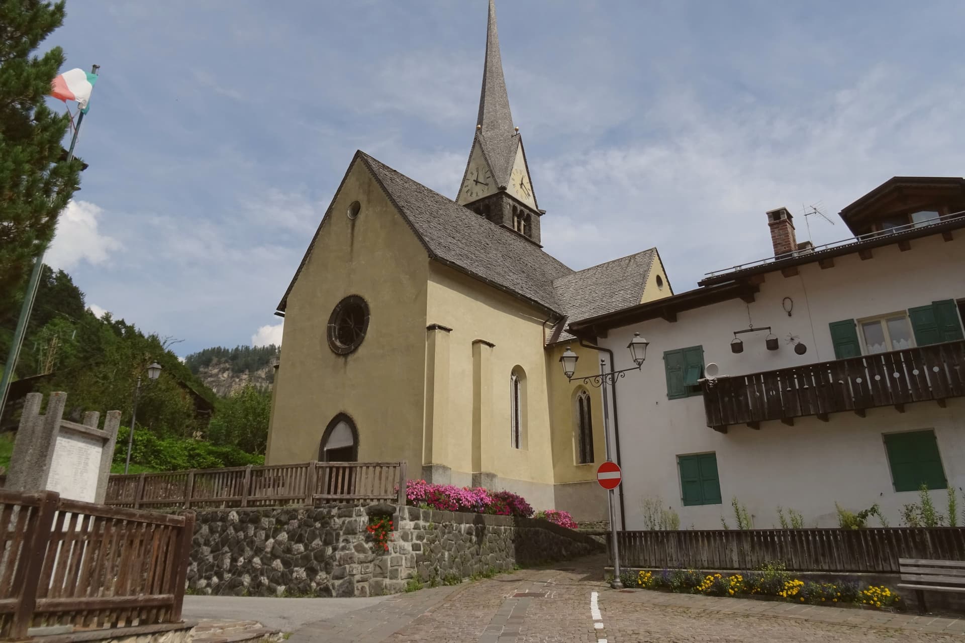
Parish church on the rock above the borgo, seat of the Magnifica Comunità della Rocca through the centuries of Tyrolean rule.
Ski Marmolada
Twelve-kilometer Bellunese run down from the cable car's summit to Malga Ciapela on the glacier, part of the Dolomiti Superski circuit.
The slow-trip planner
Building a trip? Find where Rocca Pietore fits in a slow Italy circuit.
Answer five questions. We will shape a geographically coherent slow trip from the 1,000 Italian towns most travelers skip. Yours to save and share.
Living here
- Population 1,149
- Remotei
- Pharmacy: none mapped
- Nearest high school over ~30 minutes away
- Nearest airport Venice, 2 h 8 min drive
- Regional capital Venezia, 2 h 17 min drive
Common questions
- What is Rocca Pietore known for?
- Rocca Pietore is an Agordino borgo at 1,143 meters under the Marmolada, where the Pettorina cuts a two-kilometer gorge through 100-meter rock walls.
- Where is Rocca Pietore?
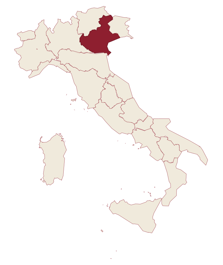
- Rocca Pietore is a comune in the province of Belluno, in Veneto, at 1143 meters above sea level.
- What is the nearest airport to Rocca Pietore?
- Venice (TSF), about 2h 8m by car.
- How long is the drive from Bolzano to Rocca Pietore?
- About 1h 31m by car.
- When is the best time to visit Rocca Pietore?
- Best in Jun–Sep, Dec–Mar. July is the warmest month, averaging 23 degrees, and July the wettest, with about 25 rain days.
- Is there a sagra or a festival in Rocca Pietore?
- The town keeps its patron saint's day: Maria Maddalena, 22 July.
- Which other towns are like Rocca Pietore?
- Falcade, San Vito di Cadore and Moena.
- How many people live in Rocca Pietore?
- 1,149 at the 2023 count.
Tags & datadesignations · numbers · sources
Recognised as
The numbers
- Elevation: 1143 m
- Population: 1,149
- Surface area: 73.29 km²
These figures were compiled from public directories: ISTAT, OpenStreetMap and Wikidata, and from the official listings of the guides named on this page. Town details change; verify with official sources before you travel.
Similar
Towns like Rocca Pietore
Falcade
Province: Belluno
both high in the mountains · both under 3,000 people
San Vito di Cadore
Province: Belluno
both high in the mountains · both under 3,000 people
Moena
Province: Trento
both high in the mountains · both under 3,000 people
Canazei
Province: Trento
both high in the mountains · both under 3,000 people
Lavarone
Province: Trento
both high in the mountains · both under 3,000 people
Geraci Siculo
Province: Palermo
both high in the mountains · both under 3,000 people
🎨 Borghi più belli d'Italia
More Borghi più belli d'Italia towns in Veneto
Arquà Petrarca
Province: Padova
The Euganean Hills village where Francesco Petrarca spent his last four years and died in 1374, renamed in his honor in 1868.
Asolo
Province: Treviso
A walled hill town at 205 meters that Caterina Cornaro ran as her court after trading Cyprus to Venice in 1489.
Borgo Valbelluna
Province: Belluno
Veneto's youngest comune, a 13,410-resident fusion of three lower-Belluno towns formed in 2019, wrapped around an old borgo in the pre-Dolomite Piave valley.
Cison di Valmarino
Province: Treviso
A Prosecco hills borgo at 261 meters under the dolomite rock of CastelBrando, the largest inhabited castle complex in Europe.
Follina
Province: Treviso
A Prosecco-hills borgo at 191 meters around the Cistercian Abbey of Santa Maria, with a cloister finished in 1268.