The best mountain towns in the province of Rieti
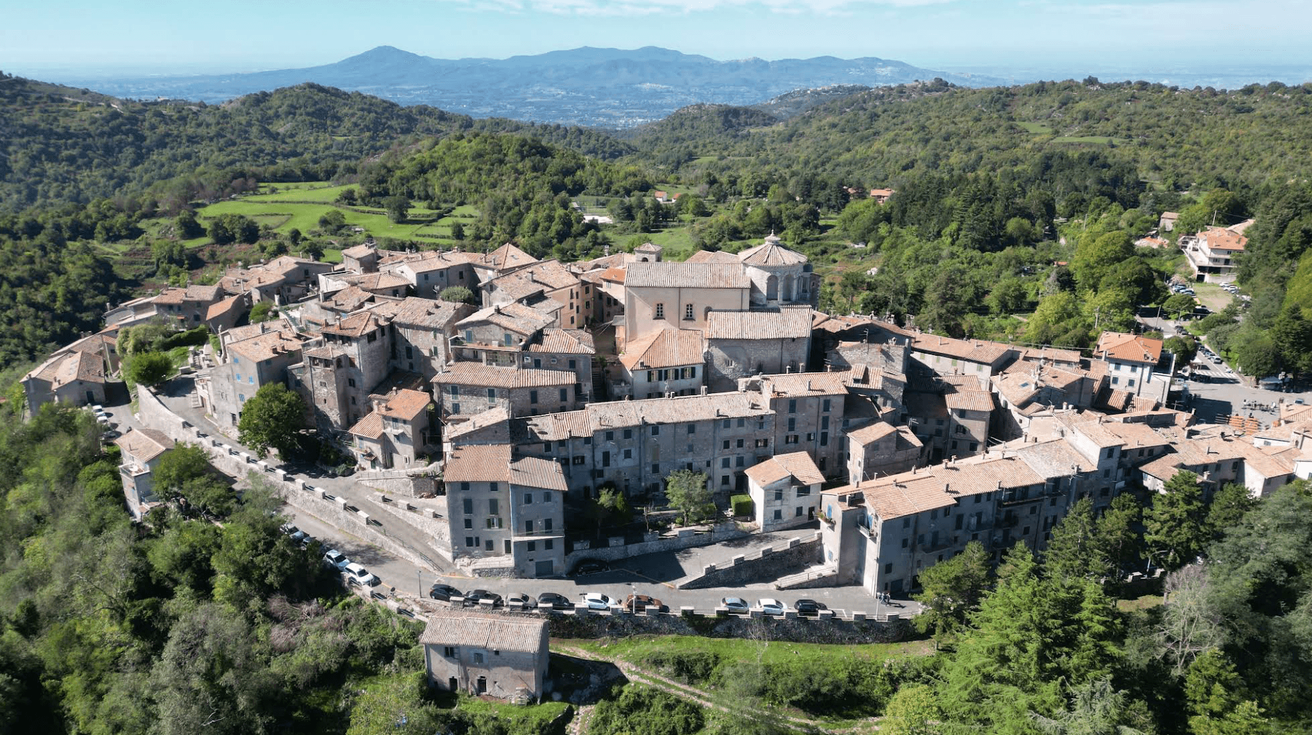
The province of Rieti is where the Sabine hills stop pretending to be countryside and start behaving like mountains. Houses are built from the grey local limestone, stacked tight around a rock spur or a castle keep, with roofs of hollow tile and streets too narrow for anything wider than a small van. The food follows the altitude: pecorino aged in cellars, lamb cooked over embers, chestnuts, lentils and the thick hand-cut pasta of the upper valleys, and in Amatrice's case a pasta sauce known in every kitchen in Italy. Autumn brings mushrooms and mist in the beech woods, winter brings snow on the ridge lines, and spring brings the sheep back up the old drove roads.
The mountain most people in Rome think of when they think of these mountains is Terminillo, close enough to the capital to have been marketed as its ski slope for the best part of a century. It fills on winter weekends with cars from the Lazio plates, queues at the lift stations and a car park that runs out early. Nearby Rieti itself absorbs the rest, a pleasant provincial capital where the coaches stop and the day-trippers eat lunch before driving home. Both are worth a look. Neither is quiet.
The same limestone continues north to the Monti della Laga and south towards the Turano and Salto lakes, and the villages along it see far fewer visitors. These are places built for shepherds and for defence: a castle above a wooded gorge, a stone terrace looking down on green reservoir water, a hermitage cut into a cliff where the Christmas crib was first staged. The towns in this list sit in that country, within reach of the same roads and the same cheese, with room to park and a bar that knows who walks in.
Of the 8 communes we have mapped in the province of Rieti, 6 qualify as mountain towns: each sits in the mountains. The smallest, Castel di Tora, has 266 residents.
Two more lists worth reading alongside this one: The best mountain towns in Lazio and The 7 best mountain towns within 90 minutes of Terni.
Castel di Tora
Why visit Castel di Tora
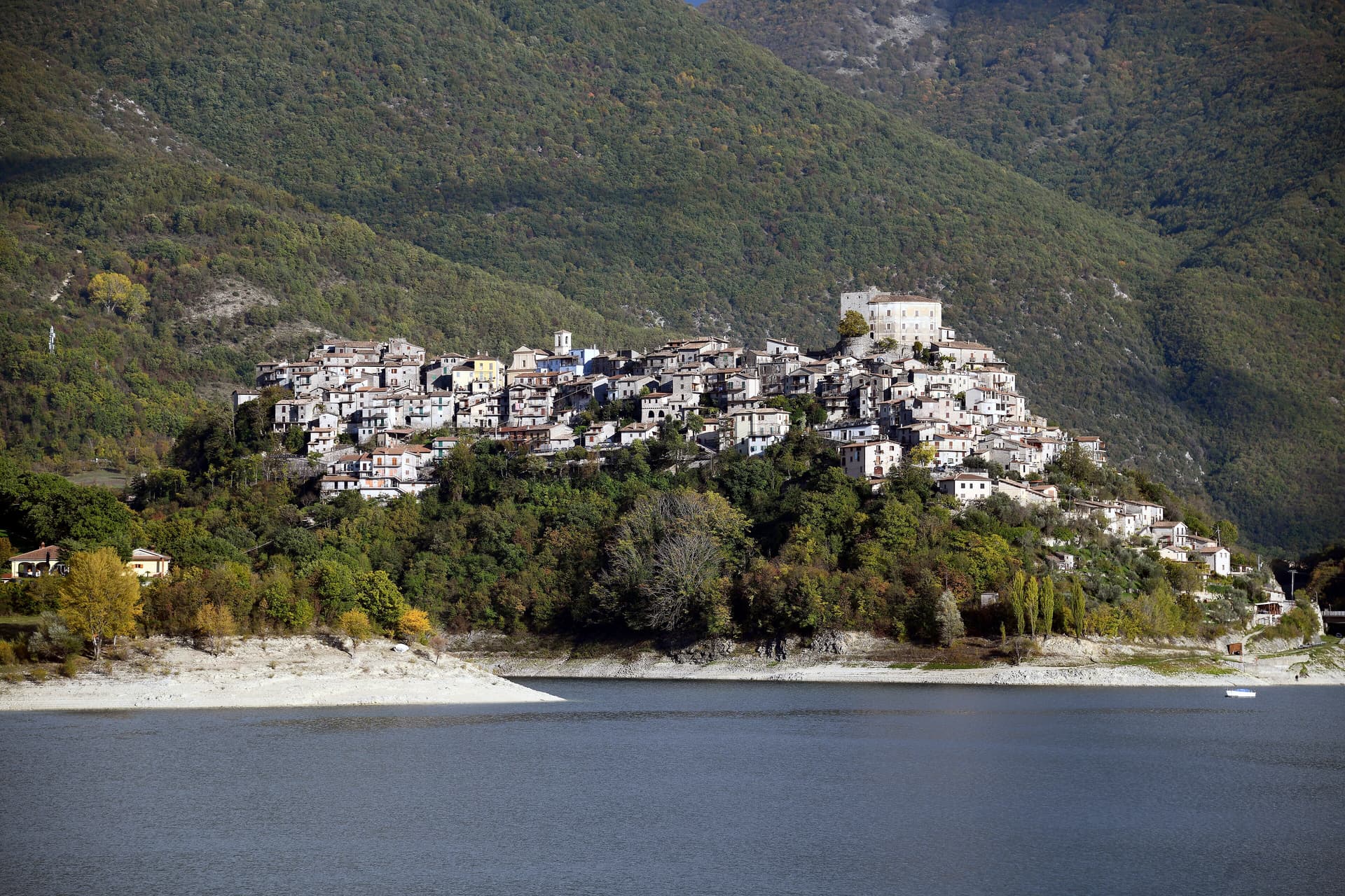
Castel di Tora sits at 607 meters on the northeast shore of Lago del Turano, in the upper Sabina, fifty kilometers northeast of Rome. The lake itself is artificial, dammed in 1936 for hydroelectric regulation of the Turano river; before then, two villages stood on the valley floor.
One of them, Antuni, gave up its houses and emptied. Today a small isthmus runs out to the Antuni promontory, where the fifteenth-century Palazzo del Drago, built with 365 windows for the days of the year, has been restored along with its garden labyrinth.
The medieval centro storico climbs the slope above the lake to a polygonal fortress tower of the eleventh century. The Monti Sabini close the western shore; the Carseolani close the eastern, rising to Monte Navegna at 1,508 meters.
Two hundred and sixty-six people live here year-round. The Cammino di San Benedetto passes through on its way from Subiaco to Rieti.
The village sits at 607 metres.
What to see in Castel di Tora
- Rocca medievale. Eleventh-century polygonal fortress tower on the cliff above the village, anchor of the original Castrum Vetus that gave the town its name.
- Antuni e Palazzo del Drago. Restored fifteenth-century palace with 365 windows for the days of the year, on the Antuni promontory across an isthmus, with a garden labyrinth.
- Lago del Turano. Artificial reservoir dammed in 1936 at 536 meters elevation, ten kilometers long, 60 meters deep, surrounded by the Sabini and Carseolani ranges.
How to get to Castel di Tora
There is no station we could confirm here, so this one means driving. Terni is roughly 72 minutes away by road.
Our tip
May through October is the season for Castel di Tora. The lake warms to swimming by late June, the Sabini stay green into August, and the chestnut woods on the slopes turn gold in October. July and August fill the lakeshore with day-trippers from Rome and Rieti, especially weekends.
Labro
Why visit Labro
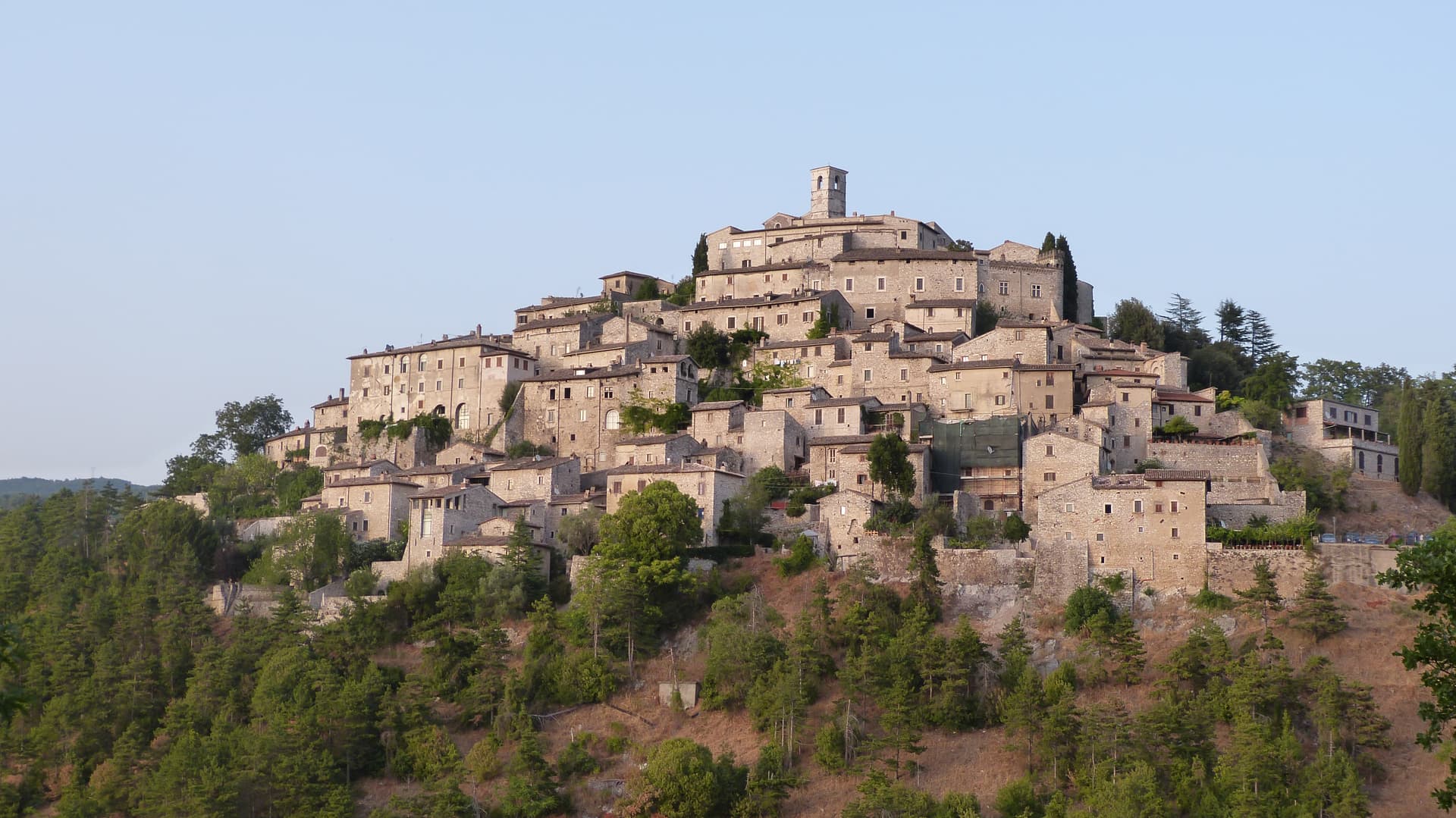
The village sits on the Lazio side of the Umbrian border, its stone houses climbing a slope that faces east over Lake Piediluco and the Reatini mountains. The name descends from the family that has held the central castle for more than a thousand years, an unbroken tenure from a royal grant to the present owners' later dynastic name.
That family shaped the top of the village around the castle and the church below it; the rest of the centro storico, some twelve hectares of stone houses, fell empty by the 1960s. The Belgian architect who began buying and restoring those houses did so with his wife, and the project passed to his children, who still own and run much of the centro.
Two families, one holding the summit since the tenth century and one rebuilding the slope since the twentieth, account for nearly all of the village that stands today. Labro survived depopulation not by chance but by becoming, in effect, two long private restorations laid one above the other.
The village sits at 628 metres.
What to see in Labro
- Castello Nobili-Vitelleschi. The castle sits at the top of the village, reached by narrow stone alleys climbing from the lower gate. Still privately owned.
- Chiesa di Santa Maria Maggiore. Parish church on the main square of the centro storico, with works of devotional art collected by the family that has long held the castle above it.
- Belvedere su Lago di Piediluco. Eastern viewpoint at 628 meters dropping to Lake Piediluco at 375 meters, with the Reatini and Sabini ranges in the background.
How to get to Labro
There is no station we could confirm here, so this one means driving. Terni is roughly 26 minutes away by road.
Our tip
May through October is the working window. Spring brings green slopes and clear views down to Piediluco; autumn turns the surrounding woods. July and August push warm but the 628-meter elevation keeps nights cool, unlike the valley below.
Collalto Sabino
Why visit Collalto Sabino
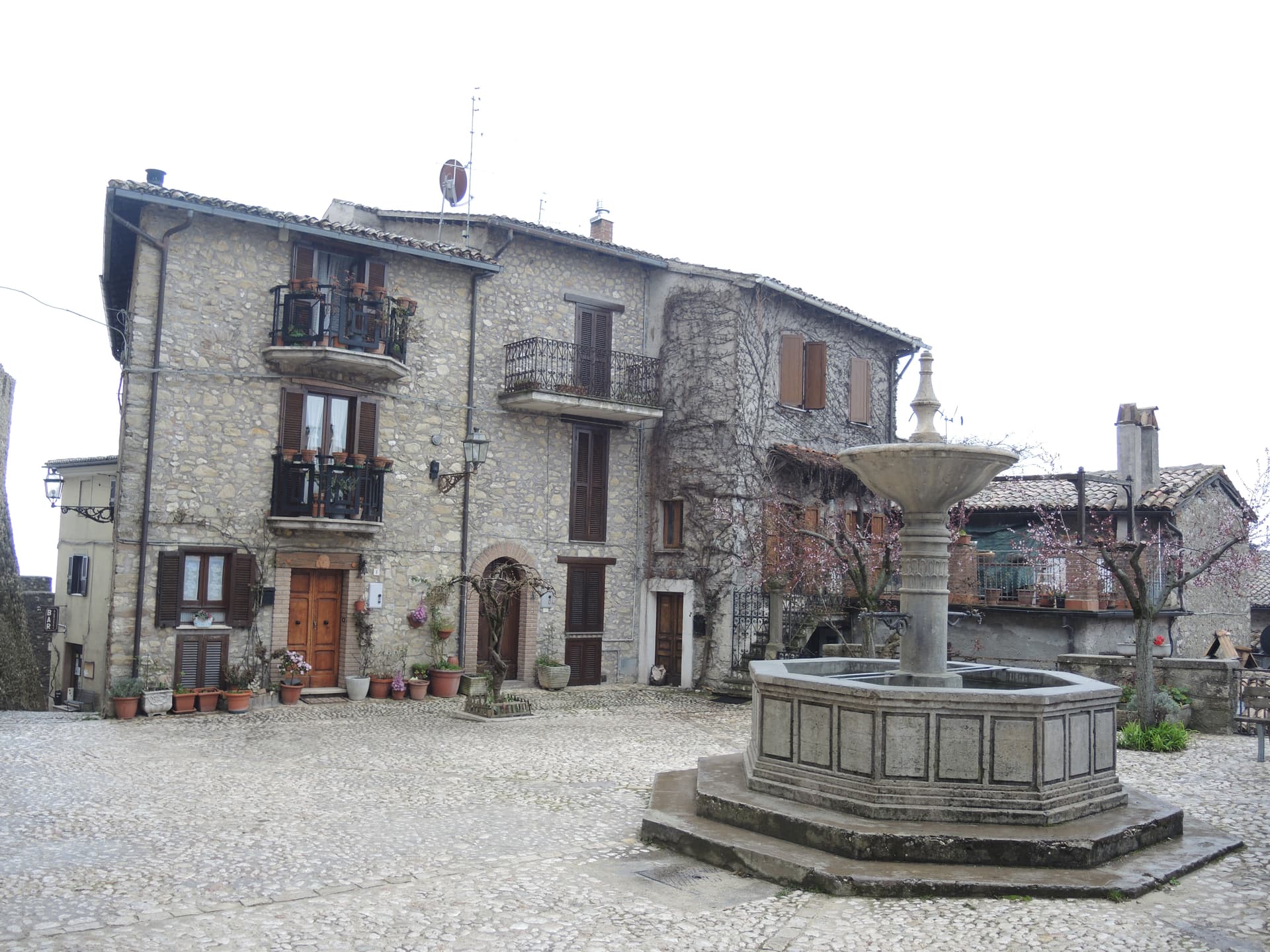
The name preserves Collis Altus and the family who first held the hill. Lombards established the village in the tenth century; the Savelli, Strozzi and Soderini families held it in turn before the fief passed to Cardinal Francesco Barberini in 1641.
The castle on the summit is the result of his work and that of his nephew Francesco Barberini junior, who enlarged the keep, fortified the walls and built dungeons inside the rock. It has a central square tower, two round corner towers and a curtain of watchtowers and sentry posts.
The village sits at 980 meters northeast of Rome, walled since the fifteenth century, with the fortress set above the stone houses and the older settlement gathered under it on the slope, narrow stairs and panoramic alleys threading between them. Ownership of the fief changed hands for centuries, from Lombards through three baronial families, before the Barberini building campaign gave the place the fortified shape that has lasted: walls below, keep above, the two still reading as one structure from the approach, the panorama at the summit the reward for climbing through all of it.
The village sits at 980 metres.
What to see in Collalto Sabino
- Castello Baronale. Dungeons cut into the rock beneath the keep, watchtowers and sentry posts along the curtain wall, the work of Cardinal Francesco Barberini and his nephew after 1641.
- Centro storico. Stone houses reached by narrow stairs, alleys that open onto the panorama below the castle walls.
- Panorama from the keep. The terrace view takes in Gran Sasso, Terminillo and Maiella at once, the three highest ranges of the central Apennines standing in a single arc from the same point.
How to get to Collalto Sabino
There is no station we could confirm here, so this one means driving. Roma is roughly 65 minutes away by road.
Our tip
May through September is the window the castle and the village were built around. At 980 meters the air stays clean in midsummer when Rome fifty-five kilometers downhill is hitting thirty-five, and the three-range panorama opens longest after spring rain clears the haze. October still holds for the woods of the Monte Navegna reserve turning copper and for short walks toward Lago del Turano below.
Orvinio
Why visit Orvinio
Orvinio sits on a saddle in the Monti Lucretili park, the last village before the slopes drop toward the Turano lake. The ancient settlement called Orvinium was destroyed before the year 1000, and the medieval town that grew up afterward took the name Canemorto, said to commemorate a Saracen defeat by Charlemagne's troops in 817.
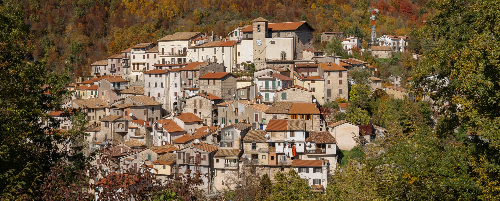
The Orsini built the Granarone palace in the fifteenth century, before the Borghese took the fief in 1632. The village they governed still reads in two layers: stone houses running in tight loops below the ridge, and the Castello Malvezzi-Campeggi above them, the physical record of who held the place longest.
The Cammino di San Benedetto crosses this lower town on its way between Subiaco and Norcia, a reminder that the village has always been a point of passage as much as a seat of lordship. What remains is a settlement whose name changed twice and whose skyline did not: the castle above, the loops of houses below, unchanged in relation even as the village below it was renamed.
The village sits at 840 metres.
What to see in Orvinio
- Castello Malvezzi-Campeggi. Rebuilt by the Borghese in the nineteenth century, it dominates the village from the upper ridge, still visibly the seat of the family that held the fief the longest.
- Abbazia di Santa Maria del Piano. Benedictine abbey founded in the early Middle Ages, the original landlords of the territory before the Orsini took it.
- Centro storico. Stone houses in tight medieval loops below the castle, with vaulted passages and the original village gates preserved.
How to get to Orvinio
There is no station we could confirm here, so this one means driving. Roma is roughly 60 minutes away by road.
Our tip
May through September is the working window at 840 meters. The Lucretili woods open, the trails dry out and the village evenings stay cool when Rome forty-five kilometers downhill is hitting thirty-five. October still holds for the woods turning copper and for the Cammino di San Benedetto walkers passing through on the route between Subiaco and Norcia. Sagra della Polenta falls in August.
Greccio
Why visit Greccio
Greccio sits at 705 meters on a forested ridge above the Rieti valley, fifteen kilometers from Rieti in the Sabina. Francis of Assisi came here in December 1223, recalling his pilgrimage to Bethlehem fifteen years earlier, and asked the local lord Giovanni Velita for a cave where he could stage a representation of the Nativity.
On Christmas Eve the friars and villagers gathered in the rock chamber with a manger, an ox and a donkey; one of the friars said Mass and Francis preached. Greccio has been making versions of that scene every Christmas for eight centuries, and the Cappella del Presepio was built into the cave itself in 1228, the year of Francis's canonisation.
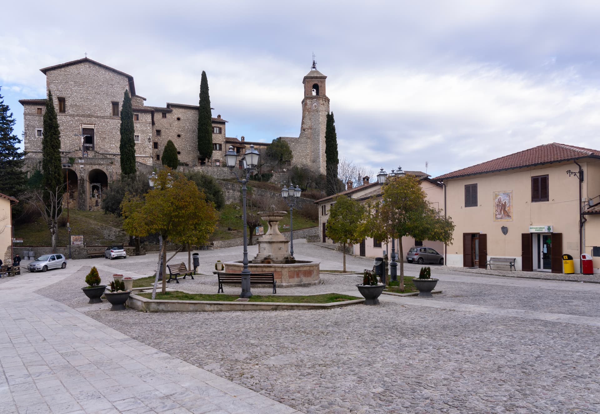
The medieval village runs along the ridge above the sanctuary, separated from it by the wooded slopes of the Monte Salto del Cieco reserve, so the walled center and the cave church remain two distinct places linked by a single climb through beech and oak woodland. Greccio is one of four shrines forming the Sacred Valley of Rieti, and the arrangement of a hilltop village standing apart from its own founding cave is what gives the place its shape: a settlement that grew beside a site it did not begin as, built to keep watch over a single night eight centuries old.
The village sits at 705 metres.
What to see in Greccio
- Santuario Francescano. Sanctuary built around the rock chamber where the manger, ox and donkey were assembled, its Cappella del Presepio carved directly into the cave wall.
- Museo Internazionale del Presepio. Crèches and presepi from cultures across the world, gathered inside the sanctuary complex.
- Centro storico medievale. Walled medieval village on the ridge above the sanctuary, with stone houses, vaulted passages and the original village gates.
How to get to Greccio
There is a railway station in the town, so you can arrive without a car and never need one while you are here. Terni is roughly 28 minutes away by road.
Our tip
May through September is the main outdoor window at 705 meters. The Rieti valley is green into June and the cool ridge stays workable through midsummer. October draws walkers for the autumn colour in the Salto del Cieco reserve.
Amatrice
Why visit Amatrice
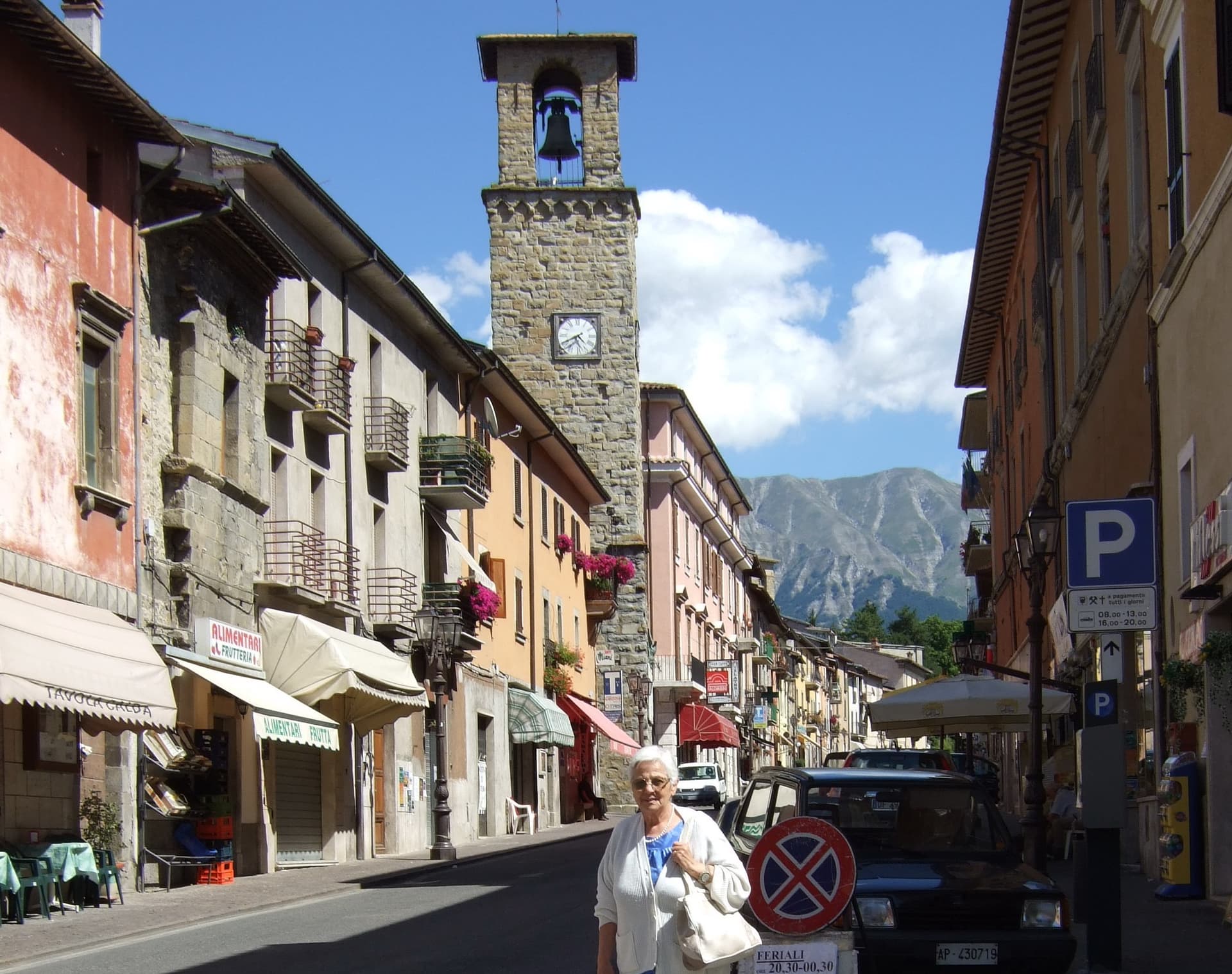
Amatrice sits on a saddle where Lazio runs into Abruzzo and the Marche, the range rising directly above the roofs. The Corso Umberto I and the Piazza Sagnotti formed the spine of the centro storico, the two anchored by the tower at their crossing and by the church nearby; both collapsed almost completely on 24 August 2016.
Two hundred and ninety-five people died in the cratere, most of them here. The town that survived gave its name to sugo all'amatriciana, guanciale, pecorino, pepper, and, since the nineteenth century, tomato.
The Sagra degli Spaghetti all'Amatriciana, run since 1967, returned in 2018 in the temporary food court Area Food, held among the ruins while reconstruction went on around it. Reconstruction continues below; the peaks above are unchanged.
The dish carried the name outward long before the earthquake made the name known for a different reason, and the two facts now sit side by side in anyone's memory of the place.
The village sits at 955 metres.
What to see in Amatrice
- Torre Civica. Fourteenth-century civic tower at the crossing of Via Roma and Corso Umberto. Severed at the bell chamber in 2016, it stood under scaffolding for six years; consolidation began in August 2022 and the bell stage was finished in 2023.
- Chiesa di Sant'Agostino. Fourteenth-century church with a rose window heightened in the twentieth century. It was the first building to fall in 2016 and is the primary reconstruction priority in the centro storico.
- Monti della Laga. Sandstone Apennine range above town, sheltering rare relict beech and silver fir forest, inside the Gran Sasso e Monti della Laga National Park.
How to get to Amatrice
There is no station we could confirm here, so this one means driving. Terni is roughly 88 minutes away by road.
Our tip
May through October is the season for Amatrice. The Laga snow clears by late May; June and September are dry and clear, with the Pizzo di Sevo visible from the temporary square. July and August are the festival months: the Sagra degli Spaghetti all'Amatriciana, run since 1967 and resumed in 2018, brings the town back to its food and its name. Sagra degli Spaghetti all'Amatriciana falls in August.