
The 10 best hidden mountain towns within 90 minutes of Rome
Ten towns: what each is best for, what a home costs, and the catch. A square meter runs from €390 in Capistrello to €1,050 in Orvinio.
From the 1,000 towns picked by Peter Benei.
92 towns written about, 908 to go. Follow along, free: Subscribe on Substack
The mountains start sooner than most people expect. Follow the valleys east or north out of Rome and within an hour the plain gives way to gray limestone ridges, beech forest that turns copper in October, and villages built from the same pale stone they stand on. The food changes with the altitude: lentils and chickpeas, hand-cut pasta with mutton ragù, pecorino aged in cellars cut into the rock, chestnuts roasted at the autumn fairs. In winter there is snow on the higher passes, and in August the temperature drops far enough after sunset that Romans have been coming up here to sleep since the days of the emperors.
Most visitors who want mountains near Rome head for Tivoli, or push on to the big Abruzzo national park at Pescasseroli. Tivoli in particular absorbs the coach traffic, its villa gardens and waterfalls on every day-trip itinerary sold in the historic center, and by midday the queues at the ticket office run down the street. The park, further out, fills its car parks every weekend from spring through the leaf season. Both are worth their reputation. Both are also where everyone else is.
The same ridges carry on well past the famous stops. Along the old road to Abruzzo, up the Turano and Salto valleys, and on the Prenestini crests above the Roman plain, there are towns with castles, mountain paths, sagre in the autumn and a bar or two on the square, and fewer people go. Trains from Rome Termini and Tiburtina reach several of them directly. This list is the mountain towns of that near hinterland, all of them inside a couple of hours of the city and none of them on the coach route.
Of the 33 communes we have mapped within 90 minutes of Rome, 12 qualify as mountain towns: each sits in the mountains. This list is the hidden ones, 10 in all, ordered smallest first. The smallest, Capranica Prenestina, has 325 residents.
If you are still choosing, we have also written The best mountain towns within 75 minutes of Rome and The best mountain towns you can reach by train within 90 minutes of Rome.
All the towns within a day trip: day trips from Rome.
1. Capranica Prenestina
Best for a walk through the old town. It is on the list of Italy's most beautiful villages.
1 h 10 min from Rome · homes €600 to €900 a m² in the center · 325 people
Why visit Capranica Prenestina
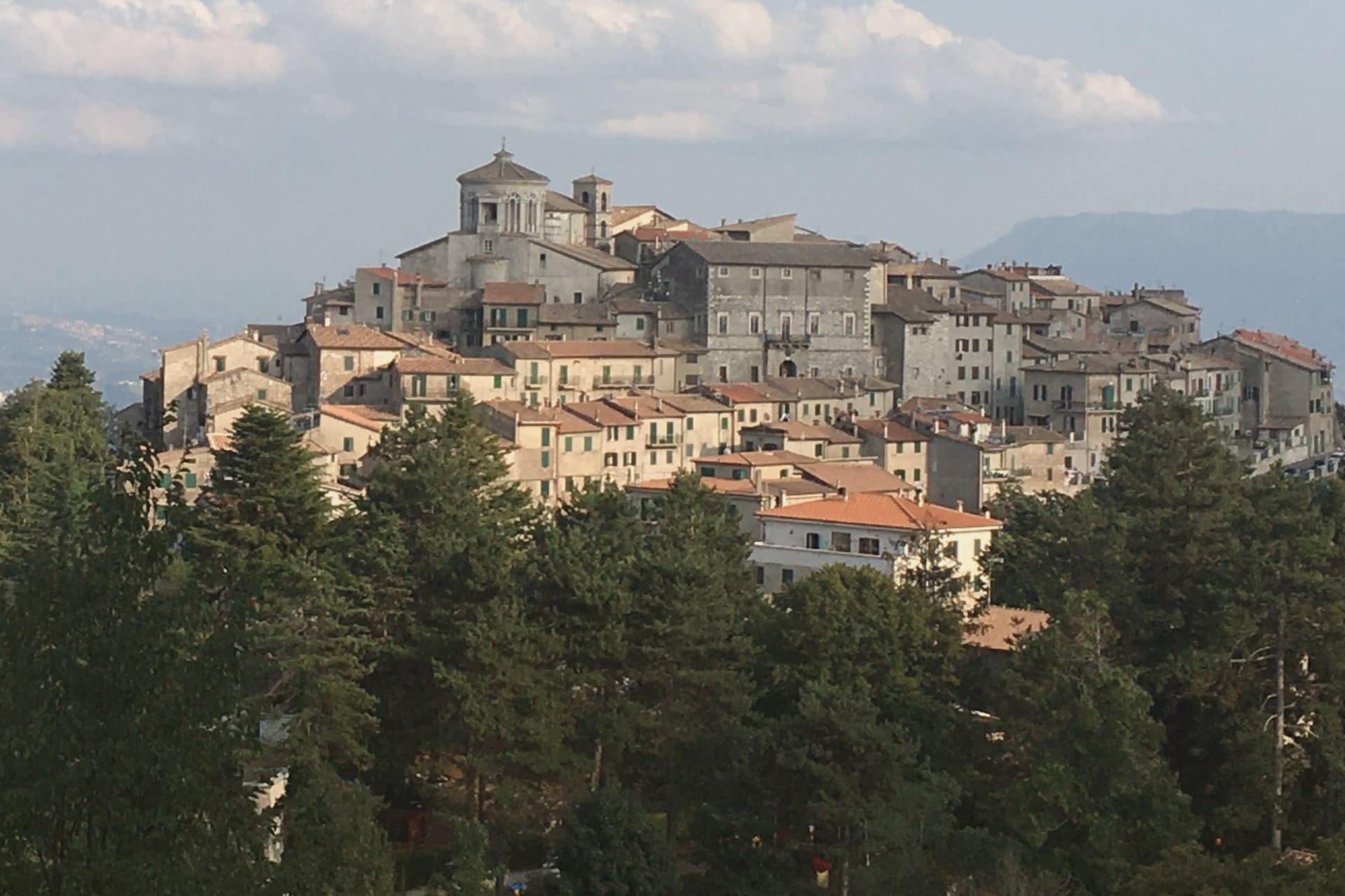
The Monti Prenestini are a small sub-Apennine range east of Rome, with Castel San Pietro Romano and Palestrina anchoring the southern flank and Capranica Prenestina set higher on the ridge above them. The village has three hundred residents and one designation, the Borghi più belli d'Italia membership it received in 2024.
Beech forest covers the slopes above the houses, and the ground beneath is karst, the subject the civic museum in the old Barberini residence was built to explain. Above it all, in the frazione of Guadagnolo, the Mentorella sanctuary sits at 1,018 meters below Monte Guadagnolo itself, and tradition ties its founding to Constantine in the fourth century; Pope John Paul II went there as cardinal and as pope.
The village is half an hour by car from Tivoli, the via Empolitana threading through the woods between them. A small ridge settlement, then, with its natural history collected in a converted palace at its center and its oldest sacred site set apart on the mountain above it, the two poles, civic and devotional, that the range holds together.
The village sits at 915 meters.
What to see in Capranica Prenestina
- Santuario della Madre di Dio alla Mentorella. The sanctuary stands on a cliff, managed today by the Polish Resurrectionist order.
- Palazzo Barberini. The residence's rooms now hold the civic natural history collection, the grandest building the centro storico has.
- Museo Civico Naturalistico dei Monti Prenestini. Civic natural history museum dedicated to the karst geology, beech forests and fauna of the surrounding range.
How to get to Capranica Prenestina
Rome is about 1 h 10 min away by road.
Our tip
May through September is the working window. At 915 meters the village stays ten degrees cooler than Rome and the beech forests on the slopes above are walkable through August. October still holds for the autumn light on the Aniene valley and for the pilgrim traffic up to Mentorella.
2. Collalto Sabino
Best for a long lunch. A food guide lists La Locanda del Poeta here.
1 h 5 min from Rome · homes €600 to €800 a m² in the center · 383 people
Why visit Collalto Sabino
The name preserves Collis Altus and the family who first held the hill. Lombards established the village in the tenth century; the Savelli, Strozzi and Soderini families held it in turn before the fief passed to Cardinal Francesco Barberini in 1641.
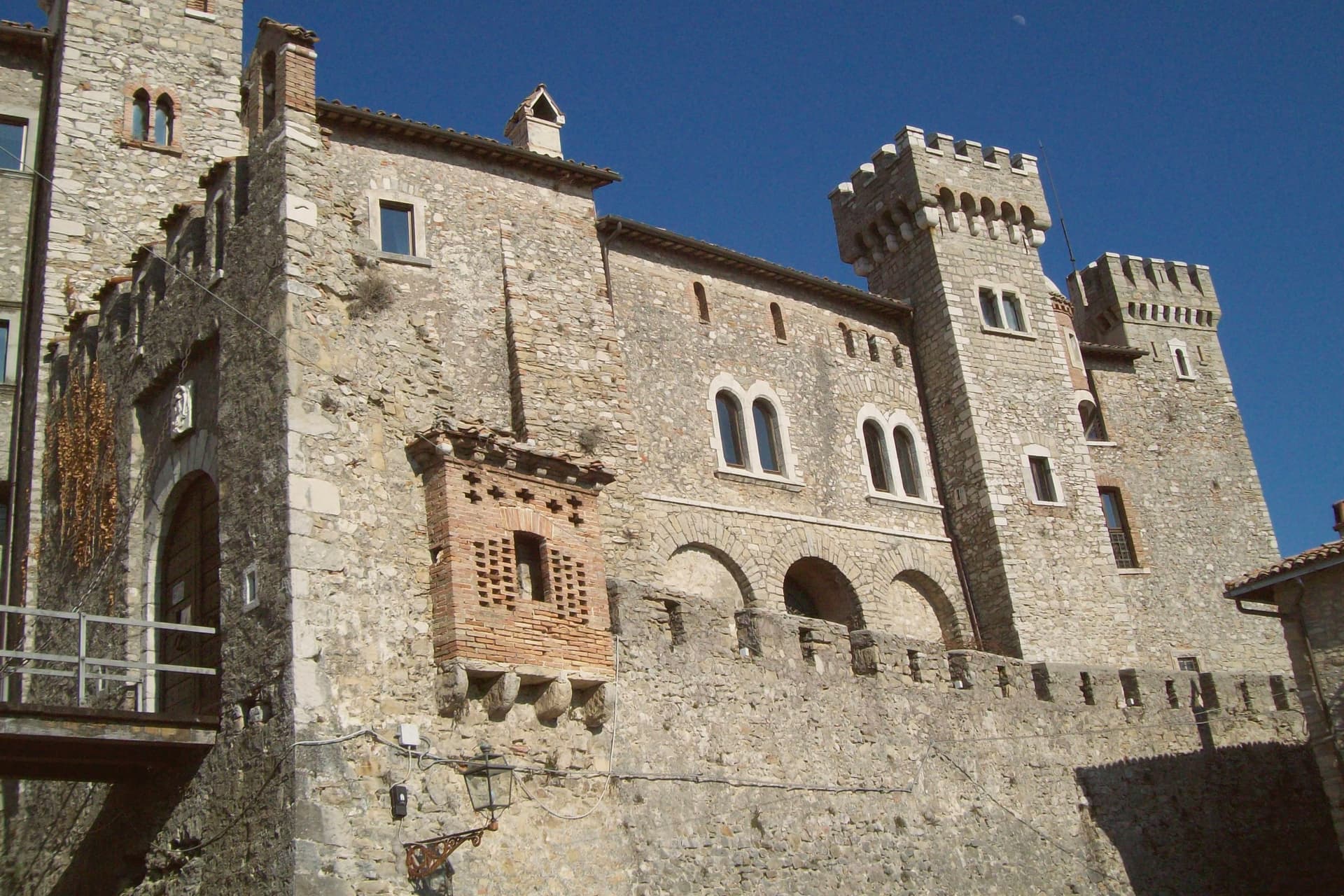
The castle on the summit is the result of his work and that of his nephew Francesco Barberini junior, who enlarged the keep, fortified the walls and built dungeons inside the rock. It has a central square tower, two round corner towers and a curtain of watchtowers and sentry posts.
The village sits at 980 meters northeast of Rome, walled since the fifteenth century, with the fortress set above the stone houses and the older settlement gathered under it on the slope, narrow stairs and panoramic alleys threading between them. Ownership of the fief changed hands for centuries, from Lombards through three baronial families, before the Barberini building campaign gave the place the fortified shape that has lasted: walls below, keep above, the two still reading as one structure from the approach, the panorama at the summit the reward for climbing through all of it.
The village sits at 980 meters.
What to see in Collalto Sabino
- Castello Baronale. Dungeons cut into the rock beneath the keep, watchtowers and sentry posts along the curtain wall, the work of Cardinal Francesco Barberini and his nephew after 1641.
- Centro storico. Stone houses reached by narrow stairs, alleys that open onto the panorama below the castle walls.
- Panorama from the keep. The terrace view takes in Gran Sasso, Terminillo and Maiella at once, the three highest ranges of the central Apennines standing in a single arc from the same point.
How to get to Collalto Sabino
Rome is about 1 h 5 min away by road.
Our tip
May through September is the window the castle and the village were built around. At 980 meters the air stays clean in midsummer when Rome fifty-five kilometers downhill is hitting thirty-five, and the three-range panorama opens longest after spring rain clears the haze. October still holds for the woods of the Monte Navegna reserve turning copper and for short walks toward Lago del Turano below.
3. Orvinio
Best for a walk through the old town. It is on the list of Italy's most beautiful villages.
1 h from Rome · homes €750 to €1,050 a m² in the center · 387 people
Why visit Orvinio
Orvinio sits on a saddle in the Monti Lucretili park, the last village before the slopes drop toward the Turano lake. The ancient settlement called Orvinium was destroyed before the year 1000, and the medieval town that grew up afterward took the name Canemorto, said to commemorate a Saracen defeat by Charlemagne's troops in 817.
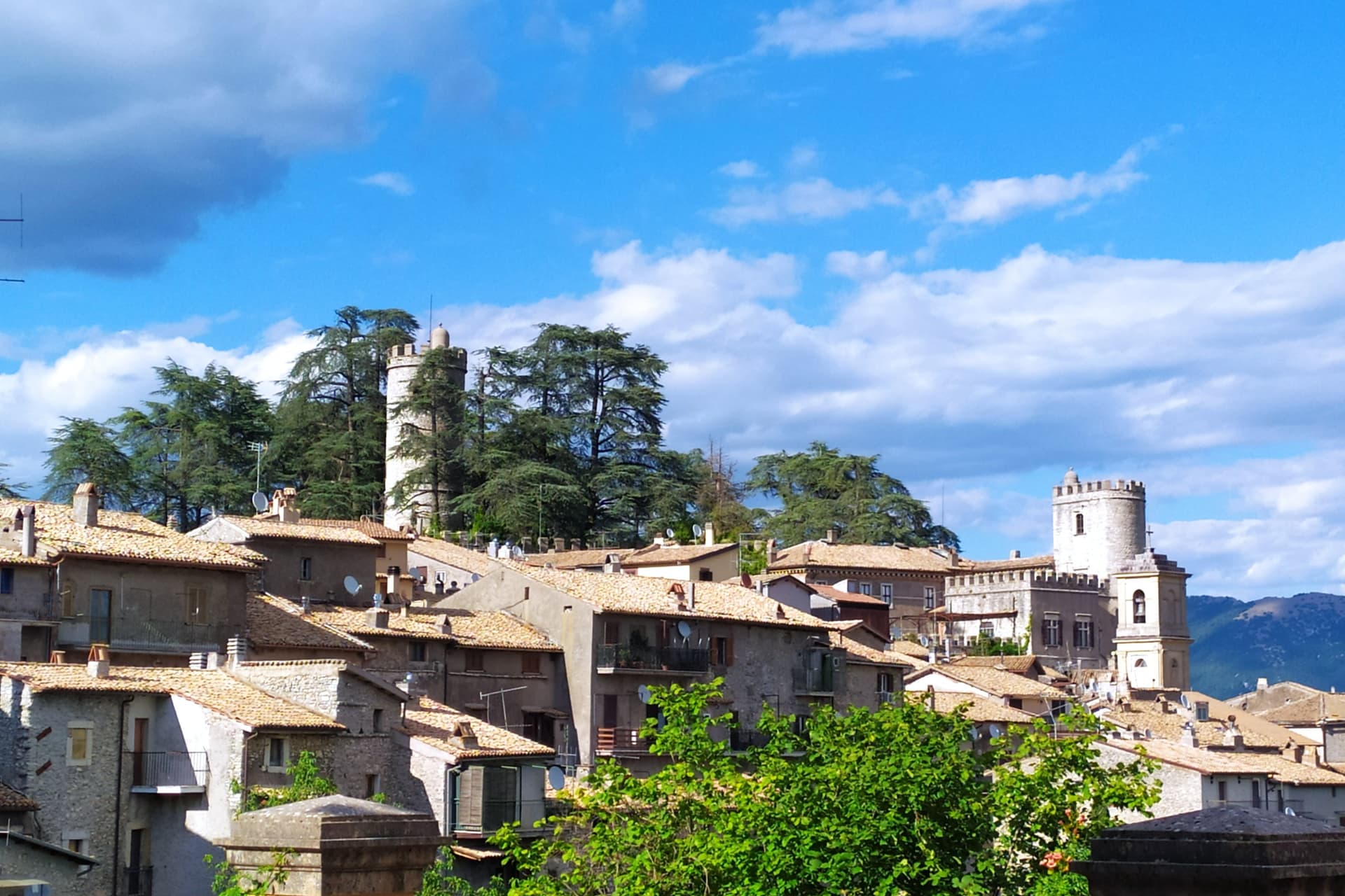
The Orsini built the Granarone palace in the fifteenth century, before the Borghese took the fief in 1632. The village they governed still reads in two layers: stone houses running in tight loops below the ridge, and the Castello Malvezzi-Campeggi above them, the physical record of who held the place longest.
The Cammino di San Benedetto crosses this lower town on its way between Subiaco and Norcia, a reminder that the village has always been a point of passage as much as a seat of lordship. What remains is a settlement whose name changed twice and whose skyline did not: the castle above, the loops of houses below, unchanged in relation even as the village below it was renamed.
The village sits at 840 meters.
What to see in Orvinio
- Castello Malvezzi-Campeggi. Rebuilt by the Borghese in the nineteenth century, it dominates the village from the upper ridge, still visibly the seat of the family that held the fief the longest.
- Abbazia di Santa Maria del Piano. Benedictine abbey founded in the early Middle Ages, the original landlords of the territory before the Orsini took it.
- Centro storico. Stone houses in tight medieval loops below the castle, with vaulted passages and the original village gates preserved.
How to get to Orvinio
Rome is about 1 h away by road.
Our tip
May through September is the working window at 840 meters. The Lucretili woods open, the trails dry out and the village evenings stay cool when Rome forty-five kilometers downhill is hitting thirty-five. October still holds for the woods turning copper and for the Cammino di San Benedetto walkers passing through on the route between Subiaco and Norcia.
4. Cappadocia
Best for a ski week. There is a mapped ski area in the comune.
1 h 20 min from Rome · homes €500 to €750 a m² in the center · 576 people
Why visit Cappadocia
The village sits in a karst-limestone valley in western Abruzzo, at 1,102m in the Marsican mountains. The river Liri rises in the commune's mountains, beside the site of the old Benedictine convent of San Tommaso.
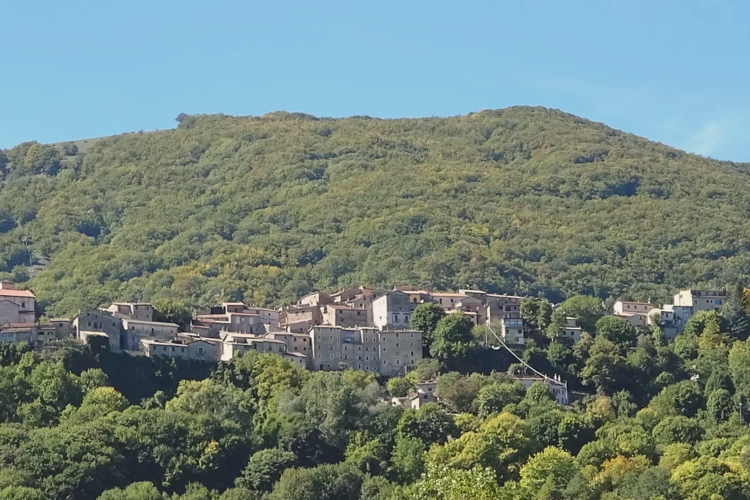
The borgo itself is small: a settlement of stone houses around a 12th-century parish church with later restorations, partial medieval walls still standing, holding a Borgo Autentico designation for the kind of community life and continuity that mark is meant to recognize. To the east the Marsica plain opens toward Avezzano.
To the south, the regional park gives the village its hiking access, with the standard half-day summit reached directly from the settlement. The name is a separate thread from the geography, tied instead to a tradition that Byzantine refugees fleeing the Arab conquests in the 7th-8th centuries AD carried the word from the Anatolian region of the same name when they settled here, a purely toponymic link with no rock-cut landscape or hot-air balloons attached to it.
Depopulation here has been steep and steady: 1,800 residents in 1951, 576 today, a pattern common to Marsican mountain villages generally.
The village sits at 1102 meters.
What to see in Cappadocia
- Sorgenti del Liri. The springs of the Liri, one of Abruzzo's main rivers, in the mountains of the commune, near the site of the Benedictine convent of San Tommaso.
- Centro storico + Chiesa di San Biagio. Quietly handsome medieval mountain settlement at 1,102m. Stone houses, the 12th-century Chiesa di San Biagio with later restorations, partial medieval walls.
- Monti Simbruini + Monte Calvo. Monte Calvo, at 1,500m, is the standard half-day summit from the village, reached directly from the settlement into the regional park's trail network.
How to get to Cappadocia
Rome is about 1 h 20 min away by road.
Our tip
Cappadocia is mountain-seasonal: May through September is the sweet spot, with the cave open year-round but most surface activities (hiking, trail network) needing the snow-free months. The cave's interior temperature is a constant 7°C. Bring a sweater even in August.
5. Castel San Pietro Romano
Best for a small town. 850 people live here.
57 min from Rome · homes €700 to €1,050 a m² in the center · 850 people
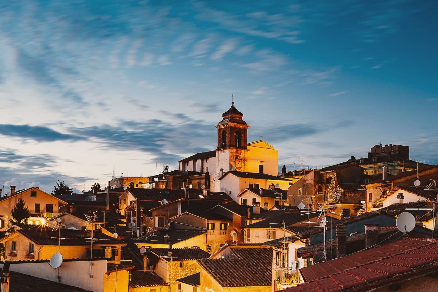
Why visit Castel San Pietro Romano
The hilltop sits three kilometers above Palestrina and forty east of Rome, and has been inhabited since the late Bronze Age. The acropolis of ancient Praeneste, the Latin city known for the sanctuary of Fortuna Primigenia, occupied this same ground before the medieval village grew inside it, which is why cyclopean walls from that earlier phase still ring the upper settlement built centuries later.
In the twelfth century the Colonna raised a castrum here for defensive control over Palestrina below. It was destroyed in 1298 and rebuilt twice over the following two centuries, then restored again in 1482, after which it lost its military role entirely and served the community as a grain store.
The village also saw the 1848 Battle of Palestrina, when Garibaldi's Roman Republic troops fought soldiers of the Kingdom of the Two Sicilies on these slopes, and later lent its streets and terraces to Wyler's cameras before the Borghi più belli d'Italia membership followed. What stands today is a single hill occupied twice over, once for a Latin acropolis and once for a Colonna stronghold, with the second built directly on the bones of the first.
The village sits at 763 meters.
What to see in Castel San Pietro Romano
- Rocca Colonna. The fortress on the summit of Monte Ginestro stands over the grain store it became after Stefano Colonna's 1482 rebuilding; the walls that face Palestrina still carry the bulk of a structure built for defense, not storage.
- Cyclopean walls of Praeneste. Pre-Roman polygonal masonry from the Latin acropolis, sections still visible inside the medieval village.
- Chiesa di San Pietro Apostolo. Parish church enlarged in 1732 under Clement XII on a project by Nicola Michetti, replacing an earlier thirteenth-century structure.
How to get to Castel San Pietro Romano
Rome is about 57 min away by road.
Our tip
May through September is the strongest window. The 763-meter altitude takes the edge off Roman summer heat and the view from the castle terrace opens cleanest in late spring and early autumn. October holds for the autumn light over the Sacco valley and the Lepini ridges.
6. Rocca di Botte
Best for a small town. 865 people live here.
1 h from Rome · homes €540 to €770 a m² in the center · 865 people
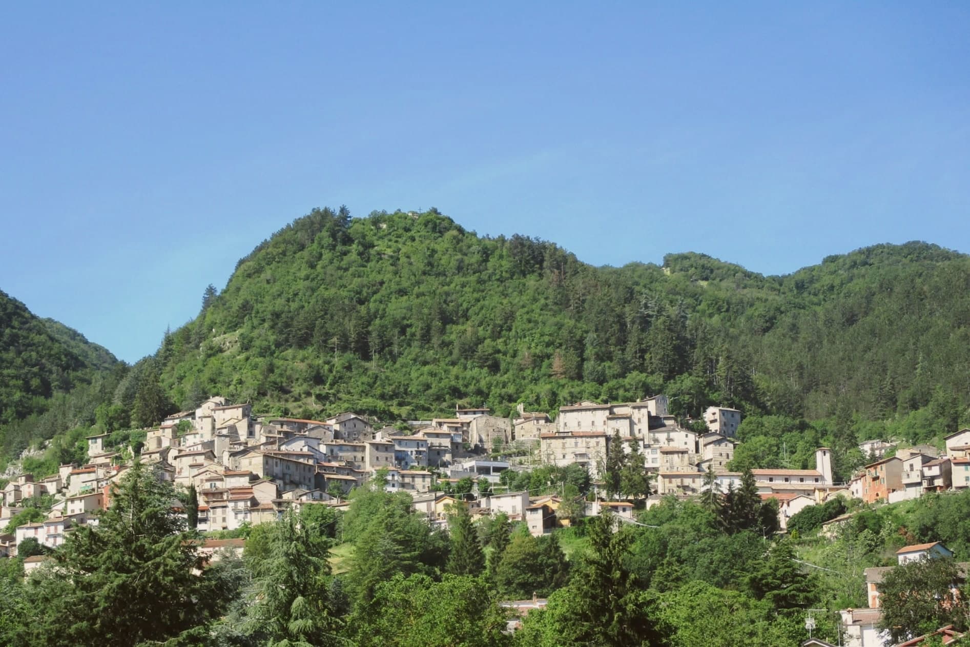
Why visit Rocca di Botte
Rocca di Botte sits at 750 meters on the north-western flank of the Carseolani mountains, where Abruzzo meets the Simbruini range across the Lazio border. The village formed around an eleventh-century Basilian monastery, and the Romanesque church of San Pietro Eremita, built in the twelfth century, is dedicated to the hermit Pietro of Trevi who was born here in the early 1000s and chose the contemplative life over an arranged marriage.
In medieval documents the place appears as Rocca de Bucte. In 1496 Ferdinand II of Naples gave it as a fief to the Colonna of Rome, and Colonna rule lasted into the modern period.
Today the commune has 865 residents and lies on the Cammino di San Pietro Eremita, a walking route that climbs from the village toward the saint's mountain above. The closer big city is Roma, fifty-five kilometers west.
The village sits at 750 meters.
What to see in Rocca di Botte
- Chiesa di San Pietro Eremita. Twelfth-century Romanesque parish church dedicated to the village's hermit-saint, with an austere stone façade and a single-nave interior.
- Centro storico. Mountain village core grown around the Basilian monastery of the eleventh century, with stone houses tight along the slope.
- Monti Carseolani and Monte San Pietro Eremita. Forested limestone range rising above the village to around 1,400 meters, walked on the Cammino di San Pietro Eremita.
How to get to Rocca di Botte
Rome is about 1 h away by road.
Our tip
May through October is the working season. The Carseolani forests are open, the cammino above the village is walkable, and the air at 750 meters stays cool even in midsummer. June and September are the cleanest months for walking, with long days and dry trails.
7. Sante Marie
Best for truffle season. It belongs to the national association of truffle towns.
1 h 8 min from Rome · homes €510 to €760 a m² in the center · 1,059 people
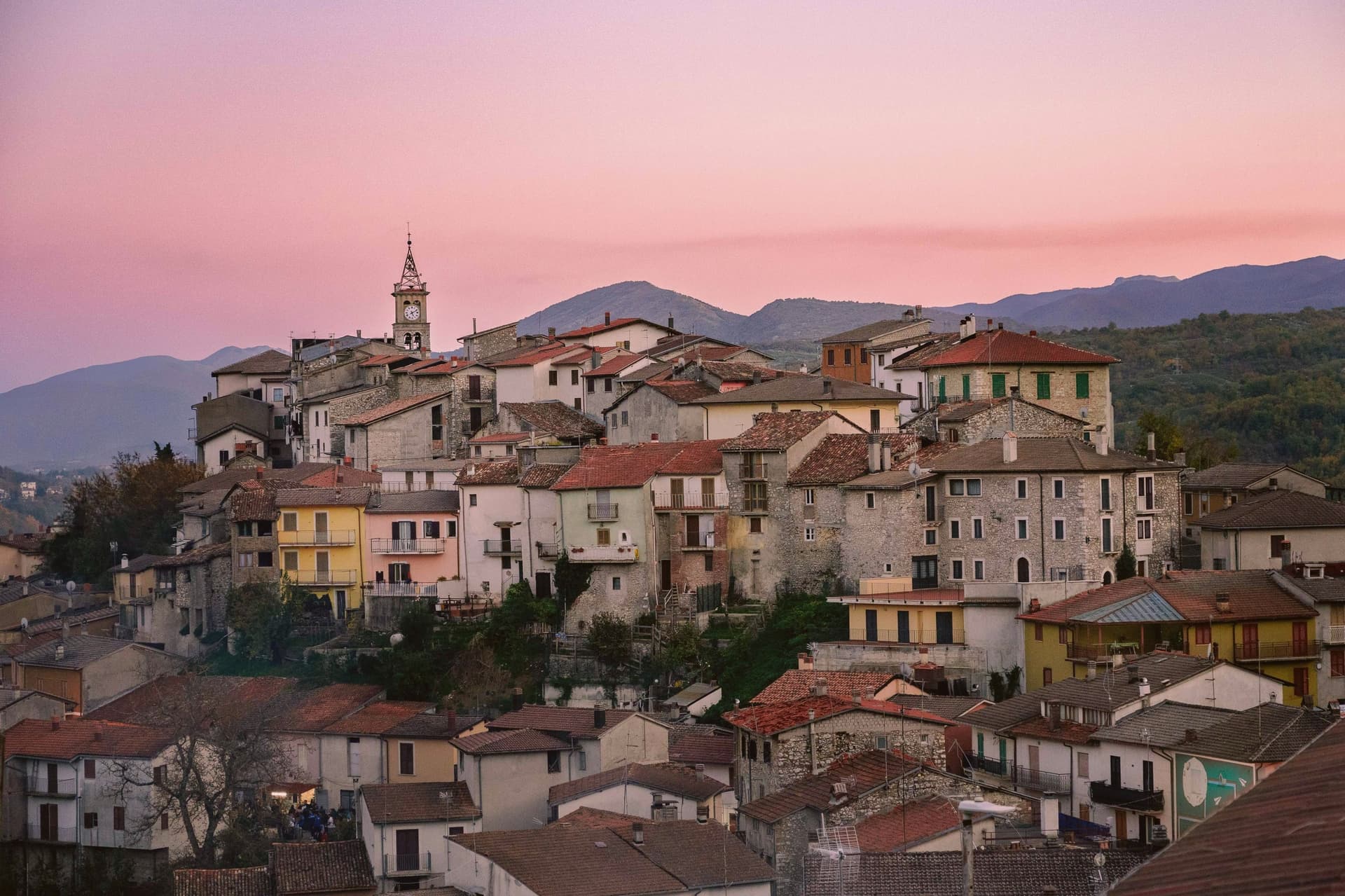
Why visit Sante Marie
Sante Marie sits at 950 meters in the western Marsica, at the border between L'Aquila and Rieti provinces. The town is the capoluogo of six fractions scattered through the hills: Scanzano, Castelvecchio, Val dei Varri, Santo Stefano, Tubione, and San Giovanni.
Its medieval history runs with the Fief of Tagliacozzo, held in turn by the Counts of Marsi, the De Pontibus, the Orsini and finally the Colonna. The Grotte di Luppa Reserve, established in 2005, sits in the surrounding karst country of the Simbruini and Carseolani mountains.
The town is best known now as the starting point of the Cammino dei Briganti, a seven-day circular trail at altitudes between 800 and 1,300 meters that follows the routes of the Cartore brigands, the post-Risorgimento bands who used these forests as cover. Walkers pick up a safe-conduct pass at the reserve office in the village before setting out.
The village sits at 950 meters.
What to see in Sante Marie
- Cammino dei Briganti. Seven-day circular hiking trail at 800 to 1,300 meters along the routes of the Cartore brigands, starting from Sante Marie.
- Riserva Naturale Grotte di Luppa. Karst reserve established in 2005 protecting caves and Apennine landscape on the Simbruini and Carseolani mountains border.
- Centro storico. Medieval hill village above the modern lower town, the historic core of the Tagliacozzo fief held by Marsi, Orsini and Colonna.
How to get to Sante Marie
It has its own railway station. Rome is about 1 h 8 min away by road. The full route from Rome.
Our tip
May through October is the hiking window. Late May and early June bring the slopes into bloom and the Cammino dei Briganti at its best, with cool morning starts and 1,300-meter ridge crossings still open. September and October dry out the trail and turn the chestnut woods gold.
8. Scurcola Marsicana
Best for a trip without a car. The train stops in the commune.
1 h 11 min from Rome · homes €470 to €700 a m² in the center · 2,686 people
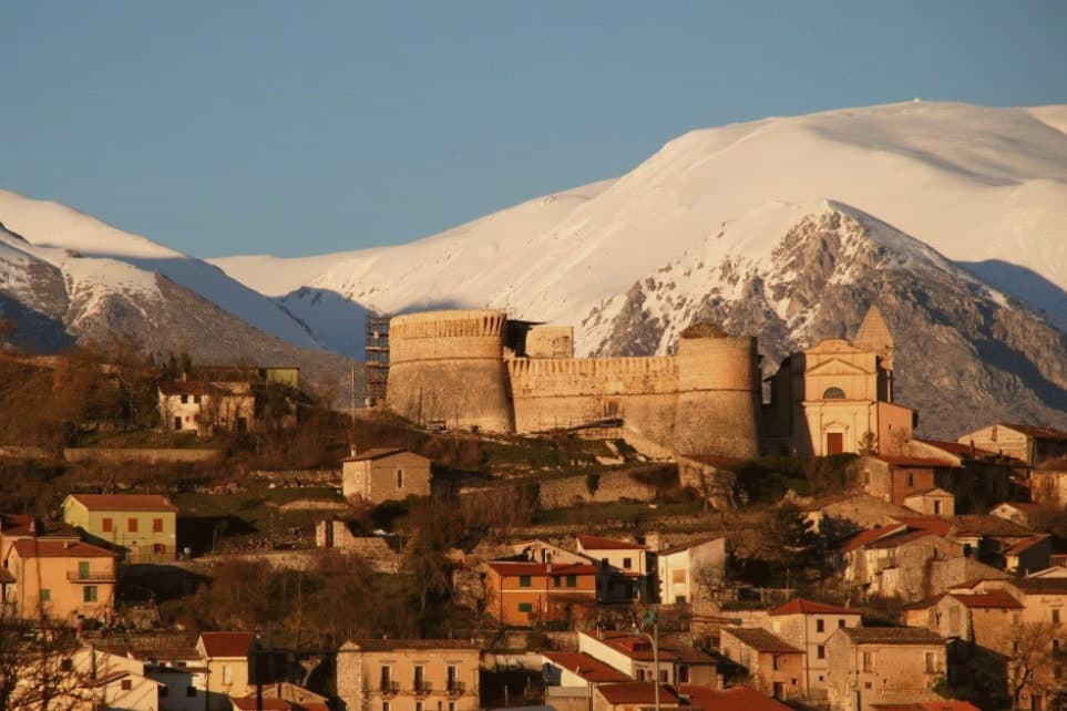
Why visit Scurcola Marsicana
Scurcola Marsicana sits on the western rim of what was once the Fucine lake. The earliest finds in the area date to the ninth and eighth centuries BC; the toponym is Lombard and shows up around 1150, long before the events that made the place known.
The village and its castle sit on the hill, the abbey and the battlefield lie on the plain below, and the mountain rises behind the whole arrangement: high ground, open ground, and the ruin that commemorates what happened on the open ground, all within sight of one another on the plain. The commune has 2,686 residents today, and the Festone every August reenacts the Madonna della Vittoria tradition.
A small town, then, built around a plain that settled a dynastic war.
The village sits at 700 meters.
What to see in Scurcola Marsicana
- Ex Abbazia di Santa Maria della Vittoria. Now ruined but still readable: broken walls and arches standing in the open plain, the clearest physical trace left of the 1268 victory and the monks who once held the site.
- Castello Orsini. Medieval fortress on the hill above the village, later passed to the Colonna family with the rest of the marquisate.
- Piani Palentini. The wide plain stretches flat in front of the village, open ground with little to break the sightline, the kind of terrain that explains why an army would meet another here rather than in the hills.
How to get to Scurcola Marsicana
It has its own railway station. Rome is about 1 h 11 min away by road. The full route from Rome.
Our tip
May through October is the working window on the Marsica plateau. The Piani Palentini and Monte San Nicola open to walkers, the August Festone fills the streets with the Madonna della Vittoria procession, and the air at 700 meters stays cool through summer. June and September are the cleanest months for the battlefield walk and the abbey ruins.
9. Capistrello
Best for a trip without a car. The train stops in the commune.
1 h 20 min from Rome · homes €390 to €580 a m² in the center · 4,649 people
Why visit Capistrello
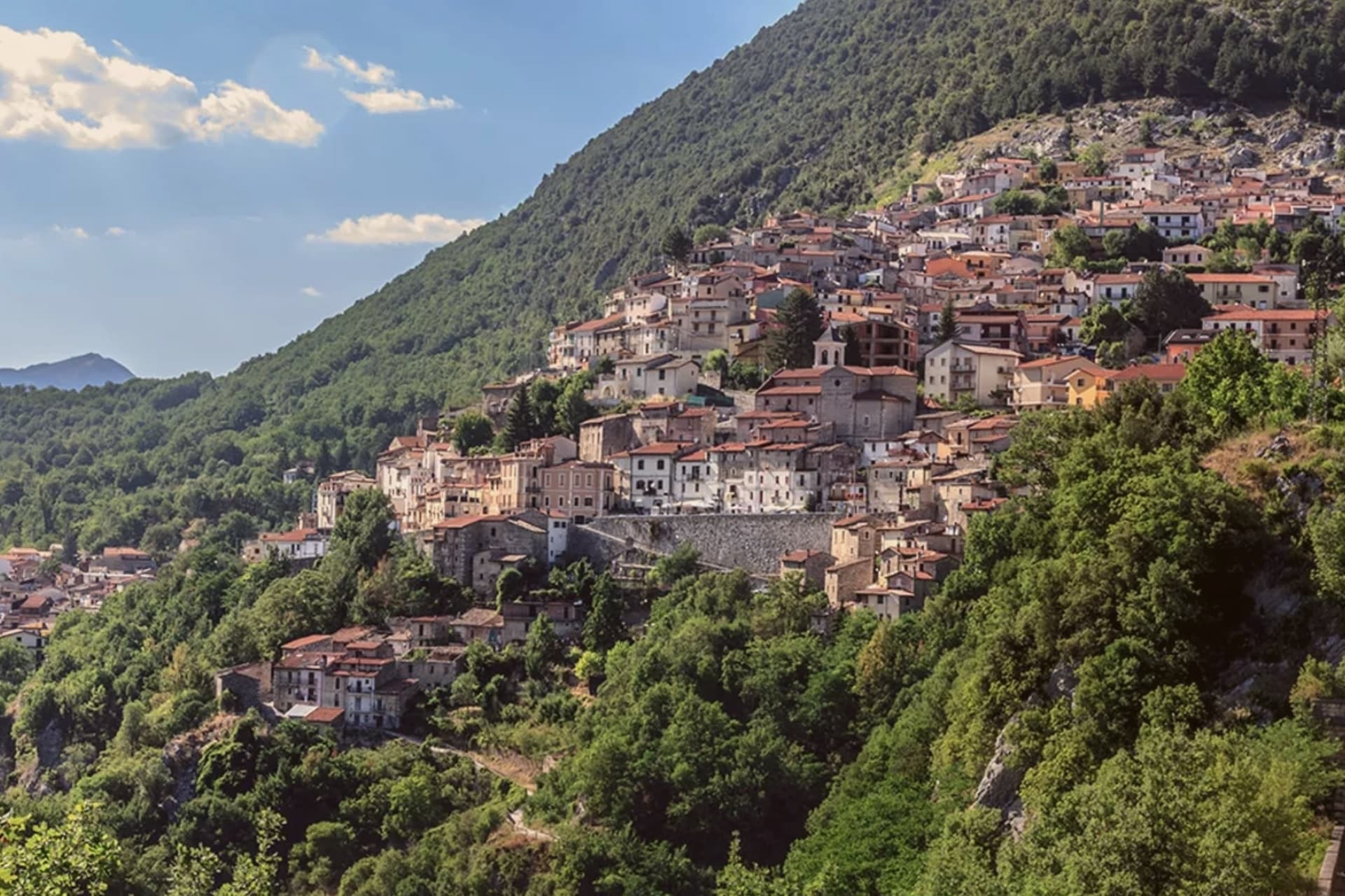
The first settlements on the site date to the Neolithic, and the modern town grew up around the tunnel mouth rather than the other way around. Capistrello borders Avezzano and Tagliacozzo along with five other communes, sitting at the corner where Abruzzo meets Lazio, with Filettino just across the regional line.
The population is around 4,650. The old village sits above the river on the valley's upper lip, stone houses stepped toward a small piazza, while the tunnel outflow lies below at the level of the water itself.
Behind the rooftops the Simbruini slopes rise into chestnut wood, the same high ground that feeds the river its cold, constant flow before it turns south for Lazio. The town reads as a hinge point: plateau above, valley below, and underground, still doing the job it was built for, the channel that connects them.
The village sits at 734 meters.
What to see in Capistrello
- Cunicoli di Claudio. The tunnel runs six kilometers underground with a drop of about eight meters, an average gradient of 1.5 meters per kilometer, still traceable beneath the town.
- Borgo storico. Old village above the river, with stone houses stepped up the slope and a small piazza at the upper edge.
- Fiume Liri. Cold river that emerges from the Simbruini springs and runs south through the valley, picking up the Fucino outflow at Capistrello.
How to get to Capistrello
It has its own railway station. Rome is about 1 h 20 min away by road. The full route from Rome.
Our tip
May through October works for Capistrello: the chestnut woods on the Simbruini fully leaf out, the Liri runs clear, and the Roman tunnel mouth is accessible without snow risk. July and August bring heat in the lower valley and a steady stream of weekend visitors from the Avezzano basin. June and September are quieter and cooler, the better months for walking the upper village or the trails toward Cappadocia and Filettino.
10. Carsoli
Best for a long lunch. Food guides list two tables here.
1 h from Rome · homes €670 to €1,000 a m² in the center · 4,957 people
Why visit Carsoli
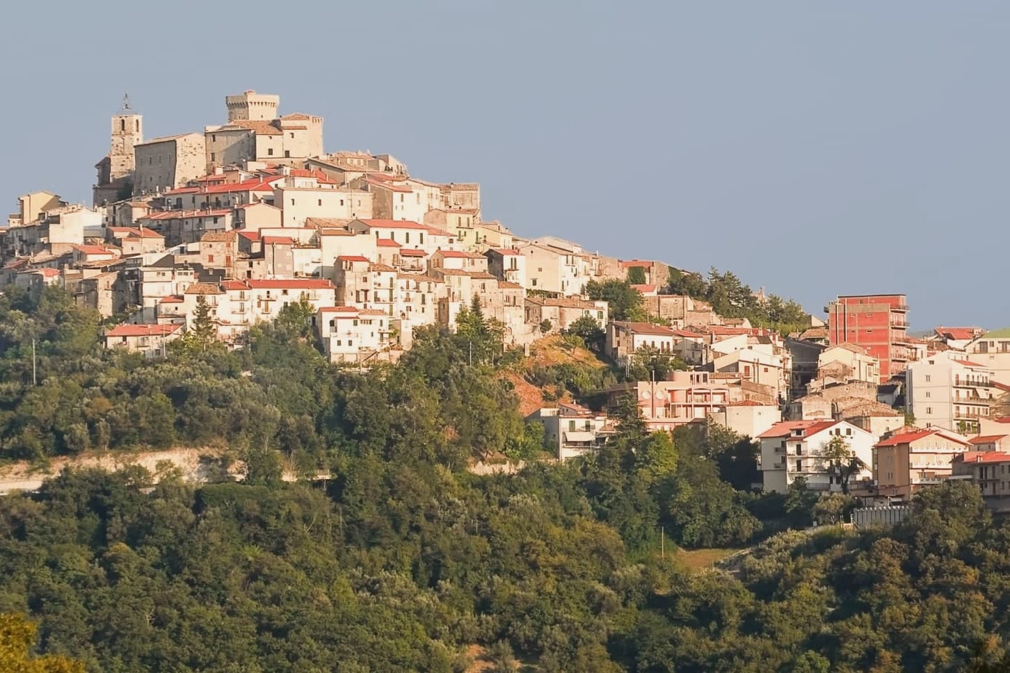
Carsoli sits at 616 meters in the Marsica, between the plain of the former Fucino lake and the valley of the Turano river, with Monte Velino and Monte Calvo both rising above 2,000 meters on its skyline. The modern town stands four kilometers northeast of Alba Fucens's neighbor Carsioli, the Roman colony founded between 302 and 298 BC as a stronghold to guard the road to Alba Fucens; walls and an aqueduct still stand at the locality of Muro Pertuso, surveyed in 1901 by the archaeologists Pfeiffer and Ashby.
The town's religious and military history sits closer to the modern center than the Roman ruins do. The Castle of Colle Sant'Angelo, raised around the year 1000 by the Counts of the Marsi, stood until later wars, and ruins of its adjoining church remain near the site.
Carsoli's autumn season runs on chestnut and polenta fairs with deep peasant roots, and the patron-saint feast of Santa Vittoria fills the streets with procession and stalls. The town's layout traces its own history: a Roman garrison post relocated over centuries into a medieval and then modern settlement, so that walking from the modern center outward means walking backward through the different periods that built it.
The village sits at 616 meters.
What to see in Carsoli
- Sito archeologico di Carsioli. The city walls and aqueduct still stand at the site, four km from the modern town, surveyed by archaeologists in 1901.
- Chiesa di Santa Maria in Cellis. The church stands on the edge of town, with a rose window set over the main portal.
- Chiesa di Sant'Antonio. 16th-century church inside the centro storico, used as a hospital and later as a nursery, with a frescoed altar inside.
How to get to Carsoli
It has its own railway station. Rome is about 1 h away by road. The full route from Rome.
Our tip
May through October is the strong window for Carsoli. Spring brings clear views toward Monte Velino and the high Marsica meadows in flower. June and September are the most comfortable months at 616 meters, with cool nights and dry days.
If you only pick one
Which town is yours
One town for each kind of trip, and the reason in a line.
Without a car
Carsoli
The train stops in the commune, so you can arrive and leave without a car.
For a short trip
Castel San Pietro Romano
57 min by car from Rome, the shortest drive from a city on this list.
For a small town
Capranica Prenestina
325 people, the smallest town on this list.
More from Anywhere Italy
- The best mountain towns within 75 minutes of RomeNear Romemountainwithin 75 min10 towns · smallest 273 residents · closest 57 min away
- The best mountain towns you can reach by train within 90 minutes of RomeNear Romemountainby trainwithin 90 min6 towns · smallest 1,059 residents · closest 60 min away
- The best mountain towns in LazioLaziomountain9 towns · smallest 273 residents
- The 7 best small mountain towns you can reach by train in the province of L'AquilaL'Aquila provincemountainby trainsmall7 towns · smallest 512 residents
- The prettiest small villages within 90 minutes of RomeNear Romewithin 90 minprettiest villagessmall6 towns · smallest 217 residents · closest 52 min away
- The prettiest villages in the province of RomaRoma provinceprettiest villages7 towns · smallest 217 residents