The best mountain towns in Piemonte
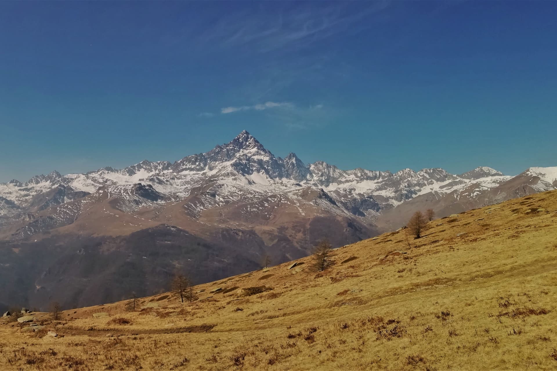
Piemonte is the mountain region that gets forgotten because the wine gets remembered first. The Alps close around it on three sides, and each valley has its own building material and its own accent: dark larch and slate under Monte Rosa, where the Walser settlers came over from the Valais and left timber houses with balconies stacked like drying racks, and further south around Cuneo it is grey stone, low roofs, chestnut woods thickening below the treeline. Autumn is when the valleys are at their best, chestnuts roasting in village squares, porcini in the woods, polenta concia heavy with toma cheese, a glass of something red from the low hills you drove through to get here. In winter the snow comes in properly and the smaller ski areas open without much ceremony. Late spring brings meltwater down every gully and the first cows back up to the alpine pasture.
The mountains most people see are the ones above Turin, the Olympic slopes at Sestriere and the resorts strung along the Val di Susa, easy off the motorway and busy from Christmas through Carnival. The lift systems are large and good, which is why they fill. Weekend traffic backs up the valley road, the hire shops queue out of the door, and the purpose-built accommodation looks much like purpose-built accommodation anywhere in the Alps. It is a fine place to ski and a poor place to understand what a Piemontese mountain village actually is.
The same ranges keep going, north into the Valsesia and the Ossola, south into the Valle Varaita, the Valle Maira and the Ligurian Alps behind Garessio. Those valleys have fortresses, Walser hamlets, painted sundials, thermal water, and towns where the bar is also the shop. Fewer people go, partly because the roads are slower and partly because nobody has bothered to advertise them. The towns below sit in those mountains, and they are worth the drive up the valley.
Of the 65 communes we have mapped in Piemonte, 10 qualify as mountain towns: each sits in the mountains. The smallest, Ostana, has 85 residents.
If you are still choosing, we have also written The best mountain towns within two hours of Turin and The best ski towns in Piemonte.
Ostana
Why visit Ostana
Ostana sits at 1,280m on the south-facing slope of the upper Po valley, in the Occitan linguistic island that runs across the upper valleys of Cuneo and Torino provinces, a dialect still spoken by maybe 50,000 people. In 1921 the village had 1,200 residents working rye, pasture and chestnut at altitude; by 1985 that had fallen to 25, with over 60 houses in ruin and the village close to abandoned, near-officially so.
The reversal began in 1985 when the newly elected mayor, an architect named Giacomo Lombardo, set a 30-year masterplan in motion: rebuild the ruined houses in their original 17th-19th-century stone-and-larch style, draw in residents through Occitan culture, and reposition the village as both an alpine architecture showcase and a cultural centre for that language. It worked on its own terms.
By 2024 the population had climbed back to 85, still small but stable, the demographic curve reversed rather than merely slowed, and the 60-plus restored houses carry insulation modern enough to meet Class A energy ratings behind their traditional stone and larch. The cultural centre, combining library, restaurant and events space, has anchored the new community life since 2012.
The village holds the Borghi piu belli d'Italia inscription despite its tiny population, and architectural press across Europe has taken to citing the case as a model for alpine village rebirth generally. The upper village of restored houses and the lower functions of trail junction and literary festival now depend on each other: walkers on the long-distance trail that crosses the village, and on the former royal hunting trail alongside it, pass through a place that would have had nothing to offer them forty years ago, and the writers who come each year for the minority-language literary prize, now in its fifteenth year and drawing entrants from Occitan to Sardinian to Maori to Welsh, stay in houses that were rubble within living memory.
The food is Occitan-alpine: gnocchi con bagna cauda, cunsa di bietole, raviolas di rapa, raclette and fontina mountain cheese, with Barolo and Barbaresco from the Langhe 60 km east. Like other alpine villages, Ostana goes quiet in winter, its high season running June to September.
What the demographic curve and the rebuilding record show together is a village that did not simply survive its emptying out but rebuilt itself around the very things, language and landscape, that might otherwise have been lost with it.
The village sits at 1280 metres.
What to see in Ostana
- Monviso direct view (3,841m). Belvedere terraces across the centro line up on the pyramid face-on, the angle that made the village's postcard reputation.
- Restored 17th-19th-c stone borgo. Larch-and-stone houses standing where ruins stood a generation ago, the insulation invisible behind old materials. Streets built for a population many times the current one, now filled in more slowly.
- Occitan culture + Premio Ostana. The Occitan dialect is audible in the village rather than archived, and the Premio Ostana, Scritture in Lingua Madre, brings minority-language writers here once a year.
How to get to Ostana
Torino is roughly 94 minutes away by road.
Our tip
Ostana is alpine-seasonal — June through September is the high season for trails + alpine activities + the Premio Ostana literary festival (late June). May and October are shoulder for cooler hiking. Winter is Alpine at 1,280m with heavy snow possible Nov-April, ski touring + winter walks but most services scaled back.
Usseaux

Why visit Usseaux
Usseaux sits at 1,416 meters in the upper Val Chisone, fifty-five kilometers west of Torino on the road that climbs toward the Colle delle Finestre. The commune holds 175 residents across the capoluogo and four high hamlets: Balboutet, Laux, Fraisse and Pourrieres, each with its own parish and its own dialect inflection.
In 1343 these communities joined the autonomous Escartons Republic, a federation of alpine villages that bought their freedom from the Dauphin and self-governed in Occitan for four hundred years until Napoleon dissolved them. The Waldensian Reformation reached the valley in the sixteenth century and left a network of temples on the slopes below.
The contemporary signature of Usseaux is the murales project: more than forty paintings on house walls showing alpine work, animals and peasant scenes, layered over stone facades that already carry sundials and carved lintels. Balboutet faces south and reads its hours from those dials.
Laux holds a small lake at the foot of the meadows above the village.
The village sits at 1416 metres.
What to see in Usseaux
- I Murales. More than forty painted murals across stone facades in the capoluogo and the borgate, depicting alpine work, peasant scenes and forest animals.
- Balboutet. South-facing hamlet known for the sundials painted and carved across the facades of its stone houses, marking time in alpine tradition.
- Lago del Laux. Small alpine lake on the meadows above the hamlet of Laux, a short walk from the village and ringed by fishing huts.
How to get to Usseaux
Torino is roughly 92 minutes away by road.
Our tip
June through September is the open alpine season at 1,416 meters: meadows in flower above the borgate, trails through the Orsiera-Rocciavrè park clear of snow, and the Lago del Laux walkable from the village in twenty minutes. December through March is the winter window, when the Vialattea ski domain a short drive west fills the valley and snow holds long on the murales walls. April, May, October and November are the difficult months.
Ronco Canavese
Why visit Ronco Canavese
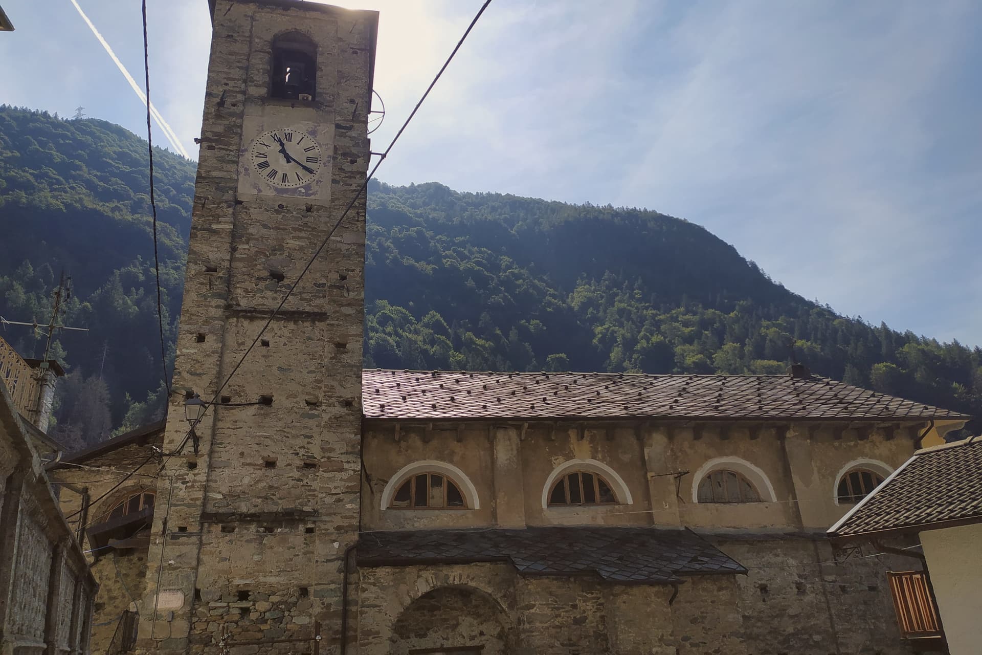
The commune's territory climbs from the valley floor around 774 meters up to alpine summits above 3,400 meters, much of it inside the protected area of the park. The first settlements between the tenth and eleventh centuries cleared land the Romans had left forested; the name comes from the Latin runcus, ground newly broken.
The first parish was recorded in the thirteenth century. Two hundred and seventy-one people live in the commune year-round, spread across the capoluogo and a dozen hamlets that make up the Valle Soana.
The park visitor centre based here turns that geography into its subject, tracking the biodiversity, ibex, chamois and golden eagle among it, that the valley's climb from 774 to over 3,400 meters supports. The Comuni Virtuosi recognition signals a working line on waste, water and community use of public land.
A village this size, spread this thin across a valley this steep, has had to make an ongoing practice of managing what little flat ground and shared resource it has.
The village sits at 956 metres.
What to see in Ronco Canavese
- Parco Nazionale del Gran Paradiso. Reached on the Piemonte side from the Valle Soana, home to ibex, chamois, marmots and golden eagles.
- Centro Visitatori del Parco. Park visitor centre titled 'Tradizioni e biodiversità in una Valle Fantastica', dedicated to the natural and cultural heritage of the valley.
- Frazioni della Valle Soana. Stone hamlets scattered up the valley, where the local language is still spoken in households and on the trail signs.
How to get to Ronco Canavese
Torino is roughly 88 minutes away by road.
Our tip
May through October is the window when Ronco Canavese is fully reachable and the Gran Paradiso opens to walkers. June through September is the high season for the park: ibex on the upper slopes, the GTA running through the valley, and refuges staffed. July and August are the busiest months in the hamlets, though crowds stay modest by alpine standards.
Fenestrelle
Why visit Fenestrelle
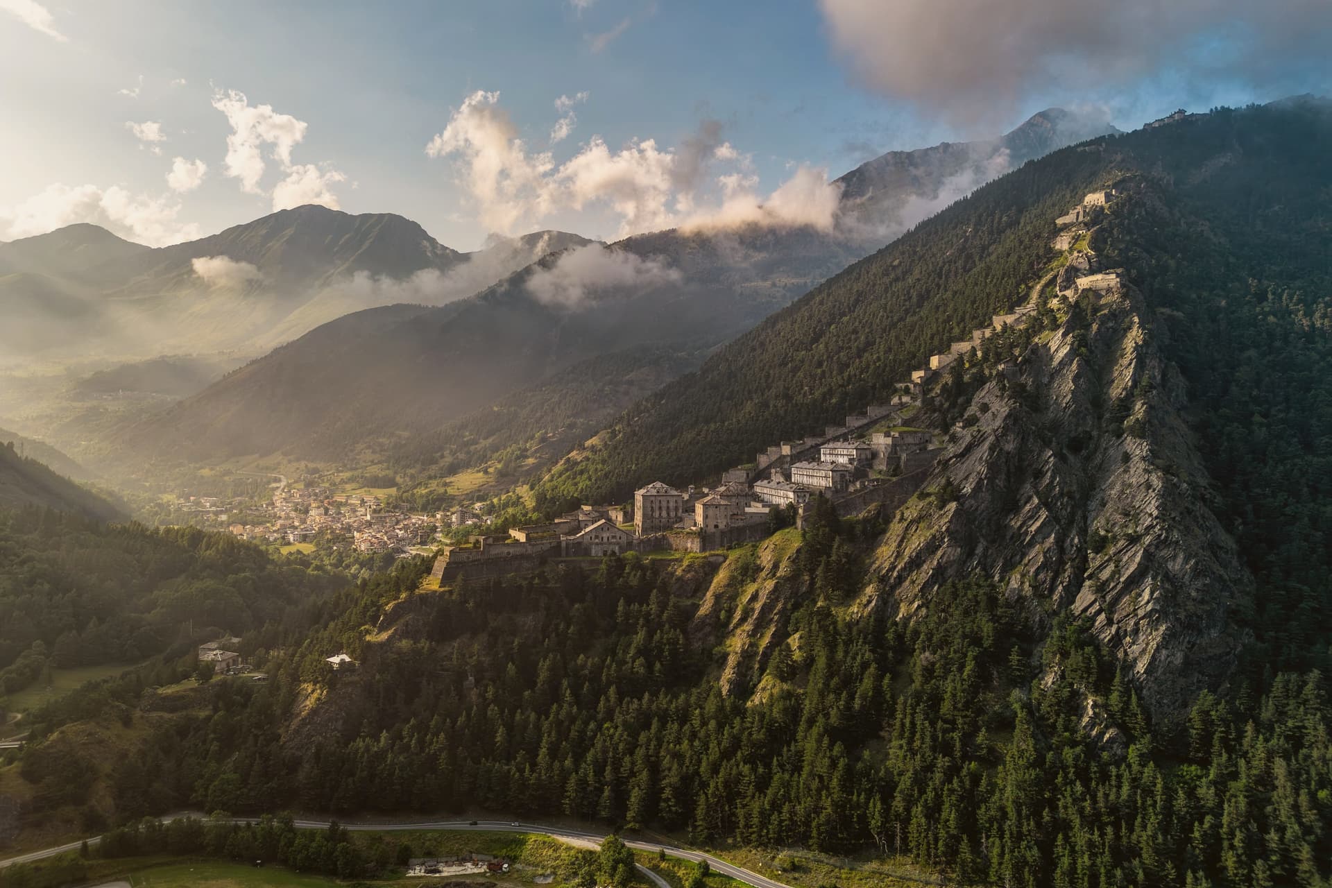
Fenestrelle sits in the middle of Val Chisone, fifty kilometers west of Torino on the road toward Sestriere. The Romans called this point Finis Terrae Cotii, the border of Cottius's land, and from the twelfth century onward the valley held a strong Waldensian community, long before any fortress stood here.
Construction on the ridge began in 1728, commissioned to secure the border against France after the Treaty of Utrecht handed Val Chisone to Piedmont, and work continued for around 120 years. What resulted sits apart from the village in every sense: the settlement stays put at the valley floor while the fortifications climb the slope above it, three separate forts staged up the ridge and joined by a single stair.
The village is the base point of a line that keeps rising until it reaches the crest, so that the same walk that starts among houses ends at open rock looking down over the whole valley. Fenestrelle today is best understood as the foot of that climb, a border town that turned into the ground floor of its own fortress.
The village sits at 1154 metres.
What to see in Fenestrelle
- Forte di Fenestrelle. The full system stretches over the ridge above the village, three connected forts joined by the covered staircase, standing above Val Chisone.
- Forte San Carlo. Lowest of the three forts, the entrance complex above the village at 1,154 meters, where the climb up the stairs begins.
- Forte Tre Denti. Middle fort of the system, home to the Garitta del Diavolo viewpoint at 1,400 meters over Val Chisone.
How to get to Fenestrelle
Torino is roughly 84 minutes away by road.
Our tip
June through September is when the fortress is fully open for guided visits, the high gradients of the staircase are walkable, and Val Chisone trails above 1,500 meters are clear of snow. December through March is the alpine winter season: the Vialattea ski domain is twenty minutes away, the lower fort is accessible in snow, and the upper forts close. April, May, October and November are the difficult shoulder months.
Macugnaga
Why visit Macugnaga
Macugnaga sits at 1,327 meters at the head of the Anzasca valley, directly beneath the east wall of Monte Rosa, the second-highest summit in western Europe at 4,634 meters. The village was founded in the 13th century by Walser colonists from the Swiss canton of Valais, who crossed the Monte Moro pass and settled the upper basin in the 1200s.
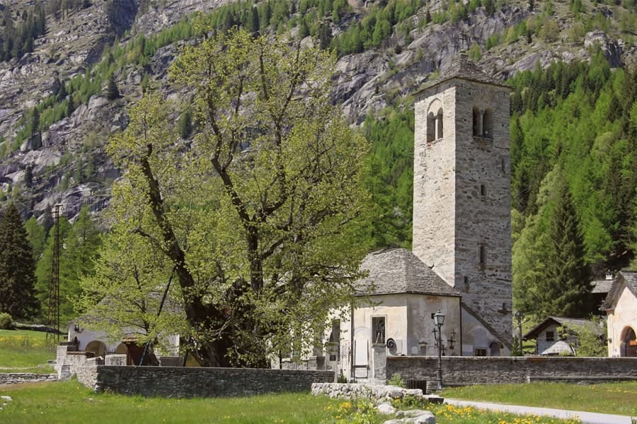
Their dark-timbered houses still stand in Borca, Staffa and Pestarena; the Walser Museum in Borca documents the German-speaking culture that held the valley for seven hundred years. The Chiesa Vecchia, mentioned in a 1317 document, sits beside the Vecchio Tiglio, a linden tree the University of Turin dates to around 500 years old, traditionally used for community assemblies.
The east wall of Monte Rosa was first climbed from here in 1872, by Richard Pendlebury's party with the guide Ferdinand Imseng. The mines at Guia and Pestarena produced industrial gold from 1710 until 1961.
The village sits at 1327 metres.
What to see in Macugnaga
- East wall of Monte Rosa. The 2,400-meter rock and ice face above the village, the largest in the Alps, first climbed in 1872 by Pendlebury and Imseng.
- Chiesa Vecchia. 13th-century Walser parish church first documented in 1317, with a frescoed bell tower and a cemetery of climbers.
- Vecchio Tiglio. Linden tree beside the Chiesa Vecchia, eight meters in circumference, used by the Walser for community assemblies.
How to get to Macugnaga
Novara is roughly 119 minutes away by road.
Our tip
June through September is the alpine summer, when the trails to the Belvedere and Monte Moro open, the high huts run service and the east wall draws climbers. December through March is the second season: the lifts at Belvedere and Monte Moro carry skiers up to glacial terrain rare for southern Europe. April, May, October and November are between seasons.
Alagna Valsesia
Why visit Alagna Valsesia
Alagna sits at the head of the Valsesia, at 1,191 meters, where the valley closes against the south face of Monte Rosa, the second-highest peak in the Alps. The commune covers 72.8 square kilometers, the largest by surface area in the province of Vercelli, and its territory reaches from the valley floor up to the glaciers, which is why a single village can hold both the wooden hamlets of the Walser settlers and the lift stations of a major ski domain.
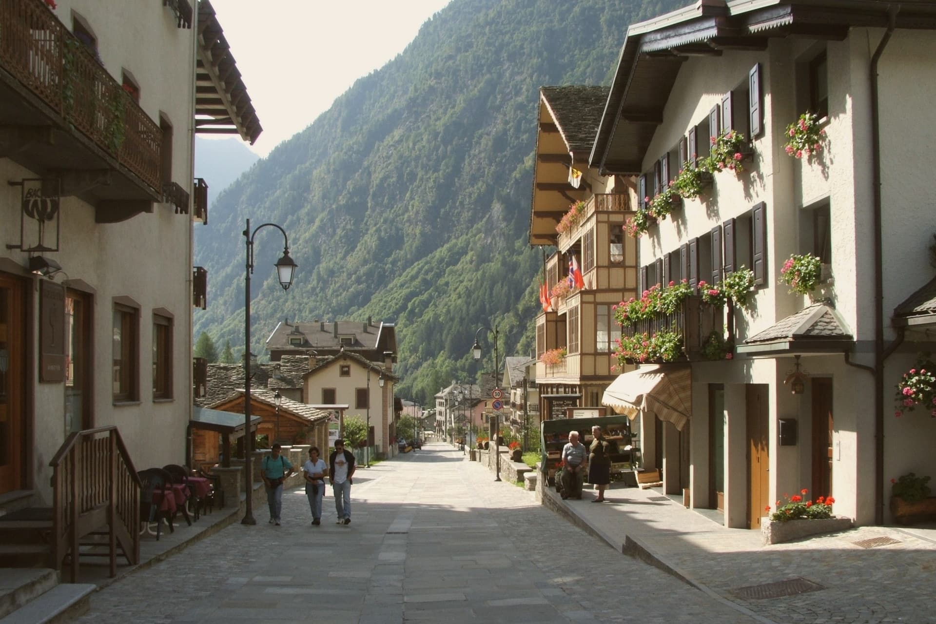
Those settlers came from the Swiss Valais in the thirteenth century and stayed, building in wood and stone between 1500 and 1700; the hamlets of Pedemonte, Riale and Resiga carry that building tradition still. The Guides Association of Alagna, founded in 1872, is the second-oldest in Italy after Courmayeur, a marker of how early the peaks above the village drew climbers rather than skiers.
The lifts came later, opening in stages from the 1950s, and Alagna is now the eastern access to a domain that crosses into the Aosta Valley. Internationally the village is known less for groomed pistes than for the freeride terrain on the massif itself.
The Bandiera Arancione of the Touring Club fires here. The two identities, Walser hamlet and freeride terminus, sit on the same ground because the valley that sheltered thirteenth-century settlers is the same one that funnels skiers up toward the glaciers today.
The village sits at 1191 metres.
What to see in Alagna Valsesia
- Frazione Pedemonte. Three-storey wooden houses still standing in their original form, the oldest a Walser hamlet built in the 1500s and 1600s.
- Museo Walser. Opened in 1976 in a 1628 Walser house in Pedemonte, reconstructing the interiors, tools and furnishings of a traditional German-Alpine household.
- Chiesa di San Giovanni Battista. Parish church built in 1511, holding sculptures by Giovanni d'Enrico, the Valsesian sculptor active around the Sacro Monte di Varallo.
How to get to Alagna Valsesia
Novara is roughly 97 minutes away by road.
Our tip
December through March is the ski season Alagna built around itself: lifts open, the Monterosa domain links to the Aosta Valley, and the freeride routes off Punta Indren run as long as the snow holds. June through September is the second season, when the same valleys become hiking and via ferrata country and the temperatures rarely break 22 degrees. April, May, October and November are quiet shoulder months.
Limone Piemonte
Why visit Limone Piemonte
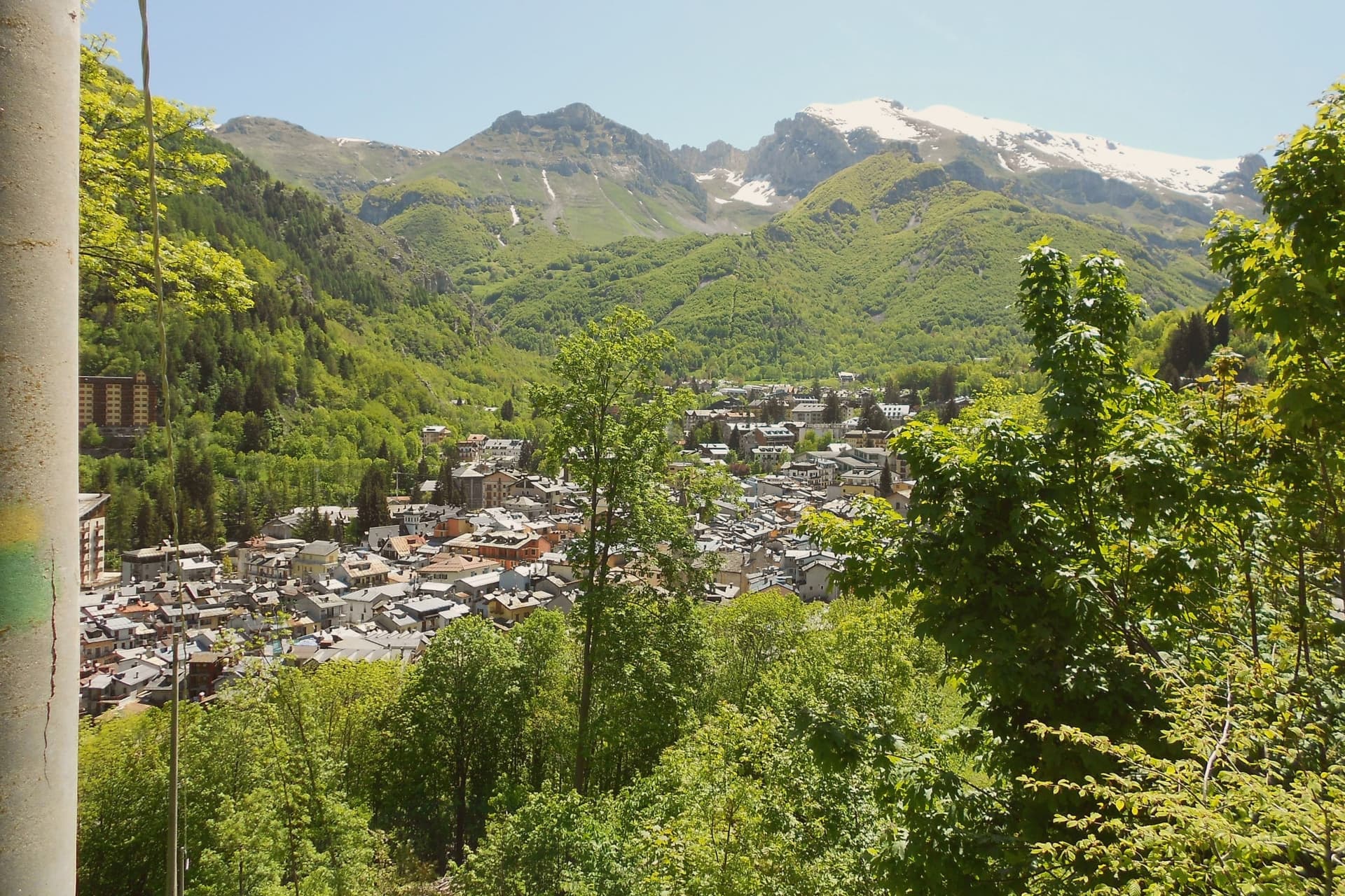
Limone Piemonte sits at 1,000 meters in the Vermenagna valley, twenty kilometers from Cuneo and fourteen from the Colle di Tenda, the historic pass into France. The Riserva Bianca ski domain rises behind the village from 1,050 to 2,085 meters, with eighty kilometers of pistes served by one gondola, ten chairlifts and three drag lifts.
The Cuneo-Ventimiglia railway, opened across this valley in 1900, runs ninety kilometers from the plain to the sea with thirty-three tunnels and twenty-seven bridges, one of the steepest mountain lines in Europe. In the village center, Piazza del Municipio holds a 16th-century stone fountain and the Gothic parish church of San Pietro in Vincoli, with elements of Romanesque and Gothic stonework from the 14th and 15th centuries.
The town empties between seasons and fills twice a year, for the ski months and for the alpine summer.
The village sits at 1000 metres.
What to see in Limone Piemonte
- Chiesa di San Pietro in Vincoli. Gothic parish church on Piazza del Municipio, built between the 14th and 15th centuries on Romanesque foundations.
- Riserva Bianca. Ski domain rising from 1,050 to 2,085 meters with 80 km of pistes, the main winter draw of the southern Piemonte Alps.
- Centro storico. Stone village core around Piazza del Municipio, with a 16th-century fountain and a Gothic-Romanesque parish church.
How to get to Limone Piemonte
There is a railway station in the town, so you can arrive without a car and never need one while you are here. Torino is roughly 132 minutes away by road.
Our tip
December through March is the ski season the village was rebuilt for: the Riserva Bianca lifts open, the centro fills on weekends and the railway carries day-trippers up from the plain. June through September brings the second peak, when the same ridges become hiking, grazing and via ferrata country and the Tenda border roads draw cyclists. April, May, October and November are quiet between the two seasons.
Ormea
Why visit Ormea
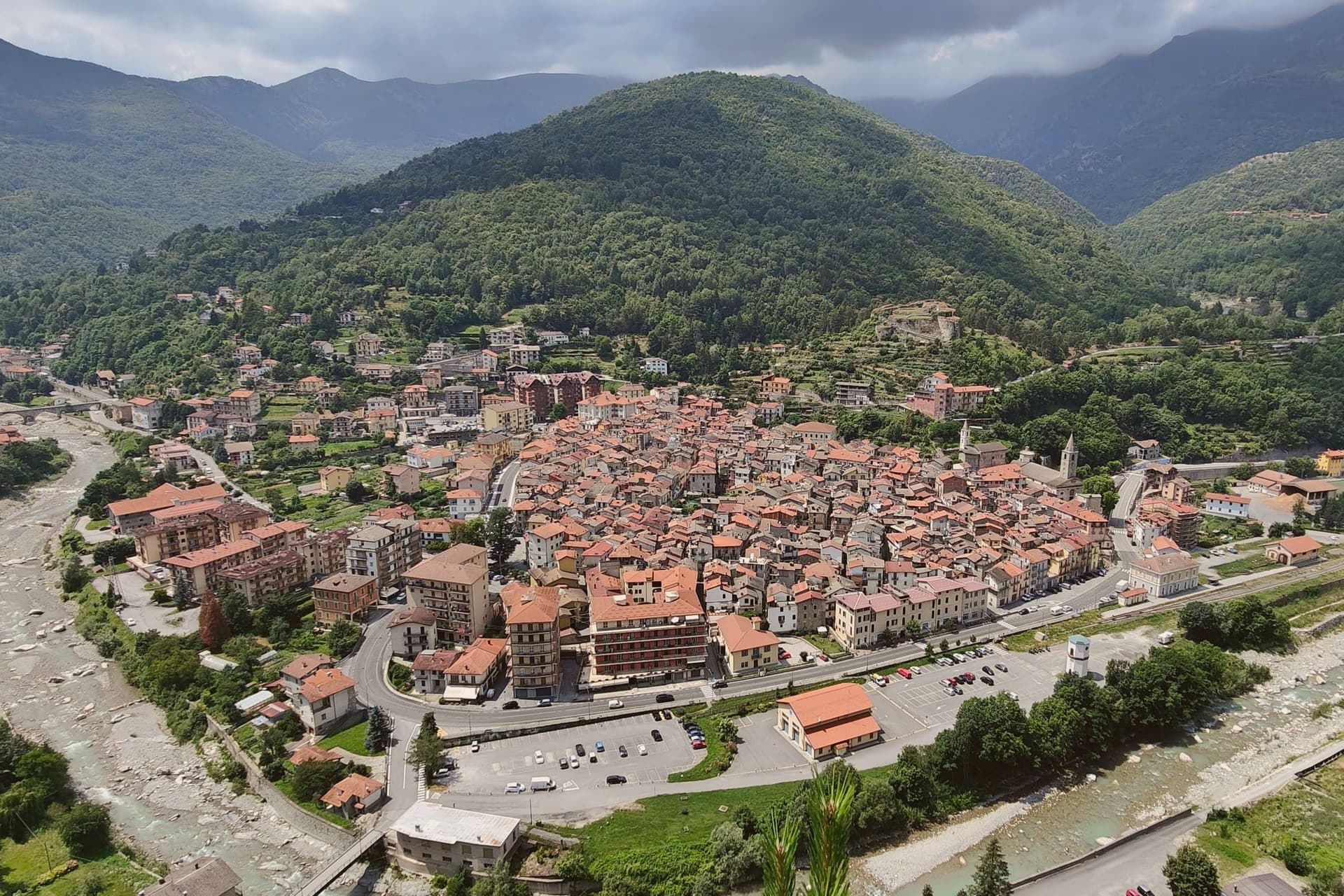
Ormea sits at 736 meters in the upper Tanaro valley, at the confluence of the Armella stream and the river, with the Pizzo d'Ormea rising to 2,476 meters above the rooftops. The historic centre has a recognisable heart-shaped perimeter, set against the Ligurian Alps that separate Cuneo from Imperia and Albenga; on clear days the Riviera sea is visible.
The territory belonged to the Aleramici and then the Marquises of Ceva from 967, contested through the 1200s with the Clavesana branch and the Republic of Genoa, before passing to the Savoys in 1558. In 1722 it became a marquisate under Carlo Vincenzo Ferrero d'Ormea, who built a textile mill capable of competing with English production until the French Revolution and Napoleon's army destroyed both the factory in the main square and the medieval castle.
The commune carries Borghi Autentici and Città del Castagno; the chestnut harvest runs the calendar from October.
The village sits at 736 metres.
What to see in Ormea
- Centro storico. Heart-shaped medieval core at the confluence of the Tanaro and Armella, narrow lanes between stone houses, with views to the Pizzo d'Ormea.
- Ruderi del Castello. Remains of the medieval castle held by the Marquises of Ceva and the Savoys, destroyed during Napoleon's Italian campaign at the end of the 18th century.
- Pizzo d'Ormea. 2,476-metre Ligurian-Alps peak above the town, the dominant summit of the upper Tanaro and a long-day hike from the centro storico.
How to get to Ormea
There is a railway station in the town, so you can arrive without a car and never need one while you are here. Torino is roughly 132 minutes away by road.
Our tip
May through June brings the chestnut woods into full leaf and the Tanaro down from snowmelt; the trails to the Pizzo d'Ormea open by late May. July and August are the climbing and trekking months, mild evenings at 736 meters even when the coast below burns. September and October are the strongest window: clear air, low fog in the valley at dawn, and the chestnut harvest with its weekend sagre.
Villar San Costanzo
Why visit Villar San Costanzo
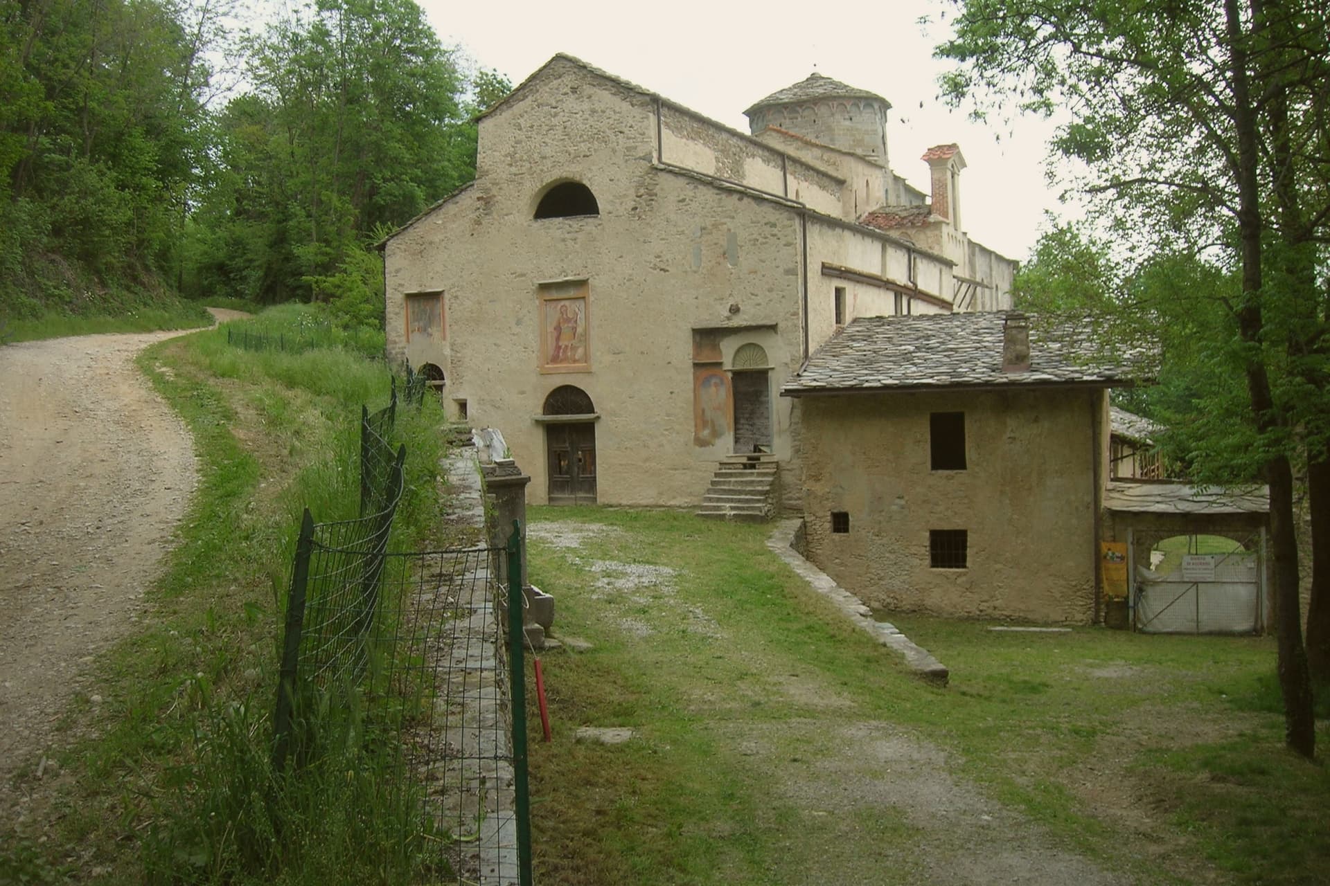
Villar San Costanzo sits at the mouth of the Val Maira, fifteen kilometers northwest of Cuneo. The village and its religious complex sit apart from the reserve on the higher ground above: an abbey anchors the settlement itself, founded in the early eighth century as the commune's historic religious center, while a church and the erosion columns both belong to the slope of the massif that rises over the village.
The name Ciciu is Piedmontese for puppet, given to the columns for their shape: a shaft of earth and stone topped by a glacial erratic boulder, the cap shielding the softer material beneath from rain while the surrounding ground wears away around it. Local legend ties the columns to the same ground as the chapel above them, reading the shapes as the petrified soldiers of Diocletian, cursed by a martyr who gave the village its name, a Roman legionary of the Theban Legion killed nearby around 303.
Village below, abbey at its center, and slope above carrying both the sanctuary built on the martyrdom site and the columns the legend attaches to it: the settlement's religious history and its natural landmark trace back to the same rise of ground and the same story.
The village sits at 605 metres.
What to see in Villar San Costanzo
- Riserva Naturale dei Ciciu del Villar. The columns stand on the slope between 670 and 1,350 meters, earth and stone shafts each shielded by its boulder cap while the ground around them erodes away.
- Chiesa di San Costanzo al Monte. The church carries frescoes from the eleventh century and stands on the site of the martyrdom, on the slope of Monte San Bernardo above the village.
- Abbazia di San Costanzo. Benedictine abbey at the heart of the village, founded in the early eighth century and the historic religious anchor of the commune.
How to get to Villar San Costanzo
Torino is roughly 91 minutes away by road.
Our tip
May through October is the open window at 605 meters under Monte San Bernardo, when the trail through the Ciciu reserve is dry and the columns are fully visible above the dwarf scrub. June and September are the strongest months for the walk, with cool air on the upper sentiero and the larch forest in full leaf. July and August warm the lower village toward the high twenties, but the climb under tree cover stays comfortable.
Garessio
Why visit Garessio
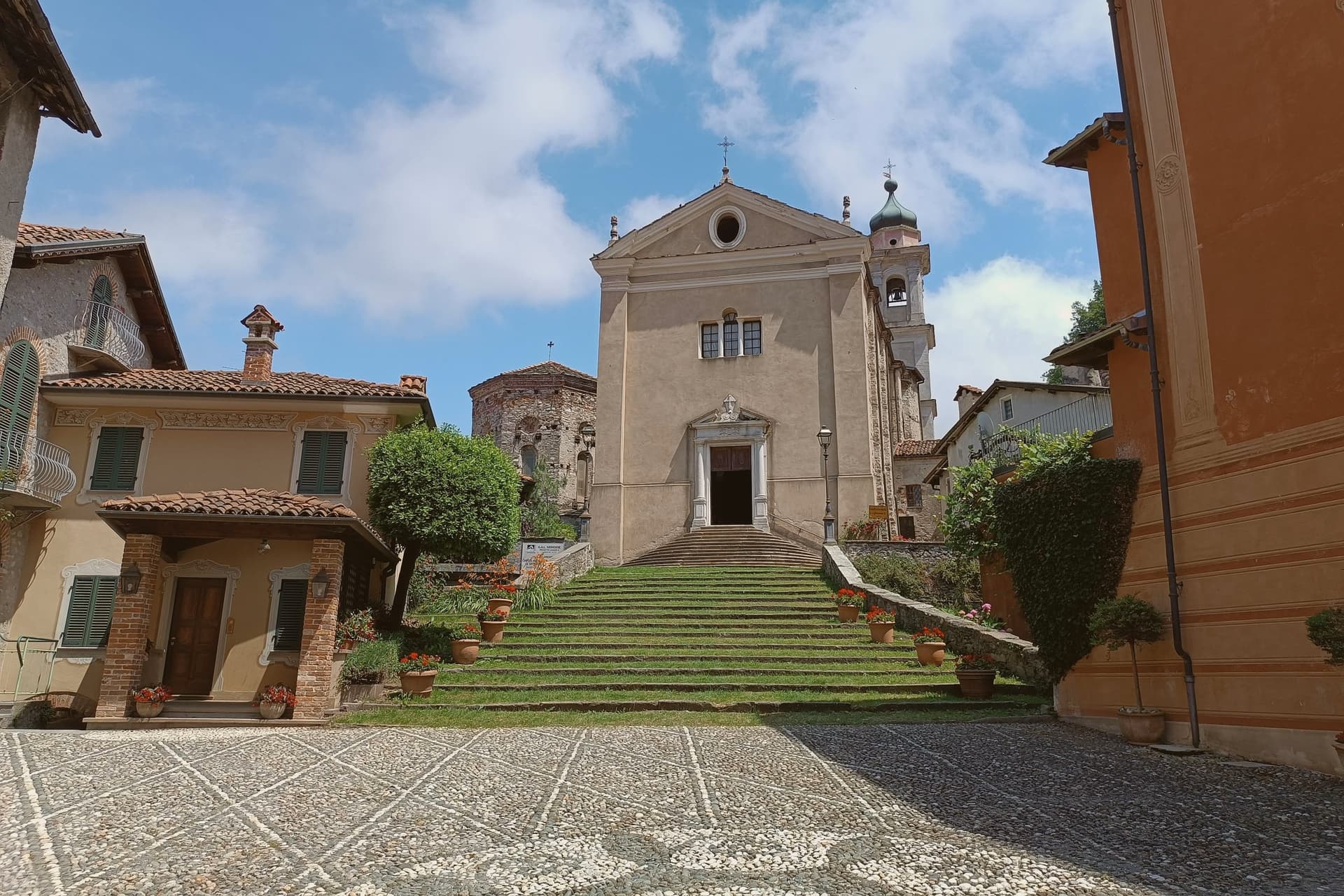
Garessio sits in the upper Tanaro valley, on the watershed where Piemonte meets Liguria. The town is built across four historic quarters, Borgo Maggiore, Borgo Ponte, Borgo Poggiolo, and the borgo that gives its name to the hillside sanctuary and spring above it, each with its own piazza and parish.
The arrangement follows the old traffic of the salt road: Mediterranean salt came up over the Ligurian Alps from Albenga, was repacked in the fortified core, and continued north toward Piemonte and the Po valley. The Savoy family later kept a hunting lodge on the wooded slopes above town, a former Carthusian charterhouse turned retreat, showing a second life for the valley once trade had moved on.
A town built to move salt and later chosen for a royal retreat and a bottling brand: the same slopes have been worked, defended, and rested in by turns, without ever losing the shape of the four quarters that founded it.
The village sits at 621 metres.
What to see in Garessio
- Borgo Maggiore. The medieval core, fortified around 1100 as a ricetto, with three surviving gates, Porta Rose, Porta Jhape, and Porta Liazoliorum, and remnants of the defensive walls.
- Reggia di Valcasotto. Former Carthusian charterhouse converted to a Savoy hunting lodge in the nineteenth century, on the wooded slopes above the town.
- Santuario di Valsorda. Hillside sanctuary above Borgo Valsorda, the town's pilgrimage site, with views over the Tanaro valley.
How to get to Garessio
There is a railway station in the town, so you can arrive without a car and never need one while you are here. Torino is roughly 95 minutes away by road.
Our tip
May through October is the open season. Spring brings the Tanaro running full and the chestnut woods turning green; September and October are dry, with the salt-road footpaths at their clearest. July and August are warm but never coastal-hot at 621 meters; the river keeps the valley cool at night. Cheers Music & Beer Festival falls in August.