
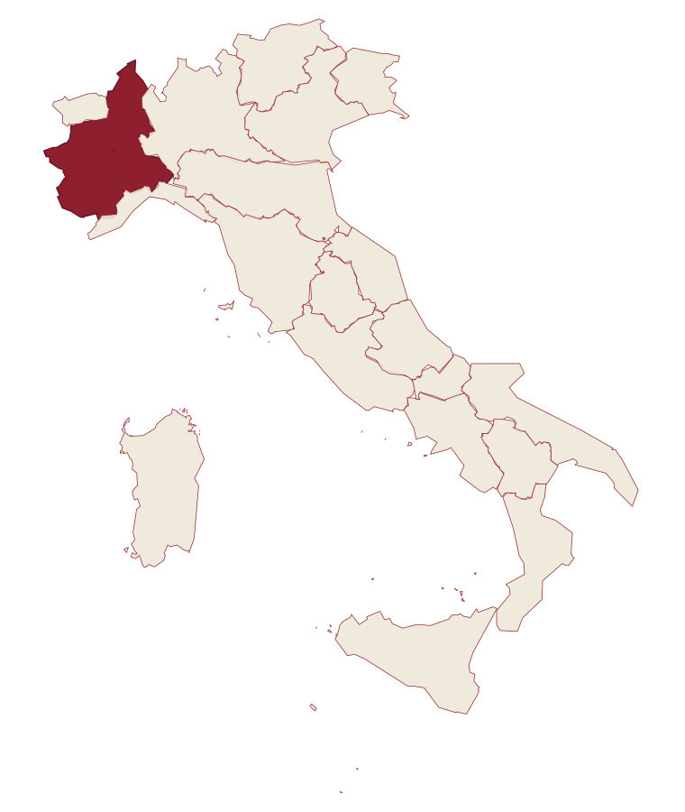
Piedmont · Cuneo
Villar San Costanzo
A Val Maira village at 605 meters, with a reserve of 479 mushroom-shaped erosion columns.
- Best time
- May–Oct
- By car
- 1 h 31 min from Turin
- Population
- 1,549
Known for
I CICIU
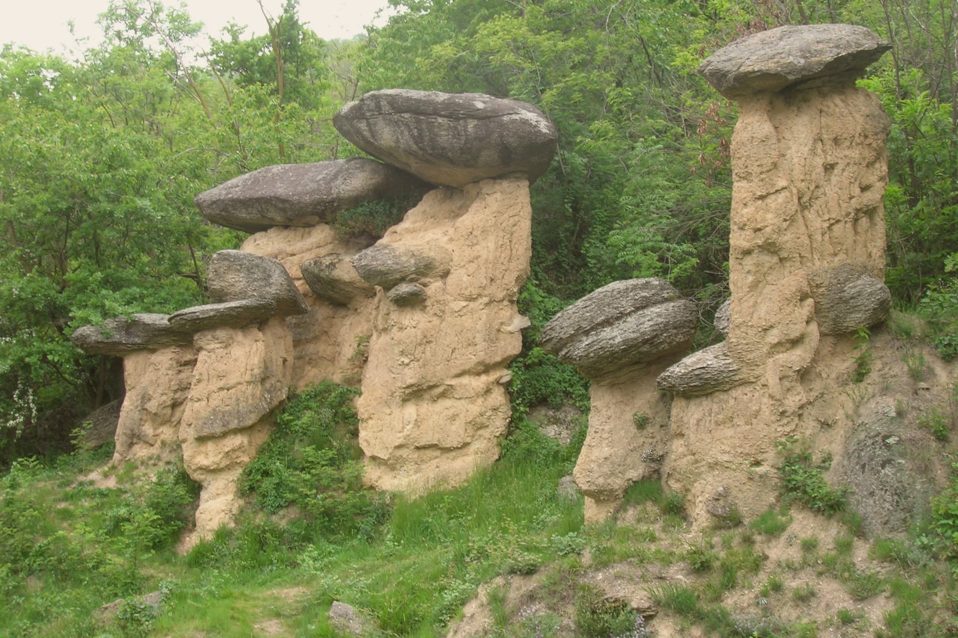
Four hundred and seventy-nine mushroom-shaped erosion columns across 64 hectares, capped by erratic boulders and protected since 1989.
SAN COSTANZO AL MONTE
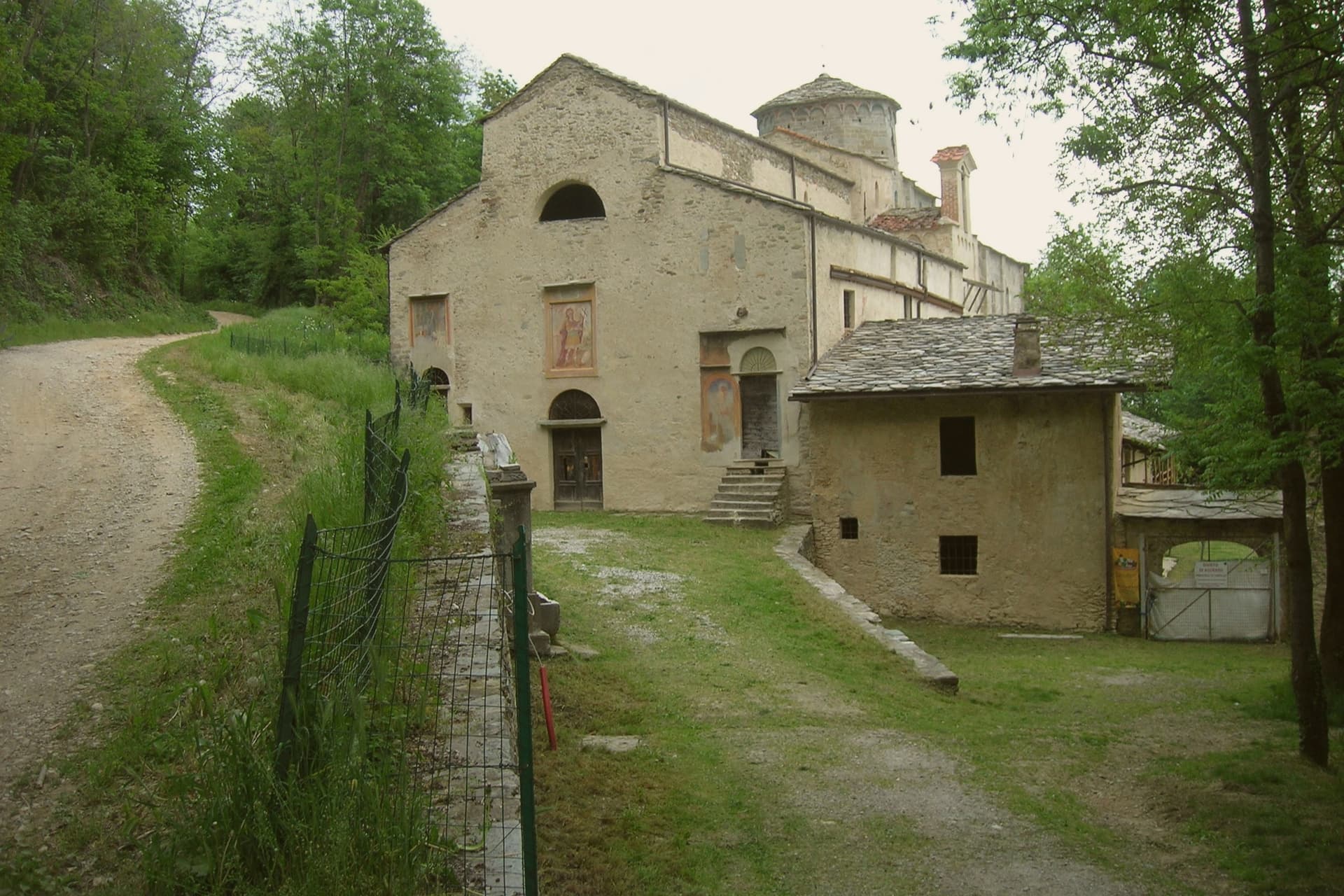
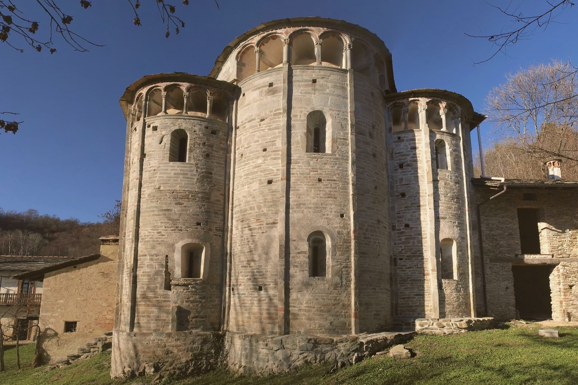
Twelfth-century Romanesque-Gothic church on the slope of the martyrdom, over an earlier eighth-century foundation.
THE LEGEND
Local tradition reads the Ciciu as petrified soldiers of Diocletian, cursed by the martyr Costanzo around 303 AD.
MELA ROSSA CUNEO
The commune lies inside the Mela Rossa Cuneo IGP production zone.
When to visit
Best · May–Oct
- J7°
- F10°
- M12°
- A16°
- M19°
- J24°
- J27°
- A27°
- S22°
- O17°
- N11°
- D7°
- Best
- Hot or crowded
- Quiet
- Mostly closed
Daytime averages, 2020–2024. Weather data by Open-Meteo.com.
The festa: Costanzo, third Sunday of September
Why come
Villar San Costanzo sits at the mouth of the Val Maira, fifteen kilometers northwest of Cuneo. The village and its religious complex sit apart from the reserve on the higher ground above: an abbey anchors the settlement itself, founded in the early eighth century as the commune's historic religious center, while a church and the erosion columns both belong to the slope of the massif that rises over the village.
The name Ciciu is Piedmontese for puppet, given to the columns for their shape: a shaft of earth and stone topped by a glacial erratic boulder, the cap shielding the softer material beneath from rain while the surrounding ground wears away around it. Local legend ties the columns to the same ground as the chapel above them, reading the shapes as the petrified soldiers of Diocletian, cursed by a martyr who gave the village its name, a Roman legionary of the Theban Legion killed nearby around 303. Village below, abbey at its center, and slope above carrying both the sanctuary built on the martyrdom site and the columns the legend attaches to it: the settlement's religious history and its natural landmark trace back to the same rise of ground and the same story.
The Sunday letter
Villar San Costanzo is on our list. Its letter is still to come.
We are writing about all 1,000 of these towns, one at a time, in a free letter every Sunday: the photo, the food, the festa. That is our mission. Sign up and you will be there when Villar San Costanzo comes up. By Peter & Sophia, from Pietrasanta.
Read on
Villar San Costanzo in our articles


How to get there
From Turin (TRN), about 1h 50m by car.
Genoa (GOA) is about 2h 17m away.
By car from the centre of Milan 3 hours.
Coming by train into Torino Porta Susa? Villar San Costanzo is about 1h 30m away by road.
What to see
Riserva Naturale dei Ciciu del Villar
The columns stand on the slope between 670 and 1,350 meters, earth and stone shafts each shielded by its boulder cap while the ground around them erodes away.
Chiesa di San Costanzo al Monte
The church carries frescoes from the eleventh century and stands on the site of the martyrdom, on the slope of Monte San Bernardo above the village.
Abbazia di San Costanzo
Benedictine abbey at the heart of the village, founded in the early eighth century and the historic religious anchor of the commune.
Sentiero dei Ciciu
Marked trail through the reserve, climbing from 670 to 1,350 meters along the Costa Pragamonti among the columns and the larch forest.
Monte San Bernardo
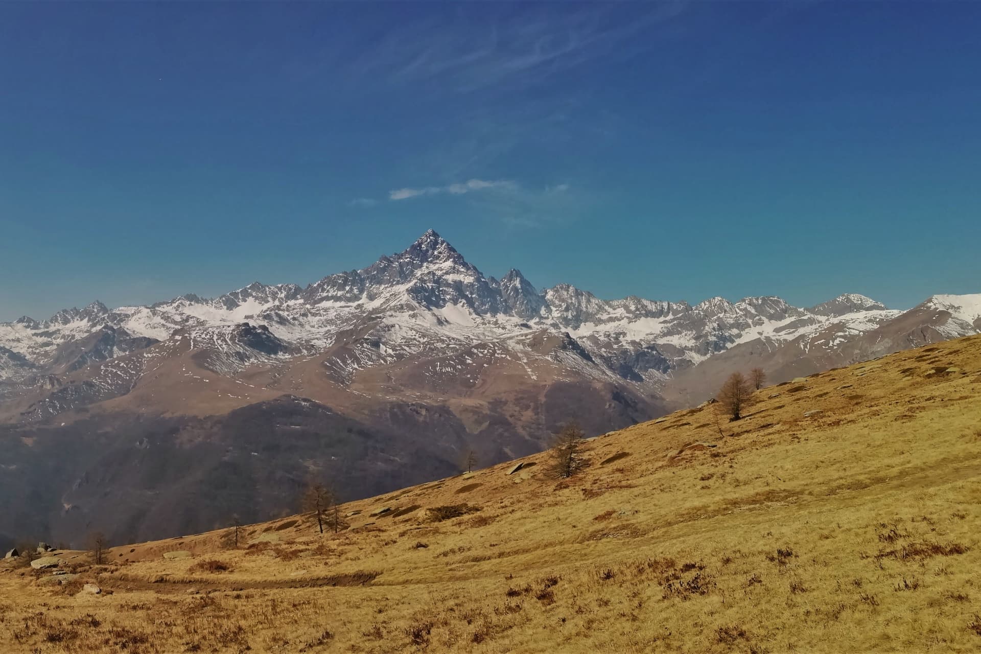
Massif above the village whose erratic deposits feed the Ciciu reserve, with marked routes to the saint's hilltop chapel.
The slow-trip planner
Building a trip? Find where Villar San Costanzo fits in a slow Italy circuit.
Answer five questions. We will shape a geographically coherent slow trip from the 1,000 Italian towns most travelers skip. Yours to save and share.
Living here
- Population 1,549
- Commuter belti
- Pharmacy in town
- High school within a 30-minute drive
- Nearest airport Turin, 1 h 50 min drive
- Regional capital Torino, 1 h 31 min drive
Common questions
- What is Villar San Costanzo known for?
- Villar San Costanzo is a Val Maira village at 605 meters, with a reserve of 479 mushroom-shaped erosion columns.
- Where is Villar San Costanzo?
- Villar San Costanzo is a comune in the province of Cuneo, in Piedmont.
- What is the nearest airport to Villar San Costanzo?
- Turin (TRN), about 1h 50m by car.
- How long is the drive from Milan to Villar San Costanzo?
- About 3 hours by car.
- When is the best time to visit Villar San Costanzo?
- Best in May–Oct. August is the warmest month, averaging 27 degrees, and May the wettest, with about 17 rain days.
- Is there a sagra or a festival in Villar San Costanzo?
- The town keeps its patron saint's day: Costanzo, third Sunday of September.
- Which other towns are like Villar San Costanzo?
- Aymavilles, Greccio and Summonte.
- How many people live in Villar San Costanzo?
- 1,549 at the 2023 count.
Tags & datadesignations · numbers · sources
Recognised as
The numbers
- Elevation: 605 m
- Population: 1,549
- Surface area: 19.5 km²
These figures were compiled from public directories: ISTAT, OpenStreetMap and Wikidata, and from the official listings of the guides named on this page. Town details change; verify with official sources before you travel.
Similar
Towns like Villar San Costanzo
Aymavilles
Province: Aosta Valley
both mountain-valley towns · both under 3,000 people
Greccio
Province: Rieti
both mountain-valley towns · both under 3,000 people
Summonte
Province: Avellino
both mountain-valley towns · both under 3,000 people
Sepino
Province: Campobasso
both mountain-valley towns · both under 3,000 people
Oratino
Province: Campobasso
both mountain-valley towns · both under 3,000 people
Scurcola Marsicana
Province: L'Aquila
both mountain-valley towns · both under 3,000 people
🏆 Borgo dei Borghi
More Borgo dei Borghi towns
Villalago
Province: L'Aquila
A 930-meter village above three lakes, named for the nine that once filled the valley, with a hermit's cave on the water's edge.
San Fele
Province: Potenza
A stone village at 872 meters between two peaks, where a 969 fortress and ten waterfalls along the Bradano still define the place.
San Nicola Arcella
Province: Cosenza
A cliff village above the Tyrrhenian Riviera dei Cedri, where a sea arch fronts a cove only reachable on foot or by boat.
Tropea
Province: Vibo Valentia
Cliff town on a tufa headland over the Tyrrhenian Coast of the Gods, with a Norman monastery on a sea rock.
Zungoli
Province: Avellino
An Irpinia ridge between the Ufita valley and the Daunian hills, with walls above and tuff caves below the houses.