
The best ski towns in Piemonte
Piemonte skiing happens at the head of long, narrow valleys where the road runs out against rock and larch. The villages up here are built from stone and dark timber, with roofs of heavy slate slabs weighted against snow, and the older Walser houses carry open galleries where hay once dried. Winter food is butter and cheese rather than olive oil: fontina and toma melted over polenta, bagna cauda on a burner in the middle of the table, gnocchi alla bava, a bottle of Nebbiolo from the low hills to the south. The season holds from December into April on the north-facing pitches, and on clear mornings the east wall of Monte Rosa stands over the valley floor like a piece of wall left standing after a fire.
In the popular imagination Piemonte skiing means Sestriere and the rest of the Via Lattea, the resorts west of Turin that hosted the Winter Olympics and still carry the lift infrastructure to prove it. The runs are long, the snowmaking is thorough, and the weekend traffic out of Turin fills them accordingly, along with buses from Milan and coach groups from further afield. The apartment blocks were built for volume and they are full at Christmas and again in February. It is good skiing, and a great many people have reached the same conclusion.
The mountains do not stop at the edge of that map. The Alpine arc curves north through the Ossola and the Valsesia, then swings all the way round to the south, where the Ligurian Alps rise straight off the coastal plain and hold snow within sight of the sea. The towns in this article sit along that curve, each with a ski area on its own ground, and each with a piazza, a market and a bar that keep working when the lifts close. Fewer people go, and the lift queues reflect it.
Of the 65 communes we have mapped in Piemonte, 8 qualify as ski towns: each has a ski area on its own territory. The smallest, Macugnaga, has 514 residents.
Elsewhere in the catalogue: The best mountain towns in Piemonte and The best towns worth staying overnight in Piemonte.
Macugnaga
Why visit Macugnaga
Macugnaga sits at 1,327 meters at the head of the Anzasca valley, directly beneath the east wall of Monte Rosa, the second-highest summit in western Europe at 4,634 meters. The village was founded in the 13th century by Walser colonists from the Swiss canton of Valais, who crossed the Monte Moro pass and settled the upper basin in the 1200s.
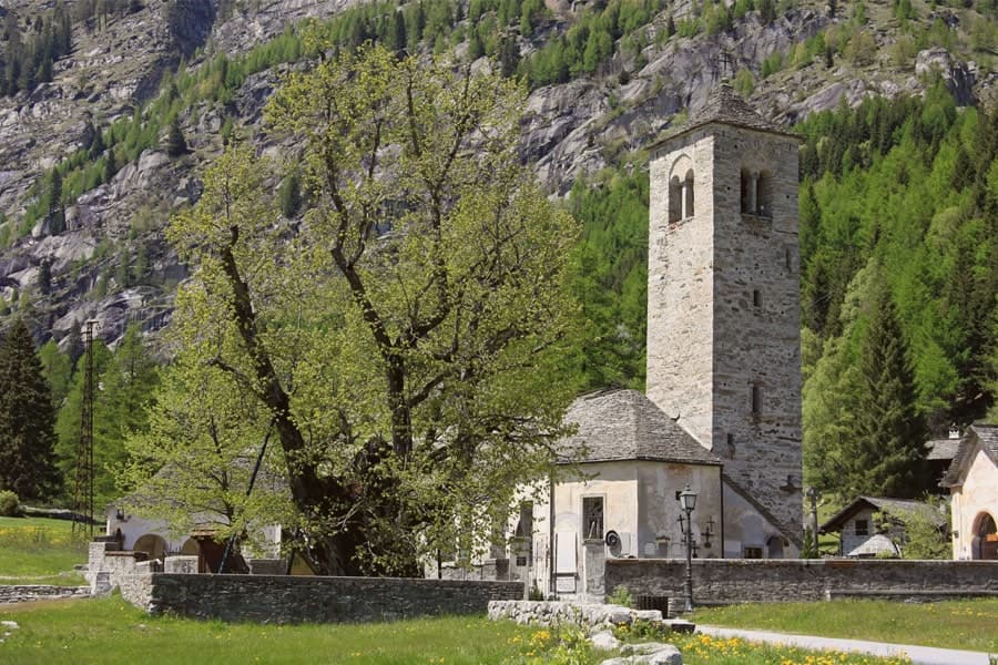
Their dark-timbered houses still stand in Borca, Staffa and Pestarena; the Walser Museum in Borca documents the German-speaking culture that held the valley for seven hundred years. The Chiesa Vecchia, mentioned in a 1317 document, sits beside the Vecchio Tiglio, a linden tree the University of Turin dates to around 500 years old, traditionally used for community assemblies.
The east wall of Monte Rosa was first climbed from here in 1872, by Richard Pendlebury's party with the guide Ferdinand Imseng. The mines at Guia and Pestarena produced industrial gold from 1710 until 1961.
There is a mapped ski area on this commune, at 1327 metres.
What to see in Macugnaga
- East wall of Monte Rosa. The 2,400-meter rock and ice face above the village, the largest in the Alps, first climbed in 1872 by Pendlebury and Imseng.
- Chiesa Vecchia. 13th-century Walser parish church first documented in 1317, with a frescoed bell tower and a cemetery of climbers.
- Vecchio Tiglio. Linden tree beside the Chiesa Vecchia, eight meters in circumference, used by the Walser for community assemblies.
How to get to Macugnaga
Novara is roughly 119 minutes away by road.
Our tip
June through September is the alpine summer, when the trails to the Belvedere and Monte Moro open, the high huts run service and the east wall draws climbers. December through March is the second season: the lifts at Belvedere and Monte Moro carry skiers up to glacial terrain rare for southern Europe. April, May, October and November are between seasons.
Alagna Valsesia
Why visit Alagna Valsesia
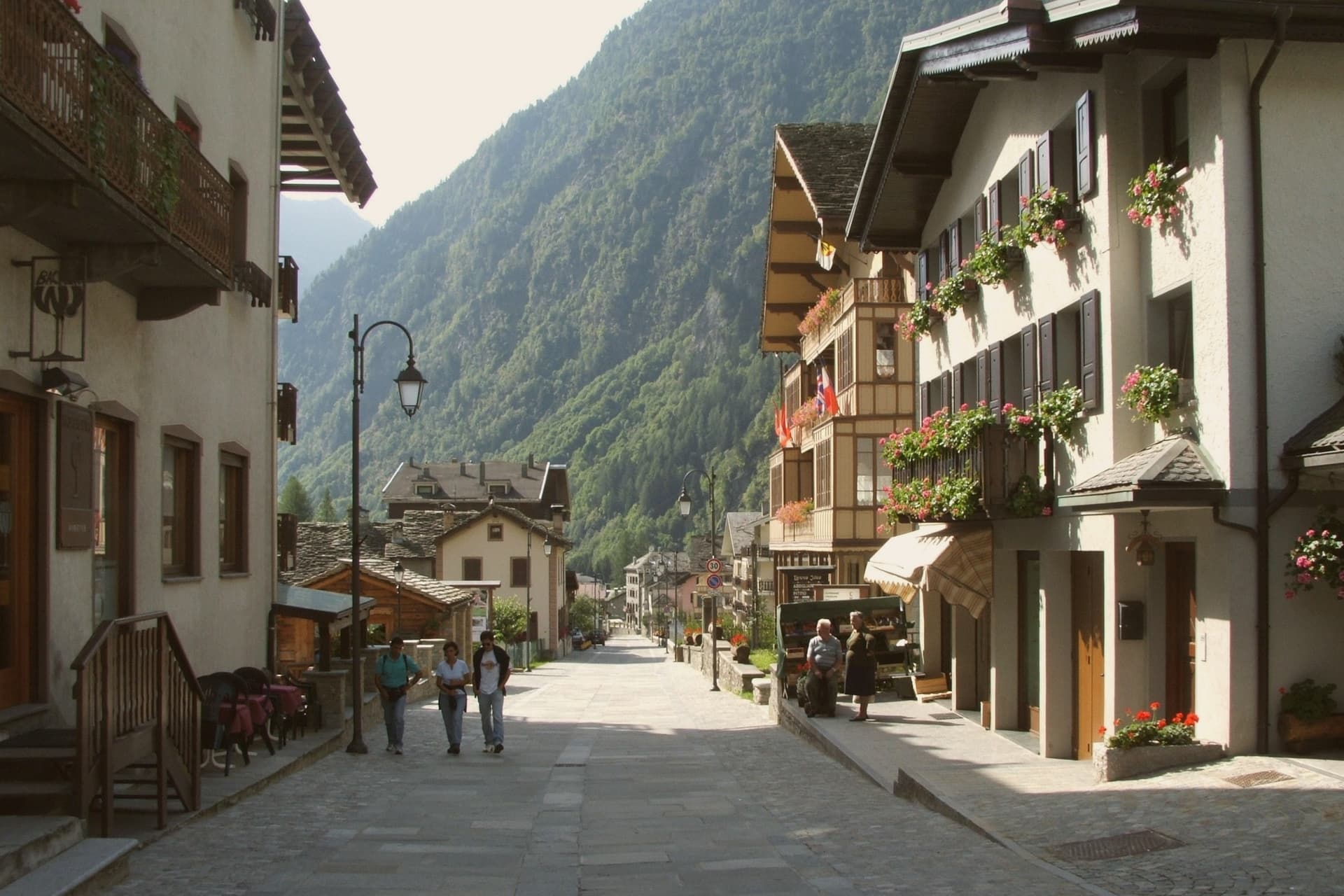
Alagna sits at the head of the Valsesia, at 1,191 meters, where the valley closes against the south face of Monte Rosa, the second-highest peak in the Alps. The commune covers 72.8 square kilometers, the largest by surface area in the province of Vercelli, and its territory reaches from the valley floor up to the glaciers, which is why a single village can hold both the wooden hamlets of the Walser settlers and the lift stations of a major ski domain.
Those settlers came from the Swiss Valais in the thirteenth century and stayed, building in wood and stone between 1500 and 1700; the hamlets of Pedemonte, Riale and Resiga carry that building tradition still. The Guides Association of Alagna, founded in 1872, is the second-oldest in Italy after Courmayeur, a marker of how early the peaks above the village drew climbers rather than skiers.
The lifts came later, opening in stages from the 1950s, and Alagna is now the eastern access to a domain that crosses into the Aosta Valley. Internationally the village is known less for groomed pistes than for the freeride terrain on the massif itself.
The Bandiera Arancione of the Touring Club fires here. The two identities, Walser hamlet and freeride terminus, sit on the same ground because the valley that sheltered thirteenth-century settlers is the same one that funnels skiers up toward the glaciers today.
There is a mapped ski area on this commune, at 1191 metres.
What to see in Alagna Valsesia
- Frazione Pedemonte. Three-storey wooden houses still standing in their original form, the oldest a Walser hamlet built in the 1500s and 1600s.
- Museo Walser. Opened in 1976 in a 1628 Walser house in Pedemonte, reconstructing the interiors, tools and furnishings of a traditional German-Alpine household.
- Chiesa di San Giovanni Battista. Parish church built in 1511, holding sculptures by Giovanni d'Enrico, the Valsesian sculptor active around the Sacro Monte di Varallo.
How to get to Alagna Valsesia
Novara is roughly 97 minutes away by road.
Our tip
December through March is the ski season Alagna built around itself: lifts open, the Monterosa domain links to the Aosta Valley, and the freeride routes off Punta Indren run as long as the snow holds. June through September is the second season, when the same valleys become hiking and via ferrata country and the temperatures rarely break 22 degrees. April, May, October and November are quiet shoulder months.
Limone Piemonte
Why visit Limone Piemonte
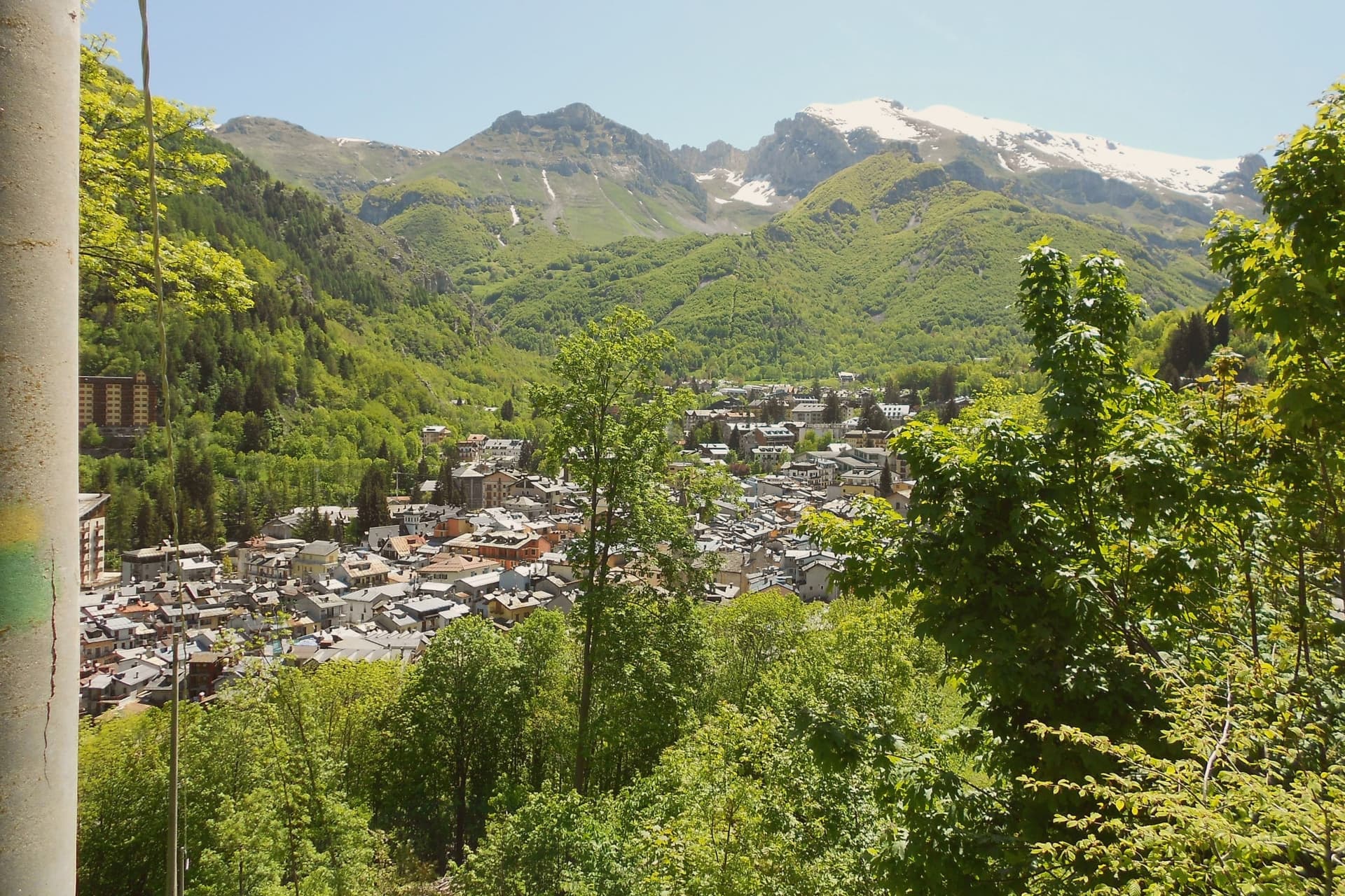
Limone Piemonte sits at 1,000 meters in the Vermenagna valley, twenty kilometers from Cuneo and fourteen from the Colle di Tenda, the historic pass into France. The Riserva Bianca ski domain rises behind the village from 1,050 to 2,085 meters, with eighty kilometers of pistes served by one gondola, ten chairlifts and three drag lifts.
The Cuneo-Ventimiglia railway, opened across this valley in 1900, runs ninety kilometers from the plain to the sea with thirty-three tunnels and twenty-seven bridges, one of the steepest mountain lines in Europe. In the village center, Piazza del Municipio holds a 16th-century stone fountain and the Gothic parish church of San Pietro in Vincoli, with elements of Romanesque and Gothic stonework from the 14th and 15th centuries.
The town empties between seasons and fills twice a year, for the ski months and for the alpine summer.
There is a mapped ski area on this commune, at 1000 metres.
What to see in Limone Piemonte
- Chiesa di San Pietro in Vincoli. Gothic parish church on Piazza del Municipio, built between the 14th and 15th centuries on Romanesque foundations.
- Riserva Bianca. Ski domain rising from 1,050 to 2,085 meters with 80 km of pistes, the main winter draw of the southern Piemonte Alps.
- Centro storico. Stone village core around Piazza del Municipio, with a 16th-century fountain and a Gothic-Romanesque parish church.
How to get to Limone Piemonte
There is a railway station in the town, so you can arrive without a car and never need one while you are here. Torino is roughly 132 minutes away by road.
Our tip
December through March is the ski season the village was rebuilt for: the Riserva Bianca lifts open, the centro fills on weekends and the railway carries day-trippers up from the plain. June through September brings the second peak, when the same ridges become hiking, grazing and via ferrata country and the Tenda border roads draw cyclists. April, May, October and November are quiet between the two seasons.
Garessio
Why visit Garessio
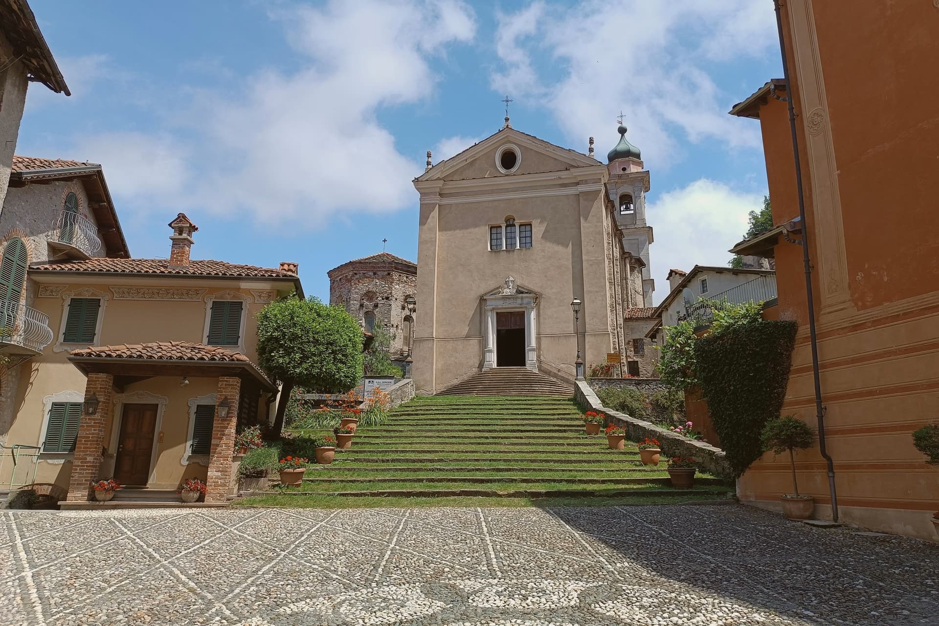
Garessio sits in the upper Tanaro valley, on the watershed where Piemonte meets Liguria. The town is built across four historic quarters, Borgo Maggiore, Borgo Ponte, Borgo Poggiolo, and the borgo that gives its name to the hillside sanctuary and spring above it, each with its own piazza and parish.
The arrangement follows the old traffic of the salt road: Mediterranean salt came up over the Ligurian Alps from Albenga, was repacked in the fortified core, and continued north toward Piemonte and the Po valley. The Savoy family later kept a hunting lodge on the wooded slopes above town, a former Carthusian charterhouse turned retreat, showing a second life for the valley once trade had moved on.
A town built to move salt and later chosen for a royal retreat and a bottling brand: the same slopes have been worked, defended, and rested in by turns, without ever losing the shape of the four quarters that founded it.
There is a mapped ski area on this commune, at 621 metres.
What to see in Garessio
- Borgo Maggiore. The medieval core, fortified around 1100 as a ricetto, with three surviving gates, Porta Rose, Porta Jhape, and Porta Liazoliorum, and remnants of the defensive walls.
- Reggia di Valcasotto. Former Carthusian charterhouse converted to a Savoy hunting lodge in the nineteenth century, on the wooded slopes above the town.
- Santuario di Valsorda. Hillside sanctuary above Borgo Valsorda, the town's pilgrimage site, with views over the Tanaro valley.
How to get to Garessio
There is a railway station in the town, so you can arrive without a car and never need one while you are here. Torino is roughly 95 minutes away by road.
Our tip
May through October is the open season. Spring brings the Tanaro running full and the chestnut woods turning green; September and October are dry, with the salt-road footpaths at their clearest. July and August are warm but never coastal-hot at 621 meters; the river keeps the valley cool at night. Cheers Music & Beer Festival falls in August.
Chiusa di Pesio
Why visit Chiusa di Pesio
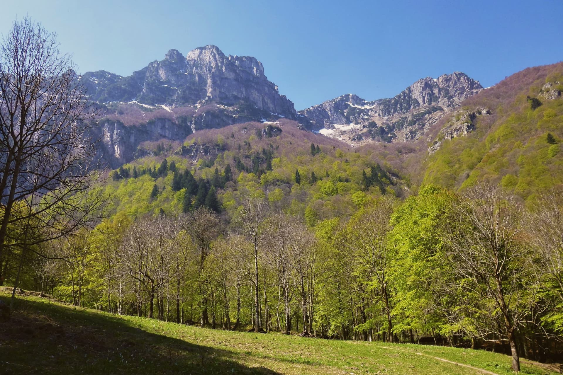
The Valle Pesio runs fifteen kilometers from the town up to the French border, a wedge of the Ligurian Alps whose municipal territory climbs from 575 meters at the village to over 2,600 meters at the ridge. The town exists because of the Certosa: in 1173 the lords of Morozzo donated upper-valley lands to a Carthusian monk named Ulderich from Casale, and the charterhouse that grew from that gift became one of the great spiritual and forestry centers of medieval Piedmont.
Lower-valley woods once managed by the order for chestnut production still supply the harvest that keeps the town in the Città del Castagno network today. The valley reads as a sequence from village to summit: the settlement at the mouth, the monastery upriver at the foot of Monte Mindino, and above both the high ground of the Marguareis, where karst has hollowed the rock into one of the most extensive cave systems in the Western Alps.
A wolf pack, the first stable one documented in the Italian Alps, established itself in this same corridor in the mid-1990s. The valley's history and its wildness sit on top of each other rather than side by side, a monastic economy giving way, without displacing it, to a landscape still wild enough for wolves.
There is a mapped ski area on this commune, at 575 metres.
What to see in Chiusa di Pesio
- Certosa di Santa Maria in Valle Pesio. Now run by the Missionaries of the Consolata, who took over after the Carthusians left in the eighteenth century, the complex remains the cultural anchor of the upper valley.
- Parco Naturale del Marguareis. Protected area of 7,900 hectares in the Ligurian Alps, holding the largest alpine karst system in Piedmont beneath its ridges.
- Karst caves of the Marguareis. More than 150 kilometers of explored caves reaching 1,000 meters depth, among the most extensive cave systems in the Western Alps.
How to get to Chiusa di Pesio
Torino is roughly 99 minutes away by road.
Our tip
April through June brings snowmelt to the Pesio, wild orchids on the lower slopes, and the chestnut woods coming into leaf. July and August are good in the upper valley, where altitude keeps temperatures down, but warm in the village itself. September and October are the chestnut months and the best hiking weather, dry and clear with the larches turning gold above 1,800 meters.
Stresa
Why visit Stresa
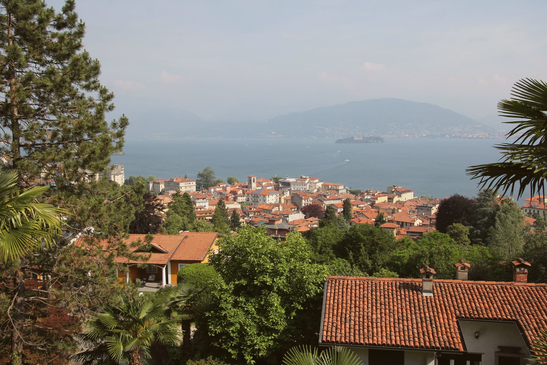
Stresa sits at 200 meters on the western shore of Lake Maggiore, ninety kilometers north of Milano on the line of the Simplon railway. The town first appears in documents in 998, as Strixsya.
From the seventeenth century the lake stage here belonged to the Borromeo family: the palazzo on what had been called l'isola inferiore was begun in 1632, the island renamed after its patron's wife. The other two islands of the group lie 400 meters offshore alongside it, reached by regular ferry from the two town piers, one still inhabited, one given to its park.
Villa Pallavicino, established 1855, sits apart from this cluster on the southern edge of town, its own botanical and wildlife ground answering the islands' gardens without belonging to the same estate. The town's other identity, as a resort, dates to 1863 and the lakefront hotel building that opened international tourism here, later drawing the festival that has filled the town each late summer since 1962.
What Stresa amounts to is a small lake shore town organized almost entirely around water it faces rather than land it occupies: the islands offshore, the piers that reach them, and a lakefront built for arrival rather than settlement.
There is a mapped ski area on this commune, at 200 metres.
What to see in Stresa
- Isola Bella. The island sits close to the town piers, its terraced Baroque gardens rising in tiers above the water and the palazzo facing the lakefront directly.
- Isola Madre. The largest of the group, given over almost entirely to its park: paths through subtropical planting and glimpses of the villa between the trees.
- Isola dei Pescatori. The one island still lived in year-round, its lanes narrow between the houses and the trattorie facing the water where the fishing boats once worked.
How to get to Stresa
There is a railway station in the town, so you can arrive without a car and never need one while you are here. Novara is roughly 57 minutes away by road.
Our tip
April through June is the green window on Lake Maggiore: Isola Bella's terraced gardens in flower, the ferries running full timetable, and the lakefront promenade open without the August press. July and August are warm and crowded; the centro empties between two and four in the afternoon heat, and the islands fill on day trips from Milano. The Settimane Musicali run from late August into September, the busiest cultural weeks of the year.
Omegna
Why visit Omegna
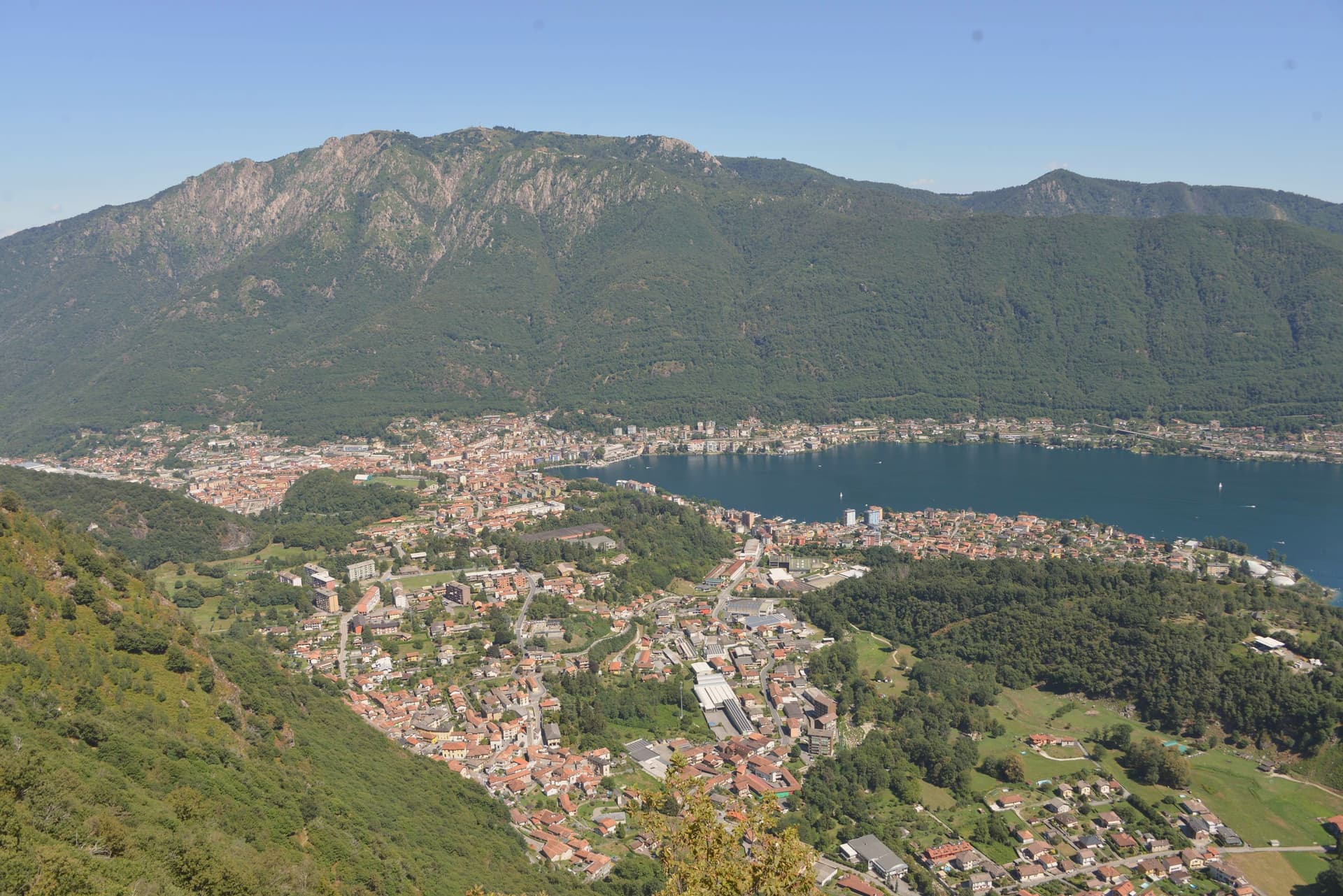
Omegna sits at 295 meters at the northern tip of Lake Orta, in the Verbano-Cusio-Ossola, where the Nigoglia leaves the lake and runs north toward the Toce, one of the few Italian rivers that flows uphill on a map. The town first appears in records in 1221, when it swore allegiance to the commune of Novara.
The Sant'Ambrogio collegiate church goes back to the tenth century, with a Romanesque nave and a Porta Romana that survives from the medieval walls. The real shift came after 1900, when Alessi (founded 1921), Bialetti, Lagostina and Girmi turned the Strona valley into the production hub for Italian pots, moka pots and pressure cookers.
Gianni Rodari was born here in 1920; the lakefront still carries the Parco della Fantasia named after him. The Forum, a steel works converted into a museum, holds the permanent collection of the local household-goods district.
The lake stays close on three sides.
There is a mapped ski area on this commune, at 295 metres.
What to see in Omegna
- Collegiata di Sant'Ambrogio. Tenth-century Romanesque collegiate church with three naves, side chapels and an ossuary, the oldest building in the centro storico.
- Porta Romana. Eleventh-century medieval gate, the last surviving of the five gates of the original city walls, standing above the Nigoglia.
- Ponte Antico. Late fifteenth-century Sforza-Visconti bridge over the Nigoglia, built after 1490 on Duke Ludovico Sforza's prompting.
How to get to Omegna
There is a railway station in the town, so you can arrive without a car and never need one while you are here. Novara is roughly 60 minutes away by road.
Our tip
April through June brings green Strona slopes and a quiet lake before the day-trippers from Milano arrive. July and August fill the Lungolago and the ferry to Orta San Giulio runs at capacity; afternoons in the centro storico thin under direct sun. September and October are the best months: clear light on the lake, the cantine of the Strona open, and the household-goods outlet shops (Alessi, Bialetti, Lagostina) operate without the summer queues.
Domodossola
Why visit Domodossola
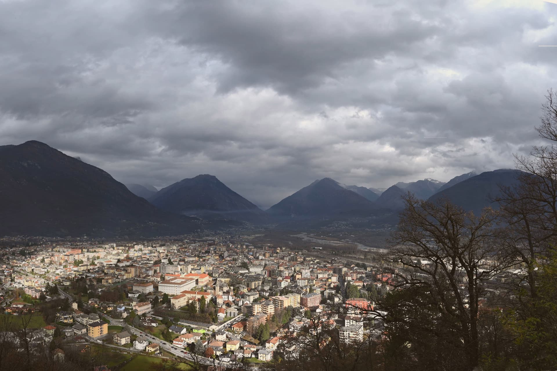
Domodossola sits at 272 meters at the confluence of the Bogna and Toce rivers, the historic capital of the Ossola valleys and the Italian end of the Simplon Pass. Two Capuchin friars chose the hill above the town in 1656, and the sanctuary that follows still marks the skyline.
The medieval core is built around the market square, its porticoes and merchant houses forming the center of the borgo, with the rest of the centro storico spreading out behind it in arcaded streets. The Castle of Charlemagne once stood at Piazza Tibaldi, until 1804, when Napoleon ordered it demolished to open the Sempione road.
The longer story of the pass arrived in 1906, when a rail tunnel under the Alps connected Domodossola to Brig in Switzerland over 19,803 meters, the longest railway tunnel in the world for most of the twentieth century. Between the hill, the square and the tunnel, the town reads as a hinge point: a valley capital shaped as much by what passes through it toward Switzerland as by what was built to stay.
There is a mapped ski area on this commune, at 272 metres.
What to see in Domodossola
- Sacro Monte Calvario. A Special Nature Reserve on the hill above town. The twelve Via Crucis chapels lead up to the sanctuary in sequence, started in 1657.
- Piazza Mercato. The porticoes still shelter the square's merchant houses, their balconies and carved loggettes intact above the arcades.
- Centro storico medievale. The walled core beyond the square, arcaded streets between fifteenth-century palazzi, named Borgo della Cultura after recent restoration.
How to get to Domodossola
There is a railway station in the town, so you can arrive without a car and never need one while you are here. Novara is roughly 93 minutes away by road.
Our tip
April through June and September through October are the working months for Domodossola: alpine light, full ferry-and-train connections through the Simplon, and walkable temperatures in the centro storico. July and August warm into the high twenties on the valley floor but stay cool on the Mattarella hill, where the Sacro Monte chapels sit in beech shade. November through March is quiet but never closed.
More from Anywhere Italy
 The best mountain towns in Piemonte
 The best towns worth staying overnight in Piemonte
 The 8 best towns you can reach by train in the province of Verbano-Cusio-Ossola
- The best lake towns you can reach by train in Piemonte
 The best small towns inside a nature park in Piemonte
 The best small towns you can reach by train that have a serious restaurant in Piemonte