The best small towns inside a nature park in Piemonte

Piemonte keeps its parks close to its villages. The stone is grey and the roofs are slate or larch shingle, laid in overlapping scales that go silver in wet weather, and the houses stand in tight clusters because the meadow around them was worth more than the space between them. Walk out past the last barn and you are in beech and chestnut, then larch, then pasture, then rock, with marmots whistling somewhere above the treeline. Autumn is the season most people would choose here: chestnuts roasting, funghi porcini in the shop windows, toma cheese from the summer alpine huts, plin ravioli and a glass of something from the hills below. In winter the same valleys go quiet and the trails become ski tracks.
The Piemonte most visitors see is Turin and then the Langhe, and in truffle season the road between Alba and Barolo is a slow queue of hire cars. It makes sense. The wine is among the best in Italy, the restaurants are serious, and the vineyard hills photograph beautifully in October fog. But the crowds concentrate hard into a small area and a short window, and the villages there have priced themselves accordingly.
Piemonte is mostly mountains, and the region has protected a great deal of them. The parks run from the Ligurian Alps up through the Cottian valleys to the Valsesia under Monte Rosa, and inside their boundaries there are villages that still work as villages, with a bar, a bakery, a church and a trailhead. Fewer people go to these ones. Each town below sits within a regional nature park, which means the walking starts where the parking ends.
Of the 65 communes we have mapped in Piemonte, 10 qualify as towns inside a nature park: each sits inside a regional nature park. This list is the small ones, 6 in all, ordered smallest first. The smallest, Usseaux, has 175 residents.
Two more lists worth reading alongside this one: The best towns inside a nature park in Piemonte and The best mountain towns in Piemonte.
Usseaux
Why visit Usseaux
Usseaux sits at 1,416 meters in the upper Val Chisone, fifty-five kilometers west of Torino on the road that climbs toward the Colle delle Finestre. The commune holds 175 residents across the capoluogo and four high hamlets: Balboutet, Laux, Fraisse and Pourrieres, each with its own parish and its own dialect inflection.
In 1343 these communities joined the autonomous Escartons Republic, a federation of alpine villages that bought their freedom from the Dauphin and self-governed in Occitan for four hundred years until Napoleon dissolved them. The Waldensian Reformation reached the valley in the sixteenth century and left a network of temples on the slopes below.
The contemporary signature of Usseaux is the murales project: more than forty paintings on house walls showing alpine work, animals and peasant scenes, layered over stone facades that already carry sundials and carved lintels. Balboutet faces south and reads its hours from those dials.
Laux holds a small lake at the foot of the meadows above the village.
What to see in Usseaux
- I Murales. More than forty painted murals across stone facades in the capoluogo and the borgate, depicting alpine work, peasant scenes and forest animals.
- Balboutet. South-facing hamlet known for the sundials painted and carved across the facades of its stone houses, marking time in alpine tradition.
- Lago del Laux. Small alpine lake on the meadows above the hamlet of Laux, a short walk from the village and ringed by fishing huts.
How to get to Usseaux
Torino is roughly 92 minutes away by road.
Our tip
June through September is the open alpine season at 1,416 meters: meadows in flower above the borgate, trails through the Orsiera-Rocciavrè park clear of snow, and the Lago del Laux walkable from the village in twenty minutes. December through March is the winter window, when the Vialattea ski domain a short drive west fills the valley and snow holds long on the murales walls. April, May, October and November are the difficult months.
Fenestrelle
Why visit Fenestrelle
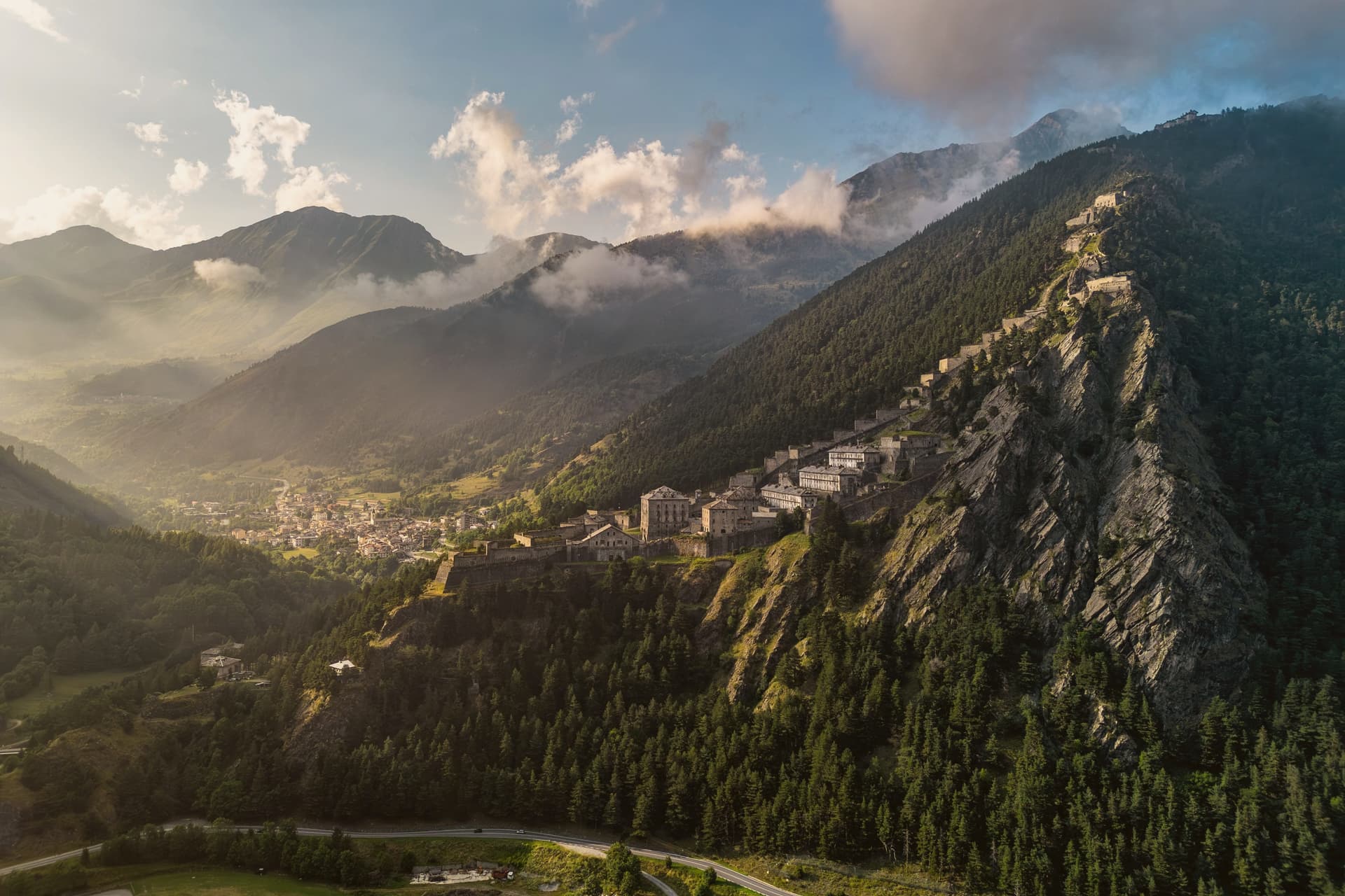
Fenestrelle sits in the middle of Val Chisone, fifty kilometers west of Torino on the road toward Sestriere. The Romans called this point Finis Terrae Cotii, the border of Cottius's land, and from the twelfth century onward the valley held a strong Waldensian community, long before any fortress stood here.
Construction on the ridge began in 1728, commissioned to secure the border against France after the Treaty of Utrecht handed Val Chisone to Piedmont, and work continued for around 120 years. What resulted sits apart from the village in every sense: the settlement stays put at the valley floor while the fortifications climb the slope above it, three separate forts staged up the ridge and joined by a single stair.
The village is the base point of a line that keeps rising until it reaches the crest, so that the same walk that starts among houses ends at open rock looking down over the whole valley. Fenestrelle today is best understood as the foot of that climb, a border town that turned into the ground floor of its own fortress.
What to see in Fenestrelle
- Forte di Fenestrelle. The full system stretches over the ridge above the village, three connected forts joined by the covered staircase, standing above Val Chisone.
- Forte San Carlo. Lowest of the three forts, the entrance complex above the village at 1,154 meters, where the climb up the stairs begins.
- Forte Tre Denti. Middle fort of the system, home to the Garitta del Diavolo viewpoint at 1,400 meters over Val Chisone.
How to get to Fenestrelle
Torino is roughly 84 minutes away by road.
Our tip
June through September is when the fortress is fully open for guided visits, the high gradients of the staircase are walkable, and Val Chisone trails above 1,500 meters are clear of snow. December through March is the alpine winter season: the Vialattea ski domain is twenty minutes away, the lower fort is accessible in snow, and the upper forts close. April, May, October and November are the difficult shoulder months.
Serralunga di Crea
Why visit Serralunga di Crea
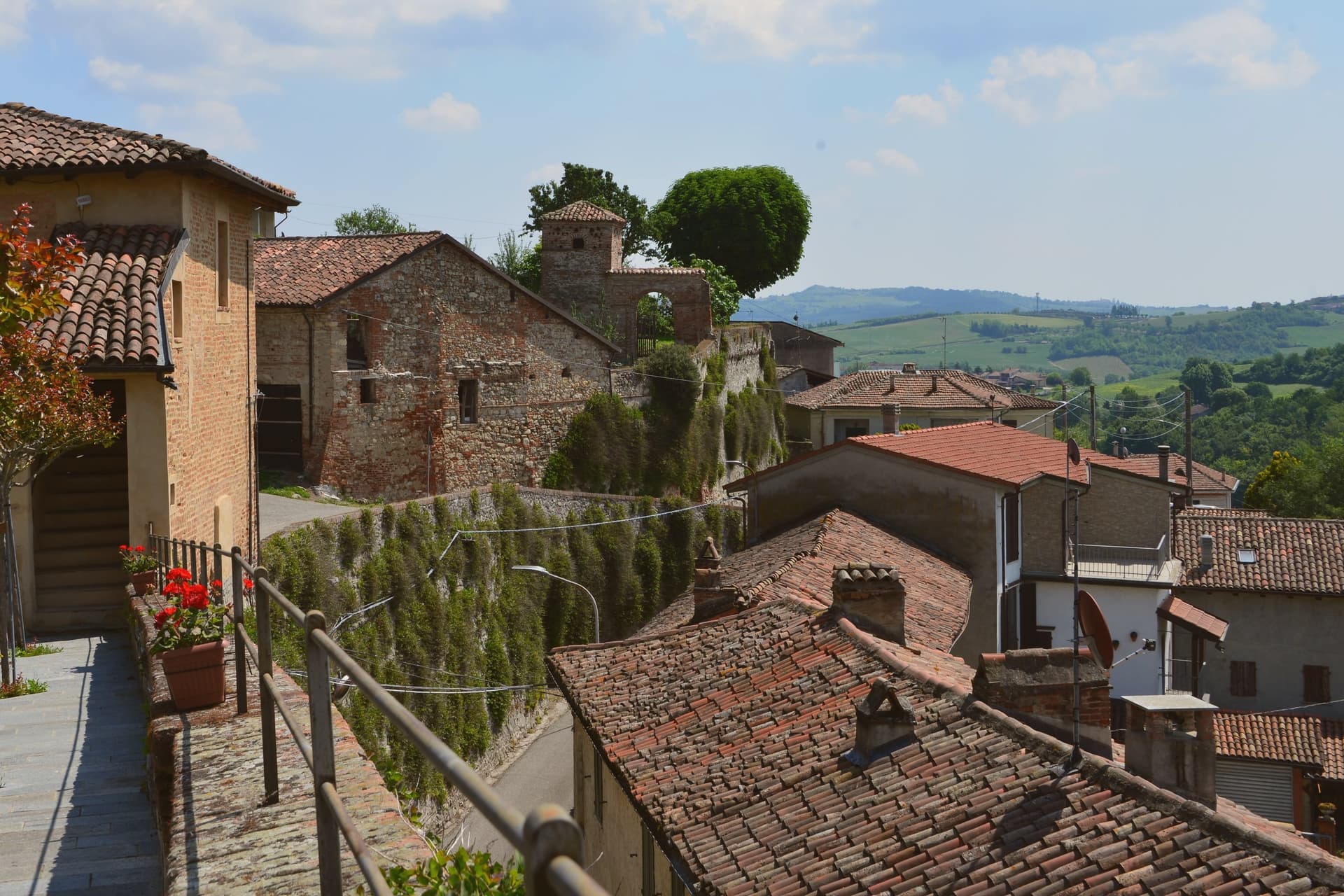
Serralunga di Crea sits in the Basso Monferrato hills forty-five kilometers east of Torino, on the highest of a series of ridges that look across the Po plain. The hill behind the village rises to 443 meters, and it is on this wooded height, rather than in the village itself, that the commune's main structures stand: the sanctuary at the centre, the ring of chapels around it, and the vineyards on the lower slopes beyond the reserve boundary.
The chapels were begun in 1589 by Costantino Massino on a plan of fifteen Rosary stations, expanded over the following two centuries to twenty-three chapels and five hermitages, so what stands today is the accumulation of a long building period rather than a single campaign. The vineyards that surround the hill carry a separate and later UNESCO recognition, from 2014, so the commune holds two world heritage lines on the same stretch of ground: one on the summit, one on the slopes around it.
The village below is small; the hill above is where its two distinctions both sit, layered rather than separate.
What to see in Serralunga di Crea
- Sacro Monte di Crea. Chapels and hermitages climb the wooded hill above the village along a Rosary-plan pilgrim route, each station set among trees with views opening intermittently over the ridge.
- Santuario di Nostra Signora di Crea. Marian sanctuary at the centre of the Sacro Monte, the building the whole climb of chapels was arranged around, traditionally founded by Saint Eusebius of Vercelli.
- Cappella del Paradiso. Final chapel of the Sacro Monte, summit of the climb, with over 300 statues in a polychrome celestial composition.
How to get to Serralunga di Crea
Novara is roughly 58 minutes away by road.
Our tip
April through June is the green window in the Basso Monferrato: hills coming into leaf, the climb up the Sacro Monte cool in the morning, and the panorama across the Po plain at its clearest. July and August touch the mid-thirties on the open ridges; the woods around the chapels stay cooler, but the late afternoon climb is hard work. September and October are the wine months, with Monferrato harvest in the surrounding cantine and pilgrim groups returning for the Rosary festivals.
Alagna Valsesia
Why visit Alagna Valsesia
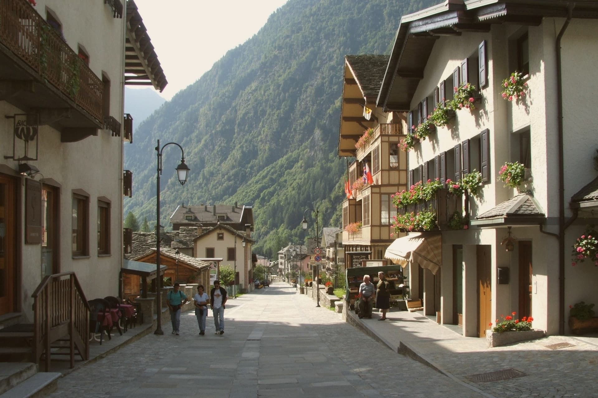
Alagna sits at the head of the Valsesia, at 1,191 meters, where the valley closes against the south face of Monte Rosa, the second-highest peak in the Alps. The commune covers 72.8 square kilometers, the largest by surface area in the province of Vercelli, and its territory reaches from the valley floor up to the glaciers, which is why a single village can hold both the wooden hamlets of the Walser settlers and the lift stations of a major ski domain.
Those settlers came from the Swiss Valais in the thirteenth century and stayed, building in wood and stone between 1500 and 1700; the hamlets of Pedemonte, Riale and Resiga carry that building tradition still. The Guides Association of Alagna, founded in 1872, is the second-oldest in Italy after Courmayeur, a marker of how early the peaks above the village drew climbers rather than skiers.
The lifts came later, opening in stages from the 1950s, and Alagna is now the eastern access to a domain that crosses into the Aosta Valley. Internationally the village is known less for groomed pistes than for the freeride terrain on the massif itself.
The Bandiera Arancione of the Touring Club fires here. The two identities, Walser hamlet and freeride terminus, sit on the same ground because the valley that sheltered thirteenth-century settlers is the same one that funnels skiers up toward the glaciers today.
What to see in Alagna Valsesia
- Frazione Pedemonte. Three-storey wooden houses still standing in their original form, the oldest a Walser hamlet built in the 1500s and 1600s.
- Museo Walser. Opened in 1976 in a 1628 Walser house in Pedemonte, reconstructing the interiors, tools and furnishings of a traditional German-Alpine household.
- Chiesa di San Giovanni Battista. Parish church built in 1511, holding sculptures by Giovanni d'Enrico, the Valsesian sculptor active around the Sacro Monte di Varallo.
How to get to Alagna Valsesia
Novara is roughly 97 minutes away by road.
Our tip
December through March is the ski season Alagna built around itself: lifts open, the Monterosa domain links to the Aosta Valley, and the freeride routes off Punta Indren run as long as the snow holds. June through September is the second season, when the same valleys become hiking and via ferrata country and the temperatures rarely break 22 degrees. April, May, October and November are quiet shoulder months.
Ormea
Why visit Ormea
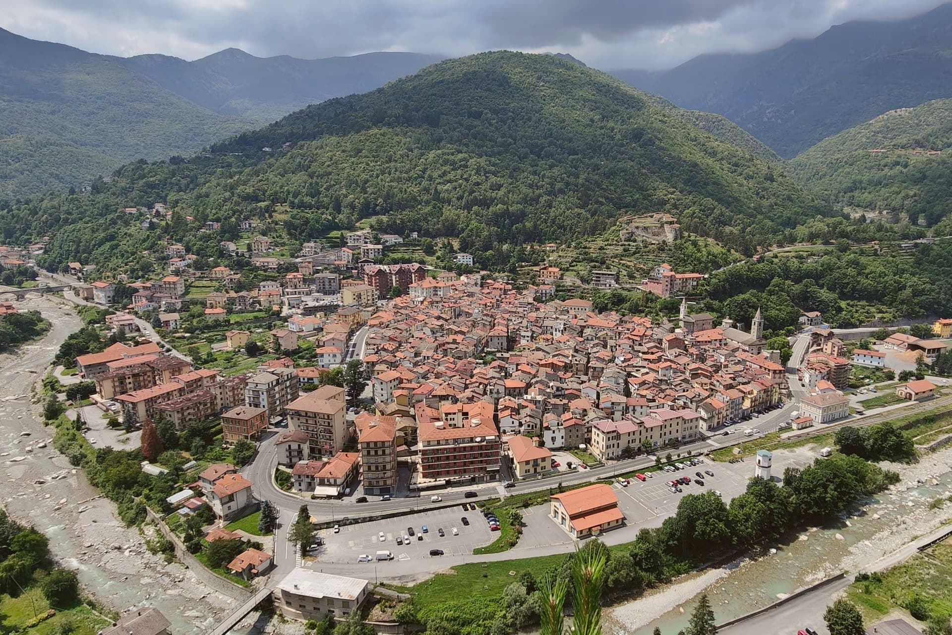
Ormea sits at 736 meters in the upper Tanaro valley, at the confluence of the Armella stream and the river, with the Pizzo d'Ormea rising to 2,476 meters above the rooftops. The historic centre has a recognisable heart-shaped perimeter, set against the Ligurian Alps that separate Cuneo from Imperia and Albenga; on clear days the Riviera sea is visible.
The territory belonged to the Aleramici and then the Marquises of Ceva from 967, contested through the 1200s with the Clavesana branch and the Republic of Genoa, before passing to the Savoys in 1558. In 1722 it became a marquisate under Carlo Vincenzo Ferrero d'Ormea, who built a textile mill capable of competing with English production until the French Revolution and Napoleon's army destroyed both the factory in the main square and the medieval castle.
The commune carries Borghi Autentici and Città del Castagno; the chestnut harvest runs the calendar from October.
What to see in Ormea
- Centro storico. Heart-shaped medieval core at the confluence of the Tanaro and Armella, narrow lanes between stone houses, with views to the Pizzo d'Ormea.
- Ruderi del Castello. Remains of the medieval castle held by the Marquises of Ceva and the Savoys, destroyed during Napoleon's Italian campaign at the end of the 18th century.
- Pizzo d'Ormea. 2,476-metre Ligurian-Alps peak above the town, the dominant summit of the upper Tanaro and a long-day hike from the centro storico.
How to get to Ormea
There is a railway station in the town, so you can arrive without a car and never need one while you are here. Torino is roughly 132 minutes away by road.
Our tip
May through June brings the chestnut woods into full leaf and the Tanaro down from snowmelt; the trails to the Pizzo d'Ormea open by late May. July and August are the climbing and trekking months, mild evenings at 736 meters even when the coast below burns. September and October are the strongest window: clear air, low fog in the valley at dawn, and the chestnut harvest with its weekend sagre.
Chiusa di Pesio
Why visit Chiusa di Pesio
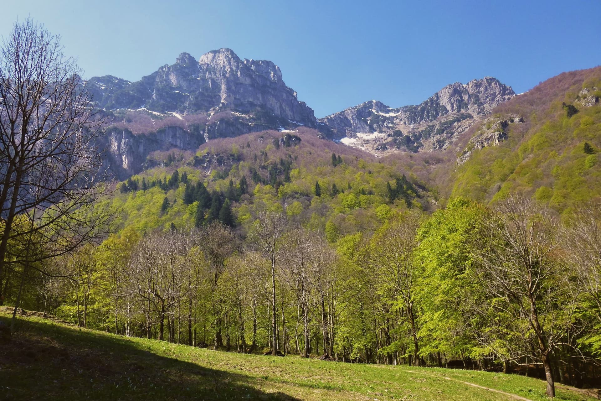
The Valle Pesio runs fifteen kilometers from the town up to the French border, a wedge of the Ligurian Alps whose municipal territory climbs from 575 meters at the village to over 2,600 meters at the ridge. The town exists because of the Certosa: in 1173 the lords of Morozzo donated upper-valley lands to a Carthusian monk named Ulderich from Casale, and the charterhouse that grew from that gift became one of the great spiritual and forestry centers of medieval Piedmont.
Lower-valley woods once managed by the order for chestnut production still supply the harvest that keeps the town in the Città del Castagno network today. The valley reads as a sequence from village to summit: the settlement at the mouth, the monastery upriver at the foot of Monte Mindino, and above both the high ground of the Marguareis, where karst has hollowed the rock into one of the most extensive cave systems in the Western Alps.
A wolf pack, the first stable one documented in the Italian Alps, established itself in this same corridor in the mid-1990s. The valley's history and its wildness sit on top of each other rather than side by side, a monastic economy giving way, without displacing it, to a landscape still wild enough for wolves.
What to see in Chiusa di Pesio
- Certosa di Santa Maria in Valle Pesio. Now run by the Missionaries of the Consolata, who took over after the Carthusians left in the eighteenth century, the complex remains the cultural anchor of the upper valley.
- Parco Naturale del Marguareis. Protected area of 7,900 hectares in the Ligurian Alps, holding the largest alpine karst system in Piedmont beneath its ridges.
- Karst caves of the Marguareis. More than 150 kilometers of explored caves reaching 1,000 meters depth, among the most extensive cave systems in the Western Alps.
How to get to Chiusa di Pesio
Torino is roughly 99 minutes away by road.
Our tip
April through June brings snowmelt to the Pesio, wild orchids on the lower slopes, and the chestnut woods coming into leaf. July and August are good in the upper valley, where altitude keeps temperatures down, but warm in the village itself. September and October are the chestnut months and the best hiking weather, dry and clear with the larches turning gold above 1,800 meters.