The best towns inside a nature park in Piemonte

Piemonte protects a great deal of itself. The regional parks here cover beech and silver fir forest above Cuneo, moraine lakes below the Susa valley, reed beds on the lake shore, and the high glacier country under Monte Rosa, and in most cases the boundary is drawn around villages rather than away from them. Houses are stone and larch, roofs are heavy slabs of gneiss laid flat against the snow, and the food follows the altitude: chestnuts and toma cheese in the lower valleys, rye bread, polenta with butter and Alpine cow's milk cheeses higher up. Autumn is the season most walkers pick, for the larch turning and the mushrooms, though the parks are at their quietest in late spring when meltwater is loud and the paths have just opened.
Most visitors who come to Piemonte for mountains go to Gran Paradiso, and the reasons are sound: it was Italy's first national park, the ibex are reliable, the ranger network is excellent and Cogne is set up to receive people. The result is a full car park by mid morning in August, booked refuges, and the same handful of valley floors carrying almost all the traffic. Turin's day trippers add to it, since the drive is short and the signposting is good. None of that makes the park less worth seeing, but it does mean the walking is shared.
The protected land does not stop there. The same forests, the same ridges of the Cottian and Maritime Alps, the same lake margins and the same Sacro Monte hills carry regional parks that fewer people go to, and inside them are towns with a bar, a bakery, a fortress or an abbey and marked paths leaving from the edge of the houses. This list covers the towns that sit within a Piemonte regional nature park, from the Rosa glaciers down to the lake and the low Monferrato hills.
Of the 65 communes we have mapped in Piemonte, 10 qualify as towns inside a nature park: each sits inside a regional nature park. The smallest, Usseaux, has 175 residents.
If you are still choosing, we have also written The best small towns inside a nature park in Piemonte and The best mountain towns in Piemonte.
Usseaux
Why visit Usseaux
Usseaux sits at 1,416 meters in the upper Val Chisone, fifty-five kilometers west of Torino on the road that climbs toward the Colle delle Finestre. The commune holds 175 residents across the capoluogo and four high hamlets: Balboutet, Laux, Fraisse and Pourrieres, each with its own parish and its own dialect inflection.
In 1343 these communities joined the autonomous Escartons Republic, a federation of alpine villages that bought their freedom from the Dauphin and self-governed in Occitan for four hundred years until Napoleon dissolved them. The Waldensian Reformation reached the valley in the sixteenth century and left a network of temples on the slopes below.
The contemporary signature of Usseaux is the murales project: more than forty paintings on house walls showing alpine work, animals and peasant scenes, layered over stone facades that already carry sundials and carved lintels. Balboutet faces south and reads its hours from those dials.
Laux holds a small lake at the foot of the meadows above the village.
What to see in Usseaux
- I Murales. More than forty painted murals across stone facades in the capoluogo and the borgate, depicting alpine work, peasant scenes and forest animals.
- Balboutet. South-facing hamlet known for the sundials painted and carved across the facades of its stone houses, marking time in alpine tradition.
- Lago del Laux. Small alpine lake on the meadows above the hamlet of Laux, a short walk from the village and ringed by fishing huts.
How to get to Usseaux
Torino is roughly 92 minutes away by road.
Our tip
June through September is the open alpine season at 1,416 meters: meadows in flower above the borgate, trails through the Orsiera-Rocciavrè park clear of snow, and the Lago del Laux walkable from the village in twenty minutes. December through March is the winter window, when the Vialattea ski domain a short drive west fills the valley and snow holds long on the murales walls. April, May, October and November are the difficult months.
Fenestrelle
Why visit Fenestrelle
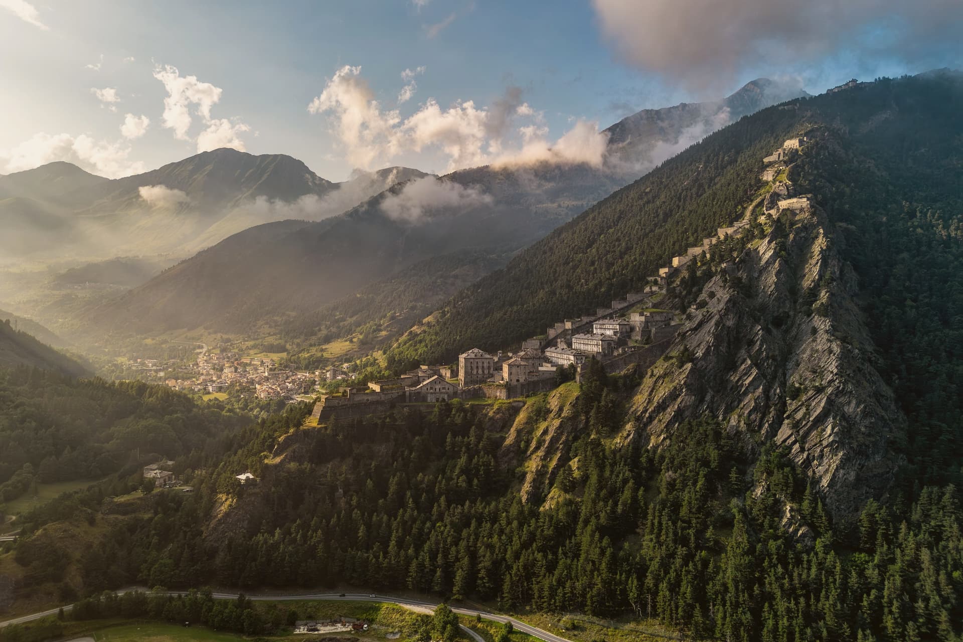
Fenestrelle sits in the middle of Val Chisone, fifty kilometers west of Torino on the road toward Sestriere. The Romans called this point Finis Terrae Cotii, the border of Cottius's land, and from the twelfth century onward the valley held a strong Waldensian community, long before any fortress stood here.
Construction on the ridge began in 1728, commissioned to secure the border against France after the Treaty of Utrecht handed Val Chisone to Piedmont, and work continued for around 120 years. What resulted sits apart from the village in every sense: the settlement stays put at the valley floor while the fortifications climb the slope above it, three separate forts staged up the ridge and joined by a single stair.
The village is the base point of a line that keeps rising until it reaches the crest, so that the same walk that starts among houses ends at open rock looking down over the whole valley. Fenestrelle today is best understood as the foot of that climb, a border town that turned into the ground floor of its own fortress.
What to see in Fenestrelle
- Forte di Fenestrelle. The full system stretches over the ridge above the village, three connected forts joined by the covered staircase, standing above Val Chisone.
- Forte San Carlo. Lowest of the three forts, the entrance complex above the village at 1,154 meters, where the climb up the stairs begins.
- Forte Tre Denti. Middle fort of the system, home to the Garitta del Diavolo viewpoint at 1,400 meters over Val Chisone.
How to get to Fenestrelle
Torino is roughly 84 minutes away by road.
Our tip
June through September is when the fortress is fully open for guided visits, the high gradients of the staircase are walkable, and Val Chisone trails above 1,500 meters are clear of snow. December through March is the alpine winter season: the Vialattea ski domain is twenty minutes away, the lower fort is accessible in snow, and the upper forts close. April, May, October and November are the difficult shoulder months.
Serralunga di Crea
Why visit Serralunga di Crea
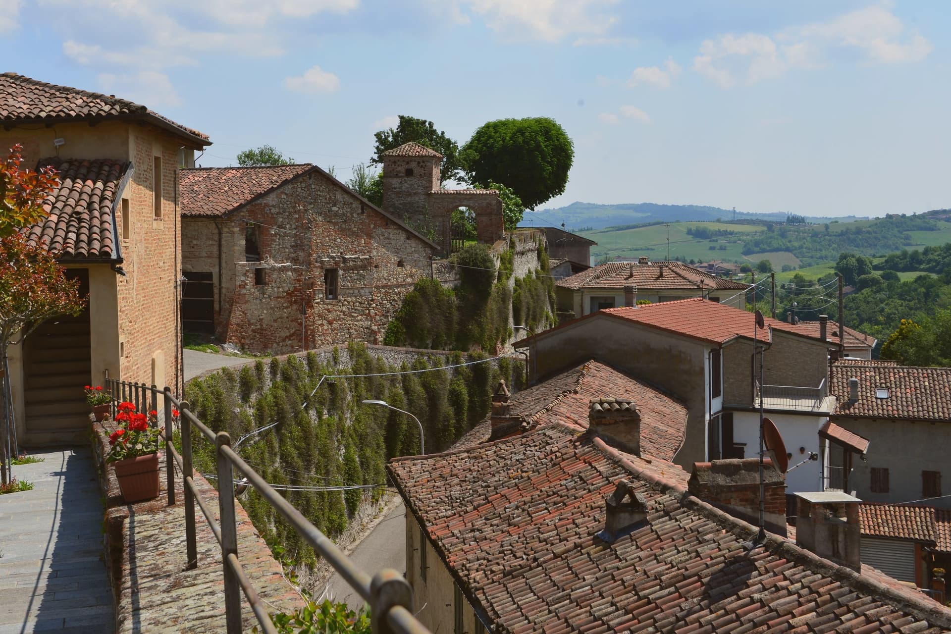
Serralunga di Crea sits in the Basso Monferrato hills forty-five kilometers east of Torino, on the highest of a series of ridges that look across the Po plain. The hill behind the village rises to 443 meters, and it is on this wooded height, rather than in the village itself, that the commune's main structures stand: the sanctuary at the centre, the ring of chapels around it, and the vineyards on the lower slopes beyond the reserve boundary.
The chapels were begun in 1589 by Costantino Massino on a plan of fifteen Rosary stations, expanded over the following two centuries to twenty-three chapels and five hermitages, so what stands today is the accumulation of a long building period rather than a single campaign. The vineyards that surround the hill carry a separate and later UNESCO recognition, from 2014, so the commune holds two world heritage lines on the same stretch of ground: one on the summit, one on the slopes around it.
The village below is small; the hill above is where its two distinctions both sit, layered rather than separate.
What to see in Serralunga di Crea
- Sacro Monte di Crea. Chapels and hermitages climb the wooded hill above the village along a Rosary-plan pilgrim route, each station set among trees with views opening intermittently over the ridge.
- Santuario di Nostra Signora di Crea. Marian sanctuary at the centre of the Sacro Monte, the building the whole climb of chapels was arranged around, traditionally founded by Saint Eusebius of Vercelli.
- Cappella del Paradiso. Final chapel of the Sacro Monte, summit of the climb, with over 300 statues in a polychrome celestial composition.
How to get to Serralunga di Crea
Novara is roughly 58 minutes away by road.
Our tip
April through June is the green window in the Basso Monferrato: hills coming into leaf, the climb up the Sacro Monte cool in the morning, and the panorama across the Po plain at its clearest. July and August touch the mid-thirties on the open ridges; the woods around the chapels stay cooler, but the late afternoon climb is hard work. September and October are the wine months, with Monferrato harvest in the surrounding cantine and pilgrim groups returning for the Rosary festivals.
Alagna Valsesia
Why visit Alagna Valsesia
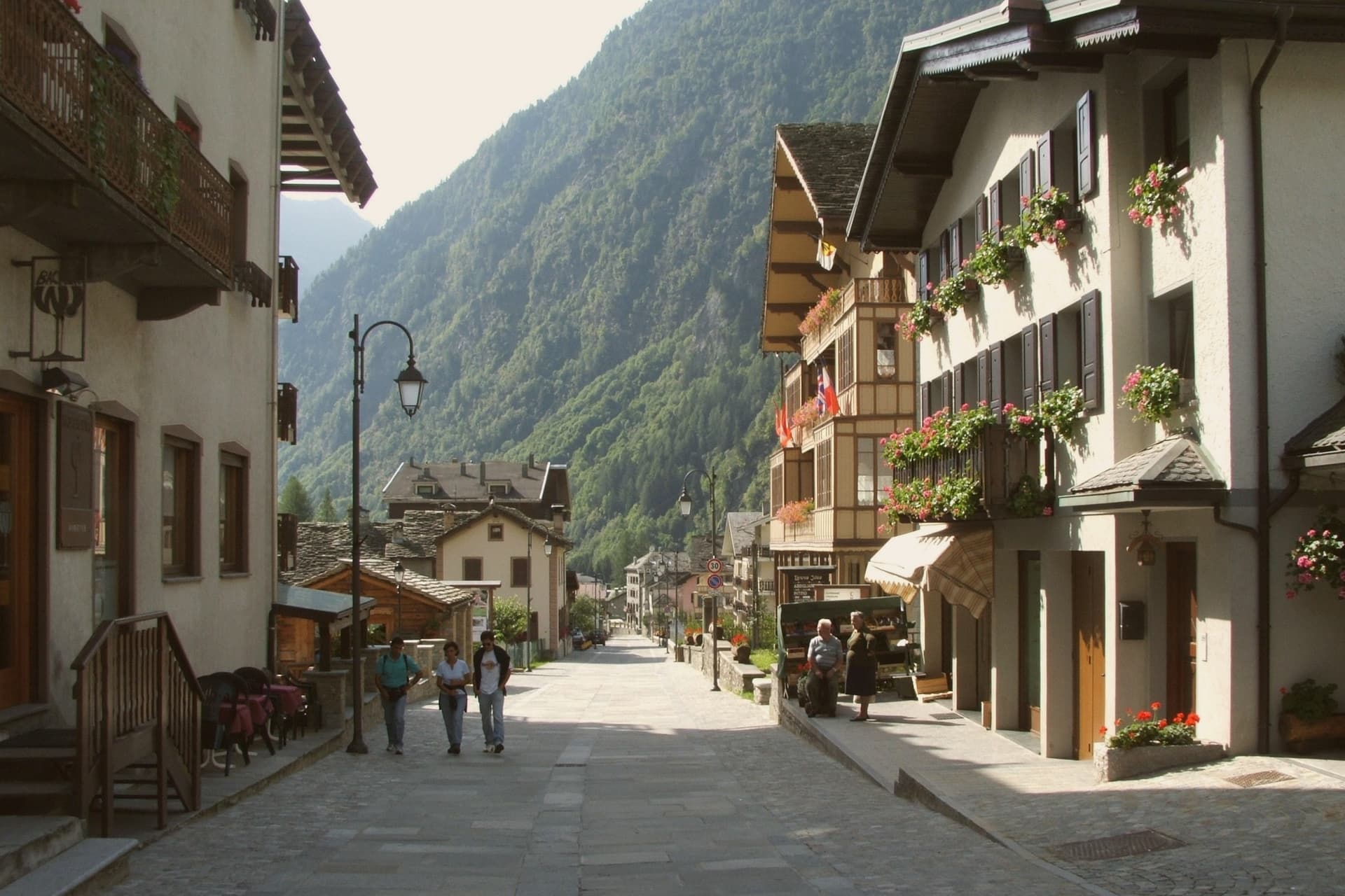
Alagna sits at the head of the Valsesia, at 1,191 meters, where the valley closes against the south face of Monte Rosa, the second-highest peak in the Alps. The commune covers 72.8 square kilometers, the largest by surface area in the province of Vercelli, and its territory reaches from the valley floor up to the glaciers, which is why a single village can hold both the wooden hamlets of the Walser settlers and the lift stations of a major ski domain.
Those settlers came from the Swiss Valais in the thirteenth century and stayed, building in wood and stone between 1500 and 1700; the hamlets of Pedemonte, Riale and Resiga carry that building tradition still. The Guides Association of Alagna, founded in 1872, is the second-oldest in Italy after Courmayeur, a marker of how early the peaks above the village drew climbers rather than skiers.
The lifts came later, opening in stages from the 1950s, and Alagna is now the eastern access to a domain that crosses into the Aosta Valley. Internationally the village is known less for groomed pistes than for the freeride terrain on the massif itself.
The Bandiera Arancione of the Touring Club fires here. The two identities, Walser hamlet and freeride terminus, sit on the same ground because the valley that sheltered thirteenth-century settlers is the same one that funnels skiers up toward the glaciers today.
What to see in Alagna Valsesia
- Frazione Pedemonte. Three-storey wooden houses still standing in their original form, the oldest a Walser hamlet built in the 1500s and 1600s.
- Museo Walser. Opened in 1976 in a 1628 Walser house in Pedemonte, reconstructing the interiors, tools and furnishings of a traditional German-Alpine household.
- Chiesa di San Giovanni Battista. Parish church built in 1511, holding sculptures by Giovanni d'Enrico, the Valsesian sculptor active around the Sacro Monte di Varallo.
How to get to Alagna Valsesia
Novara is roughly 97 minutes away by road.
Our tip
December through March is the ski season Alagna built around itself: lifts open, the Monterosa domain links to the Aosta Valley, and the freeride routes off Punta Indren run as long as the snow holds. June through September is the second season, when the same valleys become hiking and via ferrata country and the temperatures rarely break 22 degrees. April, May, October and November are quiet shoulder months.
Ormea
Why visit Ormea
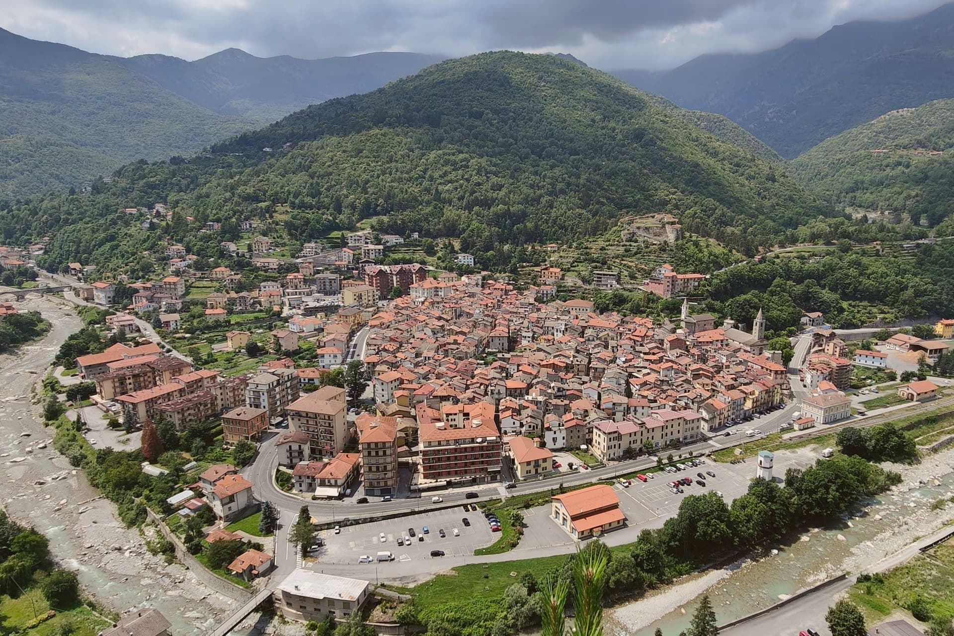
Ormea sits at 736 meters in the upper Tanaro valley, at the confluence of the Armella stream and the river, with the Pizzo d'Ormea rising to 2,476 meters above the rooftops. The historic centre has a recognisable heart-shaped perimeter, set against the Ligurian Alps that separate Cuneo from Imperia and Albenga; on clear days the Riviera sea is visible.
The territory belonged to the Aleramici and then the Marquises of Ceva from 967, contested through the 1200s with the Clavesana branch and the Republic of Genoa, before passing to the Savoys in 1558. In 1722 it became a marquisate under Carlo Vincenzo Ferrero d'Ormea, who built a textile mill capable of competing with English production until the French Revolution and Napoleon's army destroyed both the factory in the main square and the medieval castle.
The commune carries Borghi Autentici and Città del Castagno; the chestnut harvest runs the calendar from October.
What to see in Ormea
- Centro storico. Heart-shaped medieval core at the confluence of the Tanaro and Armella, narrow lanes between stone houses, with views to the Pizzo d'Ormea.
- Ruderi del Castello. Remains of the medieval castle held by the Marquises of Ceva and the Savoys, destroyed during Napoleon's Italian campaign at the end of the 18th century.
- Pizzo d'Ormea. 2,476-metre Ligurian-Alps peak above the town, the dominant summit of the upper Tanaro and a long-day hike from the centro storico.
How to get to Ormea
There is a railway station in the town, so you can arrive without a car and never need one while you are here. Torino is roughly 132 minutes away by road.
Our tip
May through June brings the chestnut woods into full leaf and the Tanaro down from snowmelt; the trails to the Pizzo d'Ormea open by late May. July and August are the climbing and trekking months, mild evenings at 736 meters even when the coast below burns. September and October are the strongest window: clear air, low fog in the valley at dawn, and the chestnut harvest with its weekend sagre.
Chiusa di Pesio
Why visit Chiusa di Pesio
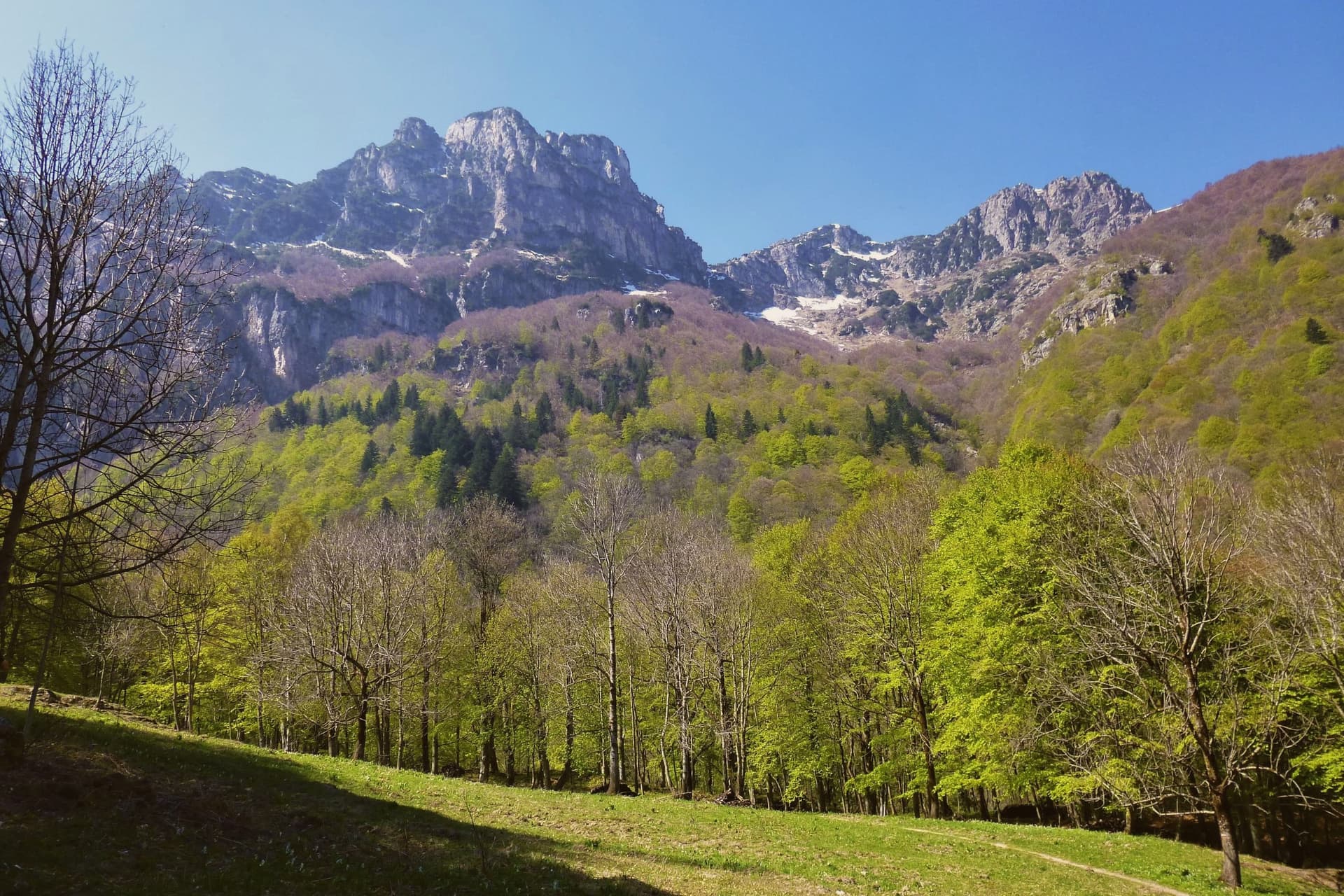
The Valle Pesio runs fifteen kilometers from the town up to the French border, a wedge of the Ligurian Alps whose municipal territory climbs from 575 meters at the village to over 2,600 meters at the ridge. The town exists because of the Certosa: in 1173 the lords of Morozzo donated upper-valley lands to a Carthusian monk named Ulderich from Casale, and the charterhouse that grew from that gift became one of the great spiritual and forestry centers of medieval Piedmont.
Lower-valley woods once managed by the order for chestnut production still supply the harvest that keeps the town in the Città del Castagno network today. The valley reads as a sequence from village to summit: the settlement at the mouth, the monastery upriver at the foot of Monte Mindino, and above both the high ground of the Marguareis, where karst has hollowed the rock into one of the most extensive cave systems in the Western Alps.
A wolf pack, the first stable one documented in the Italian Alps, established itself in this same corridor in the mid-1990s. The valley's history and its wildness sit on top of each other rather than side by side, a monastic economy giving way, without displacing it, to a landscape still wild enough for wolves.
What to see in Chiusa di Pesio
- Certosa di Santa Maria in Valle Pesio. Now run by the Missionaries of the Consolata, who took over after the Carthusians left in the eighteenth century, the complex remains the cultural anchor of the upper valley.
- Parco Naturale del Marguareis. Protected area of 7,900 hectares in the Ligurian Alps, holding the largest alpine karst system in Piedmont beneath its ridges.
- Karst caves of the Marguareis. More than 150 kilometers of explored caves reaching 1,000 meters depth, among the most extensive cave systems in the Western Alps.
How to get to Chiusa di Pesio
Torino is roughly 99 minutes away by road.
Our tip
April through June brings snowmelt to the Pesio, wild orchids on the lower slopes, and the chestnut woods coming into leaf. July and August are good in the upper valley, where altitude keeps temperatures down, but warm in the village itself. September and October are the chestnut months and the best hiking weather, dry and clear with the larches turning gold above 1,800 meters.
Susa
Why visit Susa
Susa sits fifty kilometers west of Torino, on the road that climbs toward the Moncenisio and Montgenèvre passes into France. Ligurians and Celts settled the site around 500 BC.
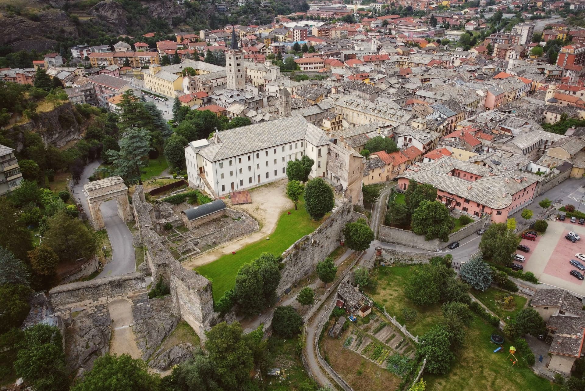
It later emerged as the capital of the kingdom of the Cozii under Marcus Julius Cottius, son of King Donnus, who allied with Rome and was confirmed as prefect of the new province of Alpes Cottiae, with Segusio, modern Susa, as its capital: the arch in the town center and the town's name in the Cottian Alps both descend from that alliance. The old core, arch, cathedral and castle, sits compact around the Roman gate that the castle absorbed into its later walls, with the amphitheatre just outside that line.
The pilgrim route threads through this core on its way down from the pass, meaning the town has functioned as a waypoint on the same north-south line, Roman road, medieval pilgrimage route, alpine crossing, since Ligurians and Celts first settled it. What the Cozii capital, the pilgrim stop and the mountain gateway add up to is a single fact repeated across the centuries the arch and the campanile have stood: Susa exists because of the road, not beside it.
What to see in Susa
- Arco di Augusto. White marble arch over 13 meters tall, standing in the centre of town and counted among the best preserved of its kind in north Italy.
- Cattedrale di San Giusto. Founded by Olderico Manfredi, with the terracotta spires added in the 1480s. The campanile remains the tallest feature of the skyline.
- Castello della Contessa Adelaide. Built into a Roman gate on the line of the old walls, later reworked into a noble residence with medieval towers and Renaissance windows. It stands beside the cathedral.
How to get to Susa
There is a railway station in the town, so you can arrive without a car and never need one while you are here. Torino is roughly 53 minutes away by road.
Our tip
April through June is the green window in the Susa valley: the Cottian Alps with snow still on the upper slopes, mild evenings at 503 meters, and the Roman monuments lit clearly in the long light. July and August are warm but cooler than the Po plain; the Arch and the Cattedrale draw most of the year's visitors and the festival programme runs through summer. September and October are the second peak, with crisp air and the chestnut woods turning above the town.
Avigliana
Why visit Avigliana
Avigliana sits at 383 meters in the lower Susa Valley, twenty-five kilometers west of Torino at the point where the Alps meet the Po plain. The first castle on Monte Pezzulano was built in 942 by the Arduinici Marquises of Turin and passed to the Counts of Savoy from 1137; Frederick Barbarossa destroyed it and Thomas I of Savoy rebuilt it, before the French marshal Catinat finally demolished it in 1691.
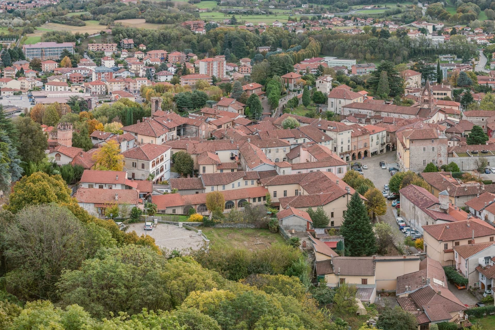
The medieval core that grew below the fortress is still ringed by porticoed houses from the twelfth to fifteenth centuries. The Chiesa di San Pietro and the Chiesa di San Giovanni hold frescoes spanning the eleventh through the sixteenth century, a run of decoration that outlasted the castle itself.
Below the centre, two glacial lakes, Lago Grande and Lago Piccolo, sit at 352 and 356 meters in a natural park established in 1980, while the Via Francigena passes through on its way toward the mountain above. What the town adds up to is a settlement built in layers around a single defensible height, with the ruined fortress marking the summit of Savoy power here and the abbey on the neighboring peak marking its longer, still-standing religious counterpart.
What to see in Avigliana
- Piazza Conte Rosso. The square that gives the old core its shape, named for Amedeo VII of Savoy and ringed by porticoed houses whose ground floors still trace the medieval street line.
- Castello di Avigliana. Ruined Savoy fortress on Monte Pezzulano, built in 942, rebuilt by Thomas I of Savoy and demolished by Marshal Catinat in 1691.
- Chiesa di San Pietro. Romanesque church on the road to the lakes, decorated with frescoes from the 11th to the 16th century.
How to get to Avigliana
There is a railway station in the town, so you can arrive without a car and never need one while you are here. Torino is roughly 36 minutes away by road.
Our tip
April through June are the green months: the moraine lakes open for kayaking and swimming, the porticoed core stays cool under shade, and the climb to the Sacra di San Michele runs free of haze. July and August touch the low thirties in the valley, though the Sacra at 962 meters carries a steady wind. September and October bring chestnuts and the wine harvest in the surrounding Pinerolese hills.
Arona
Why visit Arona
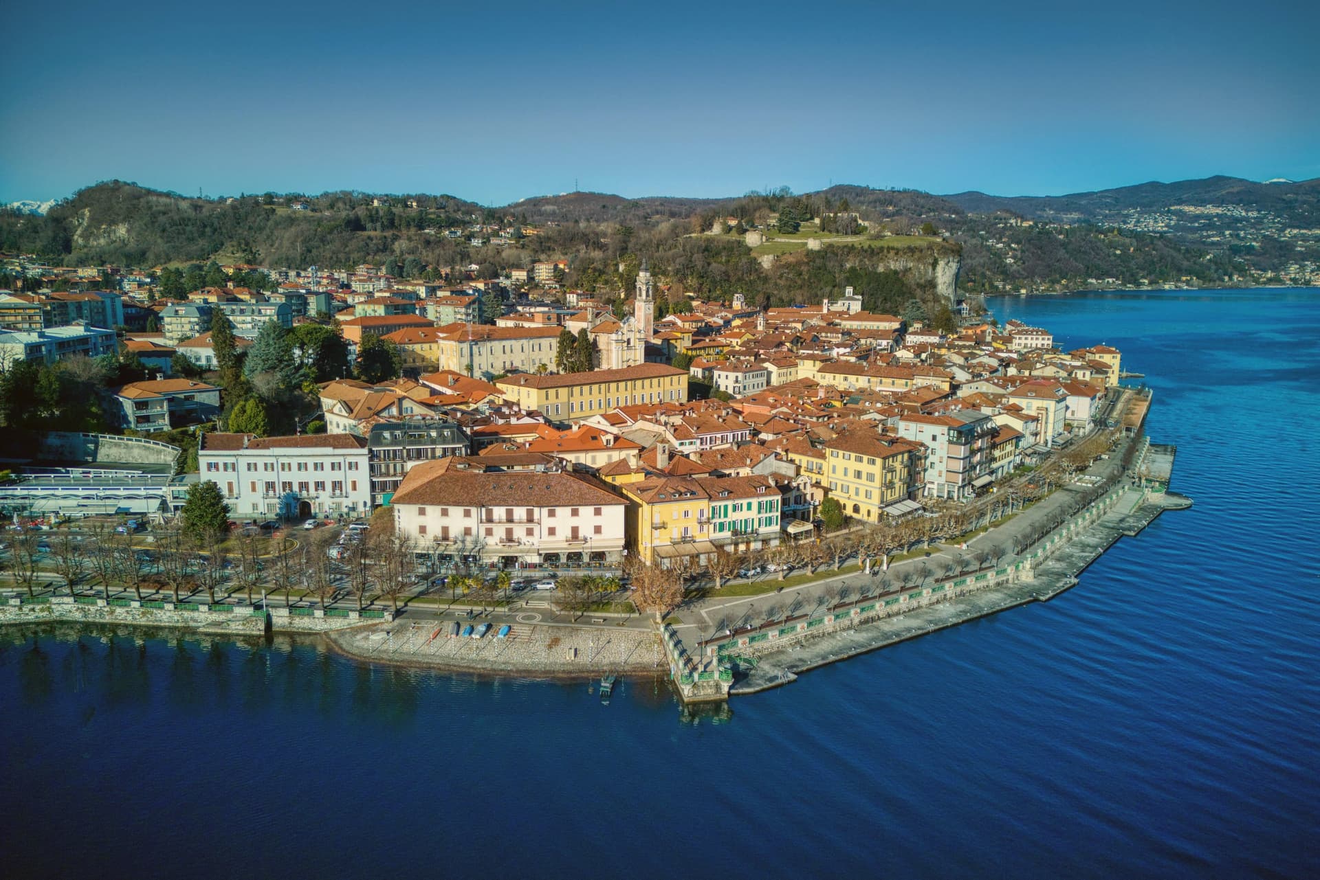
Arona sits ninety kilometers north of Milano, the first stop most travellers reach when they leave the city for the lakes. The town came under the Borromeo family in 1439 and stayed there for centuries: the castle on the hill above town was their stronghold, and the next hill over holds the statue raised in the family's honor, so the two high points of Arona both belong to the same lineage looking down on the water and on each other.
The lakefront below connects the two hills to the church on the shore and to the promenade that runs north with Angera visible across the water on the Lombard side. The natural park on the southern edge of the commune sits apart from this Borromeo core, its pile-dwelling remains far older than anything else in town and unconnected to the family's centuries of rule.
What the place adds up to is a town organized around one family's presence in stone and copper, with a much older, unrelated settlement preserved at its edge.
What to see in Arona
- Sancarlone. Copper colossus of San Carlo Borromeo, designed by Il Cerano and built between 1614 and 1698, standing above the Sacro Monte.
- Rocca di Arona. Ruined fortress on the hill above town, the walls broken into towers since the demolition, with views over the water below.
- Collegiata di Santa Maria Nascente. Late medieval church on the lakefront, holding a polyptych by Gaudenzio Ferrari completed in 1511.
How to get to Arona
There is a railway station in the town, so you can arrive without a car and never need one while you are here. Novara is roughly 49 minutes away by road.
Our tip
April through June and September into October are the best months on the south shore of Lake Maggiore. The lake stays cool, the lungolago carries traffic without congestion, and the ferries run a full timetable to Angera and the Borromeo islands further north. July and August are warm and busy: ferry queues, full hotels, and the southern lake basin gathering most of the day-trip volume from Milano.
Venaria Reale
Why visit Venaria Reale
Venaria Reale sits at 269 meters fifteen kilometers northwest of Torino, on the lowland that ran into the Savoy hunting forests of the Mandria. The modern name comes from the Latin ars venatoria, hunting.
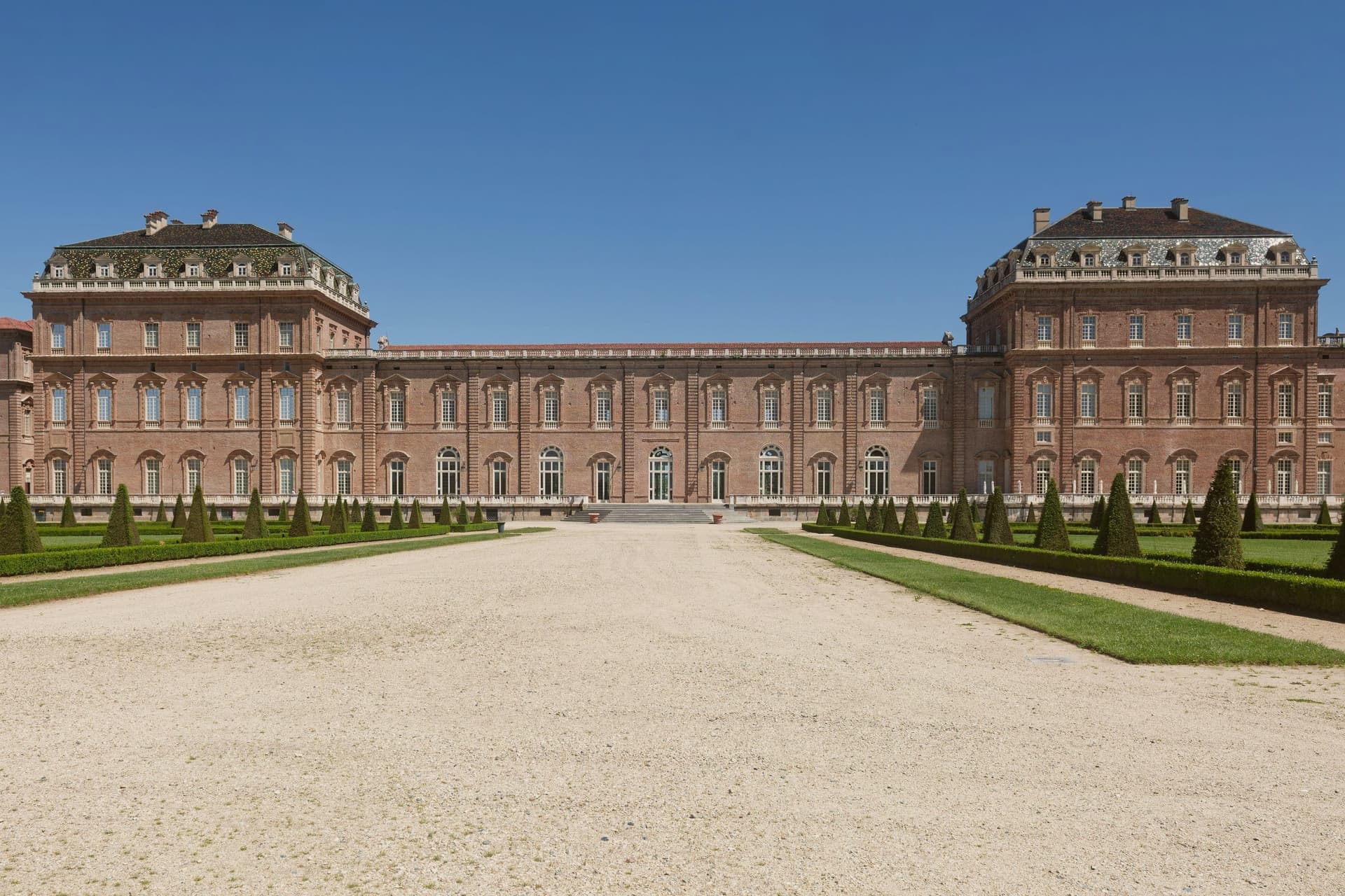
In 1658 Duke Carlo Emanuele II commissioned court architect Amedeo di Castellamonte to build a residence for hunting parties and court leisure, with a coordinated plan for palace, park, hunting wood and adjoining village. In 1716 Filippo Juvarra enlarged the complex with the Galleria Grande, the Cappella di Sant'Uberto, the Citroniera and the Scuderia, lifting the Reggia to one of the major baroque set pieces of Europe.
The Savoy Residences entered the UNESCO list in 1997. After two centuries as a military barracks the palace was restored across eight years from 1999 to 2007, in the largest cultural restoration project in European Union history, with 1,800 operators on site.
The Reggia now opens eighty thousand square meters of floor surface and sixty hectares of gardens, with the three thousand fenced hectares of the Parco della Mandria beyond.
What to see in Venaria Reale
- Reggia di Venaria. UNESCO baroque palace begun in 1658 by Amedeo di Castellamonte for Duke Carlo Emanuele II, with 80,000 m² of floors and 60 hectares of gardens.
- Galleria Grande. Filippo Juvarra's barrel-vaulted gallery of 1716, one of the longest enfilades of baroque court architecture in Europe.
- Cappella di Sant'Uberto. Royal chapel designed by Juvarra inside the palace, completed in the second decade of the eighteenth century for the hunting court.
How to get to Venaria Reale
There is a railway station in the town, so you can arrive without a car and never need one while you are here. Torino is roughly 28 minutes away by road.
Our tip
April through June is the best window for the gardens of the Reggia and the long walks through the Parco della Mandria, with parterres in full bloom and the hunting park green. September and October bring cooler air over the gardens and the start of the autumn exhibition season inside the Galleria Grande. July and August touch the mid-thirties on the Torino plain; the palace interiors stay cool, the Citroniera and the chapel hold the heat at bay, but the gardens flatten in midday glare.