The best cheese towns within two hours of Turin
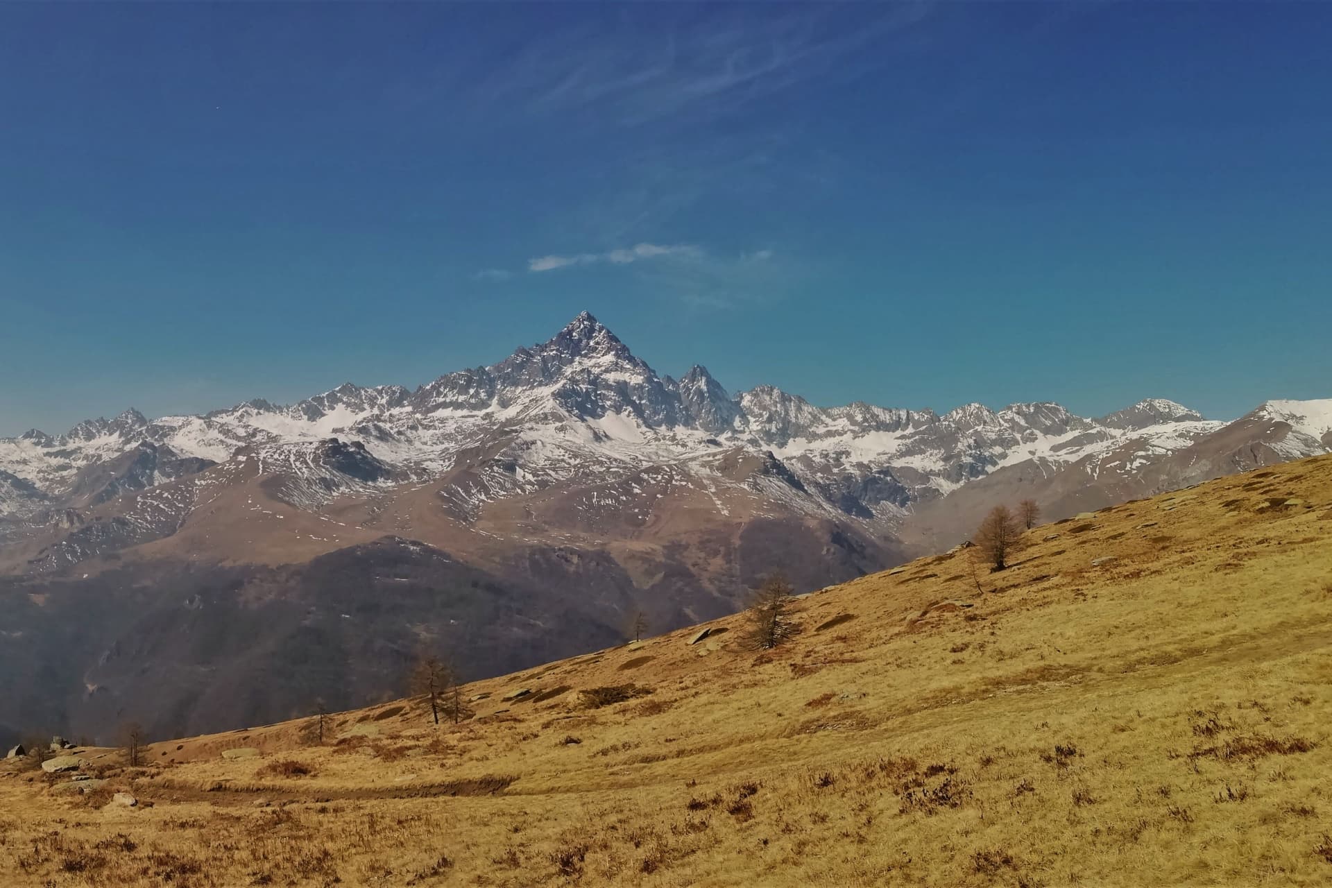
Piedmont makes cheese the way it makes wine, by law and by valley. Toma comes down from stone villages under the Monviso, where the houses are built of slate and larch and the summer pasture starts above the last hamlet. Robiola belongs to the Langhe and the Alta Langa, hazelnut country, where the hills are steep and the autumn fog sits in the valleys until midday. Further north, towards the lakes and the Ossola, the cheeses turn firmer and older, aged in cool granite cellars, and the season for eating them properly runs from the first cold weather through to spring.
Most people arrive in the region and go to Alba, especially in autumn, when the white truffle fair fills the town and the restaurant bookings vanish weeks ahead. It is a reasonable choice, the market is good and the wine list of the average trattoria is better than it has any right to be. It is also, for several weekends a year, extremely full, and the prices reflect it. Bra, an hour away, does much the same job for cheese with its biennial fair, and draws the same crowds.
The production zones do not stop at the famous towns. They are drawn around valleys, watersheds and stretches of hillside, and the dairies that supply the well-known counters sit in villages that see almost no visitors at all. The towns on this list all fall inside one of those protected zones, from the Alpine communes under Monviso to the Monferrato hills and the shore of Lake Maggiore, and each is close enough to Turin for lunch and a slow drive back.
Of the 84 communes we have mapped in a 120-minute drive of Turin, 11 qualify as cheese towns: each sits inside the production zone of a protected cheese. This list is 10 of them. The smallest, Ostana, has 85 residents.
Elsewhere in the catalogue: The best cheese towns within two hours of Genoa and The best cheese towns within 90 minutes of Milan.
Ostana
Why visit Ostana
Ostana sits at 1,280m on the south-facing slope of the upper Po valley, in the Occitan linguistic island that runs across the upper valleys of Cuneo and Torino provinces, a dialect still spoken by maybe 50,000 people. In 1921 the village had 1,200 residents working rye, pasture and chestnut at altitude; by 1985 that had fallen to 25, with over 60 houses in ruin and the village close to abandoned, near-officially so.
The reversal began in 1985 when the newly elected mayor, an architect named Giacomo Lombardo, set a 30-year masterplan in motion: rebuild the ruined houses in their original 17th-19th-century stone-and-larch style, draw in residents through Occitan culture, and reposition the village as both an alpine architecture showcase and a cultural centre for that language. It worked on its own terms.
By 2024 the population had climbed back to 85, still small but stable, the demographic curve reversed rather than merely slowed, and the 60-plus restored houses carry insulation modern enough to meet Class A energy ratings behind their traditional stone and larch. The cultural centre, combining library, restaurant and events space, has anchored the new community life since 2012.
The village holds the Borghi piu belli d'Italia inscription despite its tiny population, and architectural press across Europe has taken to citing the case as a model for alpine village rebirth generally. The upper village of restored houses and the lower functions of trail junction and literary festival now depend on each other: walkers on the long-distance trail that crosses the village, and on the former royal hunting trail alongside it, pass through a place that would have had nothing to offer them forty years ago, and the writers who come each year for the minority-language literary prize, now in its fifteenth year and drawing entrants from Occitan to Sardinian to Maori to Welsh, stay in houses that were rubble within living memory.
The food is Occitan-alpine: gnocchi con bagna cauda, cunsa di bietole, raviolas di rapa, raclette and fontina mountain cheese, with Barolo and Barbaresco from the Langhe 60 km east. Like other alpine villages, Ostana goes quiet in winter, its high season running June to September.
What the demographic curve and the rebuilding record show together is a village that did not simply survive its emptying out but rebuilt itself around the very things, language and landscape, that might otherwise have been lost with it.
What to see in Ostana
- Monviso direct view (3,841m). Belvedere terraces across the centro line up on the pyramid face-on, the angle that made the village's postcard reputation.
- Restored 17th-19th-c stone borgo. Larch-and-stone houses standing where ruins stood a generation ago, the insulation invisible behind old materials. Streets built for a population many times the current one, now filled in more slowly.
- Occitan culture + Premio Ostana. The Occitan dialect is audible in the village rather than archived, and the Premio Ostana, Scritture in Lingua Madre, brings minority-language writers here once a year.
How to get to Ostana
Torino is roughly 94 minutes away by road.
Our tip
Ostana is alpine-seasonal — June through September is the high season for trails + alpine activities + the Premio Ostana literary festival (late June). May and October are shoulder for cooler hiking. Winter is Alpine at 1,280m with heavy snow possible Nov-April, ski touring + winter walks but most services scaled back.
Mombaldone
Why visit Mombaldone
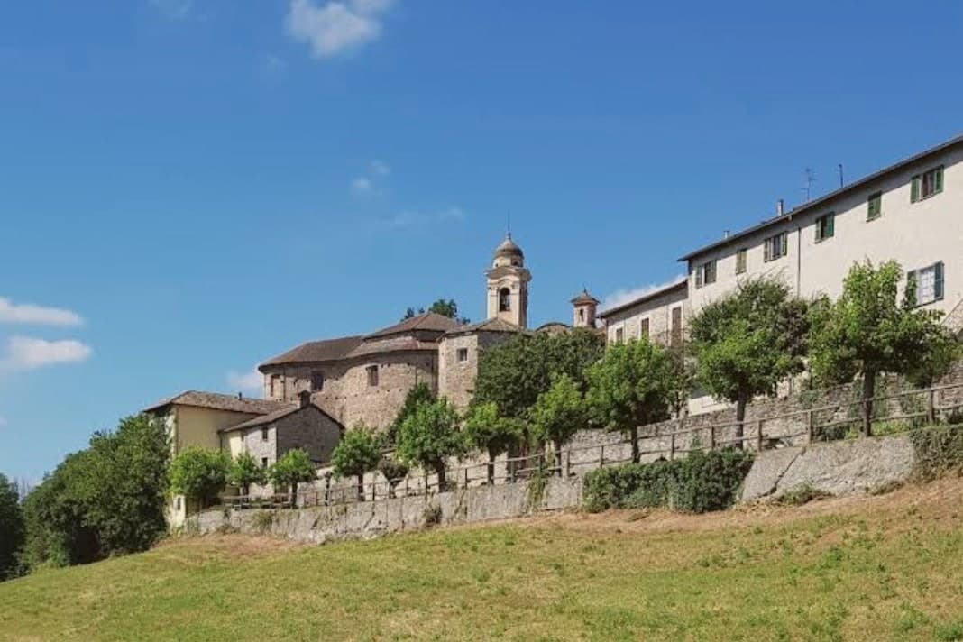
The village sits at 260 meters on a ridge, fifty kilometers north of Genova and well outside the Barolo and Barbaresco circuits. The Aleramici held the land from 991, when they founded the monastery of San Quintino di Spigno; in 1209 control passed to the Del Carretto, whose descendants still own property in the village.
The castle on the high point fell in 1637 and stands in ruin, a square tower and a stretch of wall, while the walled center below has kept its ring intact around the resident population. The church built into the old moat carries canvases by the Monevi family of Acqui, a 17th-century addition to an 18th-century building.
Bormida-valley badlands open below the walls toward Liguria. The layout reads as a sequence: ruined high point, intact walled ring beneath it, open valley beyond.
What survives is not the seat of power but the perimeter that once served it, outlasting the family and the castle both.
What to see in Mombaldone
- Castello dei Del Carretto. 13th-century castle on the highest point of the ridge, partially demolished in 1637; a square tower and wall fragments survive.
- Chiesa di San Nicolao. 18th-century Baroque parish church by Matteo Zucchi on a hexagonal plan, built into the old castle moat.
- Centro storico murato. Complete medieval walled perimeter, the only one preserved in full in the Langa Astigiana, enclosing the small borgo intact.
How to get to Mombaldone
There is a railway station in the town, so you can arrive without a car and never need one while you are here. Genova is roughly 84 minutes away by road.
Our tip
April through June bring the hills back to green and the walls draw a few weekend walkers from Acqui and Asti. September and October are dry and gold, with truffle weeks in nearby communes pulling small crowds onto the ridge roads. July and August can push past thirty degrees and the centro stays empty between two and six.
Serralunga di Crea
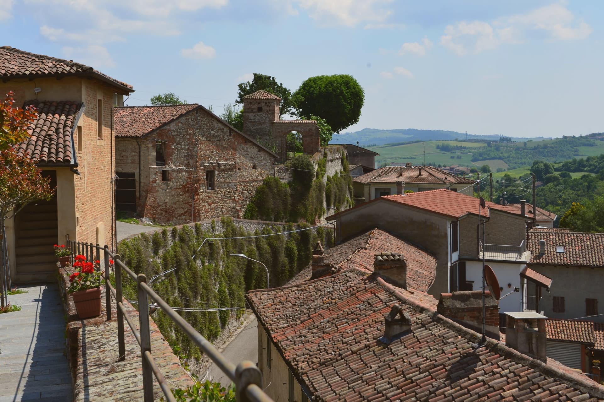
Why visit Serralunga di Crea
Serralunga di Crea sits in the Basso Monferrato hills forty-five kilometers east of Torino, on the highest of a series of ridges that look across the Po plain. The hill behind the village rises to 443 meters, and it is on this wooded height, rather than in the village itself, that the commune's main structures stand: the sanctuary at the centre, the ring of chapels around it, and the vineyards on the lower slopes beyond the reserve boundary.
The chapels were begun in 1589 by Costantino Massino on a plan of fifteen Rosary stations, expanded over the following two centuries to twenty-three chapels and five hermitages, so what stands today is the accumulation of a long building period rather than a single campaign. The vineyards that surround the hill carry a separate and later UNESCO recognition, from 2014, so the commune holds two world heritage lines on the same stretch of ground: one on the summit, one on the slopes around it.
The village below is small; the hill above is where its two distinctions both sit, layered rather than separate.
What to see in Serralunga di Crea
- Sacro Monte di Crea. Chapels and hermitages climb the wooded hill above the village along a Rosary-plan pilgrim route, each station set among trees with views opening intermittently over the ridge.
- Santuario di Nostra Signora di Crea. Marian sanctuary at the centre of the Sacro Monte, the building the whole climb of chapels was arranged around, traditionally founded by Saint Eusebius of Vercelli.
- Cappella del Paradiso. Final chapel of the Sacro Monte, summit of the climb, with over 300 statues in a polychrome celestial composition.
How to get to Serralunga di Crea
Novara is roughly 58 minutes away by road.
Our tip
April through June is the green window in the Basso Monferrato: hills coming into leaf, the climb up the Sacro Monte cool in the morning, and the panorama across the Po plain at its clearest. July and August touch the mid-thirties on the open ridges; the woods around the chapels stay cooler, but the late afternoon climb is hard work. September and October are the wine months, with Monferrato harvest in the surrounding cantine and pilgrim groups returning for the Rosary festivals.
Vogogna
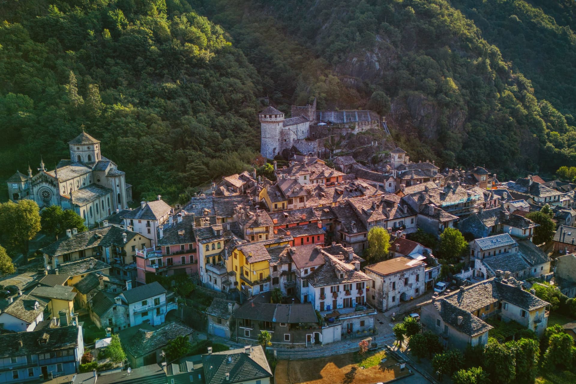
Why visit Vogogna
Vogogna sits at 226 meters on the floor of Val d'Ossola, at the narrow point of the valley where the Toce bends south toward Lago Maggiore. The castle went up on the spur above the village as part of a broader reinforcement of the Duchy of Milan against Swiss incursions over the Sempione, built alongside an older fortified rock that had already held the same defensive line.
Together they anchored the town's promotion to administrative seat for the lower half of the valley, in balance with Domodossola further up, which held the upper half. Spanish rule from the sixteenth century onward reduced the castle's strategic weight, and in 1798 it passed into municipal hands, used at one stage as a prison, before the long restoration that closed in 2005.
The borgo carries Borghi più belli d'Italia and the Bandiera Arancione, and Val Grande National Park borders the commune on the west. What the town amounts to is a lower valley's seat of government grown around a fortress that outlived its military purpose by centuries, wedged between wilderness on one side and the river's bend on the other.
What to see in Vogogna
- Castello Visconteo. Restored from 1990 to 2005, the castle is now open to visitors with a multimedia conference room installed inside its walls.
- Rocca di Vogogna. Earlier fortified rock above the Visconti castle, the original medieval defensive post over the narrow point of the Toce valley.
- Centro storico. Medieval core below the castle with stone houses, narrow streets and the Palazzo Pretorio, the historic administrative seat of Ossola Inferiore.
How to get to Vogogna
There is a railway station in the town, so you can arrive without a car and never need one while you are here. Novara is roughly 75 minutes away by road.
Our tip
April through June brings clear walking weather to the Toce valley, with the upper Val Grande slopes drying out and the Visconti castle terraces open for full hours. September and October are the harvest months in Ossola, when chestnut woods turn on the lower slopes and the cooler air carries the view from the Rocca down the valley toward Lago Maggiore. July and August warm the valley floor, but the stone houses of the centro storico keep the streets shaded.
Cortemilia
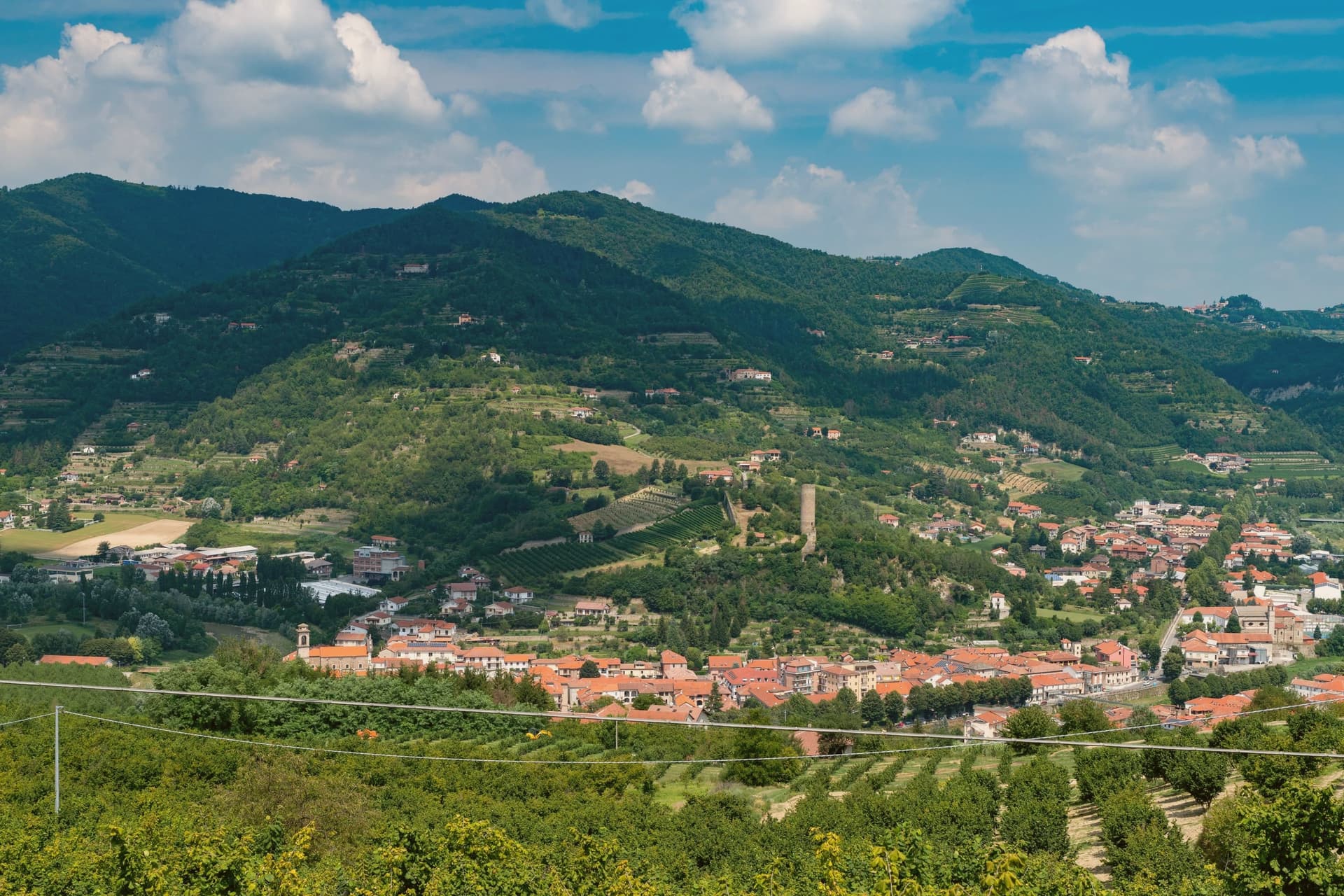
Why visit Cortemilia
Cortemilia sits at 247 meters on the Bormida river, in the heart of the Alta Langa, seventy kilometers southeast of Torino. The river splits the town into two historic borghi, San Michele on one side and San Pantaleo on the other, connected by a Romanesque bridge.
The settlement is pre-Roman in origin but expanded under Roman administration, attested by tombstones found around the centro storico. The Pieve di Santa Maria, on the slope of Monteoliveto outside the town, was built between the twelfth and thirteenth centuries in Romanesque stone, surrounded now by olives and vineyards.
What defines Cortemilia is the hazelnut. The town is the recognized capital of the Tonda Gentile di Langa, the IGP variety that supplies most of the world's premium hazelnut paste and confectionery.
The Alta Langa hills around Cortemilia provide most of the 8 to 9 percent of Italian hazelnut output that comes from Piedmont. Every August the town runs the Sagra della Nocciola.
What to see in Cortemilia
- Pieve di Santa Maria. Twelfth-thirteenth-century Romanesque parish church on the Monteoliveto slope, surrounded by hazelnut groves and olives.
- Torre Medievale di Cortemilia. Cylindrical medieval tower on the upper hill, the surviving element of the lost castle that controlled the Bormida crossing.
- Ponte sul Bormida. Stone bridge connecting the two historic borghi of San Michele and San Pantaleo on opposite banks of the river.
How to get to Cortemilia
Torino is roughly 88 minutes away by road.
Our tip
April through June brings the hazelnut groves into leaf and the Bormida back to a clean spring flow. September and October are harvest months: the Tonda Gentile is picked, the festival energy continues from August, and the Alta Langa light turns hard and gold. July and August reach the low thirties in the valley bottom; the Sagra della Nocciola fills the town in mid-August regardless. Fiera Nazionale della Nocciola di Cortemilia falls in August.
Garessio
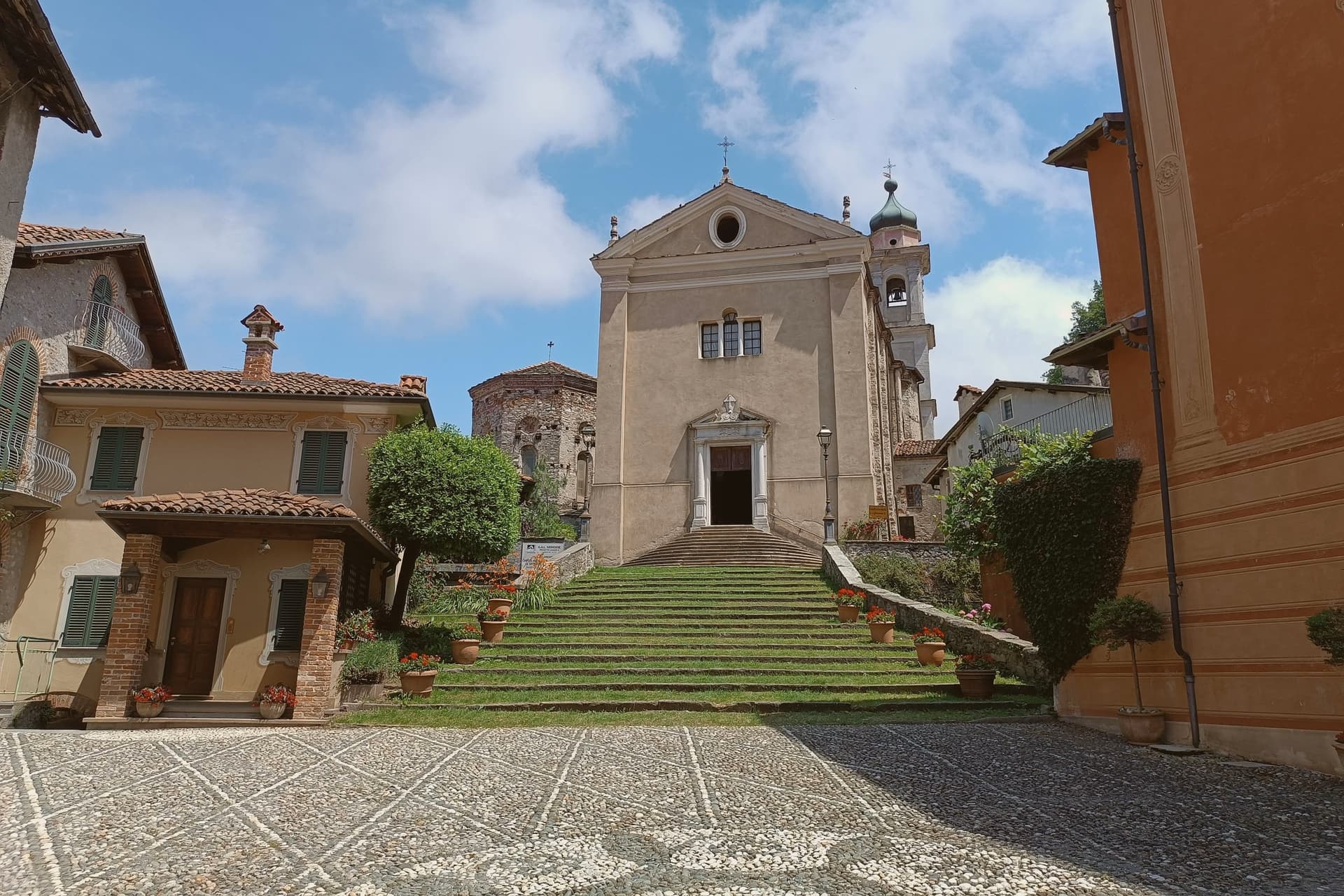
Why visit Garessio
Garessio sits in the upper Tanaro valley, on the watershed where Piemonte meets Liguria. The town is built across four historic quarters, Borgo Maggiore, Borgo Ponte, Borgo Poggiolo, and the borgo that gives its name to the hillside sanctuary and spring above it, each with its own piazza and parish.
The arrangement follows the old traffic of the salt road: Mediterranean salt came up over the Ligurian Alps from Albenga, was repacked in the fortified core, and continued north toward Piemonte and the Po valley. The Savoy family later kept a hunting lodge on the wooded slopes above town, a former Carthusian charterhouse turned retreat, showing a second life for the valley once trade had moved on.
A town built to move salt and later chosen for a royal retreat and a bottling brand: the same slopes have been worked, defended, and rested in by turns, without ever losing the shape of the four quarters that founded it.
What to see in Garessio
- Borgo Maggiore. The medieval core, fortified around 1100 as a ricetto, with three surviving gates, Porta Rose, Porta Jhape, and Porta Liazoliorum, and remnants of the defensive walls.
- Reggia di Valcasotto. Former Carthusian charterhouse converted to a Savoy hunting lodge in the nineteenth century, on the wooded slopes above the town.
- Santuario di Valsorda. Hillside sanctuary above Borgo Valsorda, the town's pilgrimage site, with views over the Tanaro valley.
How to get to Garessio
There is a railway station in the town, so you can arrive without a car and never need one while you are here. Torino is roughly 95 minutes away by road.
Our tip
May through October is the open season. Spring brings the Tanaro running full and the chestnut woods turning green; September and October are dry, with the salt-road footpaths at their clearest. July and August are warm but never coastal-hot at 621 meters; the river keeps the valley cool at night. Cheers Music & Beer Festival falls in August.
Ornavasso
Why visit Ornavasso
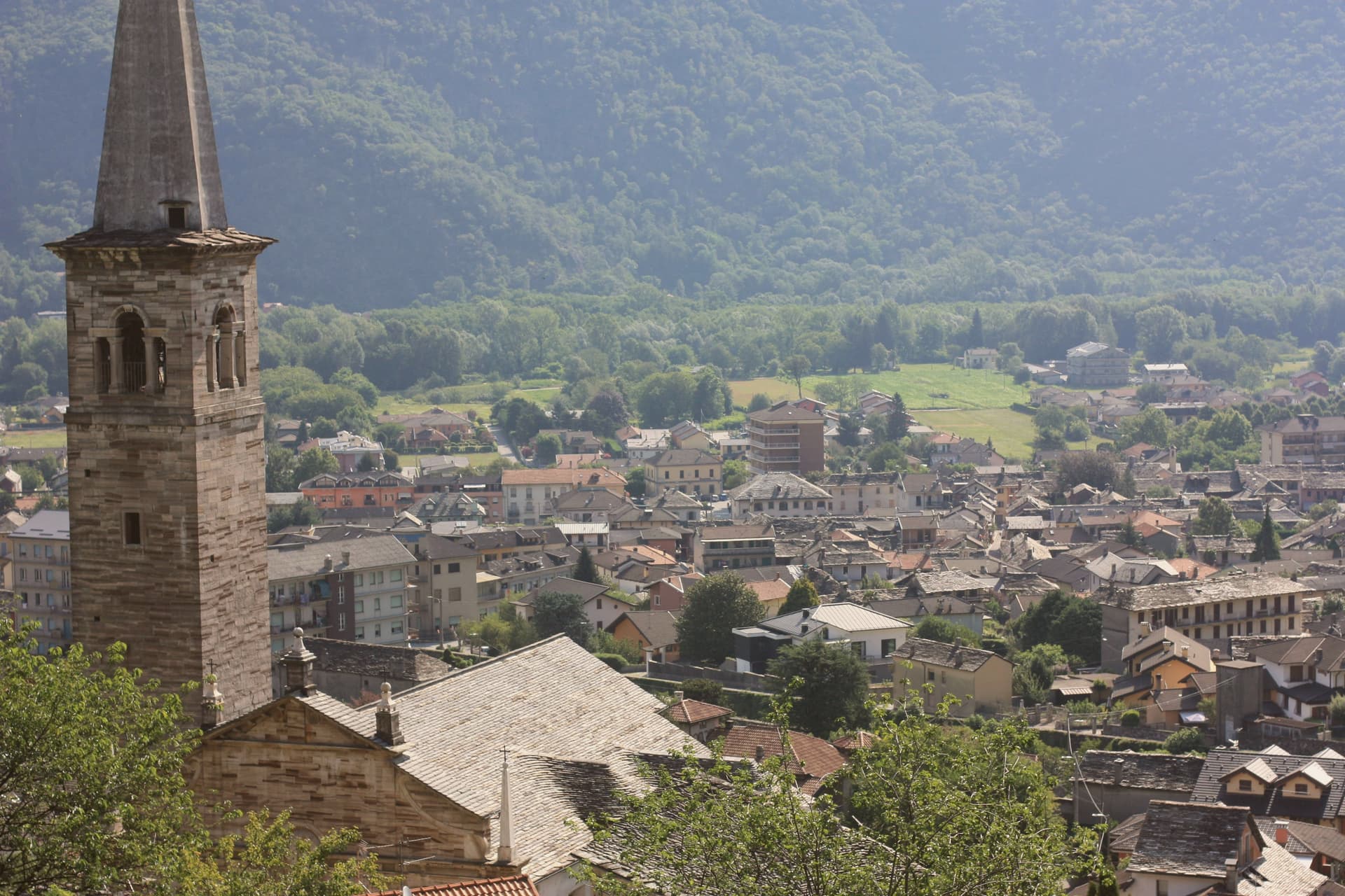
Ornavasso sits on the Toce river just upstream from Gravellona, where the valley narrows toward the southern threshold of the Val Grande. The quarries worked the right bank of the Ossola valley opposite Candoglia, and their stone traveled well beyond the commune: besides the Milan cathedral, it went into the facade of the Certosa di Pavia and the Octagon of the Duomo di Pavia, a supply line running from the fourteenth century onward.
The town's frazione, Migiandone, formed part of the same Walser settlement, colonists from the Simplon who kept a German dialect alive here into the late nineteenth century, longer than in any Walser community further up the Ossola. The ground beneath the town has its own older history: two pre-Roman necropolises, Celtic and Italic, with burials spanning the second century BC to the first century AD.
Above the centro, the devotional life of the upper Toce climbed the hillside, and in 1944 that same high ground sheltered soldiers and then partisans of the Valtoce division, in the brief Allied-recognised partisan state that held the upper valley that year. A quarry town, a language outpost, and a wartime redoubt turn out to be the same few square kilometers, stacked in time rather than spread across it.
What to see in Ornavasso
- Santuario della Madonna del Boden. Sanctuary above the town, standing 475 meters over the centro, reached by a climb that has drawn devotion from the surrounding valley since it was built.
- Santuario della Madonna della Guardia. Hilltop sanctuary that housed Italian army troops and then partisans during the brief Allied-recognised partisan state of autumn 1944.
- Cave di marmo. Quarries on the right bank of the Toce, still legible in the rock face, the source of stone for both the Duomo di Milano and the Arco della Pace.
How to get to Ornavasso
Novara is roughly 77 minutes away by road.
Our tip
April through June brings the Toce down high and clean, the chestnut and beech woods on the marble slopes filling in. July and August are warm and busy with Val Grande trekkers entering through Migiandone; the centro is quieter than Lake Maggiore but the trails fill on weekends. September and October are the strongest months: clear light on the marble quarries, the Boden sanctuary backlit at dusk, and the Val Grande in its autumn copper.
Laveno-Mombello
Why visit Laveno-Mombello
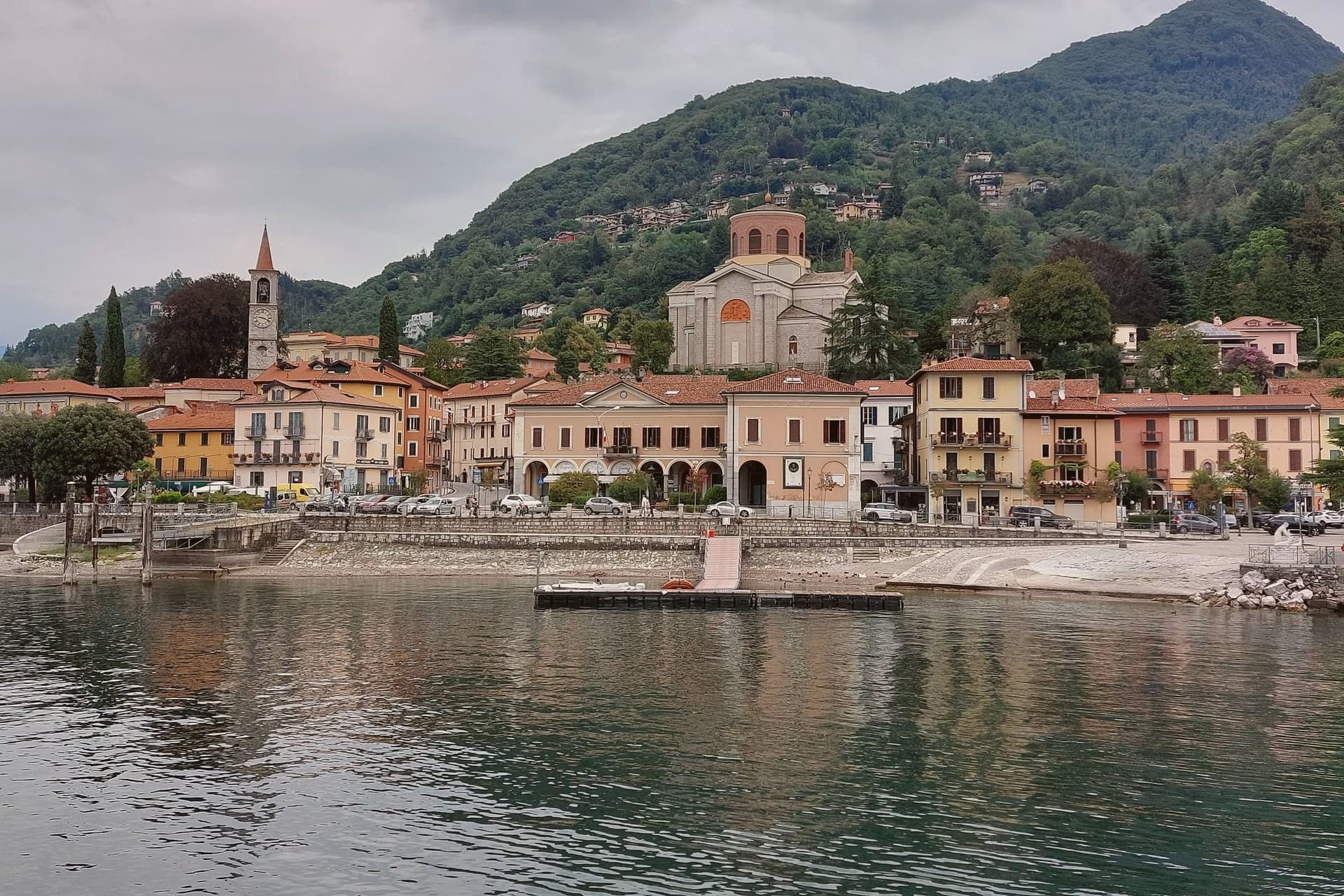
Laveno-Mombello sits on Lake Maggiore's eastern shore in the province of Varese, where a limestone wall drops directly to the water at the town's back. The ferry here crosses to Verbania and the Borromean Islands on the opposite shore, making the town as much a hinge point between Lombardia and Piemonte as a destination in itself.
Cerro, the lakefront hamlet folded into the town, kept the workshops after the ceramics factories closed in the 1990s, and its Palazzo Perabò now holds the museum that charts that industry from 1856 forward. South along the shore, a fifteen-minute drive reaches the monastery built into the cliff face, reachable by stairs, lift or boat where the road does not reach directly.
The town's shape follows the lake and the rock in equal measure: industry and transit at the shoreline, the mountain rising straight behind it, and the monastery holding on to the cliff a short way south as if the same geology that made Laveno a port also made it a place for building into stone.
La Tavola have been named by a guide.
What to see in Laveno-Mombello
- MIDeC – Museo Internazionale Design Ceramico. Ceramics design museum in the sixteenth-century Palazzo Perabò at Cerro, covering Laveno production from 1856 to the 1990s.
- Sasso del Ferro. Limestone summit reached by the bucket funicular, with a terrace looking across Lake Maggiore to Lago d'Orta and the southern Alps.
- Santa Caterina del Sasso. Fourteenth-century monastery clinging to a cliff above Lake Maggiore, fifteen minutes south, reached by stairs, lift or boat.
How to get to Laveno-Mombello
There is a railway station in the town, so you can arrive without a car and never need one while you are here. Novara is roughly 74 minutes away by road.
Our tip
April through October covers the working calendar. The Sasso del Ferro funicular runs most days from spring through autumn, weather permitting, and is unreliable in winter. May, June, September and October are the calmest weeks on the eastern shore.
Acqui Terme
Why visit Acqui Terme
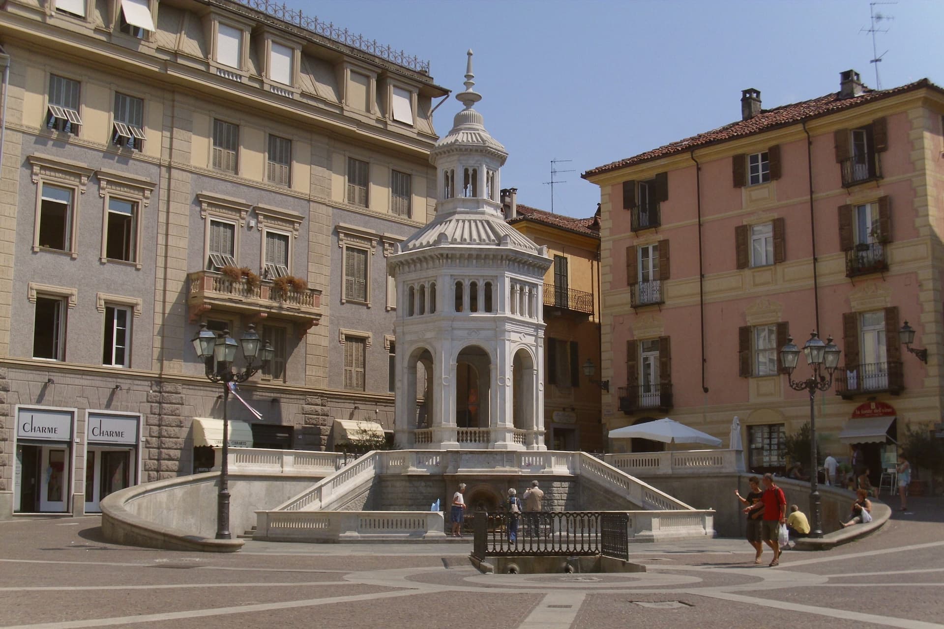
Acqui Terme sits fifty kilometers north of Genova, in the southern Monferrato hills, on the Bormida river. The Romans built their settlement here around hot sulphur springs that Pliny the Elder rated among the best in the empire, and the town's shape still follows that founding logic: baths and spring at the center, the aqueduct running out to the valley, the castle set above on higher ground where the Marquises of Monferrato later took the high point for defense.
The old town gathers close around the piazza where the water surfaces; the castle and its museum sit apart and above, holding what was dug up from the baths, theatre and amphitheatre below. The surrounding hills, meanwhile, grow the grapes for Brachetto d'Acqui DOCG, a low-alcohol sparkling red, and the town holds three separate designations at once: Spighe Verdi, Comuni Termali, Città del Vino.
The thermal trade runs year-round while the wine and the hills set the pace for everything else, so the town reads as two economies sharing one square: water pulled from the ground below, and wine brought down from the slopes above.
Il Moncalvo have been named by a guide.
What to see in Acqui Terme
- Acquedotto Romano. The structure originally carried water 13 km from the Erro stream to feed the baths of Aquae Statiellae, and still spans the valley floor intact.
- La Bollente. Octagonal marble pavilion designed by Giovanni Ceruti, its columns framing the steam that rises off the water even in the middle of the piazza.
- Duomo di Santa Maria Assunta. Romanesque cathedral built on the Latin cross plan over an earlier 10th-century church, consecrated by Bishop Guido.
How to get to Acqui Terme
There is a railway station in the town, so you can arrive without a car and never need one while you are here. Genova is roughly 68 minutes away by road.
Our tip
Acqui Terme runs on a thermal calendar, which means almost no closed season. The spa hotels operate through the cold months and the baths fill more reliably in November than in August. April through June is the gentle window: green Monferrato hills, mild evenings, the Bollente piazza busy without the August press. Mercatino degli Sgaientò falls in August.
Casale Monferrato
Why visit Casale Monferrato
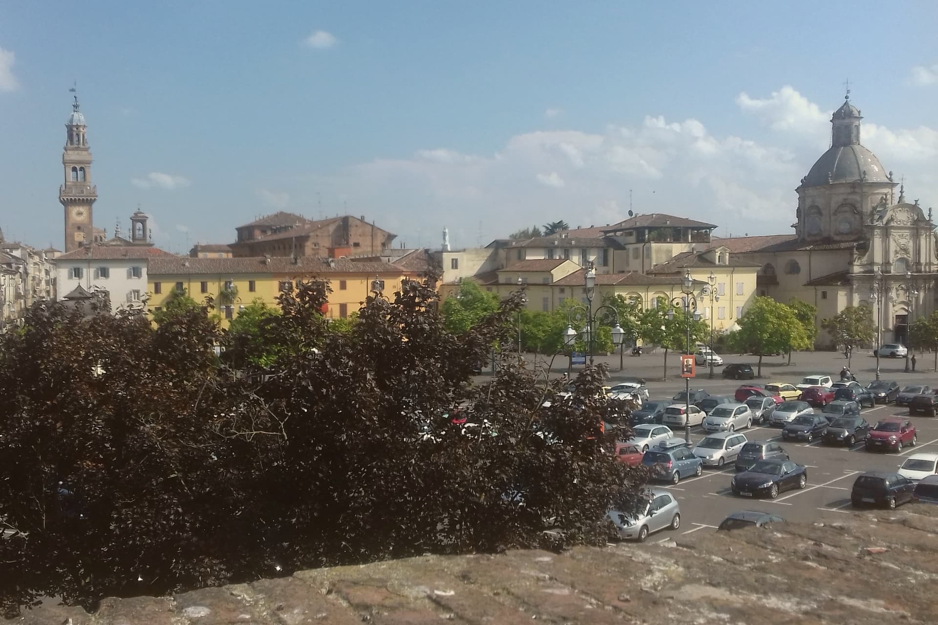
Casale Monferrato sits at 116 meters on the right bank of the Po, sixty kilometers east of Torino, at the foot of the Monferrato hills. Casale fell to the Marquess of Montferrat in 1292 and rose as capital of the Marchesato in the fifteenth and sixteenth centuries, on the strategic edge of the Po Valley.
The Duomo di Sant'Evasio is its oldest stone: consecrated on January 7, 1107 by Pope Paschal II on the site of a Roman temple to Jupiter and a Liutprandian-era church to Saint Lawrence, the basilica is one of the most important Romanesque-Lombard cathedrals in Piedmont, with five naves and a matroneum of trifore and quadrifore galleries. The Castello dei Paleologi, raised in 1352 by Giovanni II Paleologo, runs an asymmetric hexagonal plan with circular corner towers and a dry moat.
The Sinagoga, completed in 1595 in the old Jewish quarter, holds a gilded Piedmontese Baroque interior and a museum of Jewish history. The town is also the historic capital of Italian cement and Krumiri biscuits.
Osteria Bar Sport, Accademia Ristorante, Faletta 1881 and 1 more have been named by a guide.
What to see in Casale Monferrato
- Duomo di Sant'Evasio. Romanesque-Lombard cathedral consecrated 1107 by Pope Paschal II, with five naves, barrel and cross vaults, and a matroneum of trifore galleries.
- Castello dei Paleologi. 1352 castle by Giovanni II Paleologo, asymmetric hexagonal plan with circular corner towers and a dry moat, now used for exhibitions.
- Sinagoga di Casale Monferrato. 1595 synagogue in the old Jewish quarter, gilded Piedmontese Baroque interior, restored 1968 with a Jewish history museum on the upper floor.
How to get to Casale Monferrato
There is a railway station in the town, so you can arrive without a car and never need one while you are here. Novara is roughly 41 minutes away by road.
Our tip
April through June and September into October are the months Casale opens up. The Po valley clears of winter fog, the Monferrato vineyards leaf or harvest, and the Duomo's matroneum holds light it does not get in winter. July and August are hot and still on the river plain; the Paleologi castle's underground passages and the synagogue's gilded hall hold cool, but most days the town empties between two and five. Mercatino dell'antiquariato di Casale Monferrato falls in August.