
The 9 best hidden towns you can reach by train that eat well in Puglia
Puglia builds in limestone and tufa, pale stone that holds the heat all afternoon and gives it back at dusk, and the towns stack it into low white lanes that funnel wind off the Adriatic. The food is agricultural before it is anything else: orecchiette with cime di rapa, fava purée with wild chicory, raw prawns from the Gulf of Taranto, bread from Altamura's wheat, olive oil pressed from trees old enough to be listed. Spring brings artichokes and the first broad beans, late summer the tomatoes hung in bunches to dry through winter. Regional trains stitch much of it together, from the state line along the coast to the Ferrovie del Sud Est running inland through vineyards and dry-stone walls.
In high season most of the region's visitors funnel into Polignano a Mare and Lecce, and the reasons are honest ones: a swimming cove cut into a cliff, a city of baroque façades the colour of butter. Both are well served by train, which is part of why the platforms fill. By July the historic centres move at the pace of a queue, restaurant tables need booking days ahead, and the shortest walk turns into a slalom.
The same railway keeps going. It carries on into the Murgia and the Valle d'Itria, down the Salento peninsula towards the Ionian, and north to the Gargano's oak forests and citrus gardens, and the stations along the way serve towns where fewer people get off. The towns here are the smaller ones on those lines, each with a kitchen a dining guide thought worth naming, and each reachable without hiring a car.
Of the 59 communes we have mapped in Puglia, 24 qualify as towns you can reach by train that eat well: we have confirmed each is reachable without a car, and a dining guide has named a table in each. This list is the hidden ones, 9 in all, ordered smallest first. The smallest, Giurdignano, has 1,947 residents.
Two more lists worth reading alongside this one: The best hidden hill towns that eat well in Puglia and The best hidden olive oil towns that eat well in Puglia.
Giurdignano
Why visit Giurdignano
Giurdignano sits inland from Otranto on the limestone shelf of southern Salento, at 78 meters, four kilometers from the Adriatic. The village has fewer than two thousand residents and the highest concentration of megalithic monuments in Italy.
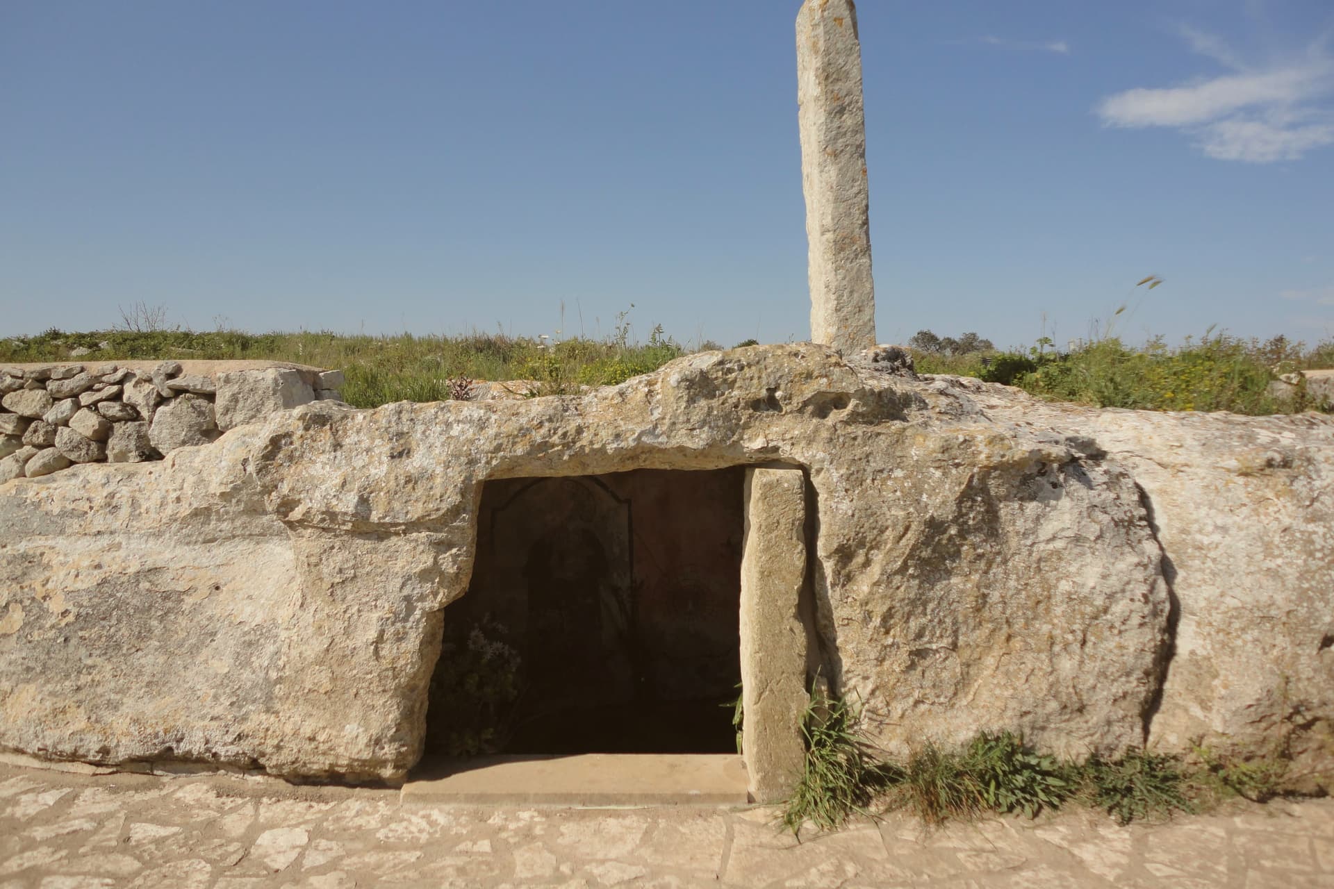
Nineteen menhirs stand in the countryside around it, the tallest the Menhir San Vincenzo at over three and a half meters; several were Christianized in the early medieval period, including the Menhir San Paolo, set beside a Byzantine rupestrian crypt and pierced at the top for an iron cross. The dolmens nearby are likely from the fifth or fourth millennium BC.
Roman imperial necropoleis from the second and third centuries AD have surfaced in the Cantalupi locality. The borgo joined the Città del Tartufo network for the Salento white truffle found in the surrounding macchia and olive groves.
Giurdignano runs as a quiet base for the Otranto coast, four kilometers away.
Casa Borgia have been named by a guide.
What to see in Giurdignano
- Menhir San Paolo. Christianized prehistoric standing stone beside a Byzantine rupestrian crypt, pierced at the top in the early medieval period to hold an iron cross.
- Menhir San Vincenzo. The tallest menhir in the Lecce province at over 3.5 meters, one of the nineteen prehistoric standing stones in the territory of Giurdignano.
- Dolmen Stabile. Megalithic funerary chamber on the road to Uggiano, three slabs and a capstone, dated to the fifth or fourth millennium BC.
How to get to Giurdignano
There is a railway station in the town, so you can arrive without a car and never need one while you are here. Taranto is roughly 128 minutes away by road.
Our tip
April through June is mild on this stretch of southern Salento, the countryside in flower and the menhir paths walkable without sweat. July and August push past thirty-five degrees and most travelers move on to the Otranto seafront four kilometers east; the borgo itself stays quiet. September and October cool back down for the olive harvest and the white-truffle season starts in the surrounding macchia.
Bovino
Why visit Bovino
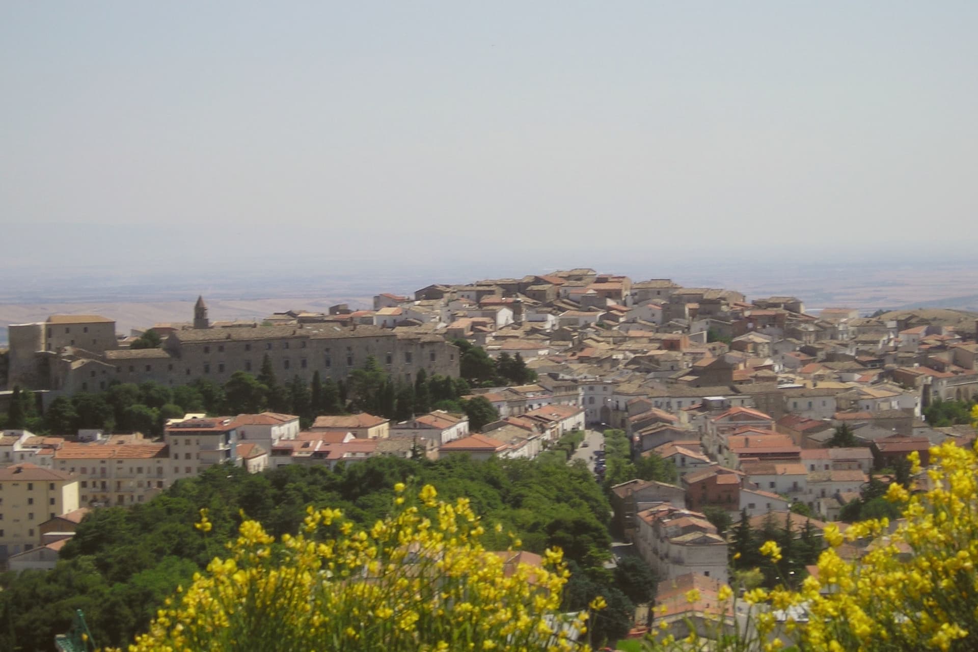
Bovino sits at 646 meters on a terrace of the Monti Dauni above the Cervaro valley, thirty-five kilometers southwest of Foggia. The Roman name Vibinum is recorded by Pliny and Polybius; in 323 BC the town fought the Samnite Wars on the Roman side.
The Norman count Drogo built the castle in the eleventh century, Frederick II expanded it in the thirteenth, and the Guevara dukes turned it into a residential palace in the seventeenth century, inhabited by the family until 1961. The coffered ceilings and the hanging garden hosted Torquato Tasso, Giovan Battista Marino, Maria Theresa of Austria, and Pope Benedict XIII.
The concattedrale of Santa Maria Assunta, originally built in 1231 in Apulian Romanesque style, was destroyed by the 1930 Irpinia earthquake and reconsecrated in 1936. Eight hundred sculpted stone portals across the centro storico are the work of local masters; the town carries both Borghi più belli and Bandiera Arancione signals.
Agriturismo Piana della Mandrie have been named by a guide.
What to see in Bovino
- Castello Ducale (Palazzo dei Guevara). Norman castle built by Count Drogo, expanded by Frederick II, turned into a Guevara ducal palace in the seventeenth century and inhabited until 1961.
- Concattedrale di Santa Maria Assunta. Romanesque cathedral of 1231, destroyed by the 1930 Irpinia earthquake and reconsecrated in 1936, co-cathedral of the Archdiocese of Foggia-Bovino.
- Centro storico. Medieval hilltop village with eight hundred sculpted stone portals carved by local masters, ringed by the surviving walls of the castrum.
How to get to Bovino
There is a railway station in the town, so you can arrive without a car and never need one while you are here. Foggia is roughly 34 minutes away by road.
Our tip
May through October is the workable season at 646 meters. June through August stay around twenty-six to twenty-eight degrees on the ridge while Foggia bakes thirty kilometers below. September is the start of the chestnut and olive work.
Otranto
Why visit Otranto
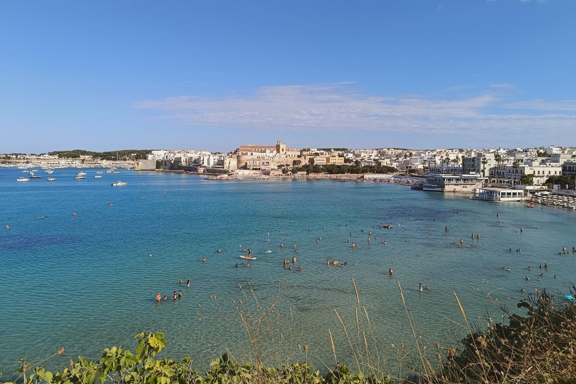
Otranto sits at sea level on a small promontory thirty kilometers southeast of Lecce, the easternmost city of Italy and the closest mainland point to Albania across the eighty-kilometer Strait of Otranto. The Cattedrale di Santa Maria Annunziata, consecrated in 1088, holds a mosaic floor laid between 1163 and 1165 by the monk Pantaleone for Archbishop Gionata.
About 800,000 tesserae across the three naves depict Adam and Eve, Noah, the Tower of Babel and a Tree of Life with biblical, classical and chivalric figures: Alexander the Great, Arthur, the months of the year. On 14 August 1480 an Ottoman force under Gedik Ahmed Pasha took the city; 813 inhabitants who refused to convert were beheaded on the Colle della Minerva and their bones are now in the cathedral, in seven glass-fronted recesses.
Pope Francis canonized them in 2013. The Castello Aragonese, raised by Ferdinand I of Aragon between 1485 and 1498, is the response: a five-sided fortress with a moat, built specifically to prevent a second sack.
Retrogusto, L' Altro Baffo, Umberto 1972 have been named by a guide.
What to see in Otranto
- Cattedrale di Santa Maria Annunziata. Norman cathedral consecrated in 1088, with Pantaleone's mosaic floor of 1163-1165 and the relics of the 813 martyrs of 1480 in seven glass recesses.
- Castello Aragonese. Five-sided Aragonese fortress raised 1485-1498 by Ferdinand I after the Ottoman sack, irregular plan with moat running the full perimeter.
- Chiesa di San Pietro. Byzantine cross-plan church in the centro storico, ninth-tenth century, with three apses and frescoes from the tenth through fifteenth centuries.
How to get to Otranto
There is a railway station in the town, so you can arrive without a car and never need one while you are here. Taranto is roughly 137 minutes away by road.
Our tip
May through September is the working coastal season, Adriatic water warm enough to swim by mid-May and the centro storico operational into the evening. July and August fill the small headland with day-trippers from across Salento and beyond; weekends in August are shoulder to shoulder along the Lungomare and the cathedral fills with queues. June and September are the sane choices, mild evenings and the same water without the crush.
Corigliano d'Otranto
Why visit Corigliano d'Otranto
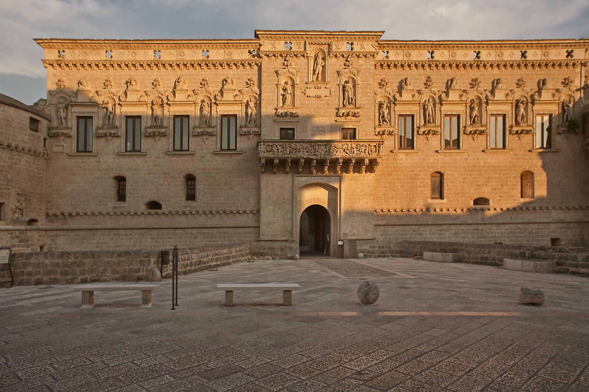
Corigliano d'Otranto sits at 95 meters on the Salento plateau, twenty-five kilometers south of Lecce. The territory carries one of the densest concentrations of megalithic remains in the area, and the town itself grew around a medieval fort that passed to the de' Monti family, a house of French origin, in 1465.
The old town organizes itself around that fort: the centro storico's lanes and baroque palazzi in pale Lecce stone lead to the fort on one side and the parish church on the other, the two structures facing each other as the twin poles of the historic core. Griko street signs sit alongside the Italian ones throughout, a language surviving in the same streets where Bronze Age dolmens and the sixteenth-century rebuilding mark two very different periods of settlement.
The town reads as a place where deep prehistory, a fortified medieval past, and a living minority language occupy the same small footprint rather than separate chapters of its history.
Sinòdia have been named by a guide.
What to see in Corigliano d'Otranto
- Castello de' Monti. The fort stands on medieval foundations acquired by the de' Monti family, who gave it a defensive perimeter and deep moat before the Lecce-stone rebuilding. It anchors the centro storico and faces the parish church across the old town.
- Chiesa di San Nicola Vescovo. Built on the site of an earlier chapel, the church stands opposite the castle as the religious anchor of the centro storico.
- Dolmen Caroppo I e II. The two tombs sit two meters apart on the same rock bank just outside town, found by Oreste Caroppo, part of one of the densest concentrations of megalithic remains in Salento.
How to get to Corigliano d'Otranto
There is a railway station in the town, so you can arrive without a car and never need one while you are here. Taranto is roughly 116 minutes away by road.
Our tip
April through June and September through October are the months the Salento plateau is dry, mild, and the centro storico walkable in afternoon light. July and August reach the high thirties and the Lecce-stone walls hold heat well into the evening; the streets empty between two and six. The Festa di San Nicola in early December and the Notte della Taranta tour stop in August are the year's civic peaks.
Vico del Gargano
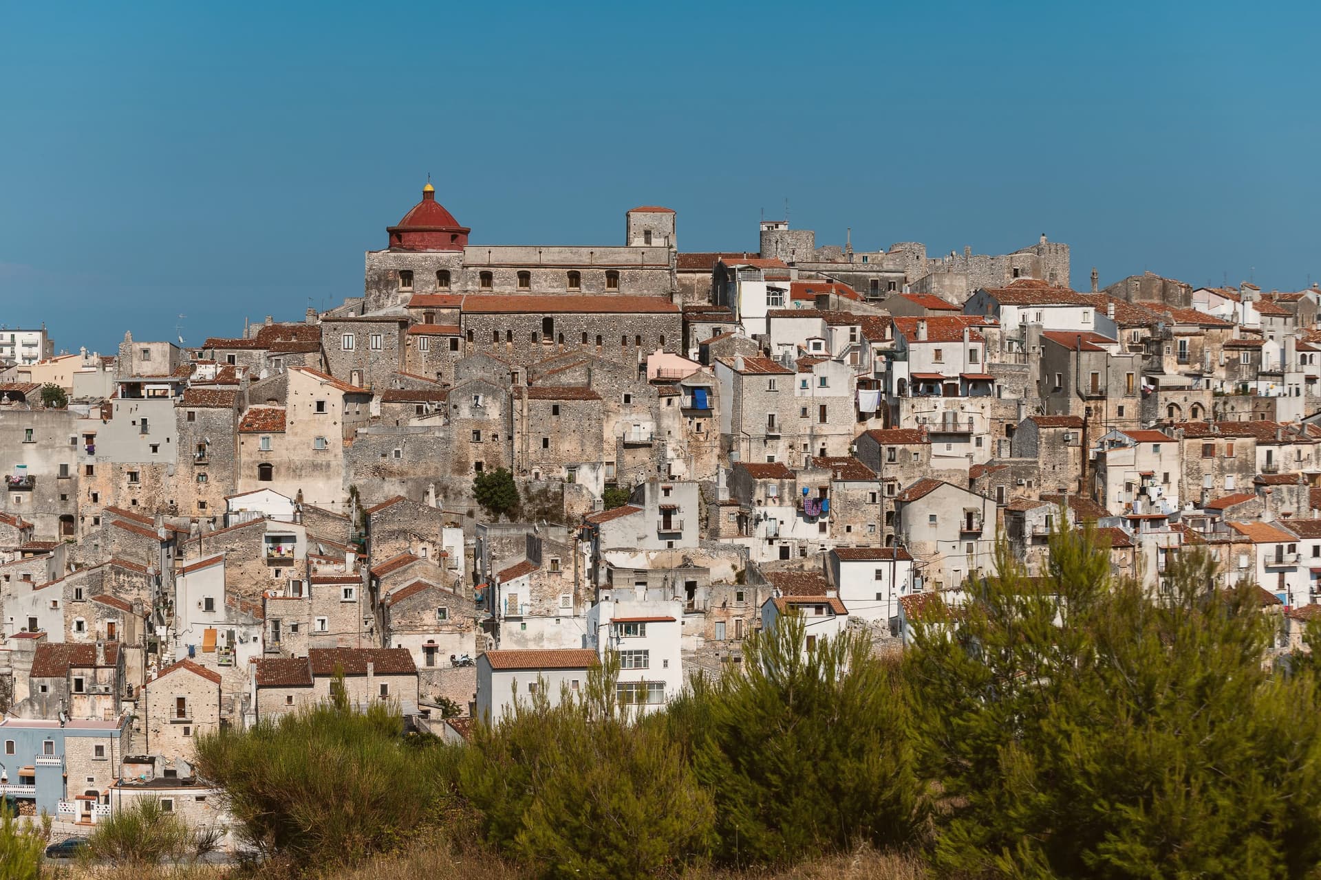
Why visit Vico del Gargano
The town sits at 445 meters on a rocky promontory, with the territory falling from the 782-meter heights of the forest above to the beaches of the coastal frazioni below. The first urban core, called Vicus, was founded around 970 by Sueripolo of the Slavonians on land granted by Byzantine authorities, the seed from which the hill town and its later defenses grew.
The upper town, walled and towered, holds the historic center and its churches close around the castle, while the citrus terraces step down from that core toward the sea, and the coastal frazioni mark where the descent ends at the Adriatic. Inland forest, hill town, and coast form one continuous drop in elevation rather than three separate places.
What holds this together is the shape of the ground itself: a settlement founded on a promontory has simply grown downward over the centuries, from Byzantine grant to Norman wall to citrus terrace to shoreline, each layer sitting on the one before it.
Eco del Mare have been named by a guide.
What to see in Vico del Gargano
- Castello Normanno-Svevo. Eleventh-century Norman castle enlarged in 1240 by Frederick II and again in 1292, the anchor of the medieval defensive system of twenty towers and walls.
- Centro storico e Vicolo del Bacio. Medieval old town of about thirteen churches and chapels, with the Kiss Alley, a passage so narrow that walking it touching is the local prescription for lasting love. The survival of this core and the density of the olive mills below it earned the town a place among the Borghi più belli d'Italia.
- Foresta Umbra. Beech and oak ancient forest of Gargano National Park, reaching 830 meters within the municipal territory, with trails to centuries-old turkey oaks.
How to get to Vico del Gargano
There is a railway station in the town, so you can arrive without a car and never need one while you are here. Foggia is roughly 99 minutes away by road.
Our tip
April through June and September through October are the months Vico is at its best: the citrus groves in flower or in fruit, the Foresta Umbra in green or autumn rust, and the centro storico mild at 445 meters while the coast below stays swimmable. July and August are hot on the coast and busy at San Menaio; the centro keeps a few degrees cooler than the beach. The Saint Valentine feast on February 14 turns the village into a pilgrimage and a wedding stage.
Minervino Murge
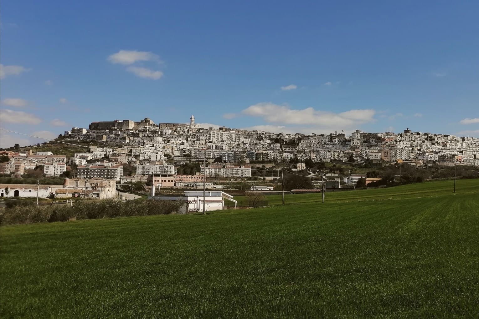
Why visit Minervino Murge
The town is built on two hills at the western edge of the Murgia plateau, where the limestone tableland gives out and the ground drops toward lower country on three sides. That break is what gives the ridge its long view and its nickname: to the east the eye crosses Murgia limestone toward the Gargano and the Adriatic, to the west it crosses cultivated fields into Basilicata, and to the north it runs the length of the Ofanto valley.
The old town sits above this drop, castle and tower on the high ground, cathedral below, the settlement organized around the same ridge that draws the view. Olive oil, almonds and grain define the rural economy beyond the walls, the plateau put to farming where it is not left to steppe grass and karst.
A ridge town, in other words, whose whole character, defensive site, pilgrimage cave, farmed hinterland, follows from the one geological fact of where the plateau ends.
La Tradizione - Cucina Casalinga, Masseria Barbera, A Sud dell'Anima have been named by a guide.
What to see in Minervino Murge
- Castello Normanno-Svevo. Norman fortress remodeled in the baronial period, with surviving towers and bastions on the high ridge above the old town.
- Torre di Pirro del Balzo. Fifteenth-century tower built between 1460 and 1490 when Minervino came to Pirro del Balzo as part of Maria Donata's dowry.
- Grotta di San Michele. Cave formed roughly two million years ago, reached through the karst rather than built, and still kept as a place of pilgrimage rather than display.
How to get to Minervino Murge
There is a railway station in the town, so you can arrive without a car and never need one while you are here. Foggia is roughly 62 minutes away by road.
Our tip
April through June and September through October are the months the Alta Murgia plateau runs best. The wildflower steppe peaks in May, almond blossom comes earlier in February, and the Ofanto valley below stays mild through autumn. July and August push past thirty-five degrees on the limestone with little shade; the centro storico empties between two and five and the panoramic belvedere is best at dawn or dusk.
Alberobello
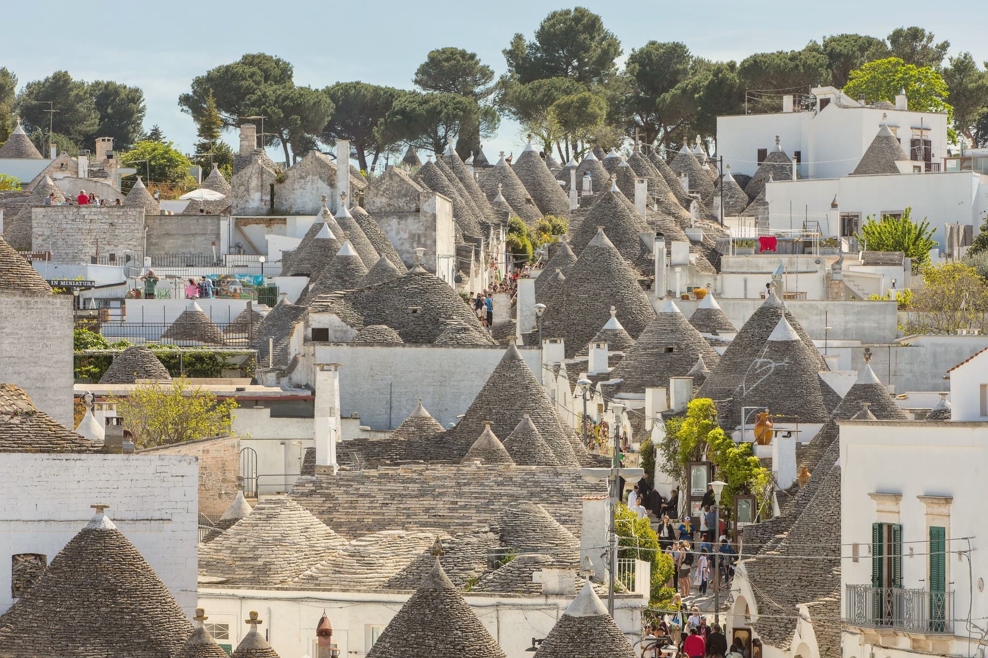
Why visit Alberobello
Alberobello sits at 402 meters in the Valle d'Itria, forty-five kilometers southeast of Bari. Two quarters of the town, Rione Monti and Aja Piccola, hold more than 1,500 trulli: limestone cones built from corbelled drystone, with conical or pyramidal roofs piled course by course without mortar.
The technique is prehistoric and still in use across the Murge, but nowhere else is the density and preservation what it is here. The Counts of Conversano enforced drystone construction on their tenant farmers to dodge a Spanish viceroy's tax on permanent settlements: a building that could be dismantled in an afternoon did not count as a town.
UNESCO listed the trulli in 1996. Some are houses, some are shops, some are inhabited by the same families that built them.
The Trullo Sovrano, the only two-storey trullo, was built around 1750 and now functions as a small museum.
Evo Ristorante have been named by a guide.
What to see in Alberobello
- Rione Monti. The larger of the two trulli quarters, a thousand cones running down the hillside, mostly converted to shops and accommodation.
- Aja Piccola. The smaller residential quarter, about four hundred trulli, still occupied as primary housing and quieter than Rione Monti.
- Trullo Sovrano. The only two-storey trullo in town, built around 1750 by the Perta family, now a small museum of trullo construction and daily life.
How to get to Alberobello
There is a railway station in the town, so you can arrive without a car and never need one while you are here. Taranto is roughly 56 minutes away by road.
Our tip
April through June and September through October are the months the Itria valley is green and the trulli are walkable without sweat. July and August push past thirty-three degrees and the Rione Monti fills with day-trippers from the coast; by ten in the morning the main streets are shoulder to shoulder. Late afternoon and after dusk are the times to walk, when the cones cast long shadows and the crowds thin.
Ugento
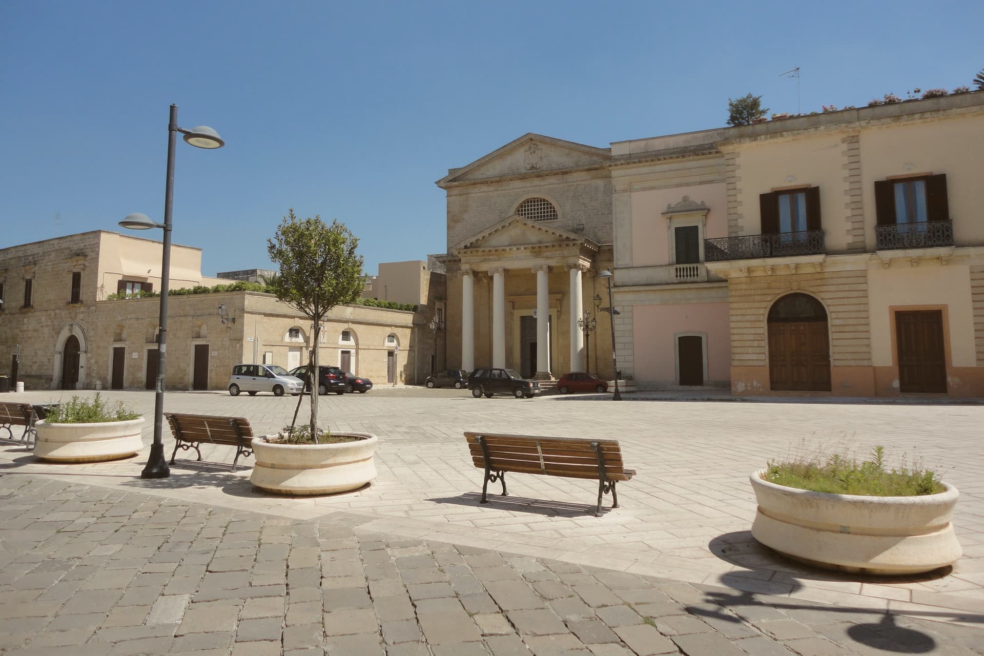
Why visit Ugento
Ugento sits five kilometers inland from the Ionian, its centro built directly over the Messapian city of Ozan, the name recorded on the fourth-century-BC Soleto Map. The walls of that older city and the chamber tombs of its necropolis mark the boundary between the modern town and the ground it grew from, remnants of the civilization that held the lower peninsula between the seventh and third centuries BC.
The castle at the center of town began as a Norman motte-and-bailey raised on those same Messapian foundations, later rebuilt as a Baroque palazzo by a family who frescoed its grand salons to record their own history. A bronze Zeus, cast around 530 BC and found by chance in a cellar in 1961, is now kept in Taranto, with only a copy remaining locally, so the town's oldest and most valuable object is known here mostly by its absence.
Inland, the layered town of walls, tombs, castle and cathedral holds the historical weight; on the coast, the frazioni carry the summer crowds. The two halves of Ugento, one built on the memory of Ozan and one facing the sea, run on entirely different clocks.
La Bottega dei Sapori, Farnari Unconventional Locanda have been named by a guide.
What to see in Ugento
- Castello di Ugento. Norman fort rebuilt as a Baroque palazzo by the d'Amore family in the 1690s, with first-floor grand salons frescoed in 1694 to celebrate family history.
- Nuovo Museo Archeologico. Town archaeological museum displaying Messapian finds, the Cozza Petrosa necropolis material and a bronze copy of the Zeus of Ugento.
- Mura Messapiche e Necropoli di Cozza Petrosa. Walls and the trullo-shaped chamber tombs of the necropolis sit at the edge of the centro, the oldest layer of the city built over by the modern town.
How to get to Ugento
There is a railway station in the town, so you can arrive without a car and never need one while you are here. Taranto is roughly 129 minutes away by road.
Our tip
May, June, September and the first half of October are the gentle months on the Ionian Salento: warm sea, cool evenings, the centro and the coast usable in the same day. July and August are dry and very hot, with the Marine packed and the centro storico empty between two and five in the afternoon. The Bandiera Blu beaches at Torre San Giovanni and Lido Marini do most of the August traffic and rates climb accordingly.
Oria
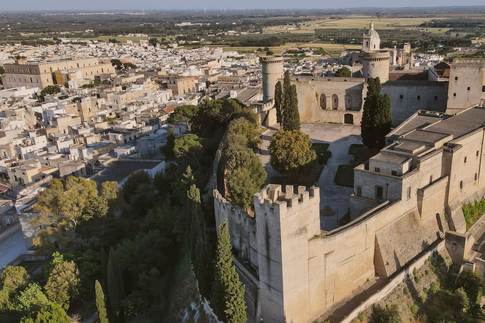
Why visit Oria
Oria sits at 166 meters on a Salento ridge between Taranto and Brindisi, north of Manduria and southeast of the ancient Taras. The town was Hyria, one of the principal Messapian cities, before the Romans absorbed the region.
Frederick II rebuilt the castle on the Messapian acropolis between 1227 and 1233; the triangular plan he chose is unique in southern Italian military architecture, with three towers, the Quadrata (Frederician), the Del Cavaliere and the Del Salto (both Angevin additions). Oria also held one of the oldest Jewish communities in Europe, a study center where philosophy, the Talmud, Greek, Latin, medicine and natural science were taught from the ninth century.
Shefatya ben Amitai and Shabbethai Donnolo, two of the first Hebrew writers native to Europe, both lived and worked here. The Jewish quarter, the Giudecca, still organizes the southern edge of the centro storico.
Osteria Luce, Masseria Palombara, Fuori Porta have been named by a guide.
What to see in Oria
- Castello Svevo di Federico II. Frederician castle of 1227-1233 on the Messapian acropolis, triangular plan with three towers, one Frederician and two Angevin, the town's defining monument.
- Cattedrale di Oria. Eighteenth-century Baroque cathedral raised over earlier medieval foundations, the seat of the diocese of Oria since the Lombard era.
- Giudecca. Old Jewish quarter on the southern flank of the centro storico, organized around the Vico degli Ebrei, a continuous medieval settlement from the ninth century.
How to get to Oria
There is a railway station in the town, so you can arrive without a car and never need one while you are here. Taranto is roughly 46 minutes away by road.
Our tip
April through June and September through October are the Salento interior months: clear light on the castle ridge, mild evenings, olive country in flower or harvest. July and August touch thirty-six degrees on the hilltop and the centro storico empties between two and five; the Corteo Storico di Federico II runs in mid-August anyway and pulls a regional crowd. October is the olive harvest. Palio di Oria falls in July.
More from Anywhere Italy
- The best hidden hill towns that eat well in Puglia
 The best hidden olive oil towns that eat well in Puglia
- The best towns that eat well in the province of Lecce
 The best hidden olive oil towns you can reach by train in Puglia
 The best hidden coastal towns that eat well in Puglia
- The prettiest villages you can reach by train in Puglia