
The best hidden hill towns that eat well in Puglia
Puglia away from the water is a landscape of low limestone ridges, olive groves gone silver in the wind, and towns built white against the heat. The cooking here is inland cooking: lamb and kid roasted in the wood oven, cicorielle and fava purée, orecchiette with turnip tops, burrata eaten the day it is made, bread with a crust the colour of a chestnut. Autumn brings the olive pressing and the new oil, green and peppery, poured over everything. Winter is when the ragù goes on at breakfast and the butchers' fornelli fill with smoke. The houses are stone, thick-walled, cool in August, and the piazzas empty out at two and fill again at seven.
Most visitors to Puglia follow the coast and then cut inland only as far as Ostuni, whose white terraces above the olive plain have become the fixed image of the region. Polignano a Mare and the trulli circuits absorb the rest, and by high summer the parking on the approach roads tells the story before you reach the centre. The restaurants there are good, and they are also booked out by people who arrived on the same bus. It is a reasonable day, but it is everyone else's day too.
The same ridges keep going, north into the Murgia and the Gargano, south into the Salento uplands where Greek is still spoken in a few communes. Those hills carry the same larder, the same ovens, the same habit of eating slowly on a weekday, with far fewer people at the next table. The towns in this list are the inland ones, smaller and further from the coast road, and a dining guide has named a table in each.
Of the 59 communes we have mapped in Puglia, 15 qualify as hill towns that eat well: each is an inland hill settlement, and a dining guide has named a table in each. This list is the hidden ones, 6 in all, ordered smallest first. The smallest, Giurdignano, has 1,947 residents.
Elsewhere in the catalogue: The 9 best hidden towns you can reach by train that eat well in Puglia and The best hidden olive oil towns that eat well in Puglia.
Giurdignano
Why visit Giurdignano
Giurdignano sits inland from Otranto on the limestone shelf of southern Salento, at 78 meters, four kilometers from the Adriatic. The village has fewer than two thousand residents and the highest concentration of megalithic monuments in Italy.
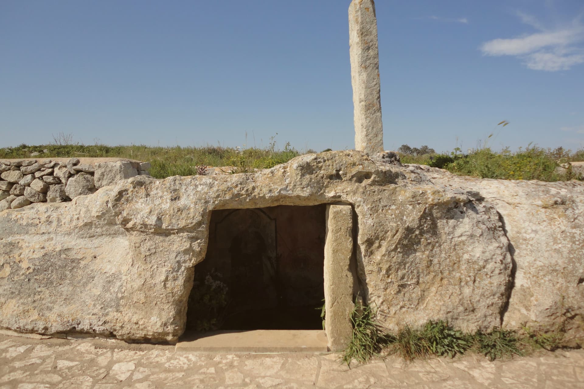
Nineteen menhirs stand in the countryside around it, the tallest the Menhir San Vincenzo at over three and a half meters; several were Christianized in the early medieval period, including the Menhir San Paolo, set beside a Byzantine rupestrian crypt and pierced at the top for an iron cross. The dolmens nearby are likely from the fifth or fourth millennium BC.
Roman imperial necropoleis from the second and third centuries AD have surfaced in the Cantalupi locality. The borgo joined the Città del Tartufo network for the Salento white truffle found in the surrounding macchia and olive groves.
Giurdignano runs as a quiet base for the Otranto coast, four kilometers away.
Casa Borgia have been named by a guide.
What to see in Giurdignano
- Menhir San Paolo. Christianized prehistoric standing stone beside a Byzantine rupestrian crypt, pierced at the top in the early medieval period to hold an iron cross.
- Menhir San Vincenzo. The tallest menhir in the Lecce province at over 3.5 meters, one of the nineteen prehistoric standing stones in the territory of Giurdignano.
- Dolmen Stabile. Megalithic funerary chamber on the road to Uggiano, three slabs and a capstone, dated to the fifth or fourth millennium BC.
How to get to Giurdignano
There is a railway station in the town, so you can arrive without a car and never need one while you are here. Taranto is roughly 128 minutes away by road.
Our tip
April through June is mild on this stretch of southern Salento, the countryside in flower and the menhir paths walkable without sweat. July and August push past thirty-five degrees and most travelers move on to the Otranto seafront four kilometers east; the borgo itself stays quiet. September and October cool back down for the olive harvest and the white-truffle season starts in the surrounding macchia.
Corigliano d'Otranto
Why visit Corigliano d'Otranto
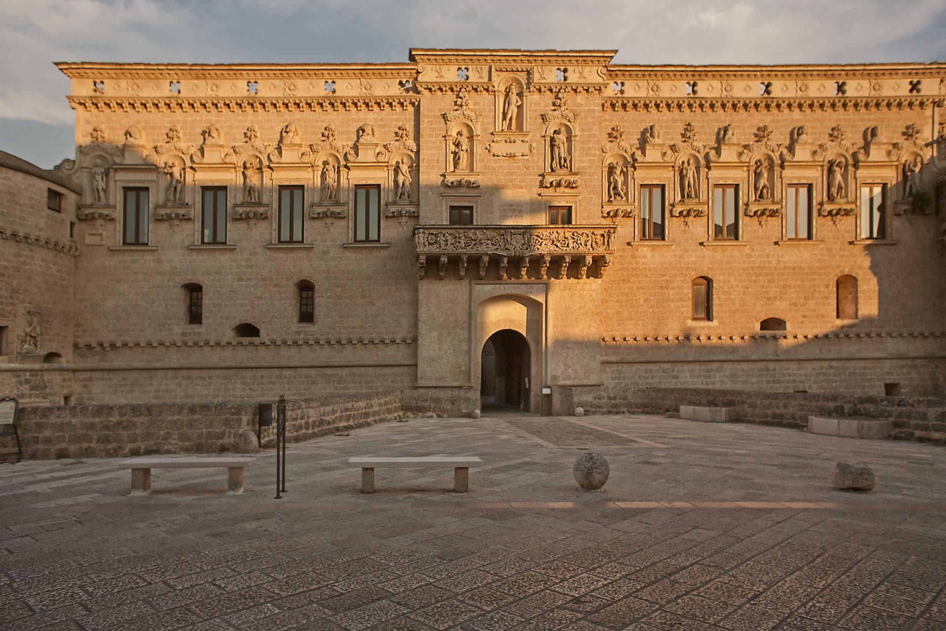
Corigliano d'Otranto sits at 95 meters on the Salento plateau, twenty-five kilometers south of Lecce. The territory carries one of the densest concentrations of megalithic remains in the area, and the town itself grew around a medieval fort that passed to the de' Monti family, a house of French origin, in 1465.
The old town organizes itself around that fort: the centro storico's lanes and baroque palazzi in pale Lecce stone lead to the fort on one side and the parish church on the other, the two structures facing each other as the twin poles of the historic core. Griko street signs sit alongside the Italian ones throughout, a language surviving in the same streets where Bronze Age dolmens and the sixteenth-century rebuilding mark two very different periods of settlement.
The town reads as a place where deep prehistory, a fortified medieval past, and a living minority language occupy the same small footprint rather than separate chapters of its history.
Sinòdia have been named by a guide.
What to see in Corigliano d'Otranto
- Castello de' Monti. The fort stands on medieval foundations acquired by the de' Monti family, who gave it a defensive perimeter and deep moat before the Lecce-stone rebuilding. It anchors the centro storico and faces the parish church across the old town.
- Chiesa di San Nicola Vescovo. Built on the site of an earlier chapel, the church stands opposite the castle as the religious anchor of the centro storico.
- Dolmen Caroppo I e II. The two tombs sit two meters apart on the same rock bank just outside town, found by Oreste Caroppo, part of one of the densest concentrations of megalithic remains in Salento.
How to get to Corigliano d'Otranto
There is a railway station in the town, so you can arrive without a car and never need one while you are here. Taranto is roughly 116 minutes away by road.
Our tip
April through June and September through October are the months the Salento plateau is dry, mild, and the centro storico walkable in afternoon light. July and August reach the high thirties and the Lecce-stone walls hold heat well into the evening; the streets empty between two and six. The Festa di San Nicola in early December and the Notte della Taranta tour stop in August are the year's civic peaks.
Vico del Gargano
Why visit Vico del Gargano
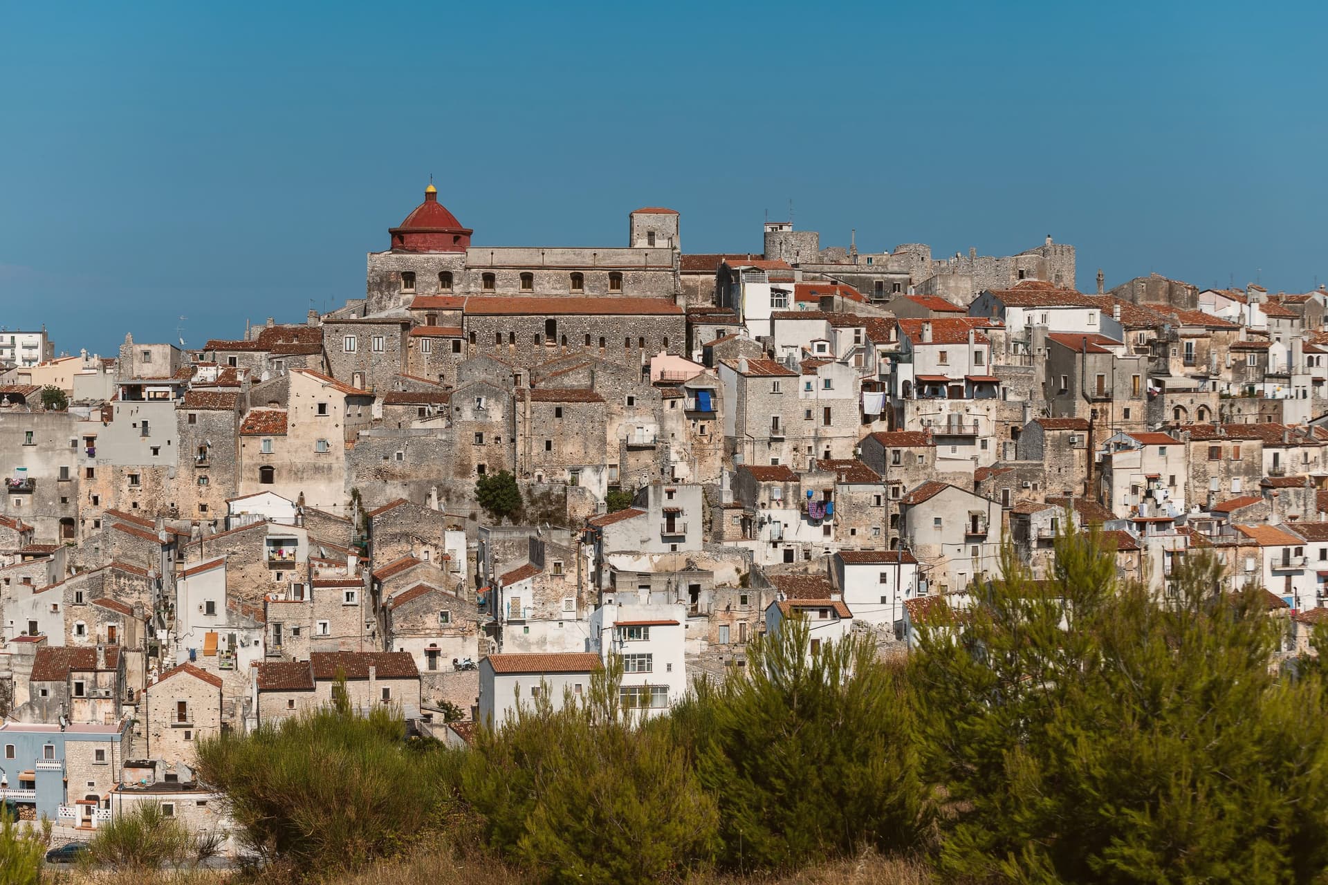
The town sits at 445 meters on a rocky promontory, with the territory falling from the 782-meter heights of the forest above to the beaches of the coastal frazioni below. The first urban core, called Vicus, was founded around 970 by Sueripolo of the Slavonians on land granted by Byzantine authorities, the seed from which the hill town and its later defenses grew.
The upper town, walled and towered, holds the historic center and its churches close around the castle, while the citrus terraces step down from that core toward the sea, and the coastal frazioni mark where the descent ends at the Adriatic. Inland forest, hill town, and coast form one continuous drop in elevation rather than three separate places.
What holds this together is the shape of the ground itself: a settlement founded on a promontory has simply grown downward over the centuries, from Byzantine grant to Norman wall to citrus terrace to shoreline, each layer sitting on the one before it.
Eco del Mare have been named by a guide.
What to see in Vico del Gargano
- Castello Normanno-Svevo. Eleventh-century Norman castle enlarged in 1240 by Frederick II and again in 1292, the anchor of the medieval defensive system of twenty towers and walls.
- Centro storico e Vicolo del Bacio. Medieval old town of about thirteen churches and chapels, with the Kiss Alley, a passage so narrow that walking it touching is the local prescription for lasting love. The survival of this core and the density of the olive mills below it earned the town a place among the Borghi più belli d'Italia.
- Foresta Umbra. Beech and oak ancient forest of Gargano National Park, reaching 830 meters within the municipal territory, with trails to centuries-old turkey oaks.
How to get to Vico del Gargano
There is a railway station in the town, so you can arrive without a car and never need one while you are here. Foggia is roughly 99 minutes away by road.
Our tip
April through June and September through October are the months Vico is at its best: the citrus groves in flower or in fruit, the Foresta Umbra in green or autumn rust, and the centro storico mild at 445 meters while the coast below stays swimmable. July and August are hot on the coast and busy at San Menaio; the centro keeps a few degrees cooler than the beach. The Saint Valentine feast on February 14 turns the village into a pilgrimage and a wedding stage.
Minervino Murge
Why visit Minervino Murge
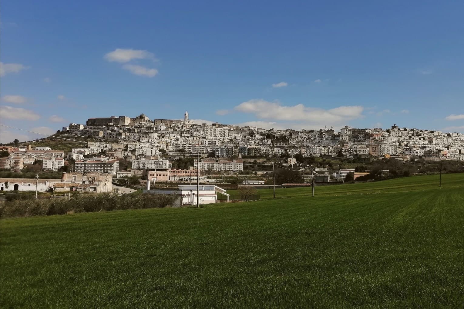
The town is built on two hills at the western edge of the Murgia plateau, where the limestone tableland gives out and the ground drops toward lower country on three sides. That break is what gives the ridge its long view and its nickname: to the east the eye crosses Murgia limestone toward the Gargano and the Adriatic, to the west it crosses cultivated fields into Basilicata, and to the north it runs the length of the Ofanto valley.
The old town sits above this drop, castle and tower on the high ground, cathedral below, the settlement organized around the same ridge that draws the view. Olive oil, almonds and grain define the rural economy beyond the walls, the plateau put to farming where it is not left to steppe grass and karst.
A ridge town, in other words, whose whole character, defensive site, pilgrimage cave, farmed hinterland, follows from the one geological fact of where the plateau ends.
La Tradizione - Cucina Casalinga, Masseria Barbera, A Sud dell'Anima have been named by a guide.
What to see in Minervino Murge
- Castello Normanno-Svevo. Norman fortress remodeled in the baronial period, with surviving towers and bastions on the high ridge above the old town.
- Torre di Pirro del Balzo. Fifteenth-century tower built between 1460 and 1490 when Minervino came to Pirro del Balzo as part of Maria Donata's dowry.
- Grotta di San Michele. Cave formed roughly two million years ago, reached through the karst rather than built, and still kept as a place of pilgrimage rather than display.
How to get to Minervino Murge
There is a railway station in the town, so you can arrive without a car and never need one while you are here. Foggia is roughly 62 minutes away by road.
Our tip
April through June and September through October are the months the Alta Murgia plateau runs best. The wildflower steppe peaks in May, almond blossom comes earlier in February, and the Ofanto valley below stays mild through autumn. July and August push past thirty-five degrees on the limestone with little shade; the centro storico empties between two and five and the panoramic belvedere is best at dawn or dusk.
Alberobello
Why visit Alberobello
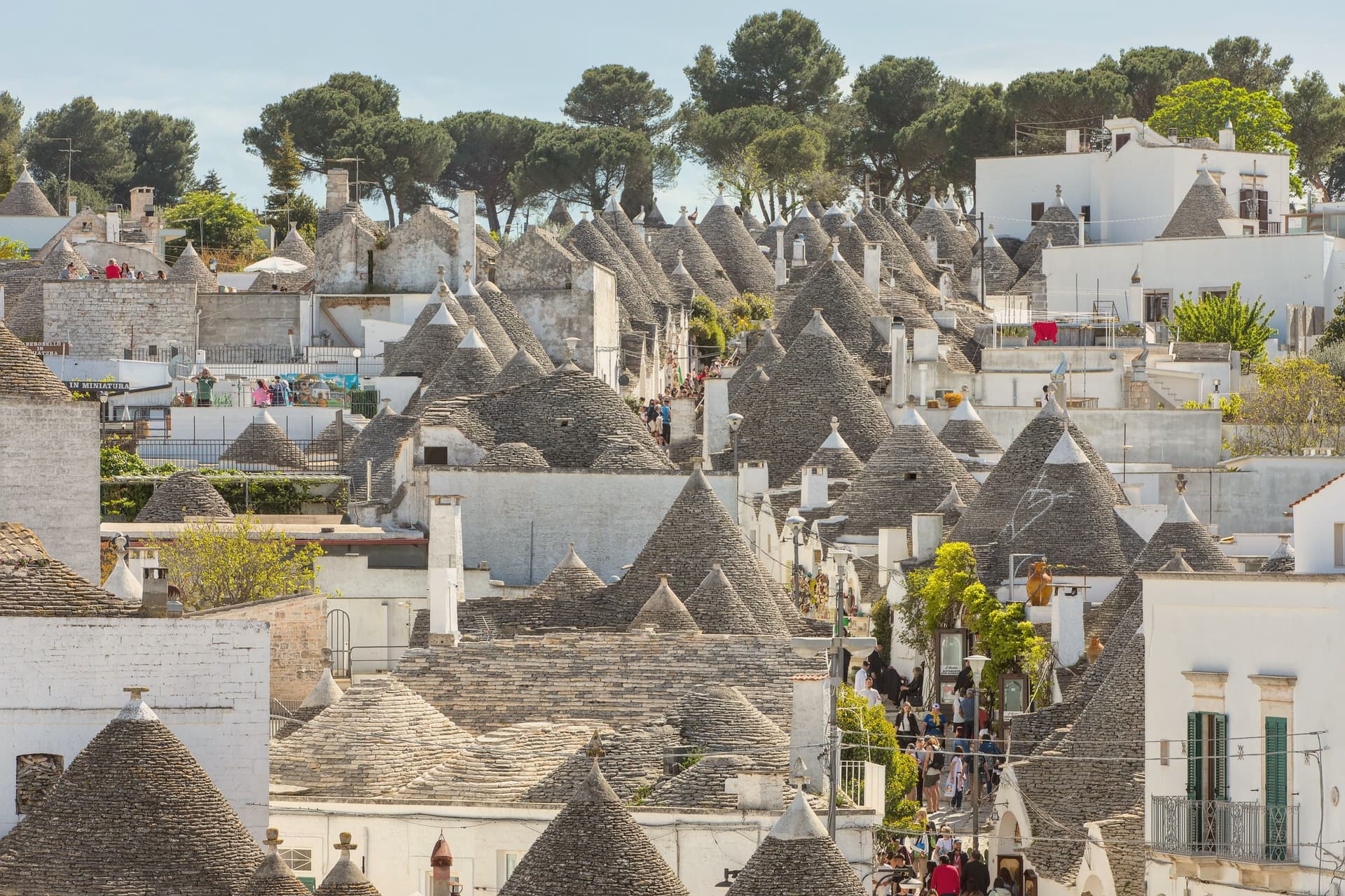
Alberobello sits at 402 meters in the Valle d'Itria, forty-five kilometers southeast of Bari. Two quarters of the town, Rione Monti and Aja Piccola, hold more than 1,500 trulli: limestone cones built from corbelled drystone, with conical or pyramidal roofs piled course by course without mortar.
The technique is prehistoric and still in use across the Murge, but nowhere else is the density and preservation what it is here. The Counts of Conversano enforced drystone construction on their tenant farmers to dodge a Spanish viceroy's tax on permanent settlements: a building that could be dismantled in an afternoon did not count as a town.
UNESCO listed the trulli in 1996. Some are houses, some are shops, some are inhabited by the same families that built them.
The Trullo Sovrano, the only two-storey trullo, was built around 1750 and now functions as a small museum.
Evo Ristorante have been named by a guide.
What to see in Alberobello
- Rione Monti. The larger of the two trulli quarters, a thousand cones running down the hillside, mostly converted to shops and accommodation.
- Aja Piccola. The smaller residential quarter, about four hundred trulli, still occupied as primary housing and quieter than Rione Monti.
- Trullo Sovrano. The only two-storey trullo in town, built around 1750 by the Perta family, now a small museum of trullo construction and daily life.
How to get to Alberobello
There is a railway station in the town, so you can arrive without a car and never need one while you are here. Taranto is roughly 56 minutes away by road.
Our tip
April through June and September through October are the months the Itria valley is green and the trulli are walkable without sweat. July and August push past thirty-three degrees and the Rione Monti fills with day-trippers from the coast; by ten in the morning the main streets are shoulder to shoulder. Late afternoon and after dusk are the times to walk, when the cones cast long shadows and the crowds thin.
Oria
Why visit Oria
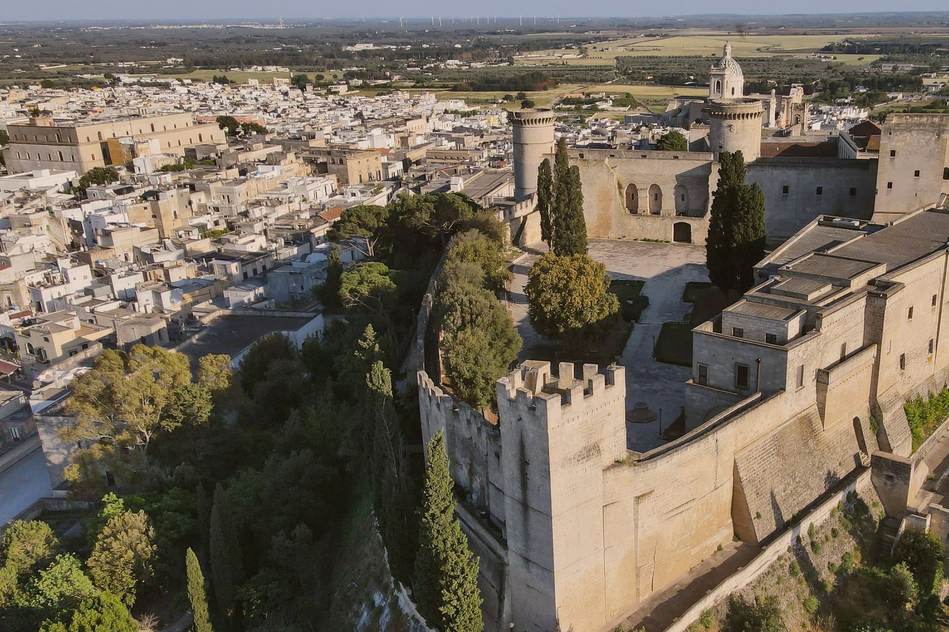
Oria sits at 166 meters on a Salento ridge between Taranto and Brindisi, north of Manduria and southeast of the ancient Taras. The town was Hyria, one of the principal Messapian cities, before the Romans absorbed the region.
Frederick II rebuilt the castle on the Messapian acropolis between 1227 and 1233; the triangular plan he chose is unique in southern Italian military architecture, with three towers, the Quadrata (Frederician), the Del Cavaliere and the Del Salto (both Angevin additions). Oria also held one of the oldest Jewish communities in Europe, a study center where philosophy, the Talmud, Greek, Latin, medicine and natural science were taught from the ninth century.
Shefatya ben Amitai and Shabbethai Donnolo, two of the first Hebrew writers native to Europe, both lived and worked here. The Jewish quarter, the Giudecca, still organizes the southern edge of the centro storico.
Osteria Luce, Masseria Palombara, Fuori Porta have been named by a guide.
What to see in Oria
- Castello Svevo di Federico II. Frederician castle of 1227-1233 on the Messapian acropolis, triangular plan with three towers, one Frederician and two Angevin, the town's defining monument.
- Cattedrale di Oria. Eighteenth-century Baroque cathedral raised over earlier medieval foundations, the seat of the diocese of Oria since the Lombard era.
- Giudecca. Old Jewish quarter on the southern flank of the centro storico, organized around the Vico degli Ebrei, a continuous medieval settlement from the ninth century.
How to get to Oria
There is a railway station in the town, so you can arrive without a car and never need one while you are here. Taranto is roughly 46 minutes away by road.
Our tip
April through June and September through October are the Salento interior months: clear light on the castle ridge, mild evenings, olive country in flower or harvest. July and August touch thirty-six degrees on the hilltop and the centro storico empties between two and five; the Corteo Storico di Federico II runs in mid-August anyway and pulls a regional crowd. October is the olive harvest. Palio di Oria falls in July.
More from Anywhere Italy
- The 9 best hidden towns you can reach by train that eat well in Puglia
 The best hidden olive oil towns that eat well in Puglia
 The best hidden olive oil towns in Puglia
 The best hidden olive oil towns you can reach by train in Puglia
 The 7 best towns inside a national park that eat well in Puglia
- The 6 best hidden hill towns in the province of Lecce