
The best hidden beach towns you can reach by train in the province of Cosenza
The coast of the province of Cosenza runs on two seas, and both of them are warm well into autumn. On the Ionian side the beaches are long and pale, broad enough that the crowd never really concentrates, with the Pollino massif standing dry and blue behind the coastal plain. Kitchens here work with what the plain and the water give them: swordfish, anchovies under salt, sweet Rocca Imperiale lemons, red onion from the Sibari flats, peperoncino in everything. Old towns sit up on their ridges in sandstone and whitewash, watching the newer marina districts that grew up around the railway line below.
Most people who come to Calabria for the sea head south, to Tropea and the Capo Vaticano cliffs, and in August the cliff-top car parks and the shuttle down to the beach make the case against themselves. Tropea earns its reputation, with the sandstone promontory and the church on its rock, but it absorbs a national holiday's worth of visitors into a very small grid of streets. The same is true of the Sila's lake resorts inland when the coast gets too hot. Both are worth going to. Neither is quiet.
The clean water and the sand carry on for a long way past the famous stretch, and the Ionian railway runs right along it, stopping in places where the station is a short walk from the shore. These are the towns on that line and on the Tyrrhenian one above Praia: smaller, less photographed, still holding the national award for bathing water quality. Fewer people get off the train here, which is the whole point of getting off the train here.
Of the 26 communes we have mapped in the province of Cosenza, 7 qualify as beach towns you can reach by train: each holds the national award for clean bathing water, and we have confirmed each is reachable without a car. This list is the hidden ones, 6 in all, ordered smallest first. The smallest, Roseto Capo Spulico, has 1,887 residents.
If you are still choosing, we have also written The best hidden towns you can reach by train in the province of Cosenza and The best hidden beach towns in Calabria.
Roseto Capo Spulico
Why visit Roseto Capo Spulico
Roseto Capo Spulico sits at the northern edge of Calabria's Ionian coast, the last commune before the Basilicata border, with the Pollino massif rising behind it. The village began as a Magna Graecia satellite of Sybaris, its name tied to the roses once cultivated to fill the mattresses of the Sybarite elite.
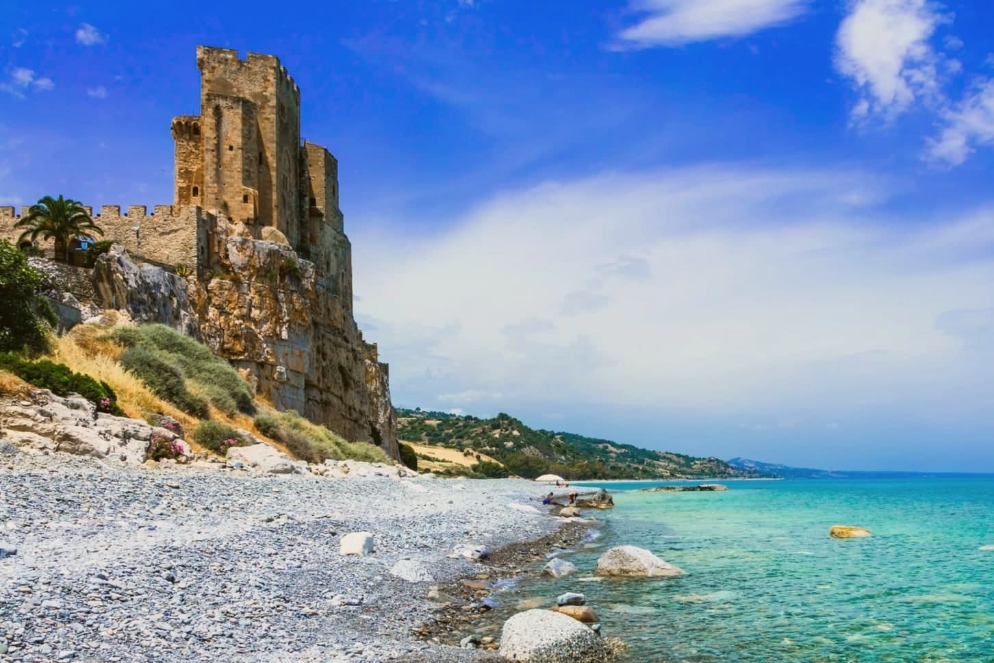
The castle above the water was requisitioned from the Templars in 1229 after their conduct during the Sixth Crusade, an episode that also carries a Shroud legend. The old town sits on the ridge above the marina, its stone houses and lanes looking down over the castle rock and the sea beyond it, while the beach runs along the shore directly below.
Inland, vineyards climb toward the Pollino slopes, and the commune holds recognition as a Borgo Autentico d'Italia and a Spiga Verde. The village reads as a settlement built in layers, from Sybarite outpost to fortress town to a place whose seafront, hilltop and inland farmland still sit visibly stacked, one above the other, along the same short stretch of coast.
We confirmed you can reach this one by train.
What to see in Roseto Capo Spulico
- Castello Federiciano di Roseto Capo Spulico. Trapezoidal fortress with three towers, one taller and crenellated, standing directly on the sea. Built under Robert Guiscard and rebuilt by Frederick II after he took it from the Templars.
- Spiaggia del Castello. Pebbled Bandiera Blu beach directly below the castle rock, with clear water and small coves along the Costa degli Achei.
- Chiesa di Santa Maria delle Grazie. Sixteenth-century mother church in the centro storico, rebuilt after earthquake damage and dedicated to the patron of the village.
How to get to Roseto Capo Spulico
There is a railway station in the town, so you can arrive without a car and never need one while you are here. Taranto is roughly 93 minutes away by road.
Our tip
May through September are the months the Ionian beach is open and the castle promontory fills with day-trippers from Sibari and Basilicata. July and August push past thirty-five degrees and the marina rentals fully book; the centro storico on the ridge above stays quieter and cooler. April and October are dry and mild, the right time to walk the castle path and the Pollino foothills inland without sweat.
Rocca Imperiale
Why visit Rocca Imperiale
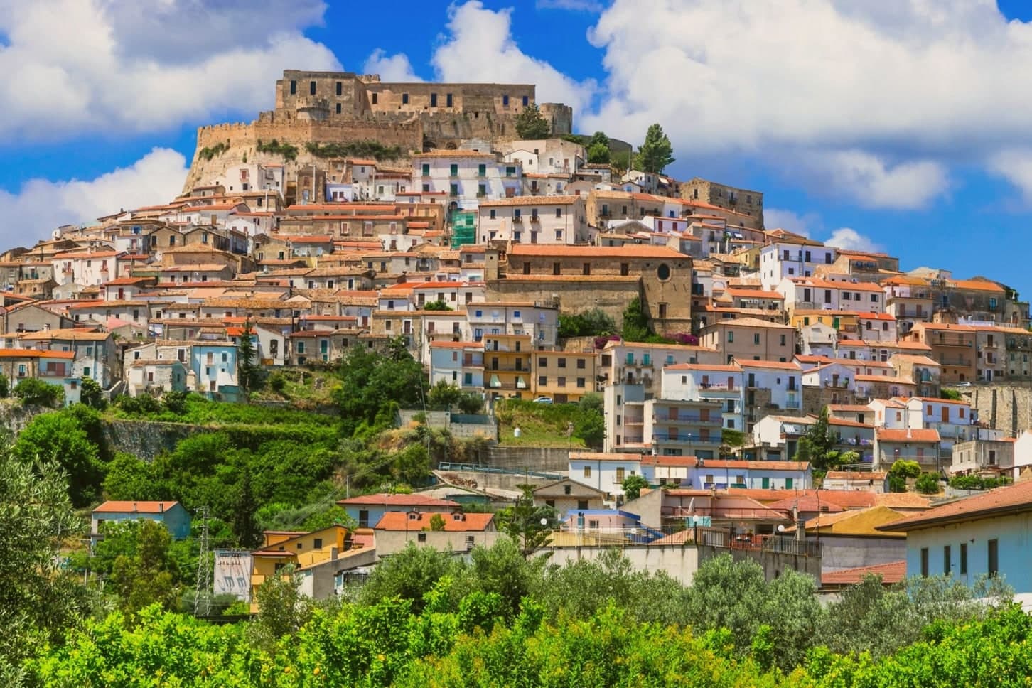
Rocca Imperiale is the northernmost commune of Calabria, pressed against the Basilicata border on the Ionian coast. The hilltop borgo sits a kilometre inland from the long sandy Marina, the two connected by the slope the town has always used to move between fortress and shore.
The castle stands on a defensible hill chosen to command the coastal route between Taranto and Reggio Calabria, and the borgo grew downhill from it in tight medieval grids of whitewashed houses and narrow vicoli, with the Chiesa Madre dell'Assunta, a 15th-century church with a Madonna by Pietro Bernini, father of Gian Lorenzo, anchoring the central piazza. Inland and upland frame the town on the other side: the Pollino park lies 30 km west and the Sila highlands further south, making Rocca a base for both while the coastal frazione below handles the beach trade.
The food is north-Calabrian-meets-Lucanian: peperoni cruschi, pasta with lardo and chilli, pesce azzurro from the Ionian, and the lemon grown only in the surrounding belt, used in liqueurs and the local pasta al limone. The Festa del Limone in early August is the year's main event.
The town works because its geography does the sorting: fortress and church hold the hill, the lemon groves hold the middle slope, and the marina holds the shore, each part visible from the others across the same short drop to the sea.
We confirmed you can reach this one by train.
What to see in Rocca Imperiale
- Castello Federiciano (1225). Frederick II Hohenstaufen's square fortress with four corner towers (two cylindrical) commanding the Ionian coastal route. Open as a cultural centre.
- Centro storico (Borghi più belli). Whitewashed houses in tight medieval vicoli cascading downhill from the castle. The Chiesa Madre dell'Assunta has a Pietro Bernini Madonna.
- Rocca Imperiale Marina (Bandiera Blu). Long sandy Ionian beach 1 km below the borgo, holding the Bandiera Blu every recent year for water clarity and beach management.
How to get to Rocca Imperiale
There is a railway station in the town, so you can arrive without a car and never need one while you are here. Taranto is roughly 81 minutes away by road.
Our tip
Rocca Imperiale is best May–June and September–October — the borgo cool in the morning, the Marina swimmable, the lemon orchards in flower or harvest. July–August fills the Marina with Italian families and the Festa del Limone (early August) is the biggest event. The borgo stays atmospheric in winter but most amenities at the Marina close November–March.
Villapiana
Why visit Villapiana
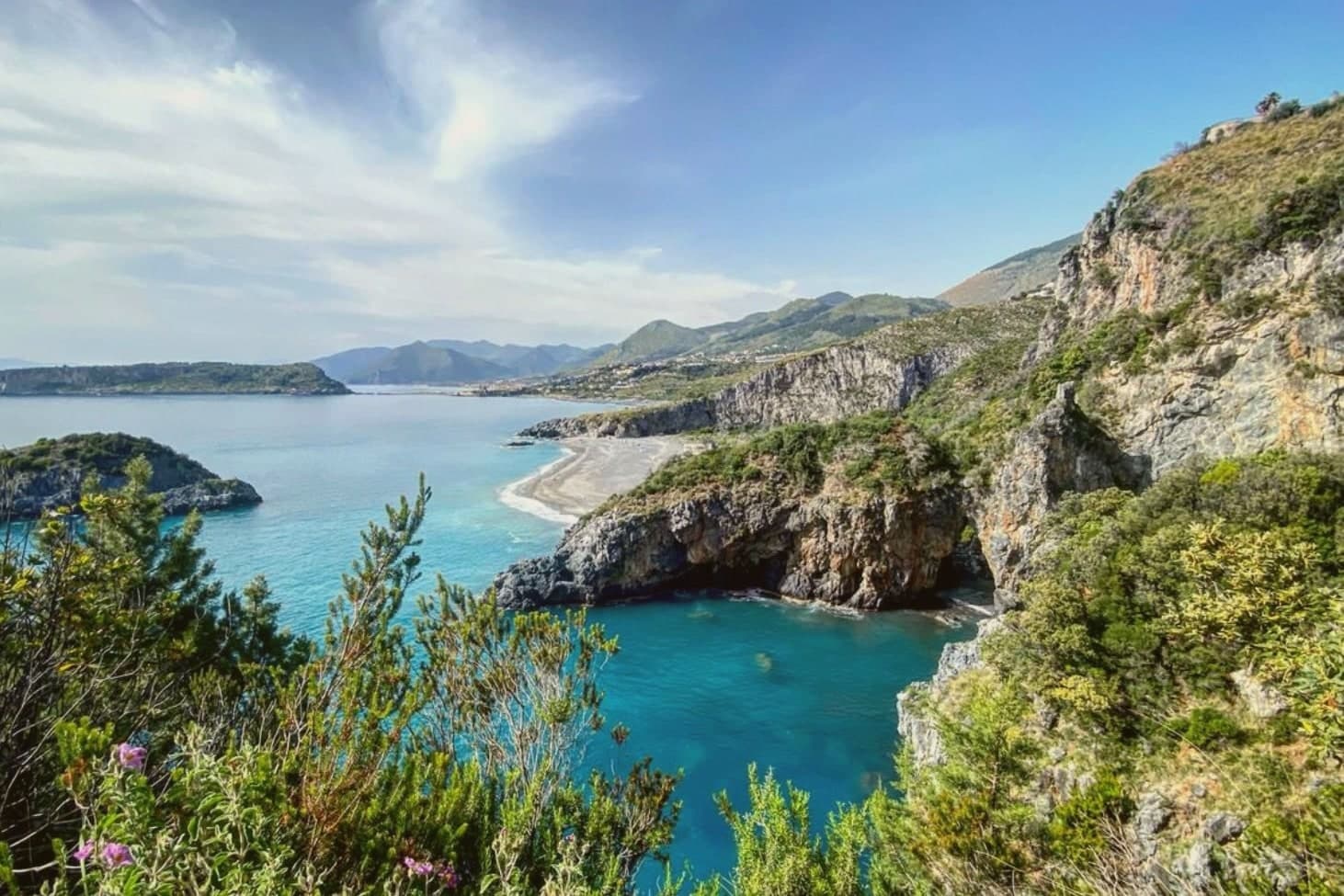
Villapiana sits at the northern corner of Cosenza province, where Calabria meets Basilicata, on the first rise above the plain. The hill that holds the historic core, at 206 meters on the left bank of the Satanasso stream, was the original nucleus; the Lido and the Scalo stretch along the Ionian below it, so the town reads as three settlements at three elevations rather than one place.
The ancient name was Leutermia, kept until the ninth century, when Saracen raids destroyed the settlement and the survivors rebuilt inland as Casalnuovo. The town took its present name only in 1863.
The Jonica railway runs the coast through the Lido and through Villapiana-Torre Cerchiara, the two municipal stations, tying the lower town to the rail line while the old hill core stays apart from it. The territory also holds a Spighe Verdi recognition, alongside its coastal award.
What the geography adds up to is a town split lengthwise between an inland hill remembered for a destruction and rebuilding, and a coastal strip that only became legible once the railway and the beach gave it a reason to exist.
We confirmed you can reach this one by train.
What to see in Villapiana
- Villapiana Lido. Bandiera Blu beach on the Gulf of Sibari, wide sandy shore facing the Ionian with the Pollino peaks behind it.
- Chiesa di Santa Maria del Piano. Hilltop church marking the original settlement, its terrace giving a panoramic view over the coast below.
- Villapiana Centro. Historic core on the left bank of the Satanasso stream, built up after Saracen raids forced the earlier population to resettle inland from the coast.
How to get to Villapiana
There is a railway station in the town, so you can arrive without a car and never need one while you are here. Taranto is roughly 109 minutes away by road.
Our tip
May through September is the working season. The Lido fills with Italian families in July and August; June and September are the gentler months, sea still warm, beach quiet enough to find your stretch of sand. The Pollino interior is the cooler complement, walkable from May through October when the lower trails out of Civita and Cerchiara are open.
Praia a Mare
Why visit Praia a Mare
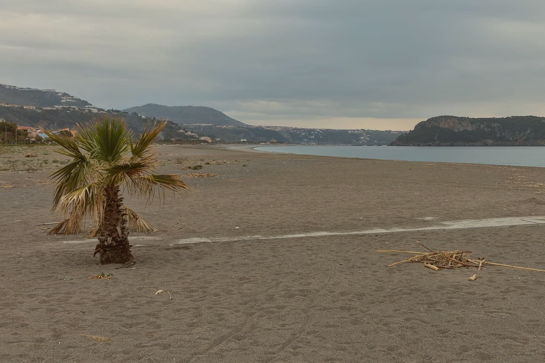
The town sits in the Gulf of Policastro at the northern end of Calabria, where the Pollino mountains drop nearly straight into the Tyrrhenian. It extends for about seven kilometers along the coast, mountain on one side, sea on the other, with Isola di Dino lying half a kilometer offshore as the point the whole shoreline is oriented toward.
Praia became an autonomous commune in 1928 and took the island with it; in 1962 Gianni Agnelli bought Dino, and a 2014 court ruling annulled the contract. The coast carries Bandiera Blu status and the inland slopes carry Pollino National Park status, so the same short stretch of ground answers to two different designations depending on which way it faces.
The bathing season runs from May into September. What holds the town together is that split: a strip of beach and pebble shore turned toward an island it once owned outright, backed by mountains that never really let go of it.
We confirmed you can reach this one by train.
What to see in Praia a Mare
- Isola di Dino. 101 meters at its peak, with four marine caves reached by boat and colonies of dwarf palm and primula covering ground that once passed through private ownership before a 2014 court ruling returned the question of the contract to dispute.
- Spiaggia di Praia a Mare. Long dark-pebble beach facing the island, the working centre of the town through the bathing season.
- Santuario della Madonna della Grotta. Cave sanctuary cut into the cliff under Monte Crucitti, dedicated to the patron of the town, with a venerated Byzantine icon.
How to get to Praia a Mare
There is a railway station in the town, so you can arrive without a car and never need one while you are here. Salerno is roughly 120 minutes away by road.
Our tip
May through September is the bathing season. Water warms by late May, the boats to Isola di Dino's caves start running, and the beach fills by mid-July. August is the busiest month, with temperatures pushing past thirty-three and the town's six thousand residents joined by several times that number of visitors.
Cariati
Why visit Cariati
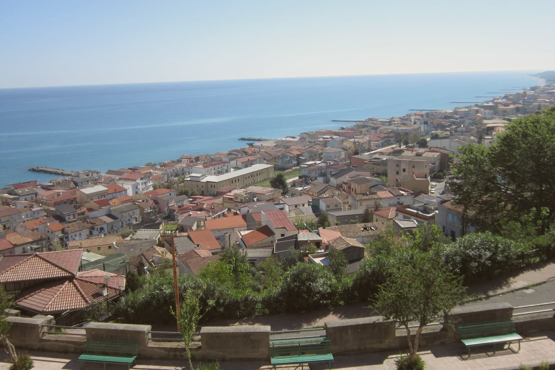
Cariati stretches along the Ionian coast of northern Calabria, sixty-five kilometers east of Cosenza, split between the hill town above the sea and the marina below. The Bretti settled the territory in the fourth and third centuries BC and a Roman foundation called Paternum followed.
Saracen raids and malaria forced the inhabitants up the hill in the early Middle Ages, where the present town took shape under Byzantine fortification: the wall that still rings the upper settlement dates from this period of retreat. The cathedral sits inside those walls, a medieval foundation carried forward in a nineteenth-century neoclassical rebuilding, its dome visible from the road along the coast.
Below, the marina holds the beach and the harbor, its territory also recognized with a Spighe Verdi designation, and in summer the working fleet's catch is grilled the length of the lungomare during the Sagra del Pesce Azzurro. The town's shape, an upper refuge and a lower shore settlement, still reads as the direct outcome of that flight from raiders and fever centuries ago.
We confirmed you can reach this one by train.
What to see in Cariati
- Mura medievali. Eight massive towers punctuate the circuit, its stone faces worn but continuous, and Porta Pia still stands as the principal gate into the upper town.
- Cattedrale di San Michele Arcangelo. Medieval foundation rebuilt in the nineteenth century in neoclassical style, with a painted majolica dome visible from the coast road.
- Cariati Superiore. The walled medieval town on the hill above the sea, the original settlement that grew after the abandonment of the Roman Paternum.
How to get to Cariati
There is a railway station in the town, so you can arrive without a car and never need one while you are here. Taranto is roughly 174 minutes away by road.
Our tip
May through September is the season. The Marina fills with Italian families in July and August, the Sagra del Pesce Azzurro and the Madonna del Carmine procession anchor the high-summer calendar. June and September are the easier months: warm enough to swim, quiet enough on the lungomare to find a table.
Trebisacce
Why visit Trebisacce
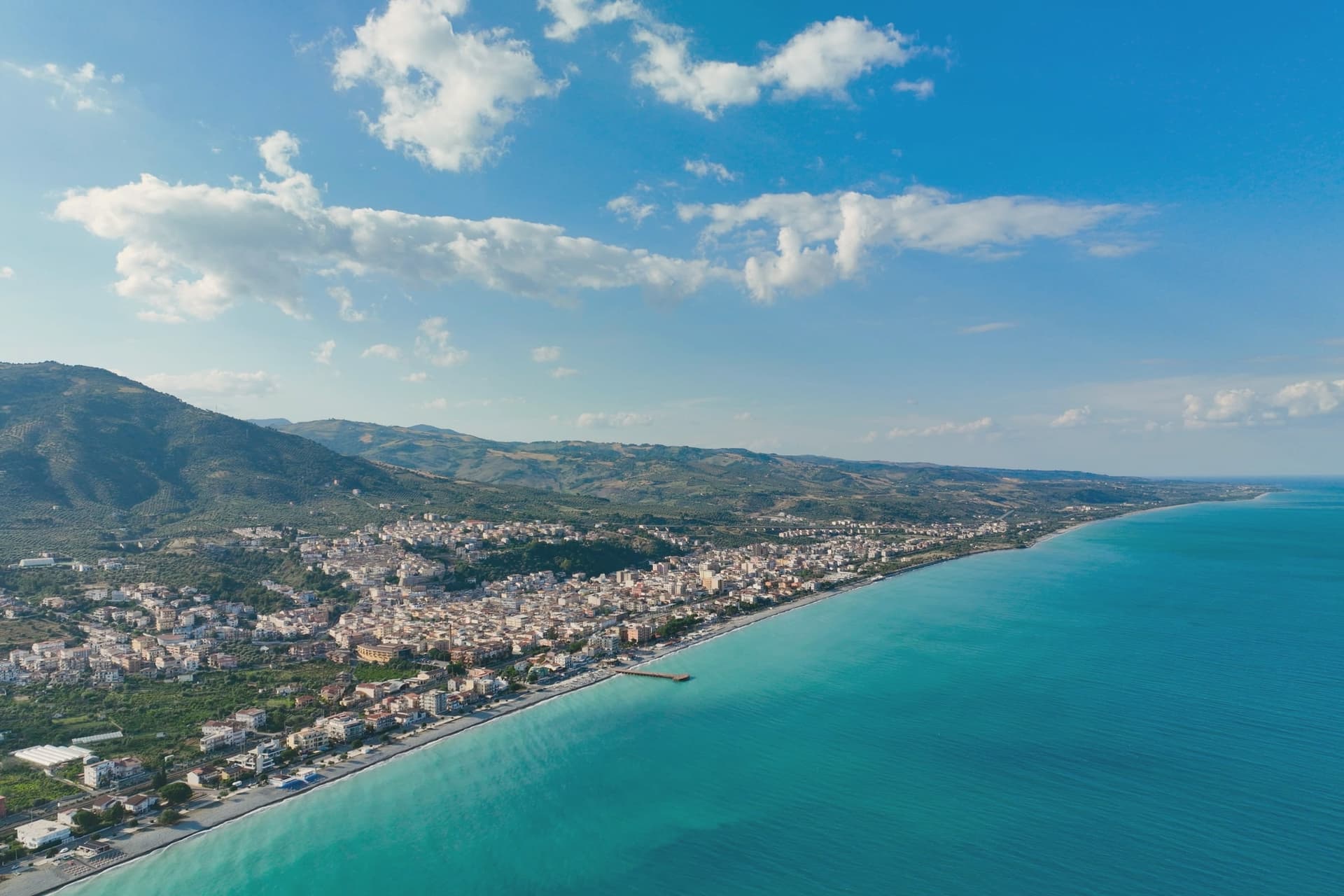
Trebisacce sits at 73 meters in the upper-Cosenza arc, on a hill whose flat top gave the town its name: the Greek Trapezàkion, small table, a literal description of the tabular ground the old town stands on. In antiquity the settlement held the road between Metaponto and Sybaris, twenty kilometres south on the Sibari plain, a position that put it on the trade routes long before the medieval walls went up.
The lower modern town runs along the seafront below; the plateau above keeps the old streets, the mother church, and the walls raised in the sixteenth century against Saracen raids. Inland and uphill, past the modern town, a rock-cut chapel sits inside a pine forest on Monte Mostarico, a different register of building from the stone church and the archaeological trenches below.
Read together, the layers, coastal plain, tabular hill, and inland forest, describe a town that has always faced two ways: out to the sea route and up to the higher, quieter ground behind it.
We confirmed you can reach this one by train.
What to see in Trebisacce
- Chiesa di San Nicola di Mira. Trullo-shaped dome and a tall pyramidal bell tower stand over the centro storico, the church's mass still setting the skyline of the old town.
- Broglio di Trebisacce. Excavated since 1979, the site has also given up a Hellenic necropolis alongside the Mycenaean finds, layered evidence of the plateau's long occupation.
- Centro storico sul plateau. Old town on the tabular hill that gives Trebisacce its name, ringed by sixteenth-century walls built against Saracen raids.
How to get to Trebisacce
There is a railway station in the town, so you can arrive without a car and never need one while you are here. Taranto is roughly 104 minutes away by road.
Our tip
May and June bring warm sea and the lungomare opening, with the plateau still cool in the evenings. July and August are hot on the Ionian coast and the modern town fills with summer residents from the Sibari plain and Basilicata. September is the better month: water still in the mid-twenties, beach umbrellas thinned out, restaurants quieter.
More from Anywhere Italy
 The best hidden towns you can reach by train in the province of Cosenza
 The best hidden beach towns in Calabria
- The best small towns you can reach by train in Calabria
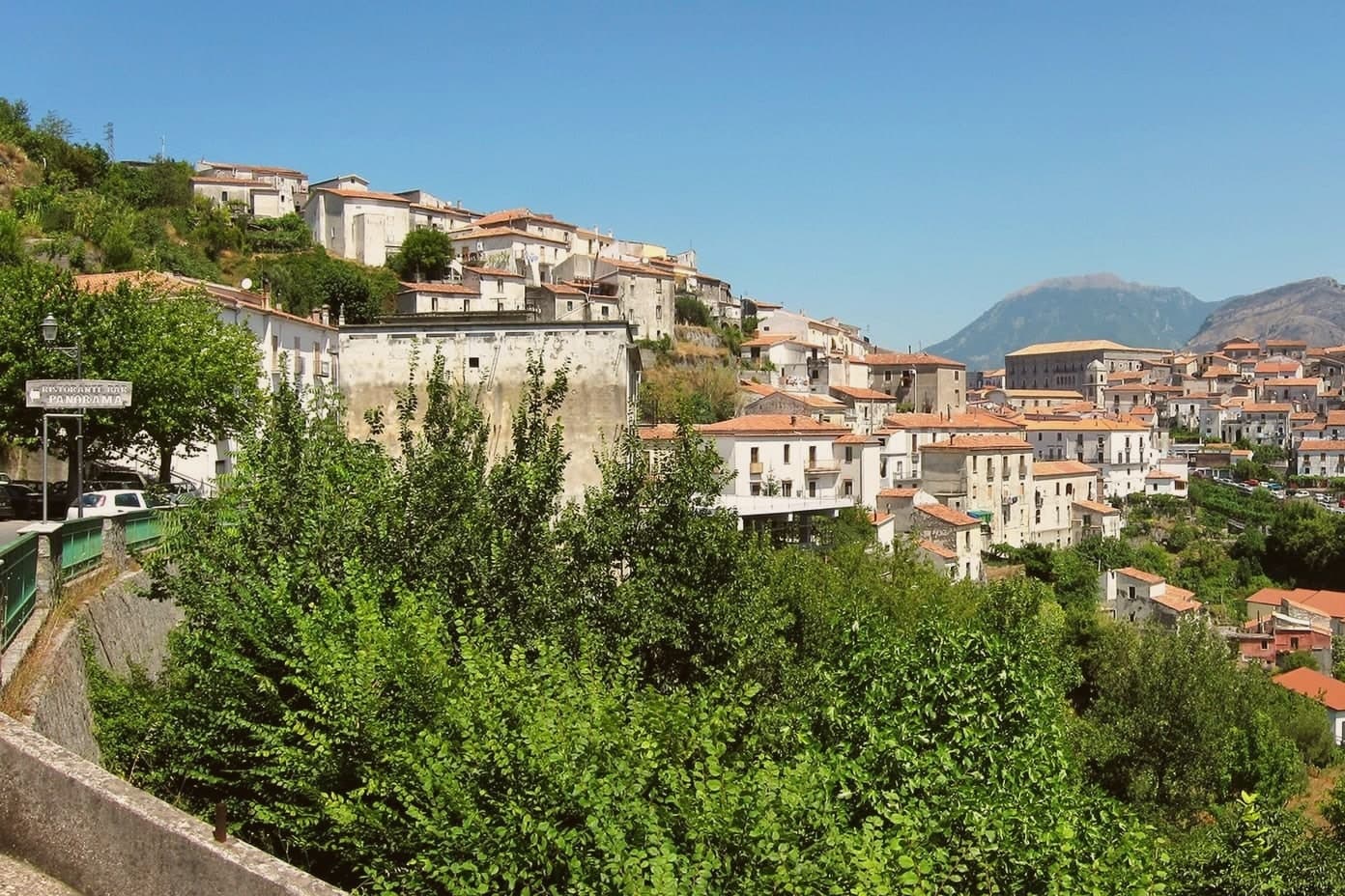 The prettiest villages in the province of Cosenza
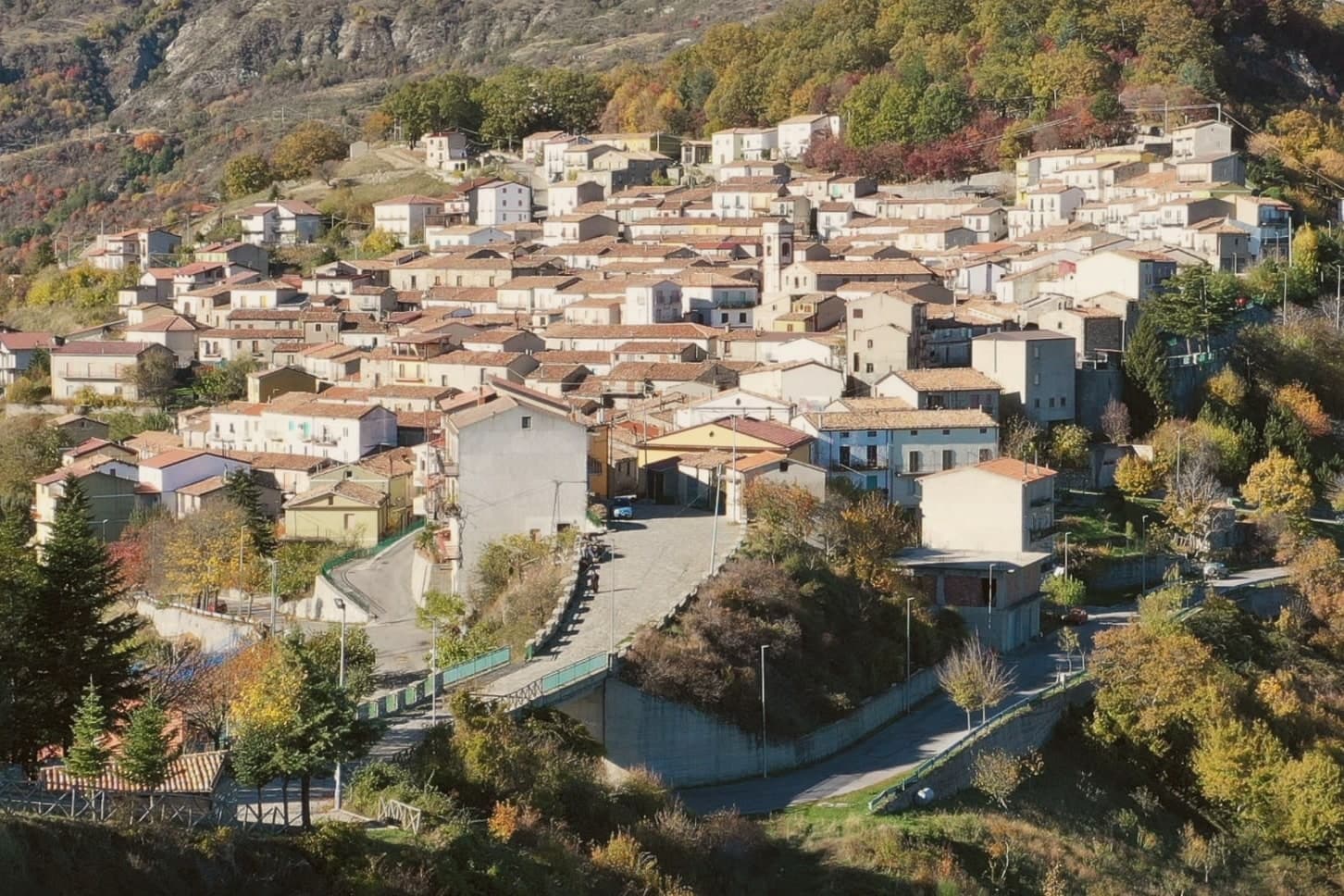 The best hidden towns inside a national park in the province of Cosenza
- The best small coastal towns in Calabria