
The best towns known for what they grow within an hour of Rimini
Romagna between the Adriatic and the first Apennine ridges is farming country before it is anything else, and it shows on every verge: peach and nectarine orchards in tidy rows, apricots ripening in early summer, shallots lifted from sandy soil, vines running up towards Bertinoro's ridge. The building material is brick, warm red and often unrendered, with bell towers that read as landmarks across flat ground. Food here is direct rather than refined, piadina cooked on a testo, squacquerone cheese, grilled fish on the coast, cappelletti in broth when the weather turns. Late June through September is the season the orchards are worth planning around, when the fruit stands appear at the roadside and the sagre follow one another week by week.
What most visitors do instead is stay on the sand. Rimini has the longest run of organised beach in Italy, umbrella lines stretching for kilometres, and in August it absorbs an enormous share of the region's traffic along with day trips to San Marino on the hill behind. It works, and the seafood is good, but the pattern keeps people in a narrow strip within sight of the water. The countryside that supplies the restaurant kitchens sits a short drive inland and goes largely unvisited.
The same plain, the same hills and the same growers continue west and north past the resorts, and that is where these towns are. Some are hill towns with a castle and a market square, some are canal ports, some are known for ceramics or thermal water as well as fruit, and each one sits inside the recognised production area of a protected crop. Fewer people go, which mostly means the fruit is eaten closer to where it was picked.
Of the 23 communes we have mapped in a one-hour drive of Rimini, 9 qualify as towns known for what they grow: each sits inside the production zone of a protected fruit or vegetable. The smallest, Castrocaro Terme e Terra del Sole, has 6,352 residents.
If you are still choosing, we have also written The best towns known for what they grow within two hours of Ancona and The best wine towns within 75 minutes of Rimini.
Castrocaro Terme e Terra del Sole
Why visit Castrocaro Terme e Terra del Sole
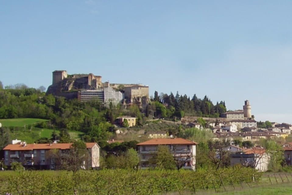
The commune sits at 68 meters on the Montone river, ten kilometers southwest of Forlì in the Apennine foothills, and is the union of two distinct towns rather than one that simply grew. Castrocaro occupies the hill, its castle controlling the valley from above.
The fortress town on the plain below it was built in one campaign to project the authority of the Grand Duchy of Tuscany into Romagna, rather than accumulated over centuries like its neighbor. The Medici governed it until 1923, when the provincial border finally moved and the arrangement ended.
The two halves of the commune read like two different centuries standing next to each other: one shaped by defense over generations, the other stamped out whole by a single ducal decision in 1564. What the pairing adds up to is a rare chance to see, in the space of one small commune, both how a medieval hill fortress evolved and what a Renaissance planner intended a fortress town to look like when built from nothing, a place called Terra del Sole.
Essentia have been named by a guide.
What to see in Castrocaro Terme e Terra del Sole
- Rocca di Castrocaro. One of the oldest castles in Italy, standing on the hill above the centro with three concentric defensive rings, built to command the valley below.
- Terra del Sole. Two squares, four gates, and bastioned walls still standing, laid out with the geometric symmetry of a town designed on paper rather than grown over time.
- Palazzo dei Commissari e del Pretorio. On the central square, the residence of the Medici governors of Romagna Fiorentina until 1772, its facade facing the town's planned axis.
How to get to Castrocaro Terme e Terra del Sole
Forlì is roughly 19 minutes away by road.
Our tip
Castrocaro Terme runs all twelve months because the thermal water does. The Terme stay open year-round, with the lowest tariffs from November to March and the most space in spa hotels through mid-week stays in winter. April through June brings green on the Apennine slopes and the gardens around Terra del Sole.
Longiano
Why visit Longiano
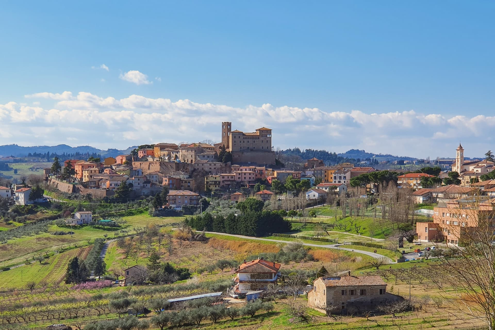
Longiano sits at 179 meters on the first hill line between Cesena and Rimini, eleven kilometers inland from Cesenatico and within sight of the Adriatic. The town shifted from the plain to the hill in the seventh and eighth centuries, when the local population moved up to escape Lombard raids, and the settlement that resulted is the hilltop borgo still walled today, with the castle at its center and the theater just below it.
Longiano passed to the Church in 1581 and stayed under papal rule until unification, before the castle came to the commune in 1989. The sanctuary stands apart from this hilltop cluster, built around its painted crucifix and held by Franciscan presence for over seven centuries, a separate thread of the town's history running alongside the Malatesta line and the civic one.
What ties the parts together is the hill itself: a defensive move made in the seventh and eighth centuries left Longiano with a compact center where a former ruling family's fortress, a nineteenth-century theater and a walled medieval borgo all sit within reach of each other, while the sanctuary's much older devotional history runs on its own separate track nearby.
Magnolia, Dei Cantoni, Terre Alte have been named by a guide.
What to see in Longiano
- Castello Malatestiano. Fortified hilltop seat of the Malatesta of Rimini, later passing to the Church and then the commune. Its rooms now hold the Fondazione Tito Balestra, so the walls that once housed a ruling family now hold paintings, drawings and sculpture.
- Teatro Petrella. Sits just below the castle. Restored in 1986, it is known today for its acoustics inside the horseshoe-shaped hall.
- Santuario del Santissimo Crocifisso. Franciscan sanctuary built around a thirteenth-century painted crucifix on oak panel, with continuous Franciscan presence for over seven centuries.
How to get to Longiano
There is a railway station in the town, so you can arrive without a car and never need one while you are here. Rimini is roughly 30 minutes away by road.
Our tip
April through June and September through October are the months for Longiano. The hilltop catches a breeze the coastal plain below does not, and the views run from the Apennines to the Adriatic on clear days. July and August touch the low thirties and the centro storico empties between two and five; many visitors come up from Cesenatico and Cervia in the late afternoon for the cooler air and the castle. Crocetta 30 in Festa falls in August.
Bertinoro
Why visit Bertinoro
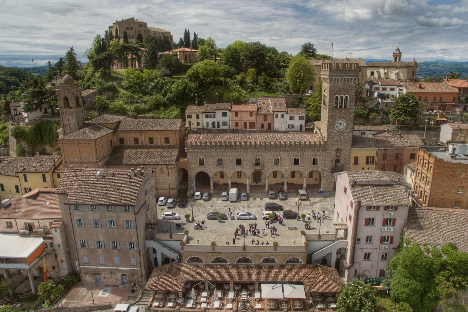
Bertinoro sits at 254 meters on Mount Cesubeo, a few kilometers south of the Via Emilia between Forlì and Cesena, the Romagna hills rolling toward the Adriatic on a clear day visible from the panoramic balcony locals call the Belvedere. The town's signature object is the Colonna delle Anella in Piazza della Libertà, a white-stone column with twelve iron rings, erected in 1300 by the noble families of the borgo so visitors arriving from the Via Emilia could tie their horse to a ring and be hosted by the family it belonged to.
The Albana grape grown on the surrounding slopes became, in 1987, the first Italian white wine to receive DOCG status; the artist Guerrino Bardeggia's Campana dell'Albana still rings to mark the opening of the harvest. Bertinoro joined the Borghi più belli d'Italia network in 2025.
The municipality holds two institutional signals: Borghi più belli, Città del Vino. Population 11,026.
What to see in Bertinoro
- Colonna delle Anella. White-stone column with twelve iron rings, erected 1300 in Piazza della Libertà so visitors could tie their horse to the ring of the family who would host them.
- Rocca Vescovile. Tenth-century fortress on the summit of Mount Cesubeo, expanded by the Ordelaffi and Malatesta and used as the bishop's residence from the sixteenth century.
- Cattedrale di Santa Caterina. Sixteenth-century cathedral on the upper part of the borgo, rebuilt over an earlier Pieve dedicated to Saint Catherine of Alexandria.
How to get to Bertinoro
Forlì is roughly 20 minutes away by road.
Our tip
April through June brings green hills, mild evenings, and the first events in Piazza della Libertà. September and October are the strongest months: the Albana harvest runs through late September, and the Festa dell'Ospitalità on the first Sunday of September re-enacts the old ring ritual, drawing visitors paired by lottery to twelve host families. July and August touch thirty-two degrees but the 254-meter elevation cools the borgo earlier than the plain below.
Santarcangelo di Romagna
Why visit Santarcangelo di Romagna
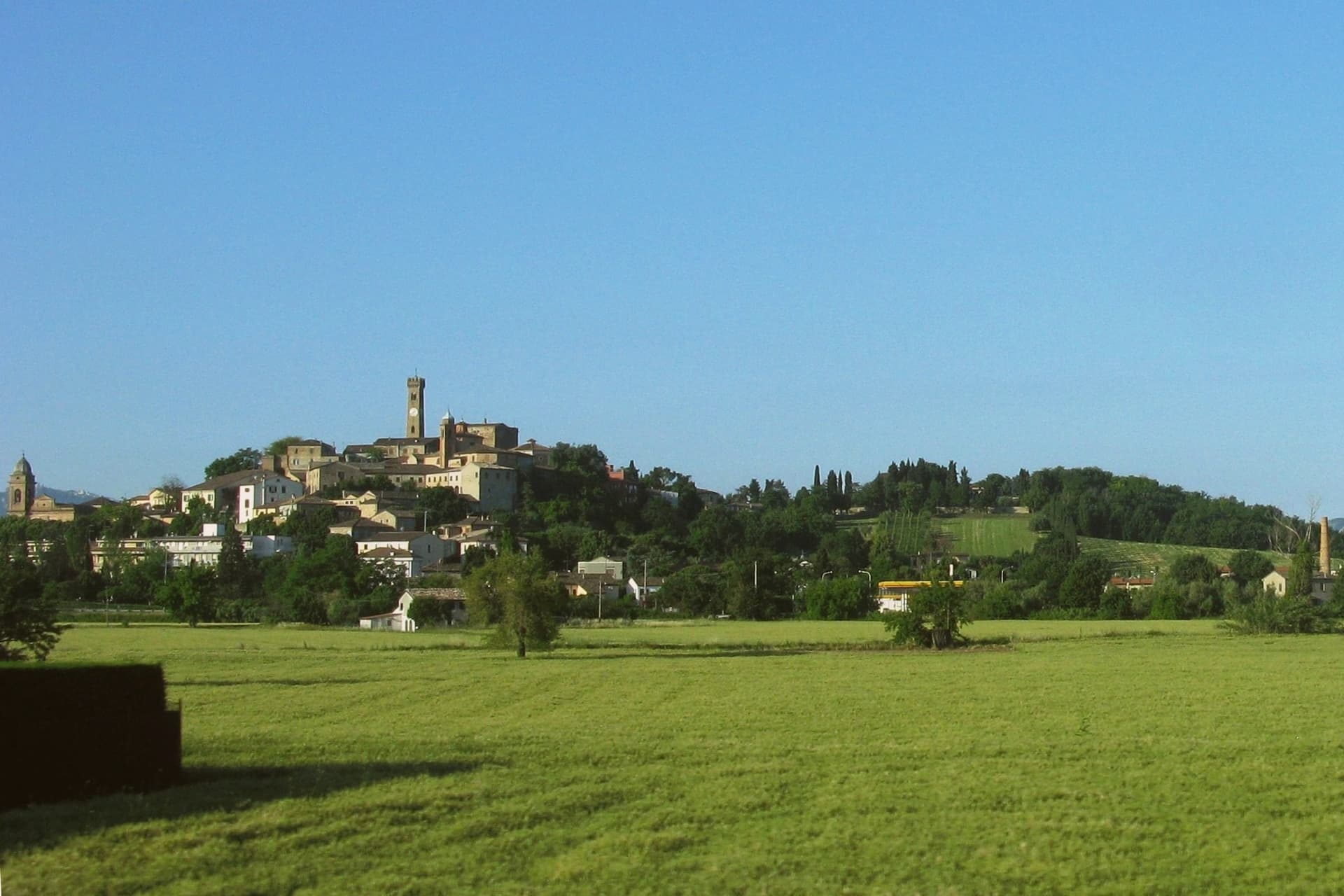
Santarcangelo di Romagna sits at 42 meters on a low hill between the Marecchia and the Uso rivers, eleven kilometers northwest of Rimini on the Via Emilia. Roman in origin, named Pagus Acervolanus, the town grew under the Malatesta of Rimini, who fortified the hill in 1386 with the Rocca Malatestiana that Carlo Malatesta built and contemporaries called an eighth wonder of the world.
Under the centro storico, over 150 man-made caves on eight levels cut into the soft tufa rock form an underground city: pagan place of worship, burial chambers, wine cellars, and in 1944 air-raid shelters that saved most of the population. The town gave the world two dialect poets, Raffaello Baldini and Tonino Guerra, whose verses earned Santarcangelo the title capital of Romagnolo dialect poetry.
Guerra, also Fellini's screenwriter, designed the Strada delle Meridiane that runs through the centro. The Festival Internazionale del Teatro in Piazza, founded in 1971, fills the streets every July.
Lazaroun, Osteria La Sangiovesa have been named by a guide.
What to see in Santarcangelo di Romagna
- Rocca Malatestiana. Hilltop fortress built by Carlo Malatesta in 1386, with the surviving keep, walls, and the Torre del Campanone over the centro.
- Grotte Tufacee. Over 150 man-made caves on eight levels cut into the tufa under the centro storico, used as pagan sanctuaries, wine cellars, and 1944 air-raid shelters.
- Piazza Ganganelli. Central square named for Pope Clement XIV (Giovanni Ganganelli, born here in 1705), with a triumphal arch from 1779.
How to get to Santarcangelo di Romagna
There is a railway station in the town, so you can arrive without a car and never need one while you are here. Rimini is roughly 17 minutes away by road.
Our tip
April through June and September through October are the working months on the Marecchia plain. Spring brings clear evenings on the hill and water in the underground grottos; autumn dries the surrounding fields and brings the wine and olive presses back to work. July fills the streets with the Festival del Teatro in Piazza, with companies performing in the piazze, the Rocca courtyard, and the lavatoio. Fiera di San Michele falls in September.
Cesenatico
Why visit Cesenatico
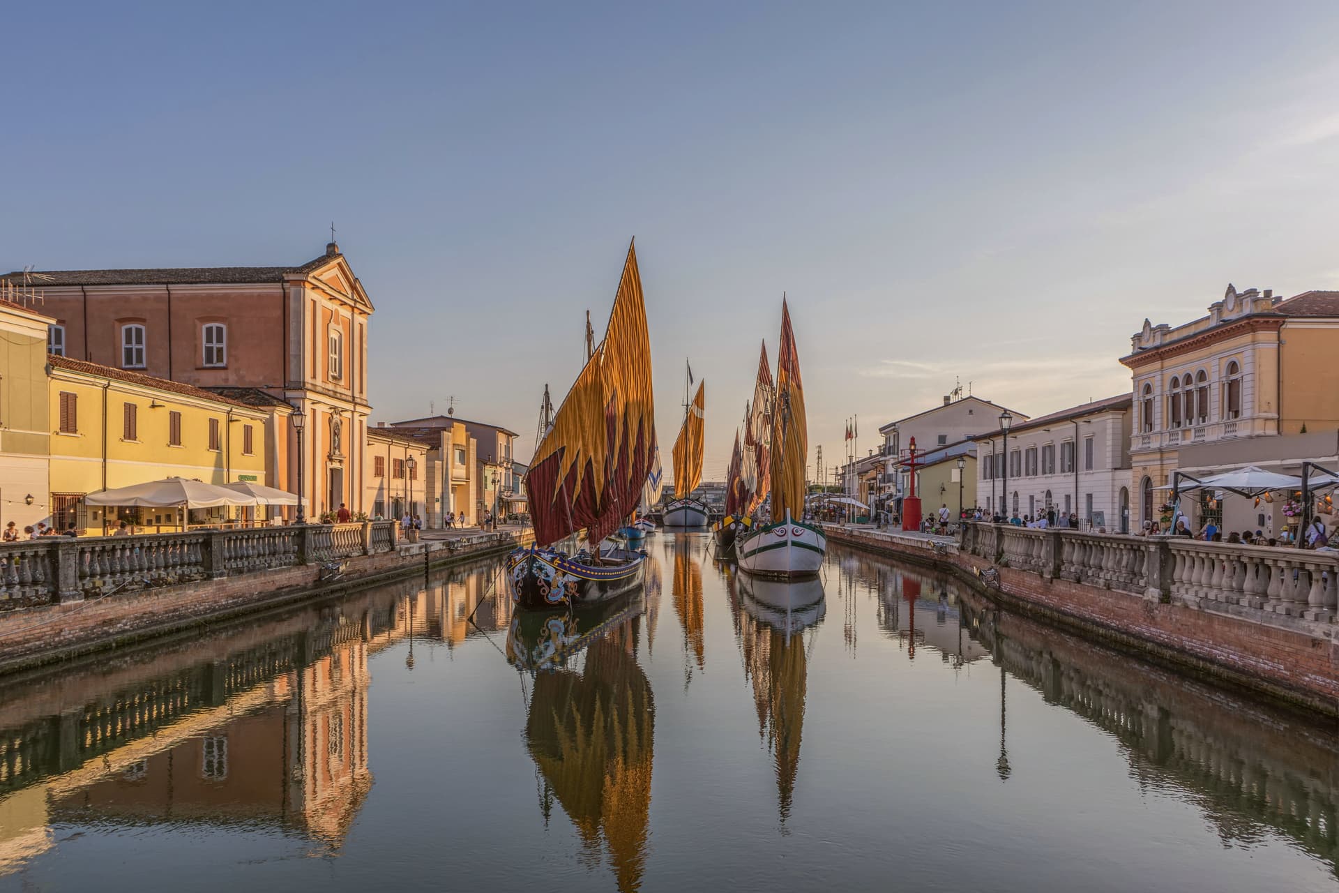
Cesenatico sits at three meters on the Adriatic, fifteen kilometers east of Cesena. The town grew around a canal port begun in 1302 by the Malatesta of Cesena to give the inland city its outlet to the sea, and the canal still runs through the centro storico as the town's working spine.
Leonardo da Vinci arrived in 1502 at the request of a Borgia patron to survey and redraw the port; his sketch, preserved in the Codex L, corresponds to the harbor layout today. Garibaldi embarked from this port in August 1849, fleeing the failed Roman Republic on commandeered fishing boats with about two hundred followers.
The canal separates and joins the two halves of the old town, its banks lined with the pastel facades of fishermen's houses, and it is this same stretch of water that carries the floating section of the Museo della Marineria, sails hoisted through the summer. Cesenatico is also the home town of the cyclist Marco Pantani, marked inland by the Nove Colli ride each May.
The beach carries Bandiera Blu. What holds the town together is the canal itself: a fifteenth-century engineering commission that outlasted the port's original purpose and became the frame for everything Cesenatico later added, from Garibaldi's escape to the moored boats of the maritime museum.
La Buca, Ancòra, Osteria Bartolini and 5 more have been named by a guide.
What to see in Cesenatico
- Porto Canale Leonardesco. Canal port begun in 1302 by the Malatesta, running through the centro storico and lined with the pastel facades of fishermen's houses. Leonardo da Vinci's redrawn layout from 1502 still corresponds to the harbor as it stands.
- Museo della Marineria. Maritime museum with a floating section of historic Adriatic sailboats moored in the canal, their sails hoisted daily in summer.
- Spazio Pantani. Museum near the railway station dedicated to the cyclist, tracing his career including the 1998 Giro and Tour double.
How to get to Cesenatico
There is a railway station in the town, so you can arrive without a car and never need one while you are here. Rimini is roughly 28 minutes away by road.
Our tip
May through September is the working season on the Cesenatico coast. June and the first half of July hold the best balance of warm sea and lighter crowds. Late July and August are the Italian beach peak, when the seven kilometers of sand fill up and the Porto Canale evening passeggiata runs until midnight.
Cervia
Why visit Cervia
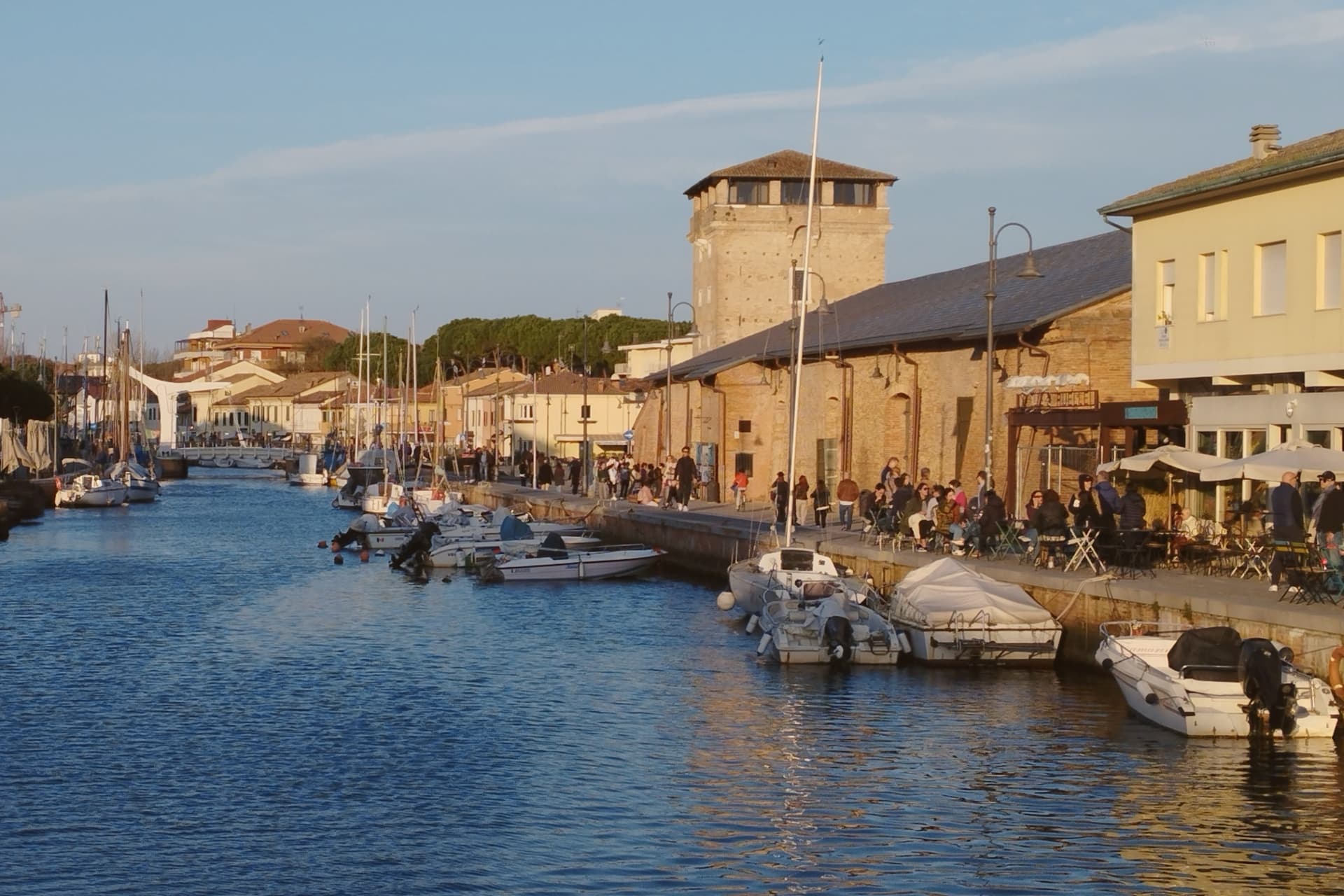
Cervia sits at sea level on the Adriatic, twenty kilometers south of Ravenna, between the pine forest of Milano Marittima and the salt pans that have given the town its identity since Roman times. The original settlement, Ficocle, stood inside the saline itself; the move to the coast in 1697 put the grid of workers' housing where it now stands, closer to the water and to the canal port that the tower on its north side was built to guard.
The two halves of the municipality read as a pairing of extraction and leisure: the saline and the old grid town to the south, worked continuously and still yielding salt by hand at one basin, and the planted pine forest to the north, laid out as a garden-city resort in the following century. The museum inside the old salt warehouse holds two thousand years of the tools and records that connect the two eras.
The beach carries Bandiera Blu recognition along nine kilometers of coast. What holds the town together is that its shape was dictated by salt long before tourism arrived: the grid, the tower, the canal and even the forest to the north all trace back to the working of the saline, with the resort at Milano Marittima grown from land the salt industry had left standing.
Osteria Bartolini, Locanda dei Salinari, Le Ghiaine and 2 more have been named by a guide.
What to see in Cervia
- Saline di Cervia. Working salt pans covering 827 hectares, the northernmost in Italy, with the Camillone basin still harvested by hand using nineteenth-century methods.
- Torre San Michele. Defensive tower built in 1691 to protect the salt warehouses and control the canal port, on the north side of the harbor.
- MUSA - Museo del Sale. Salt museum inside the Magazzino del Sale Torre, with tools, documents and photographs gathered from former salt workers.
How to get to Cervia
There is a railway station in the town, so you can arrive without a car and never need one while you are here. Forlì is roughly 29 minutes away by road.
Our tip
May through September is the Cervia season. Late May and June hold the best balance of warm sea and quiet beach, before the Italian holiday peak. July and August bring full beach and full pine forest, with thirty-degree afternoons broken by the evening sea breeze. Festa di San Lorenzo falls in August.
Faenza
Why visit Faenza
Faenza sits at 34 meters on the Via Emilia between Bologna and Rimini, on the Lamone river fifty kilometers southeast of Bologna. The city gave its name to faïence: tin-glazed earthenware that emerged here in the late fourteenth century and reached its peak in the early sixteenth, when the bianchi di Faenza, white-on-white ceramics exported across Europe, set the standard for Renaissance maiolica.
The Museo Internazionale delle Ceramiche, founded in 1908 by Gaetano Ballardini, holds 15,000 square meters of collections from 4000 BC to the present, with rooms dedicated to Picasso, Matisse, Chagall, Léger, Dalí, Burri, and Fontana. UNESCO named it a Monument Witness to a Culture of Peace in 2000.
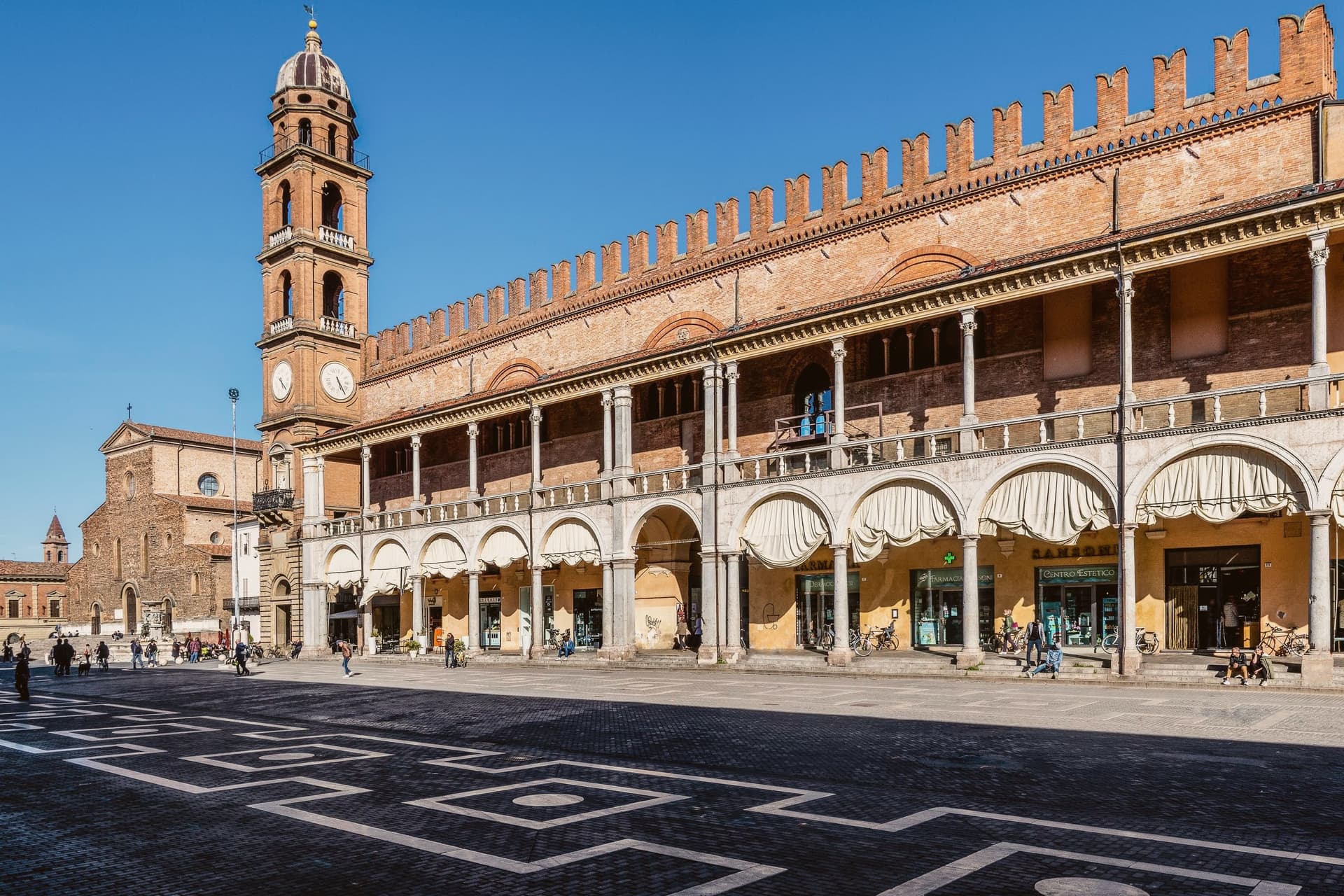
The Cattedrale di San Pietro Apostolo, begun by Giuliano da Maiano in 1474, dominates Piazza della Libertà; Piazza del Popolo next door holds the medieval Palazzo del Podestà and the municipal palace. The Palio del Niballo, an equestrian competition between the five city rioni, runs every June.
La Baita, Manueli have been named by a guide.
What to see in Faenza
- Museo Internazionale delle Ceramiche. Founded in 1908 by Gaetano Ballardini, 15,000 square meters spanning 4000 BC to contemporary work by Picasso, Matisse, Chagall, and Fontana.
- Cattedrale di San Pietro Apostolo. Renaissance cathedral begun by Giuliano da Maiano in 1474, completed by 1515, with sculptures by Benedetto da Maiano in the nave.
- Piazza del Popolo. Twin medieval square to Piazza della Libertà, framed by the Palazzo del Podestà and the porticos of the municipal palace.
How to get to Faenza
There is a railway station in the town, so you can arrive without a car and never need one while you are here. Forlì is roughly 26 minutes away by road.
Our tip
April through June and September through October are the working months on the Romagna plain. Spring brings the Palio del Niballo at the end of June and clear water in the Lamone; autumn dries the fields gold and brings the ceramics fairs back to the centro. July and August touch thirty-six degrees with high humidity, and Piazza del Popolo empties between two and five.
Imola
Why visit Imola
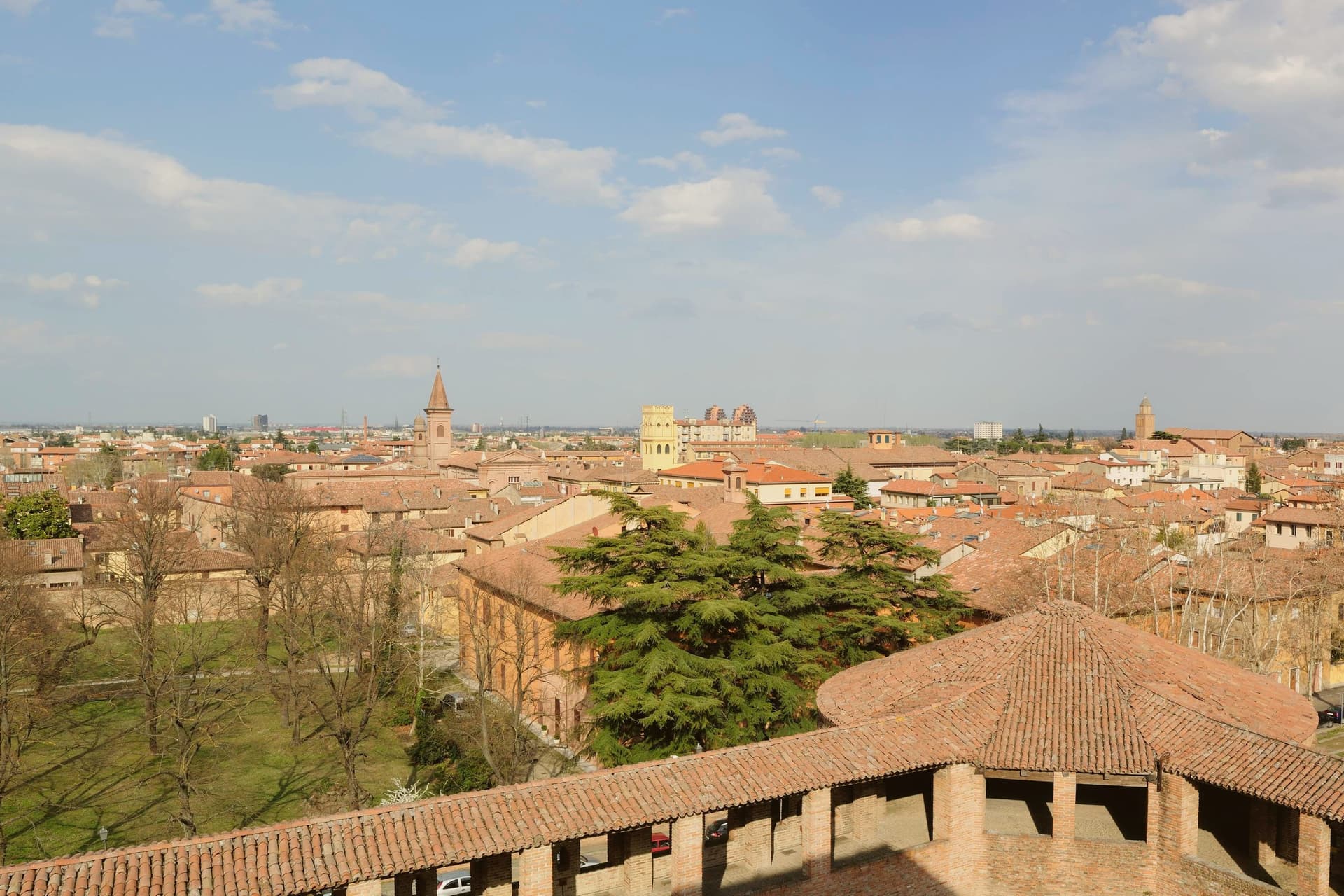
Imola is two cities sharing a name. The medieval one is a quietly handsome Romagna brick town 35 km southeast of Bologna along the Via Emilia, with the Rocca Sforzesca (rebuilt by Caterina Sforza in 1473–1499 — the Tigress of Forlì, who held this fortress through the Borgia siege of 1500) anchoring the centro.
The Palazzo Tozzoni museum, the 11th-century Cattedrale di San Cassiano with its crypt of the city's patron, the Palazzo Sersanti on the central piazza, and the medieval grid of porticoed brick streets all read as a smaller-scale Bologna. The OTHER Imola is the Autodromo Enzo e Dino Ferrari — the 4.9-km F1 circuit on the south bank of the Santerno, built 1953 and named for Enzo Ferrari and his son Dino after Dino's death.
It hosted the San Marino Grand Prix every May from 1981 to 2006 (and again 2020–present), and is the circuit where Ayrton Senna died in 1994 at the Tamburello corner — a memorial still stands there. The Emilia Romagna Grand Prix in April–May is the city's biggest tourist event of the year.
Outside race weekends the circuit is a public park; locals jog the track. The food is Romagna: piadina romagnola (the city is Città dell'Olio, and the local Brisighella Nostrana di Brisighella DOP olive oil is what dresses it), passatelli in brodo, cappelletti, Sangiovese di Romagna from the surrounding hills, and the local nocino walnut liqueur made by every grandmother in the foothills.
San Domenico, Semplice have been named by a guide.
What to see in Imola
- Rocca Sforzesca. Caterina Sforza's 1499 four-towered brick fortress at the centro's edge — the Tigress of Forlì held it against Cesare Borgia in 1500. Museum of arms and ceramics inside.
- Autodromo Enzo e Dino Ferrari. The 4.9-km F1 circuit on the Santerno. Senna memorial at Tamburello. Open as a public park outside race weekends — locals jog the track.
- Cattedrale di San Cassiano + crypt. 11th-c cathedral with the city patron's crypt; the Madonna del Piratello pilgrimage church just outside the walls is a major regional sanctuary.
How to get to Imola
There is a railway station in the town, so you can arrive without a car and never need one while you are here. Forlì is roughly 34 minutes away by road.
Our tip
Imola is best April–June and September–October. The Emilia Romagna Grand Prix (last weekend April / first weekend May) fills every hotel for 80 km — wonderful if you're going, brutal if you're not. Summer is hot and sticky. Baccanale Imola falls in October.
Ravenna
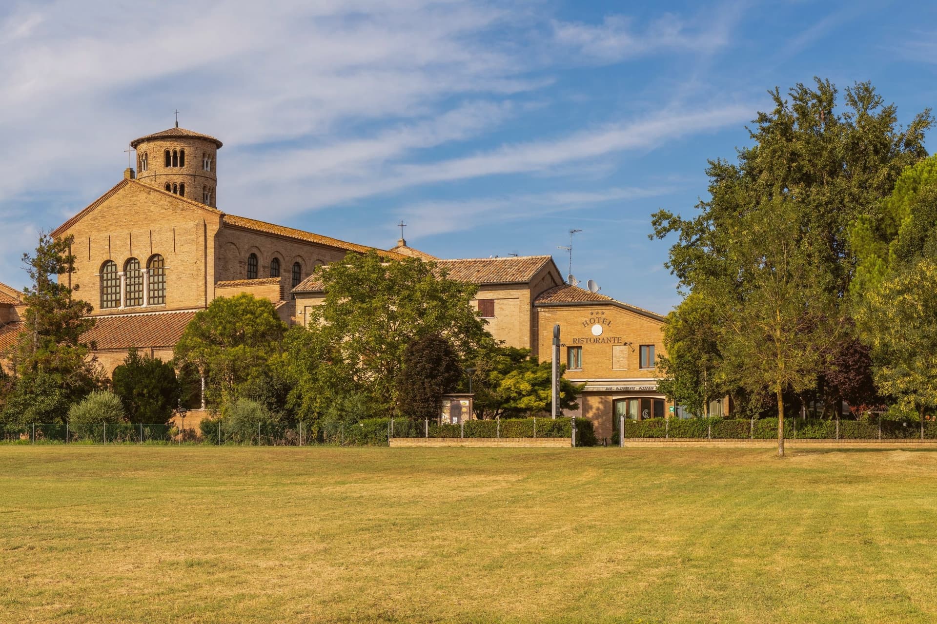
Why visit Ravenna
Ravenna sits four meters above sea level on the Adriatic coastal plain, ten kilometers from the sea and 105 kilometers east of Modena. Its position, low, flat, and close to the coast but not on it, made it defensible in a way landlocked cities were not: the surrounding marsh and lagoon kept armies at a distance while boats could still reach it.
That is why Honorius moved the Western Roman capital here in 402, why Theoderic kept it as his Ostrogothic seat, and why the Byzantine Exarchate held it for Constantinople until 751 as the last piece of imperial territory in northern Italy. Each of the three regimes built churches and paid for mosaic to decorate them, which is why the city's monuments read as a sequence rather than a single style: Roman, Gothic and Byzantine hands working in the same medium across a century and a half.
The municipality itself is split between this historic center and a stretch reaching the Adriatic, where Marina di Ravenna and Punta Marina hold Bandiera Blu beaches, so the same town that holds the fifth-century mausoleums also runs a public coastline. Population is 155,751.
What the churches add up to is less a city of monuments than a record of power changing hands, with each occupant leaving its faith in glass and gold on the walls rather than tearing down what came before.
L'Acciuga, Antica Trattoria al Gallo 1909, Osteria del Tempo Perso and 2 more have been named by a guide.
What to see in Ravenna
- Basilica di San Vitale. Octagonal basilica holding the imperial mosaics of Justinian and Theodora in the presbytery and apse, the throne room of the sequence in gold and purple.
- Mausoleo di Galla Placidia. Small mausoleum next to the basilica, vaulted in a starry blue mosaic sky with gold cross and the symbols of the Evangelists, dim enough that the gold seems to generate its own light.
- Basilica di Sant'Apollinare Nuovo. Built by Theoderic as his palace chapel, the nave walls lined with continuous mosaic processions of saints and martyrs facing each other the full length of the church.
How to get to Ravenna
There is a railway station in the town, so you can arrive without a car and never need one while you are here. Ravenna is roughly 3 minutes away by road.
Our tip
May through September is the working window for Ravenna. The Adriatic warms enough for the beaches at Marina di Ravenna and Punta Marina to fill from late May through August, and the centro storico stays open for the Ravenna Festival in June and July. The mosaics need no weather, but July and August touch thirty-three degrees and the basilica interiors hold their heat. Antica Sagra del Monticino falls in September.
More from Anywhere Italy
 The best towns known for what they grow within two hours of Ancona
- The best wine towns within 75 minutes of Rimini
 The best towns you can reach by train within 45 minutes of Rimini
- The best towns known for what they grow within two hours of Florence
 The best hot-spring towns within two hours of Rimini
 The best towns with a serious restaurant that eat well within 90 minutes of Rimini