
Umbria · Perugia
Massa Martana
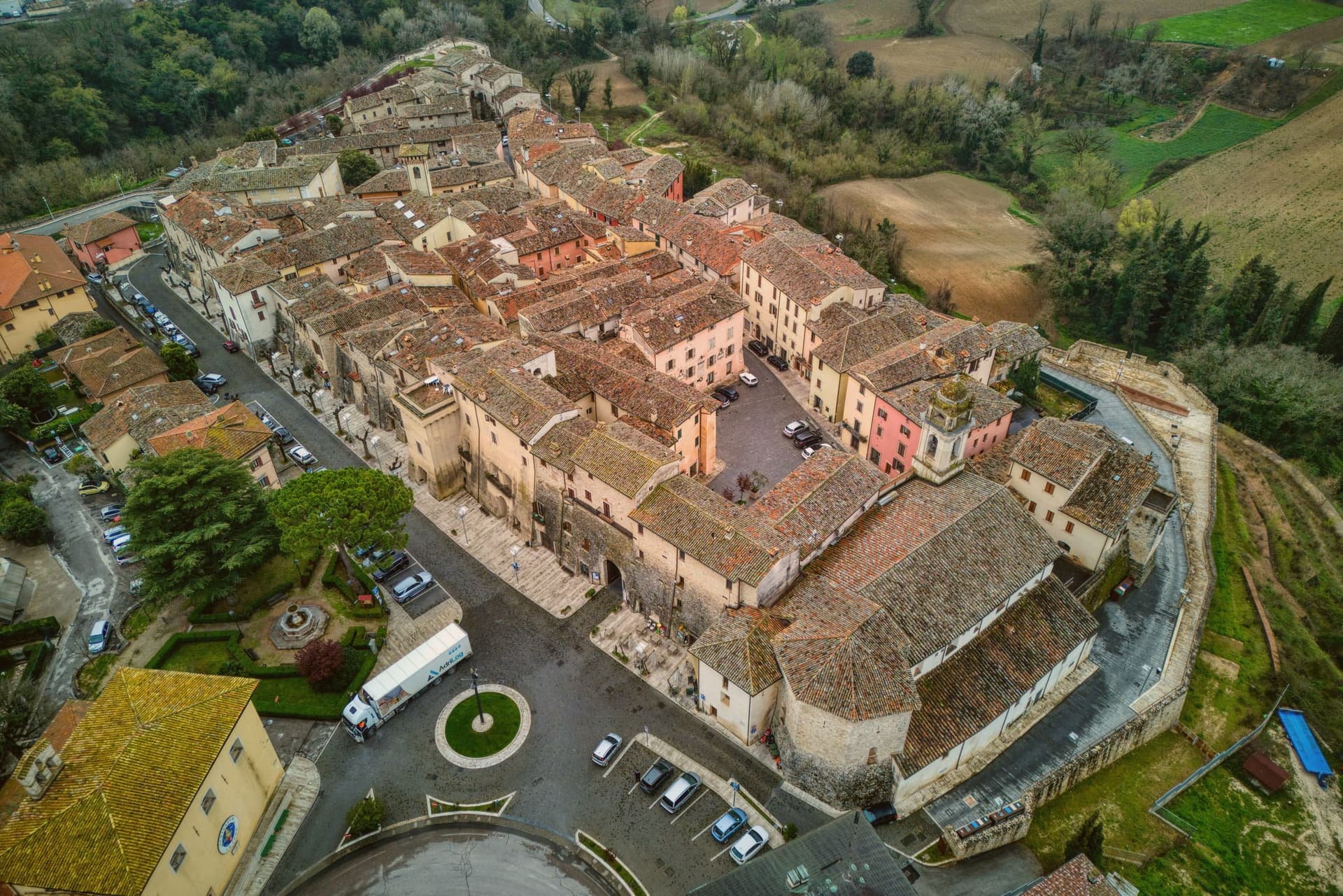
One of the Borghi più belli d'Italia on the Via Flaminia, a 3,577-resident borgo on the original Roman consular road between Rome and Rimini, with the intact 9th-c Abbazia dei Santi Fidenzio e Terenzio above town, a network of Roman-era catacombe Cristiane (Catacombe di Villa San Faustino, the only ones in Umbria), and the Borghi più belli inscription restored after the 1997 Marche-Umbria earthquake.
Picked by Peter Benei
Letter to come
Why Massa Martana is on our list
It holds Borghi più belli d'Italia.
The nearest town with a letter is Acquasparta, No. 73, 15 min by car.
Subscribe and you get Massa Martana's letter the day it comes out.
Visiting
- Best time
- Apr–Jun, Sep–Oct
- By car
- 52 min from Perugia
- Population
- 3,577
- J9°
- F12°
- M14°
- A17°
- M22°
- J28°
- J32°
- A32°
- S25°
- O20°
- N14°
- D10°
- Best
- Hot or crowded
- Quiet
- Mostly closed
Daytime air temperature, averages for 2020–2024. Weather data by Open-Meteo.com.
Why come
Massa Martana is here for the Roman road. The Via Flaminia (the original 220 BC consular road from Rome north over the Apennines to Rimini, the spine of Roman Italian infrastructure for 500+ years) passes directly through the village, and Massa Martana sits at exactly the point where the road begins climbing into the Apennine pre-massif, with sections of the original Roman paving still visible in the surrounding countryside. This made the area an important late-antique Christian community: the Catacombe di Villa San Faustino (3-4 km north of the centro) are the only Roman-era Christian catacombs in all of Umbria, discovered 1968, in continuous use from the 3rd to the 6th c AD, with 200+ tombs, original frescoes, and Latin inscriptions.
The Abbazia dei Santi Fidenzio e Terenzio (9th-c Benedictine, on the hill above town, with surviving Carolingian elements + 12th-c restorations) is the other major monastic-era survivor. The town itself is 3,577 residents altitude in central Umbria, 17 km southeast of Todi, with a medieval-Renaissance centro that was severely damaged by the 26 September 1997 Marche-Umbria earthquake (the same event that brought down the vault of the Basilica di San Francesco in Assisi). The reconstruction was completed in stages through 2010, and the town was re-inscribed on the Borghi più belli d'Italia list after restoration.
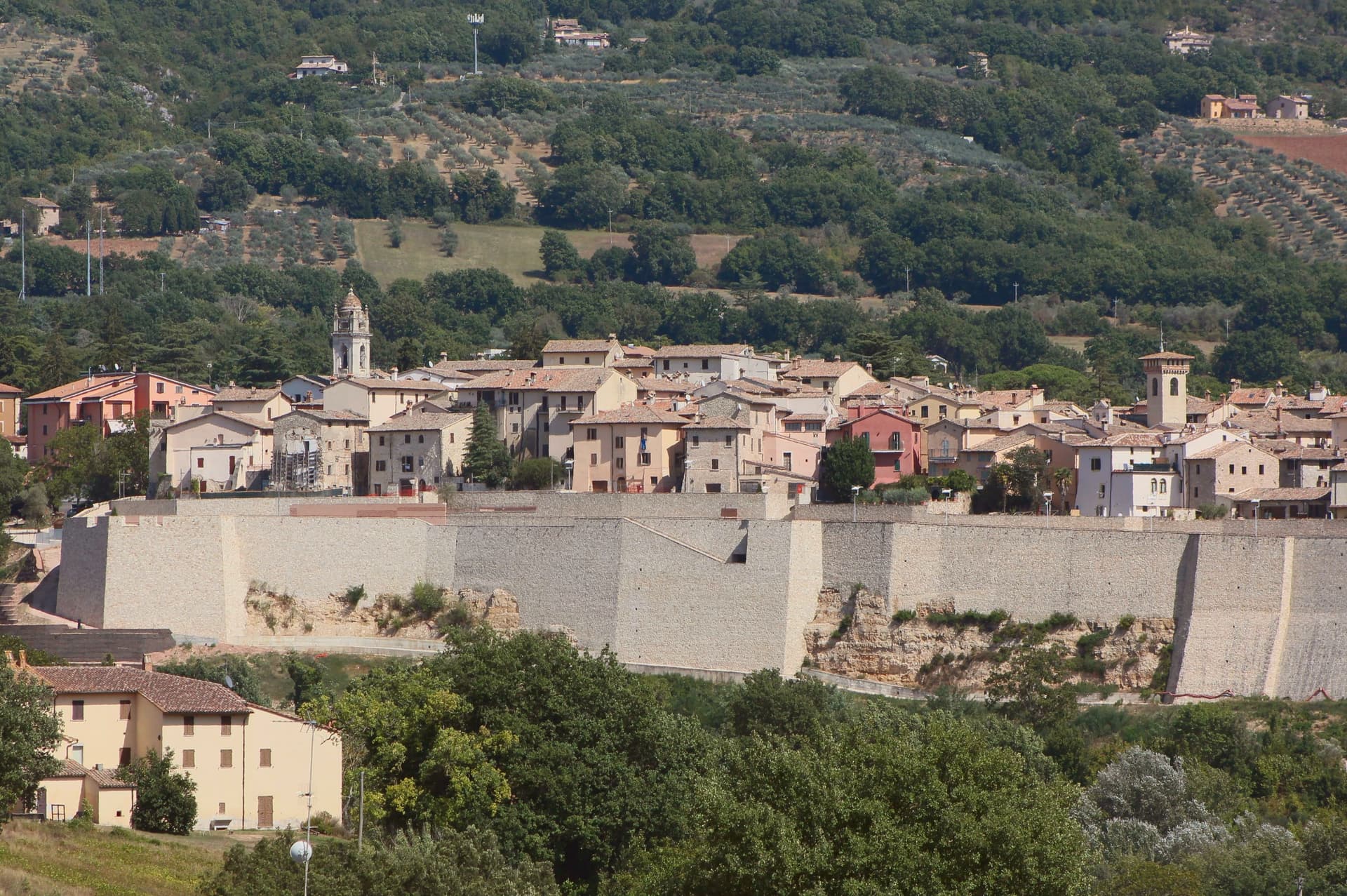
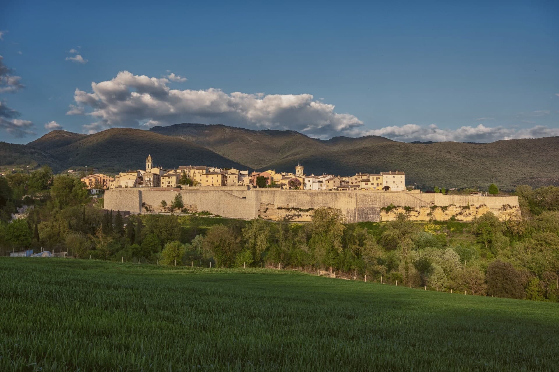
Today the centro reads as a meticulously restored small medieval ensemble: the Porta Santa Maria, the Chiesa Madre di San Felice (rebuilt), the Palazzo Comunale, the Torre Civica. Surroundings: the Monti Martani limestone massif (the prehistoric source of the Martana name) rises immediately east, with marked hiking trails, the Lago di Corbara just south, and the Todi UNESCO-fortified town 17 km away. The food is Umbrian: strangozzi with truffle (Umbria's signature pasta), porchetta, salumi, Pecorino, the local Sagrantino di Montefalco 25 km west. The Festa di San Felice (25 January) and the Sagra del Tartufo (October) are the year's main events.
How to get there
From Rome Fiumicino (FCO), about 1 h 50 min by car.
Ancona (AOI) is about 2 h 18 min away.
By car from the center of Perugia 52 min or Siena 2 h 14 min.
Coming from Rome?
Coming by train into Perugia? Massa Martana is about 52 min away by road.
Every town within reach of Rome Fiumicino airport.
First time driving in Italy? Read our complete manual.
What to see
Via Flaminia Roman road
Original 220 BC consular road from Rome to Rimini passes directly through. Sections of Roman paving visible in the surrounding countryside. The spine of Roman Italian infrastructure for 500+ years.
Catacombe di Villa San Faustino
The only Roman-era Christian catacombs in all of Umbria: 3-4 km north of the centro, in use 3rd-6th c AD, with 200+ tombs, original frescoes, Latin inscriptions. Guided tours.
Abbazia dei Santi Fidenzio e Terenzio
9th-c Benedictine abbey on the hill above town. Surviving Carolingian elements + 12th-c restorations. The most important monastic survivor in the comune.
Centro storico (restored after 1997 earthquake)
Meticulously restored medieval-Renaissance centro: Porta Santa Maria, Chiesa Madre di San Felice, Palazzo Comunale, Torre Civica. Re-inscribed in the Borghi più belli d'Italia after reconstruction.
Monti Martani + Todi
Monti Martani limestone massif immediately east (the prehistoric source of the Martana name): marked hiking trails. Todi UNESCO-fortified town 17 km away.
From the guides
Where to eat
Not our picks, but places the guides put their name to: a Michelin star, a Gambero Rosso fork, a Slow Food snail, a Michelin Key for the hotels. Worth a table, a counter, or a night when you pass through.
Fontana delle PereAgriturismo
Fontana delle Pere holds a Gambero Rosso listing.
Before you sit down: how to order at a restaurant, how to spot a tourist trap, what aperitivo is and how the Italian bar works.
Living here
Could you live here?
Massa Martana is at the end of the road.
- A village of 3,577. The nearest town of 5,000 people, Todi, is 23 min away: past our 15-minute rule, which makes this the end of the road.
- Terni, a city of 106,310, is 34 min by car. Inside our 30 to 60 minutes: close for the services, far enough to keep its own life.
The rules come from our series Where to Move in Italy, written from the places we have lived: Part 1, The End of the Road · Part 2, The Small Town · Part 3, The City · Part 4, The Postcard · Part 5, The Other Half. The towns we would pick are in Part 6, The Best Towns.
- Population 3,577, down 4.4% since 2015
- Nearest city Terni, 34 min drive
- Nearest national health service hospital Todi, 10 km as the crow flies · how healthcare works in Italy
- Homes in the center: €530 to €700 per m² to buy, €2.00 to €2.40 per m² a month to rent
All the numbers Common questions, designations, lists and sources.
More about living here
- Commuter belt
- Pharmacy in town
- High school within a 30-minute drive
- Full fibre reaches 68% of homes
- Primary school in the comune
- Earthquake zone 2, medium hazard
- Perugia airport (PEG), 53 min drive, the nearest with scheduled flights
- Regional capital Perugia, 52 min drive
If you are moving here
Who lives here
10% of residents are foreign citizens, most often from North Macedonia, Romania and Morocco, against 9% across Italy. 39 of them come from English-speaking countries or western and northern Europe, mostly the United Kingdom, the United States and the Netherlands. There are 248 people over 65 for every 100 children under 15, against 216 across Italy. 40% of homes have no resident, holiday homes and empty ones counted together, against 27% across Italy. Perugia province ranks 37th of 107 in Il Sole 24 Ore's quality of life ranking for 2025.
Health and schools
The nearest emergency room is in Todi, 10 km as the crow flies. The nearest major one is in Terni, 24 km away. The nearest IB school is Viterbo International School, 53 km as the crow flies. The nearest school listed as international is Assisi International School, 31 km away.
Information, not medical advice. Confirm with a professional.
Taxes
A home that is not your main one pays 1.14% a year in property tax, charged on the cadastral value rather than the price. A main home pays none unless it is in a luxury category. The town adds 0.8% to your income tax, with nothing due on income under €10,000. 7% pensioner tax: this town is not in a qualifying area.
Information, not tax advice. Confirm with a professional.
What it costs
The average household in Umbria spends about €2,310 a month, €550 of it on food, against about €2,170 across Italy. A family of three pays about €677 a year for water, on the Umbria average. In Perugia, the provincial capital, in September 2026, an espresso cost €1.23, a meal in a pizzeria €12.04 and a man's haircut €20.47.
Climate and risk
It is in climate zone E, on a scale from A, the warmest, to F, the coldest, and heating may run from October 15 to April 15, up to 14 hours a day, unless the mayor changes it. Under 1% of residents live in a zone the national maps rate high for floods, under 1% in a high or medium one. 5% live in a zone rated high or very high for landslides.
These shares cover the whole comune, not any one street. Check an address on IdroGEO.
Moving from abroad? Which visa you need. Sources: ISTAT, the Ministry of Health, ISPRA, the Finance Ministry, the Ministry of Enterprise, Poste Italiane, the comuni, the IB, International Schools Database, Il Sole 24 Ore, Cittadinanzattiva.
Known for
VIA FLAMINIA PASSAGE
The original Roman consular road (220 BC, Rome to Rimini) passes directly through. Sections of Roman paving visible in the surrounding countryside.
UMBRIA'S ONLY CATACOMBE
Catacombe di Villa San Faustino, the only Roman-era Christian catacombs in all of Umbria. 200+ tombs, original frescoes, 3rd-6th c AD.
BORGHI PIÙ BELLI (RESTORED)
Re-inscribed after the meticulous reconstruction following the 1997 Marche-Umbria earthquake.
ABBAZIA DEI SANTI FIDENZIO
9th-c Benedictine abbey on the hill: surviving Carolingian elements + 12th-c restorations. The major monastic survivor of the comune.
Common questions
- What is Massa Martana known for?
- One of the Borghi più belli d'Italia on the Via Flaminia, a 3,577-resident borgo on the original Roman consular road between Rome and Rimini, with the intact 9th-c Abbazia dei Santi Fidenzio e Terenzio above town, a network of Roman-era catacombe Cristiane (Catacombe di Villa San Faustino, the only ones in Umbria), and the Borghi più belli inscription restored after the 1997 Marche-Umbria earthquake.
- Where is Massa Martana?
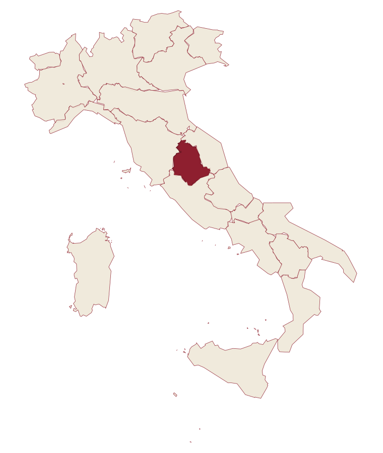
- Massa Martana is a comune in the province of Perugia, in Umbria, at 351 meters above sea level.
- What is the nearest airport to Massa Martana?
- The nearest airport with scheduled flights is Perugia (PEG), about 53 min by car.
- How long is the drive from Perugia to Massa Martana?
- About 52 min by car.
- When is the best time to visit Massa Martana?
- Best in Apr–Jun, Sep–Oct. July is the warmest month, averaging 32 degrees, and April the wettest, with about 12 rain days.
- Which other towns are like Massa Martana?
- Narni, Acquasparta and San Gemini.
- How many people live in Massa Martana?
- 3,577 residents, by ISTAT's count on 1 January 2025.
- Is Massa Martana a good place to live?
- By the rules in our Where to Move in Italy series, Massa Martana is at the end of the road: the nearest town of 5,000 people, Todi, is 23 min away. The nearest city, Terni, is 34 min away by car. The nearest national health service hospital is in Todi, 10 km as the crow flies. Full fibre reaches 68% of homes.
Tags & data designations · numbers · sources
Recognized as
Landscape
The numbers
- Elevation: 351 m
- Population: 3,577
- Surface area: 78.41 km²
These figures were compiled from public directories: ISTAT, OpenStreetMap and Wikidata, and from the official listings of the guides named on this page. Town details change; verify with official sources before you travel.
The ranked lists
Lists Massa Martana appears in
- The 6 best small towns that eat well in the province of PerugiaPerugia provinceeats wellsmall6 towns · smallest 686 residents
- The prettiest villages that eat well within 90 minutes of TerniNear Terniwithin 90 mineats wellprettiest villages7 towns · smallest 686 residents · closest 16 min away
- The 9 best hidden hill towns that eat well within 90 minutes of TerniNear Ternihill townwithin 90 mineats wellhidden9 towns · smallest 902 residents · closest 16 min away
- The best small towns that eat well in UmbriaUmbriaeats wellsmall9 towns · smallest 686 residents
Near here, with a letter
- Written about. No. 73.
Acquasparta
Province: Terni
A hill town at 350 meters above the Naia valley, where a Renaissance duchy briefly became the seat of Europe's first scientific academy.
15 min by car
- Written about. No. 72.
Todi
Province: Perugia
A walled hill town at 398 meters on the Tiber, with Etruscan, Roman, and medieval rings stacked one above the other.
23 min by car
- Written about. No. 87.
Spoleto
Province: Perugia
Lombard ducal capital at 396 meters under the Rocca Albornoziana, where a 230-meter aqueduct bridge crosses to Monteluco and Menotti founded the Festival in 1958.
17 km away
Our guide
Our nearest guide, 49 km away
Umbria: the towns, when to go, how to get there
The Umbria guide came out of the letter. Letters from the towns we visit. Free.
Read the guide: Two banks, no sea. 21 towns, the drive and train times, the months, where to eat and sleep.
Paid plans, the moving year and the books are on the membership page.