
The best small towns inside a national park in the province of Salerno
The province of Salerno holds one of the largest national parks in Italy, and most of it is not coast. It is limestone: the Alburni massif, the caves at the base of the cliffs, gorges where the water runs clear and cold enough to make swimming a brief decision. Villages are built from the same pale stone they stand on, with stepped lanes, vaulted passageways and stone thresholds worn smooth. The food follows the geology, white figs dried in the sun, goat and mutton cooked slowly, cacioricotta, anchovies salted along the shore, and the olive groves that climb the slopes behind the beaches. Spring brings broom and wild orchids on the high pastures, autumn brings chestnuts and the first pressing of oil.
The park's fame belongs to a short stretch of it. Paestum draws the coach parties for its Greek temples, and Palinuro fills through July and August with cars queueing for the sea caves and the parking above the beach. Both are inside or beside the same protected area, and both are worth seeing, but in high summer the coast road between them moves at walking pace. What most visitors take away from the park is a temple, a headland and a swim.
The park keeps going, inland and upward, well past that. The same coastline carries on south towards Capo Palinuro's quieter flank and the terraced olive slopes above it, and behind the shore the land rises through river valleys to plateaux with views back over the gulf, then to the flat farmland of the Vallo di Diano with its Carthusian monastery. The towns in this list sit inside the park boundary, in the caves, the gorges, the olive hills and the abandoned upper villages, and fewer people go to any of them.
Of the 27 communes we have mapped in the province of Salerno, 15 qualify as towns inside a national park: each sits inside the boundary of a national park. This list is the small ones, 9 in all, ordered smallest first. The smallest, Morigerati, has 608 residents.
Elsewhere in the catalogue: The 8 best hill towns inside a national park in Campania and The best hill towns within 90 minutes of Salerno.
Morigerati
Why visit Morigerati
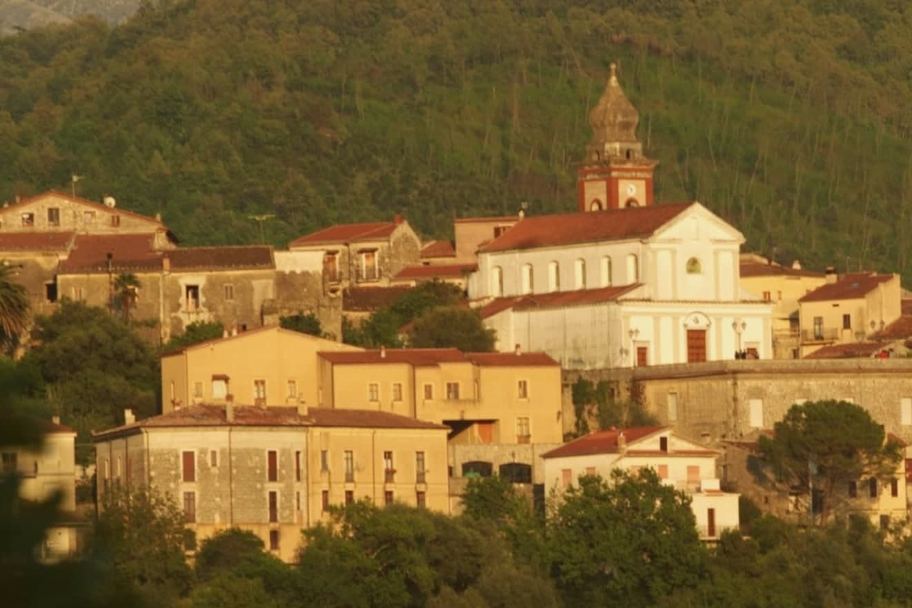
Morigerati sits at 340 meters on a cliff in the southern Cilento, inside the Cilento, Vallo di Diano and Alburni National Park, with six hundred and eight residents on a stone ridge above the Bussento. The river that gives the commune its identity disappears underground for seven kilometers and resurfaces from a series of karst caves directly below the village, the Grotte del Bussento, which the WWF designated as an oasis in 1985 and still manages on six hundred and seven hectares of forest and water.
The path down from the centro to the cave mouth is a short walk and a steep climb back. The commune is a Bandiera Arancione of the Touring Club Italiano, a member of the Città delle Grotte network, and sits inside one of the largest national parks in Italy.
The village fits the southern Cilento depopulation pattern: an aging core, emigration out, and a small return of visitors drawn by the water under the rock.
What to see in Morigerati
- Grotte del Bussento. Karst cave mouth where the Bussento river resurfaces after seven kilometers underground, with a WWF-managed oasis of 607 hectares since 1985.
- Centro storico di Morigerati. Stone village at 340 meters on the cliff above the river, with narrow lanes, arches, and overlooks down to the cave mouth below.
- Oasi WWF Grotte del Bussento. Nature reserve of beech, oak and alder along the Bussento gorge, run by WWF Italia in collaboration with the comune.
How to get to Morigerati
Salerno is roughly 92 minutes away by road.
Our tip
April through June and September into October are the months for Morigerati. The Bussento runs full from spring snowmelt above and the oasis trail down to the cave mouth stays cool under the canopy. July and August can climb past thirty-two degrees on the cliff, though the air at the cave is ten degrees cooler year-round.
Roscigno
Why visit Roscigno
Roscigno sits on the slope of Monte Pruno, inside the Cilento, Vallo di Diano e Alburni National Park, sixty kilometers inland from Salerno. The comune is split into two settlements that share little beyond a name.
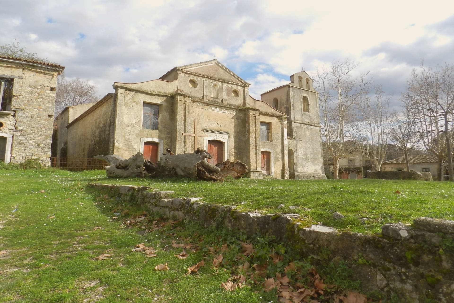
Roscigno Nuovo, built up the hill on safer ground, holds the 625 current residents and the ordinary business of the town. Below it, the old village keeps its stone houses, its square, its fountain and washing basins, and its church on its raised platform, arranged as they were when relocation laws pushed everyone uphill after the landslide.
The two halves face each other across that history: one lived in and unremarkable, the other empty and preserved by neglect rather than restoration. What draws people to Roscigno is not a monument but a whole abandoned settlement left standing, houses, square, and church together, a rural community's ordinary fabric intact and unoccupied rather than any single building.
What to see in Roscigno
- Roscigno Vecchia. Stone village of the 1600s and 1700s, its houses still standing along empty streets, unrestored and left as they were when the last families walked out.
- Piazza Giovanni Nicotera. Main square with the original fountain and public washing basins still in place, framed by the empty houses and the church above.
- Chiesa di San Nicola di Bari. Parish church on a raised platform above the piazza, unrestored, with a preserved wooden ceiling visible through the doors.
How to get to Roscigno
Salerno is roughly 79 minutes away by road.
Our tip
April through June and September into October are the months that suit Roscigno. The Cilento hills stay green, the air is mild and the empty streets of Roscigno Vecchia photograph well in the low light. July and August are hot, often crossing thirty-two degrees, and the ridge offers little shade between houses; many visitors come early in the morning.
Perito
Why visit Perito
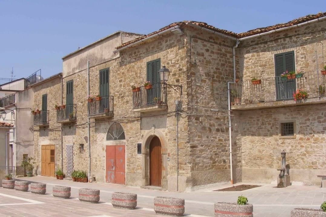
Perito sits at 480 meters on a hill above the Alento river valley, inside the Cilento and Vallo di Diano National Park. The local historian Emilio Gatto traced the founders to refugees from ancient Velia, the Greek polis below the coast, hiding from Saracen raids; the Codex diplomaticus Cavensis records the village between the tenth century and 1137.
In the middle ages it served as a fortified outpost over the valleys below. From 1801 to 1860 it was a hamlet of Orria, then a separate commune from 1850.
Perito made its name through polvere nera, black powder, ground from local sulphur and saltpetre with sandstone mortars and wooden pestles, used for hunting, defense and, in the nineteenth century, by Bourbon-era brigands. The Chiesa di San Nicola di Bari, built around 1550 and inaugurated in February 1563, rises behind a bell tower reused from an Angevin watch tower.
The commune is a Cittaslow member.
What to see in Perito
- Chiesa di San Nicola di Bari. Parish church built around 1550, inaugurated 17 February 1563, with a monumental bell tower converted from an Angevin watch tower.
- Centro storico. Stone-built ridge village above the Alento valley, with narrow lanes and the bell tower of San Nicola visible from the access road.
- Parco Nazionale del Cilento. Surrounding park with paths into the Alento basin and toward the Cittaslow neighbours of Gioi and Stio.
How to get to Perito
Salerno is roughly 83 minutes away by road.
Our tip
April through October is the open season on the Perito ridge: clear days, cool evenings, and the Alento valley trails dry enough to walk. July and August push past thirty-three degrees in the valley below; the ridge at 480 meters keeps a few degrees of breeze. April, May and September are the right weeks for the National Park walks and for the slow-food itineraries with Gioi and Stio.
Castelcivita
Why visit Castelcivita
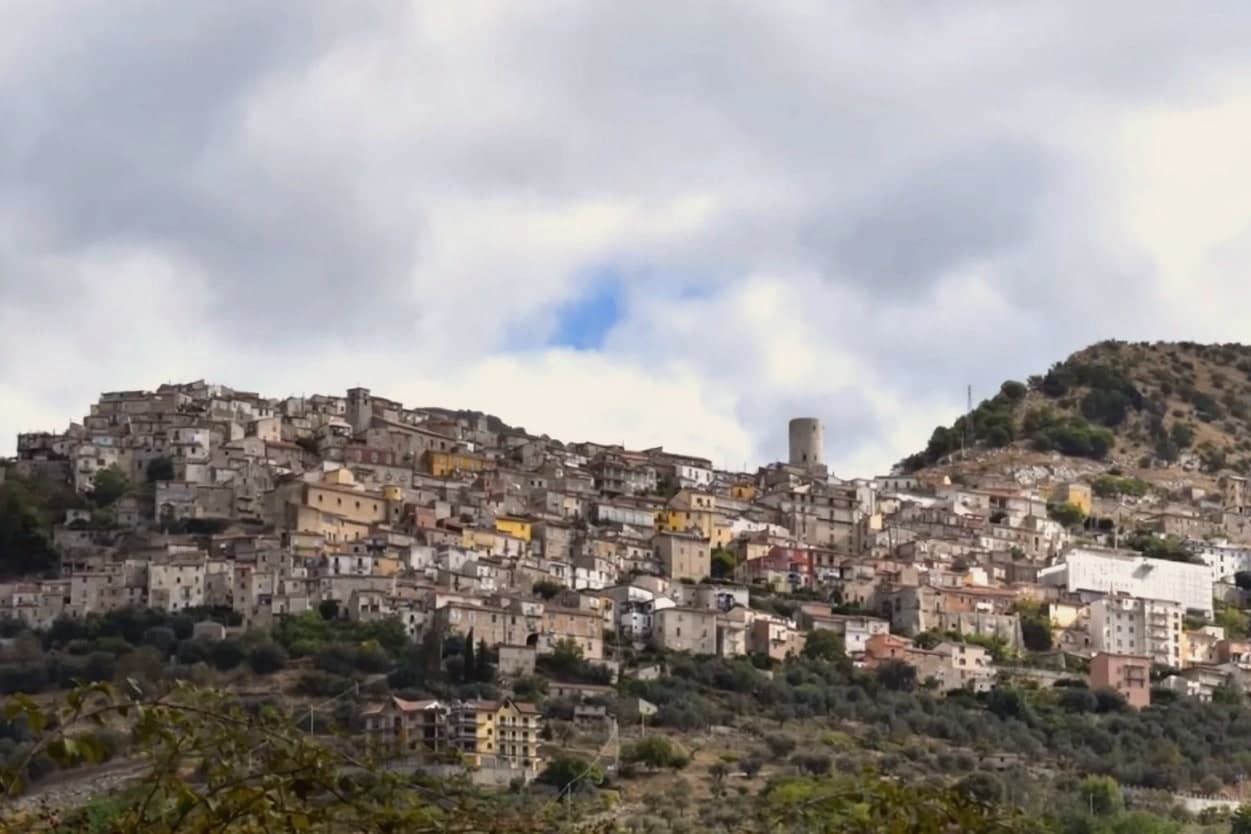
Castelcivita sits at 526 meters on the western flank of the Alburni mountains, in the Cilento, Vallo di Diano e Alburni National Park, forty-five kilometers inland from Salerno. The town has 1,441 residents and a medieval ridge plan around an Angevin tower, now the seat of the Museum of Rural Civilization.
Most visitors come for the caves below the village, the Grotte di Castelcivita, a karst system that runs for nearly 4,800 meters along the Calore river and includes named halls of the Castle, the Crocodile and the Desert. The cave mouth opens at ninety-four meters above sea level, 1.5 kilometers from the town.
In 1972 the Paleolithic deposits at the entrance turned the grotte into one of the most significant sites of early human presence in southern Italy, with stone tools and faunal remains dated to roughly 40,000 years ago. The town above is quiet.
The cave system is what brings school groups, speleologists and weekend visitors from Salerno.
What to see in Castelcivita
- Grotte di Castelcivita. Karst cave system running nearly 4,800 meters along the Calore, with Paleolithic deposits from roughly 40,000 years ago and named halls of the Castle, the Crocodile and the Desert.
- Torre Angioina. Thirteenth-century Angevin tower at the top of the centro storico, now the seat of the Museo della Civiltà Contadina with Paleolithic finds from the caves.
- Centro storico medievale. Ridge-pattern village of stone houses and stepped lanes on the slope of the Alburni, with views east across the Calore valley.
How to get to Castelcivita
Salerno is roughly 57 minutes away by road.
Our tip
April through June and September into October are the working months for Castelcivita. The Alburni stay green into early summer, the temperatures hold below thirty degrees, and the caves keep a steady fourteen degrees year round, useful when the surface is hot. July and August push past thirty-two; the centro storico empties in the afternoon and the cave queue grows. Festa della Patata di Montagna di Castelcivita falls in the season.
Trentinara
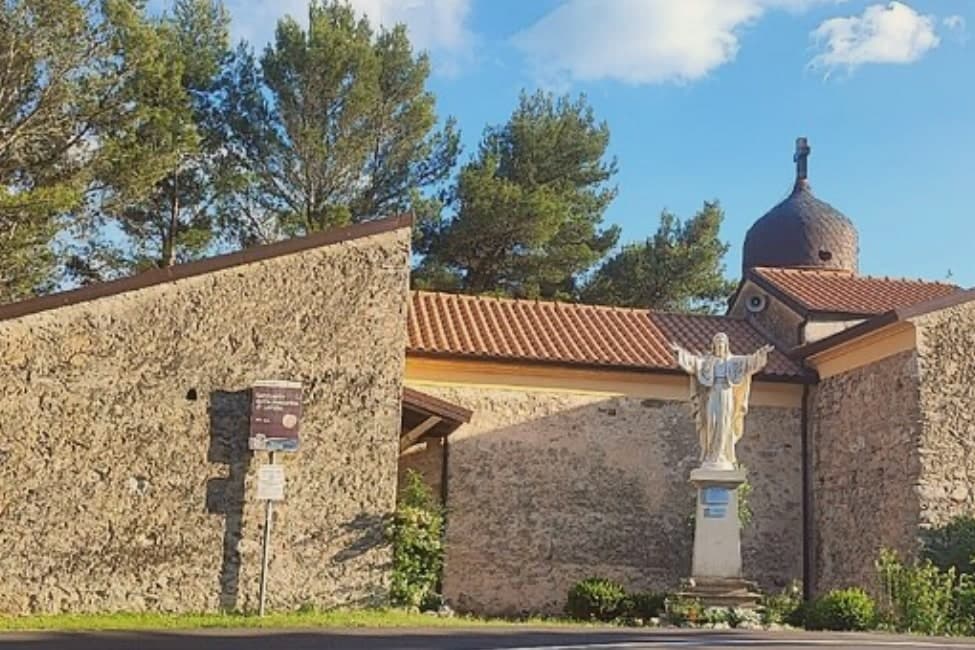
Why visit Trentinara
Trentinara sits at 606 meters on the Cantenna cliff in the northern Cilento, forty-five kilometers from Salerno, ten from Paestum. From the cliff edge the view runs across the Sele plain, the Greek temples below, the Gulf of Salerno and Capri on a clear day, which is why the town is called the Terrazza del Cilento.
The local legend explains the cliff a different way. Saul, a bandit chief, fell in love with Isabella, daughter of the marquis.
Forbidden to marry, the two jumped from the Cantenna together; the boulders below, the Preta 'ncatenata, are still pointed out as the place where their bodies fused. The Cilento in Volo zipline opened on the cliff edge: 1,500 meters of cable, 170 meters of drop, top speed 120 km/h, ending near Capaccio.
The centro storico above is small, around 1,581 residents, with the Chiesa di San Nicola at the top of the ridge and a glass terrace, the Coast to Coast skywalk, suspended over the void.
What to see in Trentinara
- Terrazza del Cilento. Panoramic cliff edge looking across the Sele plain to Paestum, the Gulf of Salerno and Capri, with a glass-floor skywalk added in 2021.
- Cilento in Volo. Zipline 1,500 meters long with a 170-meter drop and top speed of 120 km/h, descending from Monte Cantenna toward Capaccio.
- Preta 'ncatenata. Two boulders below the cliff, identified as the place where the legendary lovers Saul and Isabella came to rest, the so-called Romeo and Juliet of the Cilento.
How to get to Trentinara
Salerno is roughly 69 minutes away by road.
Our tip
May through October is the open season for Trentinara. The 606-meter cliff catches the breeze even in July and August, when the Sele plain below is hot and the temples of Paestum bake. The zipline runs through the warm months and books up on summer weekends.
Auletta
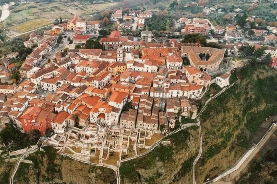
Why visit Auletta
Auletta sits at 280 meters on a hill on the right bank of the Tanagro river, at the northern edge of the Vallo di Diano, inside the Cilento, Vallo di Diano and Alburni National Park. The town was fortified by the year 1000 and is mentioned as Olibola in 1095, possibly from olea, Latin for oil.
The medieval core is reached through three gates, Porta Castello, Porta del Fiume and Porta Rivellino. The Castello Marchesale, twelfth century in origin, took its current shape in the fifteenth, when defensive systems were added; it is privately owned by the Maioli Castriota Scanderbech family.
The 1857 Great Neapolitan earthquake destroyed much of the town and was documented by the Irish seismologist Robert Mallet, in the first systematic post-earthquake survey ever attempted. In 1861, immediately after Unification, locals rose against the Piedmontese army and 45 were killed in what is remembered as the Auletta Massacre.
The town is now a Città delle Grotte for its proximity to the Pertosa-Auletta caves.
What to see in Auletta
- Castello Marchesale. Twelfth-century fortress in the highest part of the centro storico, reshaped in the fifteenth century with defensive walls and now privately held.
- Chiesa di San Nicola di Mira. Parish church inside the medieval walls, holds a relic of San Donato di Ripacandida, the town's patron saint.
- Borgo dei Mestieri. Restored part of the centro storico turned into a living museum of traditional Cilento crafts, with workshops on stone, iron and clay.
How to get to Auletta
There is a railway station in the town, so you can arrive without a car and never need one while you are here. Salerno is roughly 49 minutes away by road.
Our tip
April through October is the open season in the Tanagro valley: clear days, mild nights and the National Park trails dry enough to walk. July and August push past thirty-three degrees in the valley; the centro storico on the hill catches a slight breeze. April, May and early June are the right weeks for the Alburni hikes and the Pertosa-Auletta caves, which run at fifty degrees year-round and feel cold off a hot afternoon.
Pisciotta
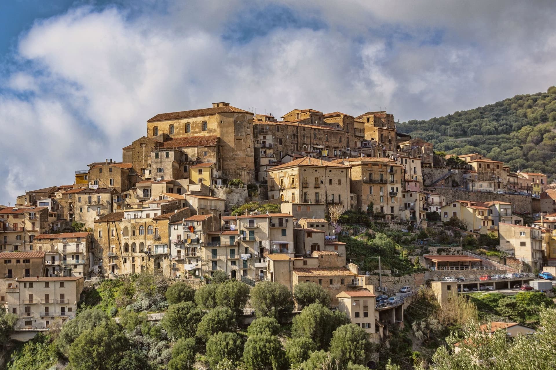
Why visit Pisciotta
The hill the town occupies rises between Ascea and Palinuro, part of the strictest zone of the Cilento and Vallo di Diano National Park, and the ridge gives the stone houses of the centro storico a clear line of sight to Capo Palinuro twelve kilometers south. The town's parts sit at different elevations doing different work: the historic core holds the ridge at 171 meters, the olive terraces cover the slopes below it, and Marina di Pisciotta occupies the shore at the foot of the hill, where the fishing boats go out.
The menaica net worked by the Marina's fishermen is a technique once widespread around the Mediterranean and now reduced to a few coves, of which this is one. Carlo Pisacane's failed 1857 revolutionary expedition landed at Sapri and was crushed nearby; the Cilento coast keeps the memory in plaques and processions rather than in any structure at Pisciotta itself.
What holds the town together is elevation: everything of note here, the anchovies, the olives, the beach, the ridge, is defined by how far it sits above or below that 171-meter line.
What to see in Pisciotta
- Centro storico di Pisciotta. Hilltop medieval core of stone houses on a ridge 171 meters above the sea, with a clear sightline to Capo Palinuro.
- Marina di Pisciotta. Fishing port at the foot of the hill, departure point for the last menaica anchovy boats on the coast, its beach holding the Blue Flag.
- Uliveti di Pisciottana. Terraces holding trees of considerable age, the source groves of the Cilento DOP extra-virgin oil.
How to get to Pisciotta
There is a railway station in the town, so you can arrive without a car and never need one while you are here. Salerno is roughly 138 minutes away by road.
Our tip
May through September is the open season on the Cilento coast: clear water, warm evenings and the menaica boats out at night. July and August push past thirty-five degrees and the Marina rentals book; the centro storico on the hill above stays a few degrees cooler in the breeze. April and October are dry and mild, the right time for the olive harvest road and Parco Nazionale walks without heat.
Padula
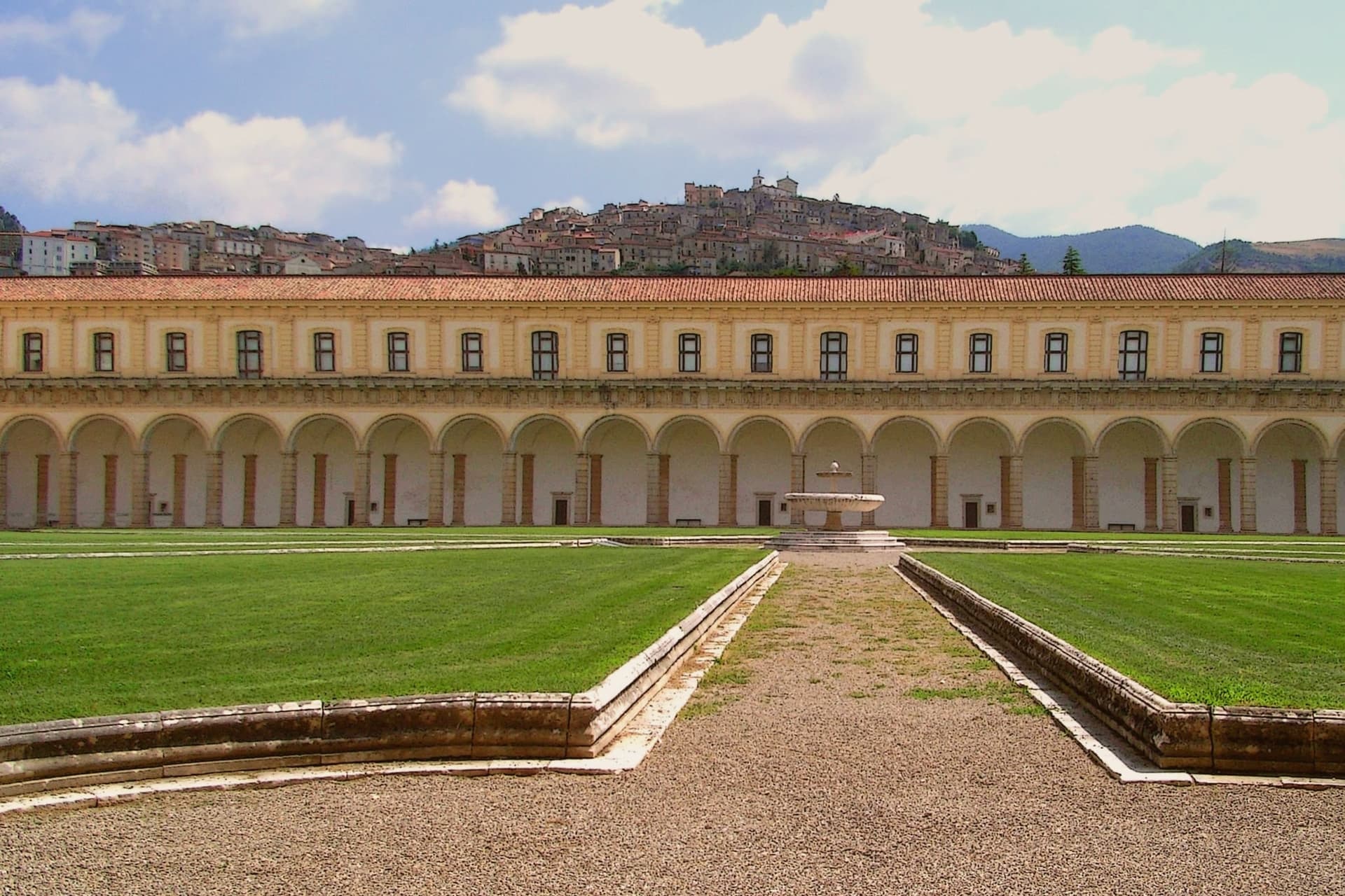
Why visit Padula
Padula sits on two hills above the Vallo di Diano, the long valley between the Cilento and the Lucanian Apennines. The monastery was founded on 27 April 1306 by Tommaso di Sanseverino, and UNESCO listed it in 1998 as part of the Cilento and Vallo di Diano serial site.
The medieval centro climbs the hill above it, stone houses and narrow lanes rising to the church of San Michele Arcangelo at the summit, from where the valley opens out below. It was in these streets that the 1857 volunteers were captured and killed, an event the town still marks with its monument.
The commune is also Città del Pane, for the round wheat loaves baked in local wood ovens. Padula reads as a town built around a single enormous fact below it and a smaller, older settlement above, the two connected by a hillside that has seen both monastic ambition and a violent end to a political expedition.
What to see in Padula
- Certosa di San Lorenzo. 320 rooms and 51,500 m² of floor above the Vallo di Diano, its plan said to recall the griddle on which the dedicatee saint was burned alive. Built and rebuilt over four centuries by Carthusians suppressed in 1866.
- Centro storico di Padula. Medieval hill town above the monastery, with stone houses, narrow lanes, and the church of San Michele Arcangelo at the top.
- Battaglia di Padula. Monument to the fight in which the volunteers were captured and killed by Bourbon troops and local farmers in the streets of the centro.
How to get to Padula
There is a railway station in the town, so you can arrive without a car and never need one while you are here. Salerno is roughly 73 minutes away by road.
Our tip
May through September is the strongest window. The Vallo di Diano at 699 meters keeps cool nights even in August, and the Certosa di San Lorenzo opens longer hours through summer. July and August can climb past thirty degrees on the valley floor but the hill above keeps a usable breeze.
Centola
Why visit Centola
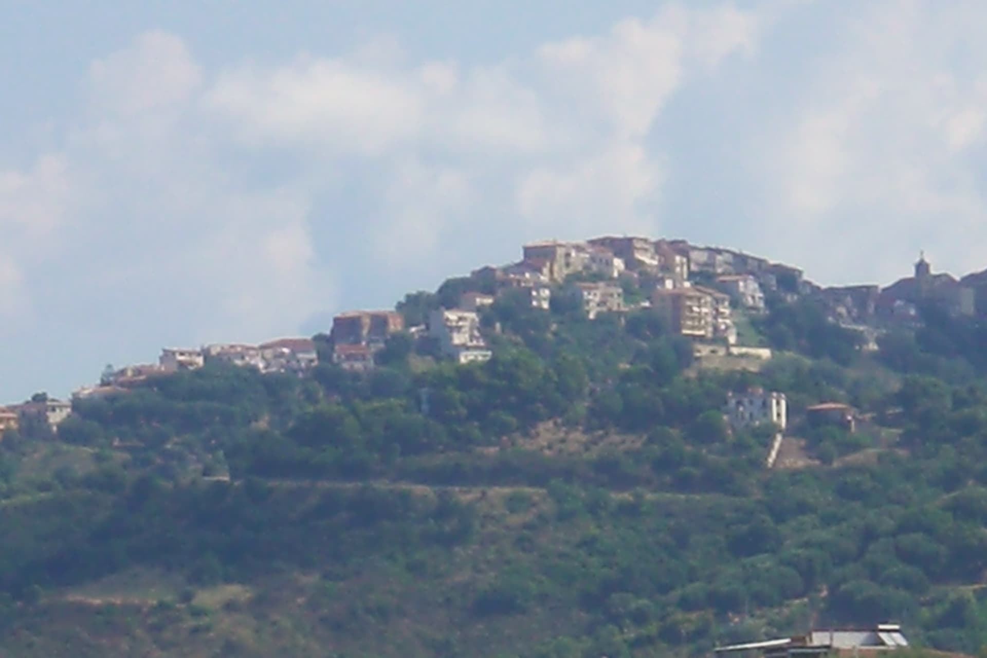
Centola sits inside the Cilento, Vallo di Diano and Alburni National Park, with four frazioni stretched between hill and shore. The hilltop centro began as a refuge for survivors of ancient Molpa, the coastal city destroyed by the Byzantine general Belisarius in 547 AD; the name likely traces to centum illuc, the hundred who fled uphill.
Centola joined the Cilento revolt of 1828 and adopted the Proclamation of Palinuro, then lost most of its population to emigration across the Americas after Unification. The commune holds a Bandiera Blu on the Palinuro coast and belongs to Città del Vino.
The hilltop and the cape are seven kilometers apart with seventy meters of climb between them, a short distance that nonetheless separates two different lives: one built by people who ran from the water, the other built on people coming back to it for the beach and the caves. What was once a flight inland has become, centuries later, a pull back toward the coast it fled.
What to see in Centola
- Centro storico di Centola. Hilltop old town above the Mingardo valley, founded by survivors who climbed from the coast after it was sacked; the streets sit apart from the shore below, reached by a climb of some seventy meters over the distance between.
- Palinuro. The seaside frazione at the cape, sitting where the Lambro and Mingardo rivers meet the sea, its marina the departure point for boats along the promontory.
- Ruderi di Molpa. Remains of the ancient coastal settlement destroyed by Belisarius in 547 AD, on the promontory above the Mingardo mouth, the origin point of the hilltop town itself.
How to get to Centola
Salerno is roughly 115 minutes away by road.
Our tip
May, June, September and early October are the months Palinuro was built for. Water temperature crosses twenty degrees, the boat tours to the Grotta Azzurra run all day, and the centro on the hill stays cool when the marina fills. July and August are the south Italian high season: the beaches fill, the SP562 backs up between Palinuro and Marina di Camerota, and prices climb.
More from Anywhere Italy
- The 8 best hill towns inside a national park in Campania
- The best hill towns within 90 minutes of Salerno
- The best coastal towns inside a national park in Campania
 The best small towns you can reach by train in Campania
- The best towns you can reach by train in the province of Salerno
- The best beach towns in the province of Salerno