
The best towns you can reach by train that sit inside a national park in Campania
90 towns visited, 910 to go. Follow along, free: Subscribe on Substack
Campania keeps its wild country close to the sea and close to the tracks. In the Cilento the hills fall in dry stone terraces toward water the color of bottle glass, olive trees hold the slopes, and the fishing towns cook alici di menaica, cured anchovies, and white figs dried in the September sun. Further north the volcanic ground grows tomatoes and apricots on soil the color of ash, and the houses are built from lava stone and tufo, warm gray and honey by turns. Spring smells of broom and wild fennel; late autumn is chestnuts, and the sea is still swimmable well past the end of the school holidays.
Most people come to Campania for the Amalfi Coast, and in July the road above Positano moves at walking pace while the coach parks fill by breakfast. It is beautiful and it is expensive, and the bus between the famous villages is the part of the trip nobody plans for. The same crowd fills the ferries from Sorrento and the queues at Capri's marina. There are reasons for all of it, but the pleasure is thin when shared with everybody else.
The protected land continues past the postcards, and it is threaded by the Naples to Reggio railway and the lines into the interior. The Vesuvius park, the Vallo di Diano and its Certosa, the Matese hills, the Cilento with its temples and coves: all of them have stations, and all of them see fewer people than the coast an hour north. The towns here are working places with markets, ruins and beaches within reach of a platform. Arrive by train, walk out of the station, and the park starts more or less where the town ends.
Of the 67 communes we have mapped in Campania, 9 qualify as towns you can reach by train inside a national park: we have confirmed each is reachable without a car, and each sits inside a national park. The smallest, Pisciotta, has 2,428 residents.
Elsewhere in the catalogue: The best coastal towns inside a national park in Campania and The best towns with a World Heritage site that sit inside a national park in Campania.
Why visit Pisciotta
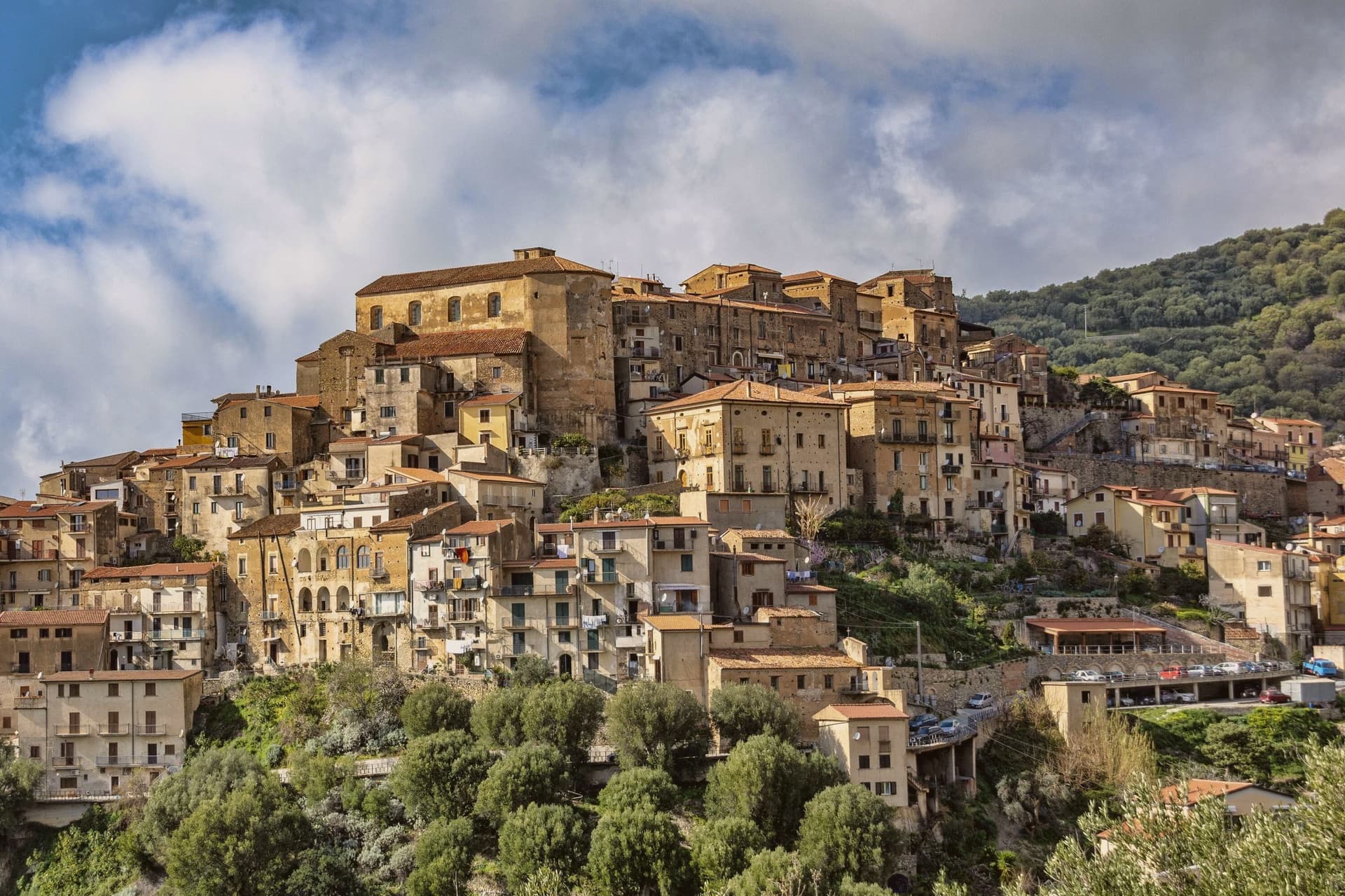
The hill the town occupies rises between Ascea and Palinuro, part of the strictest zone of the Cilento and Vallo di Diano National Park, and the ridge gives the stone houses of the centro storico a clear line of sight to Capo Palinuro twelve kilometers south. The town's parts sit at different elevations doing different work: the historic core holds the ridge at 171 meters, the olive terraces cover the slopes below it, and Marina di Pisciotta occupies the shore at the foot of the hill, where the fishing boats go out.
The menaica net worked by the Marina's fishermen is a technique once widespread around the Mediterranean and now reduced to a few coves, of which this is one. Carlo Pisacane's failed 1857 revolutionary expedition landed at Sapri and was crushed nearby; the Cilento coast keeps the memory in plaques and processions rather than in any structure at Pisciotta itself.
What holds the town together is elevation: everything of note here, the anchovies, the olives, the beach, the ridge, is defined by how far it sits above or below that 171-meter line.
What to see in Pisciotta
- Centro storico di Pisciotta. Hilltop medieval core of stone houses on a ridge 171 meters above the sea, with a clear sightline to Capo Palinuro.
- Marina di Pisciotta. Fishing port at the foot of the hill, departure point for the last menaica anchovy boats on the coast, its beach holding the Blue Flag.
- Uliveti di Pisciottana. Terraces holding trees of considerable age, the source groves of the Cilento DOP extra-virgin oil.
How to get to Pisciotta
It has its own railway station. Salerno is about 2 h 18 min away by road.
Our tip
May through September is the open season on the Cilento coast: clear water, warm evenings and the menaica boats out at night. July and August push past thirty-five degrees and the Marina rentals book; the centro storico on the hill above stays a few degrees cooler in the breeze. April and October are dry and mild, the right time for the olive harvest road and Parco Nazionale walks without heat.
Why visit Centola
Centola sits inside the Cilento, Vallo di Diano and Alburni National Park, with four frazioni stretched between hill and shore. The hilltop centro began as a refuge for survivors of ancient Molpa, the coastal city destroyed by the Byzantine general Belisarius in 547 AD; the name likely traces to centum illuc, the hundred who fled uphill.
Centola joined the Cilento revolt of 1828 and adopted the Proclamation of Palinuro, then lost most of its population to emigration across the Americas after Unification. The commune holds a Bandiera Blu on the Palinuro coast and belongs to Città del Vino.
The hilltop and the cape are seven kilometers apart with seventy meters of climb between them, a short distance that nonetheless separates two different lives: one built by people who ran from the water, the other built on people coming back to it for the beach and the caves. What was once a flight inland has become, centuries later, a pull back toward the coast it fled.
What to see in Centola
- Centro storico di Centola. Hilltop old town above the Mingardo valley, founded by survivors who climbed from the coast after it was sacked; the streets sit apart from the shore below, reached by a climb of some seventy meters over the distance between.
- Palinuro. The seaside frazione at the cape, sitting where the Lambro and Mingardo rivers meet the sea, its marina the departure point for boats along the promontory.
- Ruderi di Molpa. Remains of the ancient coastal settlement destroyed by Belisarius in 547 AD, on the promontory above the Mingardo mouth, the origin point of the hilltop town itself.
How to get to Centola
It has its own railway station. Salerno is about 1 h 55 min away by road.
Our tip
May, June, September and early October are the months Palinuro was built for. Water temperature crosses twenty degrees, the boat tours to the Grotta Azzurra run all day, and the centro on the hill stays cool when the marina fills. July and August are the south Italian high season: the beaches fill, the SP562 backs up between Palinuro and Marina di Camerota, and prices climb.
Why visit Ascea
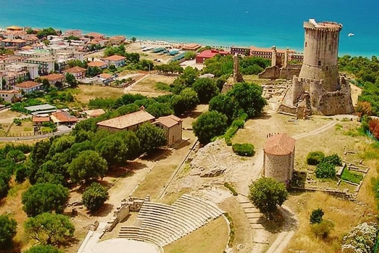
Ascea sits on the southern Cilento coast, two settlements in one comune: Ascea Paese at 230 meters above olive groves, and Ascea Marina on the flat between the Alento river and the sea. The Greek colonists from Phocaea founded Hyele here around 538 BC after fleeing the Persians; the city became Elea in Greek and Velia in Roman times, and produced the Eleatic school of Parmenides and Zeno that founded Western metaphysics.
The archaeological park keeps the Porta Rosa, the oldest known round arch in Europe, an Ionian temple acropolis, Roman baths and the medieval Castelluccio Angioino built on the city's highest point. Modern Ascea is a Bandiera Blu beach commune of nine kilometers of sand inside the Cilento, Vallo di Diano and Alburni National Park, with the Spighe Verdi mark for agro-environmental quality.
What to see in Ascea
- Parco Archeologico di Elea-Velia. Ruins of the Greek city founded around 538 BC by Phocaeans, home to Parmenides and the Eleatic school, with Porta Rosa, Ionic temple acropolis and Roman baths.
- Castelluccio Angioino. Medieval Angevin tower built on the highest point of ancient Velia, reusing Greek and Roman masonry, restored as the park's viewpoint.
- Marina di Ascea. Nine kilometers of fine sand between the Alento river mouth and Punta del Telegrafo, Bandiera Blu and Spighe Verdi within the Cilento national park.
How to get to Ascea
It has its own railway station. Salerno is about 1 h 50 min away by road.
Our tip
May through September is the open Cilento summer, with the Marina filling up from late June onward and the archaeological park staying open for evening visits in July and August. Mid-summer touches the high thirties and the beach absorbs most of the day; the paese on the hill stays a few degrees cooler. April and early October are dry and quiet, ideal for walking Velia without crowds or sun damage to the stone.
Why visit Alife
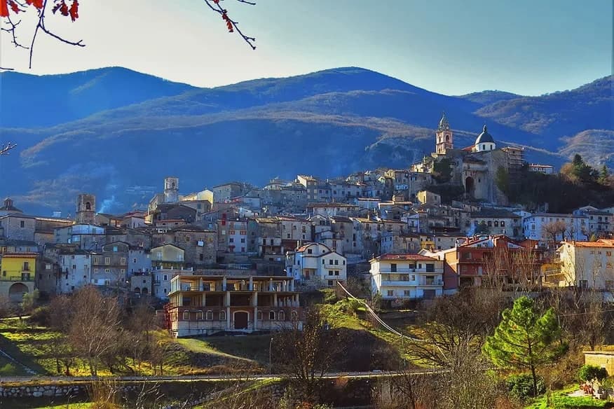
Alife sits at 110 meters at the southern foot of the Matese, the rectangular Roman walls still tracing the original plan of the 326 BC Latin colony founded after the Samnite Wars. The circuit runs 1.9 kilometers, with towers every 39 meters and four monumental gates on the cardo and decumano.
Inside the walls lies the largely buried Roman amphitheatre, 48 by 38 meters, the fourth largest in Italy after Rome, Pompeii and Capua. The Cryptoporticum, a 100-meter underground gallery, has been kept legible by recent excavation.
The town gives its name to the Cipolla di Alife, a heirloom red onion documented locally since Roman times and still cultivated on the irrigated plain along the Volturno. Modern Alife sits inside the Parco Regionale del Matese and along the Via Francigena del Sud, with extra-virgin olive oil and Pallagrello and Casavecchia wines on the surrounding slopes.
What to see in Alife
- Mura romane di Alife. Rectangular Roman walls running 1.9 kilometers, with towers every 39 meters and four monumental gates on the original cardo and decumano of the 326 BC colony.
- Anfiteatro Romano. Largely buried amphitheatre of 48 by 38 meters, the fourth largest in Italy after Rome, Pompeii and Capua, dating to the early imperial period.
- Criptoportico Romano. Underground gallery more than 100 meters long, well preserved beneath the centro storico, kept open after recent archaeological excavation.
How to get to Alife
It has its own railway station. Napoli is about 1 h 16 min away by road. The full route from Naples.
Our tip
April through June and September into October are the open months along the Matese foothills, when the Volturno plain is green and the Roman walls walk at a reasonable temperature. July and August push the inland Caserta past thirty-five degrees and the amphitheatre site closes mid-afternoon to protect visitors and stone. The Sagra della Cipolla di Alife happens in mid-September and pulls weekend visitors from Naples and Caserta.
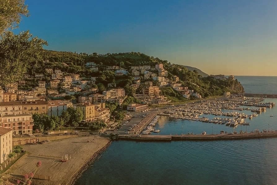
Why visit Agropoli
Agropoli is the northern gate of the Cilento coast, a promontory between two bays forty kilometers south of Salerno. The name itself, akropolis, was given by the Byzantines who fortified the high point during the Greco-Gothic war between 535 and 553.
In 882 the Saracens took the town and turned it into a rabat, a trenched stronghold from which they raided as far as the walls of Salerno until they were dislodged from the Garigliano camp in 915. The Angevin-Aragonese castle still stands on the highest point, a triangular plan with three circular towers and a moat, built on the original Byzantine foundations.
Below the castle, the centro storico runs in stone stairways down to the small fishing port. Modern Agropoli has 21,000 residents, a Bandiera Blu beach, the Spighe Verdi mark for agro-environmental quality, and Cilento National Park status that links it inland to the Mediterranean Diet biosphere.
What to see in Agropoli
- Castello Angioino-Aragonese. Triangular castle with three circular towers and a moat, built on sixth-century Byzantine foundations and remodelled by the Angevins and Aragonese.
- Centro storico sul promontorio. Old town on the headland, stone stairways from the castle down to the fishing port, with the seventeenth-century Porta arch and tight whitewashed alleys.
- Chiesa dei Santi Pietro e Paolo. Sixteenth-century mother church inside the centro storico, rebuilt after war damage, dedicated to the patrons celebrated each 29 June.
How to get to Agropoli
It has its own railway station. Salerno is about 1 h 6 min away by road. The full route from Naples.
Our tip
May through September is the open Cilento beach season, with the marina filling up from late June onward and the Trentova bay reachable by foot or boat. July and August push the Cilento past thirty-five degrees and the port and headland fill with day boats from Capri and Salerno. April and October are dry and quieter, ideal for walking the castle path without the queue.
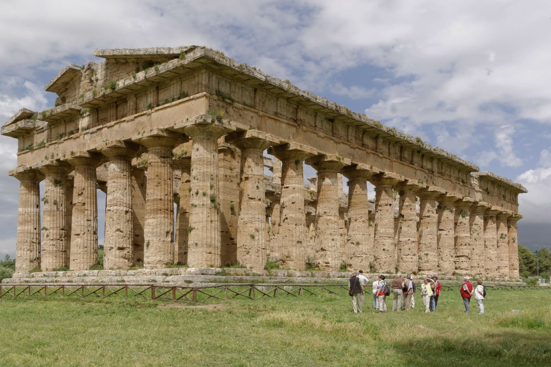
Why visit Capaccio Paestum
Capaccio Paestum is the only commune in Italy where the name pairs a medieval hilltown with an ancient city on the plain below. The seat of Capaccio sits at 419 meters on Monte Calpazio, while the archaeological park below, the city of Poseidonia founded around 600 BC, occupies the flat between the Sele river and the sea.
The two halves of the name mark two different settlements built centuries apart and never merged into one another. The layering below Monte Calpazio runs deeper than the founding city and the medieval hilltown: a Roman city followed the earlier one on the same plain, and the medieval Capaccio Vecchia, razed by Frederick II, was rebuilt as the hilltown that still carries the seat today.
The buffalo pastures that made the area's DOP mozzarella sit inside the same national park boundary as the Sele plain and the Monte Calpazio spur, so the cheese-making land and the ruins share one stretch of ground. The commune, in effect, is stacked: hill above, plain below, and each layer on the plain built over or beside the one before it.
What to see in Capaccio Paestum
- Templi di Paestum. The Basilica, the Temple of Hera II and the Temple of Athena stand on the flat ground between the Sele river and the sea, close enough to walk between in an afternoon.
- Museo Archeologico Nazionale di Paestum. The frescoes are kept indoors, apart from the temples they were painted near, giving a rare look at how the tomb's painters depicted the afterlife.
- Mura greche di Paestum. Almost five kilometers of Greek and Roman defensive walls with four gates, intact across the entire perimeter of the ancient city.
How to get to Capaccio Paestum
It has its own railway station. Salerno is about 51 min away by road. The full route from Naples.
Our tip
May, June and September are the right months on the Sele plain, with the temples at sunrise or late afternoon and the buffalo pastures still green. July and August push the plain past thirty-eight degrees, the archaeological park closes its high noon hours and the beach absorbs most visitors. April and October are dry and quiet, the Madonna del Granato feast falls on the first Sunday of May and the temples are walkable without queues.
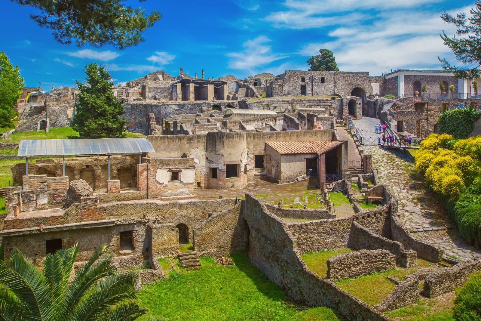
Why visit Pompei
Pompei sits at 30 meters on a volcanic plateau on the south slope of Vesuvius, twenty kilometers from Naples and a few kilometers inland from where the Sarno meets the sea. The Roman city was buried under five to six meters of ash and lapilli when the volcano erupted on 24 October 79 AD, killing the part of the population that had not already left.
Excavations began in 1748 under the Bourbons and have never stopped; the site has been UNESCO-listed since 1997 alongside Herculaneum and Torre Annunziata, and is the third most visited archaeological site in the world. Modern Pompei was founded in 1881 by the lawyer Bartolo Longo, who built the Santuario della Beata Vergine del Rosario as a center for pilgrimage and social work.
The basilica with its 80-meter campanile and the surrounding grid of streets are entirely a creation of the 1880s, separate from the dig and laid over fields that had been farmland until then.
What to see in Pompei
- Parco Archeologico di Pompei. The Roman city buried in 79 AD and excavated since 1748, UNESCO-listed since 1997, with the Forum, the Villa dei Misteri and the Lupanare.
- Santuario della Beata Vergine del Rosario. Pontifical basilica built between 1876 and 1891 by the lawyer Bartolo Longo, the heart of modern Pompei and a pilgrimage site of four million a year.
- Casa del Fauno. Roman patrician house in the dig with a bronze faun at its center and the Alexander Mosaic floor depicting Issus, now in the Naples museum.
How to get to Pompei
It has its own railway station. Napoli is about 24 min away by road. The full route from Naples.
Our tip
May, June, September and early October are the strongest months for Pompei. The dig opens at nine and the Forum stays walkable before midday heat sets in. July and August are punishing: the site sits on volcanic plateau at thirty meters with no shade in the main streets, and afternoon temperatures cross thirty-five degrees.
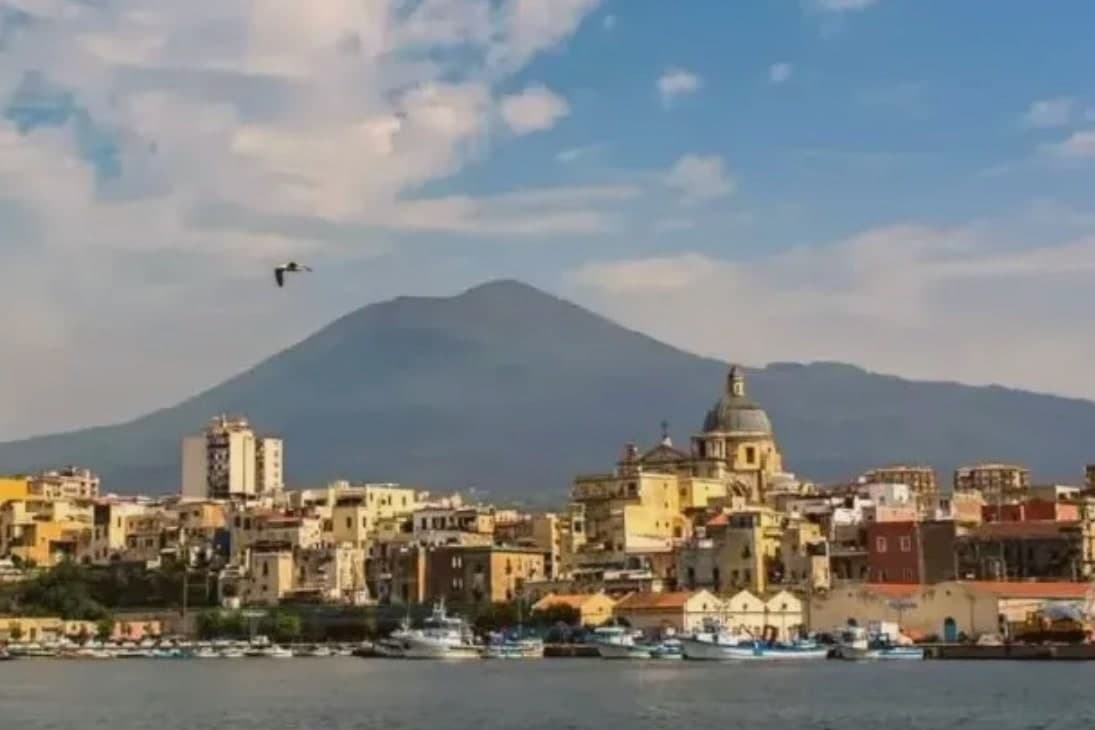
Why visit Torre Annunziata
Torre Annunziata sits at 15 meters on the Bay of Naples, 20 kilometers south of the city at the western foot of Vesuvius, where the Sarno river meets the sea. The Roman town of Oplontis stood here before 79 AD; Villa A, called the Villa di Poppea after Nero's second wife who probably owned it, is the largest of the seafront villas buried by the eruption and the most completely excavated, listed by UNESCO in 1997 with Pompeii and Herculaneum.
The modern town is named for the 1319 watchtower and the chapel of the Annunziata built next to it. From the 17th century the Sarno was channelled to power flour and pasta mills, and by 1900 Torre Annunziata had more than sixty pastifici.
Together with Naples and Gragnano it was called the Capital of the White Art, the term for industrial dried pasta. Setaro and a handful of other small pastifici still produce by traditional bronze die and slow drying.
The town was hit hard by postwar industrial decline and the 1980 Irpinia earthquake.
What to see in Torre Annunziata
- Scavi di Oplontis - Villa di Poppea. Seafront Roman villa attributed to Nero's wife Poppaea, buried 79 AD, the largest and best-preserved of the Oplontis villas, UNESCO-listed 1997.
- Basilica della Madonna della Neve. Sixteenth-century shrine of the Madonna della Neve, the patron of the town, rebuilt after 18th-century earthquakes.
- Torre dell'Annunziata. Fourteenth-century watchtower for which the town is named, built 1319 to guard against Saracen raids on the Vesuvian coast.
How to get to Torre Annunziata
It has its own railway station. Napoli is about 22 min away by road. The full route from Naples.
Our tip
April through June and September through October are the workable months. The Villa di Poppea is open all year but the unshaded Roman peristyles get punishing in July and August, when the site temperature can push 35 degrees. The bay breeze cools the lungomare in the evenings.
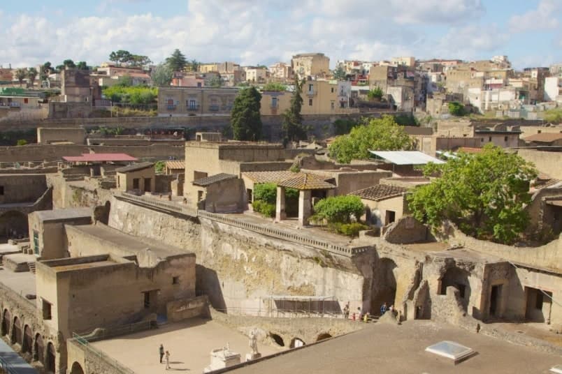
Why visit Ercolano
The eruption of AD 79 treated the two Roman towns differently. Pompeii took 3 to 4 meters of ash, hot enough to scorch organic material but not to seal it.
Herculaneum, closer to the mountain and down at the shore, was hit by repeated pyroclastic surges and ended up under a mud flow that cooled hard around everything it touched: roofs, furniture, scrolls, upper floors. That difference in burial is the reason one site kept its wood and the other did not: the carbonised wooden screen of the House of the Wooden Partition, the wooden bed in the House of the Carbonised Furniture, and the second-storey overhangs are all here because the mud sealed rather than scorched them.
The site was named UNESCO World Heritage in 1997, jointly with Pompeii and Torre Annunziata. The suburban villa attributed to Julius Caesar's father-in-law, Lucius Calpurnius Piso, once stood on the ancient seafront, now buried well inland under the weight of the deposit.
Inside it, roughly 1,800 carbonised papyrus scrolls were recovered, including the entire Epicurean philosophical library of Philodemus of Gadara. That find, the largest single ancient library ever recovered, is still being unrolled with multispectral imaging at the Officina dei Papiri Ercolanesi in Naples, and it is the building the J. Paul Getty Museum in Malibu replicated 1:1 as its main structure.
Along the old shoreline nearby, the arched boathouses hold the remains of 300 fugitives killed by the 500 degree pyroclastic surge while they waited for a rescue that never reached them, discovered in the 1980s and 1990s and now the most-photographed image of that moment. The modern town sits directly on top of the ancient one, 50,000 people on the lower slopes of the volcano, with the excavated ruins sunk below current street level in a pit at the center of things.
Excavation has gone on since 1738, when Charles of Bourbon began it, and continues piecemeal now. To the east, the ground rises toward the national park and the Gran Cono crater, reached by a half-day hike from the upper car park with reservation required.
To the west, the road along the old Golden Mile strings 122 Bourbon-era villas, built between the 1730s and 1820s by the Naples aristocracy, toward the coast; Villa Campolieto, designed by Vanvitelli in 1763 and now a cultural center, and Villa Favorita, a former royal residence, are the ones open to visitors. Upper slope, buried town, and shoreline road are three bands of the same landscape, each shaped by proximity to the same mountain.
The town's food follows the same geology: spaghetti alle vongole, mozzarella di bufala, pomodorino del piennolo del Vesuvio DOP grown on the volcanic slopes, and Lacryma Christi del Vesuvio DOC red and white from vineyards on the same soil. What holds the place together is that the volcano is not backdrop here.
It is the reason the ruins are intact, the reason the villas needed a gateway road, and the reason the food tastes the way it does.
What to see in Ercolano
- Parco Archeologico di Ercolano (UNESCO). Wooden screens, beds, and second-storey balconies stand in place, sealed by the mud rather than reduced by it. Walking the excavated streets means walking below the level of the modern town, which sits on top of what the mud buried.
- Villa dei Papiri. A 100m-long suburban villa attributed to Caesar's father-in-law, its rooms opening onto what was once the ancient seafront, now well inland of the shore under the weight of volcanic deposit.
- Boathouse skeletons. 300 fugitives killed while sheltering in the arches along the old shoreline, waiting for a rescue that the surge outran. Found in the 1980s, the arches are left much as they were uncovered.
How to get to Ercolano
It has its own railway station. Napoli is about 16 min away by road. The full route from Naples.
Our tip
Ercolano is best March–June and September–October: the archaeological park is open year-round but summer Naples heat (35°C+) is brutal on the unshaded site, and the Vesuvio crater hike is best before 10am or after 4pm in summer. Allow a full day for the site + the crater. Book Villa dei Papiri visit slots in advance: the substructure tours are limited capacity.
More from Anywhere Italy
- The best coastal towns inside a national park in CampaniaCampaniacoastalinside a park9 towns · smallest 2,428 residents
- The best towns with a World Heritage site that sit inside a national park in CampaniaCampaniainside a parkWorld Heritage6 towns · smallest 4,903 residents
- The best towns with a World Heritage site that you can reach by train in CampaniaCampaniaby trainWorld Heritage8 towns · smallest 5,750 residents
- The best towns you can reach by train in the province of SalernoSalerno provinceby train6 towns · smallest 2,428 residents
- The best beach towns you can reach by train in CampaniaCampaniaclean beachby train7 towns · smallest 2,428 residents
- The best towns with a serious restaurant that you can reach by train in CampaniaCampaniaby trainserious restaurant10 towns · smallest 2,428 residents