
The best coastal towns inside a national park in Campania
Campania keeps two national parks with a shoreline, and both change how the coast tastes and looks. In the Cilento the hills are limestone and holm oak, the beaches shelve into clear water below towers built against corsairs, and the cooking runs to white figs dried in the sun, alici di menaica salted in wooden barrels, cacioricotta from goats grazed on scrub. North of Naples the ground turns dark and volcanic, and the apricots, tomatoes and Lacryma Christi vines grow within sight of the sea. Houses are built from tufo and local stone, plastered and left to fade. Late spring and September are the sensible months, when the water is warm and the inland paths are walkable.
The default Campanian coast is the Amalfi one, and the reasons are honest: Positano stacked above its beach, the Sentiero degli Dei, the drive itself. It is also the most congested road in southern Italy for much of the summer, with coach traffic, restricted access and parking priced accordingly. Sorrento and Capri absorb the overflow. None of this makes those places worse, only busier and slower to move through.
The same sea carries on well past all of that. South of Salerno the coast runs into the Cilento, where the protected park reaches the shore at temple sites, fishing harbours and long stretches of sand, and fewer people go. Nearer Naples, the Vesuvius park holds towns that live between excavated Roman streets and the working seafront. The towns here all share the two conditions: water on one side, national park on the other.
Of the 66 communes we have mapped in Campania, 9 qualify as coastal towns inside a national park: each sits directly on the sea, and each sits inside a national park. The smallest, Pisciotta, has 2,428 residents.
Two more lists worth reading alongside this one: The best beach towns in the province of Salerno and The best hidden beach towns in Campania.
Pisciotta
Why visit Pisciotta
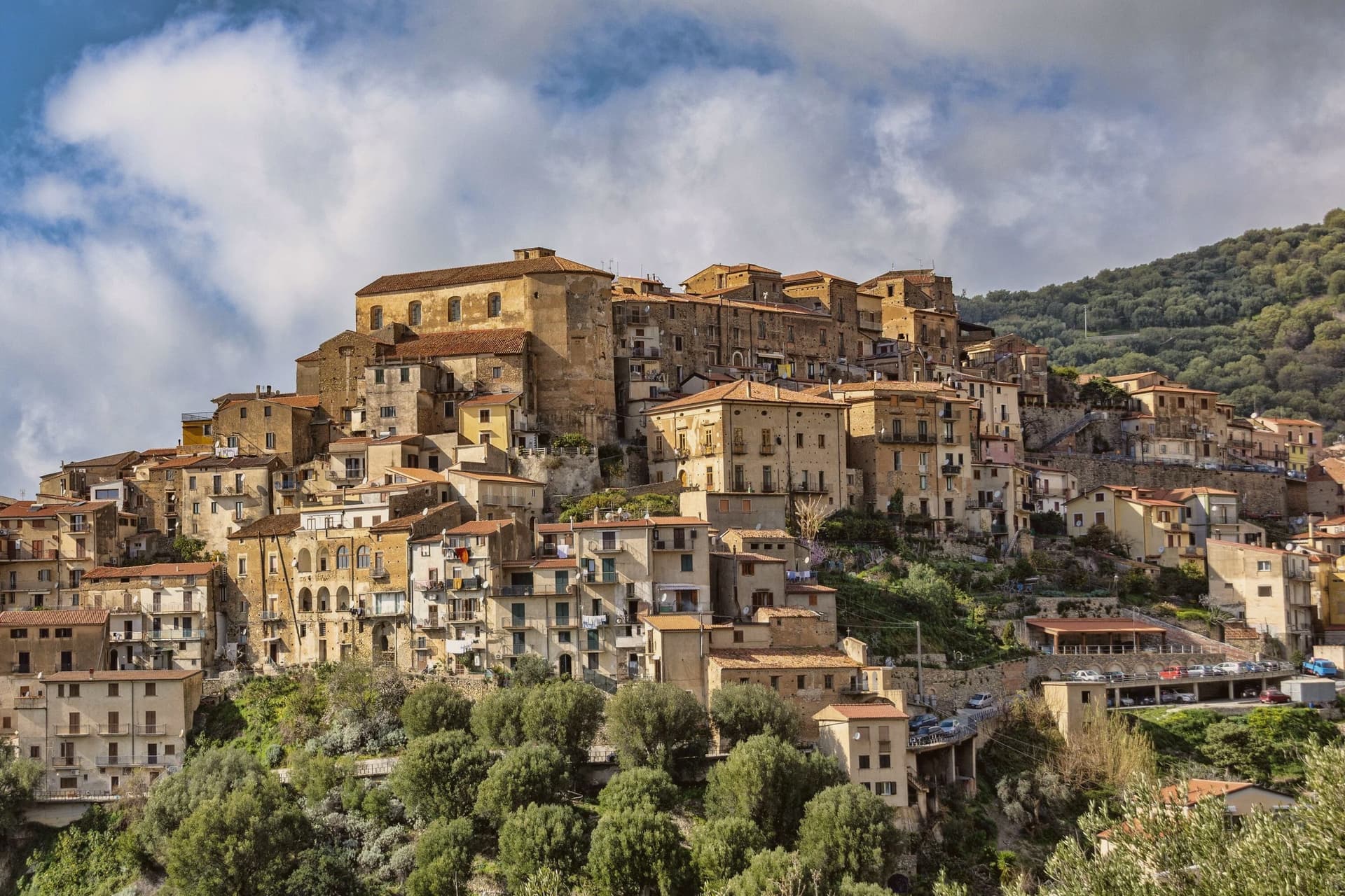
The hill the town occupies rises between Ascea and Palinuro, part of the strictest zone of the Cilento and Vallo di Diano National Park, and the ridge gives the stone houses of the centro storico a clear line of sight to Capo Palinuro twelve kilometers south. The town's parts sit at different elevations doing different work: the historic core holds the ridge at 171 meters, the olive terraces cover the slopes below it, and Marina di Pisciotta occupies the shore at the foot of the hill, where the fishing boats go out.
The menaica net worked by the Marina's fishermen is a technique once widespread around the Mediterranean and now reduced to a few coves, of which this is one. Carlo Pisacane's failed 1857 revolutionary expedition landed at Sapri and was crushed nearby; the Cilento coast keeps the memory in plaques and processions rather than in any structure at Pisciotta itself.
What holds the town together is elevation: everything of note here, the anchovies, the olives, the beach, the ridge, is defined by how far it sits above or below that 171-meter line.
The beach here holds the national bathing award, which a comune has to win back every year on water quality, beach management and safety.
What to see in Pisciotta
- Centro storico di Pisciotta. Hilltop medieval core of stone houses on a ridge 171 meters above the sea, with a clear sightline to Capo Palinuro.
- Marina di Pisciotta. Fishing port at the foot of the hill, departure point for the last menaica anchovy boats on the coast, its beach holding the Blue Flag.
- Uliveti di Pisciottana. Terraces holding trees of considerable age, the source groves of the Cilento DOP extra-virgin oil.
How to get to Pisciotta
There is a railway station in the town, so you can arrive without a car and never need one while you are here. Salerno is roughly 138 minutes away by road.
Our tip
May through September is the open season on the Cilento coast: clear water, warm evenings and the menaica boats out at night. July and August push past thirty-five degrees and the Marina rentals book; the centro storico on the hill above stays a few degrees cooler in the breeze. April and October are dry and mild, the right time for the olive harvest road and Parco Nazionale walks without heat.
Centola
Why visit Centola
Centola sits inside the Cilento, Vallo di Diano and Alburni National Park, with four frazioni stretched between hill and shore. The hilltop centro began as a refuge for survivors of ancient Molpa, the coastal city destroyed by the Byzantine general Belisarius in 547 AD; the name likely traces to centum illuc, the hundred who fled uphill.
Centola joined the Cilento revolt of 1828 and adopted the Proclamation of Palinuro, then lost most of its population to emigration across the Americas after Unification. The commune holds a Bandiera Blu on the Palinuro coast and belongs to Città del Vino.
The hilltop and the cape are seven kilometers apart with seventy meters of climb between them, a short distance that nonetheless separates two different lives: one built by people who ran from the water, the other built on people coming back to it for the beach and the caves. What was once a flight inland has become, centuries later, a pull back toward the coast it fled.
The beach here holds the national bathing award, which a comune has to win back every year on water quality, beach management and safety.
What to see in Centola
- Centro storico di Centola. Hilltop old town above the Mingardo valley, founded by survivors who climbed from the coast after it was sacked; the streets sit apart from the shore below, reached by a climb of some seventy meters over the distance between.
- Palinuro. The seaside frazione at the cape, sitting where the Lambro and Mingardo rivers meet the sea, its marina the departure point for boats along the promontory.
- Ruderi di Molpa. Remains of the ancient coastal settlement destroyed by Belisarius in 547 AD, on the promontory above the Mingardo mouth, the origin point of the hilltop town itself.
How to get to Centola
Salerno is roughly 115 minutes away by road.
Our tip
May, June, September and early October are the months Palinuro was built for. Water temperature crosses twenty degrees, the boat tours to the Grotta Azzurra run all day, and the centro on the hill stays cool when the marina fills. July and August are the south Italian high season: the beaches fill, the SP562 backs up between Palinuro and Marina di Camerota, and prices climb.
Ascea
Why visit Ascea
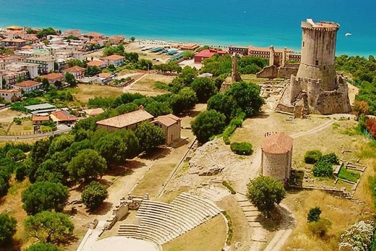
Ascea sits on the southern Cilento coast, two settlements in one comune: Ascea Paese at 230 meters above olive groves, and Ascea Marina on the flat between the Alento river and the sea. The Greek colonists from Phocaea founded Hyele here around 538 BC after fleeing the Persians; the city became Elea in Greek and Velia in Roman times, and produced the Eleatic school of Parmenides and Zeno that founded Western metaphysics.
The archaeological park keeps the Porta Rosa, the oldest known round arch in Europe, an Ionian temple acropolis, Roman baths and the medieval Castelluccio Angioino built on the city's highest point. Modern Ascea is a Bandiera Blu beach commune of nine kilometres of sand inside the Cilento, Vallo di Diano and Alburni National Park, with the Spighe Verdi mark for agro-environmental quality.
The beach here holds the national bathing award, which a comune has to win back every year on water quality, beach management and safety.
What to see in Ascea
- Parco Archeologico di Elea-Velia. Ruins of the Greek city founded around 538 BC by Phocaeans, home to Parmenides and the Eleatic school, with Porta Rosa, Ionic temple acropolis and Roman baths.
- Castelluccio Angioino. Medieval Angevin tower built on the highest point of ancient Velia, reusing Greek and Roman masonry, restored as the park's viewpoint.
- Marina di Ascea. Nine kilometres of fine sand between the Alento river mouth and Punta del Telegrafo, Bandiera Blu and Spighe Verdi within the Cilento national park.
How to get to Ascea
There is a railway station in the town, so you can arrive without a car and never need one while you are here. Salerno is roughly 110 minutes away by road.
Our tip
May through September is the open Cilento summer, with the Marina filling up from late June onward and the archaeological park staying open for evening visits in July and August. Mid-summer touches the high thirties and the beach absorbs most of the day; the paese on the hill stays a few degrees cooler. April and early October are dry and quiet, ideal for walking Velia without crowds or sun damage to the stone.
Camerota
Why visit Camerota
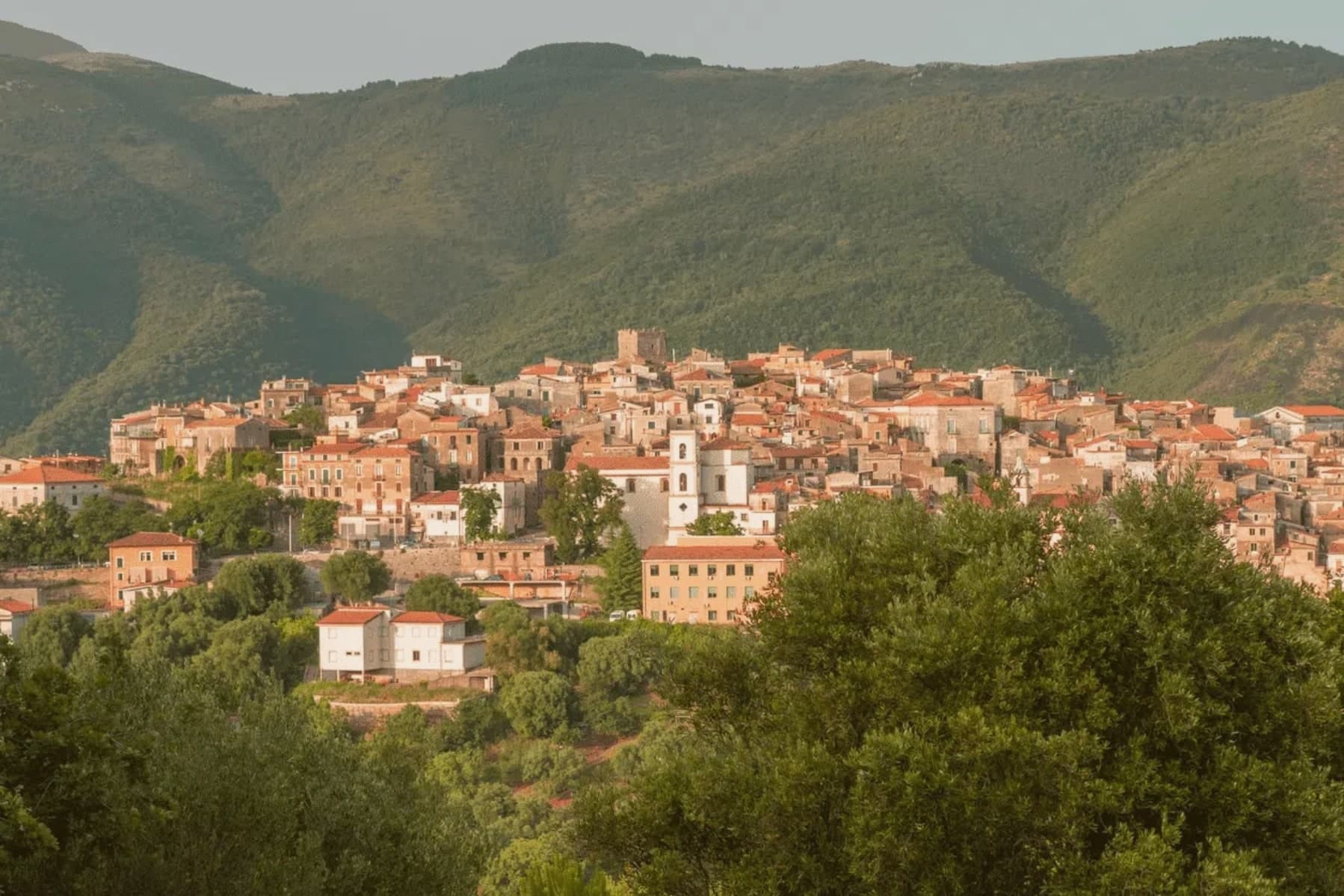
Camerota's hilltop sits six kilometres inland from its own marina, with two further hamlets, Lentiscosa and Licusati, scattered between the summit and the sea, so the town is really four settlements bound to one name rather than a single center. That name probably comes from the Greek kamaròtos, curved, after the limestone arches worked into the coast below.
The hill above stays a medieval center, nearly empty through winter and full in August, its slopes also carrying Cilento DOP olive oil down toward the water. The coast beneath it is a different register entirely: fishing village, protected marine reserve, and a run of sea caves whose excavated layers reach back through the Chalcolithic to Neanderthal occupation, among the longest such sequences on the Tyrrhenian.
What holds the two together is the geography itself, a limestone hill giving its shape to both the arches that named it and the caves that preserved what lived along its shore.
The beach here holds the national bathing award, which a comune has to win back every year on water quality, beach management and safety.
What to see in Camerota
- Grotte di Marina di Camerota. Grotta della Cala and Grotta di San Biagio sit cut into the sea cliffs, reached along the coast rather than from the hilltop, the caves themselves unassuming from outside despite what has come out of them.
- Costa degli Infreschi e della Masseta. The marine area runs between the Marina and Scario, cold freshwater surfacing straight into the sea, a stretch reachable only on foot or by boat, with no road running along it.
- Castello Marchesale di Camerota. Norman in origin, remodelled under the Marchesi, standing on the highest point of the town with the Gulf of Policastro laid out below.
How to get to Camerota
Salerno is roughly 130 minutes away by road.
Our tip
May through September is the open Cilento beach season, with Marina di Camerota filling between late June and August and the boat trips to Cala Bianca and the Infreschi springs running daily. Mid-summer touches the high thirties; the hilltown at 422 meters stays a few degrees cooler and the cave temperature holds at sixteen all year. April and October are quiet and dry, the right window to walk the Bulgheria slopes and visit Grotta della Cala without queues. Gusto Italia falls in August.
Castellabate
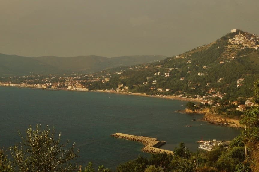
Why visit Castellabate
Castellabate sits on a Cilento ridge thirty kilometres south of Salerno, the hilltown above and the hamlets below strung along the same stretch of coast. Santa Maria, San Marco, Ogliastro Marina and Licosa run along the bay where the Saracens were defeated in 846 by a coalition of Naples, Amalfi, Sorrento and Gaeta, long before the castle on the ridge was ever built.
The abbey that gave the hilltown its name lay inland from this shoreline history, so the place carries two separate pasts: a coastal one tied to the ninth-century battle, and an upland one tied to the twelfth-century abbot's foundation. The commune today counts about nine thousand residents and holds together as a Bandiera Blu community inside the Cilento, Vallo di Diano and Alburni National Park, with the promontory to the south marking the edge of the protected marine area.
The borgo above keeps the stone and the views, the hamlets below keep the bay and the beaches, and the two halves of Castellabate read less as a single town than as an upper and lower settlement joined by the ridge between them.
The beach here holds the national bathing award, which a comune has to win back every year on water quality, beach management and safety.
What to see in Castellabate
- Castello dell'Abate. Castle begun on 10 October 1123 by Saint Costabile Gentilcore, fourth abbot of the Trinità della Cava, gave the village its name as Castrum Abbatis.
- Centro storico di Castellabate. Hilltop borgo at 280 meters, one of I Borghi più belli d'Italia, stone alleys around the castle and views down to the bay and the promontory beyond.
- Basilica Pontificia di Santa Maria de Gulia. Twelfth-century mother church at Santa Maria di Castellabate, raised to pontifical basilica in the twentieth century, with a wooden statue of the Madonna.
How to get to Castellabate
Salerno is roughly 78 minutes away by road.
Our tip
May, June and September are the open months on this stretch of Cilento, with the borgo above and the marina below working at a manageable pace and the sea warm enough to swim from late May. July and August fill Santa Maria di Castellabate with weekenders from Naples and Salerno, day boats running to Punta Licosa and the SS267 backed up at peak hours. April and October are quiet and dry, the right window for the hilltown stairs and the Monte Stella trails.
Agropoli
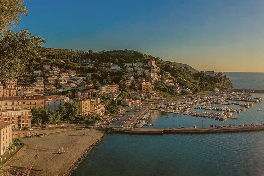
Why visit Agropoli
Agropoli is the northern gate of the Cilento coast, a promontory between two bays forty kilometres south of Salerno. The name itself, akropolis, was given by the Byzantines who fortified the high point during the Greco-Gothic war between 535 and 553.
In 882 the Saracens took the town and turned it into a rabat, a trenched stronghold from which they raided as far as the walls of Salerno until they were dislodged from the Garigliano camp in 915. The Angevin-Aragonese castle still stands on the highest point, a triangular plan with three circular towers and a moat, built on the original Byzantine foundations.
Below the castle, the centro storico runs in stone stairways down to the small fishing port. Modern Agropoli has 21,000 residents, a Bandiera Blu beach, the Spighe Verdi mark for agro-environmental quality, and Cilento National Park status that links it inland to the Mediterranean Diet biosphere.
The beach here holds the national bathing award, which a comune has to win back every year on water quality, beach management and safety.
What to see in Agropoli
- Castello Angioino-Aragonese. Triangular castle with three circular towers and a moat, built on sixth-century Byzantine foundations and remodelled by the Angevins and Aragonese.
- Centro storico sul promontorio. Old town on the headland, stone stairways from the castle down to the fishing port, with the seventeenth-century Porta arch and tight whitewashed alleys.
- Chiesa dei Santi Pietro e Paolo. Sixteenth-century mother church inside the centro storico, rebuilt after war damage, dedicated to the patrons celebrated each 29 June.
How to get to Agropoli
There is a railway station in the town, so you can arrive without a car and never need one while you are here. Salerno is roughly 66 minutes away by road.
Our tip
May through September is the open Cilento beach season, with the marina filling up from late June onward and the Trentova bay reachable by foot or boat. July and August push the Cilento past thirty-five degrees and the port and headland fill with day boats from Capri and Salerno. April and October are dry and quieter, ideal for walking the castle path without the queue.
Capaccio Paestum
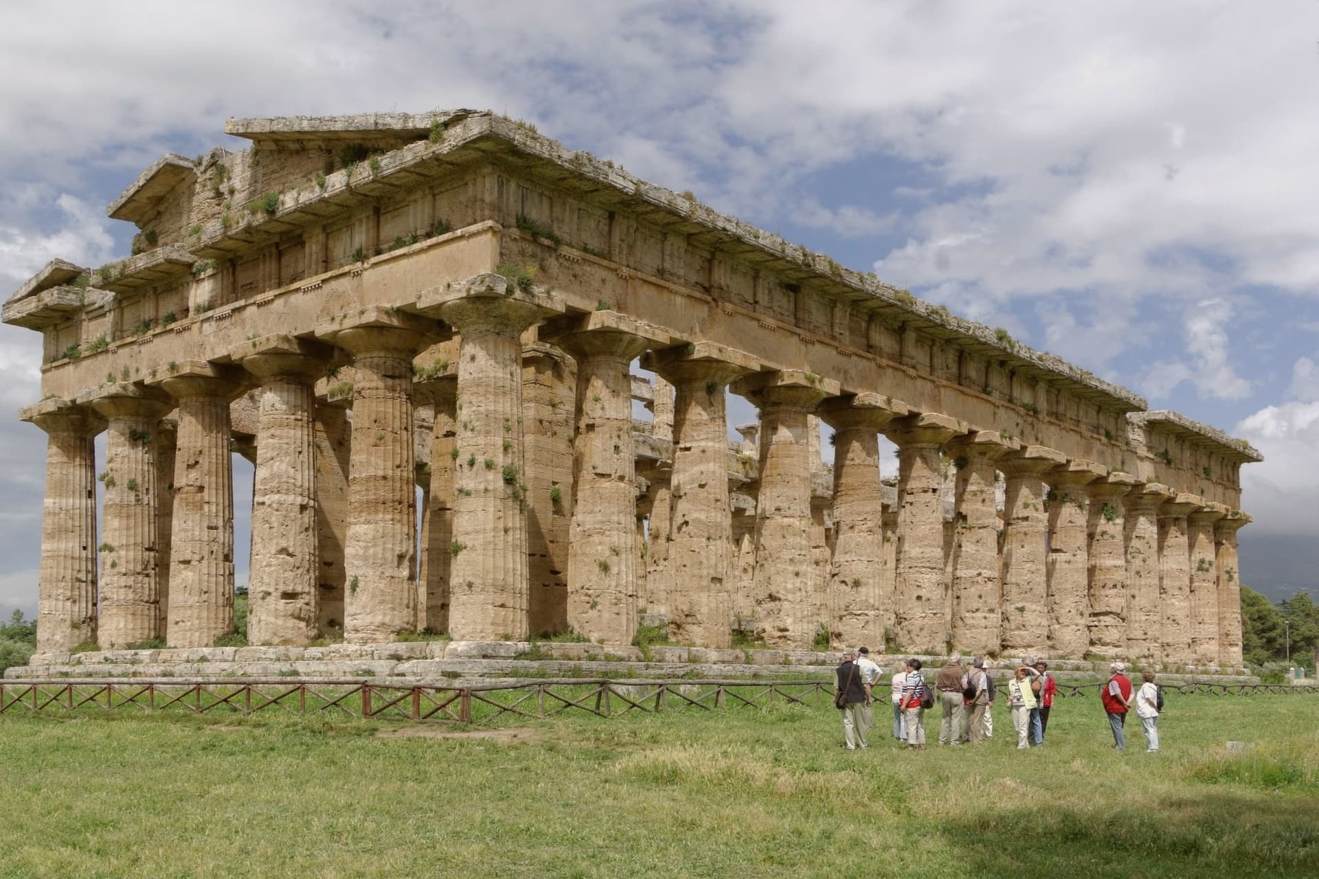
Why visit Capaccio Paestum
Capaccio Paestum is the only commune in Italy where the name pairs a medieval hilltown with an ancient city on the plain below. The seat of Capaccio sits at 419 meters on Monte Calpazio, while the archaeological park below, the city of Poseidonia founded around 600 BC, occupies the flat between the Sele river and the sea.
The two halves of the name mark two different settlements built centuries apart and never merged into one another. The layering below Monte Calpazio runs deeper than the founding city and the medieval hilltown: a Roman city followed the earlier one on the same plain, and the medieval Capaccio Vecchia, razed by Frederick II, was rebuilt as the hilltown that still carries the seat today.
The buffalo pastures that made the area's DOP mozzarella sit inside the same national park boundary as the Sele plain and the Monte Calpazio spur, so the cheese-making land and the ruins share one stretch of ground. The commune, in effect, is stacked: hill above, plain below, and each layer on the plain built over or beside the one before it.
What to see in Capaccio Paestum
- Templi di Paestum. The Basilica, the Temple of Hera II and the Temple of Athena stand on the flat ground between the Sele river and the sea, close enough to walk between in an afternoon.
- Museo Archeologico Nazionale di Paestum. The frescoes are kept indoors, apart from the temples they were painted near, giving a rare look at how the tomb's painters depicted the afterlife.
- Mura greche di Paestum. Almost five kilometres of Greek and Roman defensive walls with four gates, intact across the entire perimeter of the ancient city.
How to get to Capaccio Paestum
There is a railway station in the town, so you can arrive without a car and never need one while you are here. Salerno is roughly 51 minutes away by road.
Our tip
May, June and September are the right months on the Sele plain, with the temples at sunrise or late afternoon and the buffalo pastures still green. July and August push the plain past thirty-eight degrees, the archaeological park closes its high noon hours and the beach absorbs most visitors. April and October are dry and quiet, the Madonna del Granato feast falls on the first Sunday of May and the temples are walkable without queues.
Pompei
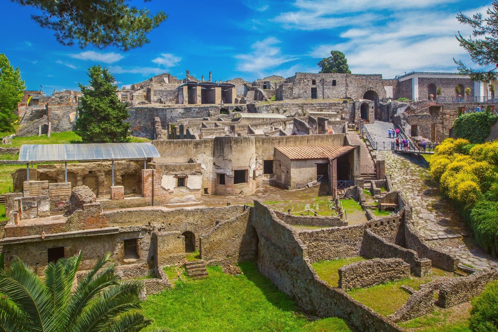
Why visit Pompei
Pompei sits at 30 meters on a volcanic plateau on the south slope of Vesuvius, twenty kilometers from Naples and a hundred meters from where the Sarno meets the sea. The Roman city was buried under five to six meters of ash and lapilli when the volcano erupted on 24 October 79 AD, killing the part of the population that had not already left.
Excavations began in 1748 under the Bourbons and have never stopped; the site has been UNESCO-listed since 1997 alongside Herculaneum and Torre Annunziata, and is the third most visited archaeological site in the world. Modern Pompei was founded in 1881 by the lawyer Bartolo Longo, who built the Santuario della Beata Vergine del Rosario as a center for pilgrimage and social work.
The basilica with its 80-meter campanile and the surrounding grid of streets are entirely a creation of the 1880s, separate from the dig and laid over fields that had been farmland until then.
What to see in Pompei
- Parco Archeologico di Pompei. The Roman city buried in 79 AD and excavated since 1748, UNESCO-listed since 1997, with the Forum, the Villa dei Misteri and the Lupanare.
- Santuario della Beata Vergine del Rosario. Pontifical basilica built between 1876 and 1891 by the lawyer Bartolo Longo, the heart of modern Pompei and a pilgrimage site of four million a year.
- Casa del Fauno. Roman patrician house in the dig with a bronze faun at its center and the Alexander Mosaic floor depicting Issus, now in the Naples museum.
How to get to Pompei
There is a railway station in the town, so you can arrive without a car and never need one while you are here. Napoli is roughly 24 minutes away by road.
Our tip
May, June, September and early October are the strongest months for Pompei. The dig opens at nine and the Forum stays walkable before midday heat sets in. July and August are punishing: the site sits on volcanic plateau at thirty meters with no shade in the main streets, and afternoon temperatures cross thirty-five degrees.
Torre Annunziata
Why visit Torre Annunziata
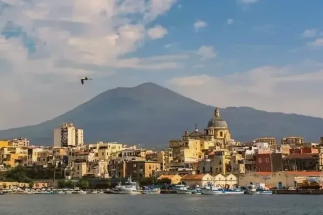
Torre Annunziata sits at 15 meters on the Bay of Naples, 20 kilometers south of the city at the western foot of Vesuvius, where the Sarno river meets the sea. The Roman town of Oplontis stood here before 79 AD; Villa A, called the Villa di Poppea after Nero's second wife who probably owned it, is the largest of the seafront villas buried by the eruption and the most completely excavated, listed by UNESCO in 1997 with Pompeii and Herculaneum.
The modern town is named for the 1319 watchtower and the chapel of the Annunziata built next to it. From the 17th century the Sarno was channelled to power flour and pasta mills, and by 1900 Torre Annunziata had more than sixty pastifici.
Together with Naples and Gragnano it was called the Capital of the White Art, the term for industrial dried pasta. Setaro and a handful of other small pastifici still produce by traditional bronze die and slow drying.
The town was hit hard by postwar industrial decline and the 1980 Irpinia earthquake.
What to see in Torre Annunziata
- Scavi di Oplontis - Villa di Poppea. Seafront Roman villa attributed to Nero's wife Poppaea, buried 79 AD, the largest and best-preserved of the Oplontis villas, UNESCO-listed 1997.
- Basilica della Madonna della Neve. Sixteenth-century shrine of the Madonna della Neve, the patron of the town, rebuilt after 18th-century earthquakes.
- Torre dell'Annunziata. Fourteenth-century watchtower for which the town is named, built 1319 to guard against Saracen raids on the Vesuvian coast.
How to get to Torre Annunziata
There is a railway station in the town, so you can arrive without a car and never need one while you are here. Napoli is roughly 22 minutes away by road.
Our tip
April through June and September through October are the workable months. The Villa di Poppea is open all year but the unshaded Roman peristyles get punishing in July and August, when the site temperature can push 35 degrees. The bay breeze cools the lungomare in the evenings.
More from Anywhere Italy
- The best beach towns in the province of Salerno
- The best hidden beach towns in Campania
 The best towns you can reach by train in the province of Salerno
- The best beach towns you can reach by train in Campania
- The best towns with a serious restaurant that you can reach by train in Campania
 The 8 best hill towns inside a national park in Campania