
The 8 best hill towns inside a national park in Campania
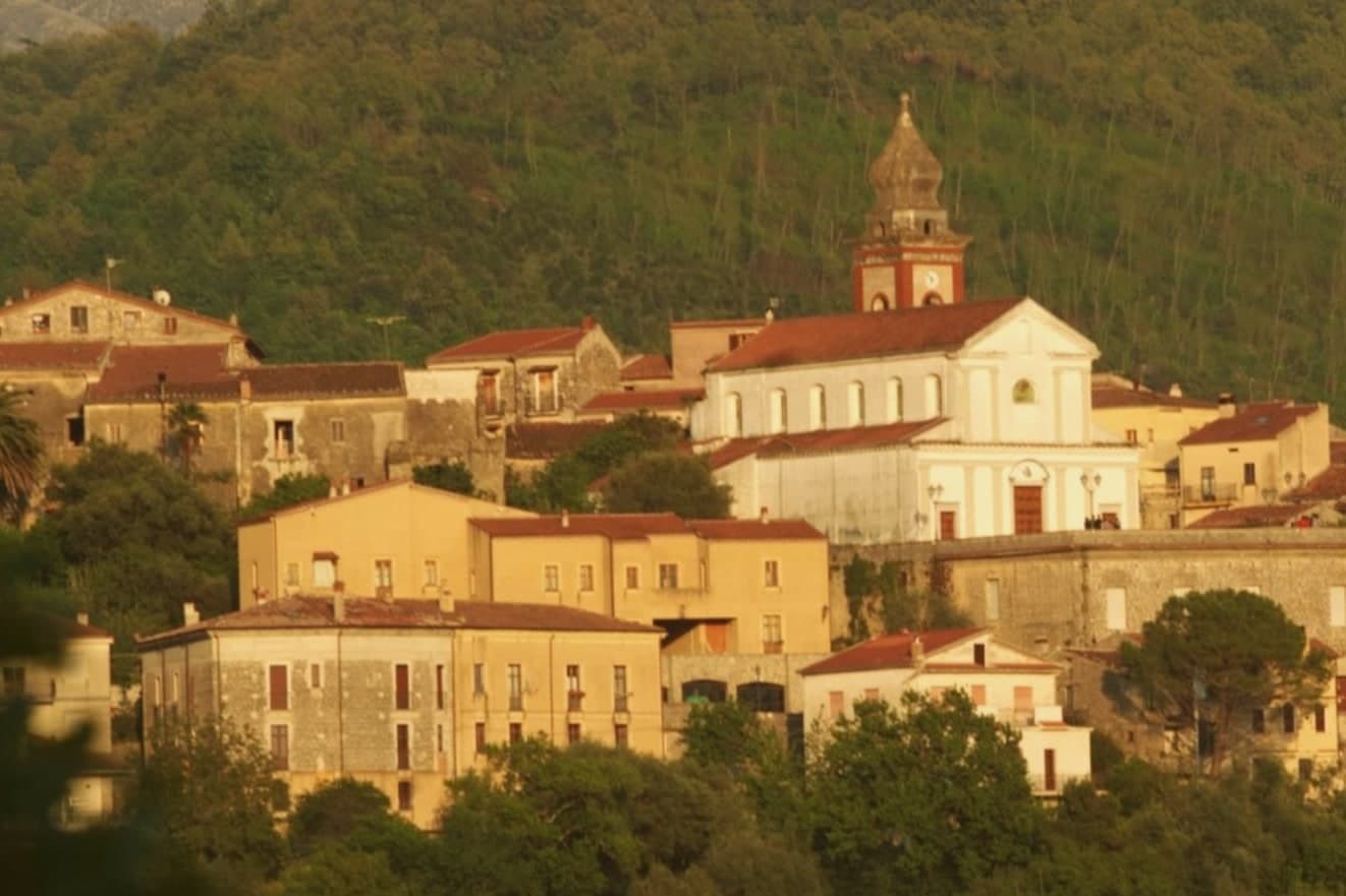
Campania away from the water is built of grey limestone and chestnut, and the hill towns here sit above river gorges that cut deep into the rock. Autumn is the season that makes the case: porcini and black truffles on the Matese slopes, chestnuts roasting in village squares, cured pork and sheep's cheese, wines from vines grown on terraces nobody has widened in generations. In the Cilento the same stone gives way to olives, figs and white beans cooked slowly with wild herbs. Winter mornings arrive with frost on the high pastures and woodsmoke in the lanes.
The coast takes almost all of it. Positano, Amalfi and Capri absorb the summer crowds, and the road along the peninsula moves at walking pace from June onwards, with the archaeological sites at Pompeii and Herculaneum taking the rest. It is a reasonable way to spend a week in Campania and most visitors never leave that narrow strip. The inland provinces, Benevento, Caserta, Salerno beyond the resorts, see a fraction of those numbers.
The hills carry on well past the last sea view. The Matese park spreads north into Caserta and Benevento, and the Cilento park covers a stretch of mountain and river valley larger than most Italian regions expect to hold. The towns in this list live inside those boundaries, where the walking trails start at the edge of the houses and the food changes with the altitude. Fewer people go, and the roads reflect it.
Of the 66 communes we have mapped in Campania, 8 qualify as hill towns inside a national park: each is an inland hill settlement, and each sits inside a national park. The smallest, Morigerati, has 608 residents.
Two more lists worth reading alongside this one: The best hill towns within 90 minutes of Salerno and The best towns with a food festival in Campania.
Morigerati
Why visit Morigerati
Morigerati sits at 340 meters on a cliff in the southern Cilento, inside the Cilento, Vallo di Diano and Alburni National Park, with six hundred and eight residents on a stone ridge above the Bussento. The river that gives the commune its identity disappears underground for seven kilometers and resurfaces from a series of karst caves directly below the village, the Grotte del Bussento, which the WWF designated as an oasis in 1985 and still manages on six hundred and seven hectares of forest and water.
The path down from the centro to the cave mouth is a short walk and a steep climb back. The commune is a Bandiera Arancione of the Touring Club Italiano, a member of the Città delle Grotte network, and sits inside one of the largest national parks in Italy.
The village fits the southern Cilento depopulation pattern: an aging core, emigration out, and a small return of visitors drawn by the water under the rock.
What to see in Morigerati
- Grotte del Bussento. Karst cave mouth where the Bussento river resurfaces after seven kilometers underground, with a WWF-managed oasis of 607 hectares since 1985.
- Centro storico di Morigerati. Stone village at 340 meters on the cliff above the river, with narrow lanes, arches, and overlooks down to the cave mouth below.
- Oasi WWF Grotte del Bussento. Nature reserve of beech, oak and alder along the Bussento gorge, run by WWF Italia in collaboration with the comune.
How to get to Morigerati
Salerno is roughly 92 minutes away by road.
Our tip
April through June and September into October are the months for Morigerati. The Bussento runs full from spring snowmelt above and the oasis trail down to the cave mouth stays cool under the canopy. July and August can climb past thirty-two degrees on the cliff, though the air at the cave is ten degrees cooler year-round.
Roscigno
Why visit Roscigno
Roscigno sits on the slope of Monte Pruno, inside the Cilento, Vallo di Diano e Alburni National Park, sixty kilometers inland from Salerno. The comune is split into two settlements that share little beyond a name.
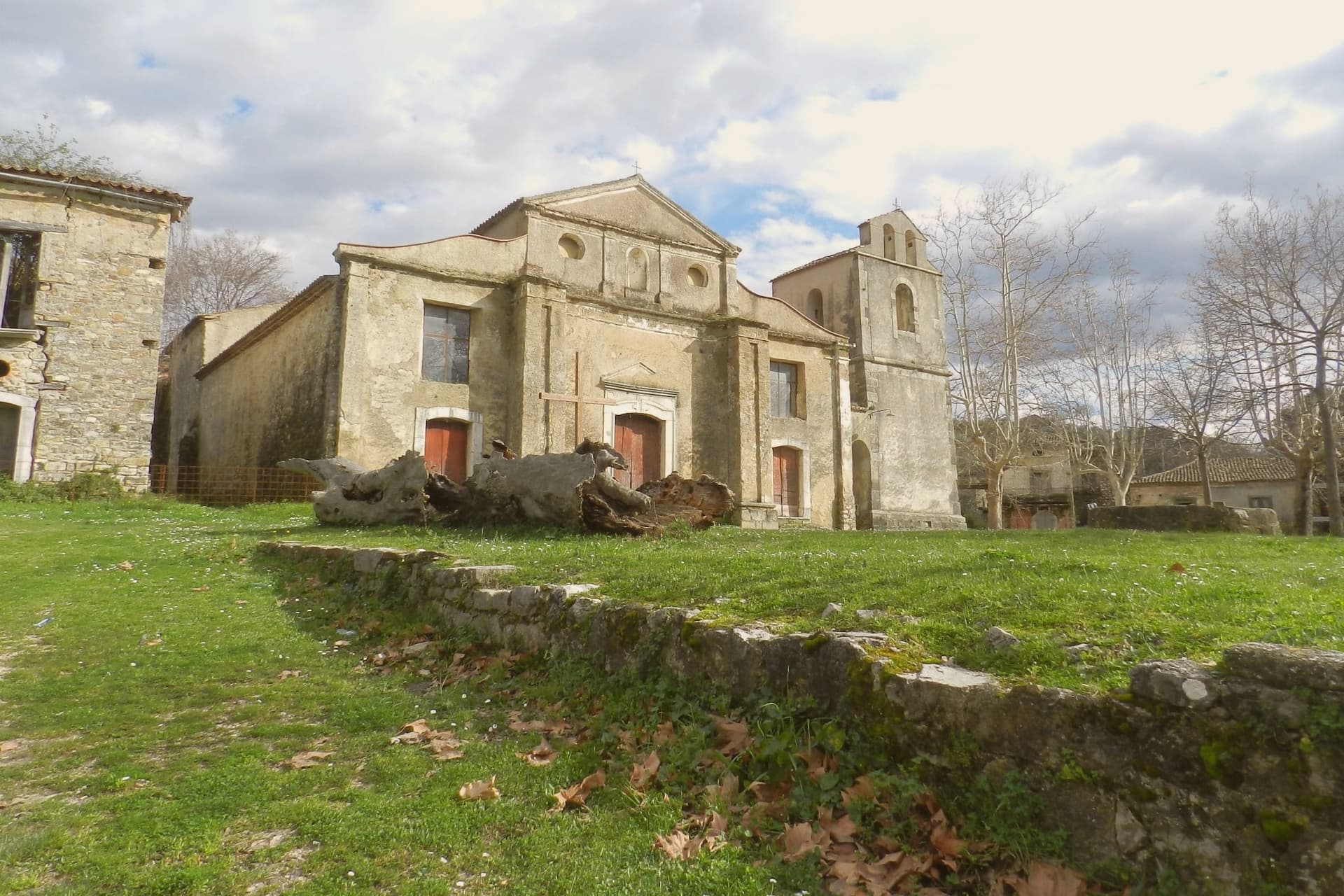
Roscigno Nuovo, built up the hill on safer ground, holds the 625 current residents and the ordinary business of the town. Below it, the old village keeps its stone houses, its square, its fountain and washing basins, and its church on its raised platform, arranged as they were when relocation laws pushed everyone uphill after the landslide.
The two halves face each other across that history: one lived in and unremarkable, the other empty and preserved by neglect rather than restoration. What draws people to Roscigno is not a monument but a whole abandoned settlement left standing, houses, square, and church together, a rural community's ordinary fabric intact and unoccupied rather than any single building.
What to see in Roscigno
- Roscigno Vecchia. Stone village of the 1600s and 1700s, its houses still standing along empty streets, unrestored and left as they were when the last families walked out.
- Piazza Giovanni Nicotera. Main square with the original fountain and public washing basins still in place, framed by the empty houses and the church above.
- Chiesa di San Nicola di Bari. Parish church on a raised platform above the piazza, unrestored, with a preserved wooden ceiling visible through the doors.
How to get to Roscigno
Salerno is roughly 79 minutes away by road.
Our tip
April through June and September into October are the months that suit Roscigno. The Cilento hills stay green, the air is mild and the empty streets of Roscigno Vecchia photograph well in the low light. July and August are hot, often crossing thirty-two degrees, and the ridge offers little shade between houses; many visitors come early in the morning.
Perito
Why visit Perito
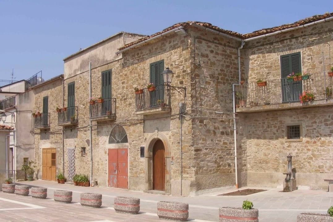
Perito sits at 480 meters on a hill above the Alento river valley, inside the Cilento and Vallo di Diano National Park. The local historian Emilio Gatto traced the founders to refugees from ancient Velia, the Greek polis below the coast, hiding from Saracen raids; the Codex diplomaticus Cavensis records the village between the tenth century and 1137.
In the middle ages it served as a fortified outpost over the valleys below. From 1801 to 1860 it was a hamlet of Orria, then a separate commune from 1850.
Perito made its name through polvere nera, black powder, ground from local sulphur and saltpetre with sandstone mortars and wooden pestles, used for hunting, defense and, in the nineteenth century, by Bourbon-era brigands. The Chiesa di San Nicola di Bari, built around 1550 and inaugurated in February 1563, rises behind a bell tower reused from an Angevin watch tower.
The commune is a Cittaslow member.
What to see in Perito
- Chiesa di San Nicola di Bari. Parish church built around 1550, inaugurated 17 February 1563, with a monumental bell tower converted from an Angevin watch tower.
- Centro storico. Stone-built ridge village above the Alento valley, with narrow lanes and the bell tower of San Nicola visible from the access road.
- Parco Nazionale del Cilento. Surrounding park with paths into the Alento basin and toward the Cittaslow neighbours of Gioi and Stio.
How to get to Perito
Salerno is roughly 83 minutes away by road.
Our tip
April through October is the open season on the Perito ridge: clear days, cool evenings, and the Alento valley trails dry enough to walk. July and August push past thirty-three degrees in the valley below; the ridge at 480 meters keeps a few degrees of breeze. April, May and September are the right weeks for the National Park walks and for the slow-food itineraries with Gioi and Stio.
Castelcivita
Why visit Castelcivita
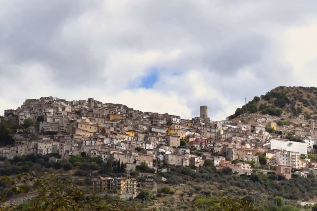
Castelcivita sits at 526 meters on the western flank of the Alburni mountains, in the Cilento, Vallo di Diano e Alburni National Park, forty-five kilometers inland from Salerno. The town has 1,441 residents and a medieval ridge plan around an Angevin tower, now the seat of the Museum of Rural Civilization.
Most visitors come for the caves below the village, the Grotte di Castelcivita, a karst system that runs for nearly 4,800 meters along the Calore river and includes named halls of the Castle, the Crocodile and the Desert. The cave mouth opens at ninety-four meters above sea level, 1.5 kilometers from the town.
In 1972 the Paleolithic deposits at the entrance turned the grotte into one of the most significant sites of early human presence in southern Italy, with stone tools and faunal remains dated to roughly 40,000 years ago. The town above is quiet.
The cave system is what brings school groups, speleologists and weekend visitors from Salerno.
What to see in Castelcivita
- Grotte di Castelcivita. Karst cave system running nearly 4,800 meters along the Calore, with Paleolithic deposits from roughly 40,000 years ago and named halls of the Castle, the Crocodile and the Desert.
- Torre Angioina. Thirteenth-century Angevin tower at the top of the centro storico, now the seat of the Museo della Civiltà Contadina with Paleolithic finds from the caves.
- Centro storico medievale. Ridge-pattern village of stone houses and stepped lanes on the slope of the Alburni, with views east across the Calore valley.
How to get to Castelcivita
Salerno is roughly 57 minutes away by road.
Our tip
April through June and September into October are the working months for Castelcivita. The Alburni stay green into early summer, the temperatures hold below thirty degrees, and the caves keep a steady fourteen degrees year round, useful when the surface is hot. July and August push past thirty-two; the centro storico empties in the afternoon and the cave queue grows. Festa della Patata di Montagna di Castelcivita falls in the season.
Auletta
Why visit Auletta
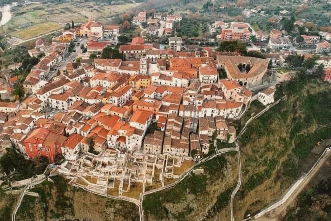
Auletta sits at 280 meters on a hill on the right bank of the Tanagro river, at the northern edge of the Vallo di Diano, inside the Cilento, Vallo di Diano and Alburni National Park. The town was fortified by the year 1000 and is mentioned as Olibola in 1095, possibly from olea, Latin for oil.
The medieval core is reached through three gates, Porta Castello, Porta del Fiume and Porta Rivellino. The Castello Marchesale, twelfth century in origin, took its current shape in the fifteenth, when defensive systems were added; it is privately owned by the Maioli Castriota Scanderbech family.
The 1857 Great Neapolitan earthquake destroyed much of the town and was documented by the Irish seismologist Robert Mallet, in the first systematic post-earthquake survey ever attempted. In 1861, immediately after Unification, locals rose against the Piedmontese army and 45 were killed in what is remembered as the Auletta Massacre.
The town is now a Città delle Grotte for its proximity to the Pertosa-Auletta caves.
What to see in Auletta
- Castello Marchesale. Twelfth-century fortress in the highest part of the centro storico, reshaped in the fifteenth century with defensive walls and now privately held.
- Chiesa di San Nicola di Mira. Parish church inside the medieval walls, holds a relic of San Donato di Ripacandida, the town's patron saint.
- Borgo dei Mestieri. Restored part of the centro storico turned into a living museum of traditional Cilento crafts, with workshops on stone, iron and clay.
How to get to Auletta
There is a railway station in the town, so you can arrive without a car and never need one while you are here. Salerno is roughly 49 minutes away by road.
Our tip
April through October is the open season in the Tanagro valley: clear days, mild nights and the National Park trails dry enough to walk. July and August push past thirty-three degrees in the valley; the centro storico on the hill catches a slight breeze. April, May and early June are the right weeks for the Alburni hikes and the Pertosa-Auletta caves, which run at fifty degrees year-round and feel cold off a hot afternoon.
Cerreto Sannita
Why visit Cerreto Sannita
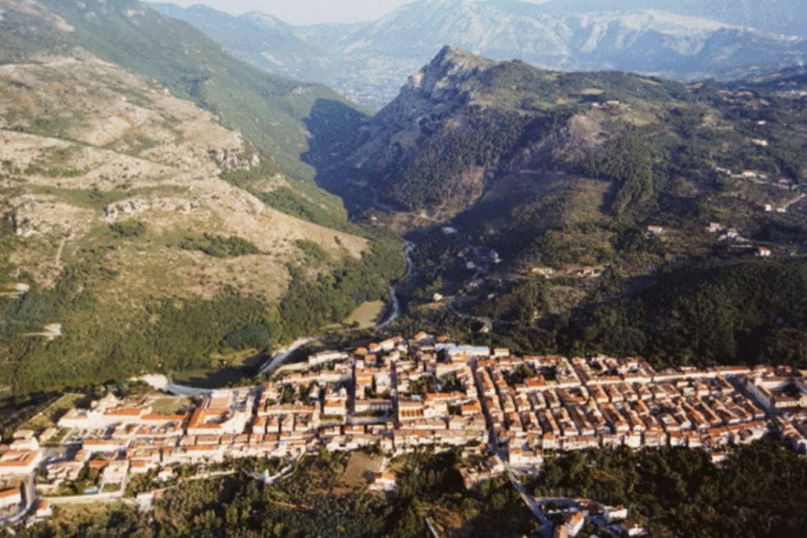
Cerreto Sannita sits at 290 meters in the Titerno valley of the Sannio, fifty-five kilometers northeast of Naples, with the Matese massif rising behind. The town was rebuilt at the order of Count Marzio Carafa, his brother Marino, and Bishop Giovanni Battista de Bellis, and the resulting grid runs orthogonally around a central piazza, a rare case of late-baroque urban planning in southern Italy.
The other anchor is ceramics, an industry the town has long shared with its neighbour. Workshops in both places have produced majolica since at least the sixteenth century, and the State Art Institute revived the craft in the mid-twentieth.
Workshops still turn out ceremonial plates, lobed jugs, apothecary jars and riggiole tiles painted with wind-rose and garland motifs. The town is a Bandiera Arancione, a Cittaslow, and one of Italy's official Città della Ceramica.
What results is a town whose street plan and whose craft both trace back to the same recovery: one rebuilt the ground it stands on, the other kept its hands busy on top of it.
What to see in Cerreto Sannita
- Cattedrale della Santissima Trinità. Baroque facade and tiled dome at the centre of the new town plan, standing where the piazza anchors the orthogonal grid.
- Museo Civico e della Ceramica Cerretese. Civic museum dedicated to four centuries of local majolica, with ceremonial plates, riggiole tiles and apothecary jars from Cerreto and San Lorenzello workshops.
- Chiesa di San Martino. Late seventeenth-century church with painted majolica floor of Cerreto tiles, one of the best preserved riggiole pavements in the Sannio.
How to get to Cerreto Sannita
Napoli is roughly 85 minutes away by road.
Our tip
April through June and September into October are the dry, walkable months in the Titerno valley, when the Matese is still green and the ceramic workshops keep regular hours. July and August push the valley into the mid-thirties; the orthogonal centro storico holds shade well enough, but afternoons go quiet between two and six. November through March is winter on the Matese flank, with cold rain and occasional snow above the town and several workshops on reduced hours.
Cusano Mutri
Why visit Cusano Mutri
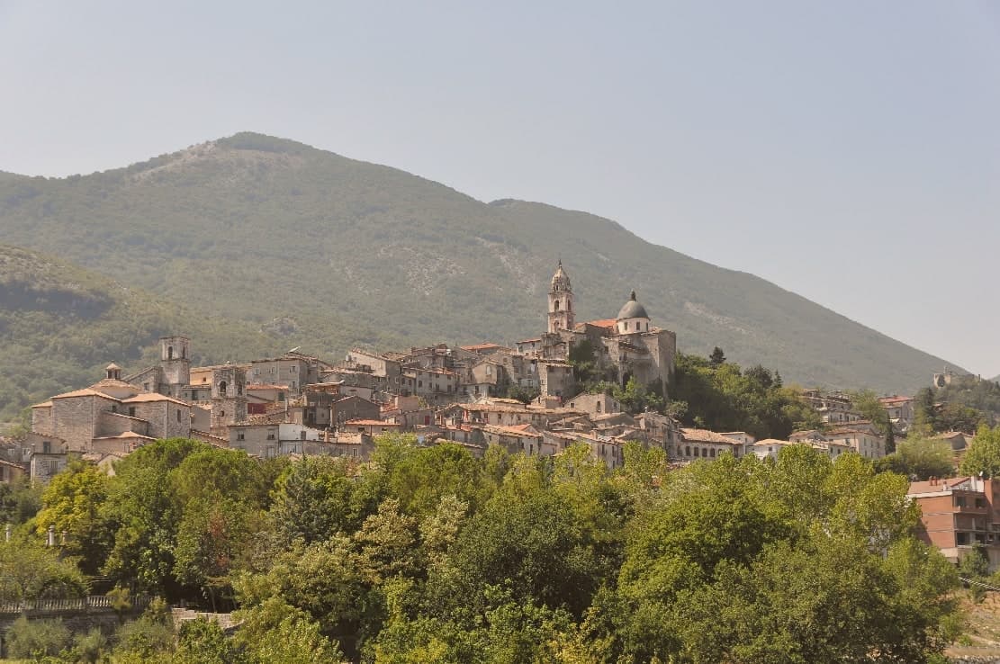
Cusano Mutri sits at 475 meters on the south-facing slope of the Matese massif, in the Parco Regionale del Matese and at the historical border of Sannio Pentro with what is now Molise. The territory climbs from the Lavella gorge at 257 meters to Monte Mutria at 1,823 meters, a vertical kilometer in less than ten of road.
The 1688 Sannio earthquake destroyed nearby Cerreto and Civitella Licinio; Cusano Mutri was the rare town in the area to come through with its medieval fabric standing, which is why the stone houses, arches, and stepped lanes of the centro look the way they do today. The commune joined the Borghi più belli d'Italia in 2006.
The Sagra dei Funghi runs from mid-September to mid-October and draws more than 100,000 visitors a year for porcini gathered on the Matese slopes. The Infioritalia carpets fill the streets in early summer.
What to see in Cusano Mutri
- Centro storico di Cusano Mutri. Medieval old town of stone houses, arches and stepped lanes that came through the 1688 earthquake intact while neighbouring towns fell.
- Monte Mutria. 1,823-meter peak on the Campania-Molise border, the highest point of the commune and the head of its trekking routes.
- Gole di Caccaviola. Narrow limestone gorge cut by the Titerno torrent, with footbridges, waterfalls and a via ferrata used in summer.
How to get to Cusano Mutri
Napoli is roughly 96 minutes away by road.
Our tip
May, June, September and October are the strongest months: cool evenings at 475 meters, walks in the Gole di Caccaviola, and porcini on the Matese in autumn. July and August can climb past thirty degrees in the daytime, though the mountain altitude keeps nights bearable; the centro fills in the second half of August for the Festa del Vino. The Sagra dei Funghi runs from mid-September to mid-October and is the busiest stretch of the year. Sagra dei Funghi falls in September.
Alife
Why visit Alife
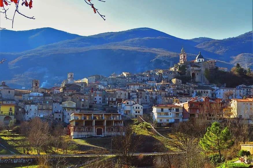
Alife sits at 110 meters at the southern foot of the Matese, the rectangular Roman walls still tracing the original plan of the 326 BC Latin colony founded after the Samnite Wars. The circuit runs 1.9 kilometres, with towers every 39 meters and four monumental gates on the cardo and decumano.
Inside the walls lies the largely buried Roman amphitheatre, 48 by 38 meters, the fourth largest in Italy after Rome, Pompeii and Capua. The Cryptoporticum, a 100-meter underground gallery, has been kept legible by recent excavation.
The town gives its name to the Cipolla di Alife, a heirloom red onion documented locally since Roman times and still cultivated on the irrigated plain along the Volturno. Modern Alife sits inside the Parco Regionale del Matese and along the Via Francigena del Sud, with extra-virgin olive oil and Pallagrello and Casavecchia wines on the surrounding slopes.
What to see in Alife
- Mura romane di Alife. Rectangular Roman walls running 1.9 kilometres, with towers every 39 meters and four monumental gates on the original cardo and decumano of the 326 BC colony.
- Anfiteatro Romano. Largely buried amphitheatre of 48 by 38 meters, the fourth largest in Italy after Rome, Pompeii and Capua, dating to the early imperial period.
- Criptoportico Romano. Underground gallery more than 100 meters long, well preserved beneath the centro storico, kept open after recent archaeological excavation.
How to get to Alife
There is a railway station in the town, so you can arrive without a car and never need one while you are here. Napoli is roughly 76 minutes away by road.
Our tip
April through June and September into October are the open months along the Matese foothills, when the Volturno plain is green and the Roman walls walk at a reasonable temperature. July and August push the inland Caserta past thirty-five degrees and the amphitheatre site closes mid-afternoon to protect visitors and stone. The Sagra della Cipolla di Alife happens in mid-September and pulls weekend visitors from Naples and Caserta. Sagra della pannocchia e dell'agricoltura alifana falls in September.
More from Anywhere Italy
- The best hill towns within 90 minutes of Salerno
- The best towns with a food festival in Campania
 The best hidden hill towns you can reach by train in Campania
- The best hill towns you can reach by train in Campania
- The best hidden hill towns within 90 minutes of Napoli
 The best hill towns inside a national park in Calabria