
The best hill towns within 90 minutes of Salerno
Behind Salerno the road stops being about the sea within half an hour. Limestone ridges rise into the Alburni and the Cilento interior, and the villages sit high on them in grey and honey stone, roofs stacked down the slope, wood smoke in the autumn air. The food shifts inland too: cicerchie and chickpeas, sausage cured with wild fennel, caciocavallo podolico aged in caves, bread baked heavy and sour. Spring brings orchids on the karst plateaux and September brings the grape harvest, which is when these hills are at their best.
Almost everyone who lands in Salerno turns the other way, towards the Amalfi Coast. Positano and Ravello earn the attention, but the coast road is a single lane of switchbacks shared by tour coaches, and in July the queue to park above Amalfi can outlast the drive itself. Prices track the view. Most visitors see the same terraced cliffs from the same three belvederes and leave without going inland at all.
The stone, the terraces and the cooking do not stop at the ridge line. They carry on east into the Alburni caves and the Cilento uplands, north into the Sannio and the volcanic tufa around Avellino, where the vines make Taurasi and Greco. The towns here are smaller, fewer people go, and most sit within an hour and a half of Salerno by car.
Of the 34 communes we have mapped within 90 minutes of Salerno, 9 qualify as hill towns: each is an inland hill settlement. The smallest, Roscigno, has 625 residents.
If you are still choosing, we have also written The 8 best hill towns inside a national park in Campania and The best hill towns you can reach by train in Campania.
Roscigno
Why visit Roscigno
Roscigno sits on the slope of Monte Pruno, inside the Cilento, Vallo di Diano e Alburni National Park, sixty kilometers inland from Salerno. The comune is split into two settlements that share little beyond a name.
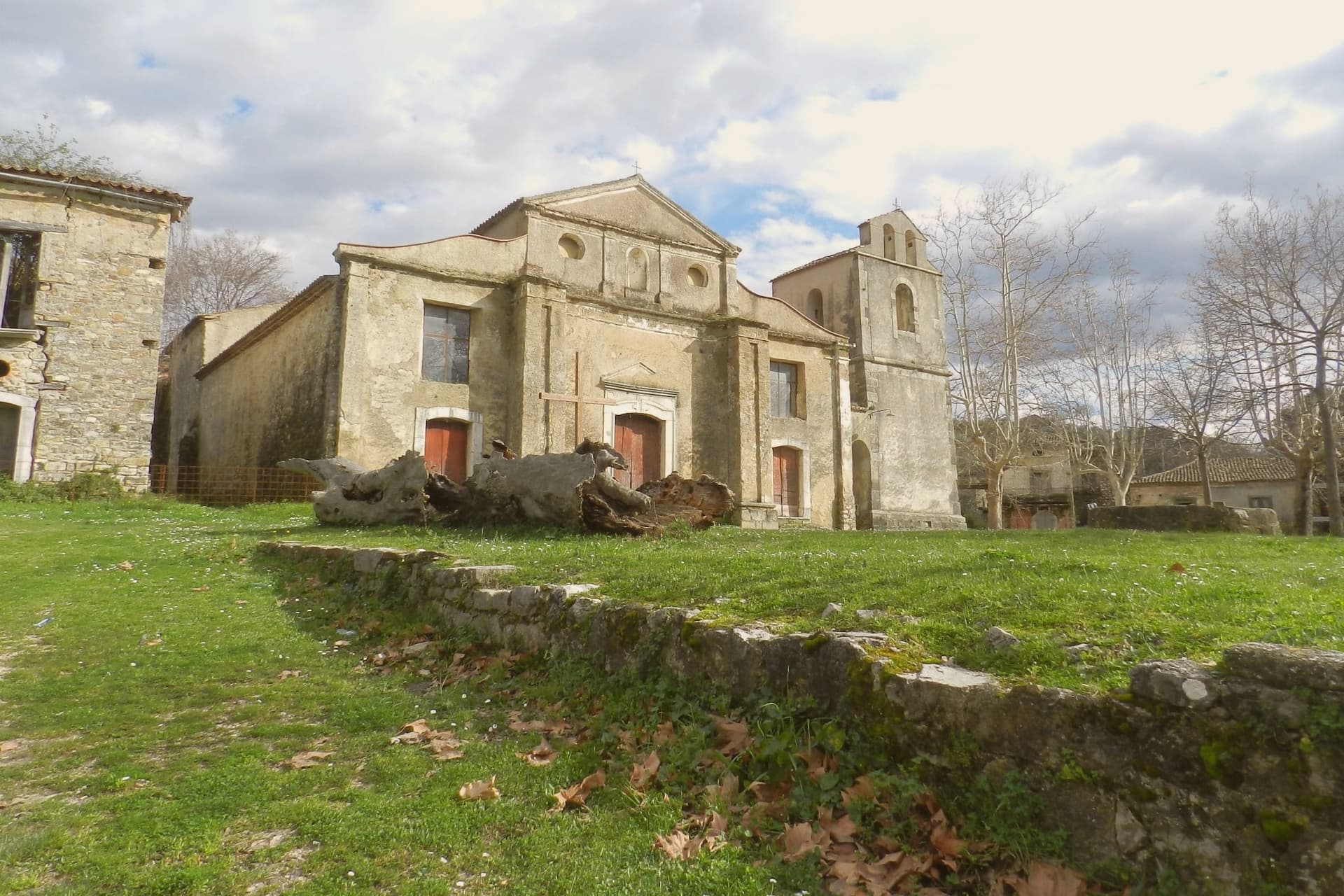
Roscigno Nuovo, built up the hill on safer ground, holds the 625 current residents and the ordinary business of the town. Below it, the old village keeps its stone houses, its square, its fountain and washing basins, and its church on its raised platform, arranged as they were when relocation laws pushed everyone uphill after the landslide.
The two halves face each other across that history: one lived in and unremarkable, the other empty and preserved by neglect rather than restoration. What draws people to Roscigno is not a monument but a whole abandoned settlement left standing, houses, square, and church together, a rural community's ordinary fabric intact and unoccupied rather than any single building.
What to see in Roscigno
- Roscigno Vecchia. Stone village of the 1600s and 1700s, its houses still standing along empty streets, unrestored and left as they were when the last families walked out.
- Piazza Giovanni Nicotera. Main square with the original fountain and public washing basins still in place, framed by the empty houses and the church above.
- Chiesa di San Nicola di Bari. Parish church on a raised platform above the piazza, unrestored, with a preserved wooden ceiling visible through the doors.
How to get to Roscigno
Salerno is roughly 79 minutes away by road.
Our tip
April through June and September into October are the months that suit Roscigno. The Cilento hills stay green, the air is mild and the empty streets of Roscigno Vecchia photograph well in the low light. July and August are hot, often crossing thirty-two degrees, and the ridge offers little shade between houses; many visitors come early in the morning.
Tufo
Why visit Tufo
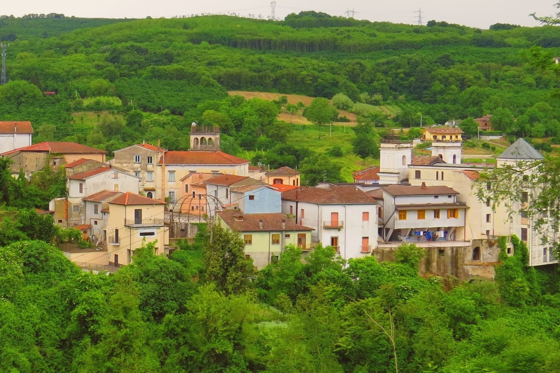
The name Tufo comes from the volcanic tuff stone the hill is built on, the same stone that runs through the slopes below and gives the local wine its mineral edge. The village sits on top of that stone at 250 meters, with the cellars at its foot and the vineyards spreading out around both.
Sulfur was mined in shafts cut into the cliffs beneath the village, work that shaped the local economy for over a century before it stopped. Most visitors are wine buyers, not tourists.
They drive in for a tasting, walk the steep main street to the medieval castle on top, and leave by dinner. The village stays quiet after they go.
What the stone gave the place economically it also gave it physically: a hill town built from the same rock that flavors what it grows, mined until the ground itself ran out of use.
What to see in Tufo
- Castello di Tufo. Medieval fortress on the top of the hill, rebuilt after the 1732 and 1980 earthquakes that damaged the village below.
- Cantine di Marzo. The cellars sit at the foot of the village, where Greco di Tufo has been produced commercially since the family took up winemaking here.
- Ex Miniere di Zolfo. Abandoned mines in the cliffs below the village, their shafts left the rock marked with rust-colored scars after closure.
How to get to Tufo
There is a railway station in the town, so you can arrive without a car and never need one while you are here. Salerno is roughly 55 minutes away by road.
Our tip
April through June covers the green months in Irpinia: vine leaves unfurling on the slopes, mild evenings on the main street. September through early October is harvest, when the cellars open more often than usual and the village smells of crushed Greco. July and August get hot in the valley, though 250 meters keeps the worst of it off.
Perito
Why visit Perito
Perito sits at 480 meters on a hill above the Alento river valley, inside the Cilento and Vallo di Diano National Park. The local historian Emilio Gatto traced the founders to refugees from ancient Velia, the Greek polis below the coast, hiding from Saracen raids; the Codex diplomaticus Cavensis records the village between the tenth century and 1137.
In the middle ages it served as a fortified outpost over the valleys below. From 1801 to 1860 it was a hamlet of Orria, then a separate commune from 1850.
Perito made its name through polvere nera, black powder, ground from local sulphur and saltpetre with sandstone mortars and wooden pestles, used for hunting, defense and, in the nineteenth century, by Bourbon-era brigands. The Chiesa di San Nicola di Bari, built around 1550 and inaugurated in February 1563, rises behind a bell tower reused from an Angevin watch tower.
The commune is a Cittaslow member.
What to see in Perito
- Chiesa di San Nicola di Bari. Parish church built around 1550, inaugurated 17 February 1563, with a monumental bell tower converted from an Angevin watch tower.
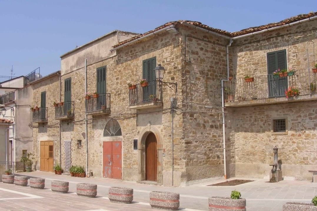
- Centro storico. Stone-built ridge village above the Alento valley, with narrow lanes and the bell tower of San Nicola visible from the access road.
- Parco Nazionale del Cilento. Surrounding park with paths into the Alento basin and toward the Cittaslow neighbours of Gioi and Stio.
How to get to Perito
Salerno is roughly 83 minutes away by road.
Our tip
April through October is the open season on the Perito ridge: clear days, cool evenings, and the Alento valley trails dry enough to walk. July and August push past thirty-three degrees in the valley below; the ridge at 480 meters keeps a few degrees of breeze. April, May and September are the right weeks for the National Park walks and for the slow-food itineraries with Gioi and Stio.
Sant'Angelo Le Fratte
Why visit Sant'Angelo Le Fratte
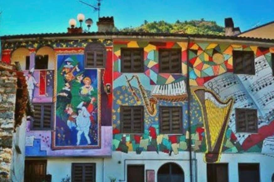
The walls are the reason to come. Sant'Angelo Le Fratte has spent years painting its own house fronts, and the best of them are not pictures hung on a village so much as arguments with it: a flight of steps that stops being stone and carries on in paint, a vine that climbs from a real pot into a painted trellis, a man with a basket of grapes looking down from a balcony that does not exist.
You walk up the stepped lanes checking which things are there. Underneath the village are the cantine, cellars cut back into the hillside where families kept wine and still do, and for four days in the middle of August they open.
The town was badly damaged by the Irpinia earthquake in 1980 and much of what stands now was built after it, which is worth knowing when the surfaces look newer than the plan of the streets. The parish church was the seat of the diocese of Satriano on and off between 1430 and 1818 and served as its cathedral, and it holds two paintings attributed to Giovanni De Gregorio.
What to see in Sant'Angelo Le Fratte
- The murales. Painted directly onto the house fronts through the old village, many of them trompe l'oeil, working with the real balconies, steps and doorways rather than beside them.
- Le cantine. The cellars cut into the hillside below the houses. They open to visitors over four days in the middle of August.
- Chiesa Madre del Sacro Cuore e San Michele Arcangelo. Seventeenth century, temporary cathedral of the diocese of Satriano during the bishopric, holding a Madonna del Rosario and a Nativity attributed to Giovanni De Gregorio.
How to get to Sant'Angelo Le Fratte
Salerno is roughly 68 minutes away by road.
Our tip
May to October is the open season at 560 metres, and the valley is green well into June. Mid-August is the loudest week of the year, when the cellars open on the 12th and run to the 15th, so come then for the crowd or a fortnight either side for the walls in peace. The feast of San Michele Arcangelo falls on 29 September and is kept again on 8 May.
Castelcivita
Why visit Castelcivita
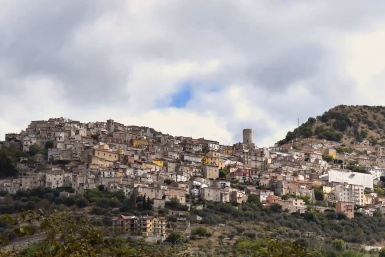
Castelcivita sits at 526 meters on the western flank of the Alburni mountains, in the Cilento, Vallo di Diano e Alburni National Park, forty-five kilometers inland from Salerno. The town has 1,441 residents and a medieval ridge plan around an Angevin tower, now the seat of the Museum of Rural Civilization.
Most visitors come for the caves below the village, the Grotte di Castelcivita, a karst system that runs for nearly 4,800 meters along the Calore river and includes named halls of the Castle, the Crocodile and the Desert. The cave mouth opens at ninety-four meters above sea level, 1.5 kilometers from the town.
In 1972 the Paleolithic deposits at the entrance turned the grotte into one of the most significant sites of early human presence in southern Italy, with stone tools and faunal remains dated to roughly 40,000 years ago. The town above is quiet.
The cave system is what brings school groups, speleologists and weekend visitors from Salerno.
What to see in Castelcivita
- Grotte di Castelcivita. Karst cave system running nearly 4,800 meters along the Calore, with Paleolithic deposits from roughly 40,000 years ago and named halls of the Castle, the Crocodile and the Desert.
- Torre Angioina. Thirteenth-century Angevin tower at the top of the centro storico, now the seat of the Museo della Civiltà Contadina with Paleolithic finds from the caves.
- Centro storico medievale. Ridge-pattern village of stone houses and stepped lanes on the slope of the Alburni, with views east across the Calore valley.
How to get to Castelcivita
Salerno is roughly 57 minutes away by road.
Our tip
April through June and September into October are the working months for Castelcivita. The Alburni stay green into early summer, the temperatures hold below thirty degrees, and the caves keep a steady fourteen degrees year round, useful when the surface is hot. July and August push past thirty-two; the centro storico empties in the afternoon and the cave queue grows. Festa della Patata di Montagna di Castelcivita falls in the season.
Auletta
Why visit Auletta
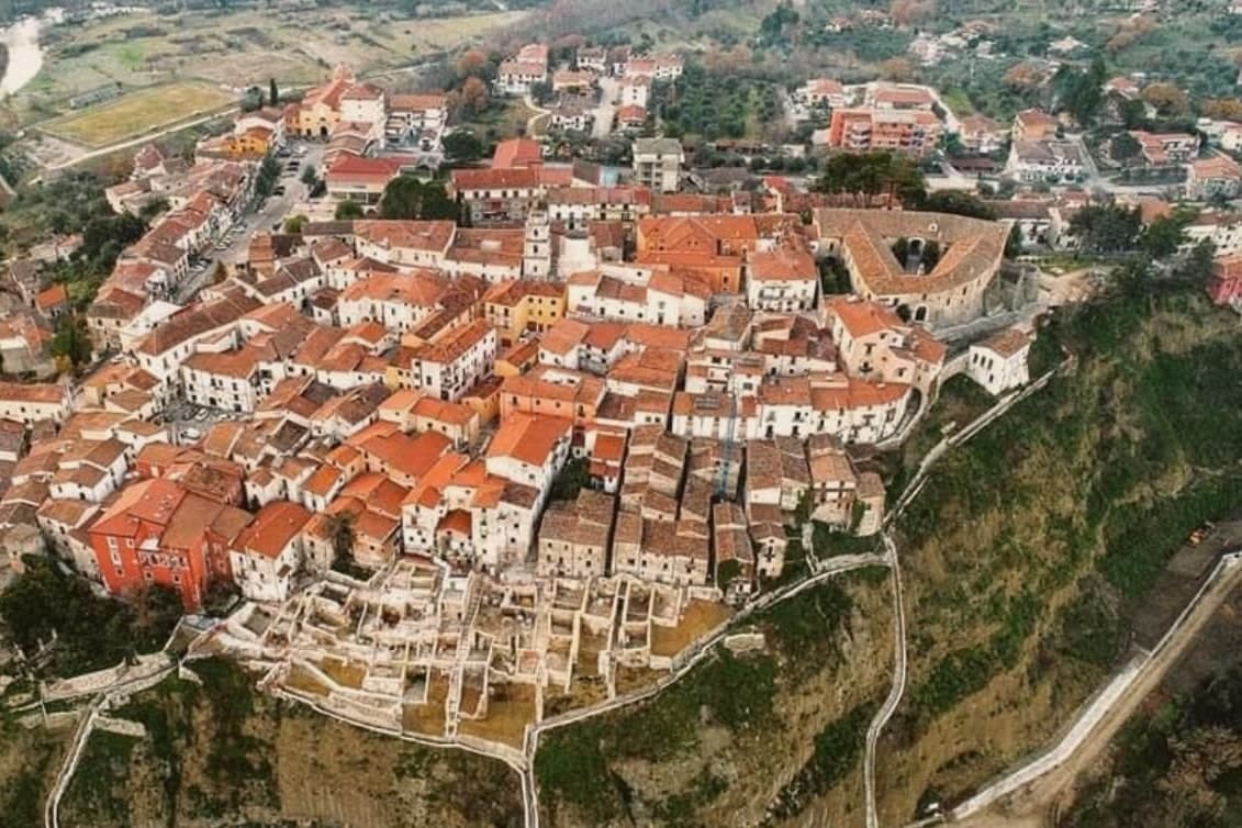
Auletta sits at 280 meters on a hill on the right bank of the Tanagro river, at the northern edge of the Vallo di Diano, inside the Cilento, Vallo di Diano and Alburni National Park. The town was fortified by the year 1000 and is mentioned as Olibola in 1095, possibly from olea, Latin for oil.
The medieval core is reached through three gates, Porta Castello, Porta del Fiume and Porta Rivellino. The Castello Marchesale, twelfth century in origin, took its current shape in the fifteenth, when defensive systems were added; it is privately owned by the Maioli Castriota Scanderbech family.
The 1857 Great Neapolitan earthquake destroyed much of the town and was documented by the Irish seismologist Robert Mallet, in the first systematic post-earthquake survey ever attempted. In 1861, immediately after Unification, locals rose against the Piedmontese army and 45 were killed in what is remembered as the Auletta Massacre.
The town is now a Città delle Grotte for its proximity to the Pertosa-Auletta caves.
What to see in Auletta
- Castello Marchesale. Twelfth-century fortress in the highest part of the centro storico, reshaped in the fifteenth century with defensive walls and now privately held.
- Chiesa di San Nicola di Mira. Parish church inside the medieval walls, holds a relic of San Donato di Ripacandida, the town's patron saint.
- Borgo dei Mestieri. Restored part of the centro storico turned into a living museum of traditional Cilento crafts, with workshops on stone, iron and clay.
How to get to Auletta
There is a railway station in the town, so you can arrive without a car and never need one while you are here. Salerno is roughly 49 minutes away by road.
Our tip
April through October is the open season in the Tanagro valley: clear days, mild nights and the National Park trails dry enough to walk. July and August push past thirty-three degrees in the valley; the centro storico on the hill catches a slight breeze. April, May and early June are the right weeks for the Alburni hikes and the Pertosa-Auletta caves, which run at fifty degrees year-round and feel cold off a hot afternoon.
Taurasi
Why visit Taurasi
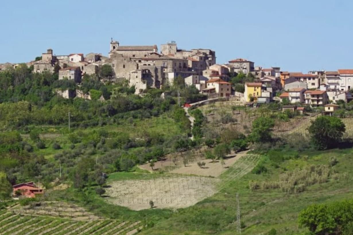
Taurasi sits at four hundred meters on a hill in the Media Valle del Calore, in the Irpinia of the Avellino province, forty kilometers inland from Salerno. The castle above the town was built in the seventh century by the Lombards, destroyed by Saracen raids between 900 and 910, rebuilt and extended by the Normans in the twelfth century with a square keep, and partly destroyed again by Alfonso d'Aragona's troops in 1461.
The Gesualdo, Filangieri, Ludovisi and Carafa families took it in turn through the early modern period, each leaving their mark on a structure that was never allowed to settle into a single style. The upper ridge holds the castle and its history of damage and repair.
The lower town holds the parish church and its patronal feast, the daily religious life set apart from the fortress above. Between them, the medieval center keeps three gates and the noble palaces that once answered to whichever family held the keep.
Around all of it, the vineyards run down the slopes, the same ground that has outlasted every family that held the castle above it. What the place adds up to is a hill town where the fortress changed hands over and over while the vines below kept producing, so the wine, not the castle, became the more durable claim to distinction.
What to see in Taurasi
- Castello Marchionale. The keep stands on the upper ridge, its stone showing the patchwork of repeated rebuilding across centuries of raids and sieges. The square Norman keep is the most legible surviving structure.
- Enoteca Regionale. Regional wine cellar inside the castle, with a Percorso Tau sensory route through the Taurasi, Fiano di Avellino and Greco di Tufo appellations.
- Centro storico. Medieval village with three surviving gates, Porta Sant'Angelo, Porta Piccola and Porta Maggiore, and noble palaces with corner towers.
How to get to Taurasi
Salerno is roughly 74 minutes away by road.
Our tip
April through June and September into October are the working months for Taurasi. The Aglianico vines bud in late spring, the slopes turn through copper into November after harvest. The vendemmia falls in late October, the latest in southern Italy because Aglianico ripens slowly.
Rivello
Why visit Rivello
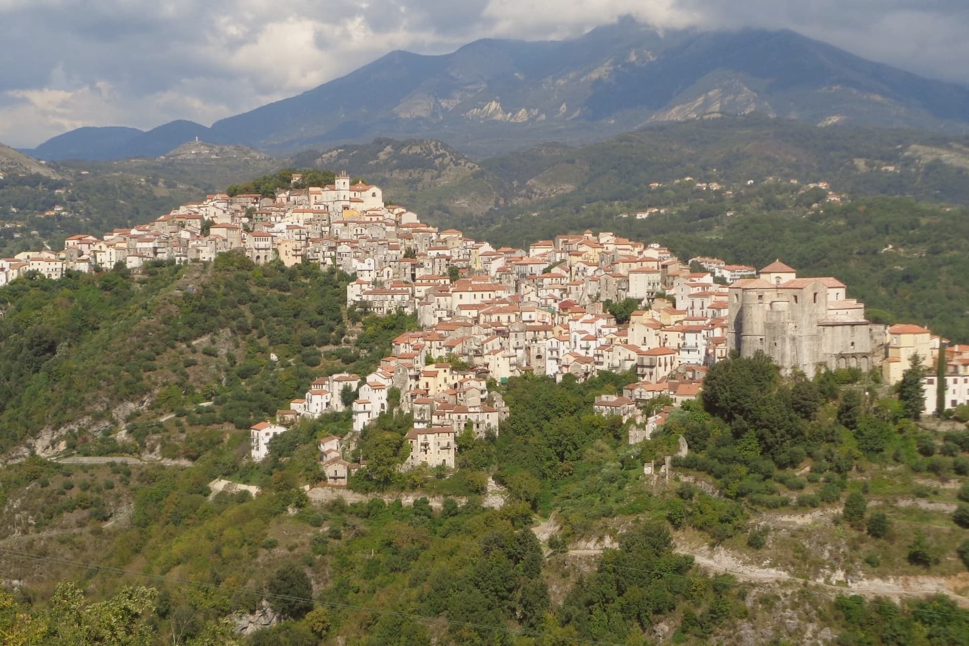
Rivello sits at 479 meters on a ridge above the Noce valley, twenty kilometers inland from Maratea and the Tyrrhenian. The town was disputed between Lombards and Byzantines after the fall of Velia, and its name is read by some as Re-Velia, the place where Velian refugees regrouped.
Both peoples settled here and never fully separated: the ridge organized itself into an upper town and a lower town, and for centuries each pole kept its own church, its own clergy, and its own rite, meeting at the market but not at the altar. The eighteenth century was Rivello's prosperous moment, judging from the parish archives and the stone houses that climb the ridge from that period, including the Baroque work layered onto older Greek-rite foundations in the lower town.
The Pollino park boundary runs nearby, and the belvedere at Passo la Colla looks down on the Gulf of Policastro, a reminder that the ridge, for all its inland feel, sits a short distance from the coast it once helped populate. What the town amounts to is a single street holding two histories that ran side by side for the better part of a millennium before finally merging.
What to see in Rivello
- Convento di Sant'Antonio da Padova. Sixteenth-century Franciscan complex built around a cloister, its frescoes by Giovanni Todisco and Giovanni De Gregorio covering the cloister walls and refectory.
- Chiesa di Santa Maria Maggiore. Upper-town church, plainer in its stonework than its lower-town counterpart, standing at the pole of the ridge that held the Latin congregation.
- Chiesa di San Nicola dei Greci. Lower-town church with Byzantine architectural elements still legible beneath an eighteenth-century reorganisation of the interior.
How to get to Rivello
Salerno is roughly 88 minutes away by road.
Our tip
April through June is the comfortable window, when the Noce valley turns green and the convent frescoes can be viewed without queues. September and October are dry and gold. July and August push toward thirty-five degrees on the ridge, hotter still in the valley, and locals retreat to the Tyrrhenian or the Pollino slopes nearby.
Benevento
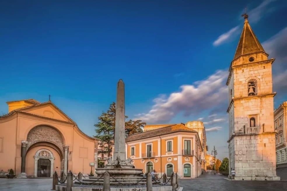
Why visit Benevento
Benevento sits at 130 meters at the confluence of the Calore and Sabato rivers, fifty-five kilometers northeast of Naples, the historic capital of the Sannio. The Lombard Duchy of Benevento was founded in 571, well before the small circular church that survives from around 760, and the city centre still carries that double layer of Roman provincial capital and Lombard duchy seat.
Walking from the cathedral down Corso Garibaldi, past the cloister sculptures set against the medieval wall, ends at the triumphal arch, so the route itself moves from the Lombard and medieval town toward the point where the Roman road left for Brindisi. The countryside around the city is Aglianico del Taburno wine and the herbal liqueur distilled here since 1860.
What holds the city together is this sequence along one line of streets: two civic identities, Roman and Lombard, laid end to end and still walkable in that order.
What to see in Benevento
- Arco di Traiano. The marble reliefs facing the road show Trajan's domestic policy, those facing the town his military campaigns, a pairing read as deliberate rather than decorative. The Via Traiana ran from this point to Brindisi.
- Chiesa di Santa Sofia. The circular plan is unusual for the period, and the interior keeps traces of the original Lombard fabric beneath later additions. It stands apart from the rectangular churches common elsewhere in the city.
- Teatro Romano. Roman theatre begun under Hadrian and completed under Caracalla, capacity for ten thousand spectators, still used for summer performances.
How to get to Benevento
There is a railway station in the town, so you can arrive without a car and never need one while you are here. Salerno is roughly 84 minutes away by road.
Our tip
April through June and September into October are the city's dry months, with mild evenings along the Calore and the Roman amphitheatre's summer programme starting in June. July and August push the inland Sannio past thirty-five degrees, and the old town empties between three and six in the afternoon while the riverbanks become the local refuge. November through March is wet, foggy at dawn, with rain a constant in February.
More from Anywhere Italy
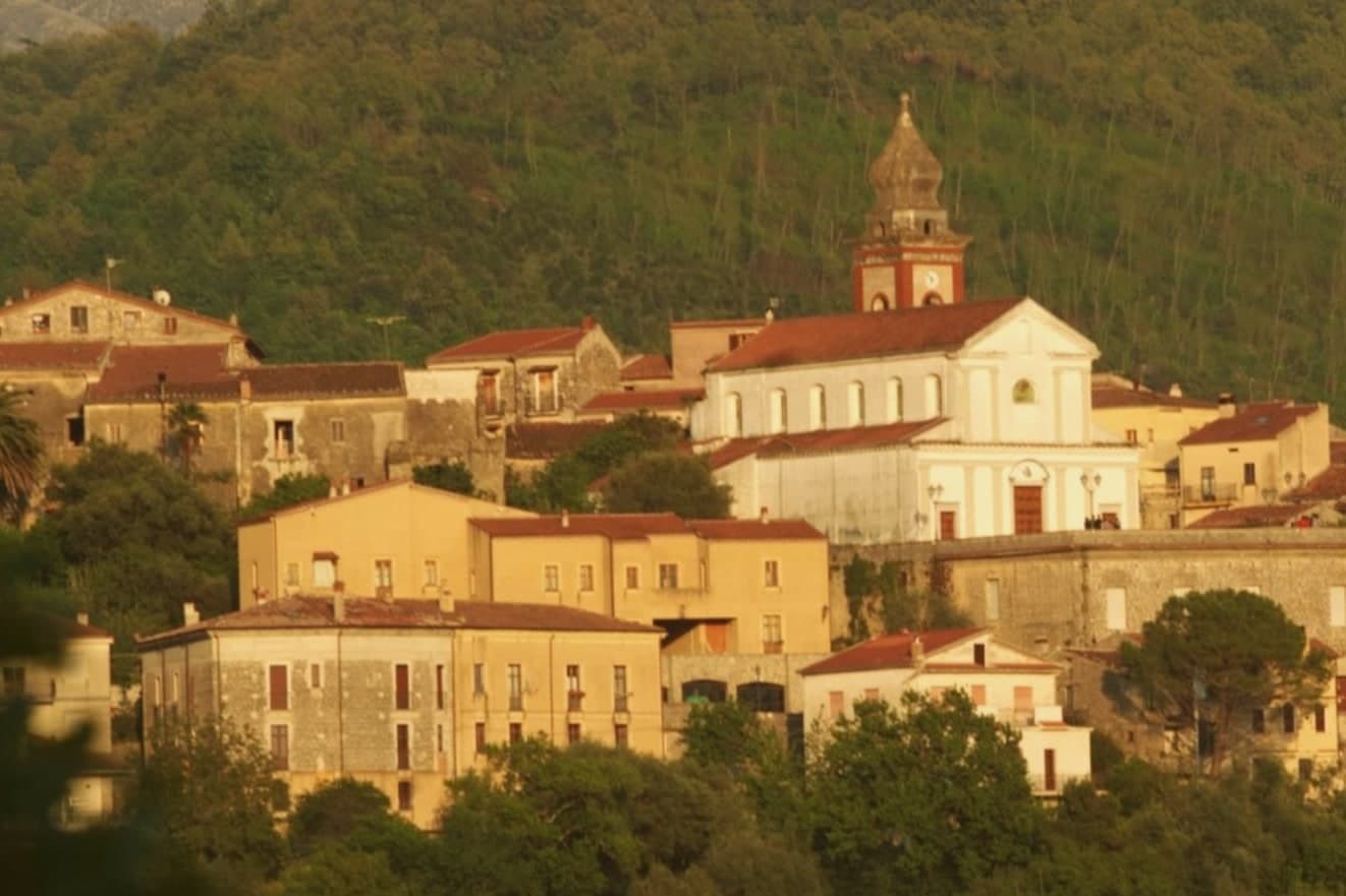 The 8 best hill towns inside a national park in Campania
- The best hill towns you can reach by train in Campania
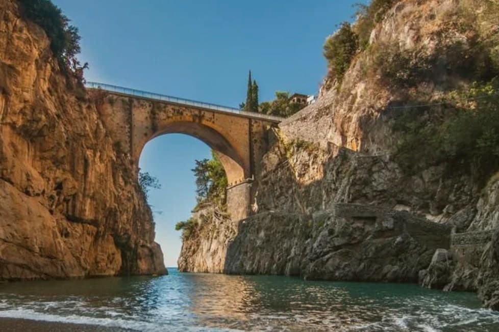 The 8 best wine towns within 90 minutes of Salerno
- The best wine towns within 90 minutes of Naples
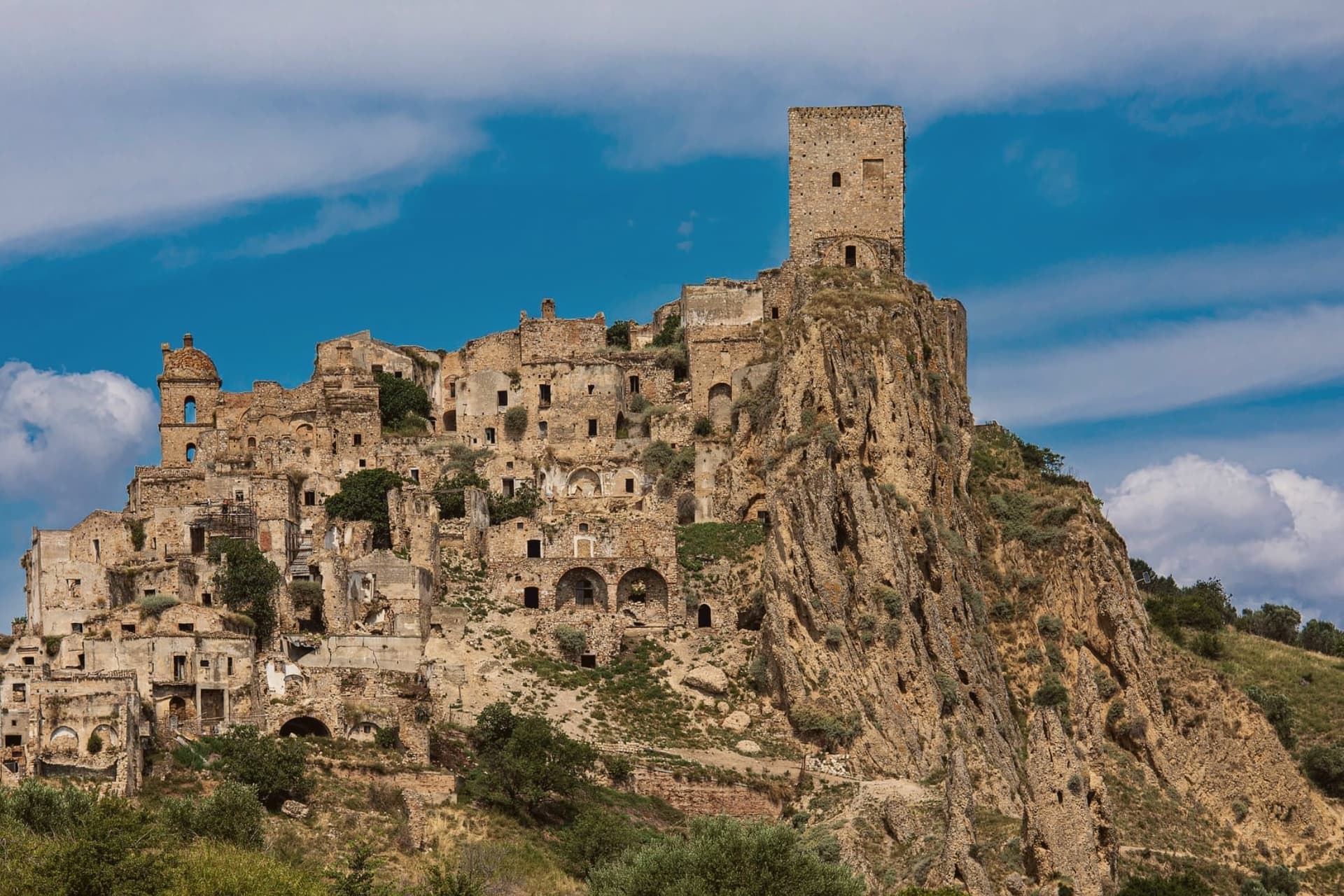 The 10 best hidden hill towns in Basilicata
- The best hidden hill towns you can reach by train in Campania