
Campania · Salerno
Morigerati
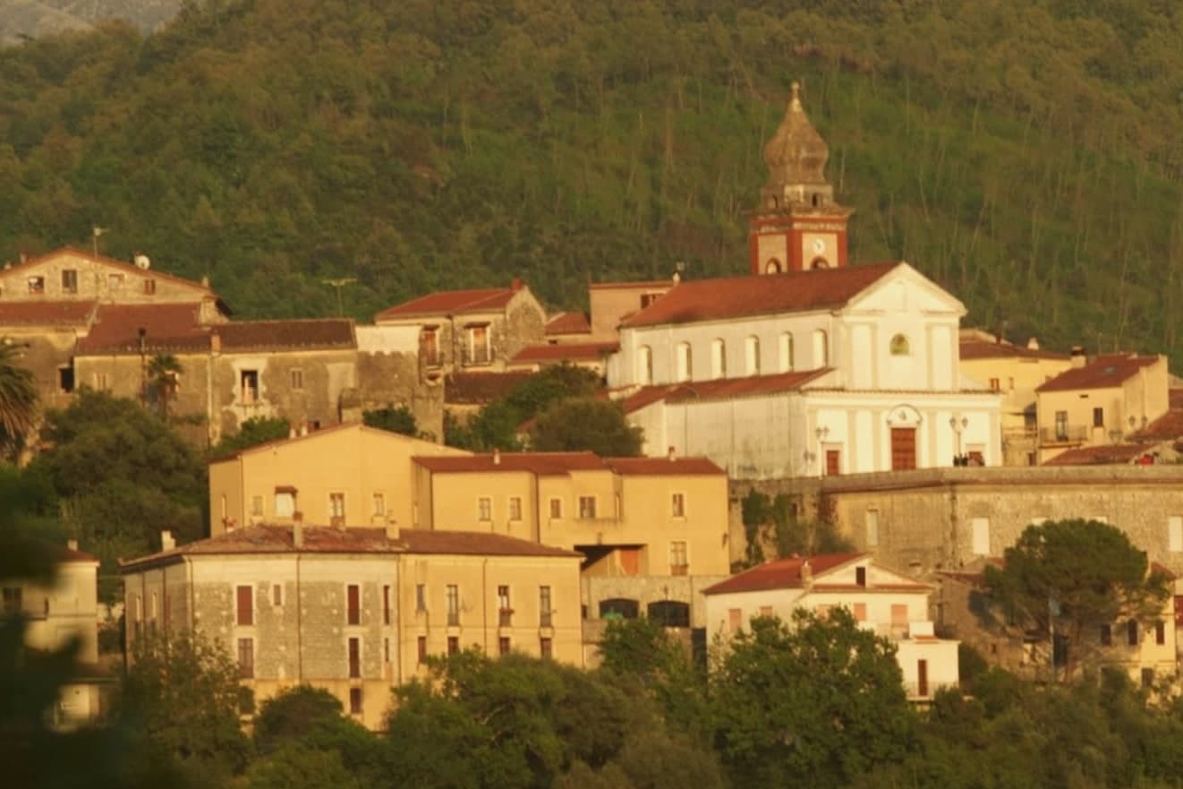
A 608-person Cilento village above the Bussento gorge, the river surfacing from underground caves directly beneath the cliffs.
- Best time
- Apr–Oct
- By car
- 1 h 33 min from Salerno
- Population
- 608
Known for
BUSSENTO RESURGENCE
Karst cave system where the Bussento river resurfaces after seven kilometers underground, one of the major karst sites of southern Italy.
WWF OASIS
Six hundred and seven hectares of forest and gorge managed by WWF Italia since 1985, the second-oldest WWF oasis in the country.
BANDIERA ARANCIONE
Touring Club Italiano quality mark for small inland villages, awarded for the integrity of the centro and the WWF site below.
When to visit
Best · Apr–Oct
- J11°
- F13°
- M13°
- A16°
- M21°
- J25°
- J28°
- A28°
- S25°
- O21°
- N16°
- D13°
- Best
- Hot or crowded
- Quiet
- Mostly closed
Daytime averages, 2020–2024. Weather data by Open-Meteo.com.
The festa: Demetrio di Tessalonica, 26 August
Why come
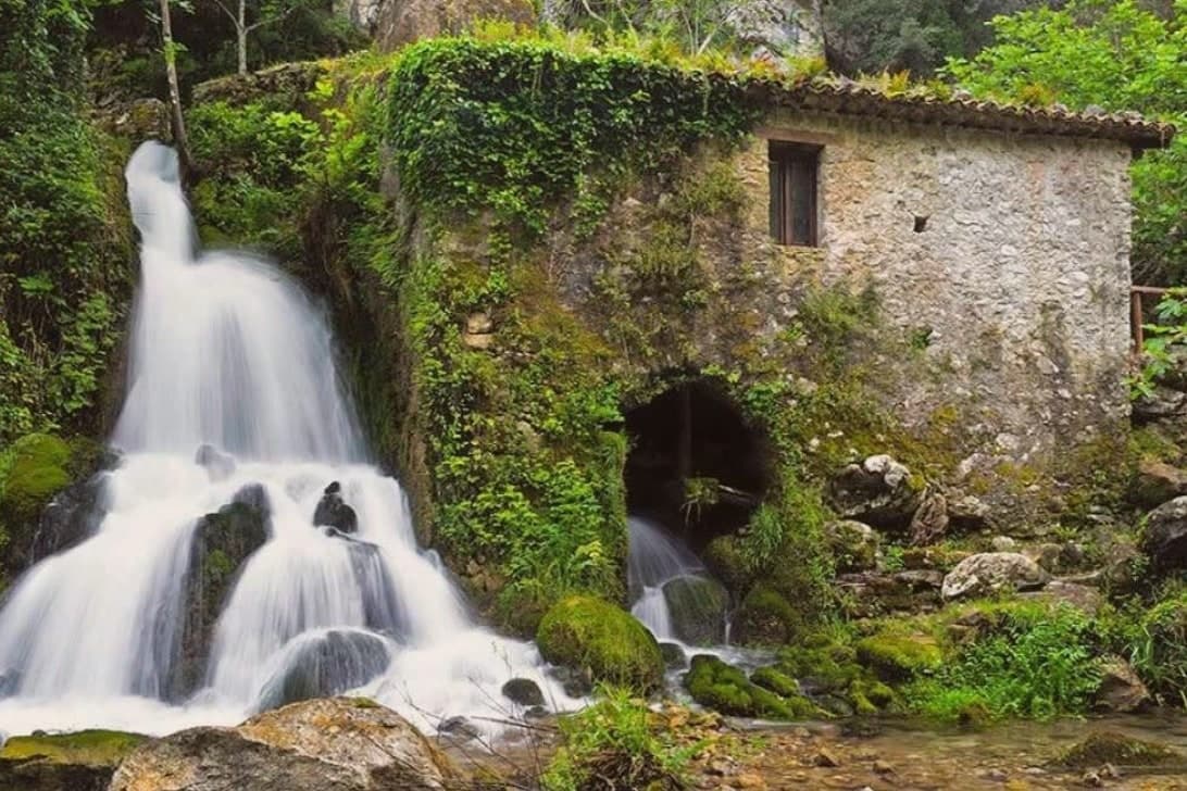
Morigerati sits on a cliff in the southern Cilento, inside the Cilento, Vallo di Diano and Alburni National Park, with six hundred and eight residents on a stone ridge above the Bussento. The river that gives the commune its identity disappears underground for seven kilometers and resurfaces from a series of karst caves directly below the village, the Grotte del Bussento, which the WWF designated as an oasis in 1985 and still manages on six hundred and seven hectares of forest and water. The path down from the centro to the cave mouth is a short walk and a steep climb back.
The commune is a Bandiera Arancione of the Touring Club Italiano, a member of the Città delle Grotte network, and sits inside one of the largest national parks in Italy. The village fits the southern Cilento depopulation pattern: an aging core, emigration out, and a small return of visitors drawn by the water under the rock.
The Sunday letter
Morigerati is on our list. Its letter is still to come.
We are writing about all 1,000 of these towns, one at a time, in a free letter every Sunday: the photo, the food, the festa. That is our mission. Sign up and you will be there when Morigerati comes up. By Peter & Sophia, from Pietrasanta.

How to get there
From Naples / Salerno (NAP), about 2h 16m by car.
Lamezia / Reggio (SUF) is about 3h 9m away.
By car from the centre of Salerno 1h 33m, Naples 2h 16m or Bari 3h 25m.
What to see
Grotte del Bussento
Karst cave mouth where the Bussento river resurfaces after seven kilometers underground, with a WWF-managed oasis of 607 hectares since 1985.
Centro storico di Morigerati
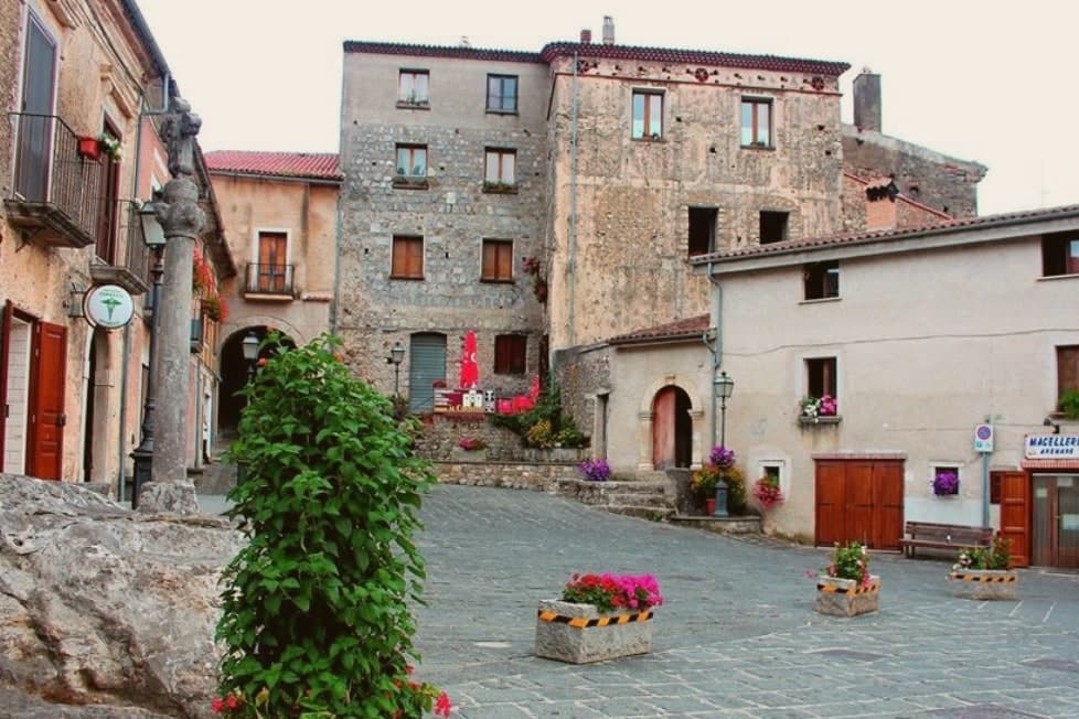
Stone village at 340 meters on the cliff above the river, with narrow lanes, arches, and overlooks down to the cave mouth below.
Oasi WWF Grotte del Bussento
Nature reserve of beech, oak and alder along the Bussento gorge, run by WWF Italia in collaboration with the comune.
Chiesa dei Santi Demetrio e Vito
Eighteenth-century parish church in the upper centro, dedicated to the Greek martyr Demetrius alongside Saint Vitus.
The slow-trip planner
Building a trip? Find where Morigerati fits in a slow Italy circuit.
Answer five questions. We will shape a geographically coherent slow trip from the 1,000 Italian towns most travelers skip. Yours to save and share.
Living here
- Population 608
- Very remotei
- Pharmacy in town
- High school within a 30-minute drive
- Nearest airport Naples / Salerno, 2 h 16 min drive
- Regional capital Napoli, 2 h 16 min drive
Common questions
- What is Morigerati known for?
- Morigerati is a 608-person Cilento village above the Bussento gorge, the river surfacing from underground caves directly beneath the cliffs.
- Where is Morigerati?
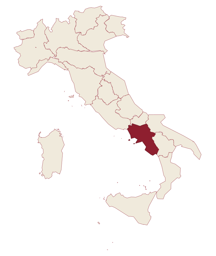
- Morigerati is a comune in the province of Salerno, in Campania, at 340 meters above sea level.
- What is the nearest airport to Morigerati?
- Naples / Salerno (NAP), about 2h 16m by car.
- How long is the drive from Salerno to Morigerati?
- About 1h 33m by car.
- When is the best time to visit Morigerati?
- Best in Apr–Oct. August is the warmest month, averaging 28 degrees, and November the wettest, with about 14 rain days.
- Is there a sagra or a festival in Morigerati?
- The town keeps its patron saint's day: Demetrio di Tessalonica, 26 August.
- Which other towns are like Morigerati?
- Roscigno, Aieta and Aliano.
- How many people live in Morigerati?
- 608 at the 2023 count.
Tags & datadesignations · numbers · sources
Recognised as
The numbers
- Elevation: 340 m
- Population: 608
- Surface area: 21.19 km²
These figures were compiled from public directories: ISTAT, OpenStreetMap and Wikidata, and from the official listings of the guides named on this page. Town details change; verify with official sources before you travel.
Similar
Towns like Morigerati
Roscigno
Province: Salerno
both inland, away from the coast · both under 1,000 people
Aieta
Province: Cosenza
both inland, away from the coast · both under 1,000 people
Aliano
Province: Matera
both inland, away from the coast · both under 1,000 people
Tufo
Province: Avellino
both inland, away from the coast · both under 1,000 people
Perito
Province: Salerno
both inland, away from the coast · both under 1,000 people
Craco
Province: Matera
both inland, away from the coast · both under 1,000 people
🟠 Bandiera Arancione
More Bandiera Arancione towns in Campania
Cerreto Sannita
Province: Benevento
A Sannio ceramics town at 290 meters, replanned on an orthogonal grid after the 1688 earthquake leveled the old hill.
Letino
Province: Caserta
At 961 meters the highest commune in the province of Caserta, where in April 1877 anarchists declared a Republic of Letino in the village hall.
Sant'Agata de' Goti
Province: Benevento
A medieval town built on a tuff cliff between two gorges, the houses standing flush with the edge over the Isclero river below.
Zungoli
Province: Avellino
An Irpinia ridge between the Ufita valley and the Daunian hills, with walls above and tuff caves below the houses.