
The best small coastal towns in Toscana
The Tuscan coast runs long, and where it stays small it smells of hot pine resin and salt. Behind the beaches, umbrella pine forest and macchia give way to hills of sandstone and clay, with villages built in dark stone and pale plaster, shutters closed against the afternoon. The eating is coastal and inland at once: cacciucco and anchovies at the shore, wild boar with olives and pecorino from the hills above, washed down with Bolgheri and Maremma reds. Late spring and September are the good months, when the sea is warm, the sand is quiet and the bars along the seafront still open early for coffee.
Most people who come to the Tuscan seaside go to Versilia, to Forte dei Marmi and Viareggio, where the beach is parcelled into numbered concessions and the passeggiata is the main event. It is easy to reach, well served by trains from Florence and Pisa, and in August the umbrellas run in unbroken rows for kilometre after kilometre. There is a reason for the crowd, and it is not a bad way to spend a week. But it is not the whole coast, and it is not the quiet part of it.
South and west of that, the shoreline keeps going: down the Etruscan Riviera past Cecina, into the Maremma, and out to the islands of the archipelago, where granite headlands drop into clear water. The towns in this list all sit directly on the sea or on an island in it, and they are the smaller ones, the sort with a single square and a ferry timetable rather than a resort strip. Fewer people go, particularly outside high summer. They are worth the detour, and several of them are worth the boat.
Of the 84 communes we have mapped in Toscana, 22 qualify as coastal towns: each sits directly on the sea. This list is the small ones, 6 in all, ordered smallest first. The smallest, Capraia Isola, has 370 residents.
Two more lists worth reading alongside this one: The best small towns with a food festival in Toscana and The best hidden coastal towns that eat well in Toscana.
Capraia Isola
Why visit Capraia Isola
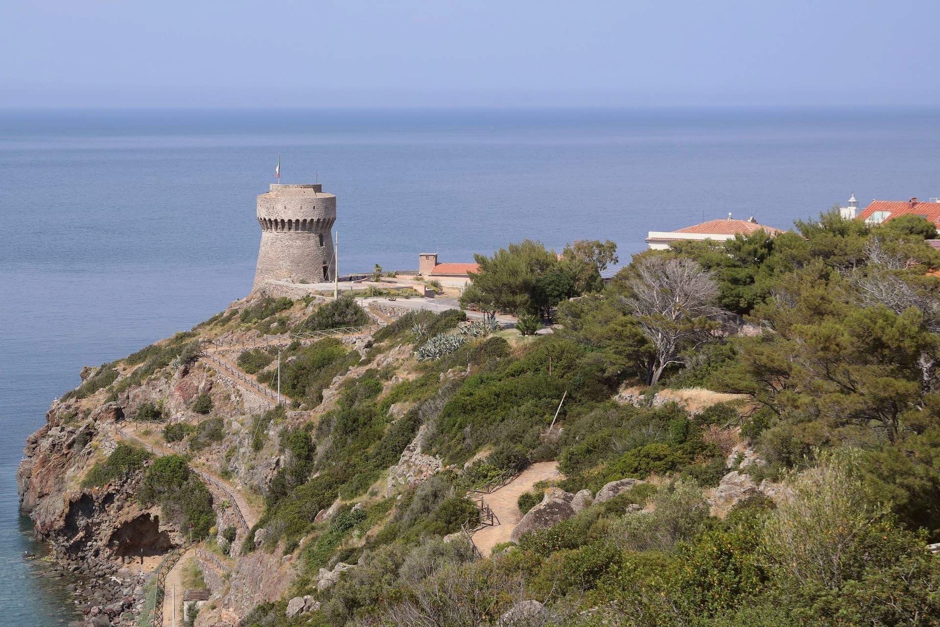
The island is the northernmost of seven, sitting apart from Elba and Giglio to its south. It carries one village and one harbor, and beyond a few service vehicles there are no cars.
The volcanic plateau rises above the settlement, holding the freshwater lake at its center, the only one of its kind among the archipelago's islands, while the coast runs down to the red cliffs on the western side and out to the abandoned signal station at the southern tip. The fort above the harbor stood guard for two centuries before the island's later history turned inward: the penal colony took two thirds of the land from 1873, pushed out most residents, and left its buildings to scrub after 1986, the same year its fences and cells came down.
Ten years later the park absorbed the island whole, water and land together. The comune now counts 370 residents, the least-populated Italian municipality with an outlet to the sea.
What was built to confine the island then opened it: a fortress, a prison, and now a park have each in turn defined how much of Capraia belongs to the few who live there and how much is held in trust for everyone else.
What to see in Capraia Isola
- Forte San Giorgio. Genoese fort above the harbor, built in 1540 on the foundation of an earlier tower destroyed by Turgut Reis. It held the line against pirates for two centuries.
- Cala Rossa. Red volcanic cove on the western side of the island, where the cliffs hold the color of oxidized basalt.
- Stagnone. Small natural lake at 320 meters on the volcanic plateau above the village, the only freshwater basin in the Tuscan Archipelago.
How to get to Capraia Isola
Our tip
May through September is the only practical season on Capraia. The ferry from Livorno runs three to four times a week in summer, less in winter, and the crossing takes two and a half hours through open sea. The Mediterranean warms enough to swim from mid-May; July and August fill the few rooms on the island and book out the small restaurants in the village. Sagra del Totano Capraia falls in October.
Isola del Giglio
Why visit Isola del Giglio
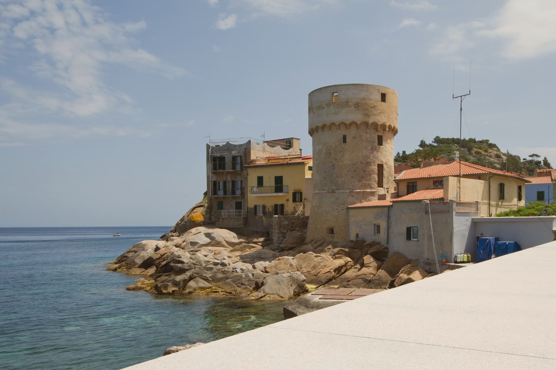
Isola del Giglio is the second-largest island in the Tuscan Archipelago, almost entirely granite, the highest point at Poggio della Pagana 496 meters above the sea. The commune has three inhabited frazioni: Giglio Porto on the eastern coast, where the ferries from Porto Santo Stefano dock; Giglio Castello on the central ridge at around 405 meters, the walled medieval village and administrative center; and Giglio Campese on the western bay, a 1960s seaside resort built on an old pyrite mine closed in 1964.
Charlemagne gave the island to the abbey of Tre Fontane in 805. It was Pisan from 1264, ceded to Antonio Piccolomini in the fifteenth century, then passed to the Medici in 1558.
Saracen raids continued until 1799. The wreck of the Costa Concordia on the night of 13 January 2012 killed thirty-two people and held the world's attention until the ship was righted, refloated and towed to Genoa in July 2014.
What to see in Isola del Giglio
- Giglio Castello. Walled medieval village on the ridge at around 405 meters, with intact mura and the Rocca Aldobrandesca, the administrative center of the island.
- Giglio Porto. Main harbor of the island on the east coast, with the colored houses around the small ferry dock and the lighthouse of Capel Rosso to the south.
- Giglio Campese. Largest bay and sandy beach of the island on the west coast, with the medieval Torre del Campese and the disused pyrite mine on the headland.
How to get to Isola del Giglio
Our tip
May through September is the only practical season for Giglio. The ferries from Porto Santo Stefano run on a full schedule, the beaches at Campese and the smaller coves work, and the temperature in Castello on the ridge stays manageable through August. July and August are crowded with mainland day-trippers; the island roughly doubles in population. Festa dell'Uva e delle Cantine falls in September.
Montescudaio
Why visit Montescudaio
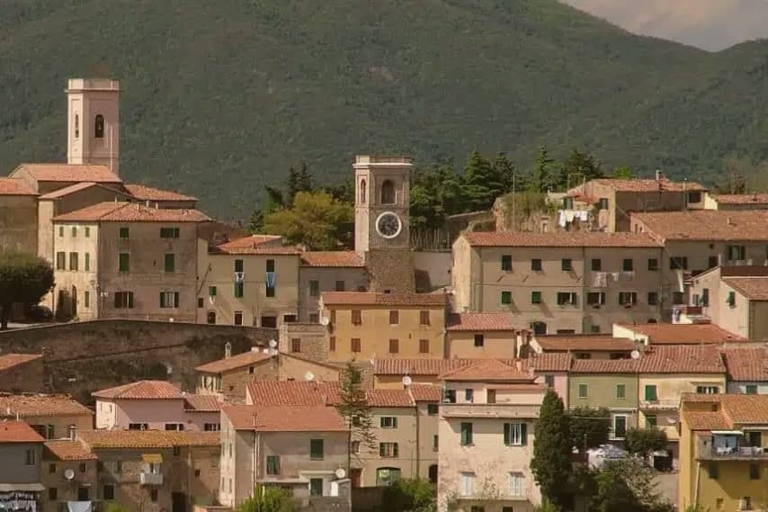
Montescudaio sits fifteen kilometers inland from the Tyrrhenian coast, on a hill above the valley the Cecina river cuts toward the sea. Fewer than 2,200 people live in the commune, and most of them are outside the centro storico, which is left as a tight knot of stone houses ringed by its old walls: a single church, the clock tower, and the terrace where the vines drop downhill toward the Val di Cecina and the water beyond.
The town carries four institutional signals at once, an unusual density for its size: a registered wine appellation, a bread-network membership rare in this part of Tuscany, a name that predates the medieval walls, and the walls themselves built around an eleventh-century abbey. Wine and bread are both grown and baked around the same hilltop that once needed fortifying.
The fortress, the loaf, and the vineyard are not three separate stories here but three uses of the same ground, worked over centuries after the shields it was named for stopped being necessary.
What to see in Montescudaio
- Centro storico. Walled medieval village, a tight ring of stone houses on the hilltop, built around the abbey that gave the settlement its first walls and structure.
- Torre Civica. Clock tower at the entrance to the borgo, the tallest visible structure and former civic landmark of the fortified village.
- Chiesa di Santa Maria Assunta. Eleventh-century parish church on the site of the medieval abbey, the anchor around which the walled village took shape.
How to get to Montescudaio
Livorno is roughly 44 minutes away by road.
Our tip
May through September is the season on the Cecina hills: dry days, vine work, harvest from late August through September. The coast lies fifteen kilometers west and the sea breeze keeps evening temperatures lower than the inland Maremma. July and August bring crowds to the beaches at Cecina and Marina di Bibbona, but the borgo on the hill stays quieter. Festa del Vino di Montescudaio falls in October.
Capalbio
Why visit Capalbio
Capalbio stands twelve kilometers from the Tyrrhenian coast, the last hill town before the border with Lazio. Charlemagne gave the land to the Abbey of Tre Fontane in 805; the Aldobrandeschi held it through the medieval period, the Orsini built the castle, and Cosimo I de' Medici took it in 1555.
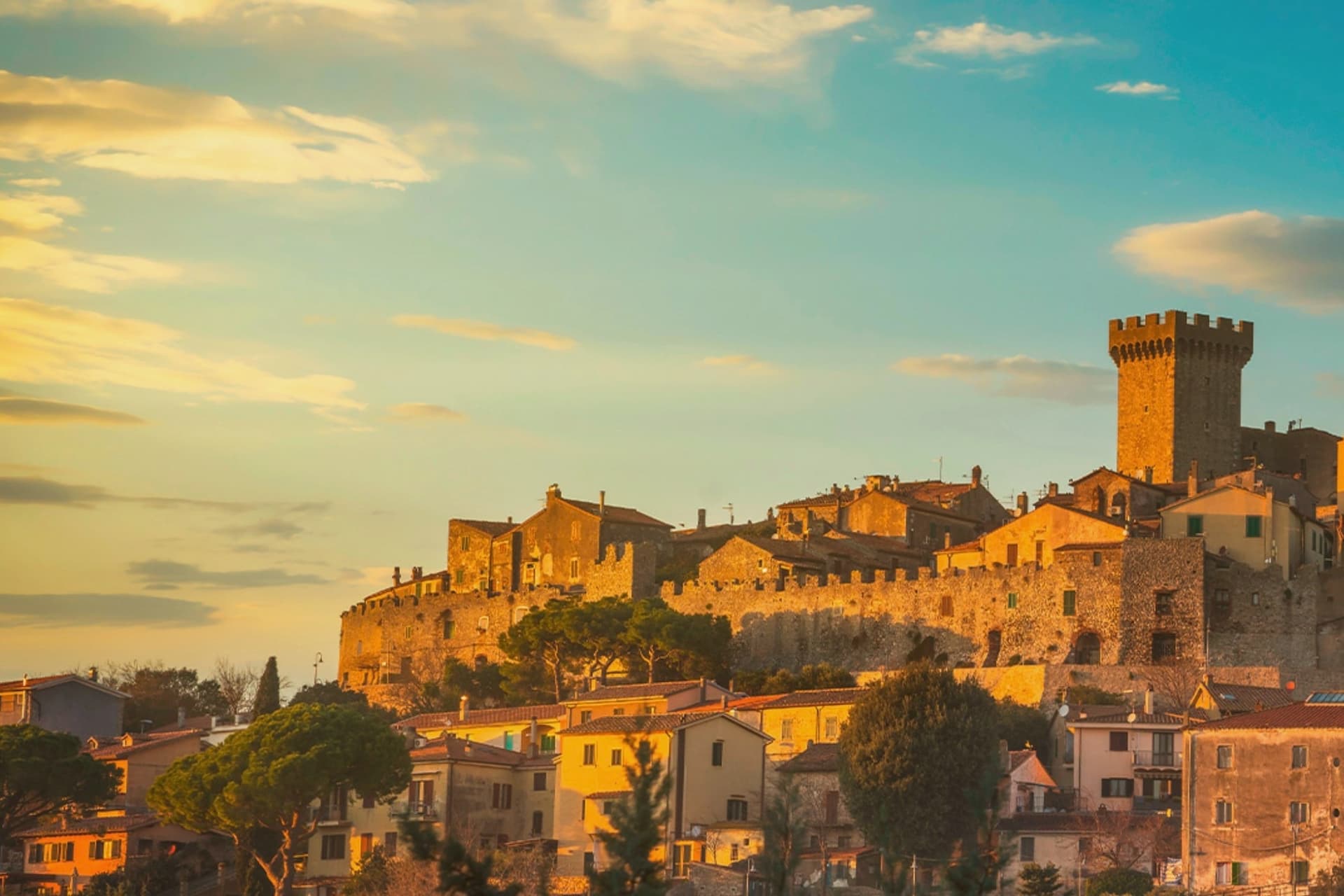
It became an independent commune in 1960. The medieval walls and the fortress define the centro storico at the top of the hill; the surrounding territory drops from the wooded uplands of Monte Calmata down to the coastal reserve at Lago di Burano.
The sculpture park sits four kilometers south of the walls, apart from the old town rather than within it. A borgo that governed itself late, held by abbey, feudal lords and Medici in turn before its own commune, and a territory that runs in one line from hilltop stone to coastal wetland.
What to see in Capalbio
- Rocca Aldobrandesca. Medieval fortress at the top of the borgo, later expanded by the Orsini, with a square tower and battlements that overlook the Maremma.
- Mura medievali. Two concentric circles of walls enclosing the centro storico, with a walkable parapet that opens onto views toward the Argentario.
- Giardino dei Tarocchi. Sculpture park four kilometers south of the borgo, its ceramic and mirrored figures set among holm oaks.
How to get to Capalbio
There is a railway station in the town, so you can arrive without a car and never need one while you are here. Roma is roughly 108 minutes away by road.
✷ We have written about Capalbio
“Everyone driving from Florence down to Rome crosses the Maremma without noticing, because there is nothing on that stretch to make them slow down. The hills give out. The cypresses stop. What opens up instead is flat open country, wheat and grass running off to a few low rises, the least Tuscan-looking part of Tuscany, a landscape you would call dull if you were being honest and which most guidebooks solve by leaving out.”
Read our piece on Capalbio →Maremma | The Last Cowboys of Tuscany
Our tip
May through September is the season the borgo and its territory work together: the centro storico stays cool at 217 meters while the Tyrrhenian coast at Chiarone-Capalbio fills with swimmers. The Giardino dei Tarocchi runs April through October. July and August are hot inland; afternoon hours in the borgo thin out and the coast takes over. Sagra del Cinghiale falls in September.
Bibbona
Why visit Bibbona
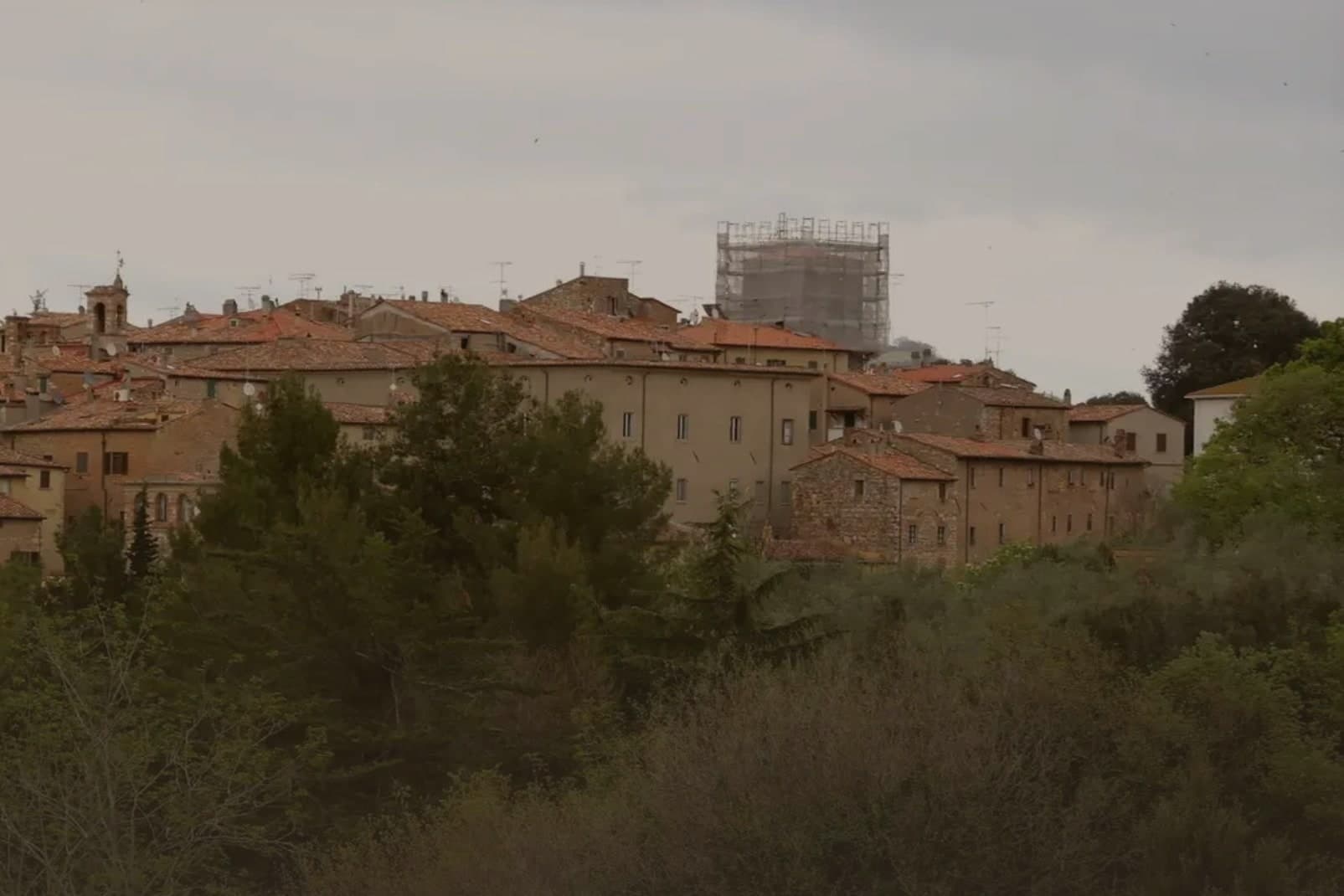
Bibbona sits at 85 meters in the Val di Cecina, in the southern province of Livorno, eight kilometers from the sea. The town has Etruscan origins, attested by a small bronze goat statuette, now in the Florence archaeological museum, that became the town symbol.
After medieval struggles between Pisa and Florence, the territory passed to the Gherardesca counts, who controlled most of the Etruscan Coast. Monk-knights, probably French and probably Templar, operated from the pieve in the medieval period, a detail that survives more clearly in local memory than in stone.
The village keeps its hill position while its coastal frazione does the work of meeting the sea: the fort once handled customs, sanitary inspection and defense, the beach now holds a national recognition, and the reserve in the inland hills once supplied the wood that moved through that same coastline. Upper town, shore and forest were never separate economies so much as three faces of one strip of land running from the Val di Cecina down to the sea.
The beach here holds the national bathing award, which a comune has to win back every year on water quality, beach management and safety.
What to see in Bibbona
- Pieve di Sant'Ilario. The church stands on Piazza XX Settembre. The right side and facade keep their Romanesque lines, while the added left nave throws the plan out of square, a visible seam between two building campaigns three centuries apart.
- Borgo medievale. Concentric ring of stone streets and stairways around the old castle, with surviving medieval gates and the central piazza.
- Forte di Marina di Bibbona. Built for customs control, sanitary inspection and defense against corsairs, the fort held a working coastline job, not a decorative one, watching the same shore the beach now occupies.
How to get to Bibbona
There is a railway station in the town, so you can arrive without a car and never need one while you are here. Livorno is roughly 51 minutes away by road.
Our tip
May and June bring warm water and quiet beaches, before the July and August crowds reach the Costa degli Etruschi. The borgo at 85 meters stays five degrees cooler than the coast and is the place to sleep in high summer. July and August are full: Marina di Bibbona fills, the pine-shaded beach fronts get crowded, and the Forte sees long queues at sunset.
Capoliveri
Why visit Capoliveri
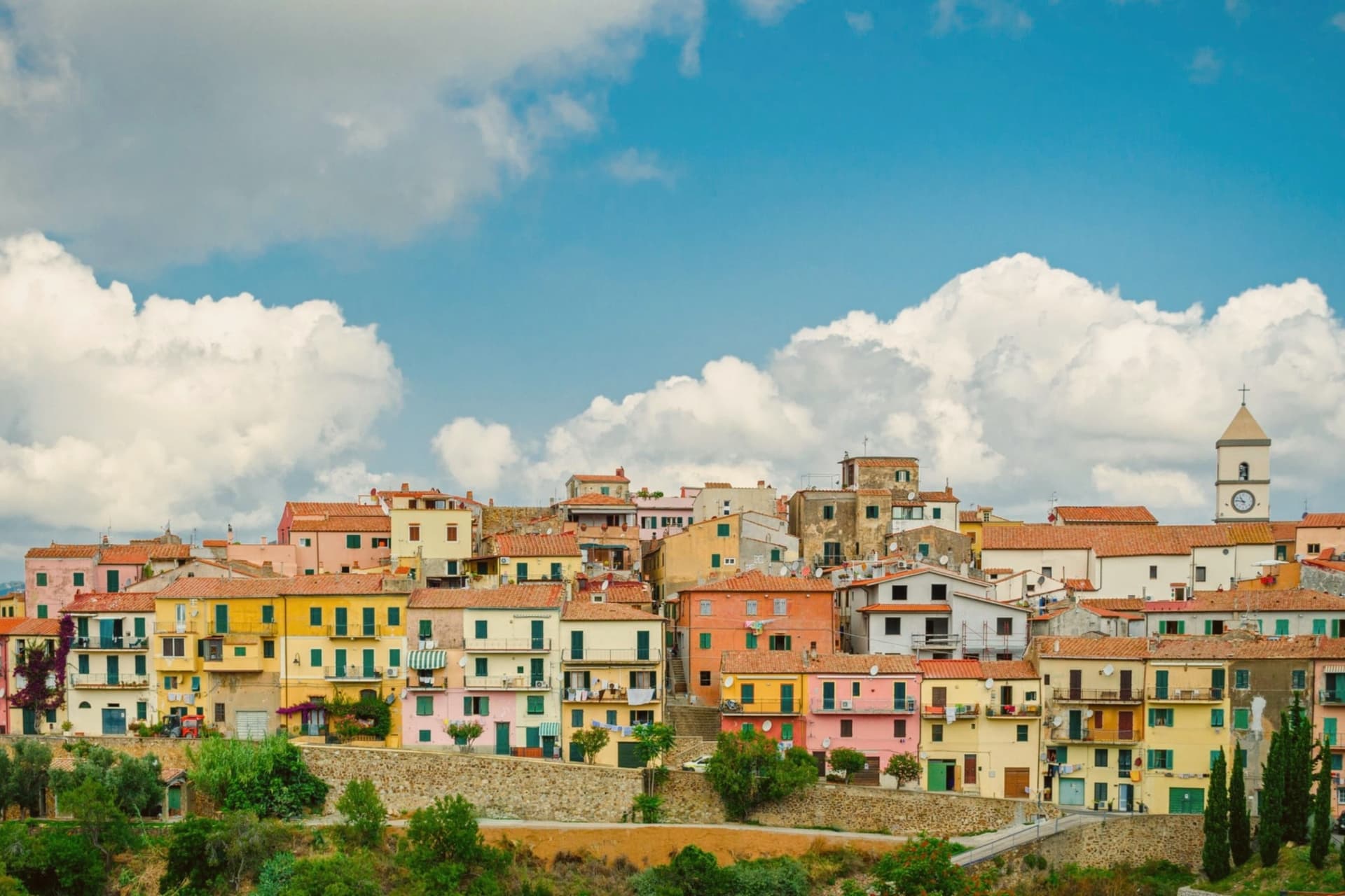
The name comes from Caput Liberum, the Roman head of the free territory. The medieval town that grew up on that ground sits on a terrace at 167 meters and is built into the slope as a maze of narrow alleys called chiassi, opening onto small piazzas rather than any wider square.
Below it the southern lobe of Elba unfolds into thirty-five kilometers of coastline, more than any other comune on the island, and the beaches, Innamorata, Morcone, Pareti and Zuccale, are reached by a network of dirt roads off the ridge rather than by a single road along the shore. The fishermen still go out at four in the morning from the cove at Naregno.
What holds the town together is that relation between height and shore: a hill settlement governing a coastline it does not directly touch, with the old mining ground on the mountain behind it folded into the same protected park as the water below.
What to see in Capoliveri
- Centro storico. Medieval village built into the slope of the mountain, with narrow stepped alleys called chiassi giving onto small piazzas.
- Miniere del Calamita. The galleries and open pits sit on the eastern flank of Monte Calamita, now a heritage trail with guided tours through the abandoned works.
- Spiaggia dell'Innamorata. Pebble beach on the southern coast, named for a sixteenth-century pair of lovers killed in a pirate raid, commemorated each July.
How to get to Capoliveri
Livorno is roughly 133 minutes away by road.
Our tip
May through September is the season Capoliveri runs on. The water warms enough to swim from mid-May, the ferries from Piombino run every hour, the beaches at Morcone and Innamorata fill from late June. July and August are crowded everywhere on the island and parking at the southern beaches becomes a small art.
More from Anywhere Italy
- The best small towns with a food festival in Toscana
- The best hidden coastal towns that eat well in Toscana
- The 7 best coastal towns in the province of Livorno
 The 10 prettiest villages with a food festival in Toscana
- The best towns inside a national park in Toscana
- The best hidden coastal towns you can reach by train in Toscana