
The best hidden coastal towns you can reach by train in Toscana
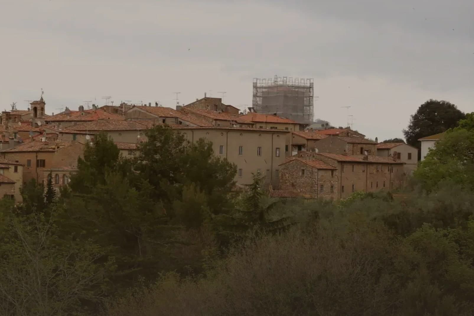
Tuscany's coast is longer and stranger than its reputation suggests. North of Livorno the Apuan Alps come down almost to the water, white with marble quarries, and the beaches are lined with pinewoods planted to hold the sand. South of the Cecina river the land flattens into Maremma, where lagoons hold flamingos and the summer air smells of resin and salt. Menus follow the geography: cacciucco and salted anchovies on the northern stretch, eel and mullet roe around the lagoons, wild boar as soon as you turn inland. The Tirrenica line, running the length of it, means much of this is reachable without ever renting a car.
Most people who come to the Tuscan seaside come to Forte dei Marmi, or take the train as far as Viareggio and stop there. Both are handsome, both are easy, and in August both are full of beach clubs charging by the row. The Versilia strip is where Milan goes in summer, and it prices accordingly.
The same railway keeps going, in both directions, past the resorts and into places where the ratio of residents to visitors stays sane through August. Some of these towns sit on the water directly, others look down on it from ridges of stone houses a bus ride from the platform. The sea is the same sea. Fewer people get off the train.
Of the 84 communes we have mapped in Toscana, 16 qualify as coastal towns you can reach by train: each sits directly on the sea, and we have confirmed each is reachable without a car. This list is the hidden ones, 8 in all, ordered smallest first. The smallest, Bibbona, has 3,170 residents.
Elsewhere in the catalogue: The best hidden coastal towns that eat well in Toscana and A 7-day trip through the Tuscan Maremma, based in Grosseto.
Bibbona
Why visit Bibbona
Bibbona sits at 85 meters in the Val di Cecina, in the southern province of Livorno, eight kilometers from the sea. The town has Etruscan origins, attested by a small bronze goat statuette, now in the Florence archaeological museum, that became the town symbol.
After medieval struggles between Pisa and Florence, the territory passed to the Gherardesca counts, who controlled most of the Etruscan Coast. Monk-knights, probably French and probably Templar, operated from the pieve in the medieval period, a detail that survives more clearly in local memory than in stone.
The village keeps its hill position while its coastal frazione does the work of meeting the sea: the fort once handled customs, sanitary inspection and defense, the beach now holds a national recognition, and the reserve in the inland hills once supplied the wood that moved through that same coastline. Upper town, shore and forest were never separate economies so much as three faces of one strip of land running from the Val di Cecina down to the sea.
We confirmed you can reach this one by train.
What to see in Bibbona
- Pieve di Sant'Ilario. The church stands on Piazza XX Settembre. The right side and facade keep their Romanesque lines, while the added left nave throws the plan out of square, a visible seam between two building campaigns three centuries apart.
- Borgo medievale. Concentric ring of stone streets and stairways around the old castle, with surviving medieval gates and the central piazza.
- Forte di Marina di Bibbona. Built for customs control, sanitary inspection and defense against corsairs, the fort held a working coastline job, not a decorative one, watching the same shore the beach now occupies.
How to get to Bibbona
There is a railway station in the town, so you can arrive without a car and never need one while you are here. Livorno is roughly 51 minutes away by road.
Our tip
May and June bring warm water and quiet beaches, before the July and August crowds reach the Costa degli Etruschi. The borgo at 85 meters stays five degrees cooler than the coast and is the place to sleep in high summer. July and August are full: Marina di Bibbona fills, the pine-shaded beach fronts get crowded, and the Forte sees long queues at sunset.
Montignoso
Why visit Montignoso
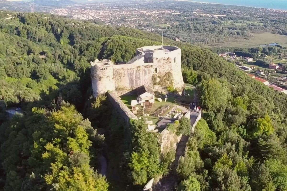
Montignoso sits at 132 meters at the foot of the Apuan Alps, between Massa and Pietrasanta, in the corner where Massa-Carrara province meets Versilia. Inland, the hill village stands under the castle's rise; the coastal frazione lies well apart from it, opening onto the Versilia beach, so the commune is really two settlements, one on the slope and one on the sand, with the wetland reserve filling the plain between them.
The town declined through the sixteenth century because of coastal malaria, which explains the gap between the fortified hill and the later life of the shore: the two halves of Montignoso grew up in different centuries for the same reason, one retreating from the coast, the other only possible once that reason had passed. The thermal signal comes from a small spring on the Pasquilio side of the commune.
Read together, Montignoso is a place defined less by any single site than by the line running from mountain to marsh to sea, each part settled on its own schedule.
We confirmed you can reach this one by train.
What to see in Montignoso
- Castello Aghinolfi. The castle stands on an isolated rise above the village. What remains is the strongpoint that once taxed and watched the road below, not a ruin left to itself but a position, still legible as one.
- Lago di Porta. The reserve covers the coastal plain, flat water against the line of the Apuan Alps. The gate it is named for is gone; the wetland it left behind is not.
- Cinquale. Fine sand with the Apuan Alps rising directly behind it, a seafront quieter than its better-known neighbor and shaped by that comparison rather than by its own crowds.
How to get to Montignoso
There is a railway station in the town, so you can arrive without a car and never need one while you are here. Pisa is roughly 52 minutes away by road.
Our tip
May through September brings the Cinquale beach into use and the trails to the Castello Aghinolfi clear of winter rain. June and September are the cleanest weather. July and August fill the seaside parking and push the Pasquilio uplands into wildfire-risk hours.
Seravezza
Why visit Seravezza
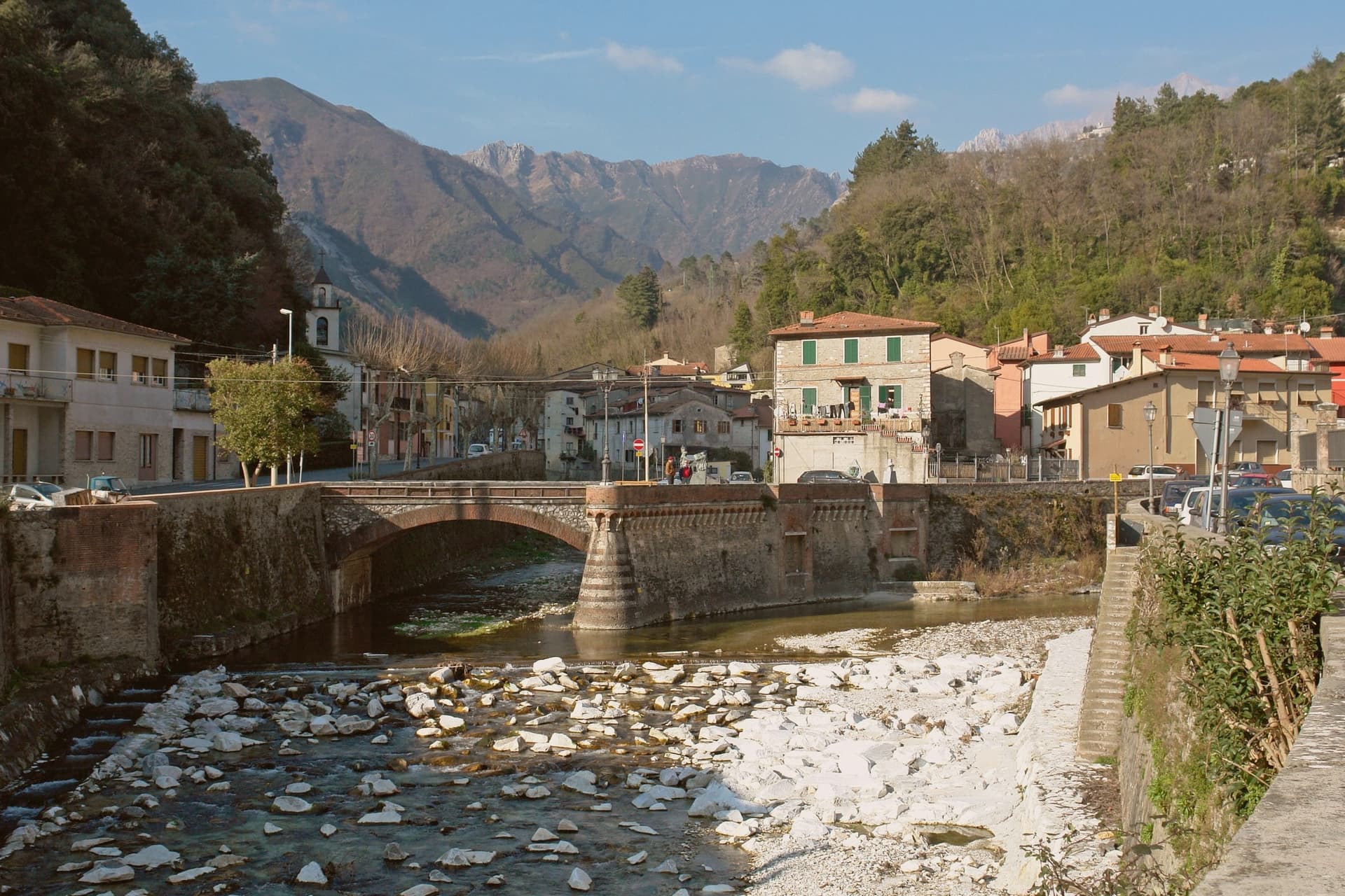
Seravezza sits at 100 meters where the Vezza and Serra streams meet, in Versilia Storica, between the Apuan Alps and the Tyrrhenian. The territory was contested between Pisa, Lucca, Genoa and Florence for centuries before passing to the Medici, and the town's position at the junction of the two watercourses, with the mountains at its back and the coast within reach, explains why it mattered enough for all four to want it.
Michelangelo spent three years on Monte Altissimo behind the town, found his veins of white stone, and built a road to take it down toward the sea. Half a century later Cosimo I commissioned the Palazzo Mediceo here, a summer residence rather than a fortress, which says something about how settled Medici rule had become by the time it was built.
The two episodes, a papal quarry and a ducal villa, sit one above the other on the same small territory: the mountain supplied the stone that Florence wanted, and the valley below became a place worth building a palace in once the stone trade had made the route familiar.
We confirmed you can reach this one by train.
What to see in Seravezza
- Palazzo Mediceo. The residence stands in the centro, its design passed from one architect to the next as the project went on. It carries the UNESCO listing among the Medici Villas.
- Pieve di San Martino alla Cappella. Eleventh-century Romanesque parish church between Seravezza and Azzano, with the ruined Annunziata Oratory alongside.
- Monte Altissimo. The peak rises behind the town at 1,589 meters. The road Michelangelo built to bring the stone down still marks the route from quarry to valley, and the mountain is worked as a quarry to this day.
How to get to Seravezza
There is a railway station in the town, so you can arrive without a car and never need one while you are here. Pisa is roughly 63 minutes away by road.
Our tip
May through September is the working Versilia season, the inland equivalent of the coastal months at Forte dei Marmi and Pietrasanta six kilometers away. June and September are the best moments to walk up to the Cappella and Azzano: the mountain trails open, the marble quarries above visible from below. July and August are hot in the lower town but cool on the slopes, and the Apuan rains hold off until late September. Sagra di Fine Estate falls in August.
Capalbio
Why visit Capalbio
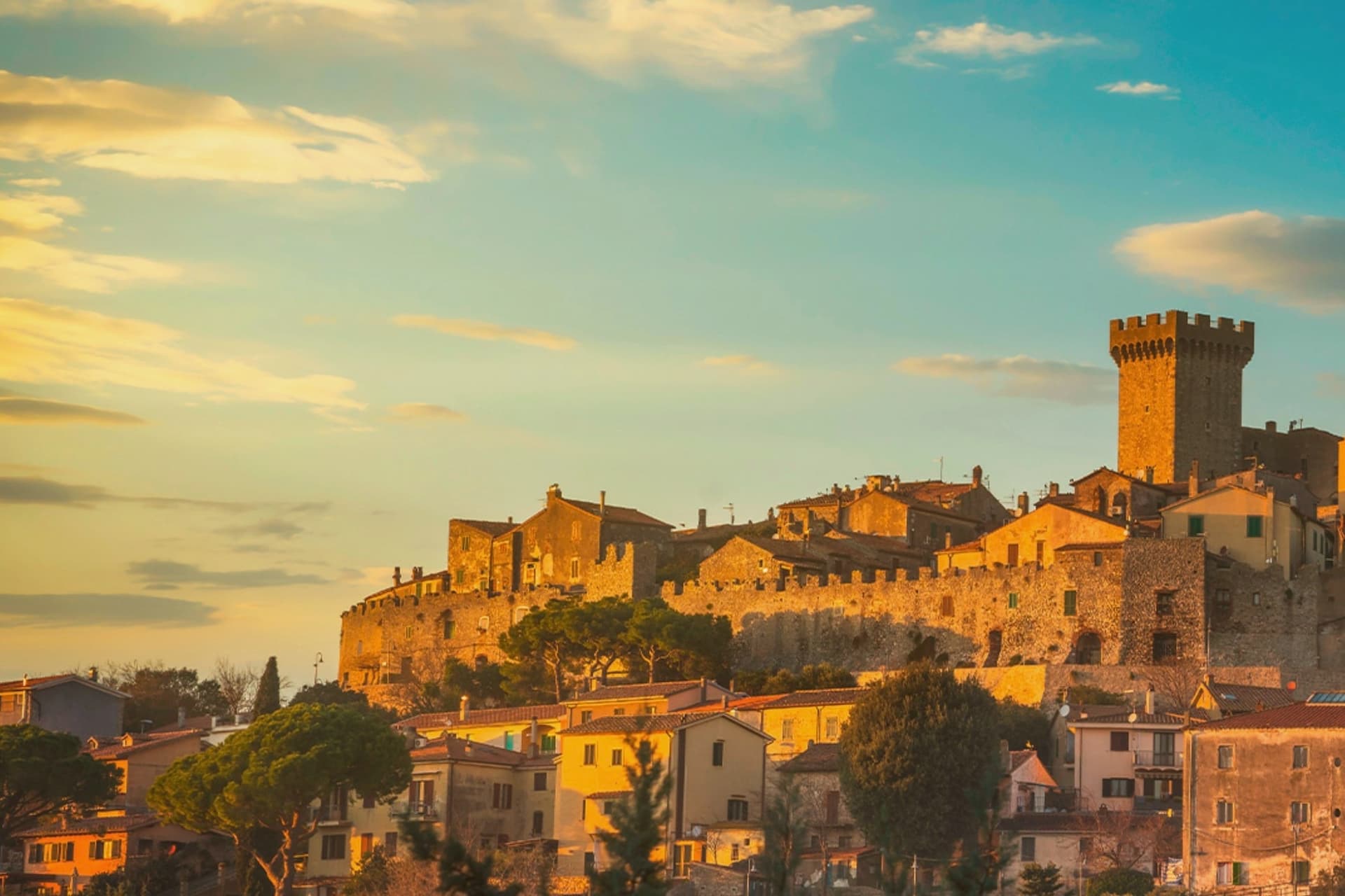
Capalbio stands twelve kilometers from the Tyrrhenian coast, the last hill town before the border with Lazio. Charlemagne gave the land to the Abbey of Tre Fontane in 805; the Aldobrandeschi held it through the medieval period, the Orsini built the castle, and Cosimo I de' Medici took it in 1555.
It became an independent commune in 1960. The medieval walls and the fortress define the centro storico at the top of the hill; the surrounding territory drops from the wooded uplands of Monte Calmata down to the coastal reserve at Lago di Burano.
The sculpture park sits four kilometers south of the walls, apart from the old town rather than within it. A borgo that governed itself late, held by abbey, feudal lords and Medici in turn before its own commune, and a territory that runs in one line from hilltop stone to coastal wetland.
We confirmed you can reach this one by train.
What to see in Capalbio
- Rocca Aldobrandesca. Medieval fortress at the top of the borgo, later expanded by the Orsini, with a square tower and battlements that overlook the Maremma.
- Mura medievali. Two concentric circles of walls enclosing the centro storico, with a walkable parapet that opens onto views toward the Argentario.
- Giardino dei Tarocchi. Sculpture park four kilometers south of the borgo, its ceramic and mirrored figures set among holm oaks.
How to get to Capalbio
There is a railway station in the town, so you can arrive without a car and never need one while you are here. Roma is roughly 108 minutes away by road.
✷ We have written about Capalbio
“Everyone driving from Florence down to Rome crosses the Maremma without noticing, because there is nothing on that stretch to make them slow down. The hills give out. The cypresses stop. What opens up instead is flat open country, wheat and grass running off to a few low rises, the least Tuscan-looking part of Tuscany, a landscape you would call dull if you were being honest and which most guidebooks solve by leaving out.”
Read our piece on Capalbio →Maremma | The Last Cowboys of Tuscany
Our tip
May through September is the season the borgo and its territory work together: the centro storico stays cool at 217 meters while the Tyrrhenian coast at Chiarone-Capalbio fills with swimmers. The Giardino dei Tarocchi runs April through October. July and August are hot inland; afternoon hours in the borgo thin out and the coast takes over. Sagra del Cinghiale falls in September.
Castagneto Carducci
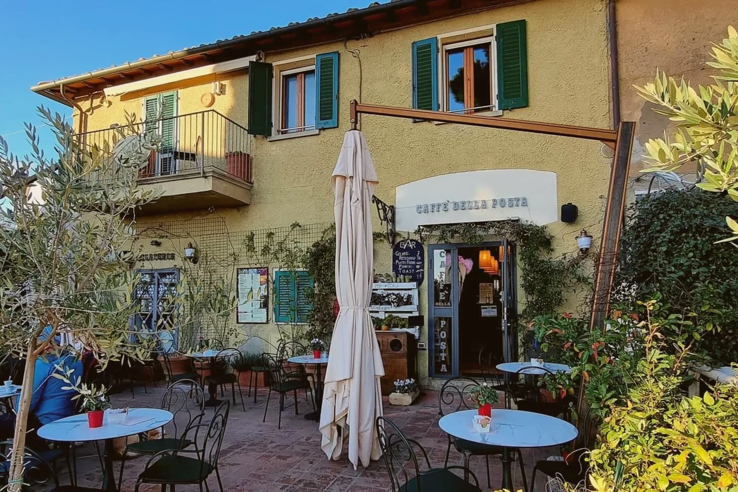
Why visit Castagneto Carducci
Castagneto Carducci sits at 194 meters on a hill above the Costa degli Etruschi, sixty kilometers south of Livorno. The town was called Castagneto until 1907, when it was renamed for the poet Giosuè Carducci, who spent part of his childhood here and made the surrounding landscape the subject of Davanti a San Guido.
The Castello della Gherardesca, the Lombard-origin fortress of the counts who held the land for nine centuries, still anchors the centro storico. Below the hill, on a coastal plain that locals call the Maremma livornese, sits the frazione of Bolgheri.
In 1944, Mario Incisa della Rocchetta planted Cabernet Sauvignon on his estate there; the resulting wine, Sassicaia, started the category that journalists in the 1970s named Supertuscan. Bolgheri DOC was created in 1983 and Bolgheri Sassicaia DOC in 1994, a sub-zone for a single estate.
The cypress avenue from the coast road up to Bolgheri, two parallel rows planted in 1832, is the one Carducci put in the poem.
We confirmed you can reach this one by train.
What to see in Castagneto Carducci
- Castello della Gherardesca. Lombard-origin fortress at the top of the borgo, held by the Della Gherardesca counts for nine centuries, still in private family use.
- Viale dei Cipressi. Five-kilometer cypress avenue between the SS1 Aurelia and the frazione of Bolgheri, planted in 1832 and immortalized by Carducci.
- Bolgheri. Coastal-plain frazione at 88 meters, walled medieval village turned wine capital, home of Sassicaia, Ornellaia and the Bolgheri DOC.
How to get to Castagneto Carducci
There is a railway station in the town, so you can arrive without a car and never need one while you are here. Livorno is roughly 55 minutes away by road.
✷ We have written about Castagneto Carducci
“You reach Bolgheri up a straight avenue of cypresses, five kilometers of them standing in two close files like a colonnade with the roof taken off, and the road does the thing it was planted centuries ago to do, which is tell you before you get there that you are arriving somewhere that thinks a great deal of itself. The comune the village belongs to carries its name.”
Read our piece on Castagneto Carducci →Bolgheri | The Story of an Amaro
Our tip
May through September is the season the comune fills, the coast at Marina di Castagneto holds Bandiera Blu, and the Bolgheri cellars run their tastings on appointment. The Bolgheri DiVino wine festival runs in mid-August. July and August push afternoon temperatures past thirty and the cypress avenue stops being walkable in midday sun.
Monte Argentario
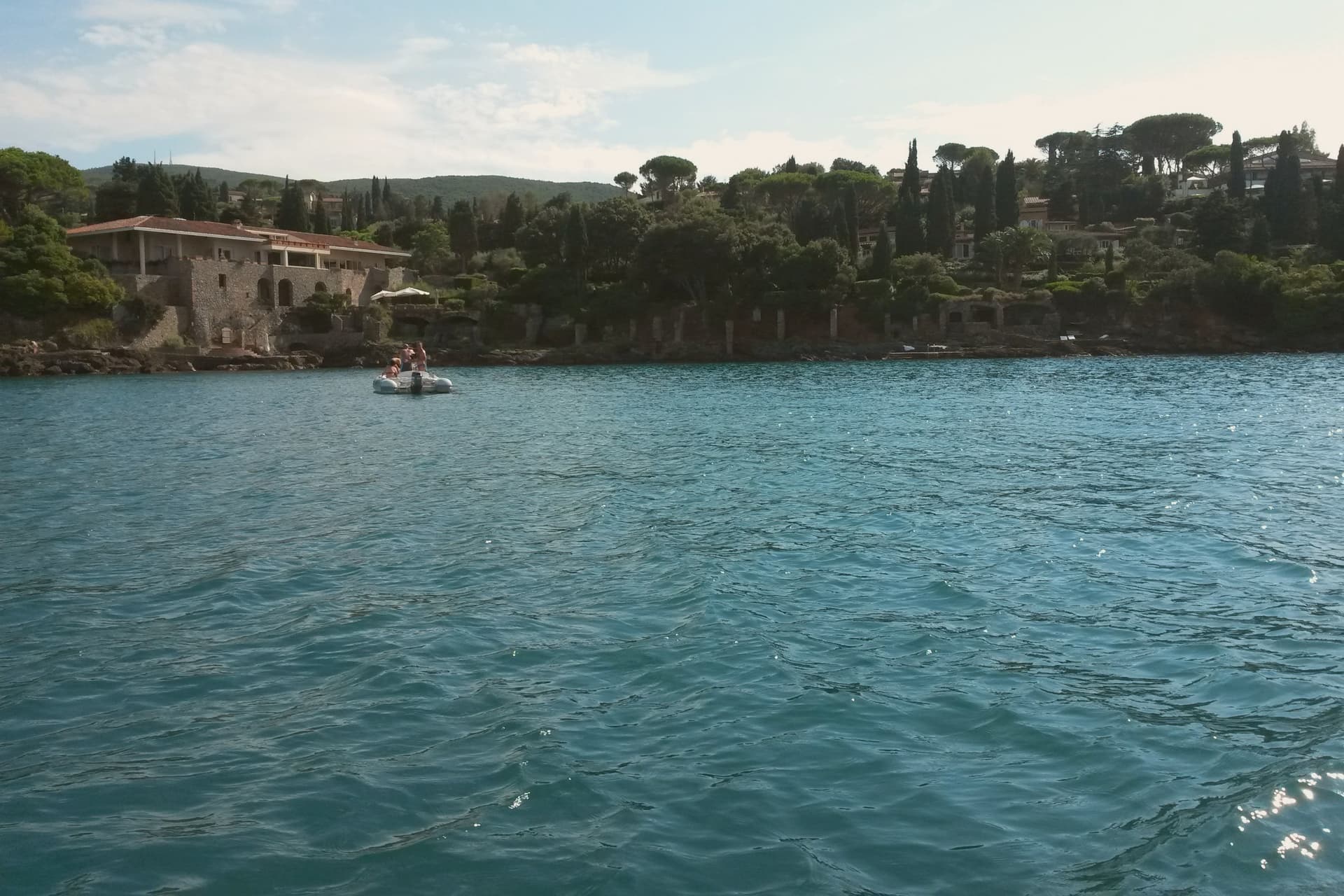
Why visit Monte Argentario
Monte Argentario is a peninsula on the southern Tuscan coast, 35 kilometers south of Grosseto, connected to the mainland by three sand spits that enclose the lagoons of Orbetello. The mountain at its center rises to 635 meters, and the two seats of the comune sit at sea level on opposite sides of it, the northern harbor facing toward Grosseto, the southern one turned toward the open coast below.
The history of the peninsula splits from the rest of Tuscany after 1557, when the territory was carved out of Sienese land and handed to the Spanish crown, which spent the next century and a half fortifying the coastline against corsair raids rather than building the kind of inland towns found elsewhere in the region. The result is a place organized around its edges rather than a center: two ports facing different waters, a mountain of forts between them, and a coastal road that ties the whole shape together for anyone crossing from one harbor to the other.
What the peninsula adds up to is a piece of Tuscany that spent its formative centuries as a Spanish military frontier, and still wears that history in its two-harbor shape and the ring of stone above them.
We confirmed you can reach this one by train.
What to see in Monte Argentario
- Forte Stella. Six-pointed star fort above Porto Ercole, designed for the Spanish by Buontalenti and Camerini and completed in the mid-1600s as part of the Presidi defense system.
- Forte Filippo. Spanish bastioned fortress above Porto Ercole, named for Philip II and built in the late 16th century to protect the Stato dei Presidi from corsair raids.
- Rocca Aldobrandesca, Porto Ercole. Earlier Aldobrandeschi fortress incorporated into the Spanish defense system, dominating the harbor and the old town of Porto Ercole.
How to get to Monte Argentario
There is a railway station in the town, so you can arrive without a car and never need one while you are here. Roma is roughly 137 minutes away by road.
Our tip
May through September is the season on the peninsula. Porto Santo Stefano and Porto Ercole fill in July and August; the Palio Marinaro on August 15 doubles the population of Porto Santo Stefano for a single afternoon. June and September are the easiest months, with warm water and fewer day-trippers. Palio Marinaro dell'Argentario falls in August.
Campiglia Marittima
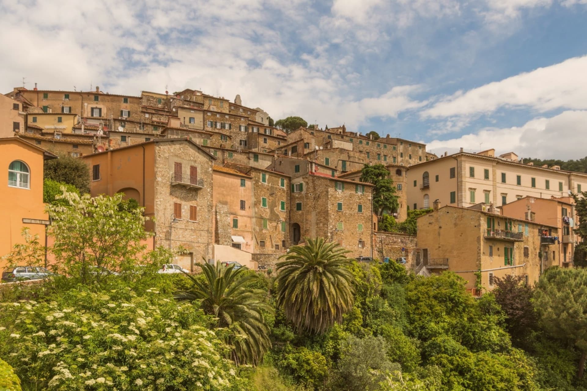
Why visit Campiglia Marittima
Campiglia Marittima sits at 231 meters on the last slopes of the Colline Metallifere above the Val di Cornia, eight kilometers inland from the Tyrrhenian coast and 60 kilometers southeast of Livorno. The Rocca occupies the highest point at 281 meters, a fortified semicircle whose 14th-century tower and town walls trace the medieval defensive line.
The territory has been mined since the Etruscans: copper, silver, lead and tin from the hills behind town, worked continuously until the last galleries closed in 1976. The Parco Archeominerario di San Silvestro, opened in 1996 on 450 hectares behind the town, centers on Rocca San Silvestro, a tenth and eleventh-century miners' village abandoned in the fourteenth century and excavated since 1984.
Visitors enter through restored galleries on a small electric train. Down on the plain the DOC Val di Cornia produces Sangiovese and Cabernet, and the thermal springs at Venturina, the frazione south of town, have flowed since Roman use as Aquae Populoniae.
We confirmed you can reach this one by train.
What to see in Campiglia Marittima
- Rocca di Campiglia. Fortified semicircle at 281 meters with the 14th-century tower, walls and the Pieve di San Giovanni, the highest point of the town.
- Parco Archeominerario di San Silvestro. 450-hectare park behind town, opened 1996, with restored mining galleries, a small electric train, and the abandoned medieval miners' village of Rocca San Silvestro.
- Centro storico. Walled hilltop borgo of stone houses, with Piazza della Repubblica at its center, the medieval gates Porta a Mare and Porta Fiorentina still intact.
How to get to Campiglia Marittima
There is a railway station in the town, so you can arrive without a car and never need one while you are here. Livorno is roughly 67 minutes away by road.
✷ We have written about Campiglia Marittima
“That is the thing the young man on the beach did not see, and the man who lives here cannot stop seeing. This is an industrial coast wearing a beach towel. Run it back far enough and the whole of it, the swamp and the steel and the slag and the white water, is one long story about iron, and the holiday is the costume the story put on after the work ran out.”
Read our piece on Campiglia Marittima →The Iron Coast | The Wrong Sea
Our tip
May through September is the season on the Val di Cornia: warm days, sea breezes that climb the hill, harvest of Sangiovese and Vermentino from late August. The beaches at San Vincenzo and Baratti are eight to fifteen kilometers away and pull the day-traffic. July and August are hot and busy on the coast; the borgo on the hill stays a few degrees cooler.
Orbetello
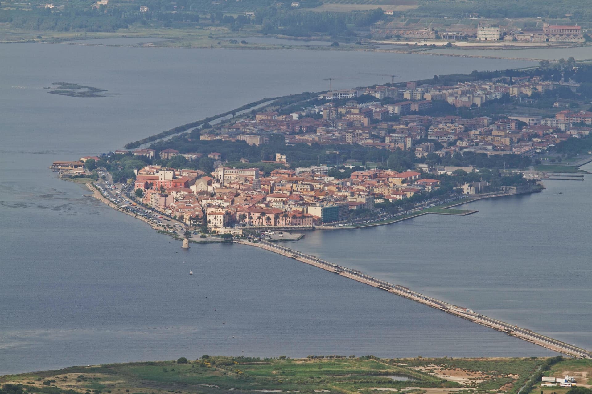
Why visit Orbetello
The isthmus runs out into the lagoon and splits it into two basins, Ponente and Levante. Two sand tombolos close the shape from either side: Giannella to the north, Feniglia to the south, both reaching toward the Monte Argentario promontory and meeting it at either end.
The Etruscans settled the site first, the Romans followed with their colony of Cosa nearby, and centuries later the Spanish took the isthmus as the seat of their coastal enclave, leaving the Governor's Palace on the main square where it still stands. Of the nine Sienese windmills once built out in the water, one remains in place, the only Italian water-and-wind mill of its type still fixed where it was built.
The lagoon that once carried Balbo's flying boats out toward Rio and Chicago now carries a WWF reserve and the nets of a bottarga and eel cooperative working the same waters since 1965. A town built on the water it is named for, held between two arms of sand and one mountain it never quite touches.
We confirmed you can reach this one by train.
What to see in Orbetello
- Duomo di Santa Maria Assunta. Fourteenth-century cathedral with a Gothic travertine façade, rebuilt over an earlier Etruscan-Roman temple foundation.
- Fortificazioni Spagnole. The bastions and the Polveriera Guzman magazine, still standing along the edges of the historic center.
- Laguna di Orbetello. The brackish water splits into two basins and is now a WWF reserve and Ramsar wetland.
How to get to Orbetello
There is a railway station in the town, so you can arrive without a car and never need one while you are here. Roma is roughly 124 minutes away by road.
Our tip
May through September is when the lagoon and the Feniglia and Giannella beaches do their work. June brings the migratory bird count back up: flamingos, herons, avocets. July and August push temperatures over thirty degrees and the tombolos fill with Roman day-trippers, so the lagoon path on the Ponente side stays the quieter option. Sagra del Pesce di Albinia falls in the season.
More from Anywhere Italy
 The best hidden coastal towns that eat well in Toscana
 A 7-day trip through the Tuscan Maremma, based in Grosseto
 The best hidden hot spring towns you can reach by train in Toscana
- The best coastal towns within two hours of Siena
 The prettiest villages you can reach by train in Toscana
 The 7 best coastal towns in the province of Livorno