
The best towns inside a national park in Toscana
Tuscany keeps its wild edges at the extremes: out on the water and up in the mountains. On the archipelago the land is granite and schist, terraced for vines that grow low against the salt wind, with holm oak and myrtle scrub running down to coves where the water goes from green to ink. In the Apennines above the Lunigiana the houses are built of grey sandstone with slate roofs, and autumn is chestnut season, flour ground for castagnaccio, mushrooms and honey sold from doorways. Inland in the Casentino the forest is beech and silver fir, wet and quiet, and the winter tables run to tortelli, pecorino and wild boar. All of it is protected land, which is why it still looks the way it does.
In practice most people arrive in Tuscany and drive the road between Florence and Siena, through Chianti and San Gimignano, because that is the Tuscany of the posters and the wine lists. The cypress avenues and the walled hill towns earn their reputation, and in July and August the car parks fill by mid-morning and the trattorie print menus in four languages. Nothing there is a national park. It is farmed, sold, photographed and, for long stretches of the year, extremely full.
The parks sit at the other ends of the region, on the same coast and the same hill country, and fewer people go. Ferries from the mainland reach islands where the marine reserve limits what can be built and where boats may anchor, and the mountain communes keep footpaths through protected forest that see walkers rather than coaches. These are the towns that fall inside those boundaries: island harbours, a Lunigiana market town, a Casentino castle above the Arno. Worth a detour, and worth more than a day.
Of the 84 communes we have mapped in Toscana, 8 qualify as towns inside a national park: each sits inside the boundary of a national park. The smallest, Capraia Isola, has 370 residents.
Elsewhere in the catalogue: The best small coastal towns in Toscana and The 7 best coastal towns in the province of Livorno.
Capraia Isola
Why visit Capraia Isola
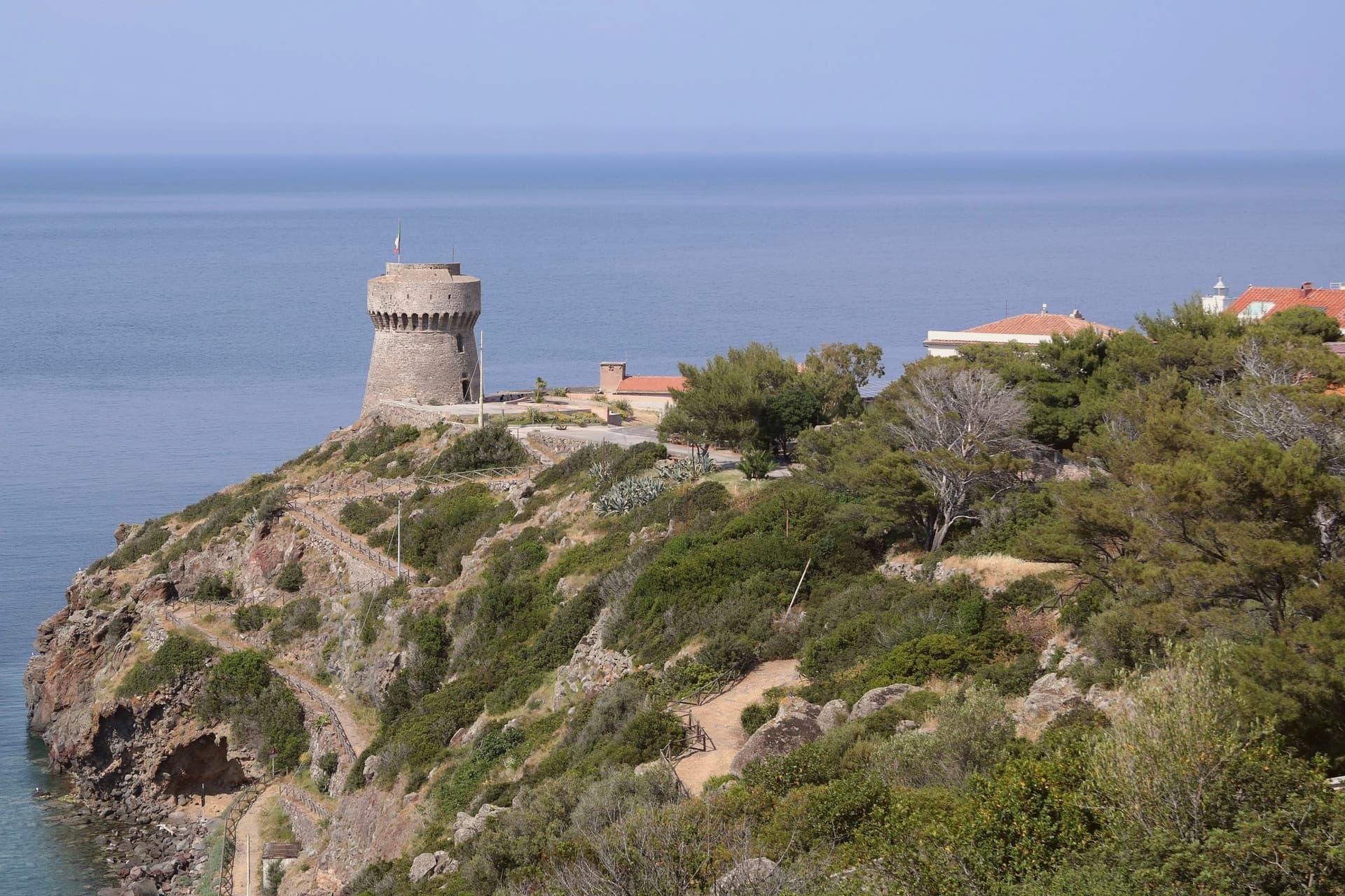
The island is the northernmost of seven, sitting apart from Elba and Giglio to its south. It carries one village and one harbor, and beyond a few service vehicles there are no cars.
The volcanic plateau rises above the settlement, holding the freshwater lake at its center, the only one of its kind among the archipelago's islands, while the coast runs down to the red cliffs on the western side and out to the abandoned signal station at the southern tip. The fort above the harbor stood guard for two centuries before the island's later history turned inward: the penal colony took two thirds of the land from 1873, pushed out most residents, and left its buildings to scrub after 1986, the same year its fences and cells came down.
Ten years later the park absorbed the island whole, water and land together. The comune now counts 370 residents, the least-populated Italian municipality with an outlet to the sea.
What was built to confine the island then opened it: a fortress, a prison, and now a park have each in turn defined how much of Capraia belongs to the few who live there and how much is held in trust for everyone else.
What to see in Capraia Isola
- Forte San Giorgio. Genoese fort above the harbor, built in 1540 on the foundation of an earlier tower destroyed by Turgut Reis. It held the line against pirates for two centuries.
- Cala Rossa. Red volcanic cove on the western side of the island, where the cliffs hold the color of oxidized basalt.
- Stagnone. Small natural lake at 320 meters on the volcanic plateau above the village, the only freshwater basin in the Tuscan Archipelago.
How to get to Capraia Isola
Our tip
May through September is the only practical season on Capraia. The ferry from Livorno runs three to four times a week in summer, less in winter, and the crossing takes two and a half hours through open sea. The Mediterranean warms enough to swim from mid-May; July and August fill the few rooms on the island and book out the small restaurants in the village. Sagra del Totano Capraia falls in October.
Isola del Giglio
Why visit Isola del Giglio
Isola del Giglio is the second-largest island in the Tuscan Archipelago, almost entirely granite, the highest point at Poggio della Pagana 496 meters above the sea. The commune has three inhabited frazioni: Giglio Porto on the eastern coast, where the ferries from Porto Santo Stefano dock; Giglio Castello on the central ridge at around 405 meters, the walled medieval village and administrative center; and Giglio Campese on the western bay, a 1960s seaside resort built on an old pyrite mine closed in 1964.
Charlemagne gave the island to the abbey of Tre Fontane in 805. It was Pisan from 1264, ceded to Antonio Piccolomini in the fifteenth century, then passed to the Medici in 1558.
Saracen raids continued until 1799. The wreck of the Costa Concordia on the night of 13 January 2012 killed thirty-two people and held the world's attention until the ship was righted, refloated and towed to Genoa in July 2014.
What to see in Isola del Giglio
- Giglio Castello. Walled medieval village on the ridge at around 405 meters, with intact mura and the Rocca Aldobrandesca, the administrative center of the island.
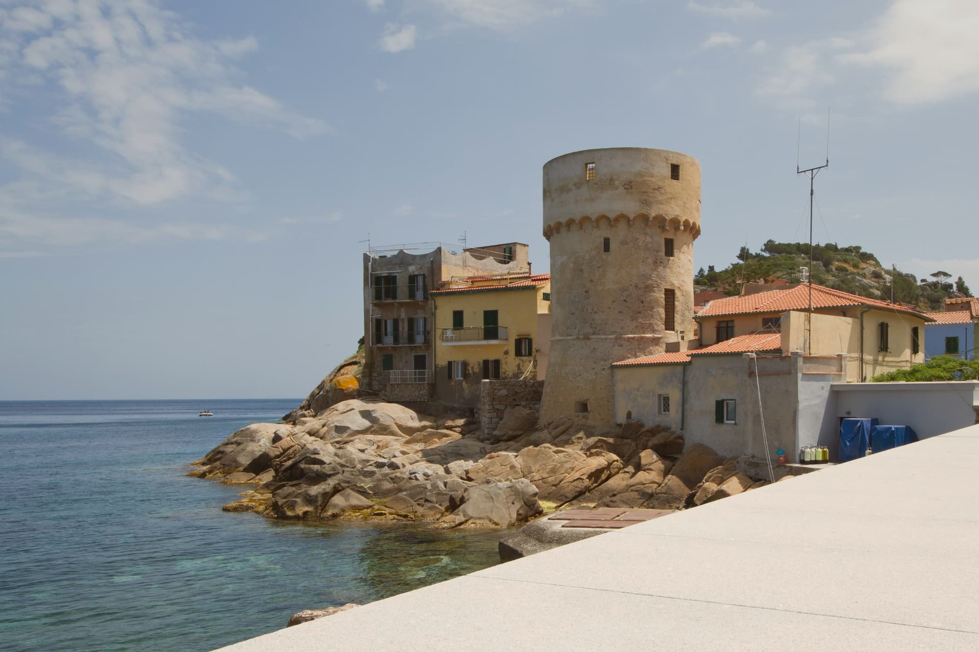
- Giglio Porto. Main harbor of the island on the east coast, with the colored houses around the small ferry dock and the lighthouse of Capel Rosso to the south.
- Giglio Campese. Largest bay and sandy beach of the island on the west coast, with the medieval Torre del Campese and the disused pyrite mine on the headland.
How to get to Isola del Giglio
Our tip
May through September is the only practical season for Giglio. The ferries from Porto Santo Stefano run on a full schedule, the beaches at Campese and the smaller coves work, and the temperature in Castello on the ridge stays manageable through August. July and August are crowded with mainland day-trippers; the island roughly doubles in population. Festa dell'Uva e delle Cantine falls in September.
Capoliveri
Why visit Capoliveri
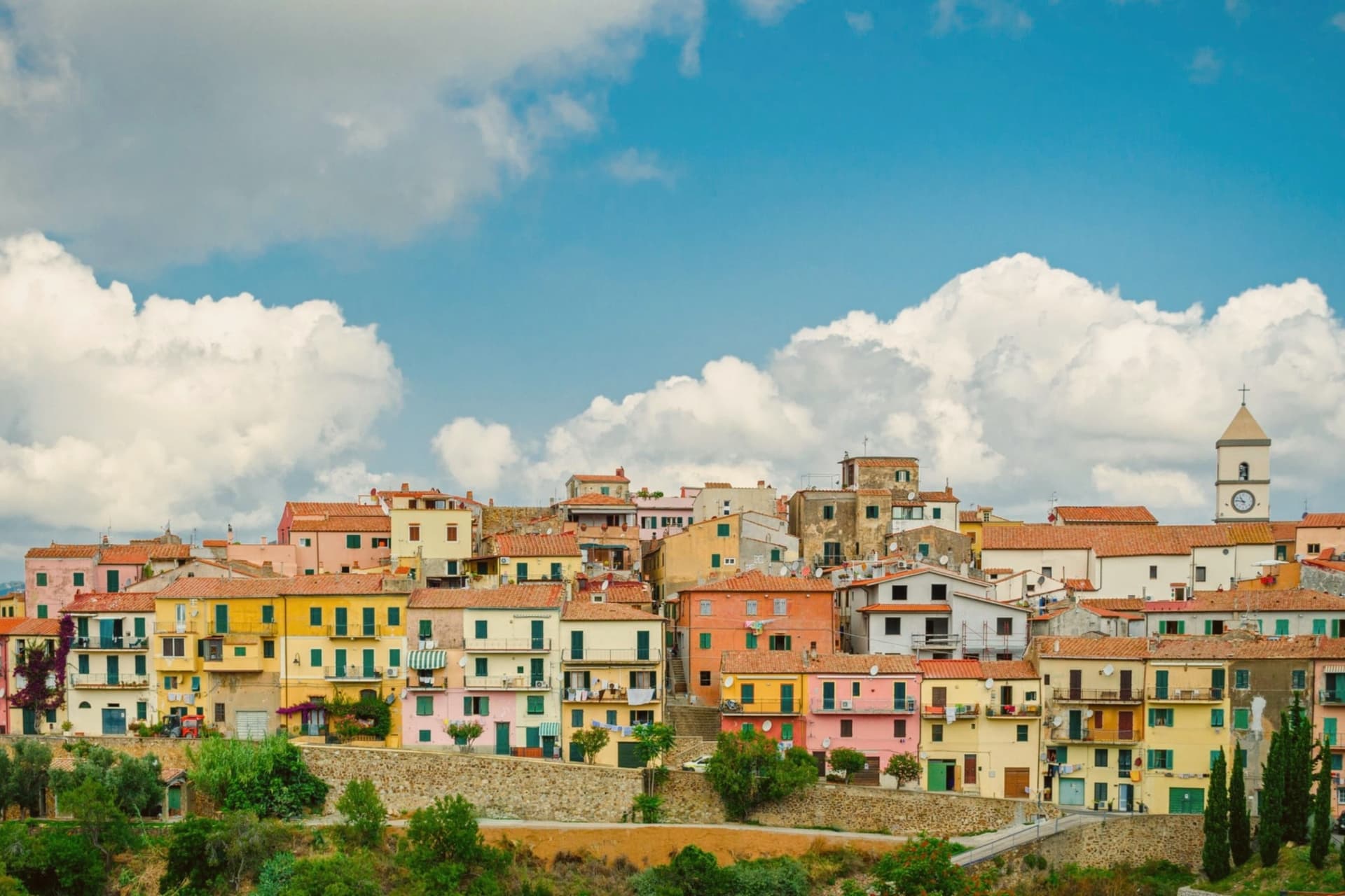
The name comes from Caput Liberum, the Roman head of the free territory. The medieval town that grew up on that ground sits on a terrace at 167 meters and is built into the slope as a maze of narrow alleys called chiassi, opening onto small piazzas rather than any wider square.
Below it the southern lobe of Elba unfolds into thirty-five kilometers of coastline, more than any other comune on the island, and the beaches, Innamorata, Morcone, Pareti and Zuccale, are reached by a network of dirt roads off the ridge rather than by a single road along the shore. The fishermen still go out at four in the morning from the cove at Naregno.
What holds the town together is that relation between height and shore: a hill settlement governing a coastline it does not directly touch, with the old mining ground on the mountain behind it folded into the same protected park as the water below.
What to see in Capoliveri
- Centro storico. Medieval village built into the slope of the mountain, with narrow stepped alleys called chiassi giving onto small piazzas.
- Miniere del Calamita. The galleries and open pits sit on the eastern flank of Monte Calamita, now a heritage trail with guided tours through the abandoned works.
- Spiaggia dell'Innamorata. Pebble beach on the southern coast, named for a sixteenth-century pair of lovers killed in a pirate raid, commemorated each July.
How to get to Capoliveri
Livorno is roughly 133 minutes away by road.
Our tip
May through September is the season Capoliveri runs on. The water warms enough to swim from mid-May, the ferries from Piombino run every hour, the beaches at Morcone and Innamorata fill from late June. July and August are crowded everywhere on the island and parking at the southern beaches becomes a small art.
Fivizzano
Why visit Fivizzano
Fivizzano-capoluogo is a quietly handsome, small Lunigiana centro of 7,000 residents on the SS63 between La Spezia and Reggio Emilia: a medieval Medici-era piazza with the Fontana Medicea of 1576, porticoes, a parish church. Fine, walkable, worth an hour.
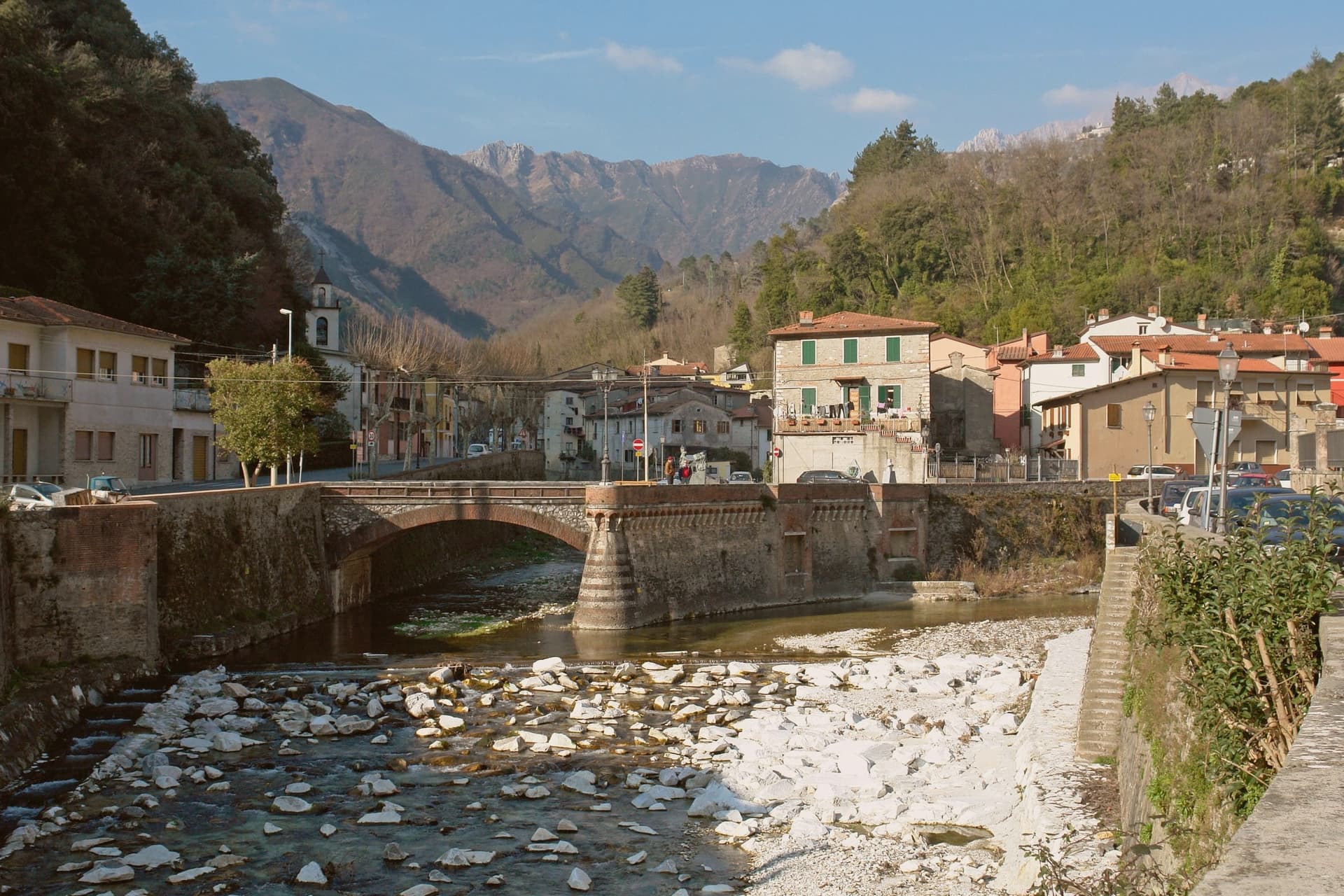
The commune around it is the actual subject: 264 km² and 92 frazioni spread across the upper Lunigiana mountains inside the Parco Nazionale dell'Appennino Tosco-Emiliano, and several of those hamlets are individually destination-grade. Equi Terme sits in a deep, narrow gorge under vertical limestone walls, the kind of setting that makes the thermal water and the cave system feel like a single geological event rather than separate attractions.
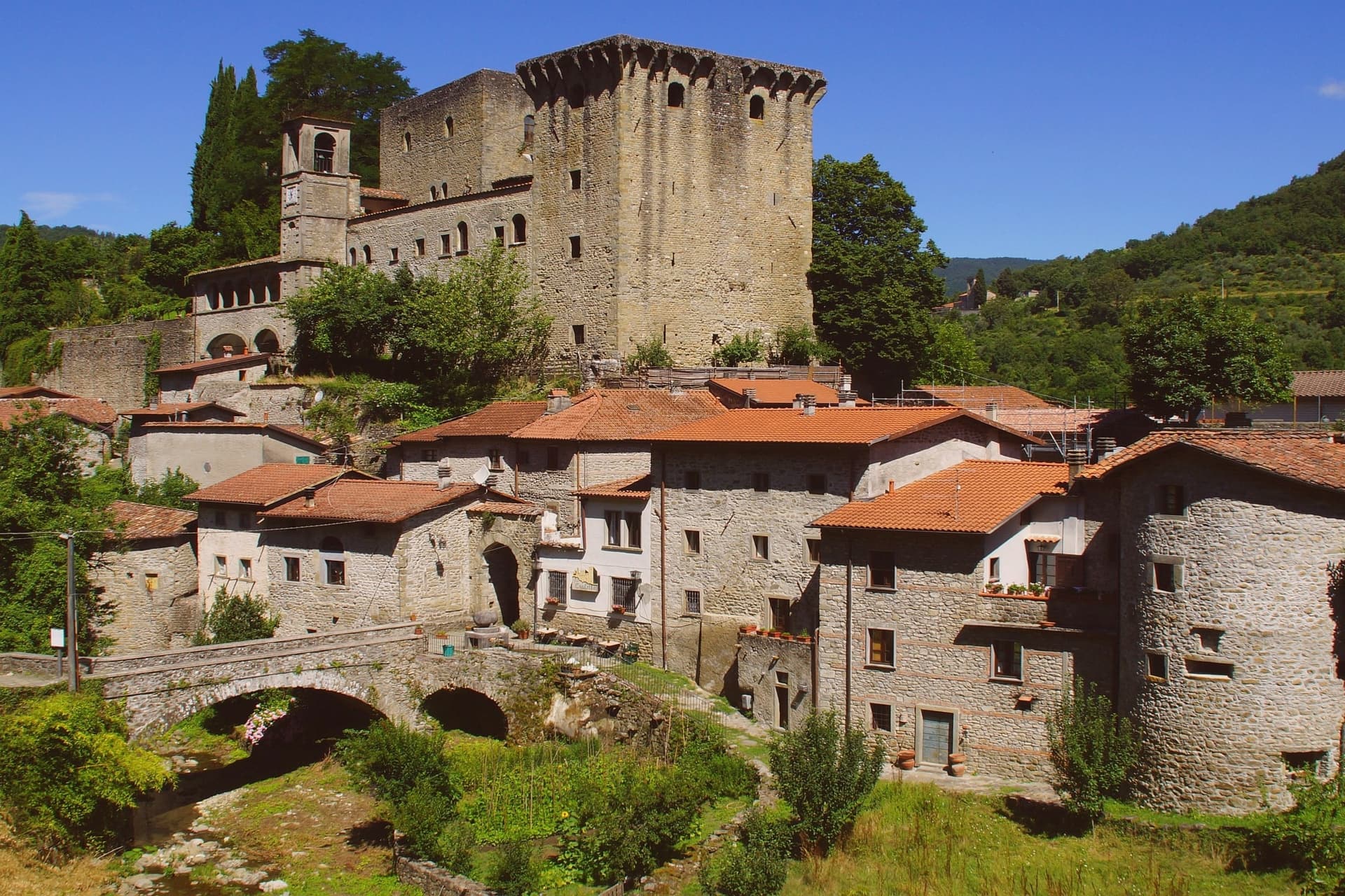
Verrucola stands apart from it, a fortified hilltop borgo rather than a gorge-bottom spa town, its scale small enough that the whole place can be seen from the courtyard Cascella once used as his studio. Gassano and the smaller hamlets, Bottignana, Ceserano, Pieve San Paolo, Pognana, Soliera Apuana, Tenerano, are strung across the ridges between them, stone-house centri with the Apuane at their backs, each one a fragment of the same mountain commune rather than a satellite of the town below.
The food carries the same regional logic across every hamlet: testaroli and panigacci unique to this valley, torta d'erbi, pasta with porcini, lardo di Colonnata from the nearby Apuane quarries, and Lunigiana DOP olive oil from the lower-valley groves, with the mid-July pasta festival at the Fivizzano centre pulling the scattered frazioni back together for one event. Depopulation has been heavy, as in most ultraperiferico Apennine communes: 13,000 residents in 1951, 7,000 today, some smaller frazioni down to 20 or 30 winter residents.
What this adds up to is a commune held together less by its capoluogo than by the mountains and the park that surround it, a single administrative territory made of places that would each stand alone if they were anywhere else.
What to see in Fivizzano
- Equi Terme (frazione) — thermal springs + Grotta. 11 sulphurous thermal springs sit in a vertical limestone gorge at Equi Terme, feeding the Grotta di Equi karst cave system, 3 km of tunnels with prehistoric cave-bear remains found inside. The Terme di Equi spa has used the spring water for sulphur therapy since the Etruscans, and the Solco di Equi trail runs the length of the gorge on foot.
- Verrucola (frazione) — Fortezza dei Malaspina. The fortress is small enough to take in on foot in minutes, its stone walls close around a courtyard open to the public. Pietro Cascella lived and worked inside it until 2008, and the rooms he used now hold the museum.
- Gassano + Lunigiana frazioni. Gassano is the panoramic perched hamlet on a ridge facing the Apuane. Bottignana, Ceserano, Pieve San Paolo, Pognana, Soliera Apuana, Tenerano: all small mountain hamlets with stone-house centri and Apennine and Apuane views.
How to get to Fivizzano
There is a railway station in the town, so you can arrive without a car and never need one while you are here. Pisa is roughly 95 minutes away by road.
✷ We have written about Fivizzano
“We chose it the way you choose a card from a deck. We pulled up the map, ignored everything we recognized, scrolled north until the roads thinned out and the names stopped meaning anything to us, and there, behind the marble of Carrara, in a fold of the Apuane I had never heard of, was a borgo called Marciaso. There was one Airbnb.”
Read our piece on Fivizzano →The Lunigiana | The Real Off the Beaten Path Italy
Our tip
Fivizzano commune is mountain-seasonal — May through September is the sweet spot, when the frazioni are accessible by car, the trails are clear, and the Equi Terme spa and cave are open without booking pressure. October is chestnut and porcini season — the best food month in the Lunigiana. Winter is Apennine — heavy snow possible in the upper frazioni, several roads close. Disfida degli arcieri di Fivizzano falls in July.
Grosseto
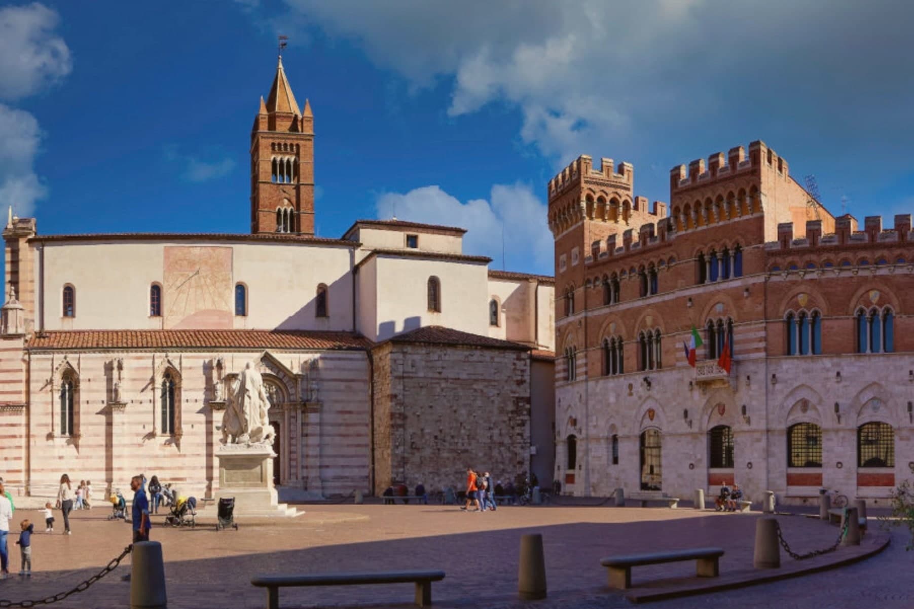
Why visit Grosseto
Grosseto sits on the right bank of the Ombrone, ten meters above sea level and twelve kilometers inland from the Tyrrhenian. The Roman city of Roselle was destroyed in 935 by Saracen pirates; refugees regrouped on the plain below and Grosseto inherited the bishopric.
From 1336 it was Sienese; in 1559 it passed to the Medici after the battle of Montalcino. Cosimo I commissioned Baldassarre Lanci to replace the medieval walls with a hexagonal bastioned circuit, begun in 1565 and finished a decade later.
The walls are intact. Six bastions, two main gates, a continuous earthwork four kilometers around, now planted and used as the city's promenade.
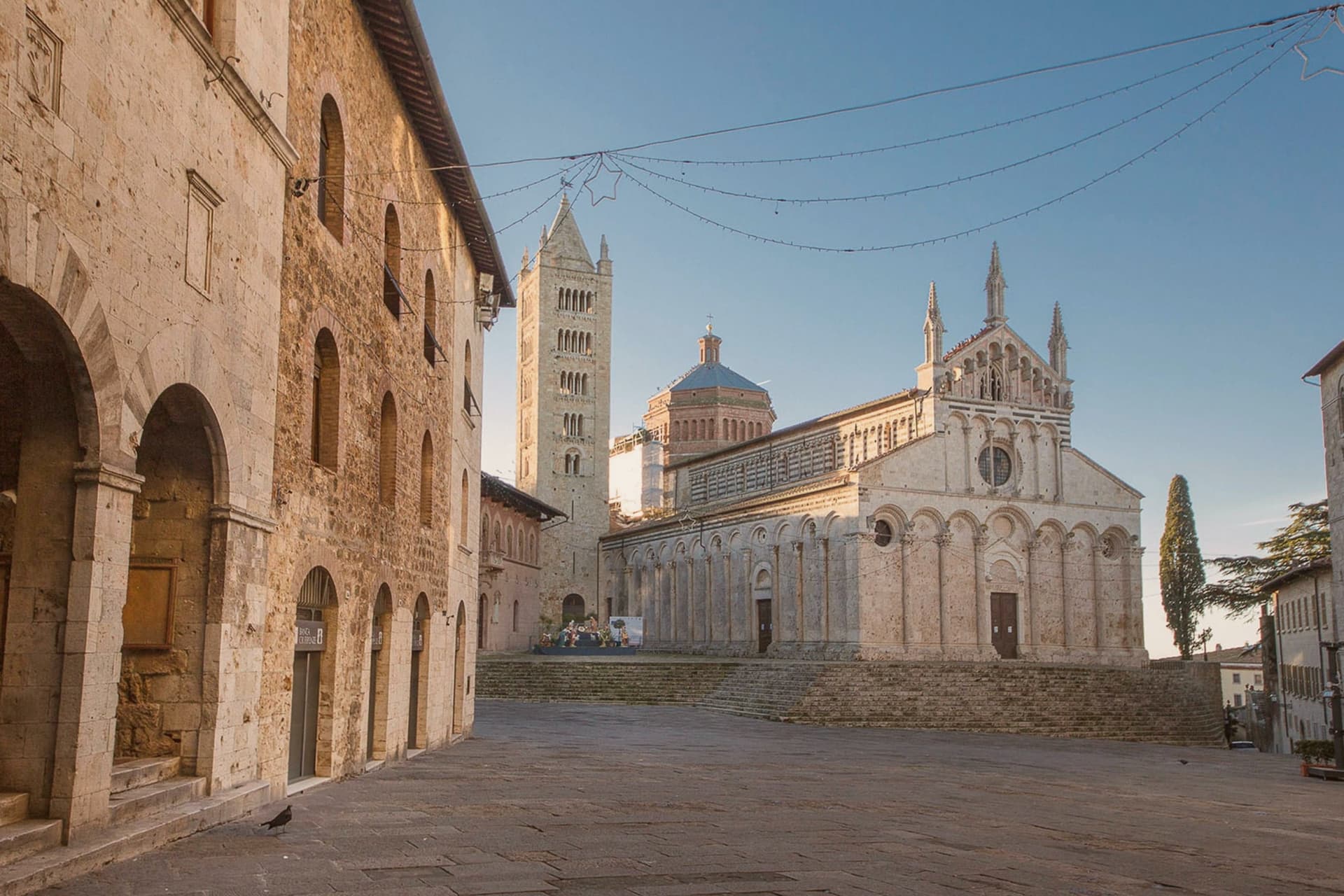
Inside, the Duomo di San Lorenzo holds a Romanesque-Gothic façade in alternating white and pink marble. The Cassero Senese, the Sienese fortress of 1345 swallowed into the later Medici walls, anchors the southeast corner.
Grosseto is the largest city of southern Toscana and the working capital of the Maremma.
What to see in Grosseto
- Mura Medicee. Hexagonal bastioned circuit commissioned by Cosimo I in 1564, designed by Baldassarre Lanci, intact and walkable for the full four kilometers.
- Duomo di San Lorenzo. Thirteenth-century cathedral with a façade in alternating white and pink marble, Latin-cross plan, semicircular apse over the nave.
- Cassero Senese. Travertine-clad Sienese fortress completed in 1345, incorporated into the southeast corner of the Medici walls, now used for exhibitions.
How to get to Grosseto
There is a railway station in the town, so you can arrive without a car and never need one while you are here. Livorno is roughly 110 minutes away by road.
✷ We have written about Grosseto
“Everyone driving from Florence down to Rome crosses the Maremma without noticing, because there is nothing on that stretch to make them slow down. The hills give out. The cypresses stop. What opens up instead is flat open country, wheat and grass running off to a few low rises, the least Tuscan-looking part of Tuscany, a landscape you would call dull if you were being honest and which most guidebooks solve by leaving out.”
Read our piece on Grosseto →Maremma | The Last Cowboys of Tuscany
Our tip
May, September and October are the Maremma months. The walls and the Parco Regionale are open without the heat, the umbrella pines hold their shade, and the wild horses are visible at dawn near the Ombrone mouth. July and August push past thirty-five degrees and the city empties between one and six in the afternoon.
Livorno
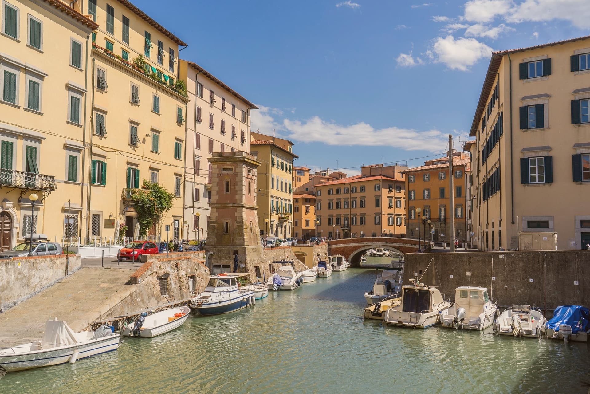
Why visit Livorno
Livorno is the Tuscan coast you don't expect: Medici-founded in 1577 as Nova Civitas, planned from scratch by Bernardo Buontalenti as a free port to rival Genoa and Venice, and unique among Tuscan cities for being entirely a Renaissance-era invention rather than a medieval inheritance. The original pentagonal city walls enclosed a Venetian-style quarter (Venezia Nuova) laced with navigable canals where merchant warehouses opened directly to the water — Jews, Greeks, Armenians, English, Dutch and North Africans were all invited to settle under the 1591–1593 'Livornine' laws granting freedom of worship and trade, making Livorno the most cosmopolitan port on the Mediterranean for two centuries.
What you see today: Fortezza Vecchia (1521) and Fortezza Nuova (1590) guarding the inner harbour; the four bronze Moors (1626) chained to the base of Ferdinando I's monument facing the port; the Terrazza Mascagni (a 1925 Art Deco chequerboard promenade with 4,100 black-and-white tiles facing the Tyrrhenian); the Cattedrale rebuilt after 1944 bombing; the Pentagono di Buontalenti street grid still visible from above. The Macchiaioli painters' movement was born here in the 1860s (Fattori, Lega, Signorini all lived and painted the local light).
Modigliani was born in Livorno in 1884. And the food: cacciucco — a 5-fish stew with toasted bread and red wine, the city's totemic dish — plus ponce alla livornese (rum-spiked coffee) at the Caffè Civili.
The Tuscan archipelago (Capraia, Gorgona, Elba) ferries out from the port within view of the promenade.
What to see in Livorno
- Terrazza Mascagni. A 1925 Art Deco seafront promenade with 4,100 black-and-white tiles facing the open Tyrrhenian — locals call it the world's most beautiful balcony, especially at sunset.
- Venezia Nuova quarter. The Medici-planned canal district from 1629. Walkable bridges, warehouse-doors-on-water, and the Effetto Venezia summer festival turn it into Tuscany's Venice.
- Quattro Mori (Monumento dei Quattro Mori). Pietro Tacca's four bronze Moors (1626) chained to the base of Grand Duke Ferdinando I's statue facing the port. Livorno's civic icon.
How to get to Livorno
There is a railway station in the town, so you can arrive without a car and never need one while you are here. Livorno is roughly 11 minutes away by road.
✷ We have written about Livorno
“I lived in Naples for weeks once, and those days remain among the best I have had, and the people there are among the finest I have met anywhere in this country, and I love the place without reservation. Naples is the same love story as Livorno.”
Read our piece on Livorno →Livorno | The City With No Time For You
Our tip
Livorno is a true year-round port city, but the sweet spot is April–June and September–October. May and June have the warm Tyrrhenian light, the Effetto Venezia festival (last week of July) brings the canal quarter alive at night, and September is still beach-warm without the crowds. July and August get hot and the port traffic peaks. Effetto Venezia falls in July.
Licciana Nardi
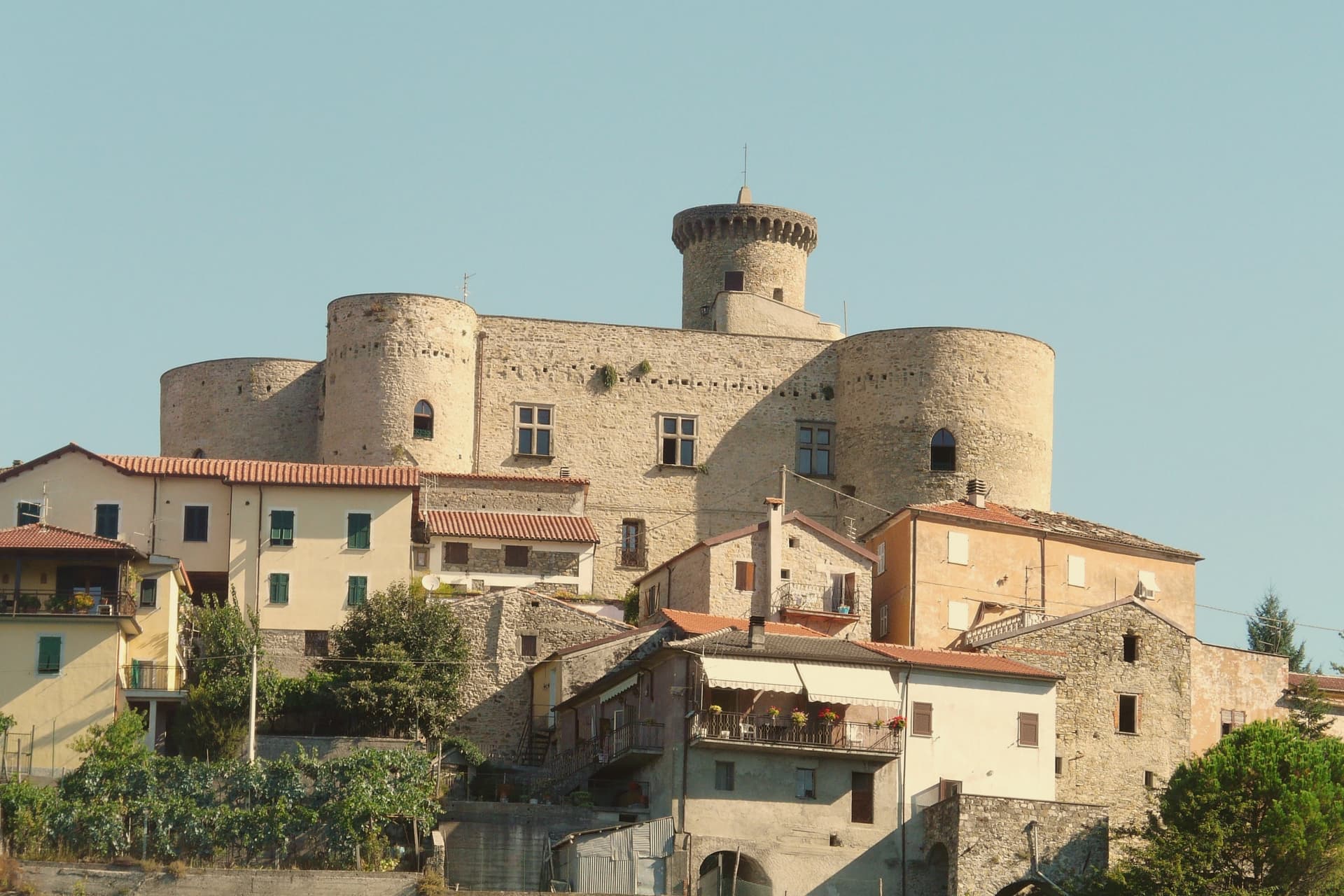
Why visit Licciana Nardi
Licciana Nardi sits at 215 meters in the eastern Lunigiana, on the slopes of the Apennino Tosco-Emiliano National Park. The town is one of several Malaspina holdings in the valley, with a castle in the centro storico and another above Bastia, three kilometers up the ridge.
In 1933 the commune added the surname Nardi to its name in honor of Anacarsi Nardi, one of the Bandiera brothers' co-conspirators, shot by Bourbon firing squad in 1844 after the failed insurrection at Cosenza. The Apennine ridge above the town is part of the national park, with chestnut and beech forests, the Lagastrello pass, and trails connecting Lunigiana to the Garfagnana on the other side.
The local plate is panigacci, thin disks of unleavened dough cooked between terracotta plates and eaten with stracchino, salume, or pesto, a Lunigiana tradition shared with Pontremoli and the upper Magra villages.
What to see in Licciana Nardi
- Castello Malaspina di Licciana. Medieval Malaspina fortress in the centro storico, partly inhabited and partly visitable on request.
- Castello di Bastia. Smaller Malaspina castle in the frazione of Bastia, three kilometers up the ridge, with a fourteenth-century keep.
- Parco Nazionale dell'Appennino Tosco-Emiliano. Chestnut and beech forests on the ridge above the town, with the Lagastrello pass and trails into the Garfagnana.
How to get to Licciana Nardi
Pisa is roughly 79 minutes away by road.
Our tip
May through October is the season in the eastern Lunigiana. The ridge stays cooler than the lower valley, the chestnut woods are open, and the trails into the Apennine park run from Apella up to the Lagastrello pass. July and August are warm but breezy at altitude.
Poppi
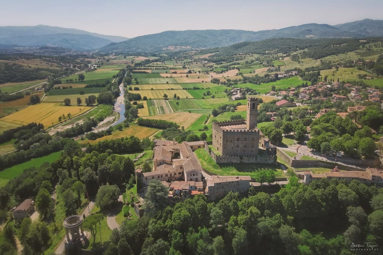
Why visit Poppi
Poppi rises above the upper Arno in the Casentino, the wooded valley set between Pratovecchio and Bibbiena. The Counts Guidi held this hill from at least 1169, and the castle they raised across the late twelfth and thirteenth centuries is attributed in its older part to Lapo di Cambio and in the later upper section to Arnolfo di Cambio.
Dante Alighieri, who fought below the hill as a young man, returned to it later as a guest of the Guidi during his exile, so the borgo held him twice, once as a soldier and once as a household guest. The town itself sits above the battle plain, the abbey church inside the walls, the castle over both.
A further Romanesque pieve stands a short distance off, and the forested ridges of the Apennine watershed rise to the east, the same terrain the Guidi once ruled from their hill. What the place adds up to is a single family's hold on a valley, visible still in the line from castle to plain to church, with the forest marking where their lordship ran out.
What to see in Poppi
- Castello dei Conti Guidi. The castle keeps a working library and a fourteenth-century chapel frescoed by the school of Giotto, along with a hand-painted model of the battle below, more than four thousand tin soldiers set out on the table.
- Piano di Campaldino. The plain sits directly beneath the castle walls, open ground still readable as a battlefield, with nothing built across it since.
- Abbazia di San Fedele. Romanesque abbey church inside the borgo, with single nave and stone façade, dating from the early twelfth century.
How to get to Poppi
There is a railway station in the town, so you can arrive without a car and never need one while you are here. Firenze is roughly 64 minutes away by road.
Our tip
April through June brings the Casentino into clear sun, the beech forests in their first leaf and the upper Arno full from spring rain. July and August are pleasant at 437 meters, never coastal-hot, with the castle and library full of weekend visitors from Florence. September and October are the harvest and chestnut months: the Foreste Casentinesi turn orange in the high cuts above Pratovecchio. Il Casentino nel piatto falls in June.
More from Anywhere Italy
- The best small coastal towns in Toscana
- The 7 best coastal towns in the province of Livorno
 The 6 best coastal towns inside a nature park in Toscana
 The 7 best towns inside a nature park that have a serious restaurant in Toscana
- The best towns inside a nature park that you can reach by train in Toscana
- The best small towns with a food festival in Toscana