
The 7 best coastal towns in the province of Livorno
This is the stretch of Tuscany where the sea is not a backdrop but the working surface: fishing boats unloading into market stalls, ferries crossing to the archipelago, breakwaters of dark volcanic stone. Inland the coast rises quickly into hills of holm oak and vine, where the villages are built of sandstone and cotto and the cellars of Bolgheri and the Val di Cornia sit within sight of the water. Kitchens here run to cacciucco, salt cod with chickpeas, raw sea urchin in spring, wild boar once the weather turns. Late May and September are the good months, when the pinewoods behind the beaches hold their shade and the water is still warm.
Most people meet the Tuscan coast further north, in Versilia, where Forte dei Marmi and Viareggio line up their bathing clubs, umbrella rows and evening passeggiata along a seafront that has been organised for holidaymakers for well over a century. It is easy to reach, it is well served, and in August the beach is rented out metre by metre. The queues form at the same lidos and the same fish restaurants, and the hills behind get looked at from the sand rather than driven into.
The same sea continues south past the marble towns, and the character changes with it. Around Livorno the shore turns rocky and industrious, then softens into the long pine-shaded beaches of the Cecina plain, then hardens again at the Piombino promontory and across the channel on Elba. The towns in this list all sit directly on that coast, and fewer people stop in them.
Of the 8 communes we have mapped in the province of Livorno, 7 qualify as coastal towns: each sits directly on the sea. The smallest, Capraia Isola, has 370 residents.
Elsewhere in the catalogue: The best coastal towns within two hours of Siena and The 6 best coastal towns inside a nature park in Toscana.
Capraia Isola
Why visit Capraia Isola
The island is the northernmost of seven, sitting apart from Elba and Giglio to its south. It carries one village and one harbor, and beyond a few service vehicles there are no cars.
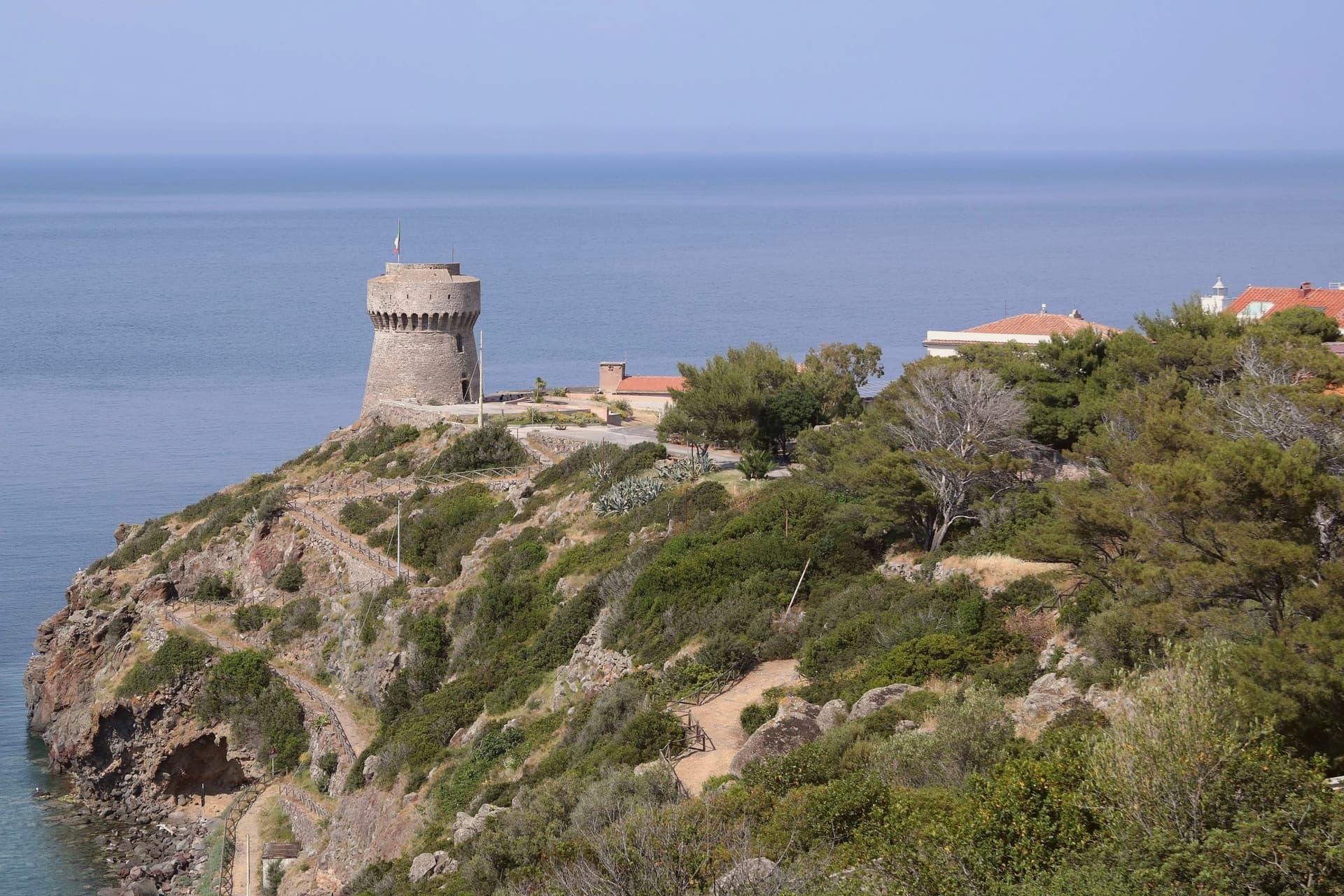
The volcanic plateau rises above the settlement, holding the freshwater lake at its center, the only one of its kind among the archipelago's islands, while the coast runs down to the red cliffs on the western side and out to the abandoned signal station at the southern tip. The fort above the harbor stood guard for two centuries before the island's later history turned inward: the penal colony took two thirds of the land from 1873, pushed out most residents, and left its buildings to scrub after 1986, the same year its fences and cells came down.
Ten years later the park absorbed the island whole, water and land together. The comune now counts 370 residents, the least-populated Italian municipality with an outlet to the sea.
What was built to confine the island then opened it: a fortress, a prison, and now a park have each in turn defined how much of Capraia belongs to the few who live there and how much is held in trust for everyone else.
What to see in Capraia Isola
- Forte San Giorgio. Genoese fort above the harbor, built in 1540 on the foundation of an earlier tower destroyed by Turgut Reis. It held the line against pirates for two centuries.
- Cala Rossa. Red volcanic cove on the western side of the island, where the cliffs hold the color of oxidized basalt.
- Stagnone. Small natural lake at 320 meters on the volcanic plateau above the village, the only freshwater basin in the Tuscan Archipelago.
How to get to Capraia Isola
Our tip
May through September is the only practical season on Capraia. The ferry from Livorno runs three to four times a week in summer, less in winter, and the crossing takes two and a half hours through open sea. The Mediterranean warms enough to swim from mid-May; July and August fill the few rooms on the island and book out the small restaurants in the village. Sagra del Totano Capraia falls in October.
Bibbona
Why visit Bibbona
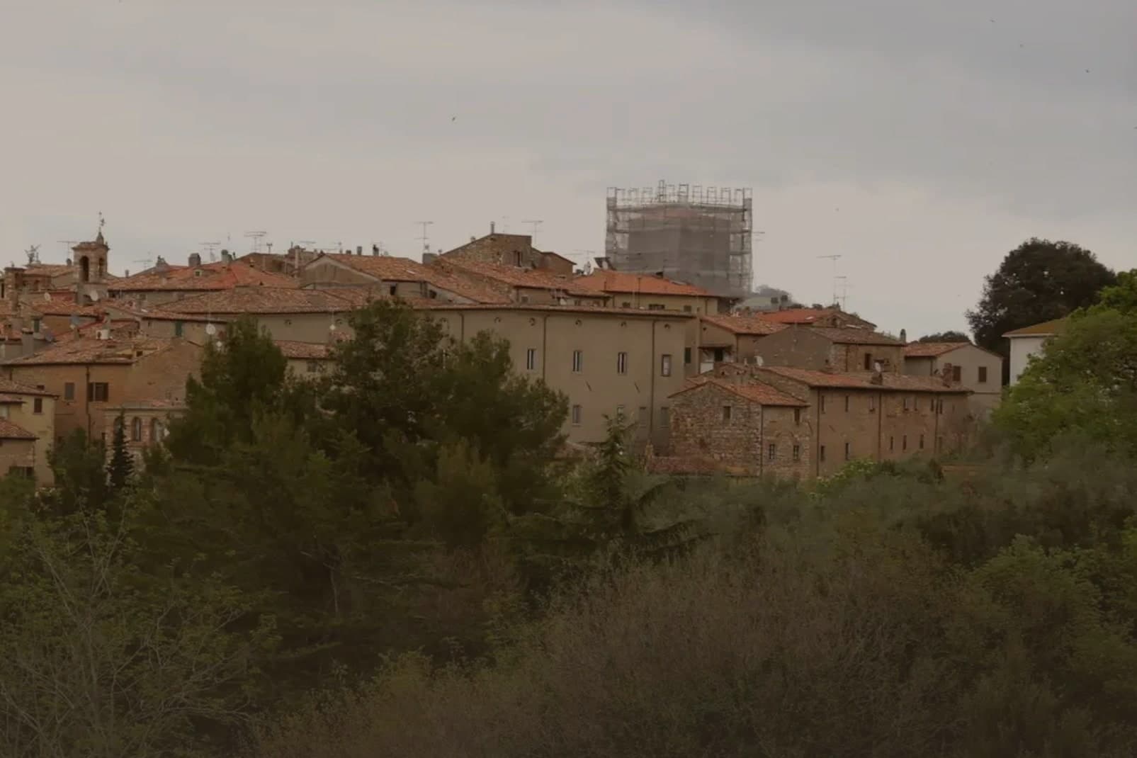
Bibbona sits at 85 meters in the Val di Cecina, in the southern province of Livorno, eight kilometers from the sea. The town has Etruscan origins, attested by a small bronze goat statuette, now in the Florence archaeological museum, that became the town symbol.
After medieval struggles between Pisa and Florence, the territory passed to the Gherardesca counts, who controlled most of the Etruscan Coast. Monk-knights, probably French and probably Templar, operated from the pieve in the medieval period, a detail that survives more clearly in local memory than in stone.
The village keeps its hill position while its coastal frazione does the work of meeting the sea: the fort once handled customs, sanitary inspection and defense, the beach now holds a national recognition, and the reserve in the inland hills once supplied the wood that moved through that same coastline. Upper town, shore and forest were never separate economies so much as three faces of one strip of land running from the Val di Cecina down to the sea.
The beach here holds the national bathing award, which a comune has to win back every year on water quality, beach management and safety.
What to see in Bibbona
- Pieve di Sant'Ilario. The church stands on Piazza XX Settembre. The right side and facade keep their Romanesque lines, while the added left nave throws the plan out of square, a visible seam between two building campaigns three centuries apart.
- Borgo medievale. Concentric ring of stone streets and stairways around the old castle, with surviving medieval gates and the central piazza.
- Forte di Marina di Bibbona. Built for customs control, sanitary inspection and defense against corsairs, the fort held a working coastline job, not a decorative one, watching the same shore the beach now occupies.
How to get to Bibbona
There is a railway station in the town, so you can arrive without a car and never need one while you are here. Livorno is roughly 51 minutes away by road.
Our tip
May and June bring warm water and quiet beaches, before the July and August crowds reach the Costa degli Etruschi. The borgo at 85 meters stays five degrees cooler than the coast and is the place to sleep in high summer. July and August are full: Marina di Bibbona fills, the pine-shaded beach fronts get crowded, and the Forte sees long queues at sunset.
Capoliveri
Why visit Capoliveri
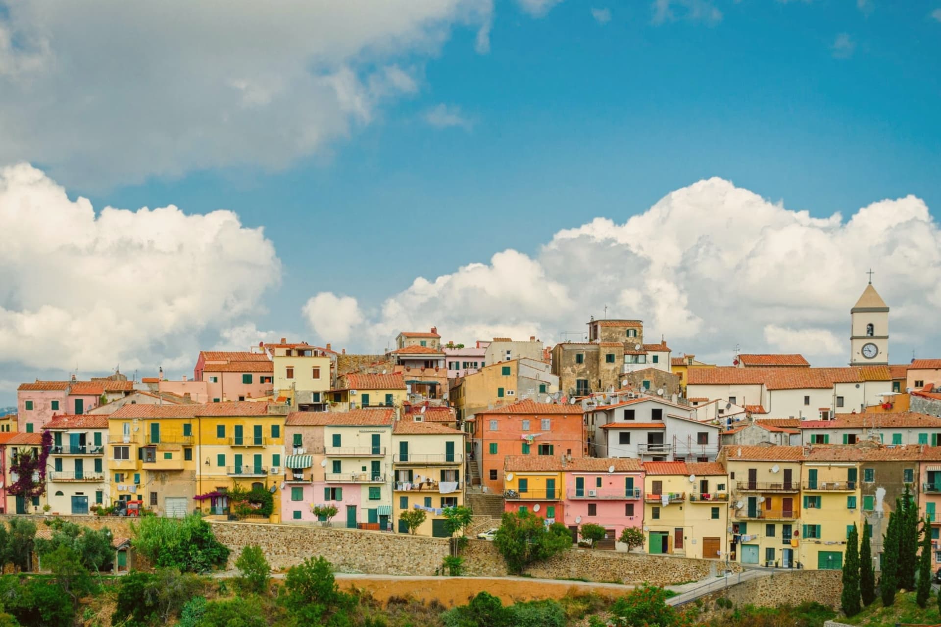
The name comes from Caput Liberum, the Roman head of the free territory. The medieval town that grew up on that ground sits on a terrace at 167 meters and is built into the slope as a maze of narrow alleys called chiassi, opening onto small piazzas rather than any wider square.
Below it the southern lobe of Elba unfolds into thirty-five kilometers of coastline, more than any other comune on the island, and the beaches, Innamorata, Morcone, Pareti and Zuccale, are reached by a network of dirt roads off the ridge rather than by a single road along the shore. The fishermen still go out at four in the morning from the cove at Naregno.
What holds the town together is that relation between height and shore: a hill settlement governing a coastline it does not directly touch, with the old mining ground on the mountain behind it folded into the same protected park as the water below.
What to see in Capoliveri
- Centro storico. Medieval village built into the slope of the mountain, with narrow stepped alleys called chiassi giving onto small piazzas.
- Miniere del Calamita. The galleries and open pits sit on the eastern flank of Monte Calamita, now a heritage trail with guided tours through the abandoned works.
- Spiaggia dell'Innamorata. Pebble beach on the southern coast, named for a sixteenth-century pair of lovers killed in a pirate raid, commemorated each July.
How to get to Capoliveri
Livorno is roughly 133 minutes away by road.
Our tip
May through September is the season Capoliveri runs on. The water warms enough to swim from mid-May, the ferries from Piombino run every hour, the beaches at Morcone and Innamorata fill from late June. July and August are crowded everywhere on the island and parking at the southern beaches becomes a small art.
Castagneto Carducci
Why visit Castagneto Carducci
Castagneto Carducci sits at 194 meters on a hill above the Costa degli Etruschi, sixty kilometers south of Livorno. The town was called Castagneto until 1907, when it was renamed for the poet Giosuè Carducci, who spent part of his childhood here and made the surrounding landscape the subject of Davanti a San Guido.
The Castello della Gherardesca, the Lombard-origin fortress of the counts who held the land for nine centuries, still anchors the centro storico. Below the hill, on a coastal plain that locals call the Maremma livornese, sits the frazione of Bolgheri.
In 1944, Mario Incisa della Rocchetta planted Cabernet Sauvignon on his estate there; the resulting wine, Sassicaia, started the category that journalists in the 1970s named Supertuscan. Bolgheri DOC was created in 1983 and Bolgheri Sassicaia DOC in 1994, a sub-zone for a single estate.
The cypress avenue from the coast road up to Bolgheri, two parallel rows planted in 1832, is the one Carducci put in the poem.
The beach here holds the national bathing award, which a comune has to win back every year on water quality, beach management and safety.
What to see in Castagneto Carducci
- Castello della Gherardesca. Lombard-origin fortress at the top of the borgo, held by the Della Gherardesca counts for nine centuries, still in private family use.
- Viale dei Cipressi. Five-kilometer cypress avenue between the SS1 Aurelia and the frazione of Bolgheri, planted in 1832 and immortalized by Carducci.
- Bolgheri. Coastal-plain frazione at 88 meters, walled medieval village turned wine capital, home of Sassicaia, Ornellaia and the Bolgheri DOC.
How to get to Castagneto Carducci
There is a railway station in the town, so you can arrive without a car and never need one while you are here. Livorno is roughly 55 minutes away by road.
✷ We have written about Castagneto Carducci
“You reach Bolgheri up a straight avenue of cypresses, five kilometers of them standing in two close files like a colonnade with the roof taken off, and the road does the thing it was planted centuries ago to do, which is tell you before you get there that you are arriving somewhere that thinks a great deal of itself. The comune the village belongs to carries its name.”
Read our piece on Castagneto Carducci →Bolgheri | The Story of an Amaro
Our tip
May through September is the season the comune fills, the coast at Marina di Castagneto holds Bandiera Blu, and the Bolgheri cellars run their tastings on appointment. The Bolgheri DiVino wine festival runs in mid-August. July and August push afternoon temperatures past thirty and the cypress avenue stops being walkable in midday sun.
Campiglia Marittima
Why visit Campiglia Marittima
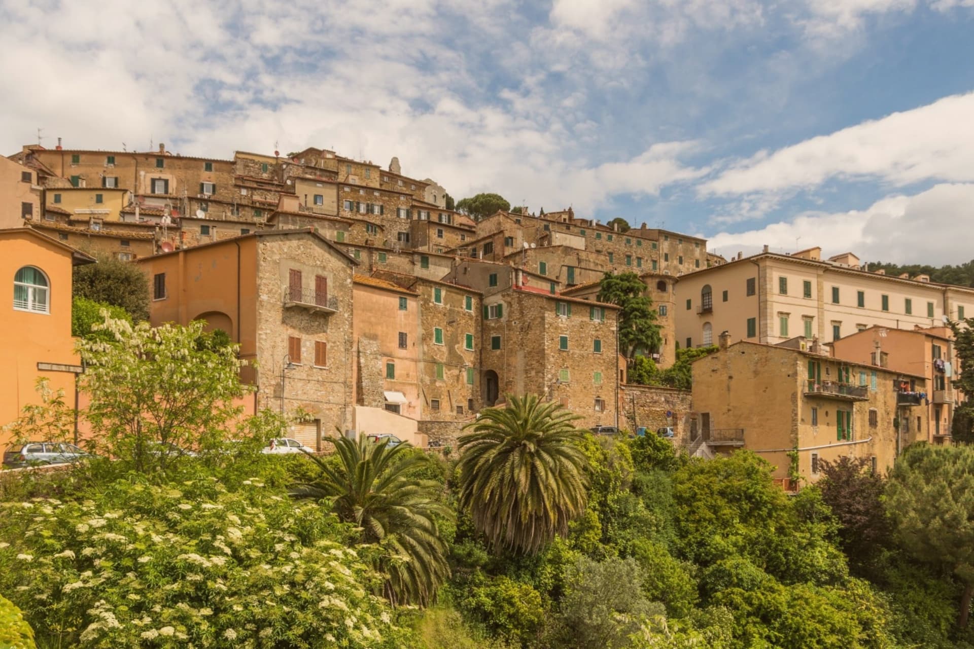
Campiglia Marittima sits at 231 meters on the last slopes of the Colline Metallifere above the Val di Cornia, eight kilometers inland from the Tyrrhenian coast and 60 kilometers southeast of Livorno. The Rocca occupies the highest point at 281 meters, a fortified semicircle whose 14th-century tower and town walls trace the medieval defensive line.
The territory has been mined since the Etruscans: copper, silver, lead and tin from the hills behind town, worked continuously until the last galleries closed in 1976. The Parco Archeominerario di San Silvestro, opened in 1996 on 450 hectares behind the town, centers on Rocca San Silvestro, a tenth and eleventh-century miners' village abandoned in the fourteenth century and excavated since 1984.
Visitors enter through restored galleries on a small electric train. Down on the plain the DOC Val di Cornia produces Sangiovese and Cabernet, and the thermal springs at Venturina, the frazione south of town, have flowed since Roman use as Aquae Populoniae.
What to see in Campiglia Marittima
- Rocca di Campiglia. Fortified semicircle at 281 meters with the 14th-century tower, walls and the Pieve di San Giovanni, the highest point of the town.
- Parco Archeominerario di San Silvestro. 450-hectare park behind town, opened 1996, with restored mining galleries, a small electric train, and the abandoned medieval miners' village of Rocca San Silvestro.
- Centro storico. Walled hilltop borgo of stone houses, with Piazza della Repubblica at its center, the medieval gates Porta a Mare and Porta Fiorentina still intact.
How to get to Campiglia Marittima
There is a railway station in the town, so you can arrive without a car and never need one while you are here. Livorno is roughly 67 minutes away by road.
✷ We have written about Campiglia Marittima
“That is the thing the young man on the beach did not see, and the man who lives here cannot stop seeing. This is an industrial coast wearing a beach towel. Run it back far enough and the whole of it, the swamp and the steel and the slag and the white water, is one long story about iron, and the holiday is the costume the story put on after the work ran out.”
Read our piece on Campiglia Marittima →The Iron Coast | The Wrong Sea
Our tip
May through September is the season on the Val di Cornia: warm days, sea breezes that climb the hill, harvest of Sangiovese and Vermentino from late August. The beaches at San Vincenzo and Baratti are eight to fifteen kilometers away and pull the day-traffic. July and August are hot and busy on the coast; the borgo on the hill stays a few degrees cooler.
Piombino
Why visit Piombino
Piombino sits on a triangular promontory pointing southeast into the Tyrrhenian, at the northern edge of the Maremma. The town was founded in the ninth century by refugees from the Etruscan port after Greek pirates attacked the city; they called the new settlement Populino, small Populonia, and the name shortened over time to what it is now.
The old city, now a frazione north on the coast, became the source of the newer town's name rather than the other way round. In the medieval period Piombino became an independent signoria under the Appiani, who ruled from here over a small state that reached out to the islands across the water.
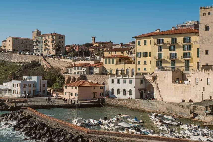
The castle at the seafront, the piazza cantilevered out over the cliff toward Elba, and the working ferry port make up the contemporary town, each looking the same direction the refugees once looked back from: toward the older settlement to the north and the channel to the islands beyond it. The Bandiera Blu coast covers the four kilometers between the port and the old acropolis, so that the walk from new town to old runs along the same shoreline that separates them by name only.
The beach here holds the national bathing award, which a comune has to win back every year on water quality, beach management and safety.
What to see in Piombino
- Castello di Piombino. Principal defensive fortress of the city on a headland pointing southeast into the sea, with the Torrione, the Rivellino and the Cittadella complex, now a museum.
- Piazza Bovio. Long rocky breakwater extending into the sea as La Rocchetta, terraced as a piazza, with a balcony view across the channel to Elba.
- Parco Archeologico di Baratti e Populonia. Chamber tombs from the seventh to second centuries BC cut into the ground of the Gulf of Baratti, laid out for walking among the excavated structures rather than viewed from a distance.
How to get to Piombino
There is a railway station in the town, so you can arrive without a car and never need one while you are here. Livorno is roughly 77 minutes away by road.
Our tip
May, June, September and October are the months when the Piombino promontory is at its best, sea warm enough to swim and the ferry to Elba running every hour without the August crush. July and August are full season, with the centro storico filling by late morning and the Baratti beach turning over twice a day. November through March is cold and windy on the promontory, with limited ferry crossings and many seaside trattorie closed. Sagra del Pesce - Piombino falls in July.
Livorno
Why visit Livorno
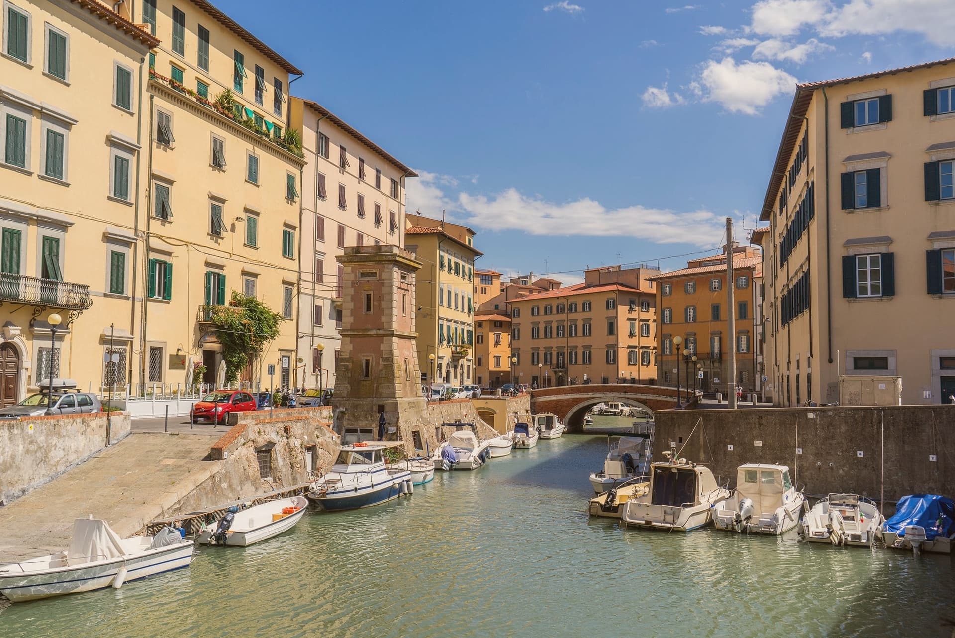
Livorno is the Tuscan coast you don't expect: Medici-founded in 1577 as Nova Civitas, planned from scratch by Bernardo Buontalenti as a free port to rival Genoa and Venice, and unique among Tuscan cities for being entirely a Renaissance-era invention rather than a medieval inheritance. The original pentagonal city walls enclosed a Venetian-style quarter (Venezia Nuova) laced with navigable canals where merchant warehouses opened directly to the water — Jews, Greeks, Armenians, English, Dutch and North Africans were all invited to settle under the 1591–1593 'Livornine' laws granting freedom of worship and trade, making Livorno the most cosmopolitan port on the Mediterranean for two centuries.
What you see today: Fortezza Vecchia (1521) and Fortezza Nuova (1590) guarding the inner harbour; the four bronze Moors (1626) chained to the base of Ferdinando I's monument facing the port; the Terrazza Mascagni (a 1925 Art Deco chequerboard promenade with 4,100 black-and-white tiles facing the Tyrrhenian); the Cattedrale rebuilt after 1944 bombing; the Pentagono di Buontalenti street grid still visible from above. The Macchiaioli painters' movement was born here in the 1860s (Fattori, Lega, Signorini all lived and painted the local light).
Modigliani was born in Livorno in 1884. And the food: cacciucco — a 5-fish stew with toasted bread and red wine, the city's totemic dish — plus ponce alla livornese (rum-spiked coffee) at the Caffè Civili.
The Tuscan archipelago (Capraia, Gorgona, Elba) ferries out from the port within view of the promenade.
The beach here holds the national bathing award, which a comune has to win back every year on water quality, beach management and safety.
What to see in Livorno
- Terrazza Mascagni. A 1925 Art Deco seafront promenade with 4,100 black-and-white tiles facing the open Tyrrhenian — locals call it the world's most beautiful balcony, especially at sunset.
- Venezia Nuova quarter. The Medici-planned canal district from 1629. Walkable bridges, warehouse-doors-on-water, and the Effetto Venezia summer festival turn it into Tuscany's Venice.
- Quattro Mori (Monumento dei Quattro Mori). Pietro Tacca's four bronze Moors (1626) chained to the base of Grand Duke Ferdinando I's statue facing the port. Livorno's civic icon.
How to get to Livorno
There is a railway station in the town, so you can arrive without a car and never need one while you are here. Livorno is roughly 11 minutes away by road.
✷ We have written about Livorno
“I lived in Naples for weeks once, and those days remain among the best I have had, and the people there are among the finest I have met anywhere in this country, and I love the place without reservation. Naples is the same love story as Livorno.”
Read our piece on Livorno →Livorno | The City With No Time For You
Our tip
Livorno is a true year-round port city, but the sweet spot is April–June and September–October. May and June have the warm Tyrrhenian light, the Effetto Venezia festival (last week of July) brings the canal quarter alive at night, and September is still beach-warm without the crowds. July and August get hot and the port traffic peaks. Effetto Venezia falls in July.
More from Anywhere Italy
 The best coastal towns within two hours of Siena
 The 6 best coastal towns inside a nature park in Toscana
- The best hidden coastal towns you can reach by train in Toscana
- The best small coastal towns in Toscana
- The best towns with a serious restaurant that eat well within 90 minutes of Livorno
- The best towns inside a national park in Toscana