
The best hidden olive oil towns in Puglia
Puglia produces more olive oil than any other Italian region, and in the towns that live off it the season is audible: tractors on the lanes in November, mills running late, the smell of crushed fruit hanging over the piazza. The trees themselves are the landscape, trunks hollowed and twisted with age, set in red soil between drystone walls. Houses are built of the same pale limestone that the walls are, whitewashed in the Valle d'Itria and left bare on the Gargano. Order the new oil on bread in a village bar in early winter and it will be green, peppery, harsh at the back of the throat, which is how it should taste.
Most visitors to Puglia land at Bari or Brindisi and drive to Ostuni, Lecce and Polignano a Mare, and by August those places are full: the white town on the hill has coach parking, the baroque centre of Lecce moves at the pace of the group in front of you, and the cliffs above the sea are photographed all day. There is nothing wrong with any of them. They are simply where everyone is, and where the olive groves are treated as scenery rather than as work.
The groves do not stop at the edge of the famous towns. They climb into the Dauni hills above the Tavoliere, run along the Gargano coast behind the beaches, and cover the Murgia inland from the Adriatic, and that is where the towns on this list are. Fewer people go to them, the mills are open to anyone who asks, and lunch tends to be cheaper and slower.
Of the 59 communes we have mapped in Puglia, 22 qualify as olive oil towns: each belongs to the national association of olive-oil towns. This list is the hidden ones, 10 in all, ordered smallest first. The smallest, Biccari, has 2,636 residents.
Elsewhere in the catalogue: The best hidden olive oil towns that eat well in Puglia and The best hidden olive oil towns you can reach by train in Puglia.
Biccari
Why visit Biccari
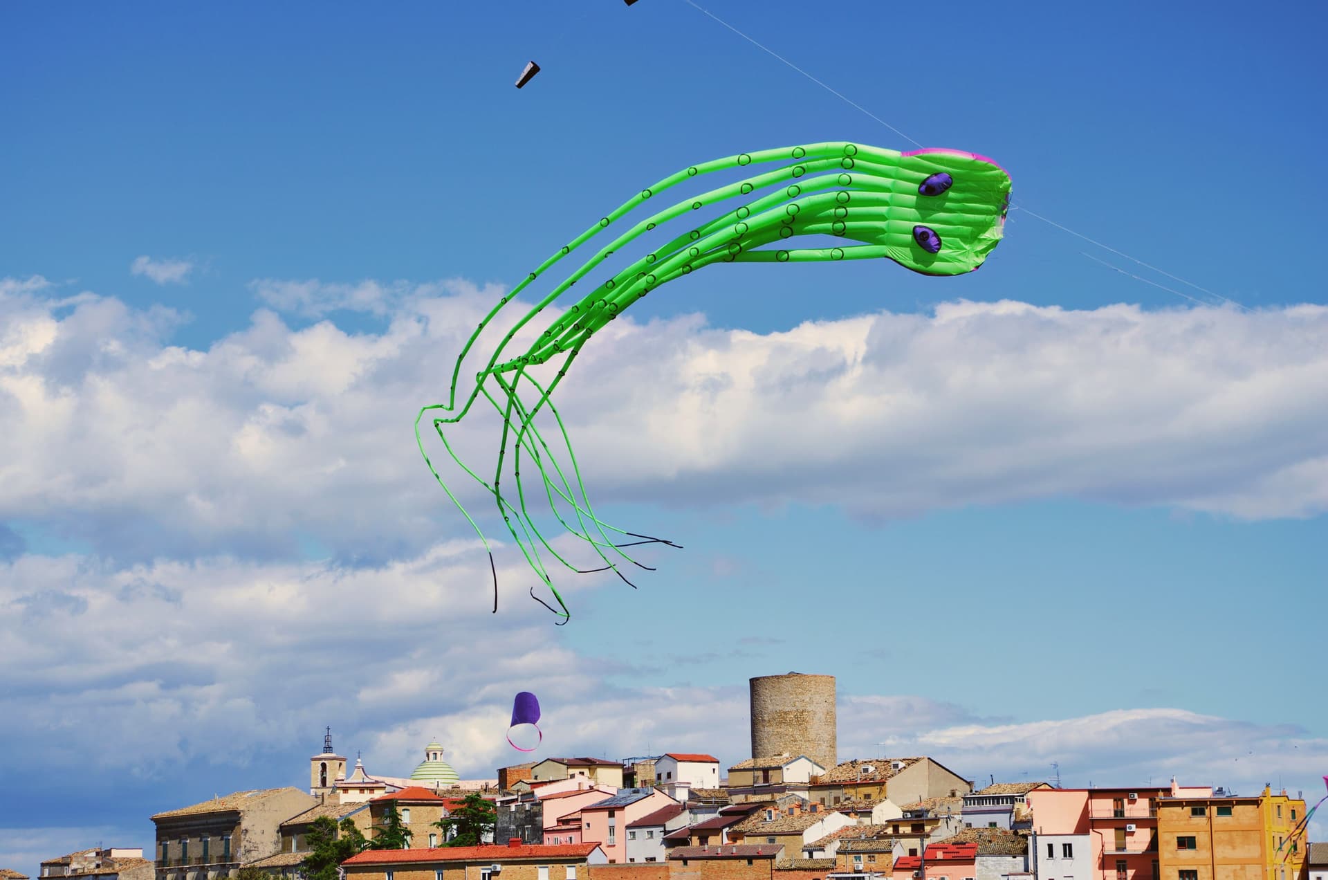
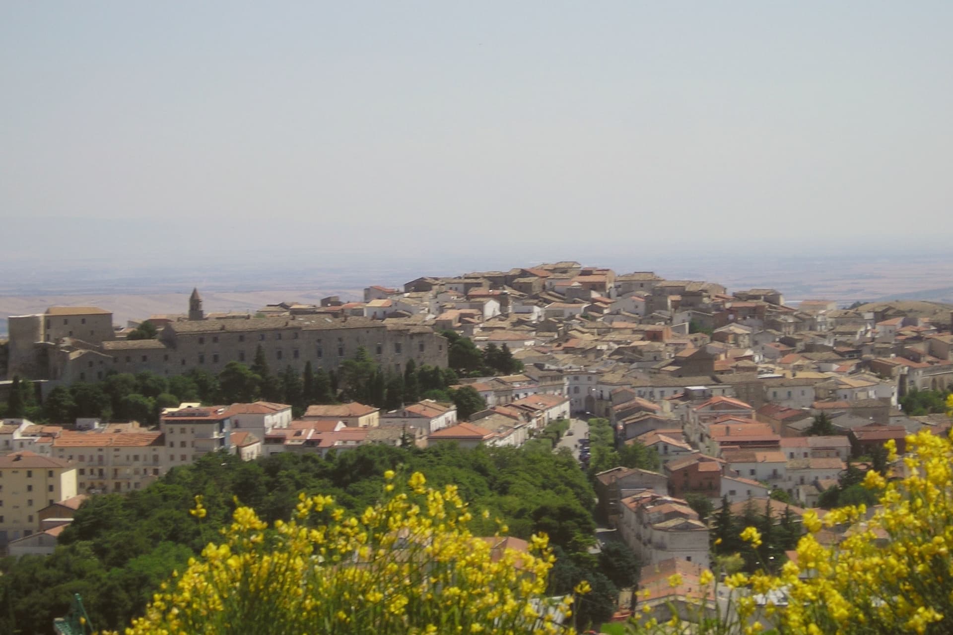
Biccari sits at 450 meters on the eastern slope of the Subappennino Dauno, with Monte Cornacchia rising behind it at 1,151 meters, the highest point in Puglia. The municipal territory runs from the peak down to the Tavoliere plain, an unusual vertical range for a Puglian commune.
The village was founded by Byzantine catepan Basilio Boioannes around 1024, then taken in the 1050s by a Norman called Pagano who fortified the original tower into a small castrum. The Torre Bizantina still stands at the centre of the village, a square stone tower that names everything around it.
The town carries four institutional signals at once, including Bandiera Arancione and Comuni Virtuosi, and runs an active second-home repopulation scheme. A Neolithic site at Boschetto, 700 meters up the Organo torrent, is one of the highest of its age in Puglia, evidence of seasonal habitation four thousand years before Christ.
What to see in Biccari
- Torre Bizantina. Square stone watchtower built by the Byzantine catepan around 1024, the structure the Norman fortifications grew around, still the highest point in the village.
- Chiesa Madre di Santa Maria Assunta. Mother church in the centro storico, rebuilt over the centuries on Byzantine and Norman foundations, anchoring the upper village.
- Lago Pescara. Small upland lake in the Cornacchia foothills, used for fishing and a summer walking circuit, at the edge of the beech and oak woodland.
How to get to Biccari
Foggia is roughly 40 minutes away by road.
Our tip
April through October are the months the Subappennino Dauno stays workable: cool evenings, dry summer air, the Cornacchia trails open. June through August reach the high twenties at 450 meters while Foggia bakes; the village climate is the main argument for visiting in high summer. October brings the chestnut and porcini season in the woods above the lake.
Mattinata
Why visit Mattinata
Mattinata sits at seventy-five meters on the eastern Gargano. The Iapyges, immigrants from Greece and the Balkans, settled the surrounding hills from the fifth century BC; the Roman port of Matinum, on the modern seafront, gave the town its name.
The current settlement is younger than most Garganic centers: it was administered as part of Monte Sant'Angelo until 1955, when it became an independent comune. The town proper sits below the mountain that watches over it, the two bound by the same limestone that runs from the abbey ruins down to the coast.
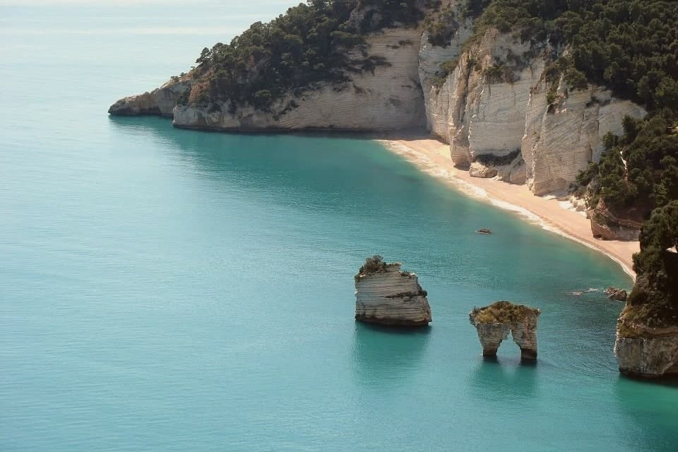
South of town the shoreline drops toward the sea stacks and, ten kilometers further on, the pebble crescent and cliffs of Baia di Vignanotica. The national park covers all of it, mountain, coast and town alike.
A settlement younger than its neighbors, built on ground far older: the Roman port beneath the seafront, the settled hills behind it, the abbey above it, all folded into a comune that has only carried its own name since the middle of the last century.
La Locanda del Maniscalco have been named by a guide.
What to see in Mattinata
- Baia delle Zagare. Bay south of town with two iconic limestone sea stacks, the arch-shaped Arco di Diomede and the scissor-shaped Le Forbici.
- Baia di Vignanotica. Pebble crescent under tall limestone cliffs, reached on foot from the Sentiero dell'Amore from Baia dei Mergoli.
- Monte Sacro and Abbazia della Santissima Trinità. Ruined abbey standing where Benedictine monks raised it to abbey status in 1138, after annexation to the abbey of Siponto brought its abandonment.
How to get to Mattinata
Foggia is roughly 72 minutes away by road.
Our tip
May through September is the season Mattinata runs at full strength. The Adriatic water at Vignanotica and Baia delle Zagare is swimmable from late May, the Monte Sacro trail is at its best when the orchids flower in May and June, and the coastal cliffs catch a long evening light through the summer. July and August push past thirty degrees and fill the beaches; the boat shuttle to the faraglioni is the easier access.
Sammichele di Bari
Why visit Sammichele di Bari
Sammichele di Bari sits at 280 meters on the Murge plateau, thirty kilometers south of Bari. The settlement was founded as a fief in 1609 when the wealthy Genoese banker Michele Vaaz bought the territory from the Centurione family and named the new town after his patron saint.
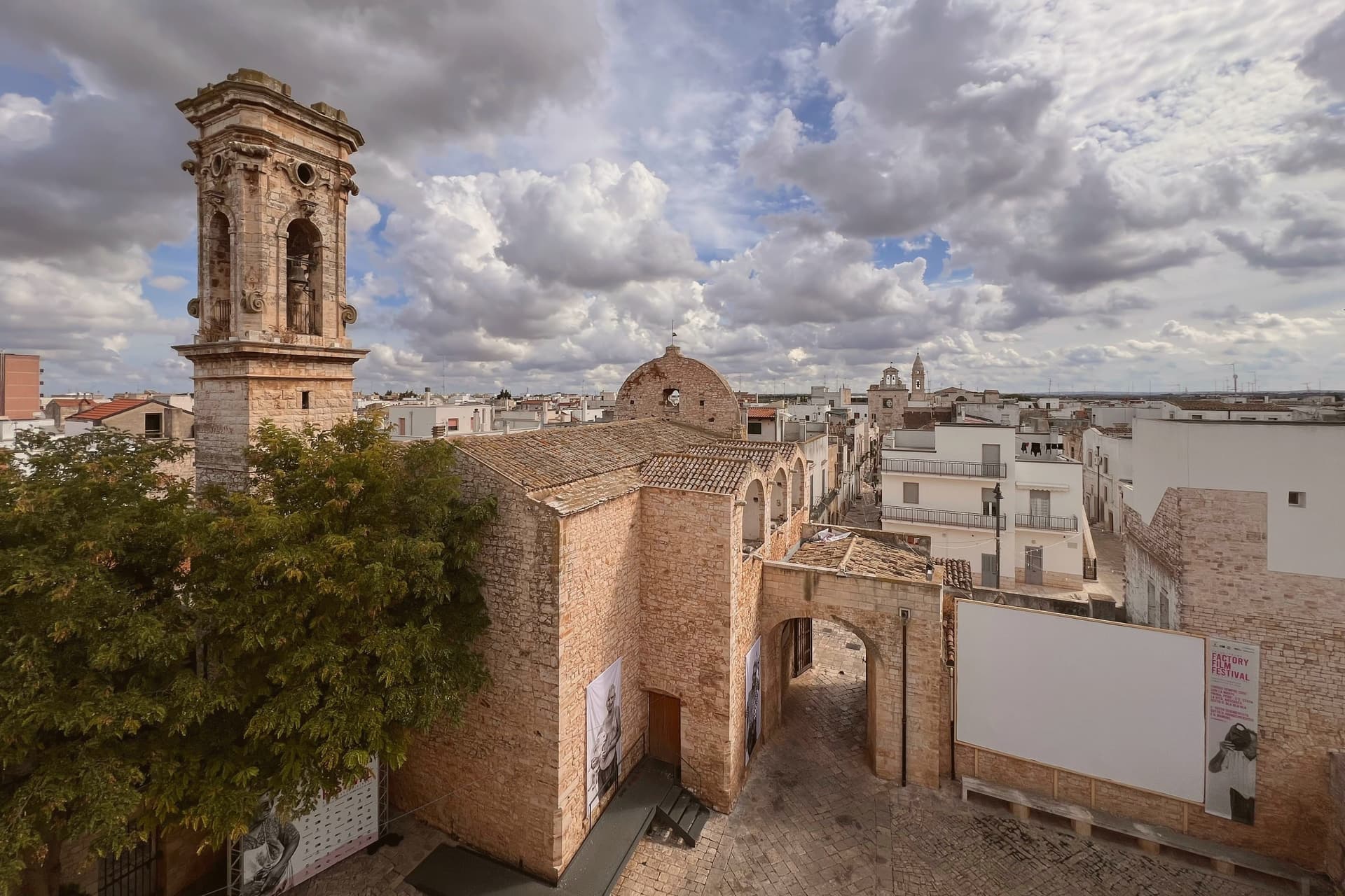
The Castello Caracciolo at the centre of the village began as a Norman outpost, passed through Centurione and Vaaz ownership, and was bought by the Caracciolo dukes in 1797 who hired the architect Amenduni to redo the eastern façade in rusticated stone with neo-Gothic bifora windows. Since 1974 the castle has held the Museo della Civiltà Contadina Dino Bianco, one of the oldest and largest ethnographic museums in Italy, with over five thousand objects of nineteenth-century peasant life arranged over four floors.
The annual Sagra della Zampina on the last weekend of September celebrates the spiced spit-roasted pork sausage that the town claims as its own.
What to see in Sammichele di Bari
- Castello Caracciolo. Norman-origin castle bought by Michele Vaaz in 1609 and remodelled by the Caracciolo dukes in the nineteenth century with neo-Gothic windows.
- Museo della Civiltà Contadina Dino Bianco. Ethnographic museum inside the castle, founded by professor Dino Bianco in 1968, over five thousand objects of nineteenth-century rural life.
- Centro storico. Walled old town on the Murge plateau, laid out by Michele Vaaz from 1609 around the castle and the parish church of San Michele Arcangelo.
How to get to Sammichele di Bari
There is a railway station in the town, so you can arrive without a car and never need one while you are here. Bari is roughly 30 minutes away by road.
Our tip
April through June and September through October are the workable months on the Murge. July and August push past thirty-five degrees on the plateau and the centro storico empties between two and five. The late-September Sagra della Zampina falls at the edge of the heat and pulls a crowd from the metropolitan area.
Vico del Gargano
Why visit Vico del Gargano
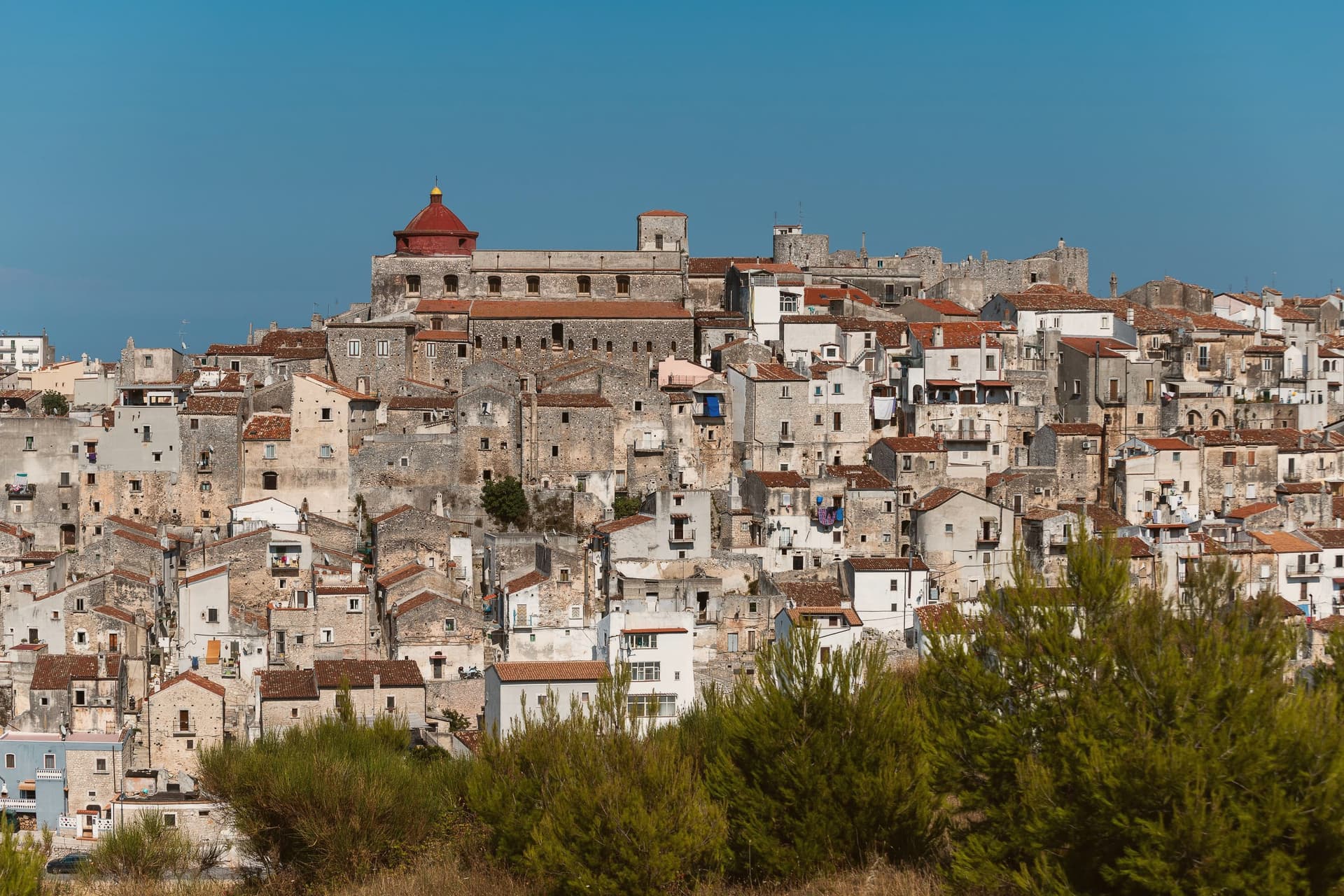
The town sits at 445 meters on a rocky promontory, with the territory falling from the 782-meter heights of the forest above to the beaches of the coastal frazioni below. The first urban core, called Vicus, was founded around 970 by Sueripolo of the Slavonians on land granted by Byzantine authorities, the seed from which the hill town and its later defenses grew.
The upper town, walled and towered, holds the historic center and its churches close around the castle, while the citrus terraces step down from that core toward the sea, and the coastal frazioni mark where the descent ends at the Adriatic. Inland forest, hill town, and coast form one continuous drop in elevation rather than three separate places.
What holds this together is the shape of the ground itself: a settlement founded on a promontory has simply grown downward over the centuries, from Byzantine grant to Norman wall to citrus terrace to shoreline, each layer sitting on the one before it.
Eco del Mare have been named by a guide.
What to see in Vico del Gargano
- Castello Normanno-Svevo. Eleventh-century Norman castle enlarged in 1240 by Frederick II and again in 1292, the anchor of the medieval defensive system of twenty towers and walls.
- Centro storico e Vicolo del Bacio. Medieval old town of about thirteen churches and chapels, with the Kiss Alley, a passage so narrow that walking it touching is the local prescription for lasting love. The survival of this core and the density of the olive mills below it earned the town a place among the Borghi più belli d'Italia.
- Foresta Umbra. Beech and oak ancient forest of Gargano National Park, reaching 830 meters within the municipal territory, with trails to centuries-old turkey oaks.
How to get to Vico del Gargano
There is a railway station in the town, so you can arrive without a car and never need one while you are here. Foggia is roughly 99 minutes away by road.
Our tip
April through June and September through October are the months Vico is at its best: the citrus groves in flower or in fruit, the Foresta Umbra in green or autumn rust, and the centro storico mild at 445 meters while the coast below stays swimmable. July and August are hot on the coast and busy at San Menaio; the centro keeps a few degrees cooler than the beach. The Saint Valentine feast on February 14 turns the village into a pilgrimage and a wedding stage.
Minervino Murge
Why visit Minervino Murge
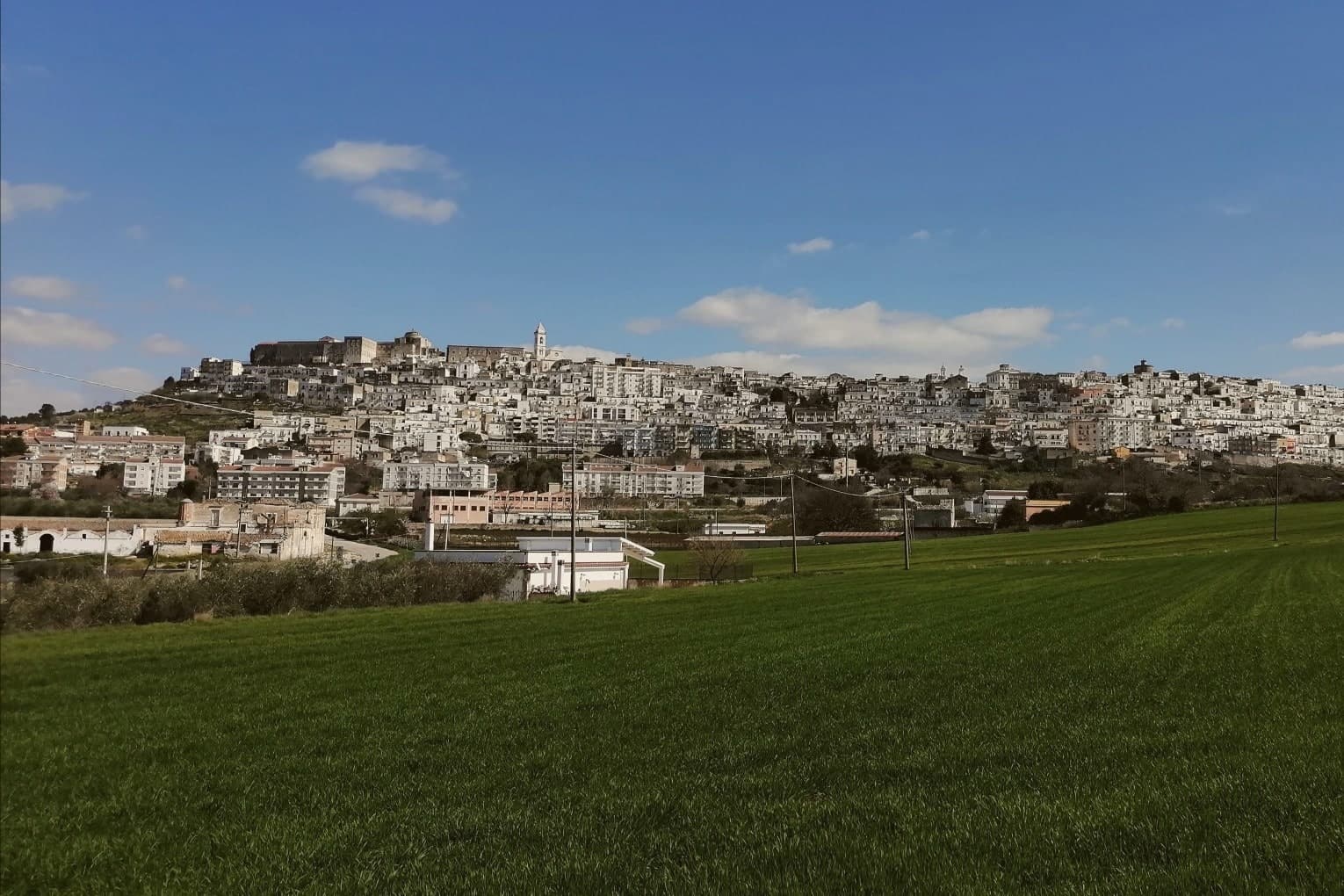
The town is built on two hills at the western edge of the Murgia plateau, where the limestone tableland gives out and the ground drops toward lower country on three sides. That break is what gives the ridge its long view and its nickname: to the east the eye crosses Murgia limestone toward the Gargano and the Adriatic, to the west it crosses cultivated fields into Basilicata, and to the north it runs the length of the Ofanto valley.
The old town sits above this drop, castle and tower on the high ground, cathedral below, the settlement organized around the same ridge that draws the view. Olive oil, almonds and grain define the rural economy beyond the walls, the plateau put to farming where it is not left to steppe grass and karst.
A ridge town, in other words, whose whole character, defensive site, pilgrimage cave, farmed hinterland, follows from the one geological fact of where the plateau ends.
La Tradizione - Cucina Casalinga, Masseria Barbera, A Sud dell'Anima have been named by a guide.
What to see in Minervino Murge
- Castello Normanno-Svevo. Norman fortress remodeled in the baronial period, with surviving towers and bastions on the high ridge above the old town.
- Torre di Pirro del Balzo. Fifteenth-century tower built between 1460 and 1490 when Minervino came to Pirro del Balzo as part of Maria Donata's dowry.
- Grotta di San Michele. Cave formed roughly two million years ago, reached through the karst rather than built, and still kept as a place of pilgrimage rather than display.
How to get to Minervino Murge
There is a railway station in the town, so you can arrive without a car and never need one while you are here. Foggia is roughly 62 minutes away by road.
Our tip
April through June and September through October are the months the Alta Murgia plateau runs best. The wildflower steppe peaks in May, almond blossom comes earlier in February, and the Ofanto valley below stays mild through autumn. July and August push past thirty-five degrees on the limestone with little shade; the centro storico empties between two and five and the panoramic belvedere is best at dawn or dusk.
Melendugno
Why visit Melendugno
The comune administers 17 km of Adriatic coast east of Lecce, 19 km from the city, with 10,045 residents spread between that shoreline and an inland centre sitting at 36m altitude. The town of Melendugno itself is the administrative seat: the Chiesa di Santa Maria della Vergine (16th century), the Palazzo Marchesale, and a medieval centro that sees none of the coastal traffic.
The coast and the inland town function almost as two separate places under one name, the beaches and the karst pool drawing visitors who may never see the Palazzo Marchesale. Along that coast, three beaches carry Bandiera Blu status, each with its own character: one framed by faraglioni, one a working marina with a still-active fishing port and a castle, one the smallest but with the most dramatic limestone arches.
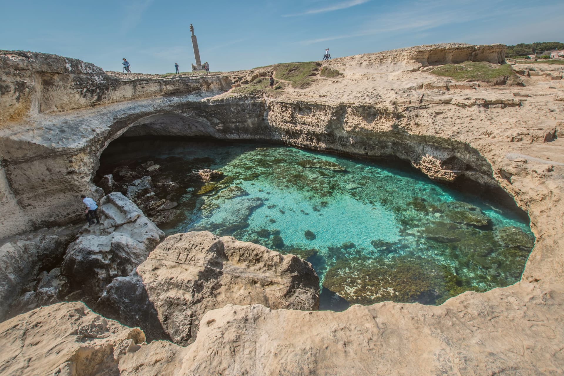
The karst pool at Roca sits beside the archaeological complex of the same stretch: a Messapian settlement built over a Bronze Age fortified predecessor, votive inscriptions cut into the cave walls in proto-Messapian, Greek, and Latin. Two finds from very different eras occupy the same short piece of coastline, one a place to swim, the other a record of who lived there first.
Inland, the comune carries a rare stack of designations beyond the coastal one: Borgo Autentico, Città dell'Olio, tied to the surrounding Salento DOP olive groves and their millennia-old trees toward Acaya, and a honey designation resting on a local beekeeping cooperative that produces thistle, eucalyptus, and millefiori varieties, marked each early autumn by its own sagra. The food follows Salento conventions: pasta con cime di rapa, pittule, bombette of pork, and pasticciotto leccese, whose original source is credited to a 1745 pastry shop in Galatone, 30 km south.
In late August the pizzica festival La Notte della Taranta, the Salento's biggest cultural event, takes place in Melpignano, 25 km south. Between the coast, the archaeology, the olive groves, and the honey cooperative, Melendugno holds more density of designation and documented history per kilometre than its size would suggest.
Il Vecchio Molo have been named by a guide.
What to see in Melendugno
- Grotta della Poesia (Roca). A karst-collapsed pool 8m below the rock surface, reached through a single jagged opening above. The water is crystal-clear and connects by underwater tunnels to two adjacent smaller pools.
- Three Bandiera Blu beaches. Torre dell'Orso has 300m of fine sand framed by the Le Due Sorelle faraglioni. San Foca is a working marina with a still-operational fishing port and the Castello Sangiovanni. Sant'Andrea is the smallest of the three, with the most dramatic limestone arches.
- Roca Vecchia archaeological site. A Messapian settlement (5th-3rd c BC) built over an earlier Bronze Age fortified village (16th c BC) on a coastal promontory. Thousands of votive inscriptions in proto-Messapian, Greek, and Latin are scratched into the cave walls.
How to get to Melendugno
Taranto is roughly 117 minutes away by road.
Our tip
Melendugno is best May–June and September–October — the Salento beach summer peaks August (Italian holiday season, ferragosto crush) and the coast is at its hottest 35°C+ in July-August. La Notte della Taranta in nearby Melpignano (late August) is the regional cultural headline. October is harvest in the Salento DOP olive groves. Sagra Ortofrutticola Borgagne falls in July.
Alberobello
Why visit Alberobello
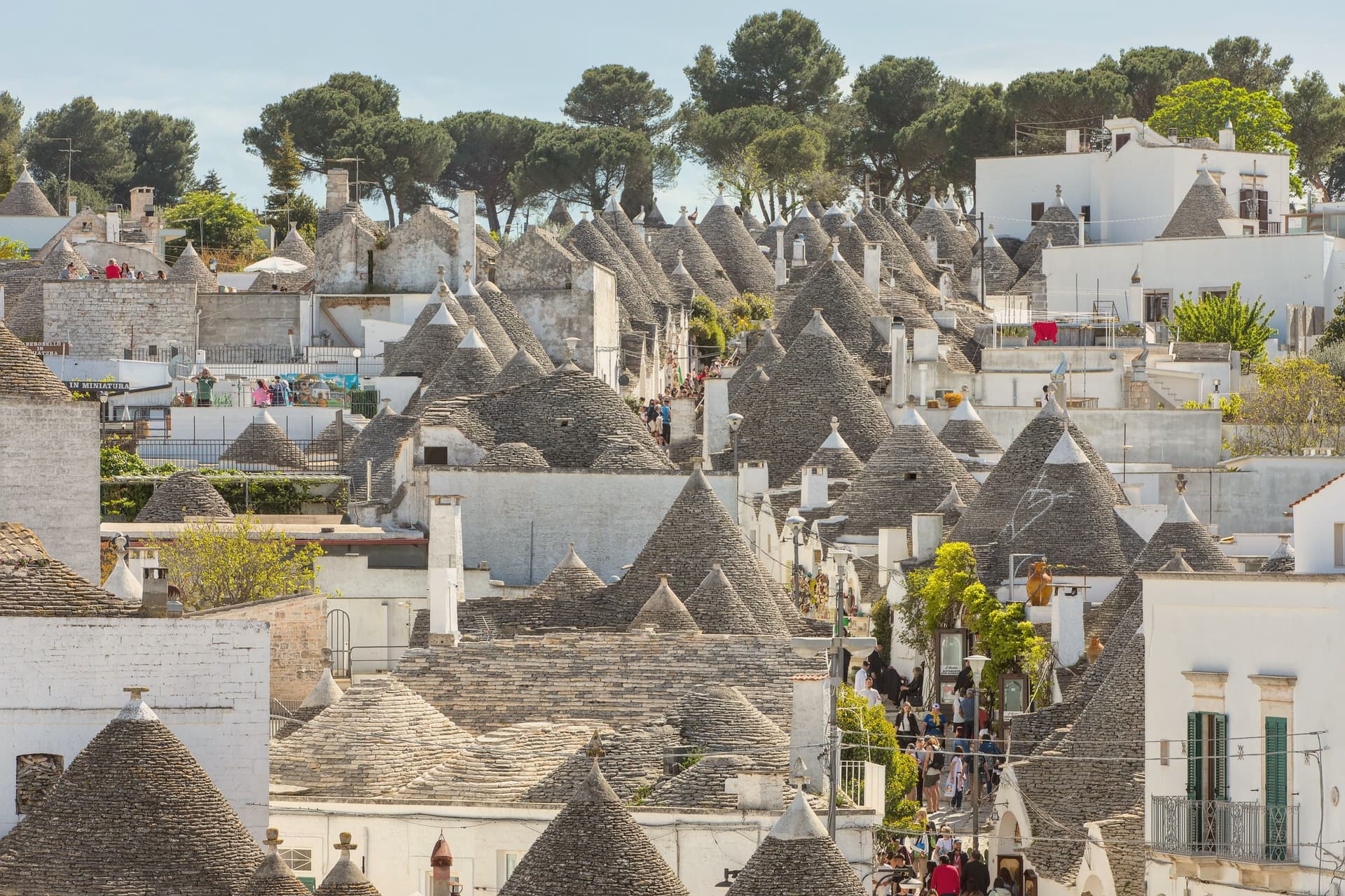
Alberobello sits at 402 meters in the Valle d'Itria, forty-five kilometers southeast of Bari. Two quarters of the town, Rione Monti and Aja Piccola, hold more than 1,500 trulli: limestone cones built from corbelled drystone, with conical or pyramidal roofs piled course by course without mortar.
The technique is prehistoric and still in use across the Murge, but nowhere else is the density and preservation what it is here. The Counts of Conversano enforced drystone construction on their tenant farmers to dodge a Spanish viceroy's tax on permanent settlements: a building that could be dismantled in an afternoon did not count as a town.
UNESCO listed the trulli in 1996. Some are houses, some are shops, some are inhabited by the same families that built them.
The Trullo Sovrano, the only two-storey trullo, was built around 1750 and now functions as a small museum.
Evo Ristorante have been named by a guide.
What to see in Alberobello
- Rione Monti. The larger of the two trulli quarters, a thousand cones running down the hillside, mostly converted to shops and accommodation.
- Aja Piccola. The smaller residential quarter, about four hundred trulli, still occupied as primary housing and quieter than Rione Monti.
- Trullo Sovrano. The only two-storey trullo in town, built around 1750 by the Perta family, now a small museum of trullo construction and daily life.
How to get to Alberobello
There is a railway station in the town, so you can arrive without a car and never need one while you are here. Taranto is roughly 56 minutes away by road.
Our tip
April through June and September through October are the months the Itria valley is green and the trulli are walkable without sweat. July and August push past thirty-three degrees and the Rione Monti fills with day-trippers from the coast; by ten in the morning the main streets are shoulder to shoulder. Late afternoon and after dusk are the times to walk, when the cones cast long shadows and the crowds thin.
Vieste
Why visit Vieste
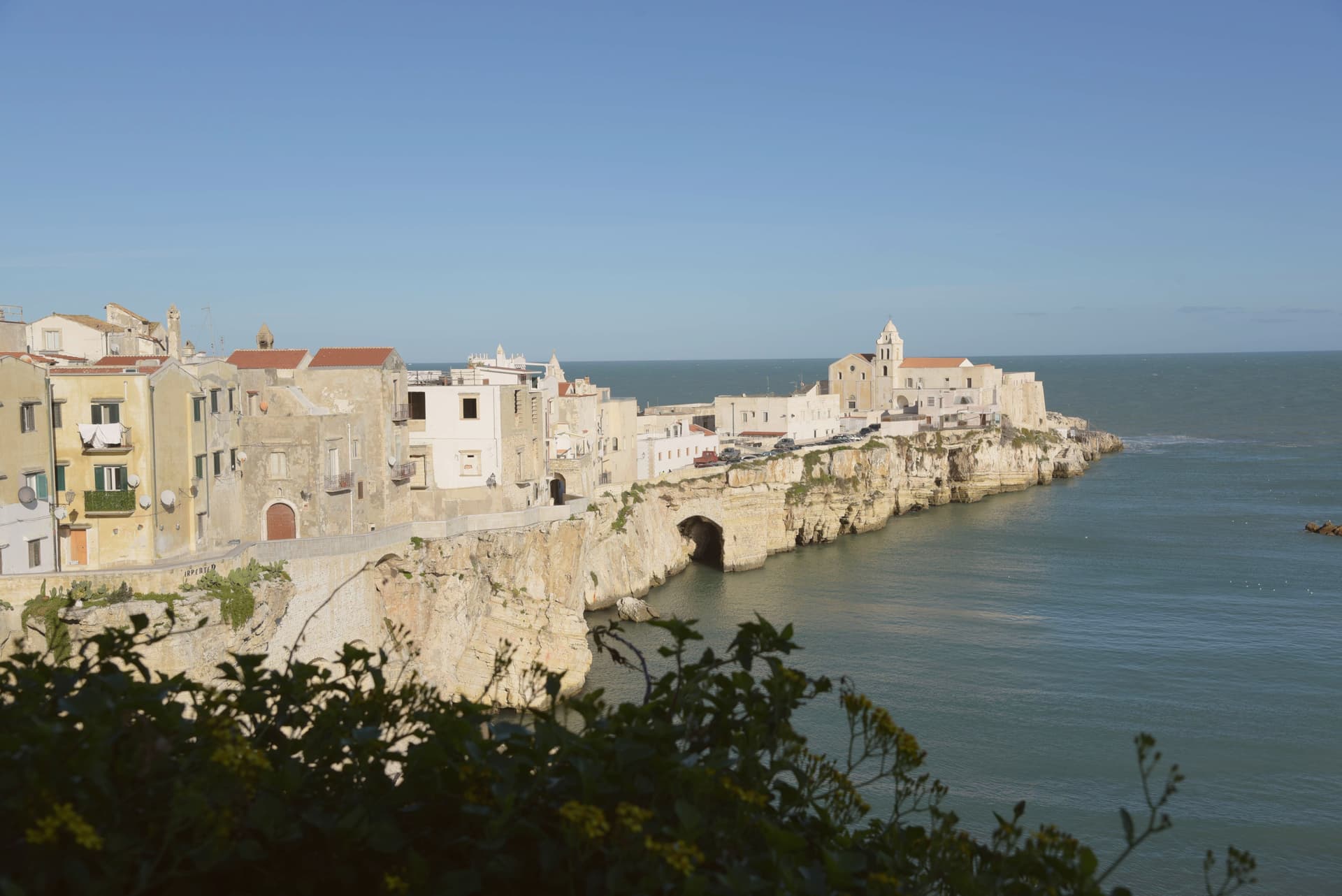
Vieste sits at the eastern tip of the Gargano promontory inside Gargano National Park, a medieval town on a white limestone cliff dropping straight into the Adriatic. The Cathedral was begun in the second half of the eleventh century in Apulian Romanesque, with three naves on two rows of six columns and capitals carved in oriental floral and animal motifs.
The Norman castle of the eleventh century was rebuilt by Frederick II in 1242 as part of a coastal fortification line; the trapezoidal block of 1242 still anchors the headland. On July 18-21, 1554, the Ottoman corsair Dragut sacked the town and executed roughly 5,000 inhabitants on the slab of stone now known as the Chianca Amara, the bitter stone, set into the lane that carries the memory.
Pizzomunno, the 26.6-meter limestone sea stack on Spiaggia del Castello, is the symbol of the Gargano and the centerpiece of a local legend about a fisherman whose lover was taken by sirens. The Bandiera Blu marks the water at Pizzomunno, Scialmarino and Lungomare Mattei.
Al Dragone, Donlù, La Ripa and 1 more have been named by a guide.
What to see in Vieste
- Cattedrale di Santa Maria Assunta. Eleventh-century Apulian Romanesque cathedral, three naves on two rows of six columns, with Corinthian and cubic capitals carved in zoomorphic and floral motifs.
- Castello Svevo. Norman fortress rebuilt by Frederick II in 1242 on the headland above the sea, part of the Hohenstaufen Adriatic defensive line, still anchoring the old town.
- Pizzomunno. Limestone sea stack 26.6 meters high on Spiaggia del Castello, the symbol of Vieste and the Gargano, attached to the legend of the fisherman and his stolen lover.
How to get to Vieste
Foggia is roughly 109 minutes away by road.
Our tip
May, June, September and the first half of October are the windows when Vieste works without the heat or the August crowd: warm Adriatic, breezy headland, the centro storico walkable in afternoon as well as evening. July and August are very hot and crowded, with the Bandiera Blu beaches at capacity and rates at peak; the centro storico empties between two and five and refills after sunset for the passeggiata. October still holds for swimming on the south-facing beaches.
Trinitapoli
Why visit Trinitapoli
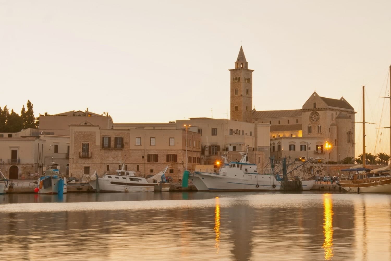
Trinitapoli sits on the Tavoliere plain four kilometers from the Adriatic and three kilometers from the Saline di Margherita di Savoia, the largest salt works in Europe and a wetland thick with pink flamingos. The town grew around a Casaltrinità chapel of the Holy Trinity first mentioned in 1186; Victor Emmanuel II changed the name from Casaltrinità to Trinitapoli by royal decree in 1863.
The Bronze Age Ipogei, discovered in 1987 in the Madonna di Loreto locality, turned out to be one of the most important religious sites of the second millennium BC in the Mediterranean: a complex of underground sanctuaries used for fertility rituals, with grave goods now displayed in the Museo Archeologico dei Dolmen e degli Ipogei. The Santuario della Beata Maria Vergine di Loreto, first recorded in 1204, was rebuilt in the nineteenth century and elevated to a diocesan sanctuary in 1971.
The nearby Salapia ruins anchor the town's deep history.
What to see in Trinitapoli
- Parco Archeologico degli Ipogei. Bronze Age underground sanctuary complex discovered in 1987, one of the most important Mediterranean ritual sites of the second millennium BC.
- Museo Archeologico dei Dolmen e degli Ipogei. Town museum displaying the grave goods and ritual objects recovered from the Ipogei, including bronzes, amber and Mycenaean ceramics.
- Santuario della Beata Maria Vergine di Loreto. Diocesan sanctuary on the western edge of town, first recorded in 1204 and rebuilt as a three-nave church in the early nineteenth century.
How to get to Trinitapoli
There is a railway station in the town, so you can arrive without a car and never need one while you are here. Foggia is roughly 59 minutes away by road.
Our tip
May, June and September are the easiest months on the Tavoliere: warm but not yet oven-hot, with the saline wetland in full flamingo season. October brings the olive harvest and the new oil. July and August touch forty degrees on the plain and the town quiets to dawn and dusk hours; the saline visitor center keeps reduced summer hours.
Locorotondo
Why visit Locorotondo
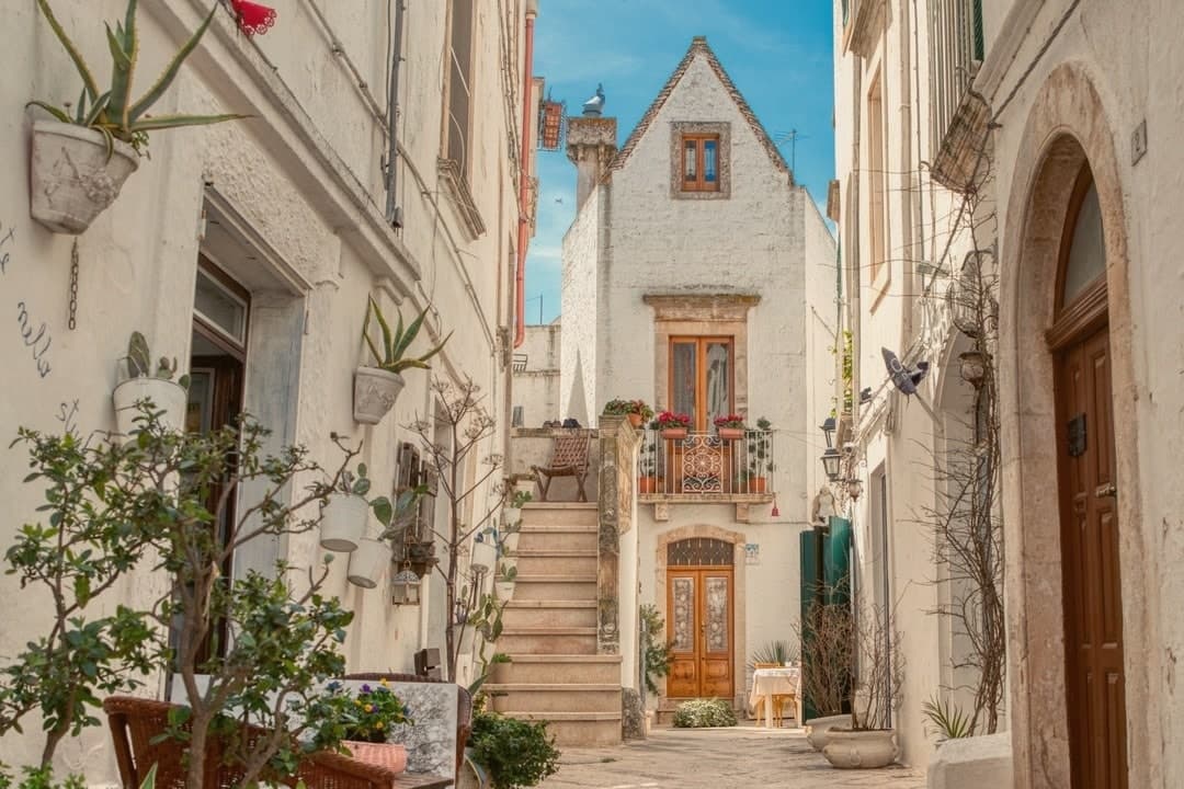
Locorotondo sits on a natural terrace at 410 meters, the high edge of the Valle d'Itria looking south over the trulli countryside between Alberobello, Cisternino and Martina Franca. The name means round place: the centro storico is a perfect circle of whitewashed houses, and the architecture is unique to this town.
The cummerse are stone houses with steep pitched roofs covered in two thin layers of limestone slabs, a profile that exists nowhere else in Puglia. The streets between them run in concentric arcs and are narrow enough to lose the sun by mid-afternoon.
Both the Borghi più belli d'Italia and the Touring Club's Bandiera Arancione recognize the place. The town also makes a white DOC wine from Verdeca and Bianco d'Alessano grapes, grown on 1,650 hectares of vineyards across the surrounding plateau, plus a Città dell'Olio membership for the oil that comes off the same hills.
What to see in Locorotondo
- Centro storico. Circular old town of whitewashed cummerse, an architectural type with double-pitch limestone-slab roofs found only here.
- Villa Garibaldi. Public garden on the ridge with the widest panoramic view over the Itria valley and its trulli countryside.
- Chiesa Madre di San Giorgio. Eighteenth-century parish church on the highest point of the historic center, with a neoclassical façade and a tall central nave.
How to get to Locorotondo
There is a railway station in the town, so you can arrive without a car and never need one while you are here. Taranto is roughly 48 minutes away by road.
Our tip
April through June and September through October are the best months on the Itria plateau. Mornings are clear, the surrounding vineyards green up, and the wind off the Murge keeps evenings cool even in summer. July and August push past thirty degrees, the centro storico fills with day-trippers from Alberobello, and the narrow streets get crowded between ten and one.
More from Anywhere Italy
- The best hidden olive oil towns that eat well in Puglia
- The best hidden olive oil towns you can reach by train in Puglia
 The best hidden olive oil towns within 90 minutes of Foggia
- The best olive oil towns with a serious restaurant in Puglia
 The best hidden beach towns in Puglia
 The prettiest villages you can reach by train in Puglia