
The best hill towns with a food festival within 90 minutes of Ancona
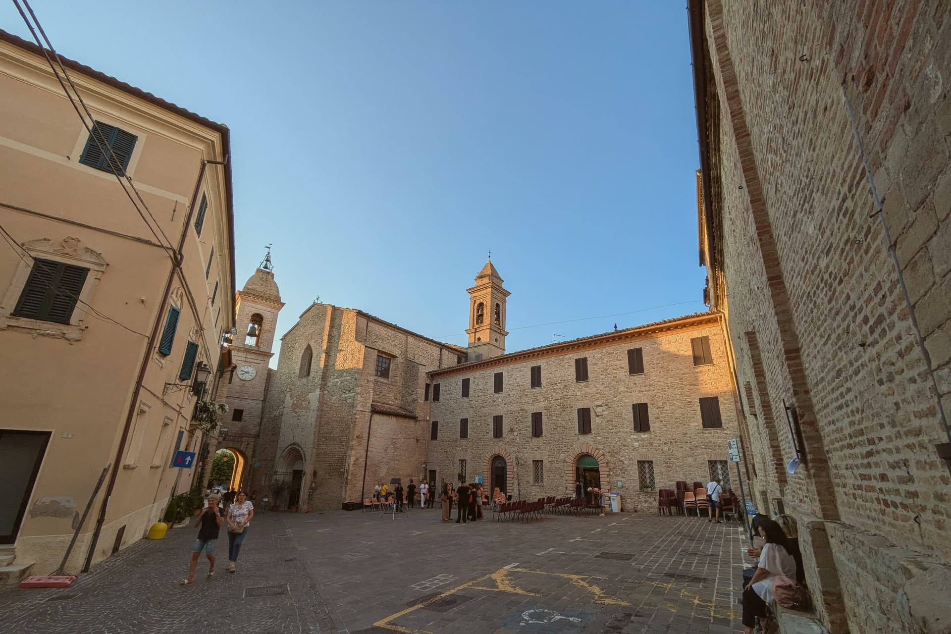
The Marche behind Ancona is a country of ridges, and every ridge carries a town built of pale brick and river stone, walled, arcaded, with a piazza that doubles as a dining room when the weather turns. Autumn is the season the interior organises itself around: white truffles dug in the oak woods above the Cesano valley, chestnuts roasted at the edge of the Sibillini, ciauscolo, the soft spreadable salami of these hills, cut into bread still warm. Verdicchio comes off the slopes around the Esino in September and the vermouth-coloured evenings smell of must. What you eat in these towns is what grows within sight of the walls, which is why the festivals exist at all.
The coast takes almost everyone. Cruise passengers land at the port of Ancona and go straight to the Conero riviera, to Sirolo and Numana and the white cliffs above the Due Sorelle, and the beaches there are full from June to September while the ferries run to Croatia and Greece. It is a good coast, and it is also the only part of the region most visitors ever see. The inland roads stay quiet in the same weeks.
The same limestone that makes the Conero headland runs back inland into gorges and hill ridges, and the food that supplies the coastal restaurants is grown up there. These are the towns holding the sagre: one ingredient, one weekend, tables in the street, cooked by people who have cooked it their whole lives. Most sit within an easy drive of Ancona, and fewer people go.
Of the 35 communes we have mapped within 90 minutes of Ancona, 12 qualify as hill towns with a food festival: each is an inland hill settlement, and each holds a recurring food festival built around one local ingredient. This list is 10 of them. The smallest, Montefiore dell'Aso, has 1,986 residents.
Elsewhere in the catalogue: The 10 best hill towns that eat well within 90 minutes of Ancona and The prettiest villages with a food festival in Marche.
Staffolo
Why visit Staffolo
Staffolo rises to 442 meters on a hill between the Esino, Misa and Musone valleys, thirty-five kilometers from Ancona. The town calls itself the Balcone della Vallesina for the panoramic ridge it stands on, and Colle del Verdicchio for the vines that cover the south-facing slopes around it.
Verdicchio cultivation here is documented from 1569; the surrounding Castelli di Jesi DOCG zone draws from south-facing parcels between 220 and 500 meters of altitude. The centro storico is almost circular, walled with partly original ramparts and entered through two opposing gates; the fourteenth-century Albornoz tower rises above the walls.
The Museo dell'Arte del Vino, carved into rooms inside the walls themselves, holds an oak press from 1695 and the working tools of the local cellars, with an enoteca attached. Three churches anchor the village: Sant'Egidio with a fifteenth-century Master of Staffolo polyptych, San Francesco with a 1769 Callido organ, and the baroque Santa Maria di Castellaretta built by survivors of the Battle of Lepanto.
What to see in Staffolo
- Centro storico. Almost circular walled medieval nucleus with partly original ramparts, two opposing gates and the fourteenth-century Torre Albornoz rising above the circuit.
- Museo dell'Arte del Vino. Wine museum carved into rooms inside the walls themselves, holding an oak grape press from 1695 and the working tools of the Staffolo cellars, with attached enoteca.
- Chiesa di Sant'Egidio. Parish church on the ridge, holding a fifteenth-century polyptych by the anonymous Master of Staffolo of the Fabrianese school.
How to get to Staffolo
Ancona is roughly 42 minutes away by road.
Our tip
April through June and September into October are the best months for Staffolo. The ridge stays cooler than the valleys below, the vineyards turn green by April and gold from late September, and the views to the Adriatic and the Apennines run cleanest in the dry weeks. July and August can touch the high twenties at 442 meters, but the breeze along the Vallesina ridge moves through town most afternoons. Verdicchio Festival falls in August.
Petritoli
Why visit Petritoli
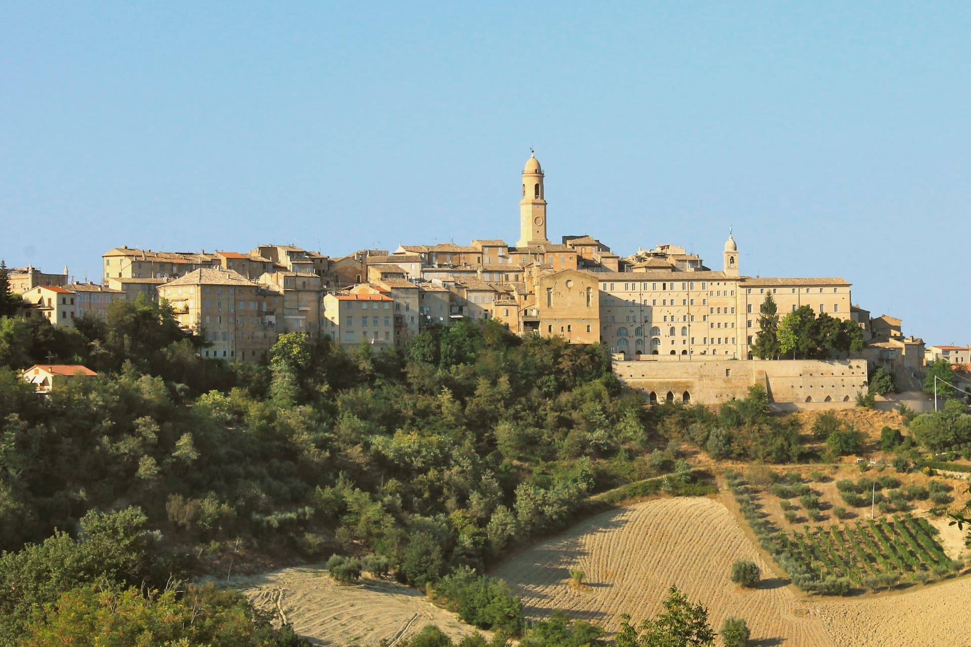
Petritoli sits in the southern Fermano, fifty kilometers north of Ascoli Piceno, on a turn-off from the Via Salaria that linked Ascoli to Fermo. The name and the site trace back to the three original nuclei, Petrosa, Petrania and Petrollavia, which merged into one hilltop settlement around the year 1000.
Their union is still legible in the stepped streets of the centro storico, where the three castle quarters knit together inside a single circuit of walls. The town looks outward as much as inward.
From the civic tower the ground falls away to the Aso valley, and on clear days the view reaches the Sibillini beyond it. Below the walls, the valley floor carries olive groves and mulberries, and oil, fruit and small-scale wine still form the working base of the local economy.
Some buildings were damaged in the 2016 earthquake and repaired in stages afterward, the town's ordinary continuity interrupted but not ended. What holds the place together, in the end, is that continuity: three separate castles resolved into one hill village, still worked from the valley it overlooks.
What to see in Petritoli
- Tre Archi. The arches frame the approach to the centro storico from below, the two flanking towers still rising clear of the newer construction around them.
- Teatro dell'Iride. Designed by Giuseppe Sabbatini, 270 seats across three tiers of boxes, still in seasonal use for concerts and prose.
- Torre Civica. Medieval civic tower above the centro storico, with views across the Aso valley to the Sibillini on clear days.
How to get to Petritoli
Ancona is roughly 67 minutes away by road.
Our tip
April through June and September into October are the months for Petritoli. The Aso valley turns green from April, the olive groves below the walls show pale silver from May, and the Sibillini line up clearest on autumn mornings. July and August touch the low thirties; the hilltop catches more breeze than the valley floor but the centro storico empties through the hottest afternoons. Sagra della Sporbatura falls in August.
Serra San Quirico
Why visit Serra San Quirico
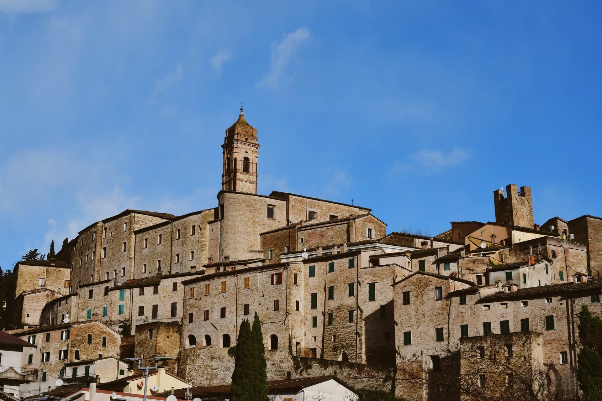
Serra San Quirico sits at 409 meters on the left bank of the Esino river, at the foot of Monte Murano and the entrance to the Gola della Rossa, forty-five kilometers from Ancona. Etruscan, Picene and Roman remains have been found in the area; the Romans established a military garrison that grew into the original village.
The medieval town is built almost entirely in stone and rock, ringed by walls dating to around 1300. Above those walls run the Copertelle, covered passageways that line the outer circuit, the true visual signature of the borgo.
The Santa Lucia complex, the former monastery in the centro storico, houses the headquarters of the Parco Naturale Regionale della Gola della Rossa e di Frasassi, the 9,167-hectare regional park that runs from Serra south to the Frasassi caves. The Chiesa di Santa Lucia, baroque inside with marble decoration and gold-leaf stucco, sits next door.
The Festa del Centro Storico in late July fills the stone lanes with theatrical reenactments.
What to see in Serra San Quirico
- Le Copertelle. Covered passageways running above the medieval outer walls from around 1300, the true visual signature of the stone borgo.
- Chiesa di Santa Lucia. Baroque church in the centro storico, with marble decoration, gold-leaf stucco and a Pasqualino Rossi seventeenth-century altarpiece.
- Parco Naturale Gola della Rossa e di Frasassi. 9,167-hectare regional park with headquarters at the Santa Lucia complex in the centro storico, running south to the Frasassi caves.
How to get to Serra San Quirico
There is a railway station in the town, so you can arrive without a car and never need one while you are here. Ancona is roughly 49 minutes away by road.
Our tip
April through June and September into October are the best months for Serra San Quirico. The Esino valley turns green from April, the Gola della Rossa runs cool through the limestone walls, and the autumn light brings out the stone of the Copertelle along the outer ring. July and August touch the high twenties at 409 meters; the gorge stays cooler than the valley floor and the centro storico catches afternoon breezes off the ridge. Sagra del Coniglio in Porchetta falls in July.
Sarnano
Why visit Sarnano
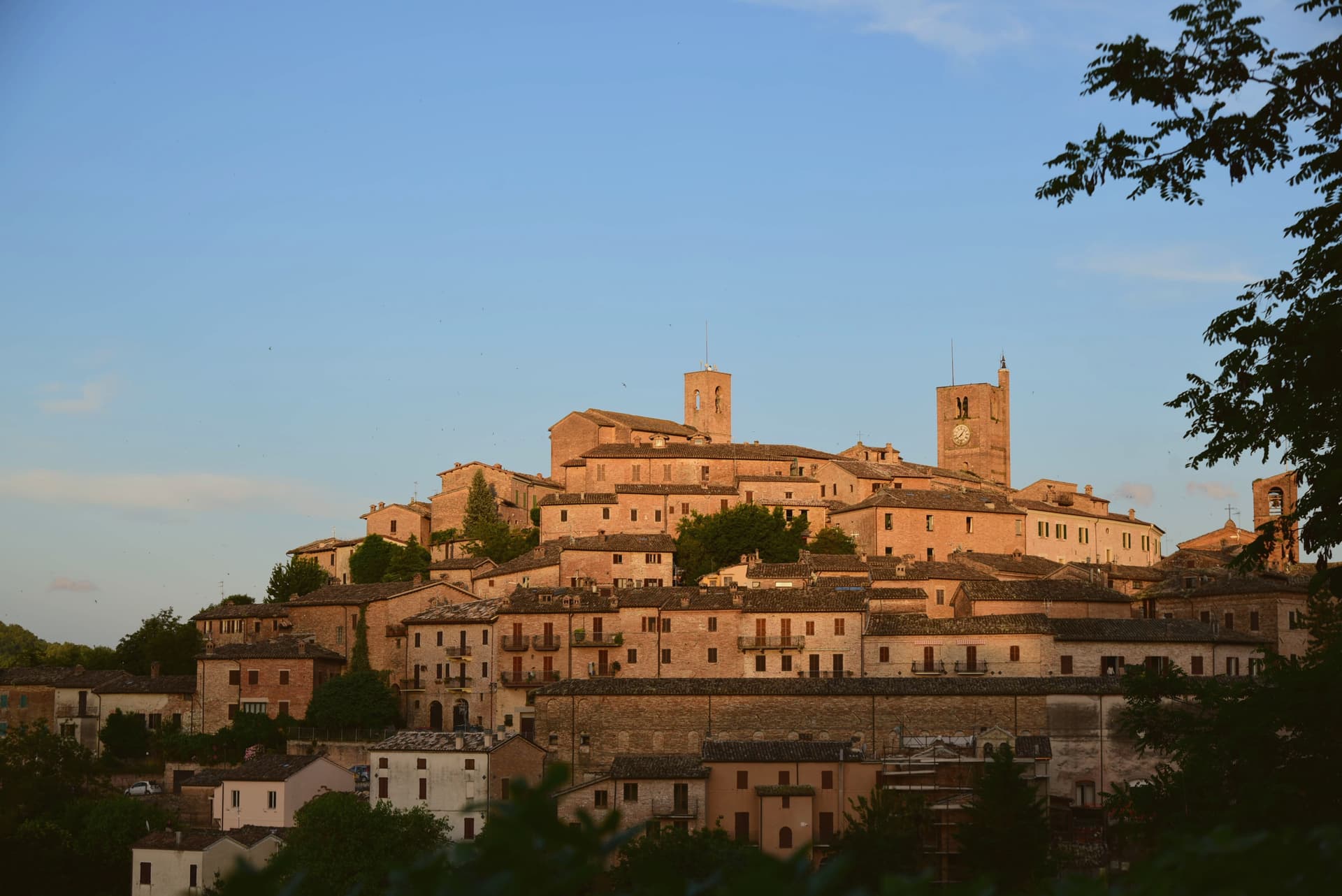
Sarnano sits on a hill within the Monti Sibillini National Park, seventy kilometers from Ancona. The old free commune built its civic center at the top of the settlement, where the square gathers the palazzi of the medieval government side by side with the church, a small stage for a town that once governed itself.
Below, the brick lanes drop away in concentric rings, the same baked brick used for houses that bridge the streets overhead and for small doors set into the walls to mark where the dead were once carried out. The spa lay downhill from the old town, drawing on springs pure enough to be used for respiratory, rheumatic and joint treatments from the 1930s until the earthquake of 24 August 2016 shut the historical building down; a new facility is being built to replace it.
Above the town, on Sassotetto, the ski slopes and the Sasso Spaccato mark the upper territory as the seasonal counterpart to the streets below. The town reads, then, as a set of layers stacked by elevation and by era: a governing hilltop, a residential brick warren beneath it, a therapeutic spa at the edge, and a working mountain above, each holding its own use across centuries rather than competing for the same one.
What to see in Sarnano
- Piazza Alta. The fourteenth-century Palazzo del Popolo, Palazzo dei Priori and Palazzo del Podestà stand together on the small civic stage of the old free commune, the church at their side.
- Centro storico di Sarnano. The lanes wind in concentric rings, crossed overhead by ponte houses, and small bricked-up doors of the dead are set into the walls at intervals along the brick.
- Chiesa di Santa Maria di Piazza Alta. Romanesque-gothic facade on the square's church, which once held the town's civic art collection, since moved to the Pinacoteca.
How to get to Sarnano
Ancona is roughly 84 minutes away by road.
Our tip
April through June and September into October are the best months for Sarnano. The Sibillini meadows turn green from May, the lavender fields above town bloom in early July, and the autumn light brings the brick centro storico to its warmest tone. July and August touch the high twenties at 539 meters but the elevated position and the forested slopes above keep the evenings cool. Festa del Ciauscolo e del salame spalmabile falls in September.
Arcevia
Why visit Arcevia
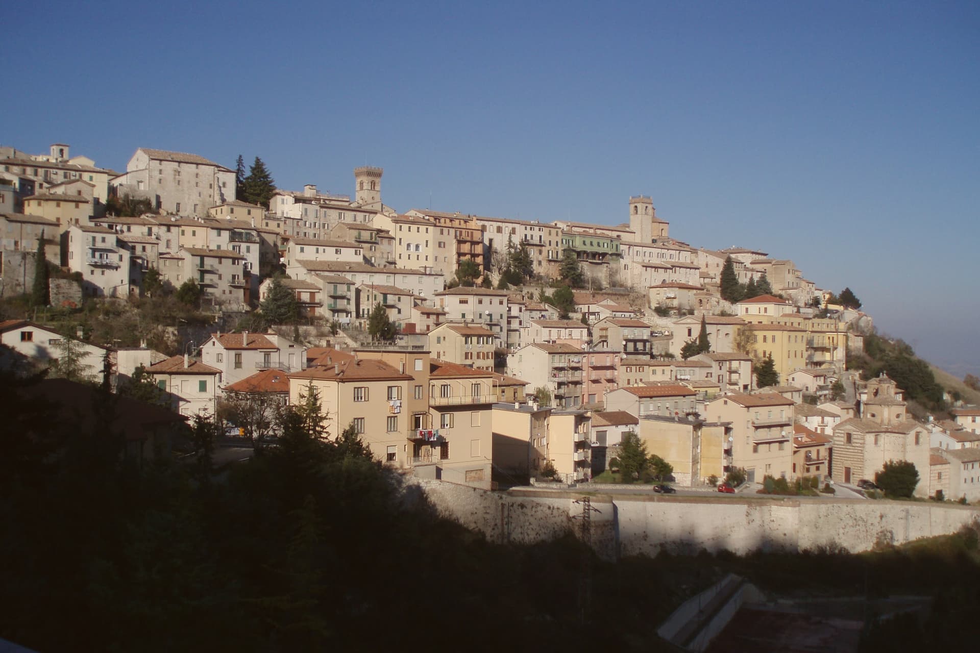
Arcevia sits at 535 meters between the Misa and Nevola valleys, forty-five kilometers from Ancona and inside the Parco Naturale Regionale della Gola della Rossa e di Frasassi. The town was the medieval seat of a free commune that built nine fortified satellite villages on the surrounding ridges between the thirteenth and fifteenth centuries to defend its territory against Serra San Quirico and other rivals: Avacelli, Castiglioni, Caudino, Loretello, Montale, Nidastore, Palazzo, Piticchio and San Pietro.
Loretello, the oldest, was founded in 1072 by the monks of Fonte Avellana. Each of the eight surviving castles retains its original layout, defensive walls and watchtower; together they form one of the most coherent medieval fortified networks in central Italy.
The Collegiata di San Medardo, in the capoluogo, holds a Luca Signorelli polyptych and a Giovanni della Robbia terracotta altarpiece. The Misa valley wines and the cooperative-pressed olive oil carry the local table.
What to see in Arcevia
- I Nove Castelli. Avacelli, Castiglioni, Caudino, Loretello, Montale, Nidastore, Palazzo, Piticchio and San Pietro: medieval fortified villages on the ridges around the capoluogo.
- Castello di Loretello. Oldest of the nine, founded 1072 by the monks of Fonte Avellana, expanded in the late fourteenth century, intact circuit of walls.
- Collegiata di San Medardo. Capoluogo's main church, holding a Luca Signorelli polyptych of 1507 and a Giovanni della Robbia terracotta altarpiece.
How to get to Arcevia
Ancona is roughly 69 minutes away by road.
Our tip
April through June and September into October are the best months for Arcevia. The Misa and Nevola valleys turn green from April, the vineyards on the surrounding ridges color from late August, and the woodland trails to the satellite castles stay open through autumn. July and August touch the high twenties at 535 meters; the ridge breeze keeps the centro storico cooler than the valley floor. Festa del Tartufo Nero Estivo falls in August.
Pergola
Why visit Pergola
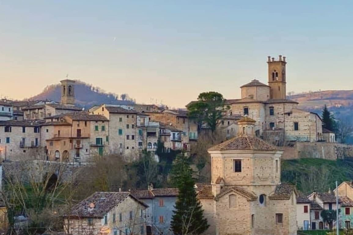
Pergola sits at 265 meters on a terrace at the confluence of the Cesano and the Cinisco, fifty-five kilometers from Ancona in the inland Apennines. The town was founded in 1234 by the people of Gubbio with inhabitants of the surrounding castles, raised on older Roman ground along the Via Flaminia.
The defining find is the Bronzi Dorati da Cartoceto: hundreds of gilded bronze fragments unearthed in June and July 1946 at Santa Lucia di Calamello, in the frazione of Cartoceto, the only surviving group of Roman gilded bronze statues from antiquity. Reassembled into two standing women, two riders and two horses, the group dates to the late Republican period between 50 and 30 BC and is held in the Museo dei Bronzi Dorati, opened on 9 October 1999 in the fourteenth-century convent of San Giacomo.
Pergola is also a Città del Tartufo, with the Mostra Mercato del Tartufo Bianco Pregiato running across three weekends in October.
What to see in Pergola
- Museo dei Bronzi Dorati e della Città di Pergola. Opened 9 October 1999 in the fourteenth-century former convent of San Giacomo, holding the only surviving group of Roman gilded bronze statues, found at Cartoceto in 1946.
- Bronzi Dorati da Cartoceto di Pergola. Two standing women, two riders and two horses in gilded bronze from the late Republican period, 50 to 30 BC, the only surviving group of its kind in the world.
- Cattedrale di San Secondo. Pergola was a co-cathedral diocese until 1986; the cathedral on the central piazza holds works tied to the medieval and renaissance town.
How to get to Pergola
Ancona is roughly 75 minutes away by road.
Our tip
April through June and September into October are the best months for Pergola. The Cesano valley turns green in spring, the white truffle woods open from late September, and the inland Apennine air stays clearer than the coast on summer days. July and August touch the high twenties at 265 meters, with the centro storico quietest through midday. Sagra delle Tagliatella falls in August.
Montecosaro
Why visit Montecosaro
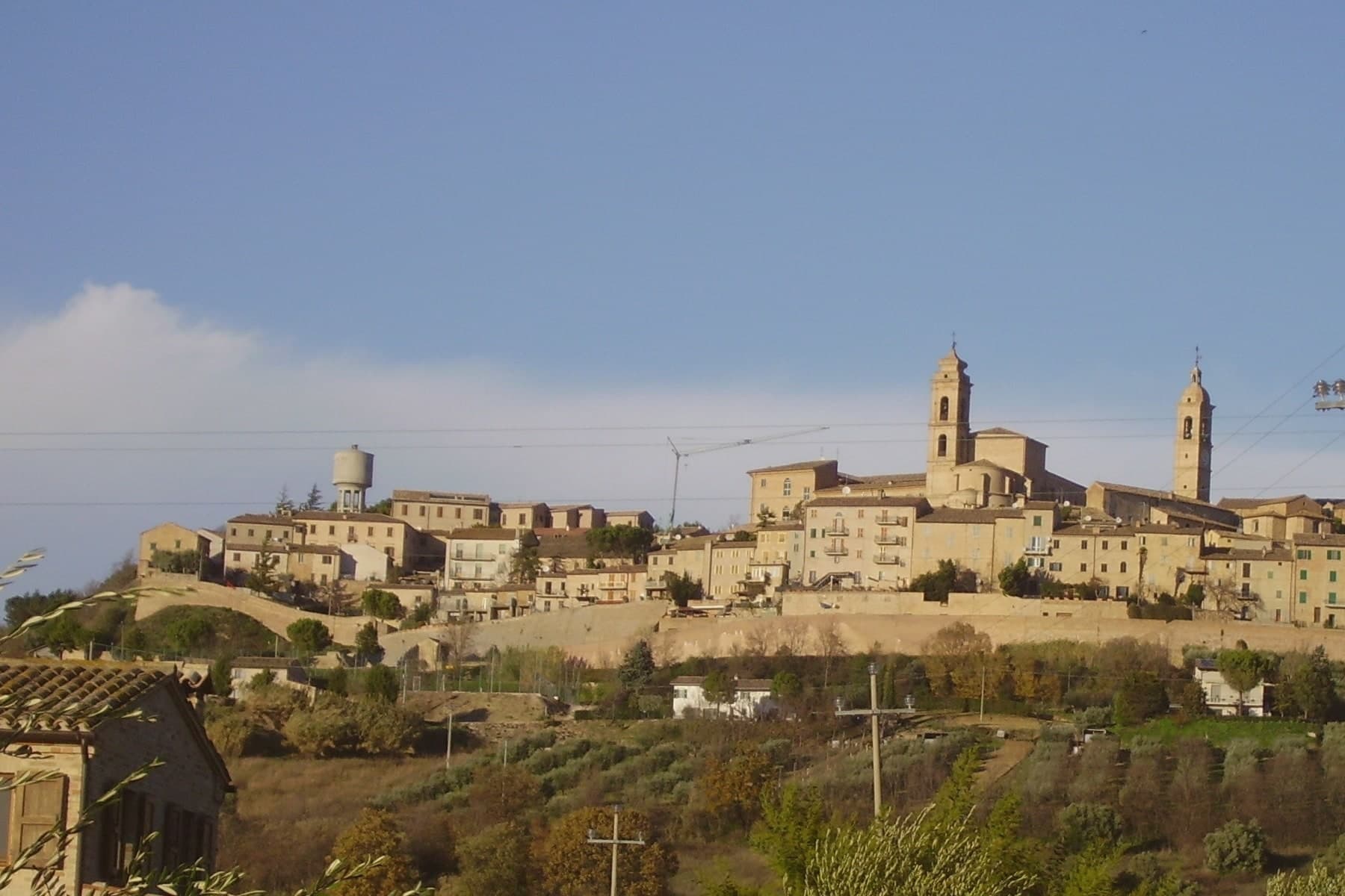
Montecosaro sits at 267 meters on a hill above the lower Chienti valley, fifteen kilometers from Macerata and inland from the Adriatic at Civitanova. The first record of a monastery in the river plain dates to 936, when the abbot Ildebrando received the church of Santa Maria from Farfa.
The current Basilica di Santa Maria a Piè di Chienti was raised in 1125 by the Lombard abbot Agenolfo, on the left bank a few kilometers from the river mouth: a three-nave Romanesque church with a raised presbytery and a ring of apsidioles, holding among the strongest Cluniac architecture in central Italy. The hilltop borgo above grew from a medieval castle after 1200, walled in the fourteenth century inside an oval that culminates at the Cassero, the former fortress now a public garden.
The Augustinian convent and the church of Sant'Agostino in the upper town date from the same century, rebuilt in the late eighteenth.
The re-enactment here is Contesa dei Cento Ducati, usually held in August.
What to see in Montecosaro
- Basilica di Santa Maria a Piè di Chienti. Romanesque church rebuilt in 1125 by the Lombard abbot Agenolfo on a Farfa monastic foundation of 936, three naves with raised presbytery and apsidioles.
- Centro storico. Oval-walled medieval centro storico on the hill, with fourteenth-century walls and concentric streets climbing toward the Cassero.
- Cassero. Highest point of the walled borgo, where the medieval fortress once stood, now a public garden with views over the Chienti valley.
How to get to Montecosaro
There is a railway station in the town, so you can arrive without a car and never need one while you are here. Ancona is roughly 46 minutes away by road.
Our tip
April through June and September into October are the best months for Montecosaro. The Chienti valley turns green in spring and gold through the autumn harvest weeks, with mild afternoons on the hilltop and long views from the Cassero across to the Sibillini. July and August touch the low thirties; the hill catches more breeze than the river plain below, and the Basilica di Santa Maria stays cool through the day. Contesa dei Cento Ducati falls in August.
Morrovalle
Why visit Morrovalle
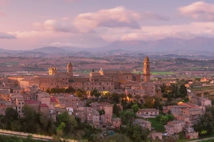
Morrovalle sits eleven kilometers east of Macerata, on a hill above the lower Chienti valley. The Roman municipality of Pausolae stood nearby, but the present town grew in the early Middle Ages from a ministerium de Valle dependent on the bishop of Fermo, with a castle called Mor-ro on the hilltop that gradually freed itself from episcopal control.
That castle is the origin of the walled centro storico that still occupies the hilltop today, its layout and signage now recognized as an orange flag town. Just outside those walls stands the former convent, founded around 1290 and now serving as an auditorium.
On the night between 16 and 17 April 1560 a fire destroyed its conventual church, and clearing the high altar on 27 April revealed a consecrated host and a silver pyx intact in a wall cavity, an event a pope authenticated by bull that September. Works recovered from the burned church were later moved to the parish church in the centro storico, tying the hilltop town to the convent below it.
Below both, the slopes descend toward the Chienti, where the same hills that gave the town its defensive position now carry the vineyards of the surrounding wine commune.
What to see in Morrovalle
- Ex Convento di San Francesco (Auditorium Borgo Marconi). Franciscan convent founded around 1290 just outside the walls, its conventual church the site of the fire that produced the Eucharistic Miracle. The building now serves as the municipal auditorium.
- Centro storico. Walled medieval hilltop layout with the signage and visitor route that earned the Bandiera Arancione recognition.
- Palazzo Lazzarini. Noble palace on Piazza Vittorio Emanuele, with a brick facade and a portal that frames the civic centre of the medieval borgo.
How to get to Morrovalle
There is a railway station in the town, so you can arrive without a car and never need one while you are here. Ancona is roughly 50 minutes away by road.
Our tip
April through June and September into October are the best months for Morrovalle. The Chienti valley turns green by late April and gold through August, the hilltop catches Adriatic breezes from the coast eighteen kilometers east, and the Sibillini stay visible on clear afternoons. July and August touch the low thirties, with the centro storico quietest between three and seven. Calici di Stelle falls in August.
Fermo
Why visit Fermo
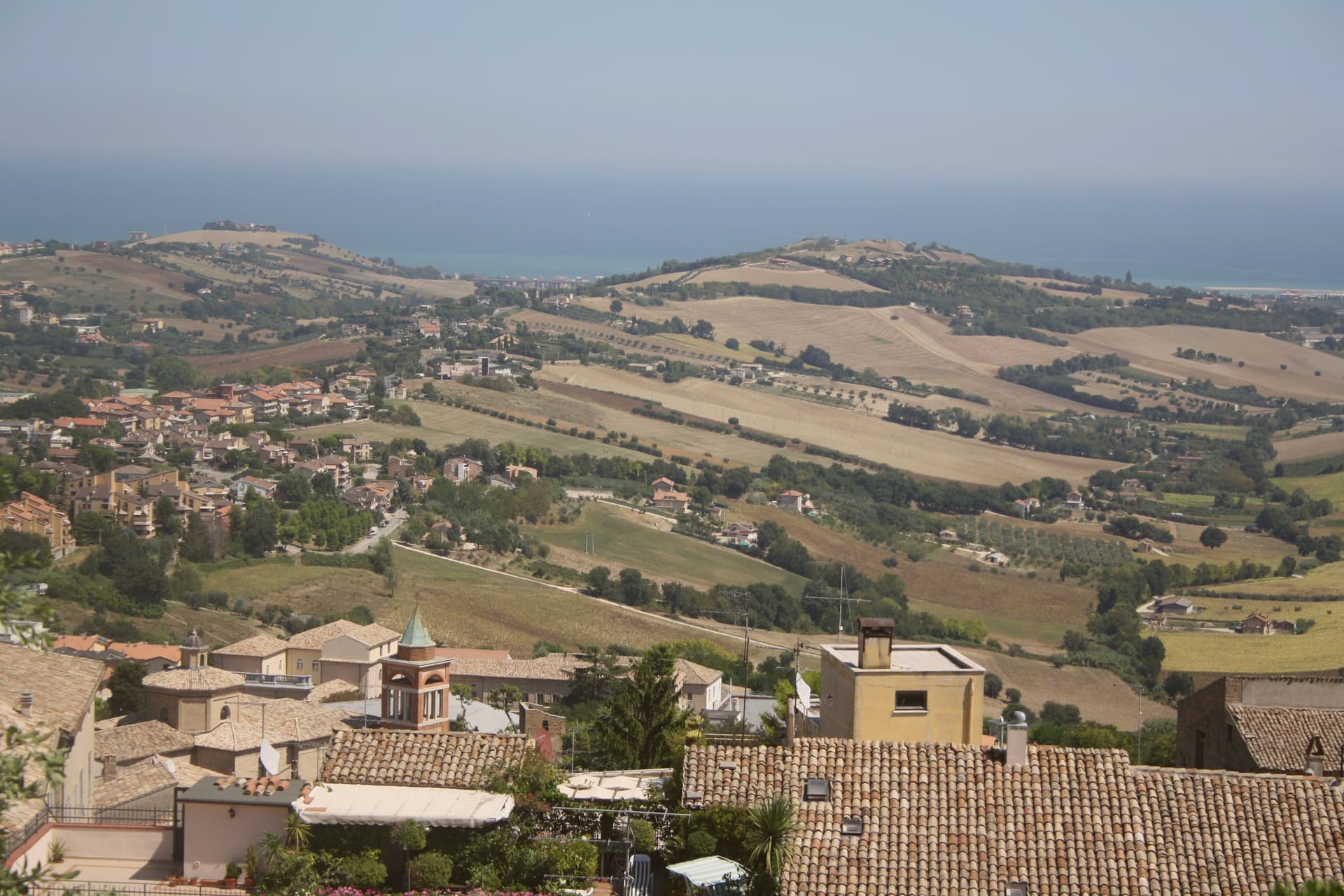
Fermo sits eight kilometers inland from the Adriatic and from the seaside frazione of Lido di Fermo, which holds the commune's Bandiera Blu: a hill town with its own beach attached at a distance, the two connected by the same municipal boundary but separated in character and elevation. The Roman colony of Firmum Picenum was founded on the hilltop in 264 BC after the conquest of the Picentes, with six thousand Latin colonists settled there.
In the tenth century the town became the capital of the Marchia Firmana, the territorial label that eventually gave the region its name. The historic center still reads as a hilltop capital looking down toward a coast it administers rather than touches.
What began as a Latin colony on high ground, gained a name that outgrew it and spread to the whole region, and kept its port at arm's length: the distance between the hill and the shore is not incidental but the shape of how Fermo has always held its territory.
The re-enactment here is Cavalcata dell'Assunta, usually held in August.
What to see in Fermo
- Cisterne Romane. Thirty barrel-vaulted rooms in three parallel rows under the historic center, opus signinum waterproofing still in place, built to hold 15,000 cubic meters of water.
- Piazza del Popolo. The porticoes meet at the head of the square where the Palazzo dei Priori stands, the arrangement that has organized the civic center since the medieval period.
- Palazzo dei Priori. Built in 1296 by joining a thirteenth-century palace and a church, housing the Pinacoteca Civica, the Sala del Mappamondo and the Sixtus V bronze statue.
How to get to Fermo
Ancona is roughly 60 minutes away by road.
Our tip
April through June and September into October are the months for Fermo. The hilltop catches Adriatic light without coastal humidity, the Sabulo's wide views across the Aso and Tenna valleys run clear, and Lido di Fermo's beach eight kilometers below holds its Bandiera Blu status from May. July and August touch the low thirties in the valley but the centro storico stays cooler at 319 meters; the Cavalcata dell'Assunta on August 15 fills the streets with the historic medieval procession dating to 1182. Cavalcata dell'Assunta falls in August.
Macerata
Why visit Macerata
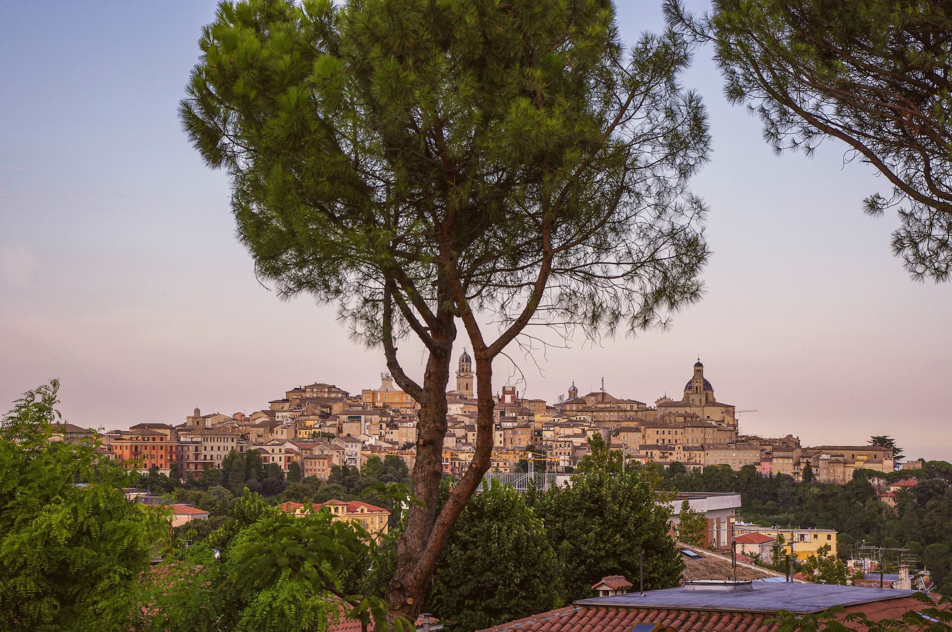
Macerata sits at 315 meters on a hilltop between the Chienti and Potenza valleys, thirty-five kilometers south of Ancona. The Roman Helvia Recina stood on the plain below; after the city was destroyed by the Goths the survivors moved up to the present site, where the town grew into the provincial capital.
The University, founded in 1290, is one of the oldest in continuous operation in Europe. The Sferisterio, the city's signature monument, is a 100-meter neoclassical arena designed by Ireneo Aleandri in 1823, originally built for pallone col bracciale, the bracelet-ball game once played across central Italy.
From 1921, when Verdi's Aida was first staged there, it became one of Italy's principal open-air opera venues. The Macerata Opera Festival runs through July and August.
The provincial museum holds works by Carlo Crivelli, Lorenzo Lotto and Antonio Canova. The 2016 earthquakes damaged outlying frazioni but the centro storico held.
The re-enactment here is Rievocazione storica della Trebbiatura - Degustazione dell'oca, usually held across June and July.
What to see in Macerata
- Sferisterio. Neoclassical 100-meter open-air arena designed by Ireneo Aleandri in 1823, originally built for pallone col bracciale, now seat of the Macerata Opera Festival since 1921.
- Università di Macerata. Founded in 1290, one of the oldest continuously operating universities in Europe, with its main rectorate on Piazza della Libertà.
- Piazza della Libertà. Main square of the centro storico, holds the Loggia dei Mercanti, the Palazzo del Comune and the Torre dei Tempi with its astronomical clock.
How to get to Macerata
There is a railway station in the town, so you can arrive without a car and never need one while you are here. Ancona is roughly 58 minutes away by road.
Our tip
April through June and September into October are the best months for Macerata. The Chienti and Potenza valleys hold green from April, the centro storico runs cool in the morning and the surrounding hills toward Montelupone and Treia are open for walking. July and August anchor the Macerata Opera Festival at the Sferisterio, with three major productions across roughly six weeks; nights stay warm but the open arena keeps moving air. Rievocazione storica della Trebbiatura - Degustazione dell'oca falls in June.
More from Anywhere Italy
 The 10 best hill towns that eat well within 90 minutes of Ancona
 The prettiest villages with a food festival in Marche
- The best towns with a food festival that eat well in Marche
 The best hill towns you can reach by train within 90 minutes of Ancona
- The 9 best hill towns in the province of Ancona
 The 7 best hill towns in the province of Fermo