
The 7 best hill towns in the province of Fermo
The province of Fermo is ridge country. Villages here were set on the highest ground available, which means brick walls following the contour of a spur, arcaded streets that tilt, and belvederes that look west to the snow on the Sibillini and east to a flat grey line of Adriatic. The building material shifts as you climb: warm handmade brick in the Tenna and Aso valleys, pale stone and travertine as the ground rises towards Amandola and the mountain passes. Autumn is the season the region does best, when the vernaccia grapes come in around Serrapetrona's neighbours, chestnuts and truffles reach the market stalls, and kitchens fall back on maccheroncini di Campofilone, ciauscolo salami soft enough to spread, and lamb cooked over embers.
Most people who come to this part of the Marche point their car at the coast. San Benedetto del Tronto and the beach strip around Porto San Giorgio fill up from June, with the long rows of umbrellas, the seafront traffic and the parking that vanishes by mid-morning. The other magnet is the Sibillini themselves, where Lago di Pilato and the Gola dell'Infernaccio see coach parties and queues at the trailheads on August weekends. Both are worth the time. Both mean sharing the view.
The hills between the two are far less trafficked. The same valleys that carry the road up from the sea to the mountains are lined with small settlements that never grew because the ground would not let them, and the food, the views and the Romanesque churches carry on well past the famous names. These are the towns in this list, all inland, all built on slopes steep enough to keep them compact, and most of them reachable on a slow drive of an afternoon from one another.
Of the 8 communes we have mapped in the province of Fermo, 7 qualify as hill towns: each is an inland hill settlement built on ground too steep to spread. The smallest, Monte Rinaldo, has 317 residents.
Two more lists worth reading alongside this one: The 10 best hill towns that eat well within 90 minutes of Ancona and The best hill towns with a food festival within 90 minutes of Ancona.
Monte Rinaldo
Why visit Monte Rinaldo
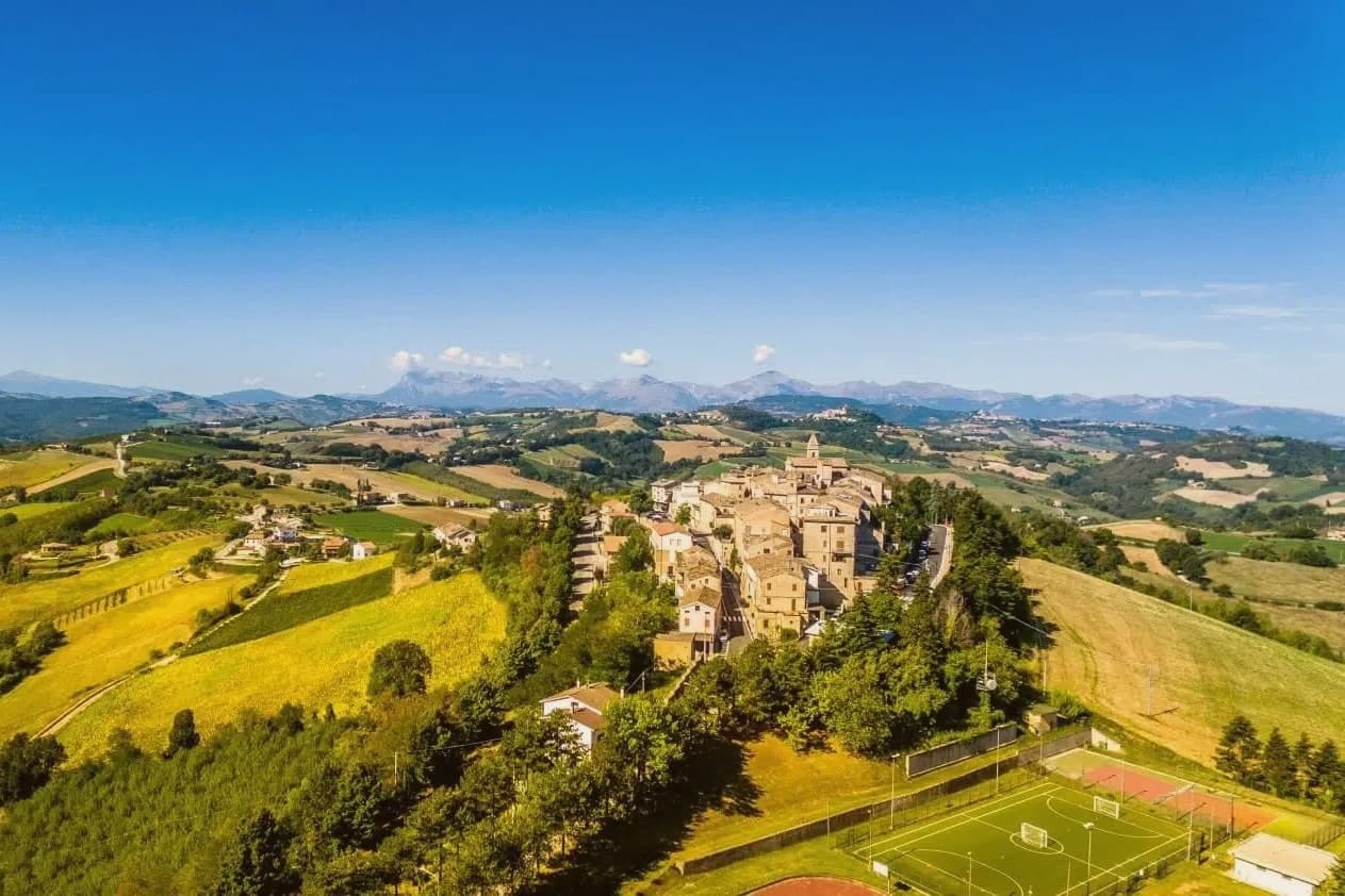
The ridge here runs between the Aso and Tenna valleys, deep in the Marche interior, 75 kilometres south-west of Ancona. Monte Rinaldo sits at 478 metres along it, one of the smallest active comuni in the region, its 317 residents keeping the village in the Borghi Autentici network.
Half a kilometre below the village, reached by a walking path through olive groves and oak woods, lies La Cuma. The sanctuary is thought to have marked a Picene-Roman religious crossroads where the ridge route linking the Adriatic coast to the Apennines passed through: a meeting point before it was a monument.
The village above holds the other half of the story in miniature, a single piazza and the parish church of San Leonardo, with the votive terracottas, coins, and fragments pulled from the excavation kept in the site museum nearby. What the ridge preserves, then, is a layered crossing: coast to mountains below, past to present in the walk between the two.
What to see in Monte Rinaldo
- Area Archeologica de La Cuma. A 38-metre Ionic portico faces a temple platform, standing to a height and completeness rare among pre-imperial sites in central Italy. The complex was found again in 1957 and lies half a kilometre below the village.
- Antiquarium / site museum. Holds the votive terracottas, coins, and architectural fragments recovered from the excavation. Small but well-catalogued.
- Centro storico. Quiet stone village around a single piazza, with the parish church of San Leonardo and views east to the Sibillini foothills.
How to get to Monte Rinaldo
Ancona is roughly 77 minutes away by road.
Our tip
May through October is the open season at 478 metres. June and September are the best months for the archaeological area — long warm light on the Ionic portico, no crowds at any time of year but those two months are the most photogenic. July and August are warm but workable at this elevation.
Moresco
Why visit Moresco
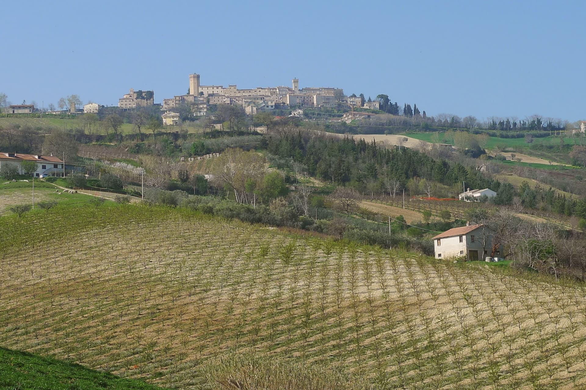
Moresco sits at 405 meters on a hill above the Aso valley, twenty kilometers from Fermo and ten from the Adriatic. The walled village holds 516 residents and a triangular piazza on the summit, with the seven-sided watchtower rising at the entrance.
The Torre Eptagonale is 25 meters high and dates to the twelfth century; its seven sides appear to be the only such plan in Europe, and the reason for the unusual geometry is not documented. The Arabic-style spire collapsed in 1918 and was replaced by the Ghibelline crenellations still in place.
The fortified castle around it passed in the thirteenth century to Federico II, then to King Manfred, and finally in 1266 to the city of Fermo through a sale to the Doge of Venice Lorenzo Tiepolo. The Chiesa di Santa Sofia and a smaller civic tower share the piazza.
The Aso valley below is planted in vineyards and orchards.
What to see in Moresco
- Torre Eptagonale. 25-meter twelfth-century watchtower with a seven-sided plan, thought to be the only one of its kind in Europe, topped by Ghibelline crenellations after the 1918 collapse of its original spire.
- Piazza Castello. Triangular summit piazza of the walled village, framed by the Torre Eptagonale, the civic tower and the Chiesa di Santa Sofia.
- Torre dell'Orologio. Smaller civic clock tower on the central piazza, alongside the heptagonal watchtower and the Santa Sofia church.
How to get to Moresco
Ancona is roughly 59 minutes away by road.
Our tip
April through June and September into October are the best months for Moresco. The Aso valley turns green in spring, vine rows fill out below the hill, and the Sibillini stay visible inland on clear days. July and August touch the high twenties on the hilltop, with the village largely empty between three and seven in the afternoon and the small piazza holding sagras through the warm evenings.
Magliano di Tenna
Why visit Magliano di Tenna
Magliano di Tenna sits at 281 meters on a low hill above the Tenna river in the province of Fermo, eleven kilometers inland from the provincial capital. The castle is first documented in 1030.
Tradition gives the foundation to a captain of fortune named Malleano or Majano around the year 1000, from whom the town took its name. By the late Middle Ages Magliano belonged to Fermo as Castrum Ultra Tomiam, an outpost on the south bank of the river.
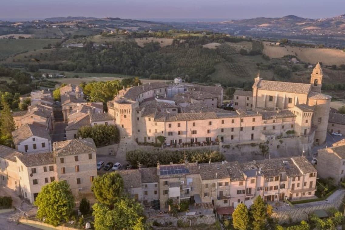
The circular fourteenth-century walls still run almost completely around the borgo. Of the original six towers, two remain visible: Porta da Bora at the northwest, the main gate and the largest tower, now a private residence, and the Torre da Sole on the south side.
The double-faced houses along the perimeter follow the line of the walls and open onto narrow inner alleys. The commune joined the Borghi Autentici d'Italia for the preserved medieval geometry.
What to see in Magliano di Tenna
- Porta da Bora. The largest of the original six towers and main northwestern gate to the borgo, now a private residence preserving its medieval profile.
- Torre da Sole. Southern tower on the perimeter walls, connected to Porta da Bora by surviving sections of fourteenth-century stonework.
- Mura medievali. Fourteenth-century walls running in a circular line around the borgo, once defended by six towers and a moat now filled in.
How to get to Magliano di Tenna
Ancona is roughly 66 minutes away by road.
Our tip
April through October is the working season for Magliano di Tenna. The Tenna valley turns green from April, the perimeter walls and the two surviving towers are walkable through the warm months, and the surrounding hills toward Fermo and Servigliano open to slow walks. July and August touch the low thirties in the valley; the borgo at 281 meters stays a few degrees cooler than the river bed below.
Petritoli
Why visit Petritoli
Petritoli sits in the southern Fermano, fifty kilometers north of Ascoli Piceno, on a turn-off from the Via Salaria that linked Ascoli to Fermo. The name and the site trace back to the three original nuclei, Petrosa, Petrania and Petrollavia, which merged into one hilltop settlement around the year 1000.
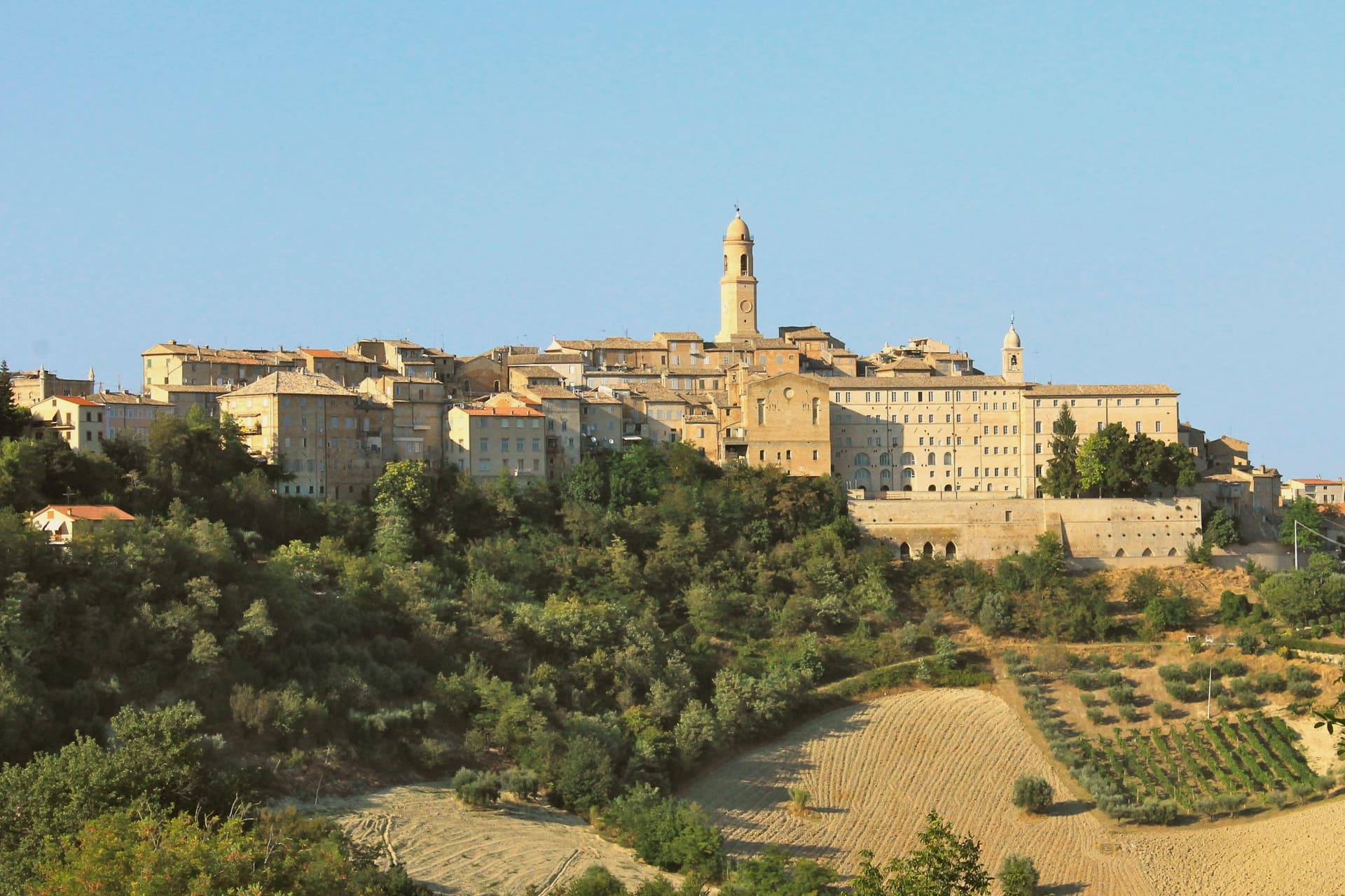
Their union is still legible in the stepped streets of the centro storico, where the three castle quarters knit together inside a single circuit of walls. The town looks outward as much as inward.
From the civic tower the ground falls away to the Aso valley, and on clear days the view reaches the Sibillini beyond it. Below the walls, the valley floor carries olive groves and mulberries, and oil, fruit and small-scale wine still form the working base of the local economy.
Some buildings were damaged in the 2016 earthquake and repaired in stages afterward, the town's ordinary continuity interrupted but not ended. What holds the place together, in the end, is that continuity: three separate castles resolved into one hill village, still worked from the valley it overlooks.
What to see in Petritoli
- Tre Archi. The arches frame the approach to the centro storico from below, the two flanking towers still rising clear of the newer construction around them.
- Teatro dell'Iride. Designed by Giuseppe Sabbatini, 270 seats across three tiers of boxes, still in seasonal use for concerts and prose.
- Torre Civica. Medieval civic tower above the centro storico, with views across the Aso valley to the Sibillini on clear days.
How to get to Petritoli
Ancona is roughly 67 minutes away by road.
Our tip
April through June and September into October are the months for Petritoli. The Aso valley turns green from April, the olive groves below the walls show pale silver from May, and the Sibillini line up clearest on autumn mornings. July and August touch the low thirties; the hilltop catches more breeze than the valley floor but the centro storico empties through the hottest afternoons. Sagra della Sporbatura falls in August.
Servigliano
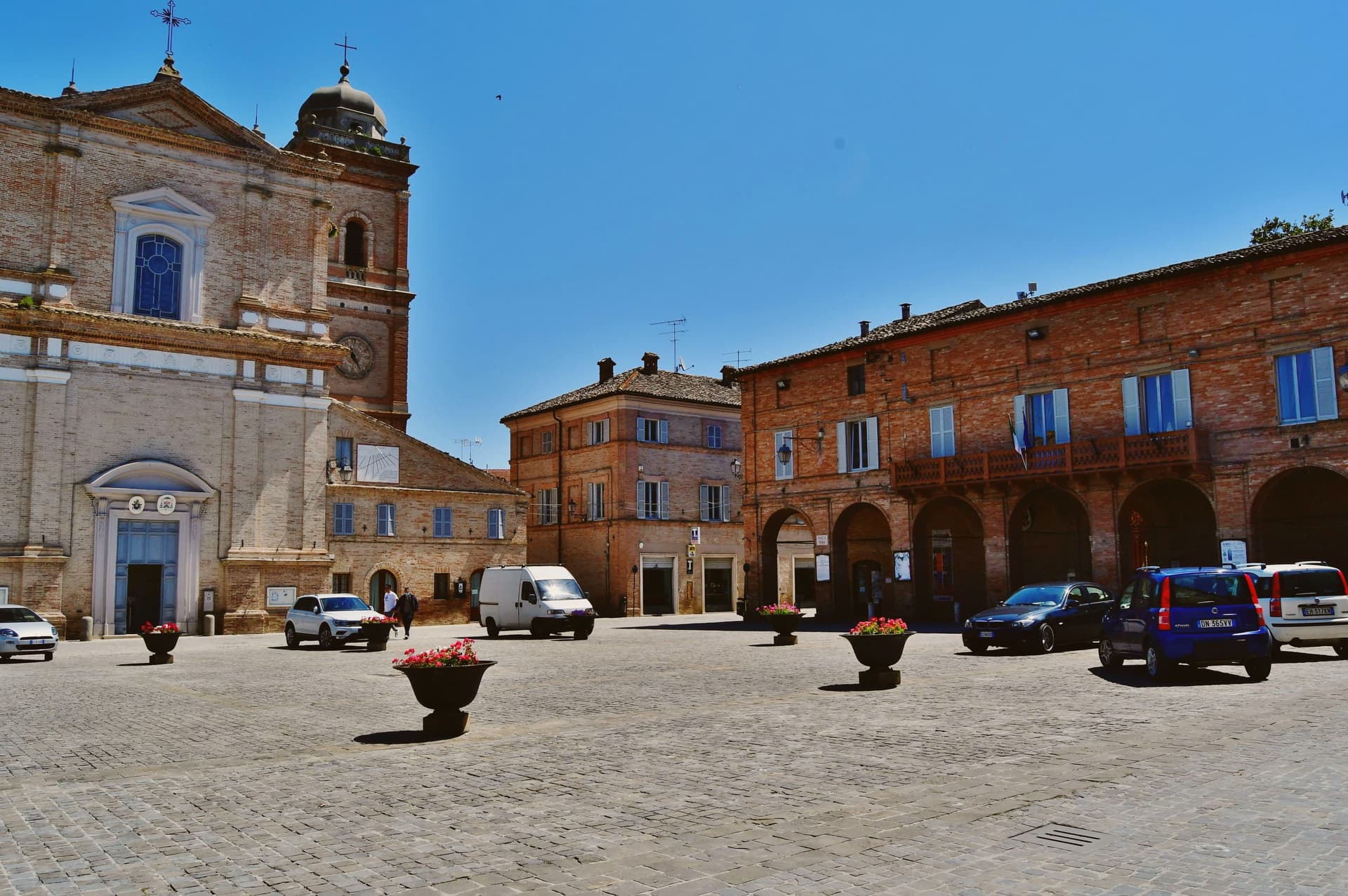
Why visit Servigliano
Servigliano sits at 215 meters above the Tenna valley, sixty kilometers south of Ancona. The old hill village began to slide in 1758, slowly enough that the inhabitants had time to abandon it.
Pope Clement XIV commissioned the architect Virginio Bracci to build a replacement on the valley floor four kilometers away, and work started in 1772. The new town was named Castel Clementino after the pontiff and kept that name for almost a century until Italian unification restored the older one.
Bracci laid it out as an ideal city: a quadrangle of 137 by 144 meters, three gates (Porta Clementina, Porta Pia, Porta Santo Spirito), a cardo and a decumano crossing at Piazza Roma, the Collegiata di San Marco closing the eastern axis. The geometry is still legible from the air.
The frazioni in the surrounding hills hold the older Servigliano, the one that slipped.
What to see in Servigliano
- Centro storico (Castel Clementino). Eighteenth-century quadrangular ideal city of 137 by 144 meters, designed by Virginio Bracci from 1772, with cardo, decumano and three monumental gates.
- Collegiata di San Marco. Eighteenth-century collegiate church closing the eastern axis of Piazza Roma, with a monumental bell tower and the relics of San Servigliano and San Gualtiero.
- Santa Maria del Piano. Oldest building of the commune, just outside the quadrilateral, built on the foundations of a Roman villa, single nave with seven side altars.
How to get to Servigliano
Ancona is roughly 80 minutes away by road.
Our tip
April through June and September into October are the best months for Servigliano. The Tenna valley turns green in spring, the wheat ripens through June, and the autumn light catches the porticoes of the new town across long afternoons. July and August can touch the low thirties; the quadrangle holds the heat, but the surrounding frazioni in the hills stay cooler.
Amandola
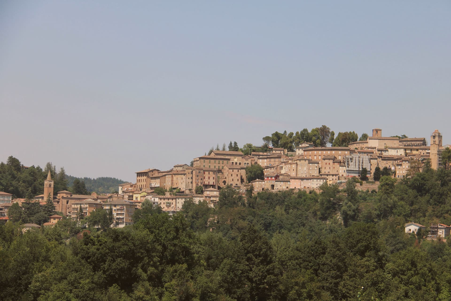
Why visit Amandola
Amandola spreads across three hills, Marrubbione, Castel Leone and Agello, on the eastern slope of the Sibillini at 550 meters, above the left bank of the Tenna river. The town was founded in 1248 from the merger of three earlier castles and grew into one of the main civic centers of the Sibillini area, with the Palazzo del Podestà built in 1352 and the tower rebuilt in 1547.
The Chiesa di San Francesco, Romanesque-gothic in the lower town, preserves a twelfth-century wooden crucifix and a cloister that now houses the Museo Antropogeografico and the museum of peasant culture. The 24 August 2016 earthquake damaged many buildings; the artworks were moved into the deconsecrated Collegiata for safekeeping while reconstruction continues.
The territory is the third largest in the Fermo province and includes 48 frazioni, beekeepers, truffle hunters and the eastern access trails into the Monti Sibillini National Park.
What to see in Amandola
- Chiesa di San Francesco. Romanesque-gothic church with twelfth-century wooden crucifix and a cloister that holds the Museo Antropogeografico and the museum of peasant culture.
- Palazzo del Podestà. Built 1352, with the tower partially rebuilt in 1547, the civic anchor of the centro storico across the Agello hilltop.
- Ex Collegiata di Santa Maria Assunta. Deconsecrated former collegiate church, now used to house artworks recovered from buildings damaged in the 2016 earthquake.
How to get to Amandola
Ancona is roughly 92 minutes away by road.
Our tip
April through June and September into October are the best months for Amandola. The Sibillini meadows above town turn green by May, the truffle woods open from September, and the Tenna valley below holds long afternoon light through autumn. July and August touch the high twenties at 550 meters but the high pastures and forest trails stay cooler; the festa weekends fill the centro storico with sagras through both months.
Fermo
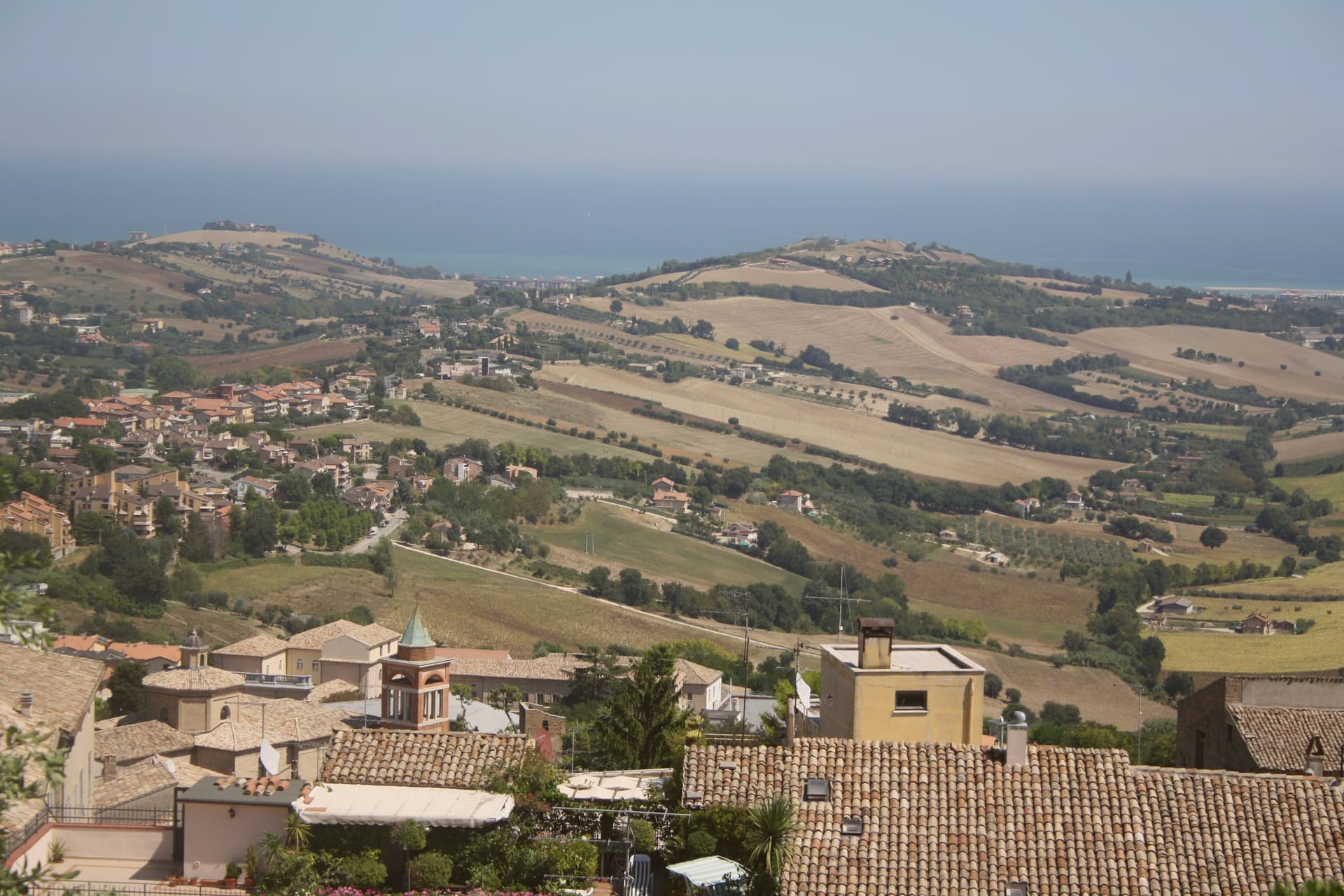
Why visit Fermo
Fermo sits eight kilometers inland from the Adriatic and from the seaside frazione of Lido di Fermo, which holds the commune's Bandiera Blu: a hill town with its own beach attached at a distance, the two connected by the same municipal boundary but separated in character and elevation. The Roman colony of Firmum Picenum was founded on the hilltop in 264 BC after the conquest of the Picentes, with six thousand Latin colonists settled there.
In the tenth century the town became the capital of the Marchia Firmana, the territorial label that eventually gave the region its name. The historic center still reads as a hilltop capital looking down toward a coast it administers rather than touches.
What began as a Latin colony on high ground, gained a name that outgrew it and spread to the whole region, and kept its port at arm's length: the distance between the hill and the shore is not incidental but the shape of how Fermo has always held its territory.
What to see in Fermo
- Cisterne Romane. Thirty barrel-vaulted rooms in three parallel rows under the historic center, opus signinum waterproofing still in place, built to hold 15,000 cubic meters of water.
- Piazza del Popolo. The porticoes meet at the head of the square where the Palazzo dei Priori stands, the arrangement that has organized the civic center since the medieval period.
- Palazzo dei Priori. Built in 1296 by joining a thirteenth-century palace and a church, housing the Pinacoteca Civica, the Sala del Mappamondo and the Sixtus V bronze statue.
How to get to Fermo
Ancona is roughly 60 minutes away by road.
Our tip
April through June and September into October are the months for Fermo. The hilltop catches Adriatic light without coastal humidity, the Sabulo's wide views across the Aso and Tenna valleys run clear, and Lido di Fermo's beach eight kilometers below holds its Bandiera Blu status from May. July and August touch the low thirties in the valley but the centro storico stays cooler at 319 meters; the Cavalcata dell'Assunta on August 15 fills the streets with the historic medieval procession dating to 1182. Cavalcata dell'Assunta falls in August.
More from Anywhere Italy
- The 10 best hill towns that eat well within 90 minutes of Ancona
 The best hill towns with a food festival within 90 minutes of Ancona
 The prettiest villages with a food festival in Marche
 The best hill towns with a serious restaurant in Marche
- The 6 best small hill towns that eat well in Marche
 The 7 best towns with a medieval festival in Marche