
Marche · Ancona
Arcevia
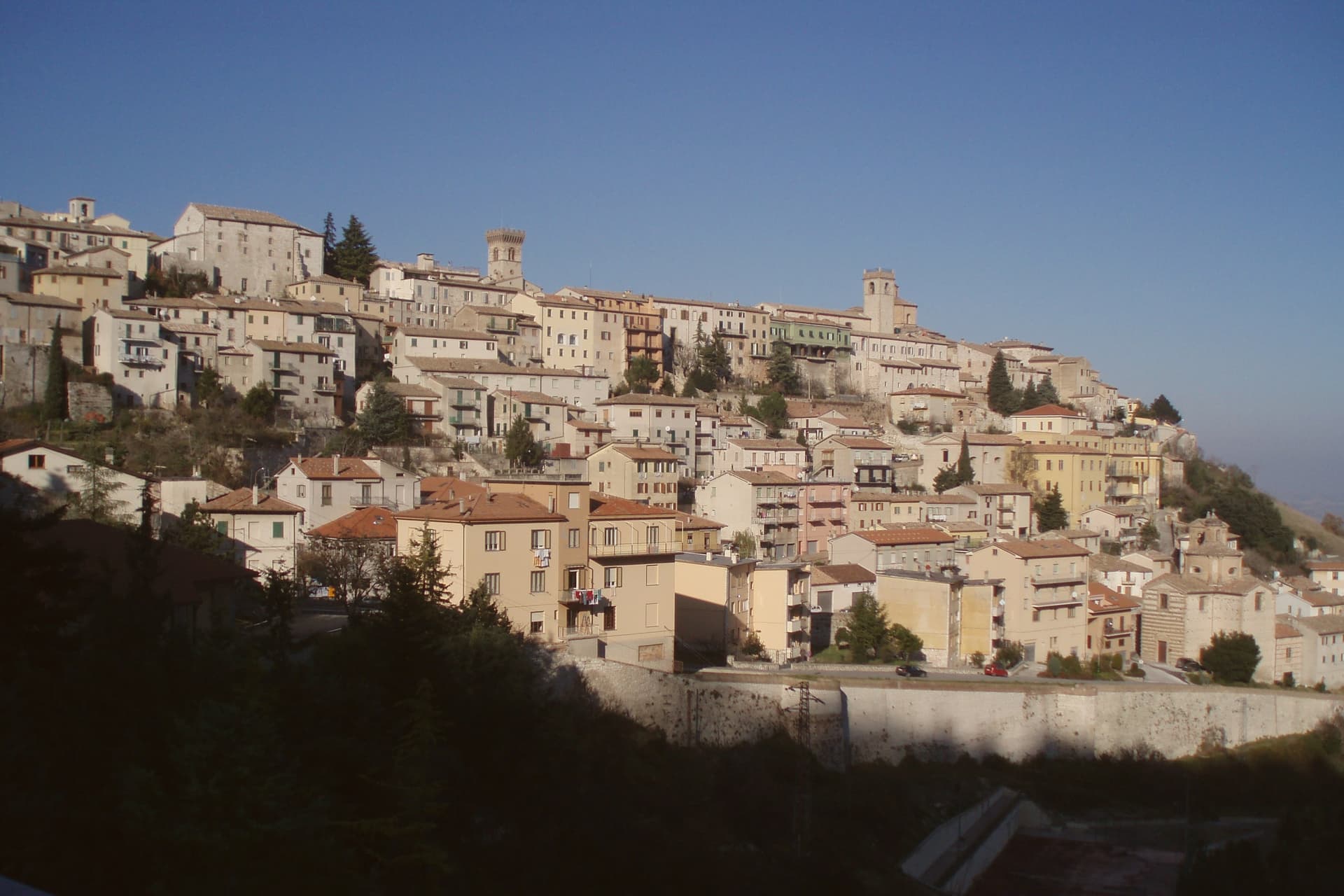
A hilltop borgo at 535 meters above the Misa and Nevola valleys, defended in the Middle Ages by a ring of nine satellite castles.
Picked by Peter Benei
Letter to come
Why Arcevia is on our list
It holds Borghi più belli d'Italia.
Subscribe and you get Arcevia's letter the day it comes out.
Visiting
- Best time
- Apr–Oct
- By car
- 1 h 9 min from Ancona
- Population
- 4,270
- J8°
- F11°
- M12°
- A15°
- M20°
- J26°
- J30°
- A29°
- S24°
- O19°
- N13°
- D10°
- Best
- Hot or crowded
- Quiet
- Mostly closed
Daytime air temperature, averages for 2020–2024. Weather data by Open-Meteo.com.
Why come
Arcevia sits at 535 meters between the Misa and Nevola valleys, forty-five kilometers from Ancona and inside the Parco Naturale Regionale della Gola della Rossa e di Frasassi. The town was the medieval seat of a free commune that built nine fortified satellite villages on the surrounding ridges between the thirteenth and fifteenth centuries to defend its territory against Serra San Quirico and other rivals: Avacelli, Castiglioni, Caudino, Loretello, Montale, Nidastore, Palazzo, Piticchio and San Pietro. Loretello, the oldest, was founded in 1072 by the monks of Fonte Avellana.
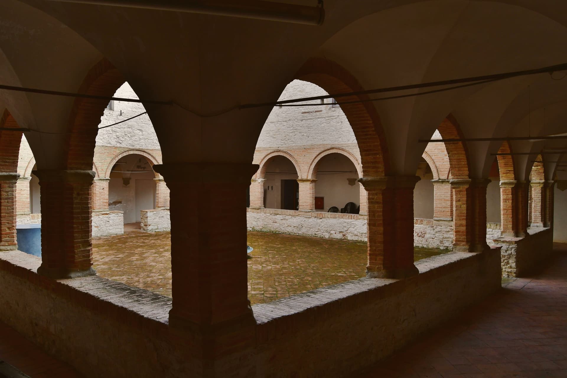
Each of the eight surviving castles retains its original layout, defensive walls and watchtower; together they form one of the most coherent medieval fortified networks in central Italy. The Collegiata di San Medardo, in the capoluogo, holds a Luca Signorelli polyptych and a Giovanni della Robbia terracotta altarpiece. The Misa valley wines and the cooperative-pressed olive oil carry the local table.
How to get there
From Ancona (AOI), about 57 min by car.
Rimini (RMI) is about 1 h 39 min away.
By car from the center of Ancona 1 h 9 min or Perugia 1 h 29 min.
Coming by train into Rimini? Arcevia is about 1 h 23 min away by road.
Every town within reach of Ancona airport.
First time driving in Italy? Read our complete manual.
What to see
I Nove Castelli
Avacelli, Castiglioni, Caudino, Loretello, Montale, Nidastore, Palazzo, Piticchio and San Pietro: medieval fortified villages on the ridges around the capoluogo.
Castello di Loretello
Oldest of the nine, founded 1072 by the monks of Fonte Avellana, expanded in the late fourteenth century, intact circuit of walls.
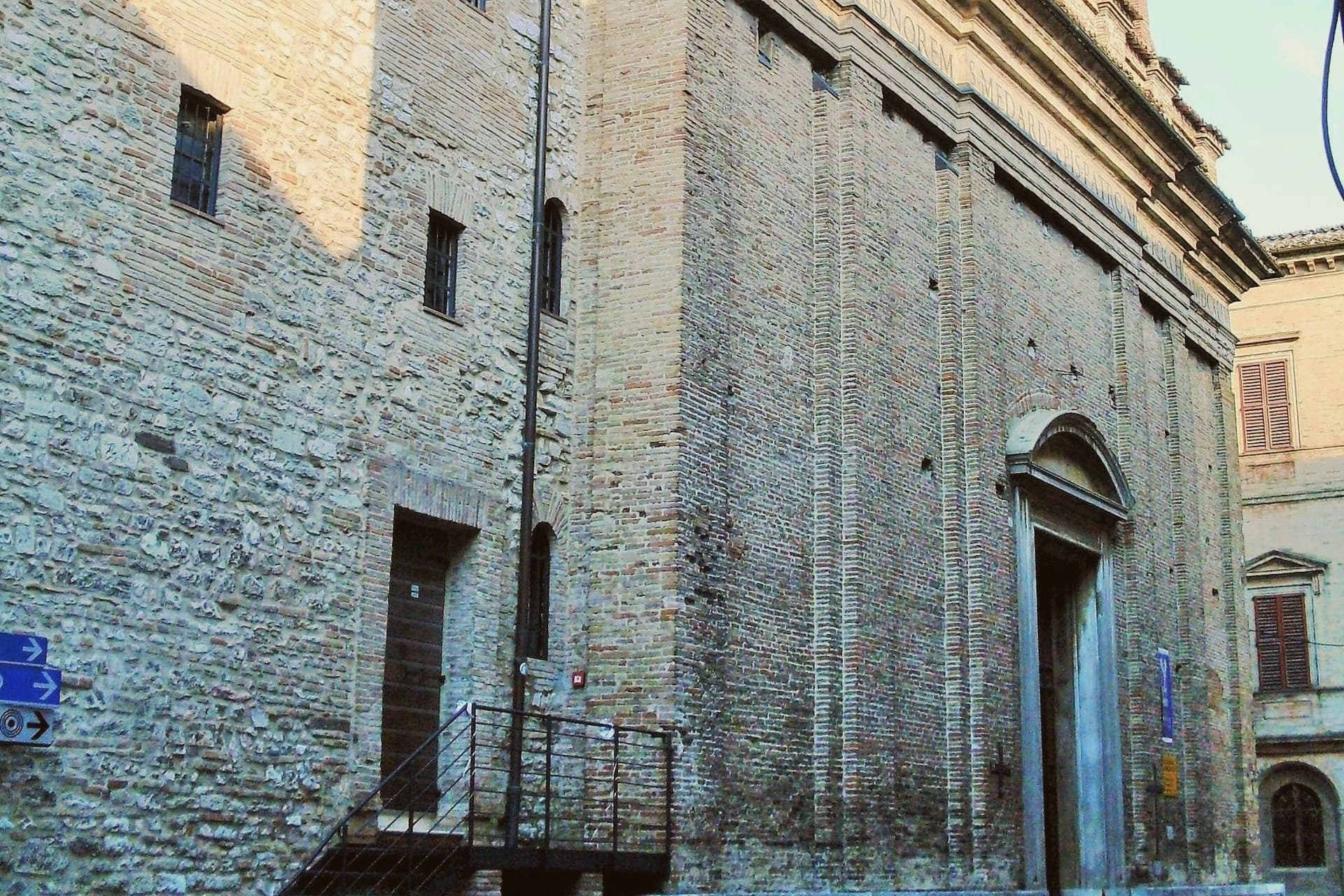
Collegiata di San Medardo
Capoluogo's main church, holding a Luca Signorelli polyptych of 1507 and a Giovanni della Robbia terracotta altarpiece.
Centro storico di Arcevia
Walled medieval centro storico on the ridge, with the Palazzo dei Priori, the Porta del Sasso, and views across both valleys.
Parco della Gola della Rossa e di Frasassi
Regional natural park covering 9,167 hectares of limestone ridges, the Frasassi caves and the Rossa gorge, with Arcevia at its northern edge.
Living here
Could you live here?
Arcevia is at the end of the road.
- A village of 4,270. The nearest town of 5,000 people, Pergola, is 26 min away: past our 15-minute rule, which makes this the end of the road.
- Fano, a city of 59,903, is 55 min by car. Inside our 30 to 60 minutes: close for the services, far enough to keep its own life.
The rules come from our series Where to Move in Italy, written from the places we have lived: Part 1, The End of the Road · Part 2, The Small Town · Part 3, The City · Part 4, The Postcard · Part 5, The Other Half. The towns we would pick are in Part 6, The Best Towns.
- Population 4,270, down 9.5% since 2015
- Nearest city Fano, 55 min drive
- Nearest national health service hospital Pergola, 12 km as the crow flies · how healthcare works in Italy
- Homes in the center: €480 to €710 per m² to buy, €1.30 to €1.90 per m² a month to rent
All the numbers Common questions, designations, lists and sources.
More about living here
- In-between
- Pharmacy in town
- High school within a 30-minute drive
- Full fibre reaches 75% of homes
- Primary school in the comune
- Earthquake zone 2, medium hazard
- Ancona airport (AOI), 57 min drive, the nearest with scheduled flights
- Regional capital Ancona, 1 h 9 min drive
If you are moving here
Who lives here
13% of residents are foreign citizens, most often from Pakistan, Bangladesh and Argentina, against 9% across Italy. 87 of them come from English-speaking countries or western and northern Europe, mostly Germany, the Netherlands and the United Kingdom. There are 381 people over 65 for every 100 children under 15, against 216 across Italy. 50% of homes have no resident, holiday homes and empty ones counted together, against 27% across Italy. Ancona province ranks 30th of 107 in Il Sole 24 Ore's quality of life ranking for 2025.
Health and schools
The nearest emergency room is in Pergola, 12 km as the crow flies. The nearest major one is in Ancona, 45 km away. The nearest children's emergency room is in Ancona, 45 km away. The nearest IB school is International School of Rimini, 69 km as the crow flies. The nearest school listed as international is Assisi International School, 58 km away.
Information, not medical advice. Confirm with a professional.
Taxes
A home that is not your main one pays 1.04% a year in property tax, charged on the cadastral value rather than the price. A main home pays none unless it is in a luxury category. The town adds 0.8% to your income tax. 7% pensioner tax: this town is not in a qualifying area.
Information, not tax advice. Confirm with a professional.
What it costs
The average household in Marche spends about €2,480 a month, €620 of it on food, against about €2,170 across Italy. A family of three pays about €643 a year for water, on the Marche average. In Ancona, the provincial capital, in September 2026, an espresso cost €1.30, a meal in a pizzeria €12.69 and a man's haircut €20.60.
Climate and risk
It is in climate zone E, on a scale from A, the warmest, to F, the coldest, and heating may run from October 15 to April 15, up to 14 hours a day, unless the mayor changes it. Under 1% of residents live in a zone the national maps rate medium for floods. 3% live in a zone rated high or very high for landslides.
These shares cover the whole comune, not any one street. Check an address on IdroGEO.
Moving from abroad? Which visa you need. Sources: ISTAT, the Ministry of Health, ISPRA, the Finance Ministry, the Ministry of Enterprise, Poste Italiane, the comuni, the IB, International Schools Database, Il Sole 24 Ore, Cittadinanzattiva.
Known for
NINE CASTLES
Medieval fortified ring on the ridges around the capoluogo; eight remain with their walls and watchtowers intact.
SIGNORELLI POLYPTYCH
The Collegiata di San Medardo holds Luca Signorelli's 1507 polyptych, painted for the parish and never moved.
GOLA DELLA ROSSA
Regional natural park covering the limestone ridges south of town, including the Frasassi caves and the Rossa gorge.
Common questions
- What is Arcevia known for?
- Arcevia is a hilltop borgo at 535 meters above the Misa and Nevola valleys, defended in the Middle Ages by a ring of nine satellite castles.
- Where is Arcevia?
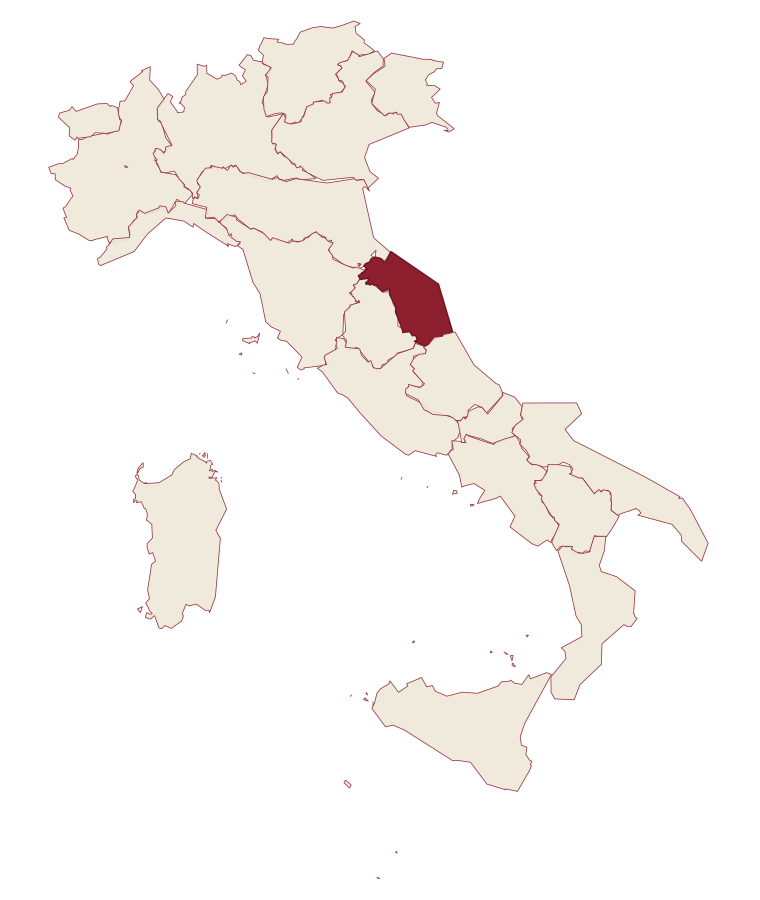
- Arcevia is a comune in the province of Ancona, in Marche.
- What is the nearest airport to Arcevia?
- The nearest airport with scheduled flights is Ancona (AOI), about 57 min by car.
- How long is the drive from Ancona to Arcevia?
- About 1 h 9 min by car.
- When is the best time to visit Arcevia?
- Best in Apr–Oct. July is the warmest month, averaging 30 degrees, and May the wettest, with about 13 rain days.
- Which other towns are like Arcevia?
- Mondavio, Acqualagna and Giano dell'Umbria.
- How many people live in Arcevia?
- 4,270 residents, by ISTAT's count on 1 January 2025.
- Is Arcevia a good place to live?
- By the rules in our Where to Move in Italy series, Arcevia is at the end of the road: the nearest town of 5,000 people, Pergola, is 26 min away. The nearest city, Fano, is 55 min away by car. The nearest national health service hospital is in Pergola, 12 km as the crow flies. Full fibre reaches 75% of homes.
Tags & data designations · numbers · sources
Recognized as
Landscape
The numbers
- Elevation: 535 m
- Population: 4,270
- Surface area: 128.33 km²
These figures were compiled from public directories: ISTAT, OpenStreetMap and Wikidata, and from the official listings of the guides named on this page. Town details change; verify with official sources before you travel.
The ranked lists
Lists Arcevia appears in
- The 6 best towns inside a nature park in the province of AnconaAncona provinceinside a park6 towns · smallest 1,648 residents
- The 9 best hill towns in the province of AnconaAncona provincehill town9 towns · smallest 1,648 residents
- The 9 best towns inside a nature park in MarcheMarcheinside a park9 towns · smallest 1,648 residents
Similar
Towns like Arcevia
What all six share with Arcevia: inland, away from the coast · between 3,000 and 10,000 people
Mondavio
Province: Pesaro e Urbino
both hill towns
Acqualagna
Province: Pesaro e Urbino
both hill towns
Giano dell'Umbria
Province: Perugia
both hill towns
- Written about. No. 78.
Città della Pieve
Province: Perugia
both hill towns
- Written about. No. 8.
Fosdinovo
Province: Massa-Carrara
both hill towns
Cingoli
Province: Macerata
55 min apart by road
Our guide
Our nearest guide, 72 km away
Umbria: the towns, when to go, how to get there
The Umbria guide came out of the letter. Letters from the towns we visit. Free.
Read the guide: Two banks, no sea. 21 towns, the drive and train times, the months, where to eat and sleep.
Paid plans, the moving year and the books are on the membership page.