
The 9 best hill towns in the province of Ancona
The hills behind Ancona are made of soft ground and hard building. Towns here sit on ridges and spurs, walled in warm brick and pale local stone, with lanes that climb rather than spread because there was never flat land to spread onto. Below them the fields run in long strips of wheat and sunflower, and the vines that make Verdicchio and Lacrima grow on the slopes facing the sea. Autumn is the season that pays off best: grape harvest, white truffle from the Esino valley, mixed fried vegetables and rabbit on the table, mist sitting in the valleys until mid-morning. Spring brings broom and wild asparagus, and the walls hold the heat well into the evening.
Most people who come to this province come for the coast, and specifically for the Riviera del Conero, where the limestone headland drops into clear water at Sirolo and Numana. It is good, and in August it is full. The beaches below Monte Conero fill by mid-morning, the shuttle car parks fill after that, and the seafood restaurants take bookings weeks ahead. Ancona itself absorbs ferry traffic to Croatia and Greece, which does the old port no favours in high season.
The same landscape carries on inland, and it empties out quickly. Within an hour of the water the road is climbing through gorges, past abbeys and cave systems and towns whose brick gates still frame the street. These are the places where the wine is made rather than poured for the view, where the medieval centre is a working centre, and where fewer people go simply because the sea is in the other direction. The nine below are all hill towns in the strict sense, built on ground too steep to build on any other way.
Of the 13 communes we have mapped in the province of Ancona, 9 qualify as hill towns: each is an inland hill settlement built on ground too steep to spread. The smallest, Genga, has 1,682 residents.
Two more lists worth reading alongside this one: The 6 best towns inside a nature park in the province of Ancona and The best hill towns with a food festival within 90 minutes of Ancona.
Genga
Why visit Genga
Genga sits at 322 meters on the Sentino river in the Apennine foothills of the Marche, seven kilometers downstream from Sassoferrato and twelve north of Fabriano. The commune is the ancestral seat of the della Genga, the noble family that gave the Catholic Church Pope Leo XII, born at the Castello della Genga in 1760.
The territory is best known for the Grotte di Frasassi, a thirteen-kilometer karst system whose entrance was found in 1971 and opened to visitors in 1974. The Abisso Ancona, a single chamber roughly 180 by 120 meters and nearly 200 tall, is large enough to hold the Milan cathedral.
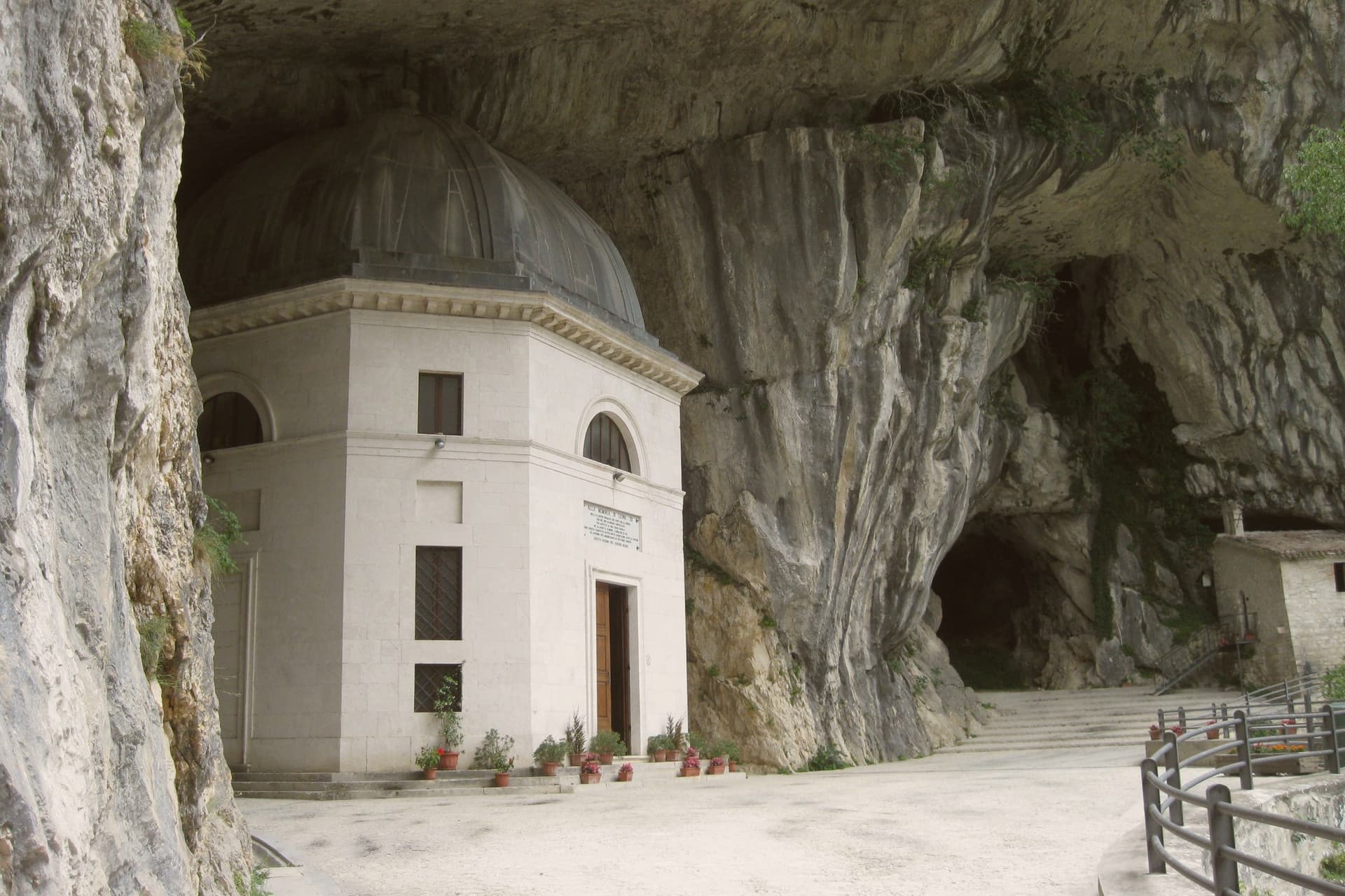
Above the cave entrance, the Tempio del Valadier, an octagonal neoclassical chapel set into a cliff wall, was commissioned by Leo XII from Giuseppe Valadier in 1828. The Abbazia di San Vittore alle Chiuse, a Romanesque Benedictine church on a Greek-cross plan, stands at the gorge mouth and dates to before 1080.
What to see in Genga
- Grotte di Frasassi. Thirteen kilometers of karst passageways found in 1971 and opened in 1974, with the Abisso Ancona chamber 180 by 120 meters wide and 200 meters tall.
- Tempio del Valadier. Octagonal neoclassical chapel commissioned by Pope Leo XII from Giuseppe Valadier in 1828, built of travertine and set into the cliff above the gorge.
- Abbazia di San Vittore alle Chiuse. Romanesque Benedictine church on a Greek-cross plan with four columns, built of local limestone, attested before 1080 at the mouth of the Frasassi gorge.
How to get to Genga
There is a railway station in the town, so you can arrive without a car and never need one while you are here. Ancona is roughly 62 minutes away by road.
Our tip
April through June and September into October are the best months for Genga. The Sentino valley turns green from April, the limestone gorges hold the cool, and the woodland trails through the Gola della Rossa park stay open through autumn. The Frasassi caves run at a constant fourteen degrees year-round; a light jacket is needed even in August.
Morro d'Alba
Why visit Morro d'Alba
Morro d'Alba sits on a hill twelve kilometers northwest of Jesi, one of the Castelli that ring the lower Esino valley. The walled village is built around La Scarpa, the covered ring walkway that runs the full perimeter of the medieval walls; a 1654 municipal decision authorized residents to build dwellings directly onto the fortifications, and those houses still open onto the walkway today, which is why it is covered rather than open like a typical wall-walk.
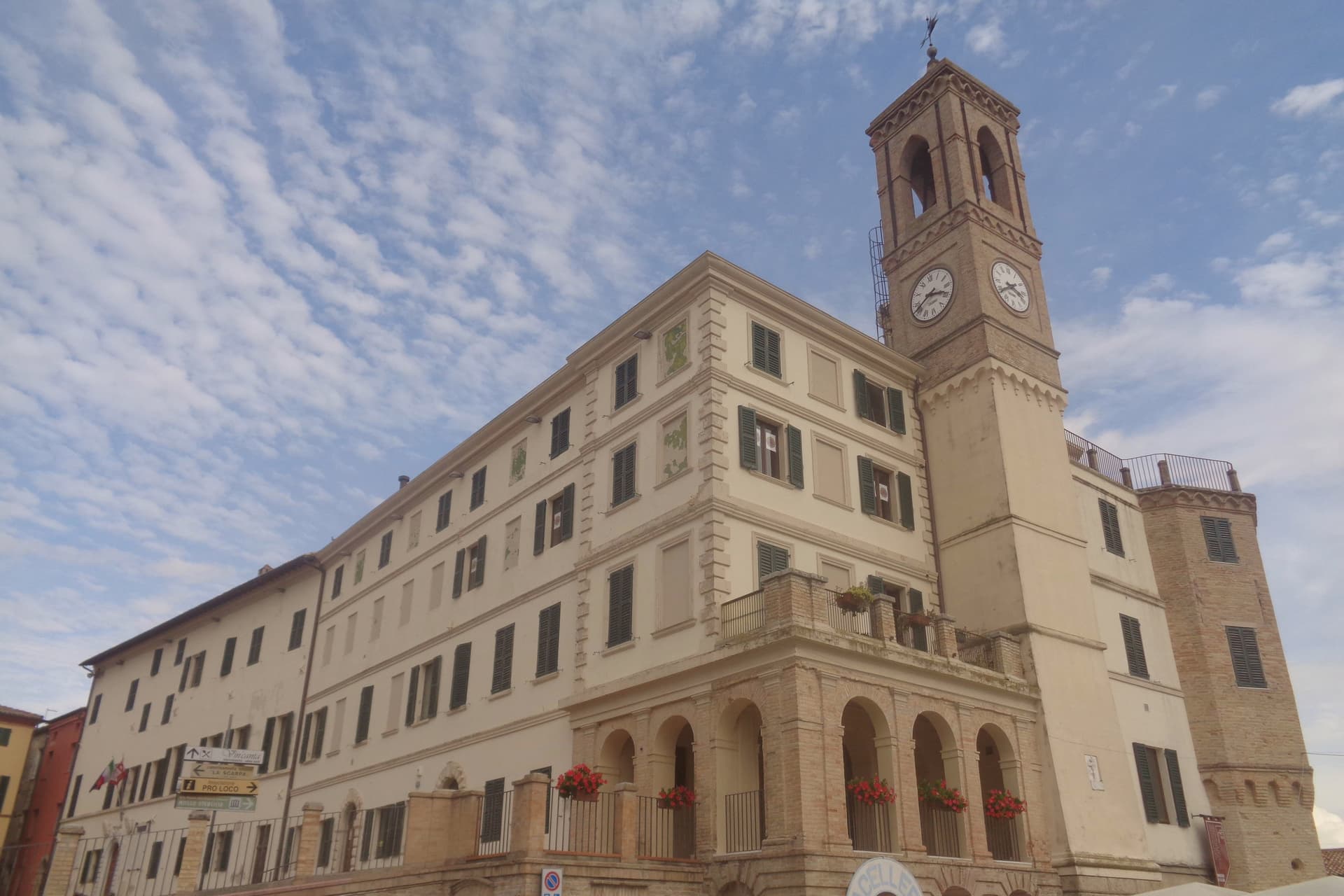
The piazza at the center of the borgo, flanked by the parish church and the town hall, gives onto the stairs that climb to La Scarpa, so the civic life of the village and its defensive ring are joined at a single point of access. The grape that carries the town's name beyond the valley, Lacrima, was first mentioned in a chronicle the same year Frederick Barbarossa took the castle as his residence during the siege of Ancona, though the vine itself was only recovered as a distinct variety in recent decades.
A small hill village, then, whose walls turned into houses and whose grape turned into a wine, both taking centuries to be reclaimed as what they are now known for.
What to see in Morro d'Alba
- La Scarpa. Flanked by arcades along its full length, the walkway offers views across the surrounding hills to the Sibillini and to the Conero on clear days, the houses built into the fortifications visible from below.
- Piazza Romagnoli. Central piazza of the walled borgo, flanked by the parish church and the municipal palace, opening onto the access stairs to the walkway above.
- Chiesa di San Gaudenzio. Parish church on the main piazza, of medieval origin, rebuilt across the centuries inside the walled circuit of the Castello di Jesi.
How to get to Morro d'Alba
Ancona is roughly 42 minutes away by road.
Our tip
April through June and September into October are the best months for Morro d'Alba. The Verdicchio and Lacrima vineyards turn from leaf-green in spring to deep red and copper through the autumn harvest, and the walls catch warm light from the long western horizon. July and August touch the low thirties on the hill, with La Scarpa offering shade through the long afternoons.
Offagna
Why visit Offagna
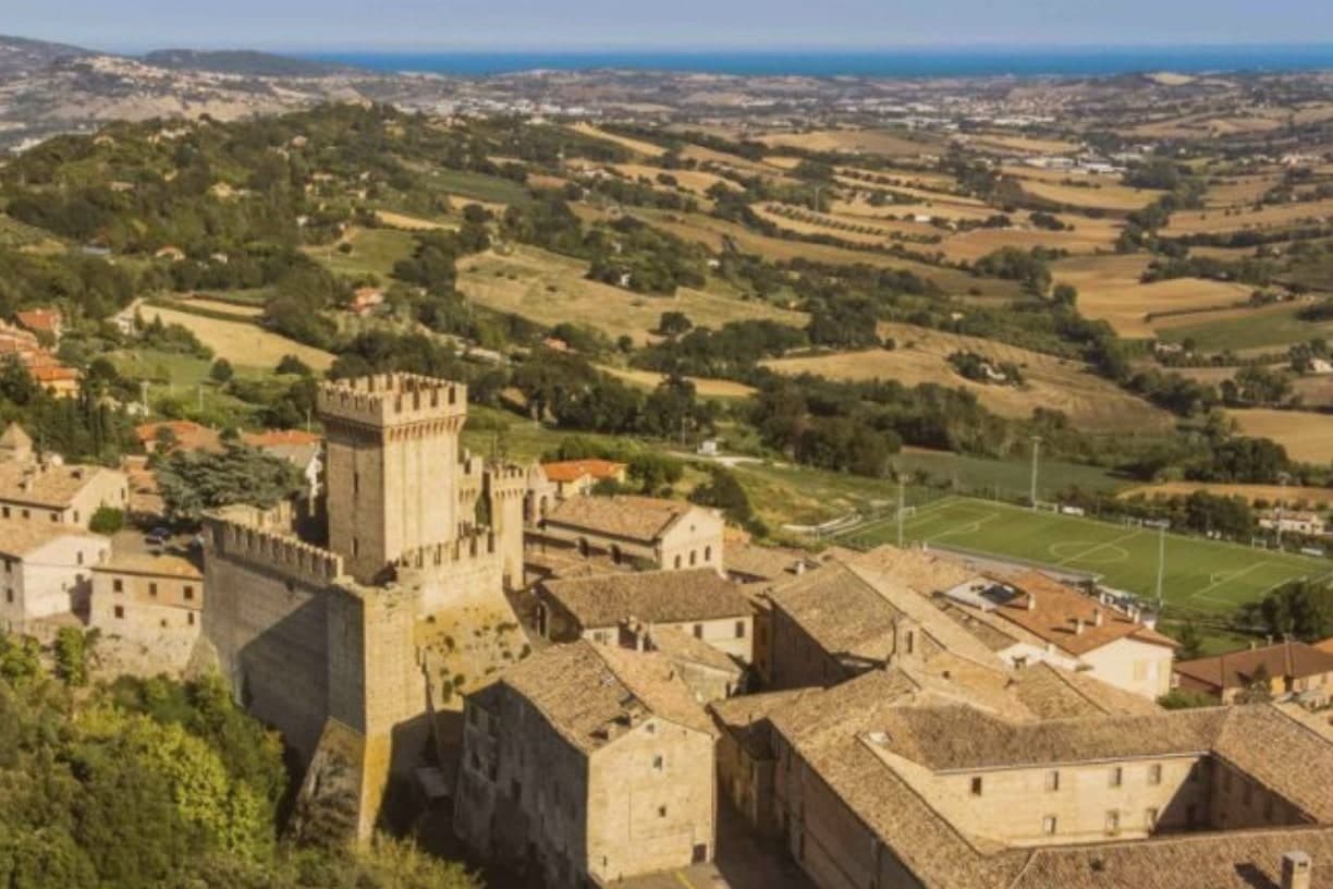
Offagna sits at 309 meters on a sandstone outcrop between Ancona and Osimo, ten kilometers from the Adriatic. The Rocca was built by the city of Ancona between 1454 and 1456 as a fortified outpost to defend its inland frontier, raised in just two years on the ruins of an earlier castle and well preserved through the centuries.
Tall walls, four square towers and a slender keep make it one of the cleanest examples of mid-fifteenth-century military architecture in central Italy. Inside, the Museo della Rocca holds medieval and renaissance arms and a collection of crossbows.
The walled village around it received both the Borghi più Belli recognition and the Touring Club Bandiera Arancione in May 2013. The Feste Medievali in the last week of July fill the centro storico with neighborhood Quarters competing in archery and crossbow, fairs and processions through the Maniero square.
The Conero is visible from the towers.
What to see in Offagna
- Rocca di Offagna. Mid-fifteenth-century fortress built by Ancona 1454-1456 in just two years, with four square towers, a slender keep and one of the best-preserved military profiles in the Marche.
- Museo della Rocca. Inside the fortress, holding medieval and renaissance arms, crossbows and military objects from the Anconitan territorial defense.
- Centro storico. Walled medieval village around the Rocca, with stepped streets, the Maniero square at the centre, and both Borghi più belli and Bandiera Arancione recognition from 2013.
How to get to Offagna
Ancona is roughly 24 minutes away by road.
Our tip
April through June and September into October are the best months for Offagna. The Aspio valley turns green in spring and gold through the late summer harvest, with the Adriatic visible from the Rocca walls and the Conero promontory rising above the coast ten kilometers east. July and August touch the low thirties; the centro storico quietens between three and seven in the afternoon. Fiera del Colombaccio falls in September.
Staffolo
Why visit Staffolo
Staffolo rises to 442 meters on a hill between the Esino, Misa and Musone valleys, thirty-five kilometers from Ancona. The town calls itself the Balcone della Vallesina for the panoramic ridge it stands on, and Colle del Verdicchio for the vines that cover the south-facing slopes around it.
Verdicchio cultivation here is documented from 1569; the surrounding Castelli di Jesi DOCG zone draws from south-facing parcels between 220 and 500 meters of altitude. The centro storico is almost circular, walled with partly original ramparts and entered through two opposing gates; the fourteenth-century Albornoz tower rises above the walls.
The Museo dell'Arte del Vino, carved into rooms inside the walls themselves, holds an oak press from 1695 and the working tools of the local cellars, with an enoteca attached. Three churches anchor the village: Sant'Egidio with a fifteenth-century Master of Staffolo polyptych, San Francesco with a 1769 Callido organ, and the baroque Santa Maria di Castellaretta built by survivors of the Battle of Lepanto.
What to see in Staffolo
- Centro storico. Almost circular walled medieval nucleus with partly original ramparts, two opposing gates and the fourteenth-century Torre Albornoz rising above the circuit.
- Museo dell'Arte del Vino. Wine museum carved into rooms inside the walls themselves, holding an oak grape press from 1695 and the working tools of the Staffolo cellars, with attached enoteca.
- Chiesa di Sant'Egidio. Parish church on the ridge, holding a fifteenth-century polyptych by the anonymous Master of Staffolo of the Fabrianese school.
How to get to Staffolo
Ancona is roughly 42 minutes away by road.
Our tip
April through June and September into October are the best months for Staffolo. The ridge stays cooler than the valleys below, the vineyards turn green by April and gold from late September, and the views to the Adriatic and the Apennines run cleanest in the dry weeks. July and August can touch the high twenties at 442 meters, but the breeze along the Vallesina ridge moves through town most afternoons. Verdicchio Festival falls in August.
Serra San Quirico
Why visit Serra San Quirico
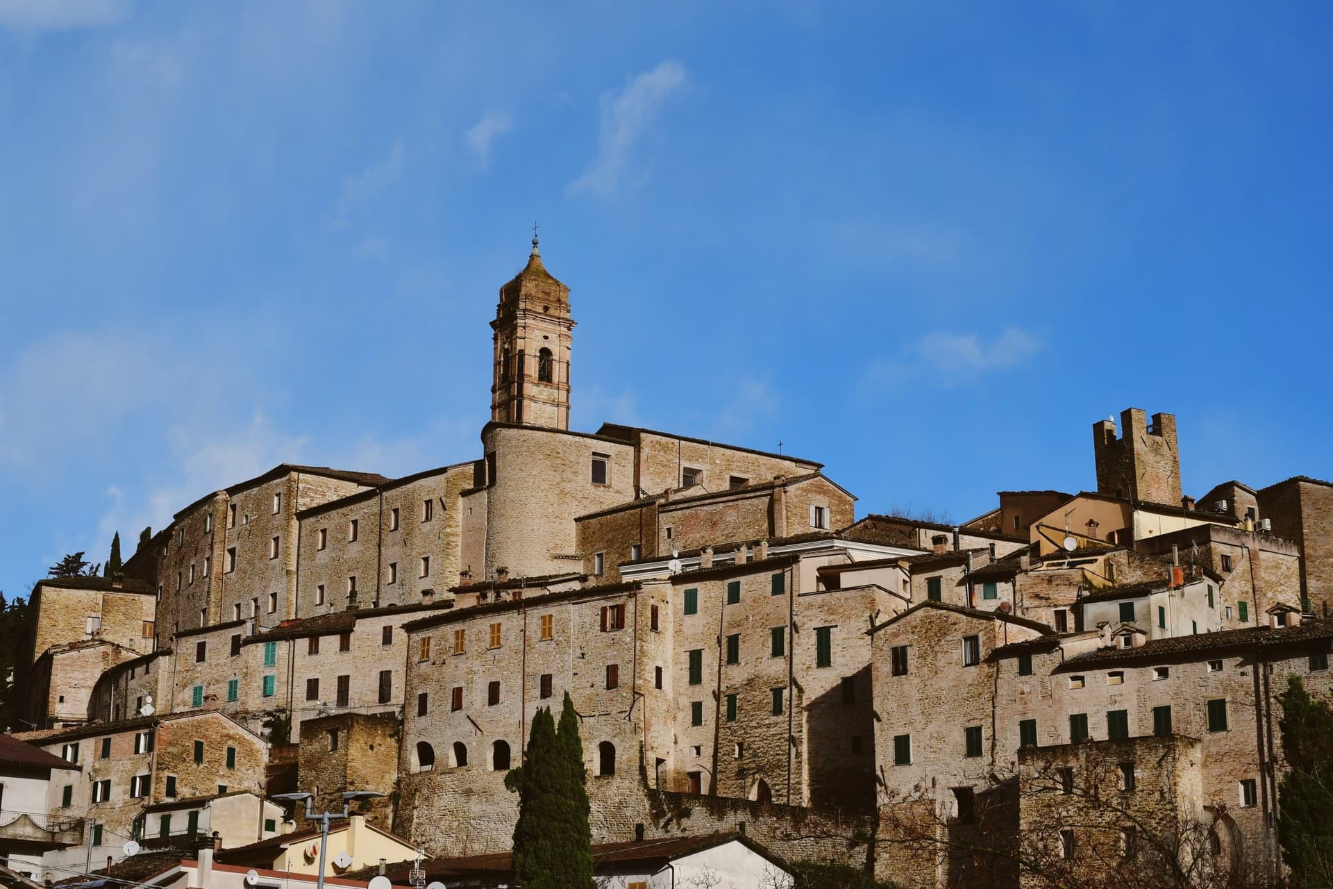
Serra San Quirico sits at 409 meters on the left bank of the Esino river, at the foot of Monte Murano and the entrance to the Gola della Rossa, forty-five kilometers from Ancona. Etruscan, Picene and Roman remains have been found in the area; the Romans established a military garrison that grew into the original village.
The medieval town is built almost entirely in stone and rock, ringed by walls dating to around 1300. Above those walls run the Copertelle, covered passageways that line the outer circuit, the true visual signature of the borgo.
The Santa Lucia complex, the former monastery in the centro storico, houses the headquarters of the Parco Naturale Regionale della Gola della Rossa e di Frasassi, the 9,167-hectare regional park that runs from Serra south to the Frasassi caves. The Chiesa di Santa Lucia, baroque inside with marble decoration and gold-leaf stucco, sits next door.
The Festa del Centro Storico in late July fills the stone lanes with theatrical reenactments.
What to see in Serra San Quirico
- Le Copertelle. Covered passageways running above the medieval outer walls from around 1300, the true visual signature of the stone borgo.
- Chiesa di Santa Lucia. Baroque church in the centro storico, with marble decoration, gold-leaf stucco and a Pasqualino Rossi seventeenth-century altarpiece.
- Parco Naturale Gola della Rossa e di Frasassi. 9,167-hectare regional park with headquarters at the Santa Lucia complex in the centro storico, running south to the Frasassi caves.
How to get to Serra San Quirico
There is a railway station in the town, so you can arrive without a car and never need one while you are here. Ancona is roughly 49 minutes away by road.
Our tip
April through June and September into October are the best months for Serra San Quirico. The Esino valley turns green from April, the Gola della Rossa runs cool through the limestone walls, and the autumn light brings out the stone of the Copertelle along the outer ring. July and August touch the high twenties at 409 meters; the gorge stays cooler than the valley floor and the centro storico catches afternoon breezes off the ridge. Sagra del Coniglio in Porchetta falls in July.
Arcevia
Why visit Arcevia
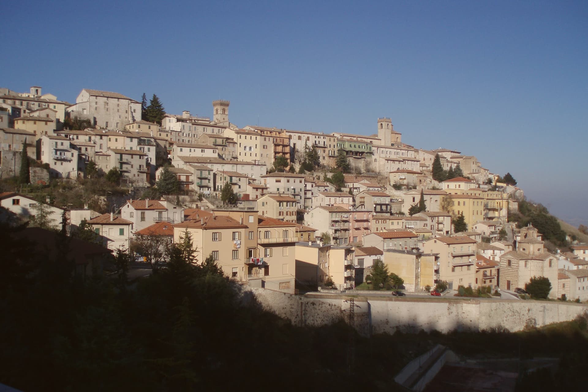
Arcevia sits at 535 meters between the Misa and Nevola valleys, forty-five kilometers from Ancona and inside the Parco Naturale Regionale della Gola della Rossa e di Frasassi. The town was the medieval seat of a free commune that built nine fortified satellite villages on the surrounding ridges between the thirteenth and fifteenth centuries to defend its territory against Serra San Quirico and other rivals: Avacelli, Castiglioni, Caudino, Loretello, Montale, Nidastore, Palazzo, Piticchio and San Pietro.
Loretello, the oldest, was founded in 1072 by the monks of Fonte Avellana. Each of the eight surviving castles retains its original layout, defensive walls and watchtower; together they form one of the most coherent medieval fortified networks in central Italy.
The Collegiata di San Medardo, in the capoluogo, holds a Luca Signorelli polyptych and a Giovanni della Robbia terracotta altarpiece. The Misa valley wines and the cooperative-pressed olive oil carry the local table.
What to see in Arcevia
- I Nove Castelli. Avacelli, Castiglioni, Caudino, Loretello, Montale, Nidastore, Palazzo, Piticchio and San Pietro: medieval fortified villages on the ridges around the capoluogo.
- Castello di Loretello. Oldest of the nine, founded 1072 by the monks of Fonte Avellana, expanded in the late fourteenth century, intact circuit of walls.
- Collegiata di San Medardo. Capoluogo's main church, holding a Luca Signorelli polyptych of 1507 and a Giovanni della Robbia terracotta altarpiece.
How to get to Arcevia
Ancona is roughly 69 minutes away by road.
Our tip
April through June and September into October are the best months for Arcevia. The Misa and Nevola valleys turn green from April, the vineyards on the surrounding ridges color from late August, and the woodland trails to the satellite castles stay open through autumn. July and August touch the high twenties at 535 meters; the ridge breeze keeps the centro storico cooler than the valley floor. Festa del Tartufo Nero Estivo falls in August.
Corinaldo
Why visit Corinaldo
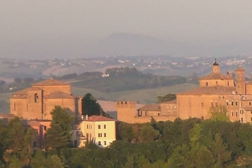
Corinaldo sits at 203 meters on a hill above the Cesano valley, forty kilometers from Ancona and thirteen from Senigallia on the Adriatic coast. The town is built as a single fortified block on the hillside, walls following the contour of the slope so that the historic center reads from below as one continuous ring of stone rather than a cluster of separate buildings.
Inside, the Piaggia climbs from the lower gates toward the top of the hill, and the Pozzo della Polenta sits partway up that stair, the point where the street's steepness is sharpest and where the town's best-known legend is anchored: a peasant carrying a sack of cornmeal stopped to rest against the well, dropped the sack in, climbed down after it, and was laughed at by the whole town. That story is walked back through every July.
Maria Goretti was born in the town in 1890 and lived in the commune until she was nine, a separate strand of the town's history, tied to the sanctuary and family home rather than to the walls or the well. The three things sit close together on the same small hill: fortification, stair-well legend, and saint's birthplace, each occupying its own corner of a town small enough to hold all three within sight of each other.
What to see in Corinaldo
- Mura di Corinaldo. The walls run unbroken around the historic center, gates and bastions still standing at height, the walkway along the top open to the Cesano valley on one side and the roofs of the old town on the other.
- Pozzo della Polenta and Piaggia. The well sits mid-flight on the Piaggia, the stepped street climbing the hill, stone worn from the steps around it and from the crowds that gather there each July for the reenactment.
- Santuario di Santa Maria Goretti. Diocesan sanctuary near the historic center, with the family's preserved birthplace standing nearby, the two sites close enough to visit as one stop.
How to get to Corinaldo
Ancona is roughly 56 minutes away by road.
Our tip
April through June and September into October are the months for Corinaldo. The walled streets are walkable in daylight without sweating, the surrounding hills run green into May then gold through the wheat harvest, and the Cesano valley below stays clear. July touches the low thirties; the third Sunday brings the Contesa del Pozzo della Polenta and a packed historic center.
Sassoferrato
Why visit Sassoferrato
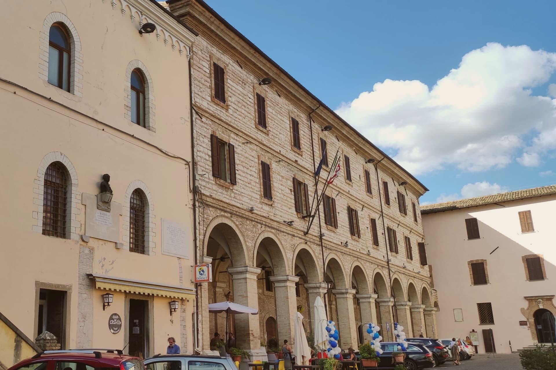
Sassoferrato sits on the eastern slope of the Apennines on two levels: the Borgo at around 310 meters and the Castello at 400 meters, dominated by the Rocca built in 1365 by order of Cardinal Albornoz. A kilometer south of the modern town lies Sentinum, the Roman city next to which the consuls Publius Decius Mus and Fabius Maximus Rullianus defeated a coalition of Samnites, Etruscans, Umbrians and Senone Gauls in 295 BC, in the decisive battle of the Third Samnite War that allowed Rome to unify central Italy.
The archaeological park preserves the cardo and decumanus, the urban baths, a second extramural bath complex and the ruins of a metalworking shop. The Civic Archaeological Museum inside the Palazzo dei Priori, built 1355, holds the finds from Sentinum, including a Byzantine Saint Demetrius mosaic icon on wooden support.
Giovanni Battista Salvi, called Il Sassoferrato, was born here in 1609; Palazzo Oliva holds a collection of his Raphaelesque devotional paintings. The town gives its name to the Battle of the Nations historical reenactment, held each August.
What to see in Sassoferrato
- Rocca Albornoz. Fourteenth-century fortress built 1365 by order of Cardinal Albornoz, dominating the upper Castello district at 400 meters.
- Parco Archeologico di Sentinum. Roman city a kilometer south of town, with the cardo and decumanus, the urban baths and the extramural bath complex still visible.
- Museo Civico Archeologico. Inside the 1355 Palazzo dei Priori, holding the finds from Sentinum and the Byzantine Saint Demetrius mosaic icon on wooden support.
How to get to Sassoferrato
Perugia is roughly 74 minutes away by road.
Our tip
April through June and September into October are the best months for Sassoferrato. The Sentino valley turns green from April, the archaeological park at Sentinum opens its full guided program through the warmer months, and the Palio di Sant'Ugo and Battaglia delle Nazioni reenactment fill the streets each August. July and August touch the high twenties at 386 meters but the two-level position keeps the Castello cooler than the Borgo and the lower river. Palio della Miniera di Zolfo falls in August.
Fabriano
Why visit Fabriano
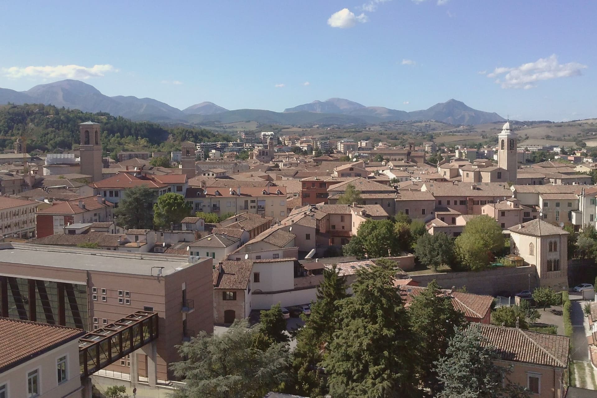
Fabriano sits at 325 meters on the Apennine watershed in inland Ancona province, fifty kilometers from Perugia and the Umbrian border. An Amalfi-style document held today in Matelica records paper production here from 1264, and by 1276 Fabriano was one of the earliest centers of European paper.
Its status as a UNESCO Creative City of Crafts and Folk Art rests on that continuous tradition rather than on any single building. The town's medieval wealth shows in the stone of its square, where the civic palace and fountain were both built in white Vallemontagnana stone within thirty years of each other, and in the cathedral, begun in the thirteenth century and carried through a seventeenth-century rebuilding without losing its fourteenth-century fresco cycle.
Paper, stone and paint all trace back to the same span of medieval prosperity, and what remains in Fabriano today is less a single monument than the accumulated evidence of one town's long specialization in making things by hand.
What to see in Fabriano
- Museo della Carta e della Filigrana. Paper and watermark museum in a former convent, with reproduced medieval workshops, working vats and the largest documented watermark collection.
- Piazza del Comune. Main square where the civic palace and the stone fountain still stand together as laid out in the thirteenth century.
- Cattedrale di San Venanzio. Thirteenth-century cathedral rebuilt 1607 to 1617, preserving the Cappella di San Lorenzo frescoes from the 1360s.
How to get to Fabriano
There is a railway station in the town, so you can arrive without a car and never need one while you are here. Perugia is roughly 58 minutes away by road.
Our tip
April through June and September into October are the months for Fabriano. The Apennine valley around the town runs green into May, the paper museum and pinacoteca are open without queues, and the surrounding mountains hold their snow into late spring at higher altitudes. July and August touch the high twenties in the valley; the centro storico stays cool in the stone-paved streets. Festa di Castelletta falls in September.
More from Anywhere Italy
- The 6 best towns inside a nature park in the province of Ancona
- The best hill towns with a food festival within 90 minutes of Ancona
 The 9 best towns inside a nature park in Marche
- The best hill towns you can reach by train within 90 minutes of Ancona
- The 6 best towns that eat well in the province of Ancona
- The best hidden hill towns you can reach by train in Marche