
The best hill towns that eat well in Friuli-Venezia Giulia
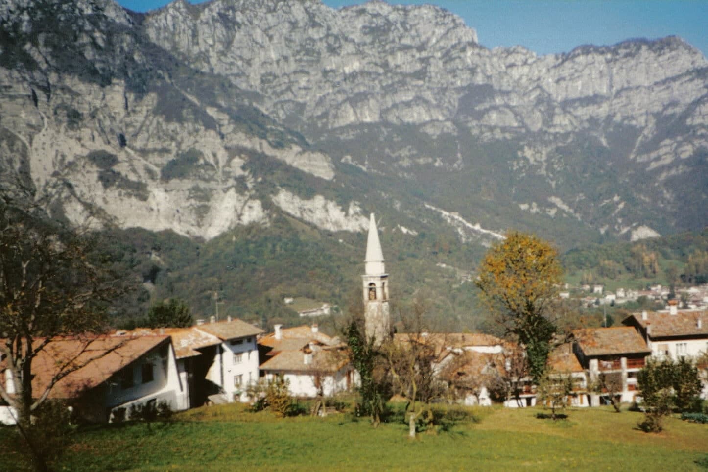
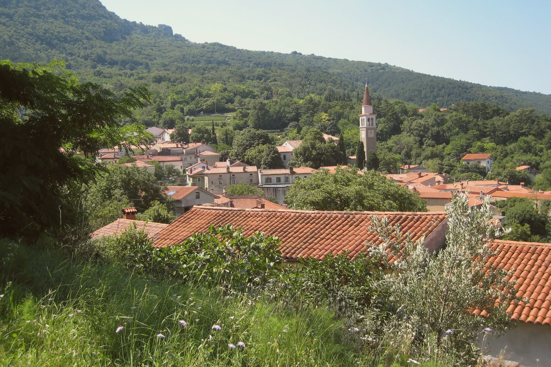
The Friulian hills rise north of the plain in long green ridges, planted to vines almost to the treeline, with houses of river stone and pale plaster and roofs of weathered terracotta. The food here answers to three grammars at once, Venetian, Austrian and Slovene, so a single lunch can run from a plate of San Daniele prosciutto to cjarsons, ravioli filled with sweet herbs and dusted with smoked ricotta, to frico, the fried crust of Montasio cheese and potato that every family makes differently. Autumn is the season the region organises itself around, with grape harvest in the Collio, chestnuts in the Carnic foothills and new white wine drunk young and cold. Ribolla gialla, friulano and picolit come from slopes narrow enough that the vineyard and the osteria often share a name.
Most visitors to this corner of Italy go to Trieste, and the pull is understandable: the Habsburg squares opening onto the Adriatic, the old coffee houses, the wind coming down off the karst. It has become the region's one recognised destination, which means its central cafés fill early and its restaurant bookings run weeks ahead in summer. Trieste is a fine city and worth the days people give it. It is also, geographically, the far corner of a region whose cooking is at its most particular well inland.
The hills keep going west and north of the city, past Gorizia's vineyards and up towards the Carnic and Julian pre-Alps, and the eating gets better as the crowds thin. These are the smaller inland places where the guide-listed table sits on a piazza rather than a promenade, and where the menu is written around what the surrounding valley grows and cures. Fewer people go, which is mostly a matter of transport rather than merit. Each town here is a hill settlement with a kitchen a national dining guide has named, which is a reasonable basis for a week of driving and lunching.
Of the 26 communes we have mapped in Friuli-Venezia Giulia, 6 qualify as hill towns that eat well: each is an inland hill settlement, and a dining guide has named a table in each. The smallest, Frisanco, has 572 residents.
Elsewhere in the catalogue: The best hill towns in Friuli-Venezia Giulia and The 9 best towns with a serious restaurant in Friuli-Venezia Giulia.
Why visit Frisanco
Frisanco sits at 415 meters in the Val Colvera, a side valley of the Cellina that cuts north from the Pordenone plain into the Carnian Prealps. The commune holds 572 residents across four hamlets, of which Poffabro, at 525 meters, is the one that draws visitors.
The painter Armando Pizzinato called Poffabro the most rational example of spontaneous architecture in the Friulian Prealps: three-storey stone houses with wooden ballatoi running the full length of each upper floor, arched porticoes at ground level, and roofs of split larch. The town burned in 1606, taking the public archive with it, and rebuilt in the same vernacular.
Inquisition records from 1648 to 1650 describe Frisanco as a nido di streghe, a witches' nest. The presepi tradition has run since 1997: every December, residents place nativity scenes in windows, niches, and courtyards across Poffabro, and the village fills with visitors from late November through Epiphany.
The Parco Naturale Dolomiti Friulane begins at the village edge.
Osteria da Cippi have been named by a guide.
What to see in Frisanco
- Borgo di Poffabro. Frazione at 525 meters with three-storey stone houses, wooden ballatoi running across each floor, and arched ground-floor porticoes, classed Borghi più belli.
- Chiesa di San Nicolò. Parish church at the head of Poffabro's main street, mentioned as early as 1492, with an eighteenth-century facade and a single nave.
- Parco Naturale Dolomiti Friulane. Regional park bordering the commune, with trails into Monte Raut, the Cellina gorges, and the Val Cimoliana on the Veneto side.
How to get to Frisanco
Udine is roughly 68 minutes away by road.
Our tip
April through October is the open season for Frisanco. The Val Colvera trails dry out by April and the Dolomiti Friulane park is walkable into October. July and August can push past twenty-eight degrees in the valley, though the village stays cooler than the Pordenone plain below.
Why visit Fagagna
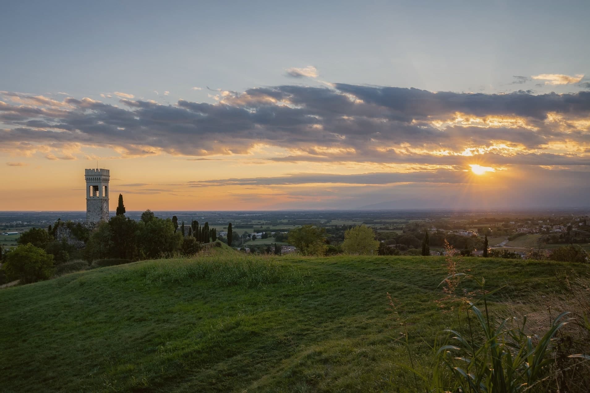
Fagagna, Friulian Feagne, sits at 177 meters on the morainic hills thirteen kilometers northwest of Udine. The hill has been strategic since Roman times, and the castle passed to the Patriarch Rodoaldus as part of the 983 donation.
What remains today is scattered rather than whole: a stretch of wall, the Borgo gate, the clock-tower converted into a bell tower, the ruined keep, a fourteenth-century house, and the small church tucked inside the old walls. The four boroughs, Centro, Palûd, Pic, and Riul, each keep a colour and a stake in the town's identity that surfaces once a year in the piazza, and otherwise define the town's internal geography more than its street plan does.
A regional nature reserve on the edge of town gives Fagagna a second, unrelated distinction alongside its medieval fragments. The town has been a member of Borghi più belli d'Italia since 2007.
Between the broken castle, the annual race, and the ibis reserve, the town reads less as one attraction than as several small, unconnected reasons to stop, each surviving on its own terms.
San Michele have been named by a guide.
What to see in Fagagna
- Castello di Fagagna. What survives is fragmentary: wall fragments, the Borgo gate, and the clock-tower, the visible remnant of the donated fortress.
- Chiesa di San Michele Arcangelo. Small castle chapel inside the original walls, one of the surviving medieval structures from the patriarchal period.
- Oasi dei Quadris. Regional wetland reserve where the ibis colony nests and feeds, set in the countryside outside the built-up center.
How to get to Fagagna
Udine is roughly 20 minutes away by road.
Our tip
April through October is the working window. May and June bring the morainic hills at their greenest; the Oasi dei Quadris is busiest with ibis breeding and visiting birders. July and August get hot, though the elevation keeps nights cooler than Udine on the plain. Sagrute di Vilalte falls in July.
Why visit Cormons
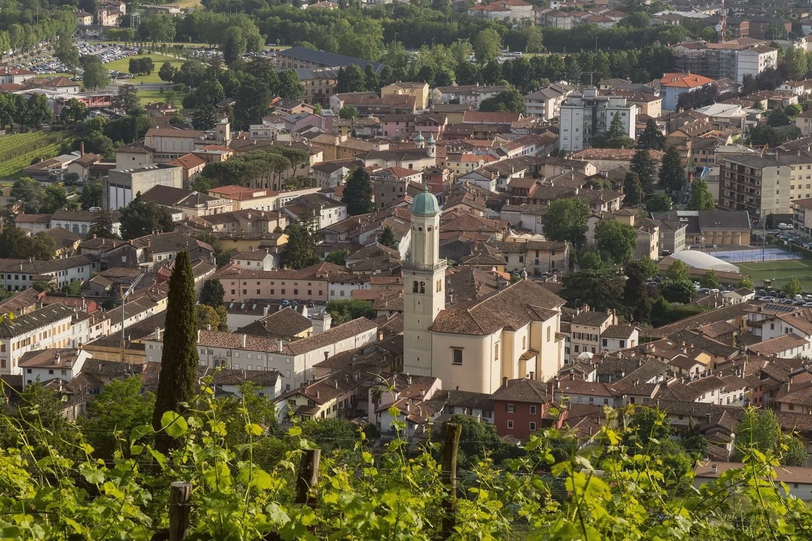
Cormons sits at 51 meters where the Friulian plain rises into the Collio hills, twelve kilometers west of Gorizia on the Slovenian border. Once a Lombard fortress, then a residence of the Patriarchs of Aquileia, the town was contested between Venice and the Habsburgs and stayed Austrian from 1500 to 1918.
Palazzo Locatelli and Palazzo Waiz Del Mestri, facing the main square, keep the Viennese restraint of that period, and the church that anchors the square dates from the same Habsburg-era rebuilding. The vineyards begin on the slopes immediately north of town, where the soil locals call ponka gives way to the hill of Monte Quarin above, its ruined fortress looking down over the DOC zone and across the border into Slovenia.
The cooperative cellar draws its grapes from growers scattered through those same slopes. In 1870 Count La Tour brought French vines into nearby Russiz di Capriva for the Imperial Court palate, which the 1891 Austrian Oenological Congress in Gorizia codified.
What holds the town together is the border itself: a fortress height, a planted slope, and a square built by the empire that once ruled both, still standing in the order Austrian rule left them.
Trattoria al Cacciatore, Locanda alle Vigne have been named by a guide.
What to see in Cormons
- Piazza della Libertà. Central Habsburg-era square framed by Palazzo Locatelli and other Austrian-influenced civic buildings, with the statue of Emperor Maximilian I at its center.
- Duomo di Sant'Adalberto. Eighteenth-century cathedral on the central square, the principal church of the Habsburg-era town, with painted ceiling and altarpieces of the period.
- Monte Quarin. Hill above Cormons (274 m) with ruins of the Lombard-patriarchal fortress, panoramic views over the Collio vineyards and into Slovenia.
How to get to Cormons
There is a railway station in the town, so you can arrive without a car and never need one while you are here. Udine is roughly 34 minutes away by road.
Our tip
April through June is the green window on the Collio hills, vines budding then leafing, ponka soil still cool from spring. September and October are the vendemmia months, the harvest dictating the rhythm of every cantina in the commune. July and August are warm and humid, the plain's heat pushed into the hills; tasting rooms run on appointment. Borgnano in Festa! falls in August.
Why visit Cividale del Friuli
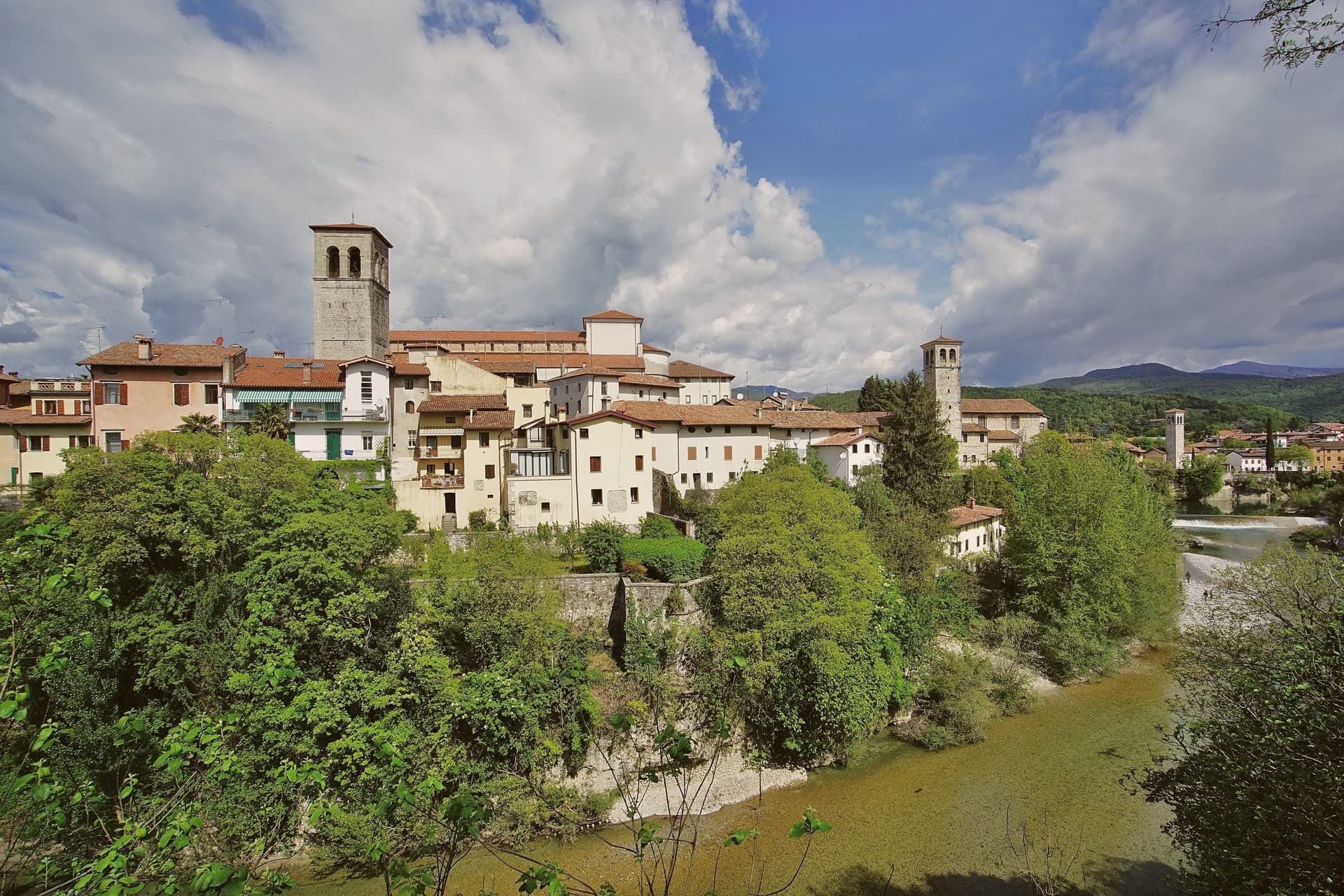
Cividale del Friuli sits at 138 meters on the right bank of the Natisone, fifteen kilometers from Udine and close enough to the Slovenian border that the river marks it. Julius Caesar founded the place as Forum Iulii in the first century BC, the name that eventually gave Friuli its own.
In 568 the Lombard king Alboin made it the capital of his first Italian duchy, and the Patriarchate of Aquileia later moved its seat here for four centuries. The Tempietto Longobardo, an eighth-century palatine chapel, holds six stucco female saints carved around 760, the best-preserved sculpture of the Lombard age in Europe.
It is one of seven sites in the UNESCO serial nomination Longobardi in Italia. The Ponte del Diavolo, begun in 1442, spans the Natisone gorge in two asymmetrical arches.
The Palio di San Donato fills the streets in late August, and Mittelfest brings Central European theater and music to the piazzas every July.
Al Monastero have been named by a guide.
What to see in Cividale del Friuli
- Tempietto Longobardo. Eighth-century palatine chapel in the Monastero di Santa Maria in Valle, with six stucco female saints in high relief, UNESCO-listed since 2011.
- Ponte del Diavolo. Stone bridge over the Natisone gorge, begun in 1442 on two asymmetrical arches resting on a central rock outcrop.
- Duomo di Santa Maria Assunta. Fifteenth-century cathedral with the Pala di Pellegrino II, a twelfth-century gilded silver altarpiece, and an attached Museo Cristiano.
How to get to Cividale del Friuli
There is a railway station in the town, so you can arrive without a car and never need one while you are here. Udine is roughly 26 minutes away by road.
Our tip
April through June and September into October are the months when the Natisone valley shows best, with green hills, mild evenings, and the Slovenian border country open for walking. July brings Mittelfest and August the Palio di San Donato, so the centro storico fills with theater crowds and historical pageant. Both months can push past thirty degrees, though 138 meters of elevation and the river keep nights cooler than the Friulian plain. Palio di San Donato falls in August.
Why visit Spilimbergo
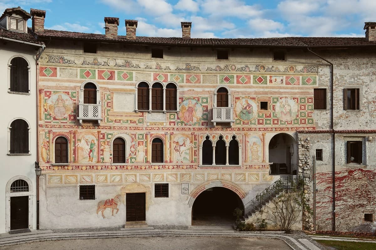
Spilimbergo takes its name from the castrum de Spengenberg, built by Carinthian counts who came south as vassals of the Patriarch of Aquileia. Their fortress anchors one end of a centro storico that reads as a sequence of additions: the Romanesque-Gothic cathedral raised through the fourteenth century, the painted palace that later hosted Charles V, Bona Sforza, and Henry III of France, and Corso Roma running between frescoed palazzi to the old market stone still used to measure trade.
The Scuola Mosaicisti, founded in 1922, is the newest of these layers but the one that has carried the town's name furthest, its alumni's work turning up in the Library of Congress, the Holy Sepulchre, the Foro Italico, and the World Trade Center transit hub. The Folkest folk-music festival runs every July, and the town carries Borghi più belli and Borgo dei Borghi finalist recognition.
Outside it, the Tagliamento broadens into the braided, three-kilometer bed that gives the town its setting on the right bank. A place, in sum, where a medieval frontier post and a twentieth-century craft school have ended up equally responsible for putting Spilimbergo on a map.
Osteria da Afro, La Torre have been named by a guide.
What to see in Spilimbergo
- Castello di Spilimbergo. Eleventh-century fortress of the Spengenberg counts, burned in the 1511 popular revolt and partially rebuilt; the palace with the painted façade survived.
- Palazzo Dipinto. The frescoes cover prancing horses, ladies, pages, and figures of the Theological and Cardinal virtues across the fifteenth-century façade.
- Duomo di Santa Maria Maggiore. Romanesque-Gothic cathedral begun in 1284 by count Walterpertoldo II, with apse frescoes executed between 1350 and 1359.
How to get to Spilimbergo
Udine is roughly 39 minutes away by road.
Our tip
April through June is the season for the Tagliamento gravel beds and the Bellunello frescoes; the light catches the Palazzo Dipinto best in the late afternoon. Folkest fills the piazzas with folk musicians from across Europe through early July. August is hot and the centro storico empties between two and five. Istrago in Festa falls in the season.
Why visit Gorizia
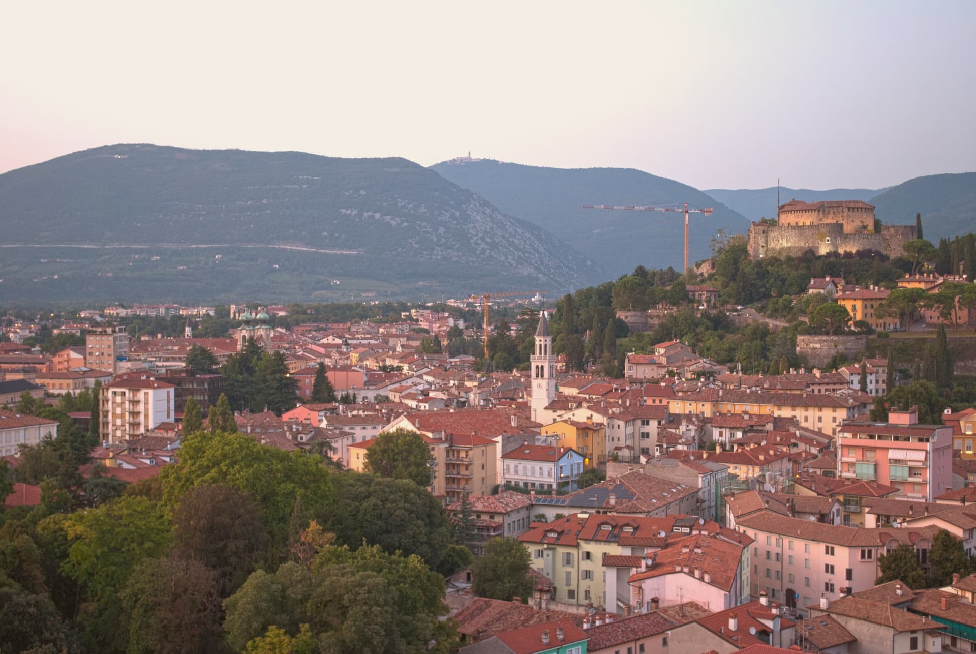
Gorizia sits at 84 meters at the foot of the Julian Alps, on the Slovenian border. The Counts of Gorizia held the town as an independent county from 1127 until 1500, when it passed to the Habsburgs, who kept it until 1918.
Annexed to Italy after World War I, the city lost part of its territory to Yugoslavia in 1947, when a wall went up that became one of the symbols of the Iron Curtain, cutting the border square in front of the railway station the Austrians had built in 1906 into two halves. Schengen lifted the border in 2007, and in 2025 Gorizia and Nova Gorica together held the joint cultural title that marked the year, the first cross-border holders in the program's history.
The city itself divides between the medieval upper town, Borgo Castello, rising around the eleventh-century castle, and the plain below, where the Isontino stretches out to produce Collio and Carso wines. The rebozzato cafés on Corso Verdi still serve in Friulian, Italian, Slovenian, and German, a hangover from a border that has moved but never quite disappeared.
A city built on a fault line, first political, then physical, now a shared cultural address for two towns that were once one and then were forced apart.
Rosenbar, Chincaglieria Gastronomica, Alla Luna and 1 more have been named by a guide.
What to see in Gorizia
- Castello di Gorizia. Eleventh-century castle on the hill above the city, restored after World War I damage, with museum rooms and ramparts open to walk.
- Borgo Castello. Medieval upper town inside the castle ramparts, the original nucleus of the city before it spread onto the plain below.
- Piazza della Transalpina (Trg Evrope). Border square cut in two by the 1947 line, reunited in 2004, with the old dividing line still marked by a strip of pavement tile. Served as the inauguration stage of European Capital of Culture.
How to get to Gorizia
There is a railway station in the town, so you can arrive without a car and never need one while you are here. Udine is roughly 41 minutes away by road.
Our tip
April through June and September into October are the working windows, the Isontino plain green or gold, the hill paths around the castle walkable without humidity. July and August carry the Friulian-plain heat moderated only slightly by altitude. The European Capital of Culture program in 2025 stretched events across all twelve months and proved that the city carries shoulder-season weight. Flavors of the Frontier falls in September.
More from Anywhere Italy
- The best hill towns in Friuli-Venezia Giulia
 The 9 best towns with a serious restaurant in Friuli-Venezia Giulia
 The best towns you can reach by train that eat well in Friuli-Venezia Giulia
- The best hill towns within 45 minutes of Udine
 The best hill towns within 90 minutes of Trieste
- The prettiest villages in the province of Pordenone