
The best hill towns within 90 minutes of Trieste
The land behind Trieste rises quickly. Limestone karst, sinkholes and scrub oak give way to the low green hills of Collio and the Colli Orientali, where rows of ribolla gialla and friulano run up to villages built from pale stone with red pantile roofs. This is prosciutto and frico country, cured ham sliced thin in a cool cellar, cheese and potato crisped in a pan, poured over with a glass of white that tastes of the gravel it grew in. Autumn is the season most people would choose, when the vines turn copper and the fog sits in the valleys until midday, though spring brings asparagus and the first bright wines of the year.
Most visitors to this corner of Italy stay on the coast, which means Trieste itself and its cafés, the Molo Audace at sunset, then a run out to Miramare and the Grotta Gigante before turning back. The city earns the attention, and in summer the seafront and the castle grounds fill accordingly, with cruise passengers arriving in blocks and the piazza tables all taken by early evening. The bathing places along the Riviera towards Duino are busy for the same reason: they are the obvious thing, and they are close.
The same hills that make the karst plateau interesting keep going north, through the wine slopes on the Slovenian border and up towards the Alpine foothills, and that is where these towns are. Each of them stands on high ground rather than out on the Friulian plain, which means a bell tower visible from a distance, a defensible ridge, and views over the vineyards or the river gravels below. Fewer people go, and most sit within a comfortable drive of Trieste.
Of the 19 communes we have mapped in a 90-minute drive of Trieste, 6 qualify as hill towns: each stands on high ground rather than on the plain. The smallest, San Dorligo della Valle-Dolina, has 5,688 residents.
If you are still choosing, we have also written The best hill towns in Friuli-Venezia Giulia and The best hill towns within 45 minutes of Udine.
San Dorligo della Valle-Dolina
Why visit San Dorligo della Valle-Dolina
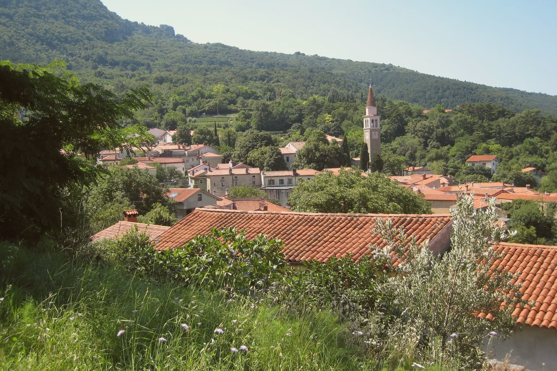
San Dorligo della Valle, called Dolina in Slovene, sits in a karst depression at 84 meters between the Trieste plateau and the Istrian border. The municipality is officially bilingual: Slovene is the majority home language across its sixteen hamlets, and signs, schools, and the comune name itself appear in both languages.
The Slovene name Dolina means "valley," which is what the village is. The town manages the Val Rosandra–Glinščica Nature Reserve, the only true canyon in the Karst, with a waterfall, the remains of a Roman aqueduct that carried water to Tergeste, and limestone walls used by Trieste's climbing schools since the 1920s.
The vineyards on the south-facing slopes produce Refosco and Vitovska Garganja, two of the autochthonous grapes that survived a century of border shifts. The olive groves higher up are the easternmost in mainland Italy, pressed into a single-estate oil that carries the Città dell'Olio designation.
What to see in San Dorligo della Valle-Dolina
- Riserva Naturale Val Rosandra–Glinščica. The only real canyon in the Trieste Karst, with a 40-meter waterfall, Roman aqueduct ruins, and limestone cliffs used for climbing.
- Chiesa di Sant'Ulderico / Cerkev sv. Urha. Parish church of the main village, dedicated to St. Ulrich, the saint whose Friulian-Slovene name Dorligo gave the comune its Italian half.
- Borgo di Dolina. Karst stone houses around a sloping main square, with the dialect, food, and architecture of the Slovene communities of the Trieste hinterland.
How to get to San Dorligo della Valle-Dolina
Trieste is roughly 15 minutes away by road.
Our tip
April through October works on the Karst side of San Dorligo. The Val Rosandra trail dries out by April and stays walkable until November rain. July and August can push above thirty degrees on the limestone, and the canyon floor offers the only real shade.
Fagagna
Why visit Fagagna
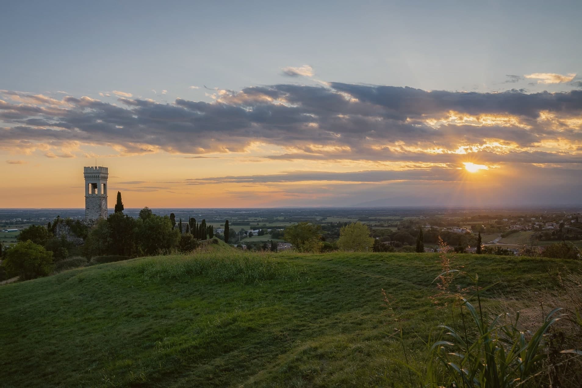
Fagagna, Friulian Feagne, sits at 177 meters on the morainic hills thirteen kilometers northwest of Udine. The hill has been strategic since Roman times, and the castle passed to the Patriarch Rodoaldus as part of the 983 donation.
What remains today is scattered rather than whole: a stretch of wall, the Borgo gate, the clock-tower converted into a bell tower, the ruined keep, a fourteenth-century house, and the small church tucked inside the old walls. The four boroughs, Centro, Palûd, Pic, and Riul, each keep a colour and a stake in the town's identity that surfaces once a year in the piazza, and otherwise define the town's internal geography more than its street plan does.
A regional nature reserve on the edge of town gives Fagagna a second, unrelated distinction alongside its medieval fragments. The town has been a member of Borghi più belli d'Italia since 2007.
Between the broken castle, the annual race, and the ibis reserve, the town reads less as one attraction than as several small, unconnected reasons to stop, each surviving on its own terms.
What to see in Fagagna
- Castello di Fagagna. What survives is fragmentary: wall fragments, the Borgo gate, and the clock-tower, the visible remnant of the donated fortress.
- Chiesa di San Michele Arcangelo. Small castle chapel inside the original walls, one of the surviving medieval structures from the patriarchal period.
- Oasi dei Quadris. Regional wetland reserve where the ibis colony nests and feeds, set in the countryside outside the built-up center.
How to get to Fagagna
Udine is roughly 20 minutes away by road.
Our tip
April through October is the working window. May and June bring the morainic hills at their greenest; the Oasi dei Quadris is busiest with ibis breeding and visiting birders. July and August get hot, though the elevation keeps nights cooler than Udine on the plain. Sagrute di Vilalte falls in July.
Cormons
Why visit Cormons
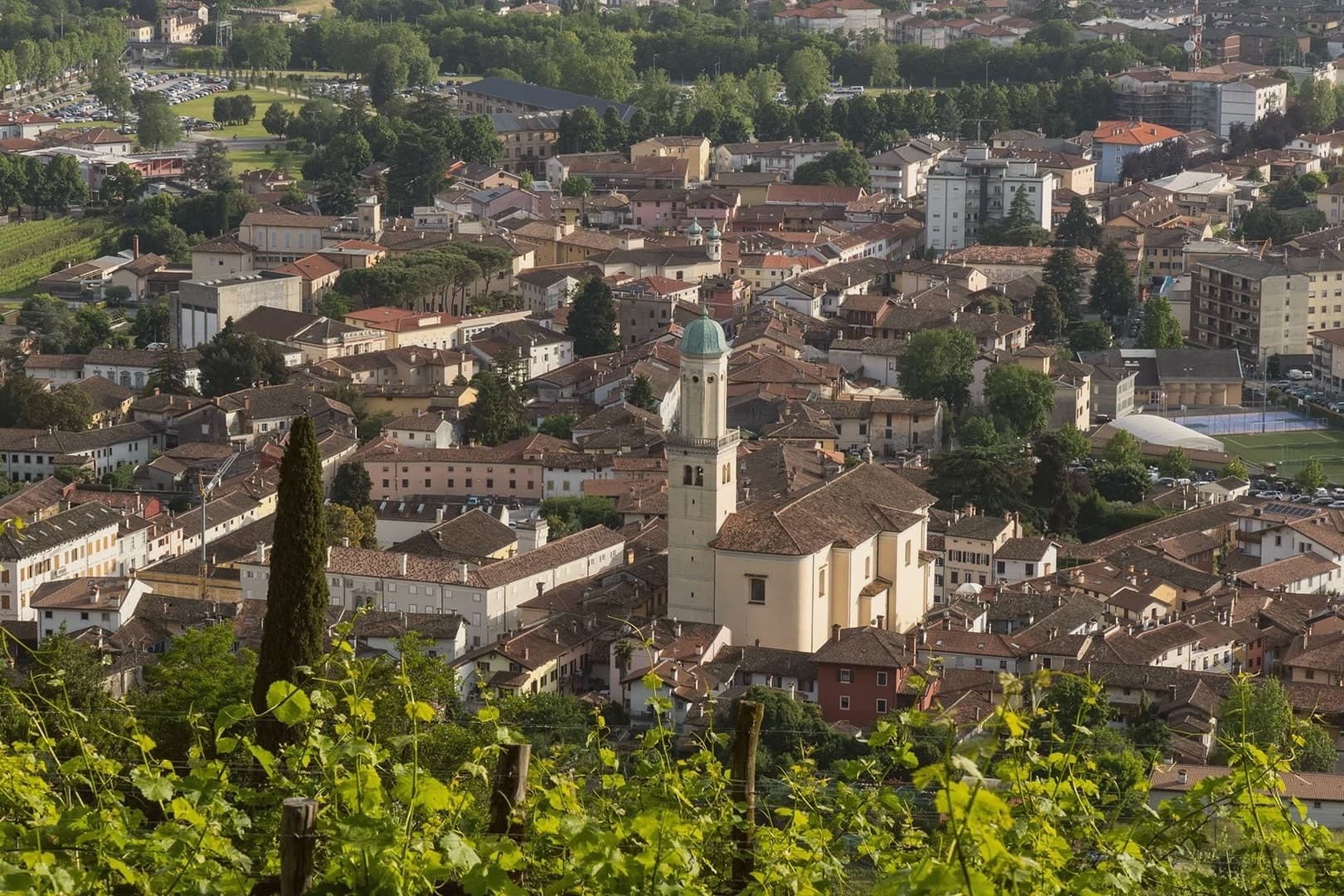
Cormons sits at 51 meters where the Friulian plain rises into the Collio hills, twelve kilometers west of Gorizia on the Slovenian border. Once a Lombard fortress, then a residence of the Patriarchs of Aquileia, the town was contested between Venice and the Habsburgs and stayed Austrian from 1500 to 1918.
Palazzo Locatelli and Palazzo Waiz Del Mestri, facing the main square, keep the Viennese restraint of that period, and the church that anchors the square dates from the same Habsburg-era rebuilding. The vineyards begin on the slopes immediately north of town, where the soil locals call ponka gives way to the hill of Monte Quarin above, its ruined fortress looking down over the DOC zone and across the border into Slovenia.
The cooperative cellar draws its grapes from growers scattered through those same slopes. In 1870 Count La Tour brought French vines into nearby Russiz di Capriva for the Imperial Court palate, which the 1891 Austrian Oenological Congress in Gorizia codified.
What holds the town together is the border itself: a fortress height, a planted slope, and a square built by the empire that once ruled both, still standing in the order Austrian rule left them.
What to see in Cormons
- Piazza della Libertà. Central Habsburg-era square framed by Palazzo Locatelli and other Austrian-influenced civic buildings, with the statue of Emperor Maximilian I at its center.
- Duomo di Sant'Adalberto. Eighteenth-century cathedral on the central square, the principal church of the Habsburg-era town, with painted ceiling and altarpieces of the period.
- Monte Quarin. Hill above Cormons (274 m) with ruins of the Lombard-patriarchal fortress, panoramic views over the Collio vineyards and into Slovenia.
How to get to Cormons
There is a railway station in the town, so you can arrive without a car and never need one while you are here. Udine is roughly 34 minutes away by road.
Our tip
April through June is the green window on the Collio hills, vines budding then leafing, ponka soil still cool from spring. September and October are the vendemmia months, the harvest dictating the rhythm of every cantina in the commune. July and August are warm and humid, the plain's heat pushed into the hills; tasting rooms run on appointment. Borgnano in Festa! falls in August.
San Daniele del Friuli
Why visit San Daniele del Friuli
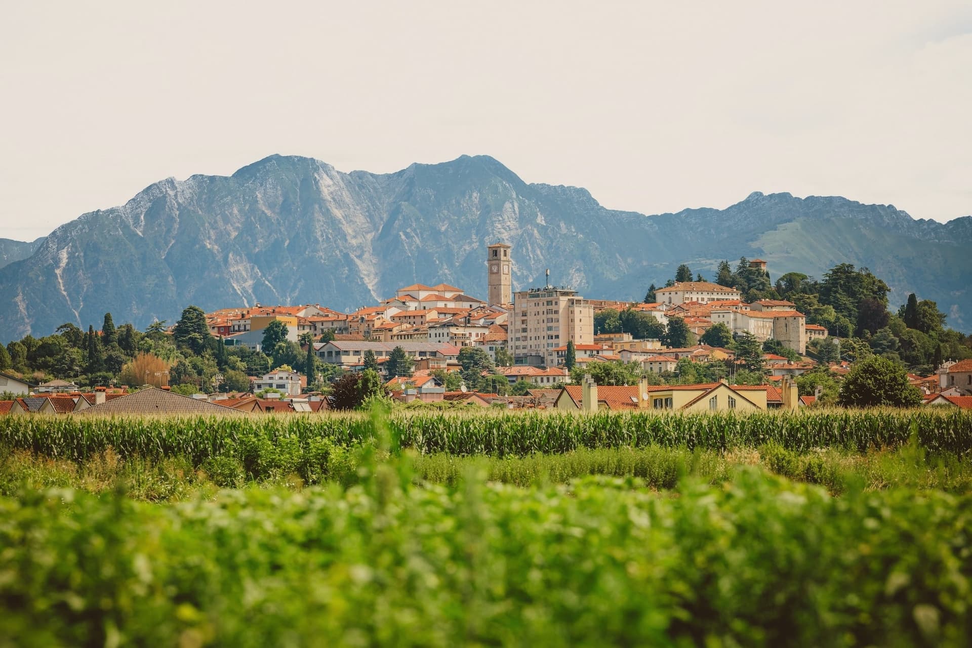
San Daniele del Friuli is where Italy's most prized raw-cured ham is made, and the town has been producing prosciutto continuously since at least 1063 (the first documented mention is in a Patriarchate of Aquileia tax record). The geography is the entire reason: San Daniele sits on a 252m hilltop in the Friuli morainic amphitheatre, where the Tagliamento valley funnels warm south winds from the Adriatic upward and the alpine downdraughts from the Carnic Alps come down to meet them — the result is a uniquely dry, ventilated microclimate that cures hams perfectly without artificial control.
The Consorzio del Prosciutto di San Daniele admits 31 producers, all within the historic centro and immediate frazioni, all curing whole pork legs (deboned only after curing) with sea salt and a minimum 14 months of aging. The trademark crescent-moon shape, the sweetness from low-salt curing, and the Trota di Mare softness are what distinguish San Daniele from its Parma cousin.
The Aria di Festa in late June (4-day festival, 100k+ visitors) is the year's main event — all 31 producers open their workshops, plus tastings across the centro. Beyond prosciutto: the Chiesa di Sant'Antonio Abate (15th-c) contains the complete fresco cycle by Pellegrino da San Daniele (1497–1522, the most important Friulan painter of his generation, called 'il Pellegrino' for his itinerant career), the Biblioteca Guarneriana (1466, the oldest public library in Friuli, founded by the humanist Guarnerio d'Artegna, with manuscripts including a 13th-c Bible), the Cattedrale di San Michele (rebuilt 1707), and the panoramic Belvedere over the Friulan plain stretching to the Adriatic.
The Tagliamento river loops past the town and the Carnic Alps rise to the north. Beyond prosciutto: the Friulan kitchen — frico (potato + Montasio cheese pancake), cjarsons (sweet-savoury filled pasta from Carnia), polenta, the local Friulano DOC white wine.
What to see in San Daniele del Friuli
- Prosciutterie + Consorzio del Prosciutto. 31 producers within the centro and immediate frazioni — all open for visits and tastings. The Consorzio HQ runs daily guided tours. The Aria di Festa late June is the 4-day festival.
- Chiesa di Sant'Antonio Abate (Pellegrino frescoes). Complete 1497–1522 fresco cycle by Pellegrino da San Daniele — the most important Friulan Renaissance painter, in the church that gives its name to his style.
- Biblioteca Guarneriana. The oldest public library in Friuli (founded 1466 by Guarnerio d'Artegna). Manuscripts include a 13th-c illuminated Bible. Open for visits + scheduled research access.
How to get to San Daniele del Friuli
Udine is roughly 33 minutes away by road.
Our tip
San Daniele is best April–June and September–October — the Aria di Festa late June is the year's main event (book accommodation 2 months ahead). Summer is hot in the Friulan plain but the 252m hilltop catches the alpine downdraught breeze. Autumn is harvest season for the surrounding Friulano vineyards. Festa Due Pistoni falls in July.
Cividale del Friuli
Why visit Cividale del Friuli
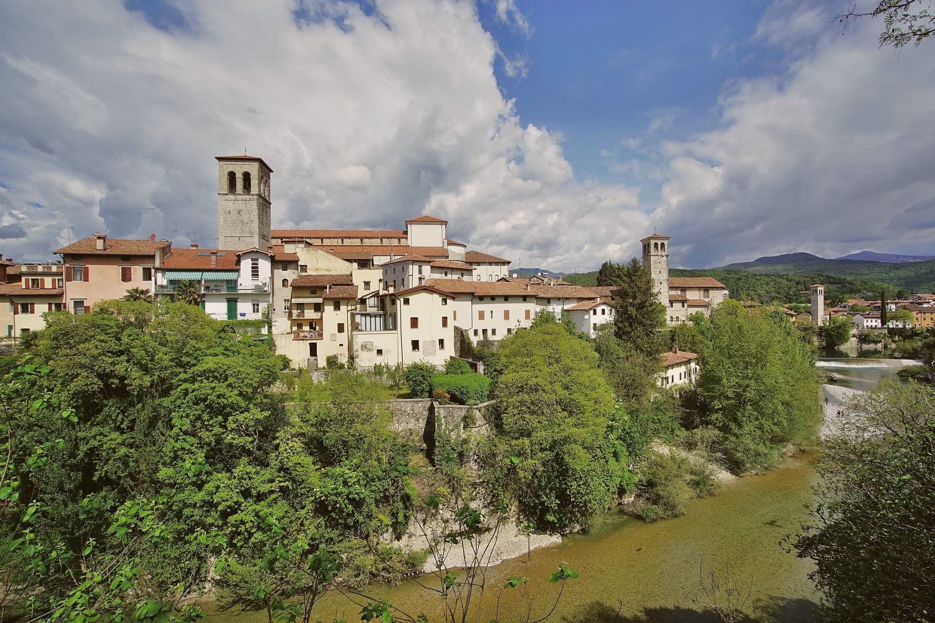
Cividale del Friuli sits at 138 meters on the right bank of the Natisone, fifteen kilometers from Udine and close enough to the Slovenian border that the river marks it. Julius Caesar founded the place as Forum Iulii in the first century BC, the name that eventually gave Friuli its own.
In 568 the Lombard king Alboin made it the capital of his first Italian duchy, and the Patriarchate of Aquileia later moved its seat here for four centuries. The Tempietto Longobardo, an eighth-century palatine chapel, holds six stucco female saints carved around 760, the best-preserved sculpture of the Lombard age in Europe.
It is one of seven sites in the UNESCO serial nomination Longobardi in Italia. The Ponte del Diavolo, begun in 1442, spans the Natisone gorge in two asymmetrical arches.
The Palio di San Donato fills the streets in late August, and Mittelfest brings Central European theater and music to the piazzas every July.
What to see in Cividale del Friuli
- Tempietto Longobardo. Eighth-century palatine chapel in the Monastero di Santa Maria in Valle, with six stucco female saints in high relief, UNESCO-listed since 2011.
- Ponte del Diavolo. Stone bridge over the Natisone gorge, begun in 1442 on two asymmetrical arches resting on a central rock outcrop.
- Duomo di Santa Maria Assunta. Fifteenth-century cathedral with the Pala di Pellegrino II, a twelfth-century gilded silver altarpiece, and an attached Museo Cristiano.
How to get to Cividale del Friuli
There is a railway station in the town, so you can arrive without a car and never need one while you are here. Udine is roughly 26 minutes away by road.
Our tip
April through June and September into October are the months when the Natisone valley shows best, with green hills, mild evenings, and the Slovenian border country open for walking. July brings Mittelfest and August the Palio di San Donato, so the centro storico fills with theater crowds and historical pageant. Both months can push past thirty degrees, though 138 meters of elevation and the river keep nights cooler than the Friulian plain. Palio di San Donato falls in August.
Gorizia
Why visit Gorizia
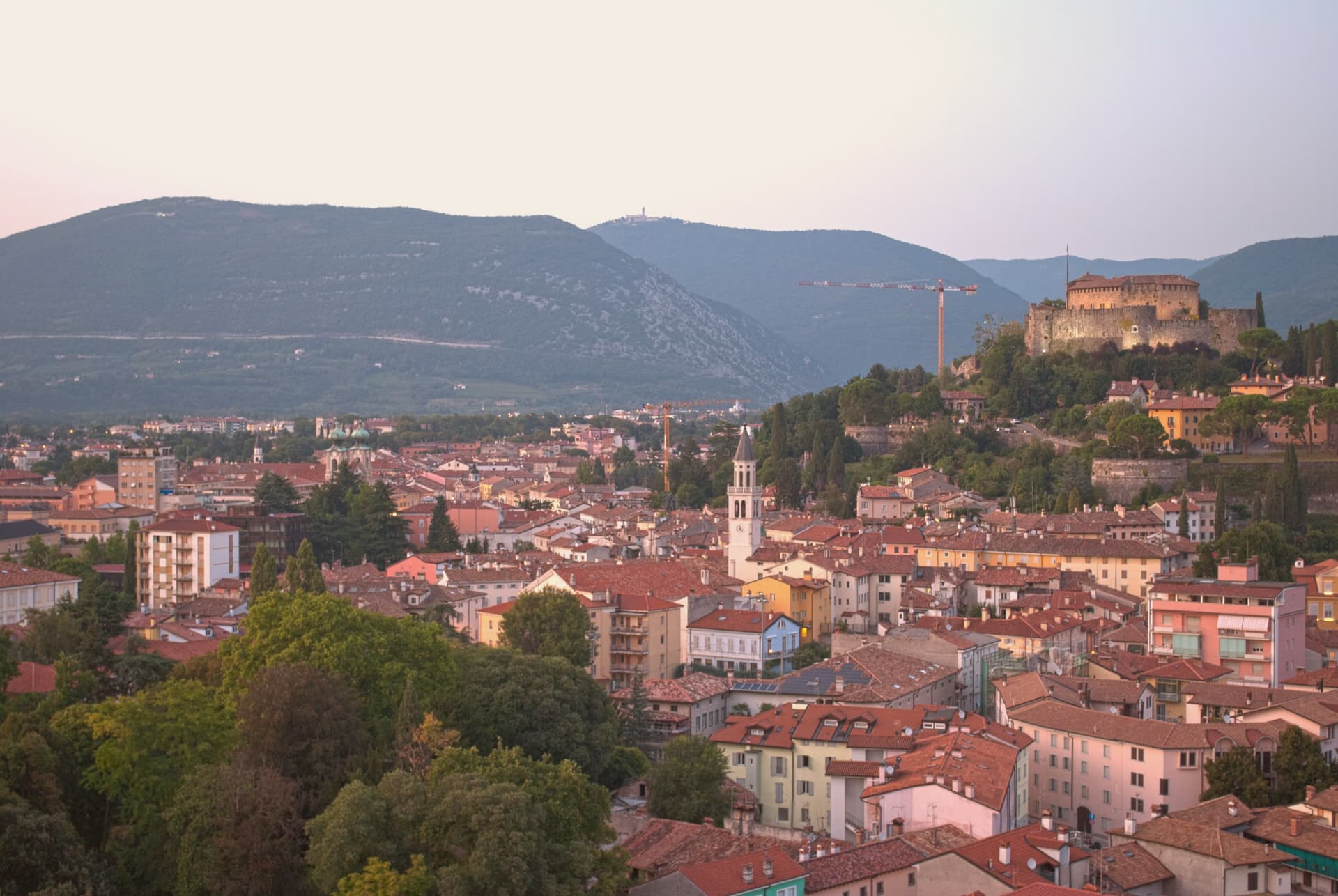
Gorizia sits at 84 meters at the foot of the Julian Alps, on the Slovenian border. The Counts of Gorizia held the town as an independent county from 1127 until 1500, when it passed to the Habsburgs, who kept it until 1918.
Annexed to Italy after World War I, the city lost part of its territory to Yugoslavia in 1947, when a wall went up that became one of the symbols of the Iron Curtain, cutting the border square in front of the railway station the Austrians had built in 1906 into two halves. Schengen lifted the border in 2007, and in 2025 Gorizia and Nova Gorica together held the joint cultural title that marked the year, the first cross-border holders in the program's history.
The city itself divides between the medieval upper town, Borgo Castello, rising around the eleventh-century castle, and the plain below, where the Isontino stretches out to produce Collio and Carso wines. The rebozzato cafés on Corso Verdi still serve in Friulian, Italian, Slovenian, and German, a hangover from a border that has moved but never quite disappeared.
A city built on a fault line, first political, then physical, now a shared cultural address for two towns that were once one and then were forced apart.
What to see in Gorizia
- Castello di Gorizia. Eleventh-century castle on the hill above the city, restored after World War I damage, with museum rooms and ramparts open to walk.
- Borgo Castello. Medieval upper town inside the castle ramparts, the original nucleus of the city before it spread onto the plain below.
- Piazza della Transalpina (Trg Evrope). Border square cut in two by the 1947 line, reunited in 2004, with the old dividing line still marked by a strip of pavement tile. Served as the inauguration stage of European Capital of Culture.
How to get to Gorizia
There is a railway station in the town, so you can arrive without a car and never need one while you are here. Udine is roughly 41 minutes away by road.
Our tip
April through June and September into October are the working windows, the Isontino plain green or gold, the hill paths around the castle walkable without humidity. July and August carry the Friulian-plain heat moderated only slightly by altitude. The European Capital of Culture program in 2025 stretched events across all twelve months and proved that the city carries shoulder-season weight. Flavors of the Frontier falls in September.
More from Anywhere Italy
 The best hill towns in Friuli-Venezia Giulia
- The best hill towns within 45 minutes of Udine
- The best hill towns that eat well in Friuli-Venezia Giulia
 The best towns with a food festival in Friuli-Venezia Giulia
 The best wine towns in Friuli-Venezia Giulia
 The best towns that eat well within 75 minutes of Trieste