
Friuli-Venezia Giulia · Pordenone
Frisanco
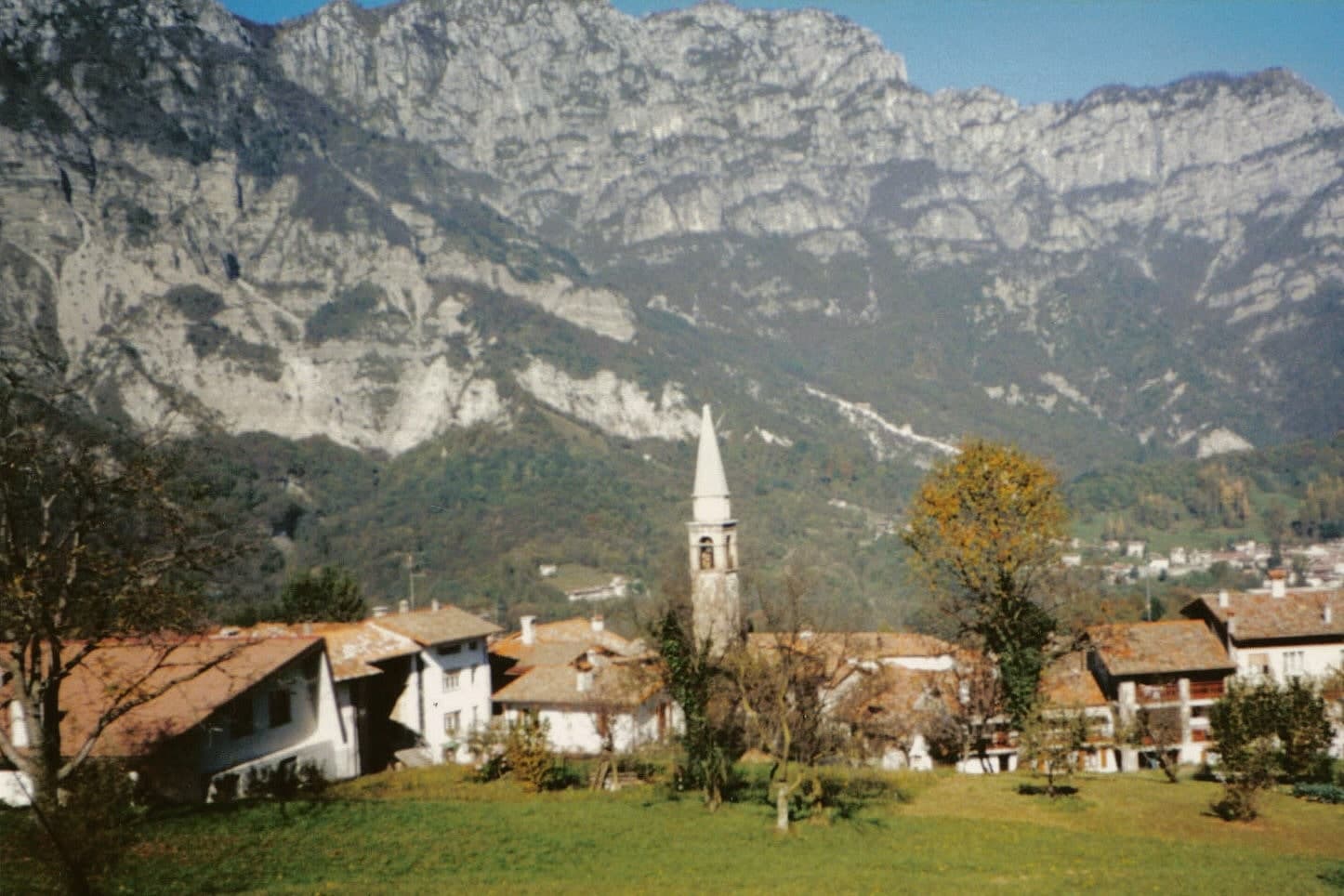
A 588-resident commune in the Val Colvera whose frazione Poffabro, became a model of Prealpine stone-and-wood vernacular architecture.
Picked by Peter Benei
Letter to come
Why Frisanco is on our list
It holds Borghi più belli d'Italia and Bandiera Arancione.
Subscribe and you get Frisanco's letter the day it comes out.
Visiting
- Best time
- Apr–Oct
- By car
- 1 h 8 min from Udine
- Population
- 588
- J7°
- F9°
- M11°
- A14°
- M19°
- J23°
- J26°
- A26°
- S21°
- O17°
- N12°
- D8°
- Best
- Hot or crowded
- Quiet
- Mostly closed
Daytime air temperature, averages for 2020–2024. Weather data by Open-Meteo.com.
Why come
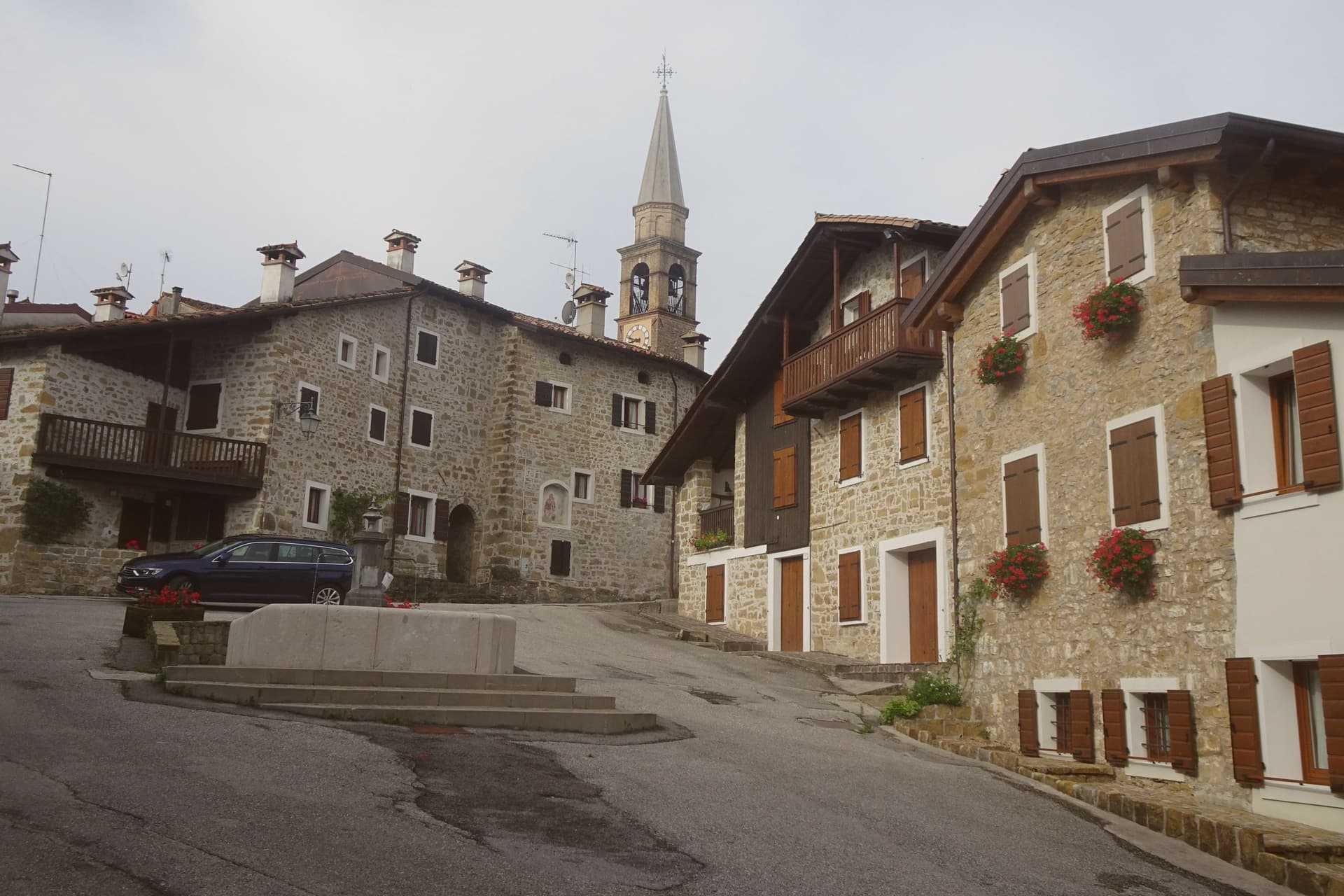
Frisanco sits in the Val Colvera, a side valley of the Cellina that cuts north from the Pordenone plain into the Carnian Prealps. The commune holds 588 residents across four hamlets, of which Poffabro, is the one that draws visitors. The painter Armando Pizzinato called Poffabro the most rational example of spontaneous architecture in the Friulian Prealps: three-storey stone houses with wooden ballatoi running the full length of each upper floor, arched porticoes at ground level, and roofs of split larch.
The town burned in 1606, taking the public archive with it, and rebuilt in the same vernacular. Inquisition records from 1648 to 1650 describe Frisanco as a nido di streghe, a witches' nest. The presepi tradition has run since 1997: every December, residents place nativity scenes in windows, niches, and courtyards across Poffabro, and the village fills with visitors from late November through Epiphany. The Parco Naturale Dolomiti Friulane begins at the village edge.
How to get there
From Treviso (TSF), about 1 h 38 min by car.
Verona (VRN) is about 2 h 59 min away.
By car from the center of Udine 1 h 8 min or Trieste 2 h 2 min.
Every town within reach of Treviso airport.
First time driving in Italy? Read our complete manual.
What to see
Borgo di Poffabro
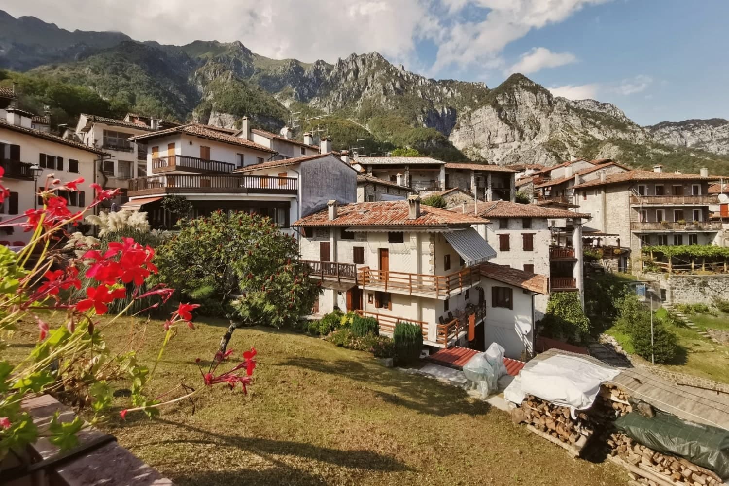
Frazione at 525 meters with three-storey stone houses, wooden ballatoi running across each floor, and arched ground-floor porticoes, classed Borghi più belli.
Chiesa di San Nicolò
Parish church at the head of Poffabro's main street, mentioned as early as 1492, with an eighteenth-century facade and a single nave.
Parco Naturale Dolomiti Friulane
Regional park bordering the commune, with trails into Monte Raut, the Cellina gorges, and the Val Cimoliana.
Val Colvera
Narrow valley between Maniago and the Dolomiti Friulane, with stone-paved mule tracks linking Frisanco, Poffabro, Casasola, and Andreis.
Frazione di Casasola
Second hamlet of the commune, smaller than Poffabro, with the same Prealpine vernacular and a partly abandoned upper centro.
From the guides
Where to eat
Not our picks, but places the guides put their name to: a Michelin star, a Gambero Rosso fork, a Slow Food snail, a Michelin Key for the hotels. Worth a table, a counter, or a night when you pass through.
Osteria da CippiRistorante
Osteria da Cippi has a spot in the Michelin Guide to its name.
Before you sit down: how to order at a restaurant, how to spot a tourist trap, what aperitivo is and how the Italian bar works.
Living here
Could you live here?
Frisanco is at the end of the road.
- A village of 588. The nearest town of 5,000 people, Maniago, is 23 min away: past our 15-minute rule, which makes this the end of the road.
- Pordenone, a city of 52,314, is 43 min by car. Inside our 30 to 60 minutes: close for the services, far enough to keep its own life.
The rules come from our series Where to Move in Italy, written from the places we have lived: Part 1, The End of the Road · Part 2, The Small Town · Part 3, The City · Part 4, The Postcard · Part 5, The Other Half. The towns we would pick are in Part 6, The Best Towns.
- Population 588, down 4.9% since 2015
- Nearest city Pordenone, 43 min drive
- Nearest national health service hospital Spilimbergo, 16 km as the crow flies · how healthcare works in Italy
- Homes in the center: €500 to €750 per m² to buy, €2.00 to €3.00 per m² a month to rent
All the numbers Common questions, designations, lists and sources.
More about living here
- In-between
- Pharmacy: none mapped
- High school within a 30-minute drive
- Full fibre reaches 94% of homes
- No primary school in the comune's register
- Earthquake zone 1, Italy's highest hazard
- Trieste airport (TRS), 1 h 31 min drive, the nearest with scheduled flights
- Regional capital Trieste, 2 h 2 min drive
If you are moving here
Who lives here
8% of residents are foreign citizens, most often from Ukraine and Romania, against 9% across Italy. There are 380 people over 65 for every 100 children under 15, against 216 across Italy. 57% of homes have no resident, holiday homes and empty ones counted together, against 27% across Italy. Pordenone province ranks 24th of 107 in Il Sole 24 Ore's quality of life ranking for 2025.
Health and schools
The nearest emergency room is in Spilimbergo, 16 km as the crow flies. The nearest major one is in Udine, 43 km away. The nearest children's emergency room is in Pordenone, 29 km away. The nearest IB school is Collegio Vescovile Pio X International, 72 km as the crow flies. The nearest school listed as international is Udine International School, 41 km away.
Information, not medical advice. Confirm with a professional.
Taxes
Friuli Venezia Giulia has its own property tax, ILIA, in place of IMU. 7% pensioner tax: this town is not in a qualifying area.
Information, not tax advice. Confirm with a professional.
What it costs
The average household in Friuli-Venezia Giulia spends about €2,350 a month, €520 of it on food, against about €2,170 across Italy. A family of three pays about €478 a year for water, on the Friuli-Venezia Giulia average. In Pordenone, the provincial capital, in September 2026, an espresso cost €1.38, a meal in a pizzeria €12.63 and a man's haircut €25.56.
Climate and risk
It is in climate zone F, the coldest of Italy's six, with no national limit on when the heating runs. Under 1% of residents live in a zone the national maps rate high for floods. 1% live in a zone rated high or very high for landslides.
These shares cover the whole comune, not any one street. Check an address on IdroGEO.
Moving from abroad? Which visa you need. Sources: ISTAT, the Ministry of Health, ISPRA, the Finance Ministry, the Ministry of Enterprise, Poste Italiane, the comuni, the IB, International Schools Database, Il Sole 24 Ore, Cittadinanzattiva.
Known for
POFFABRO
Frazione of three-storey stone houses with continuous wooden ballatoi, classed among Italy's Borghi più belli for its intact vernacular.
PRESEPE TRA I PRESEPI
Nativity scene festival running since 1997, with hundreds of crèches in windows and courtyards from late November through 6 January.
DOLOMITI FRIULANE
Regional park starting at the commune's edge, with trails into Monte Raut, the Cellina gorges, and the Val Cimoliana.
PITINA
The commune lies inside the Pitina IGP production zone.
Common questions
- What is Frisanco known for?
- Frisanco is a 588-resident commune in the Val Colvera whose frazione Poffabro, at 525 meters, became a model of Prealpine stone-and-wood vernacular architecture.
- Where is Frisanco?
- Frisanco is a comune in the province of Pordenone, in Friuli-Venezia Giulia, at 415 meters above sea level.
- What is the nearest airport to Frisanco?
- The nearest airport with scheduled flights is Trieste (TRS), about 1 h 31 min by car.
- How long is the drive from Udine to Frisanco?
- About 1 h 8 min by car.
- When is the best time to visit Frisanco?
- Best in Apr–Oct. July is the warmest month, averaging 26 degrees, and May the wettest, with about 20 rain days.
- Which other towns are like Frisanco?
- Garbagna, Valfornace and Monte Rinaldo.
- How many people live in Frisanco?
- 588 residents, by ISTAT's count on 1 January 2025.
- Is Frisanco a good place to live?
- By the rules in our Where to Move in Italy series, Frisanco is at the end of the road: the nearest town of 5,000 people, Maniago, is 23 min away. The nearest city, Pordenone, is 43 min away by car. The nearest national health service hospital is in Spilimbergo, 16 km as the crow flies. Full fibre reaches 94% of homes.
Tags & data designations · numbers · sources
Landscape
The numbers
- Elevation: 415 m
- Population: 588
- Surface area: 60.99 km²
These figures were compiled from public directories: ISTAT, OpenStreetMap and Wikidata, and from the official listings of the guides named on this page. Town details change; verify with official sources before you travel.
The ranked lists
Lists Frisanco appears in
- The best hill towns that eat well in Friuli-Venice GiuliaFriuli-Venezia Giuliahill towneats well6 towns · smallest 588 residents
- The prettiest small villages in Friuli-Venice GiuliaFriuli-Venezia Giuliaprettiest villagessmall6 towns · smallest 588 residents
- The prettiest villages in the province of PordenonePordenone provinceprettiest villages6 towns · smallest 588 residents
- The prettiest villages that eat well in Friuli-Venice GiuliaFriuli-Venezia Giuliaeats wellprettiest villages6 towns · smallest 588 residents
- The 9 best towns with a serious restaurant in Friuli-Venice GiuliaFriuli-Venezia Giuliaserious restaurant9 towns · smallest 390 residents
- The best hill towns in Friuli-Venice GiuliaFriuli-Venezia Giuliahill town9 towns · smallest 588 residents
Similar
Towns like Frisanco
What all six share with Frisanco: inland, away from the coast · under 1,000 people · hill towns
The letter
Frisanco is on our list. Its letter is still to come.
We are writing about all 1,000 of these towns, one at a time, in a free letter: the photo, what is worth eating, and when to turn up. That is our mission. Sign up and you will be there when Frisanco comes up. By Peter & Sophia, from Turin.
The nearest town we have written up is Chioggia, 116 km away. Read its letter →
Paid plans, the moving year and the books are on the membership page.