The best hill towns in the province of Frosinone
The province of Frosinone is a landscape of ridges and river valleys, the Sacco running one way and the Liri cutting down towards the Garigliano, with towns stacked on limestone spurs because the flat ground was needed for olives and grain. The houses are built from the same pale stone as the ancient polygonal walls that hold up half of these hilltops, and in some places you cannot tell where the pre-Roman masonry stops and the medieval wall begins. Autumn is the season that makes the argument: olive pressing, chestnuts, wild boar, gnocchi with mutton ragù, and the sharp local ricotta that turns up on everything. Winter mornings bring mist into the valleys and leave the towns floating above it.
There is a strong pull towards the obvious inland Lazio circuit, and most of it happens elsewhere. Coach parties head for the abbey of Montecassino over the provincial border, or for Tivoli's gardens on the way out of Rome, and the day trip is timed so tightly that the Ciociaria proper is glimpsed from a motorway junction. The Rome to Naples corridor carries enormous traffic and delivers almost none of it into these hills. Frosinone itself, the provincial capital, is largely a modern working town and rarely holds anyone for an afternoon.
The ridges do not stop where the tour buses turn around. The same walls, the same terraces and the same kitchens continue up the valleys, into towns that were Volscian strongholds, papal seats and paper-making centres long before the motorway existed. Fewer people go, which means the bars still serve locals at nine in the morning and the churches are opened by whoever has the key. These are the hill towns worth the detour off the A1.
Of the 10 communes we have mapped in the province of Frosinone, 7 qualify as hill towns: each is an inland hill settlement built on ground too steep to spread. The smallest, Pico, has 2,634 residents.
Two more lists worth reading alongside this one: The 6 best hill towns within 90 minutes of Latina and The best olive oil towns in Lazio.
Pico
Why visit Pico
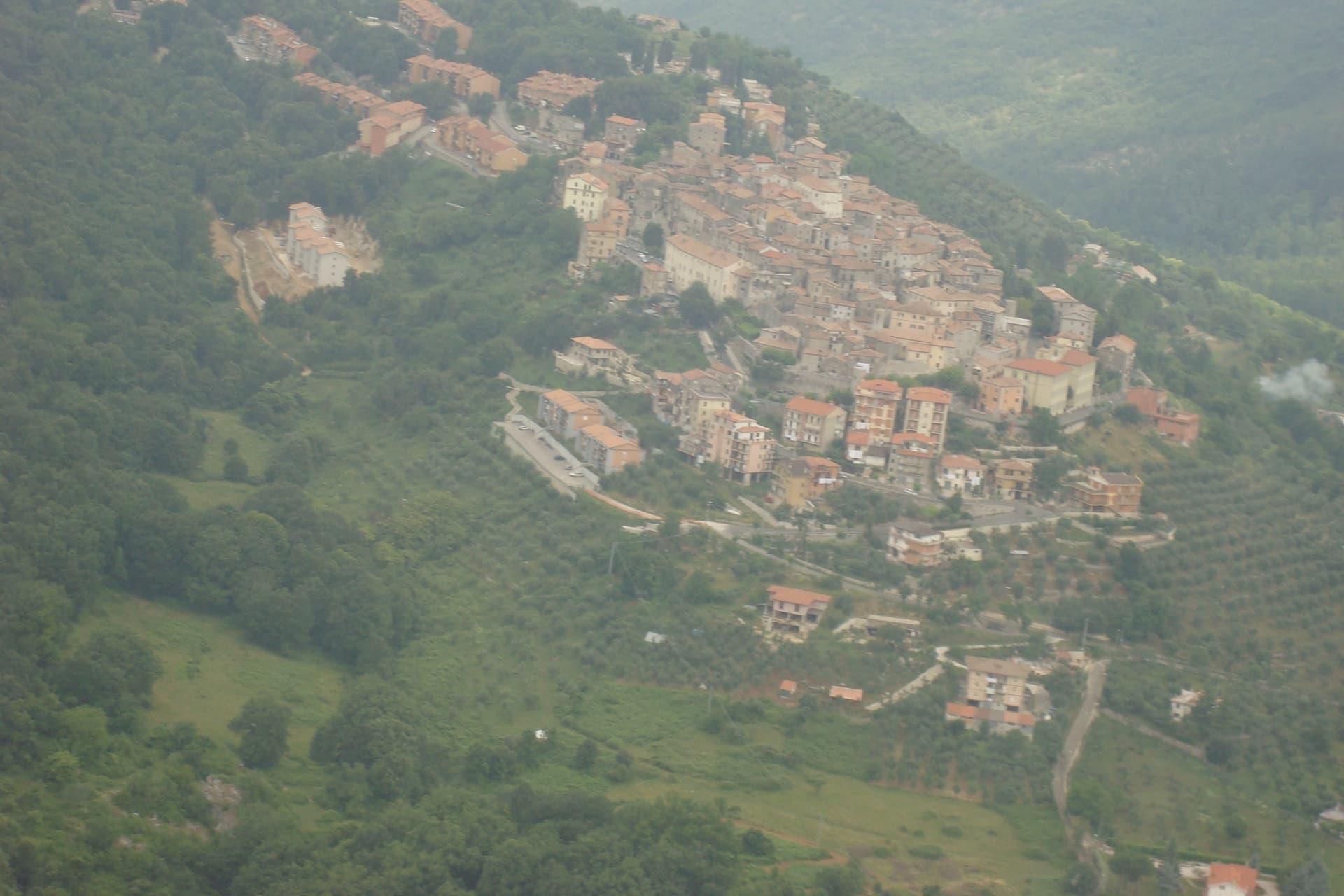
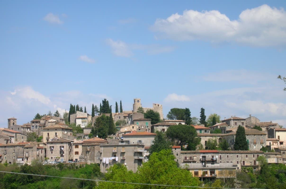
The town sits on a limestone spur at 220m, between Rome (115 km north) and Naples (140 km south), in the Ciociaria mountain landscape that runs into the national parks to the south and the Liri valley route toward Fondi. The Monastero di Montecassino lies 40 km east.
The castle at the high point of the town, built in the 16th century on 11th-century Norman foundations, belonged to the Boncompagni family, into which the writer Tommaso Landolfi was born; his fantastic-realism stories (Mar delle blatte, La pietra lunare, Il dialogo dei massimi sistemi) place him alongside Borges or Kafka in Italian letters, and the museum now inside the castle also covers the broader school he belonged to, including Buzzati, Calvino, and Bontempelli. Below the castle, the streets of the old town descend to the central piazza, and the Palazzo Boncompagni, the baronial family's residence, sits at that lower point between the two.
The mountains that border the town on the south side are the same range the medieval centro was built to look out over, and they carry the karst hiking, the wild boar territory, and the historic route through the Liri valley that give the area its hunting economy. The food follows that same pattern found across the surrounding villages: pasta alla ciociara, abbacchio, Pecorino, salame ciociaro, and boar from those forests, with the Cesanese del Piglio DOCG red, from the Piglio hills 30 km north, as the local wine.
Population has fallen from 5,200 in 1951 to 2,634 today, the same depopulation that has thinned most Ciociaria mountain villages. What the town amounts to is a single hill settlement where a family castle, a writer's inheritance, and a mountain economy of hunting and wine all occupy the same small footprint, with little distance between the literary museum at the top and the working village below it.
What to see in Pico
- Casa Museo Tommaso Landolfi (Castello Baronale). The 16th-c Boncompagni baronial castle holds the writer's library, manuscripts, and the rooms where he wrote, preserved as he left them, alongside exhibits on the wider Italian fantastic-realism school.
- BPB medieval centro. Narrow stone-paved vicoli climb from the central piazza to the castle, past the Chiesa di Sant'Antonino (15th-c), the Chiesa di San Rocco, and the Palazzo Boncompagni.
- Monti Ausoni + Aurunci parks. The Monti Ausoni and Monti Aurunci National Parks sit immediately south, with karst hiking, wild boar territory, and the Liri valley historic route.
How to get to Pico
Latina is roughly 91 minutes away by road.
Our tip
Pico is best April–June and September–October. The Festa di Sant'Antonino (10 May) and the Sagra del Cinghiale (mid-October) frame the season. Summer is hot in the Ciociaria — the Castello + Casa Museo are the cool indoor refuges.
Atina
Why visit Atina
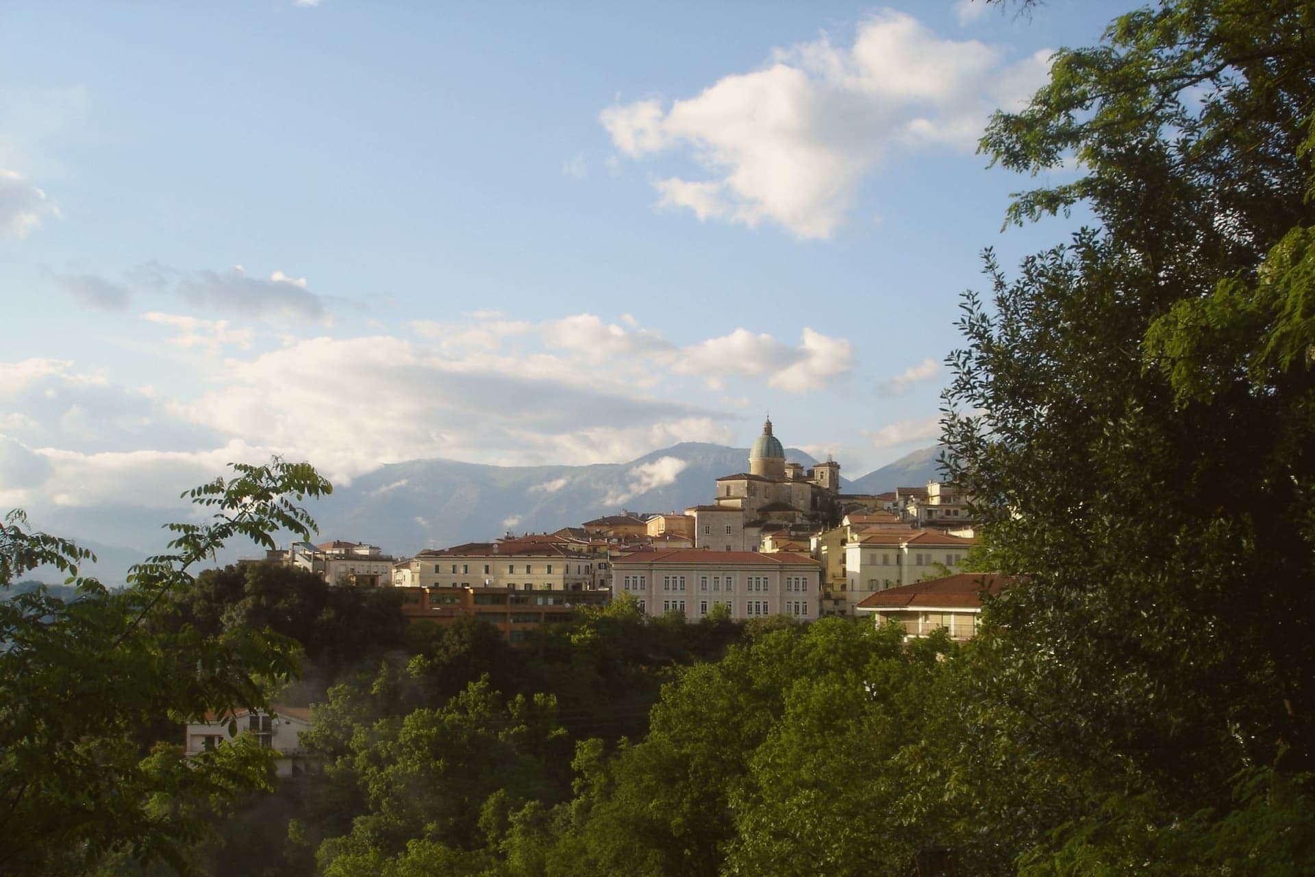
Atina sits at 500 meters in the province of Frosinone, at the foot of the Meta and Mainarde ranges. The Volsci held the ground first, then the Samnites built their defenses here, and Cicero, born fourteen kilometers away in Arpino, mentions the town in his De Lege Agraria.
The old town is built directly over that earlier settlement, its streets gathered around Piazza Garibaldi with the ducal palace on one side and the cathedral closing the other end. Below the hill, the Val di Comino opens toward the Mainarde and Ernici, the upper reach of the Liri-Garigliano valley.
Atina anchors the upper valley while the valley floor beneath it grows the Cabernet blend that carries the town's name as a DOC. Fifteen kilometers downhill, past the vineyards, the Lago di Posta Fibreno sits with its floating island, a detail Pliny the Elder recorded.
What holds this place together is the relation between height and floor: a fortified ridge that watched the routes from Cassino, and the valley bottom below it that now grows the grapes.
What to see in Atina
- Mura poligonali. The walls survive in stretches below the medieval ridge, massive uncut blocks fitted without mortar, still visible where the modern town has not built over them.
- Palazzo Cantelmo (Ducale). Faces Piazza Garibaldi at the center of the old town, the seat of the Cantelmo dukes now given over to municipal offices.
- Cattedrale di Santa Maria Assunta. Closes one end of the historic center, its current form the result of rebuilding after repeated earthquake damage.
How to get to Atina
Napoli is roughly 86 minutes away by road.
Our tip
April through October is the open season for Atina: vineyards in leaf in May, the Cabernet harvest in late September, mild dry air through October. July and August are warm in the valley below but cooler at 500 meters; the centro storico holds shade through the afternoon. November through March is quiet.
Castro dei Volsci
Why visit Castro dei Volsci
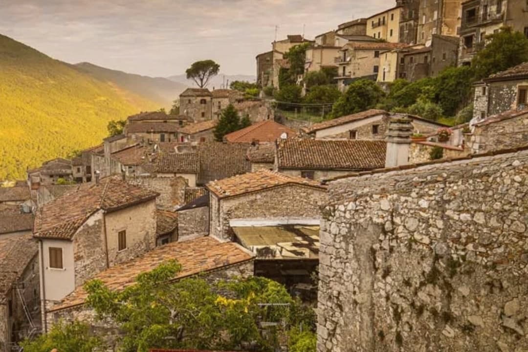
Castro dei Volsci sits at 385 meters on a ridge above the Sacco river valley, ninety kilometers southeast of Rome and fourteen from Frosinone. The Volsci, an Italic tribe Rome spent two centuries subduing, held this hill before the Latins took it; the name preserves both occupants, Castrum and Volsci, castle and people.
After the year 1000 the village fell to the Papal States and stayed inside that orbit until unification. The valley floor below the ridge holds Roman-era foundations and mosaics, remains of a settlement separate from the hill village above it.
The slopes between the two carry the olive groves that still supply the town's oil. The upper village, where the clock tower and castle ruins stand, is where Nino Manfredi was born in 1921 before the family's path led him to Rome and to postwar cinema; the town he left behind kept its stacked houses, its gates and its position over the valley, and it is that unbroken layout, hill above, groves on the slope, valley floor beneath, that the Borghi più belli d'Italia listing recognizes.
What to see in Castro dei Volsci
- Torre dell'Orologio. Medieval clock tower in the upper village. Inside, a permanent exhibition holds Nino Manfredi's films, scripts and personal effects.
- Castello. Ruins of the medieval fortress at the top of the borgo, with a panorama over the Sacco valley and the Monti Ausoni.
- Centro storico. Stacked stone houses, vaulted passages and medieval gates that earned the borgo its Borghi più belli d'Italia membership.
How to get to Castro dei Volsci
There is a railway station in the town, so you can arrive without a car and never need one while you are here. Latina is roughly 71 minutes away by road.
Our tip
April through June and September through October are the best windows. The Sacco valley is green in spring and the panoramas from the castle ruins open clean once the haze burns off. July and August push past thirty-five degrees; the centro storico empties between two and five in the afternoon, and the olive groves on the slopes go silent until evening.
Arpino
Why visit Arpino
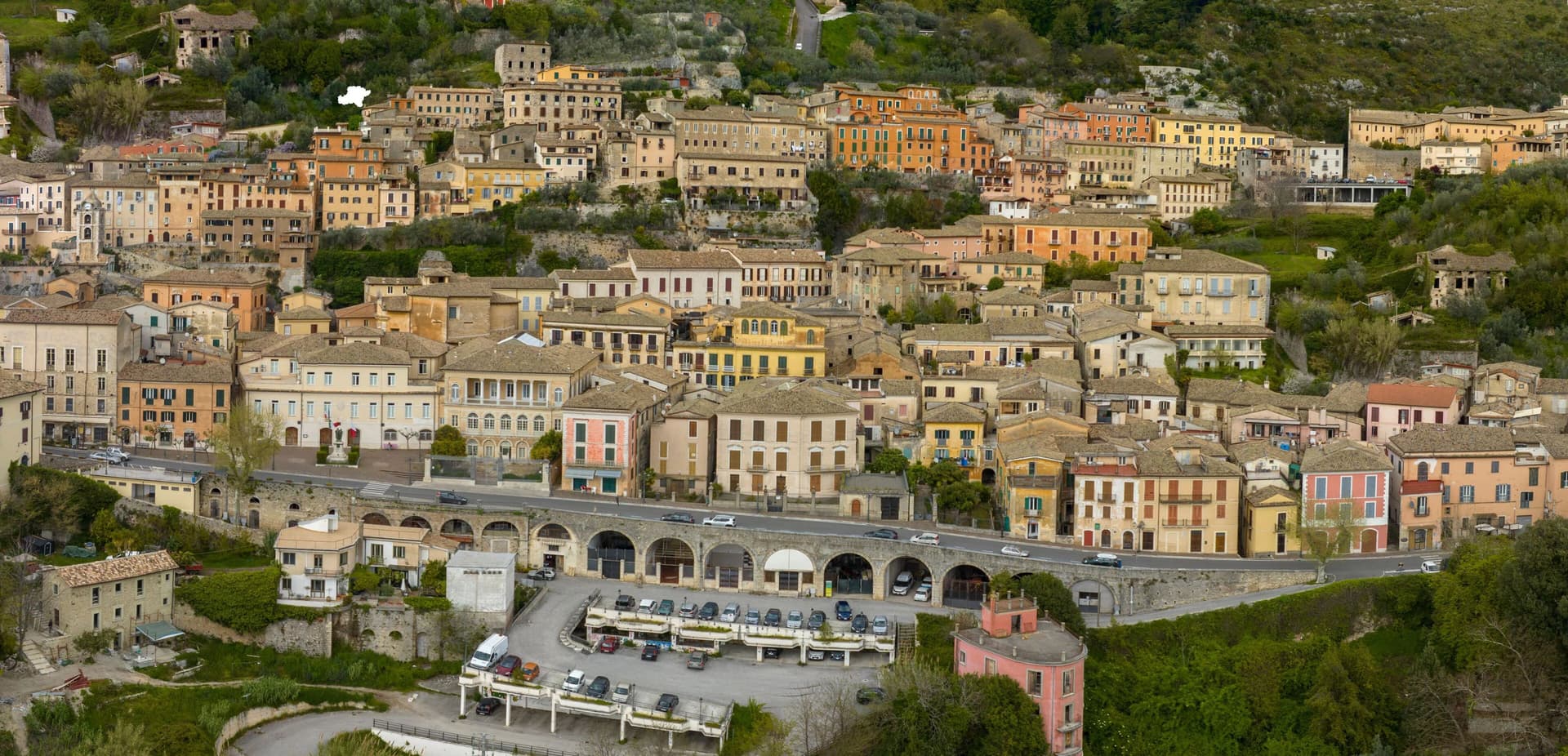
Arpino sits at 450 meters on two hills in the Liri valley, in the Ciociaria region of southern Lazio. The ancient city of Arpinum, on the upper hill now called Civitavecchia, was a Volscian-Samnite stronghold captured by Rome in 305 BC.
The lower hill is the medieval and modern town. Two Roman consuls were born here: Gaius Marius, the military reformer who fought the Cimbri and Teutones, and Marcus Tullius Cicero, the orator and senator killed in 43 BC.
The villa where Cicero was born stood just north, on the Liri, in what is now Isola del Liri. The upper acropolis is ringed by polygonal cyclopean walls of the sixth or fifth century BC, with the Arco a Sesto Acuto, a pointed-arch gate cut into the same stone work.
Arpino is on the Bandiere Arancioni list and on the Cammino di San Benedetto, the long pilgrim route from Norcia to Montecassino.
What to see in Arpino
- Acropoli di Civitavecchia. Pre-Roman upper city on the hill above modern Arpino, surrounded by cyclopean polygonal walls of the sixth or fifth century BC.
- Arco a Sesto Acuto. Pointed-arch gate cut into the cyclopean walls of the acropolis, the only known pre-Roman ogival arch in central Italy.
- Torre di Cicerone. Medieval tower on the acropolis, traditionally linked to Cicero by local memory though built more than a thousand years after his death.
How to get to Arpino
There is a railway station in the town, so you can arrive without a car and never need one while you are here. Latina is roughly 94 minutes away by road.
Our tip
April through June and September through October are the strong months. Spring brings green hills along the Liri and clear views from the acropolis; autumn is dry and gold. July and August push past thirty degrees in the valley, although Arpino's 450-meter position offers some relief in the upper town. Il Gonfalone falls in July.
Boville Ernica
Why visit Boville Ernica
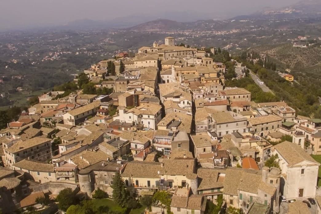
Boville Ernica sits at 450 meters above the Sacco and Liri valleys in Ciociaria, in the province of Frosinone. The Ernici, an Italic tribe contemporary with the Volsci, gave the place its second name, added in 1900 to distinguish it from another Bauco.
That name links the town's two layers: the polygonal walls at Monte Fico above the centro storico, built by the Ernici to defend a hill village and its place of worship, and the medieval circuit below, raised centuries later over the same defensive instinct after the Saracen and Hungarian raids. The borgo itself grew around that walled core.
Cardinal Ennio Filonardi, a sixteenth-century papal nuncio born in Boville, built his palace over the medieval castle and reorganized the urban plan around it, so the renaissance layer sits inside the medieval one rather than beside it. The abbey holding the Angelo del Navicella occupies the same historical register, a twelfth-century structure raised over a saint's cave, carrying inside it a mosaic fragment centuries older than the building itself.
The hills above town, signed Città dell'Olio, are the one part of the landscape still doing what it has always done. Put together, the town reads as a single hill continuously fortified and rebuilt, each century adding a layer without erasing the one beneath it.
What to see in Boville Ernica
- Abbazia di San Pietro Ispano. Twelfth-century abbey built over a grotto associated with the saint. The Angelo del Navicella is kept inside, a small mosaic fragment set against the scale of the building raised to house it.
- Mura medievali. The circuit is walkable and complete, tower after tower in the round-then-square rhythm, a rebuilding that answered the Saracen and Hungarian raids of the tenth century.
- Palazzo Filonardi. Sixteenth-century palace built by Cardinal Ennio Filonardi over the medieval castle, anchor of the renaissance reorganization of the centro storico.
How to get to Boville Ernica
Latina is roughly 74 minutes away by road.
Our tip
April through June and September through October are the months for Boville Ernica. The Sacco valley clears, the hill groves stay cool, and the eighteen-tower walls hold light in the late afternoon. July and August touch thirty-three on the valley floor but moderate on the hilltop.
Isola del Liri
Why visit Isola del Liri
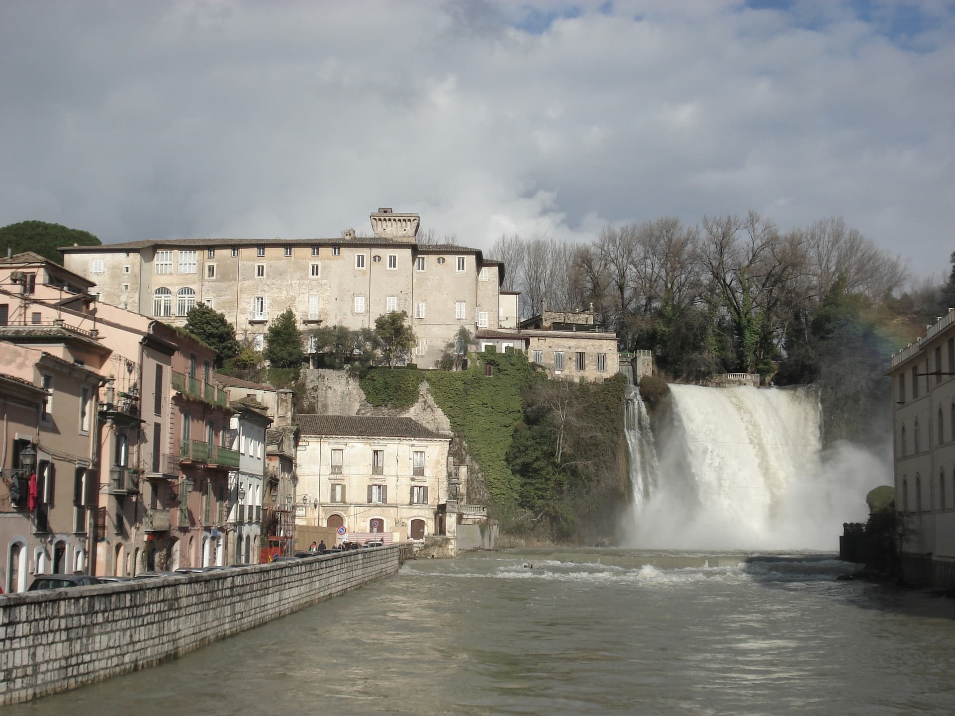
Isola del Liri is built on an actual island, where the Liri river splits into two arms and the two arms fall over a limestone shelf into the lower valley. The Cascata Grande is 27 meters high and lands inside the historic center, fifty meters from the Castello Boncompagni-Viscogliosi, the fortified palace above it.
The second fall, Cascata del Valcatoio, is partly diverted for hydropower. From the 19th century the river ran the paper mills, felt mills and wool mills that gave the town the name Manchester of Italy: the Fibreno-Lefebvre mill exported to North America.
The paper industry collapsed in the late 20th century. The town responded with the Liri Blues Festival, started in 1988 by a local businessman, Luciano Duro, to draw attention back to a place that had lost its trade; it became one of Europe's longer-running free blues festivals.
The Cammino di San Benedetto walking route passes through.
What to see in Isola del Liri
- Cascata Grande. 27-meter waterfall in the center of town, the Liri river dropping over a limestone shelf next to the castle.
- Cascata del Valcatoio. Second urban waterfall on the right arm of the Liri, partially diverted for hydroelectric production.
- Castello Boncompagni-Viscogliosi. Fortified palace from the 14th century above the Cascata Grande, residence of the Boncompagni-Ludovisi from the 16th century.
How to get to Isola del Liri
There is a railway station in the town, so you can arrive without a car and never need one while you are here. Latina is roughly 80 minutes away by road.
Our tip
April through June is when the Liri runs hardest after the spring melt and the Cascata Grande is at maximum volume. July is the festival month: the Liri Blues runs across several July evenings on stages in the centro storico and on the riverbanks. August stays hot in the Liri valley, the town thins out for the coast.
Anagni
Why visit Anagni
Anagni sits on a hilltop at 424 meters in Ciociaria, fifty-five kilometers southeast of Rome, looking over the Sacco valley and the Hernici mountains. It is one of four communes called the Città dei Papi, the others being Segni, Ferentino, and Veroli; four medieval popes were born here, Innocent III, Gregory IX, Alexander IV, and a fourth who would later be attacked in his own palace.
Agents of Philip IV of France, acting on his orders, stormed that palace on the hill and physically assaulted the reigning pope inside it. The centralized medieval papacy died with him within the month, and within five years the papal court had moved to Avignon.
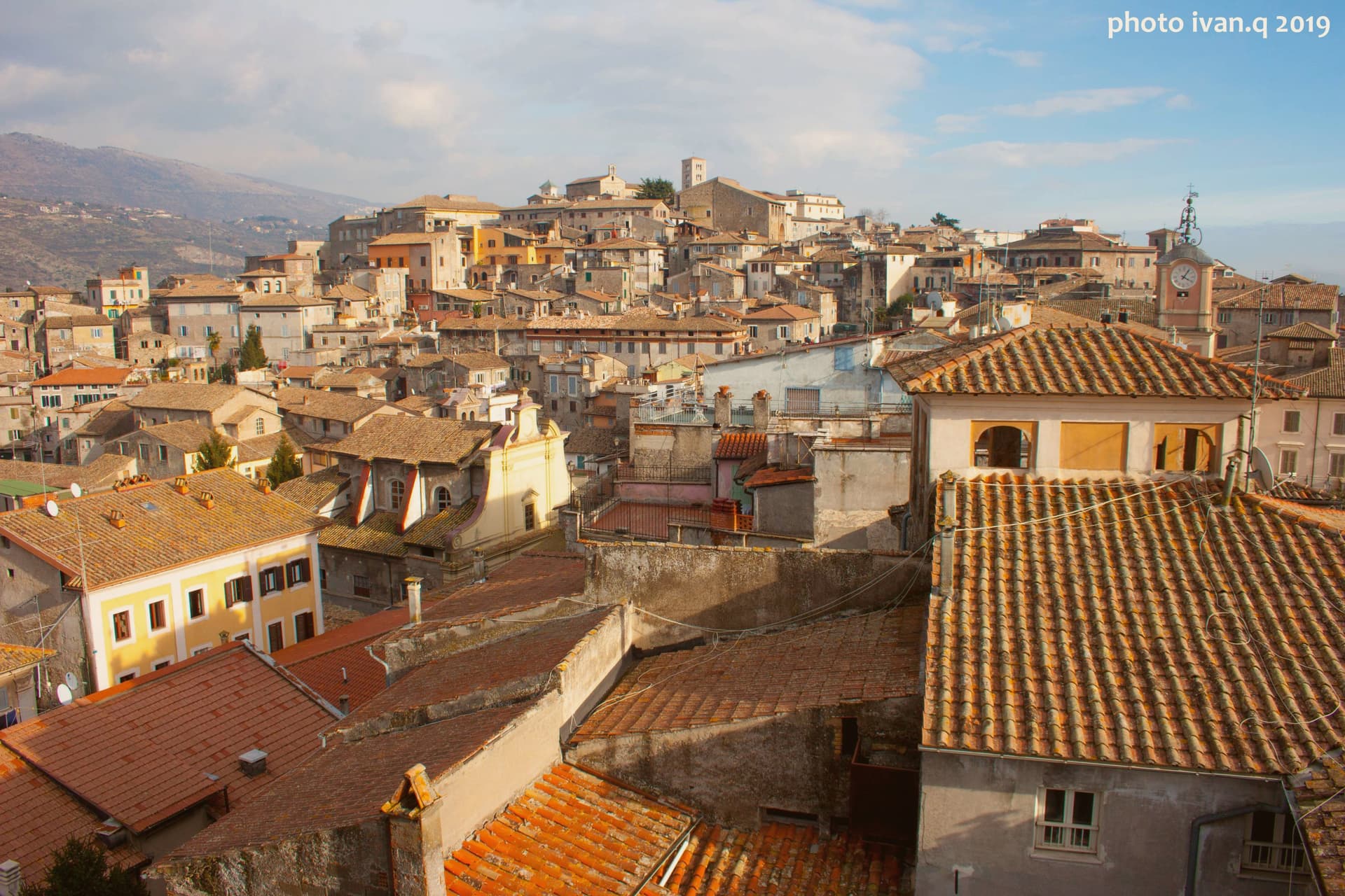
The town's medieval fabric runs along Via Vittorio Emanuele, where the communal loggia, a frescoed church, and a house layered with nineteenth-century inscriptions sit within walking distance of each other on the same climb up from the lower town to the cathedral above. A single event inside a single palace on this hill is the reason the town's name outgrew its size: four popes were born here, but it is one pope's injury, not birth, that historians still date the end of an era to.
What to see in Anagni
- Cattedrale di Santa Maria. Romanesque cathedral on the highest point of the hill, with Gothic additions, a campanile, and a Cosmati pavement underfoot.
- Cripta di San Magno. The crypt beneath the cathedral floor, walls covered edge to edge in painting, dim enough that the colors need a moment to settle into view.
- Palazzo di Bonifacio VIII. The papal palace where Sciarra Colonna struck Boniface VIII during the Outrage of Anagni, its thirteenth-century rooms still standing on the hill.
How to get to Anagni
There is a railway station in the town, so you can arrive without a car and never need one while you are here. Roma is roughly 55 minutes away by road.
Our tip
April through June and September through October are the strong months. The hilltop position keeps Anagni cooler than the Sacco valley below, and the cathedral and crypt are best seen in the soft light of spring and autumn. July and August push past thirty-two degrees and the centro storico empties between two and five in the afternoon. Sagra dei Maltagliati falls in July.