

Lazio · Frosinone
Atina
A polygonal-walled town at the foot of the Mainarde, and the DOC that makes Cabernet in central Italy.
- Best time
- Apr–Oct
- By car
- 1 h 26 min from Naples
- Population
- 4,133
Known for
ATINA CABERNET DOC
Granted 1999, a red of 50–70% Cabernet Sauvignon blended with Syrah, Merlot and Cabernet Franc on the Val di Comino floor.
CYCLOPEAN WALLS
Samnite polygonal masonry below the medieval town, double barrier defending the routes from Cassino into Samnium.
VAL DI COMINO
Upper valley between the Mainarde and Ernici, anchored by Atina, with Lago di Posta Fibreno and its floating island fifteen kilometers downhill.
When to visit
Best · Apr–Oct
- J9°
- F12°
- M13°
- A16°
- M21°
- J26°
- J31°
- A30°
- S25°
- O19°
- N14°
- D11°
- Best
- Hot or crowded
- Quiet
- Mostly closed
Daytime averages, 2020–2024. Weather data by Open-Meteo.com.
The festa: Marco di Atina, 1 October
Why come
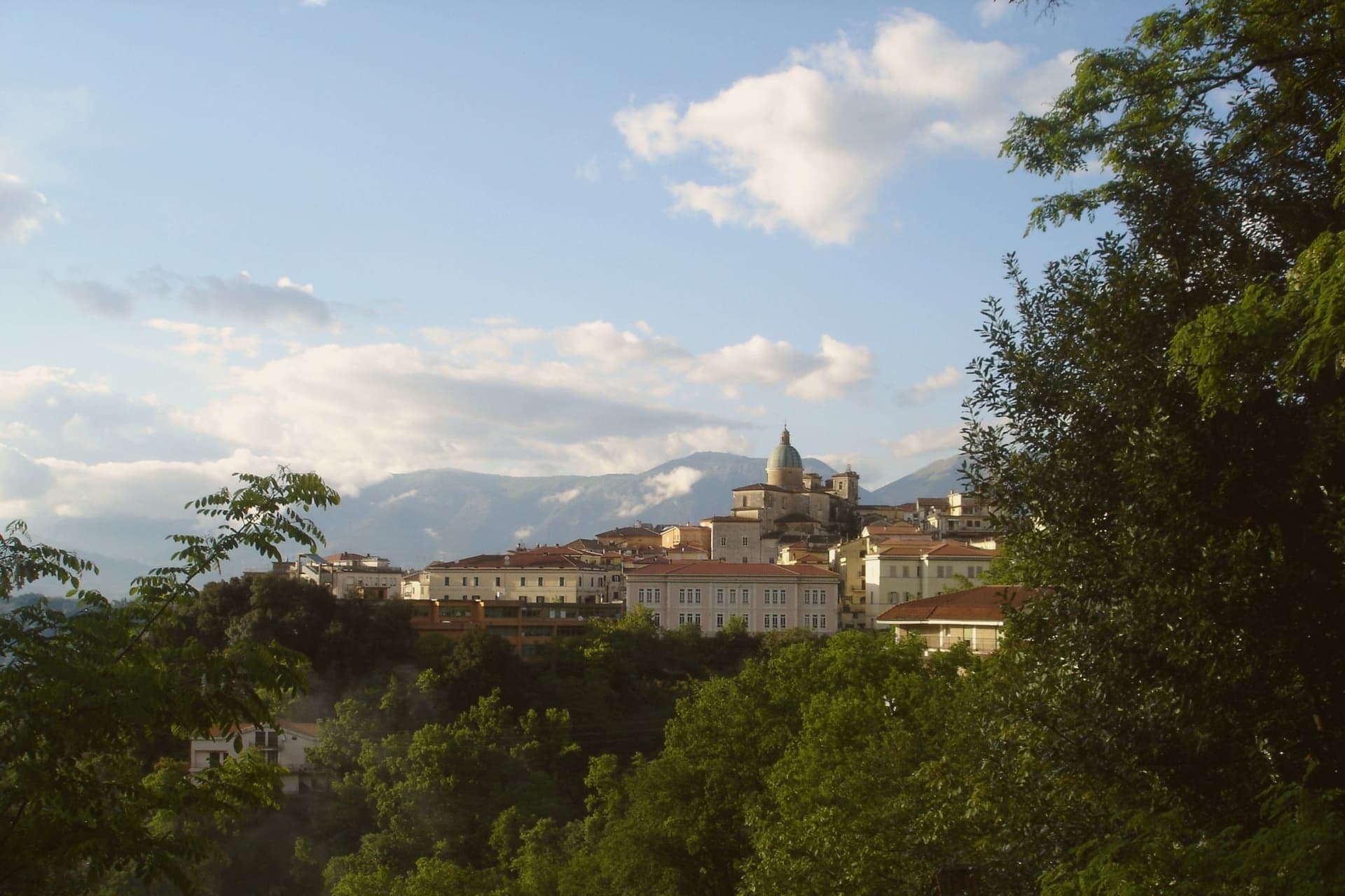
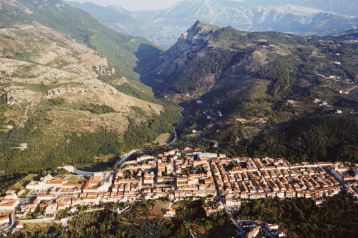
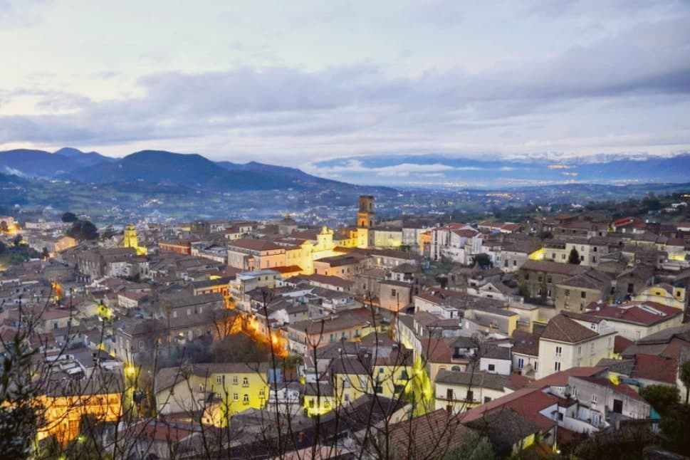
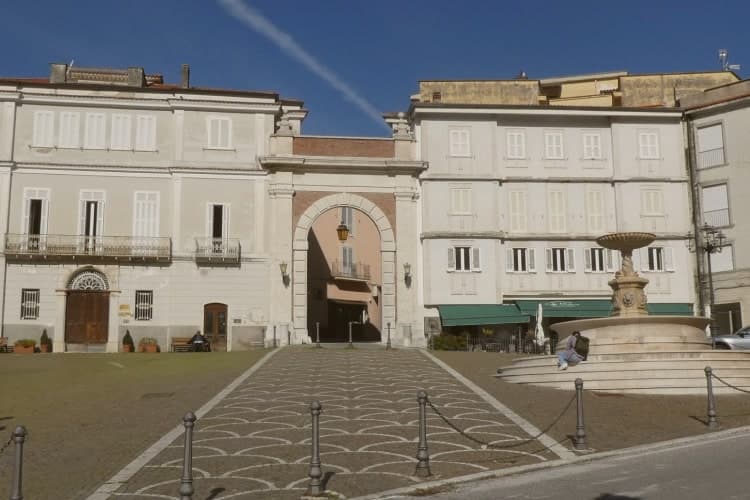
Atina sits at 500 meters in the province of Frosinone, at the foot of the Meta and Mainarde ranges. The Volsci held the ground first, then the Samnites built their defenses here, and Cicero, born fourteen kilometers away in Arpino, mentions the town in his De Lege Agraria. The old town is built directly over that earlier settlement, its streets gathered around Piazza Garibaldi with the ducal palace on one side and the cathedral closing the other end.
Below the hill, the Val di Comino opens toward the Mainarde and Ernici, the upper reach of the Liri-Garigliano valley. Atina anchors the upper valley while the valley floor beneath it grows the Cabernet blend that carries the town's name as a DOC. Fifteen kilometers downhill, past the vineyards, the Lago di Posta Fibreno sits with its floating island, a detail Pliny the Elder recorded. What holds this place together is the relation between height and floor: a fortified ridge that watched the routes from Cassino, and the valley bottom below it that now grows the grapes.
The Sunday letter
Atina is on our list. Its letter is still to come.
We are writing about all 1,000 of these towns, one at a time, in a free letter every Sunday: the photo, the food, the festa. That is our mission. Sign up and you will be there when Atina comes up. By Peter & Sophia, from Pietrasanta.
Read on
Atina in our articles
How to get there
From Naples / Salerno (NAP), about 1h 21m by car.
Rome (FCO) is about 2h 24m away.
By car from the centre of Naples 1h 26m or Salerno 1h 50m.
Coming by train into Napoli Centrale? Atina is about 1h 27m away by road.
What to see
Mura poligonali
The walls survive in stretches below the medieval ridge, massive uncut blocks fitted without mortar, still visible where the modern town has not built over them.
Palazzo Cantelmo (Ducale)
Faces Piazza Garibaldi at the center of the old town, the seat of the Cantelmo dukes now given over to municipal offices.
Cattedrale di Santa Maria Assunta
Closes one end of the historic center, its current form the result of rebuilding after repeated earthquake damage.
Val di Comino
Wine and olive country on the valley floor, the ground where the Cabernet DOC vines are planted below the hill town.
Centro storico
A ridge town laid over an earlier Volscian-Samnite acropolis, its streets recognized among Italy's most beautiful borghi.
The slow-trip planner
Building a trip? Find where Atina fits in a slow Italy circuit.
Answer five questions. We will shape a geographically coherent slow trip from the 1,000 Italian towns most travelers skip. Yours to save and share.
We recommend
Where to eat
Not our picks, but places the guides put their name to: a Michelin star, a Gambero Rosso fork, a Slow Food snail, a Michelin Key for the hotels. Worth a table, a counter, or a night when you pass through.
Il VicoloRistorante
Il Vicolo has one Gambero Rosso fork (77/100) to its name.
Villa Ischia RestaurantRistorante
Villa Ischia Restaurant carries one Gambero Rosso fork (75/100).
Living here
- Population 4,133
- Commuter belti
- Pharmacy in town
- High school within a 30-minute drive
- Nearest airport Naples / Salerno, 1 h 21 min drive
- Regional capital Roma, 1 h 53 min drive
Common questions
- What is Atina known for?
- Atina is a polygonal-walled town at the foot of the Mainarde, and the DOC that makes Cabernet in central Italy.
- Where is Atina?
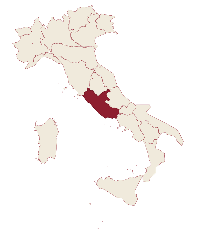
- Atina is a comune in the province of Frosinone, in Lazio, at 500 meters above sea level.
- What is the nearest airport to Atina?
- Naples / Salerno (NAP), about 1h 21m by car.
- How long is the drive from Naples to Atina?
- About 1h 26m by car.
- When is the best time to visit Atina?
- Best in Apr–Oct. July is the warmest month, averaging 31 degrees, and May the wettest, with about 15 rain days.
- Is there a sagra or a festival in Atina?
- The town keeps its patron saint's day: Marco di Atina, 1 October.
- Which other towns are like Atina?
- Boville Ernica, Caprarola and Bagnoregio.
- How many people live in Atina?
- 4,133 at the 2023 count.
Tags & datadesignations · numbers · sources
Recognised as
The numbers
- Elevation: 500 m
- Population: 4,133
- Surface area: 29.89 km²
These figures were compiled from public directories: ISTAT, OpenStreetMap and Wikidata, and from the official listings of the guides named on this page. Town details change; verify with official sources before you travel.
Similar
Towns like Atina
Boville Ernica
Province: Frosinone
both inland, away from the coast · both between 3,000 and 10,000 people
Caprarola
Province: Viterbo
both inland, away from the coast · both between 3,000 and 10,000 people
Bagnoregio
Province: Viterbo
both inland, away from the coast · both between 3,000 and 10,000 people
Vitorchiano
Province: Viterbo
both inland, away from the coast · both between 3,000 and 10,000 people
Ripatransone
Province: Ascoli Piceno
both inland, away from the coast · both between 3,000 and 10,000 people
Stroncone
Province: Terni
both inland, away from the coast · both between 3,000 and 10,000 people
🎨 Borghi più belli d'Italia
More Borghi più belli d'Italia towns in Lazio
Acquapendente
Province: Viterbo
The northernmost town in Lazio, at 420 meters above the Paglia, named in 964 for its waterfalls.
Bassano in Teverina
Province: Viterbo
A tufa-spur borgo of 1,260 above the Tiber valley between Lazio and Umbria, with a clock tower that hides an eleventh-century animated bell tower.
Boville Ernica
Province: Frosinone
A Ciociaria hilltop town with eighteen intact medieval towers, ringed by a walled circuit that has stood since the tenth century.
Capranica Prenestina
Province: Roma
A 915-meter ridge village east of Rome, with a sanctuary above the Giovenzano valley at 1,018 meters.
Castel Gandolfo
Province: Roma
A papal town on the rim of Lake Albano's volcanic crater, summer residence of the popes since 1626.