
The best hill towns on a walking route in Lazio
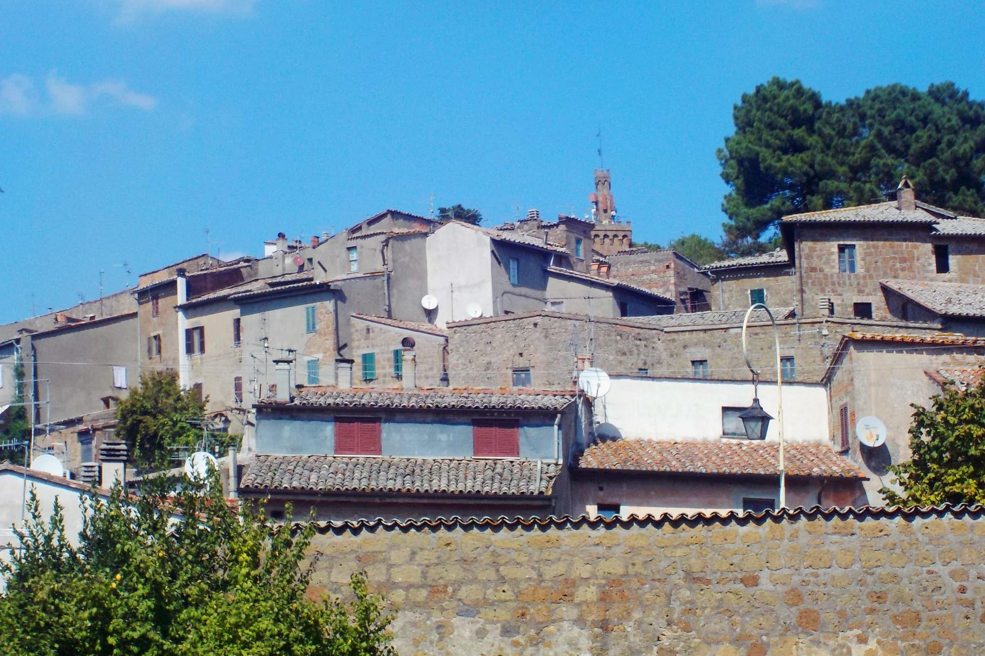
Lazio away from the sea is built on volcanic rock and limestone, and the towns show it. Houses go up in grey peperino and warm tufa, cut from the ridge they stand on, with lanes that climb rather than wander. The walking is best in late spring and again in October, when the chestnut woods turn and the vineyards around Lake Bolsena are being picked. Table food follows the same logic: lake fish, coratella, sheep's cheese from the Lepini pastures, olive oil pressed within sight of the trail, bread baked without salt in the old inland habit.
Almost everyone who comes to Lazio comes for Rome, and the walking routes are read backwards from it: the Via Francigena as the last week before St Peter's, the Cammino di San Benedetto as a line ending in the capital's orbit. The city absorbs the attention and the beds, and day trippers push out to Tivoli and Villa d'Este in numbers that fill the car parks by mid morning. Both are worth the time. Neither is a walking day.
The same routes keep going, north through the Tuscia towards the Umbrian border and south through the Valle Latina towards Cassino, and the hill towns strung along them see a fraction of that traffic. Some have Etruscan tombs cut below the road, some a Renaissance castle or a Cyclopean wall, some a waterfall in the middle of the built-up centre. They are stages, which means they know how to feed and house someone who has walked all day. Fewer people stop, and that is the point of stopping.
Of the 61 communes we have mapped in Lazio, 9 qualify as hill towns on a walking route: each is an inland hill settlement, and each is a stage on one of the long historic walking routes. The smallest, Acquapendente, has 5,266 residents.
Elsewhere in the catalogue: The best towns with a serious restaurant that sit on a walking route in Lazio and The 9 best hill towns with a serious restaurant in Lazio.
Acquapendente
Why visit Acquapendente
Acquapendente sits at the northern edge of Lazio, where the Paglia river marks the boundary with Tuscany. The name first appears in a document of Emperor Otto I dated 964, taken from the small waterfalls that drop the river toward the plain.
The town grew up along the pilgrim road that runs north to south through it, and the church at its center, with its Romanesque crypt and sacellum copying the tomb in Jerusalem, gave the settlement its old nickname, the Green Jerusalem. The built-up center holds the basilica and the streets that carry the floral mosaics each May, while outward from it the town's territory stretches to two very different edges: the frazione of Torre Alfina to the north, with its own restored castle and a listing among the country's most beautiful villages, and the forest of the Monte Rufeno reserve beyond that, nearly 3,000 hectares of oak and beech reached by marked trails.
A river border, a pilgrim route, and a nickname earned by a copied tomb: together they describe a town shaped less by what it produced than by what passed through it and what was built to receive those travelers.
What to see in Acquapendente
- Basilica Concattedrale del Santo Sepolcro. Twenty-four columns divide the crypt into nine naves. The sacellum sits carved into the rock at the center, a form pilgrims would have recognized as a copy of the tomb it names.
- Pugnaloni. Panels built from flower petals pressed into wooden frames, carried through the streets by each quarter of the town on the third Sunday of May.
- Castello di Torre Alfina. Neo-Gothic restored fortress in the frazione of Torre Alfina, itself listed among I Borghi più belli d'Italia.
How to get to Acquapendente
Terni is roughly 96 minutes away by road.
Our tip
April through June and September into October are the months for walking the Via Francigena and the trails of Monte Rufeno. The Pugnaloni festival fills the streets on the third Sunday of May and is the single best weekend in the calendar. July and August touch the mid-thirties in the Paglia valley; pilgrims start earlier and finish by mid-morning.
Sutri
Why visit Sutri
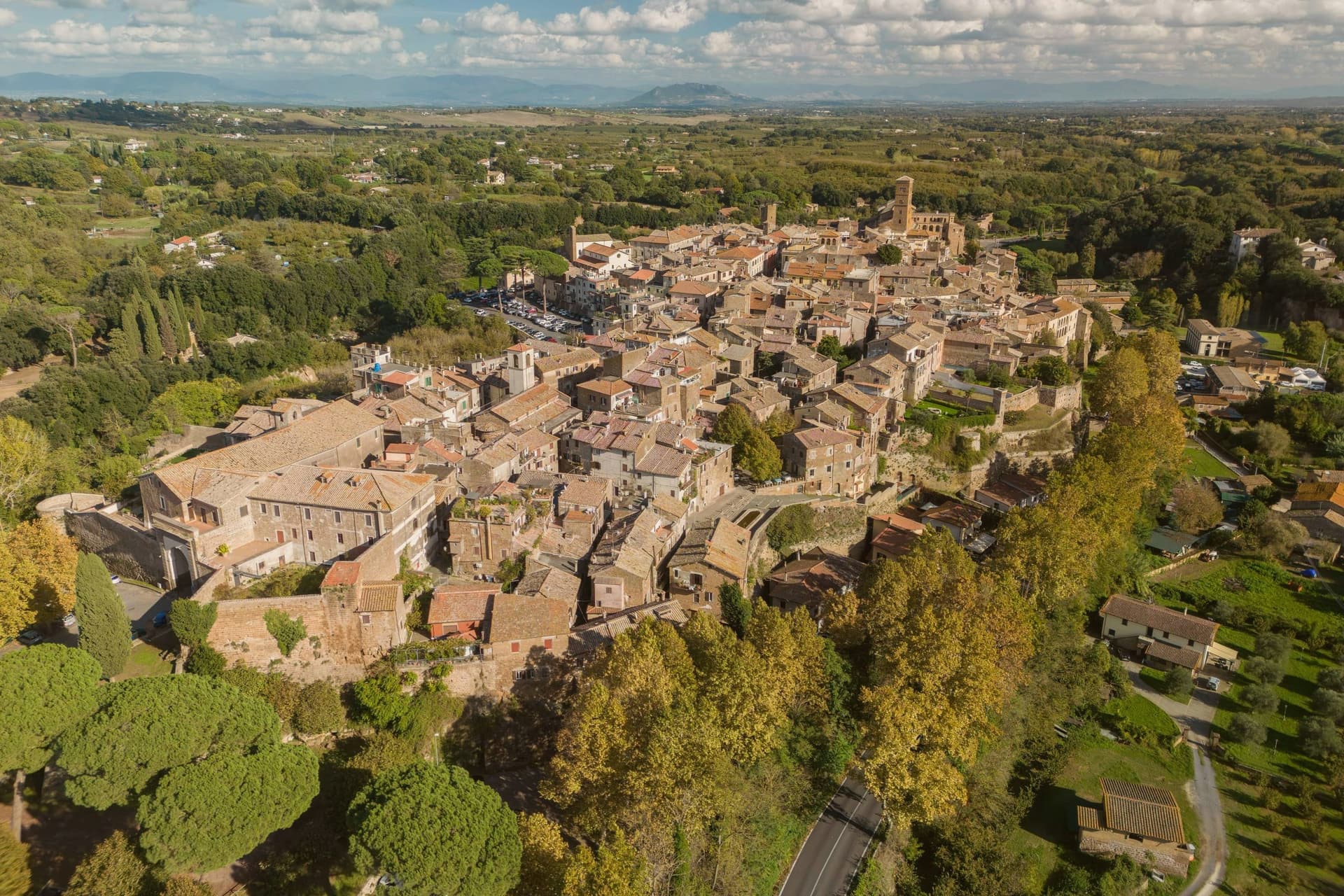
Sutri sits at 291 meters on a narrow tuff spur, fifty kilometers north of Rome on the old road linking the two. The Etruscans held it before the Romans took it in the fourth century BC, and it was among the colonies that refused further military contributions to Rome during the Second Punic War in 209 BC.
The rock-cut monuments that define the town, the arena, the temple turned sanctuary, the chamber tombs, all come from the same tuff spur the town is built on, so the stone that gives Sutri its ground is also what its Etruscan and Roman residents carved into. The high ground above, where the eighteenth-century villa and its gardens sit, looks down over that older excavated town rather than sitting apart from it.
Local tradition ties the town's beans to Charlemagne, who passed through and was supposedly relieved of an attack of gout by Sutri's variety. What the place adds up to is a settlement where the town and its excavation are the same rock: nothing was built so much as removed.
What to see in Sutri
- Anfiteatro Romano. Elliptical amphitheater about forty-nine by forty meters, carved directly out of the tuff rock rather than built on it.
- Mithraeum / Madonna del Parto. Roman temple to Mithras hewn into the tuff and reused as a Marian sanctuary, accessed through the medieval rock-cut church.
- Necropoli rupestre. Etruscan necropolis with dozens of rock-cut chamber tombs in the cliff face along the Via Cassia.
How to get to Sutri
Roma is roughly 57 minutes away by road.
Our tip
April through June and September into October are the best months in the tuff country, when the amphitheater grass is green and the gardens of Villa Savorelli are open. July and August push afternoons into the mid-thirties; the rock-cut Mithraeum and tomb chambers stay cool and become the part of the visit that doesn't need to be timed. November through March is quiet. Sagra del Fagiolo falls in August.
Arpino
Why visit Arpino
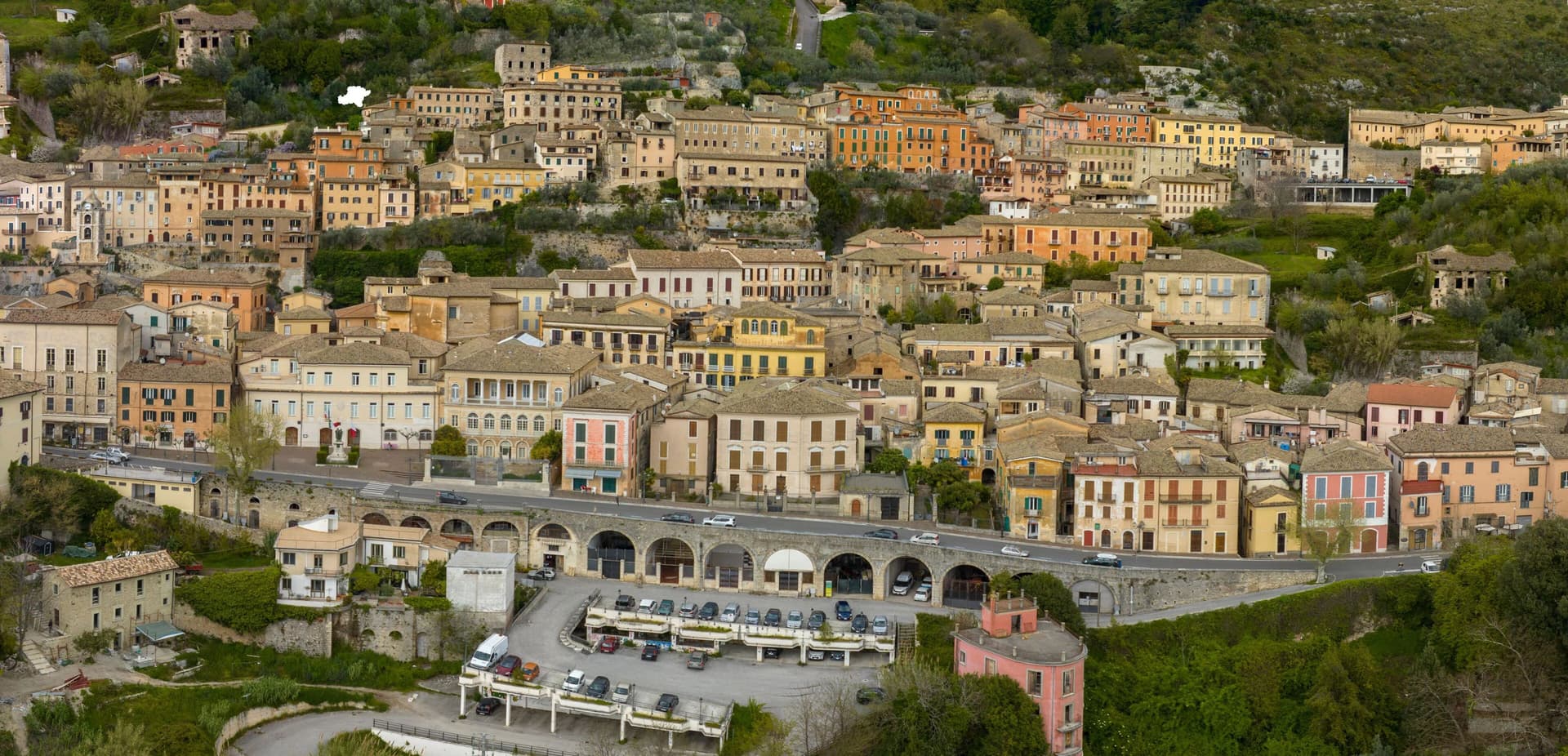
Arpino sits at 450 meters on two hills in the Liri valley, in the Ciociaria region of southern Lazio. The ancient city of Arpinum, on the upper hill now called Civitavecchia, was a Volscian-Samnite stronghold captured by Rome in 305 BC.
The lower hill is the medieval and modern town. Two Roman consuls were born here: Gaius Marius, the military reformer who fought the Cimbri and Teutones, and Marcus Tullius Cicero, the orator and senator killed in 43 BC.
The villa where Cicero was born stood just north, on the Liri, in what is now Isola del Liri. The upper acropolis is ringed by polygonal cyclopean walls of the sixth or fifth century BC, with the Arco a Sesto Acuto, a pointed-arch gate cut into the same stone work.
Arpino is on the Bandiere Arancioni list and on the Cammino di San Benedetto, the long pilgrim route from Norcia to Montecassino.
What to see in Arpino
- Acropoli di Civitavecchia. Pre-Roman upper city on the hill above modern Arpino, surrounded by cyclopean polygonal walls of the sixth or fifth century BC.
- Arco a Sesto Acuto. Pointed-arch gate cut into the cyclopean walls of the acropolis, the only known pre-Roman ogival arch in central Italy.
- Torre di Cicerone. Medieval tower on the acropolis, traditionally linked to Cicero by local memory though built more than a thousand years after his death.
How to get to Arpino
There is a railway station in the town, so you can arrive without a car and never need one while you are here. Latina is roughly 94 minutes away by road.
Our tip
April through June and September through October are the strong months. Spring brings green hills along the Liri and clear views from the acropolis; autumn is dry and gold. July and August push past thirty degrees in the valley, although Arpino's 450-meter position offers some relief in the upper town. Il Gonfalone falls in July.
Capranica
Why visit Capranica
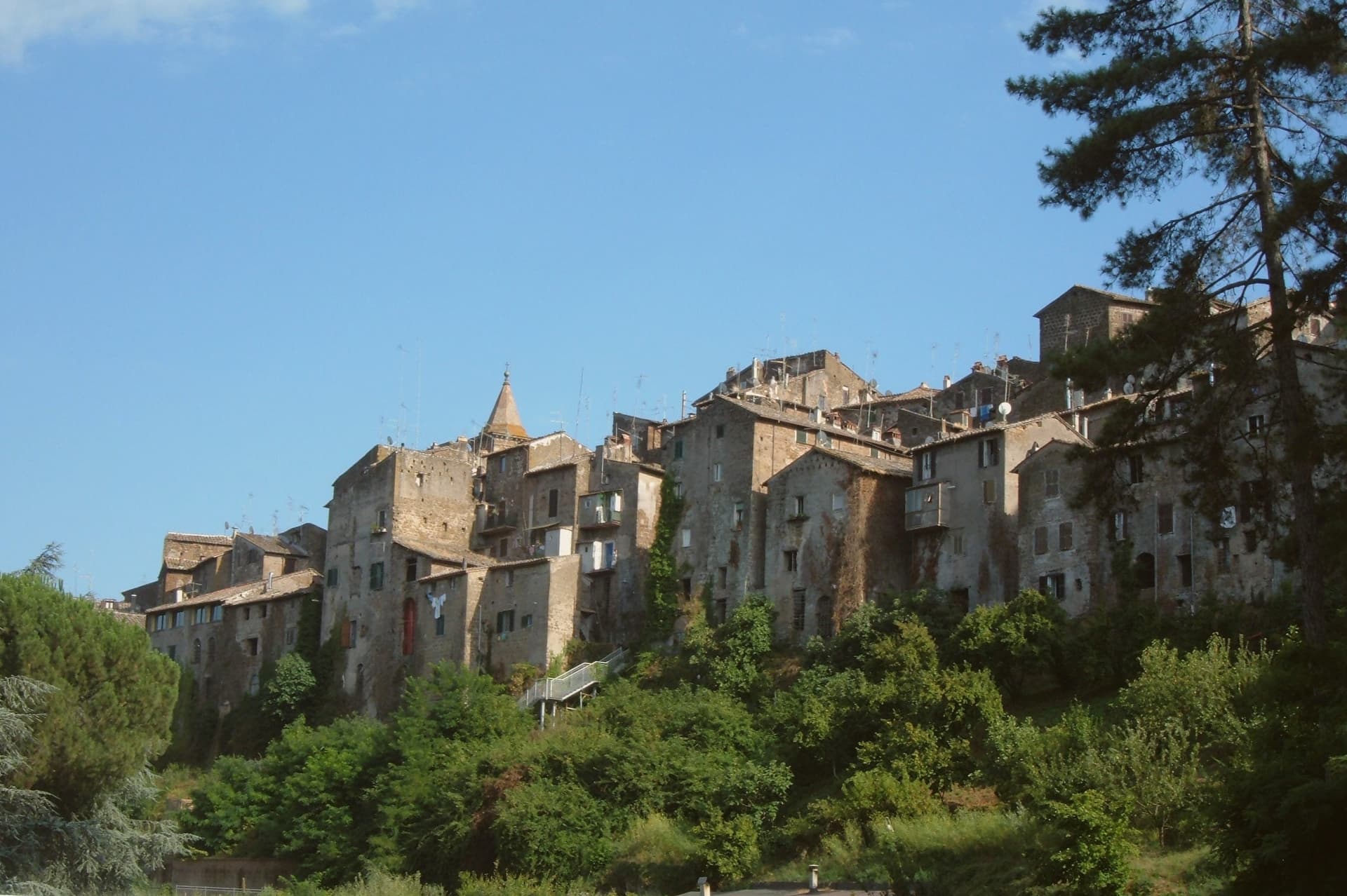
Capranica sits in the Tuscia at the fifty-fifth kilometer of the Via Cassia, on a hill overlooking the Sutri valley between Lake Bracciano and Lake Vico. The Etruscans worked this ground; the medieval borgo grew along the Cassia after the road was rebuilt in the second century BC.
The Anguillara family appeared in 1305 and held the town through most of the fourteenth century. In 1337, under Orso degli Anguillara, Francesco Petrarca stayed here on his way south, the moment local memory still attaches to the place.
Castrovecchio is the oldest quarter, a wedge of stone houses and stepped streets above the Castello degli Anguillara. The town is one of the Italian comuni crossed by the Via Francigena, with a marked stage running north toward Sutri and Vetralla.
Hazelnut groves cover the surrounding slopes; Capranica is a member of the Città della Nocciola network and supplies the Tonda Gentile Romana, the local DOP variety.
What to see in Capranica
- Castello degli Anguillara. Medieval fortress at the head of Castrovecchio, seat of the Anguillara family from 1305 and the place Petrarch stayed in 1337.
- Castrovecchio. Oldest quarter of the town, a wedge of stone houses and stepped streets rising above the Cassia toward the castle.
- Chiesa di San Francesco. Fourteenth-century Franciscan church on the edge of Castrovecchio, with fresco fragments and Anguillara family tombs.
How to get to Capranica
There is a railway station in the town, so you can arrive without a car and never need one while you are here. Roma is roughly 72 minutes away by road.
✷ We have written about Capranica
“So a borgo like Capranica, and especially Capranica, has nothing to offer except this vibe. After darkness sets, the town becomes the same medieval village that it was 500 years ago. The only difference is the electric lighting and some satellite dishes on some roofs.”
Read our piece on Capranica →Capranica | The stop on the journey
Our tip
April through June and September into October are the walking months in the Tuscia, when the hazelnut groves are green and the Cassia is light. July and August push the slopes into the low thirties; the medieval centro storico holds shade well enough, but afternoons stay quiet. The hazelnut harvest runs through late August and September and the air around the town smells of toasted nuts for weeks. Festeggiamenti in Onore di San Terenziano falls in August.
Subiaco
Why visit Subiaco
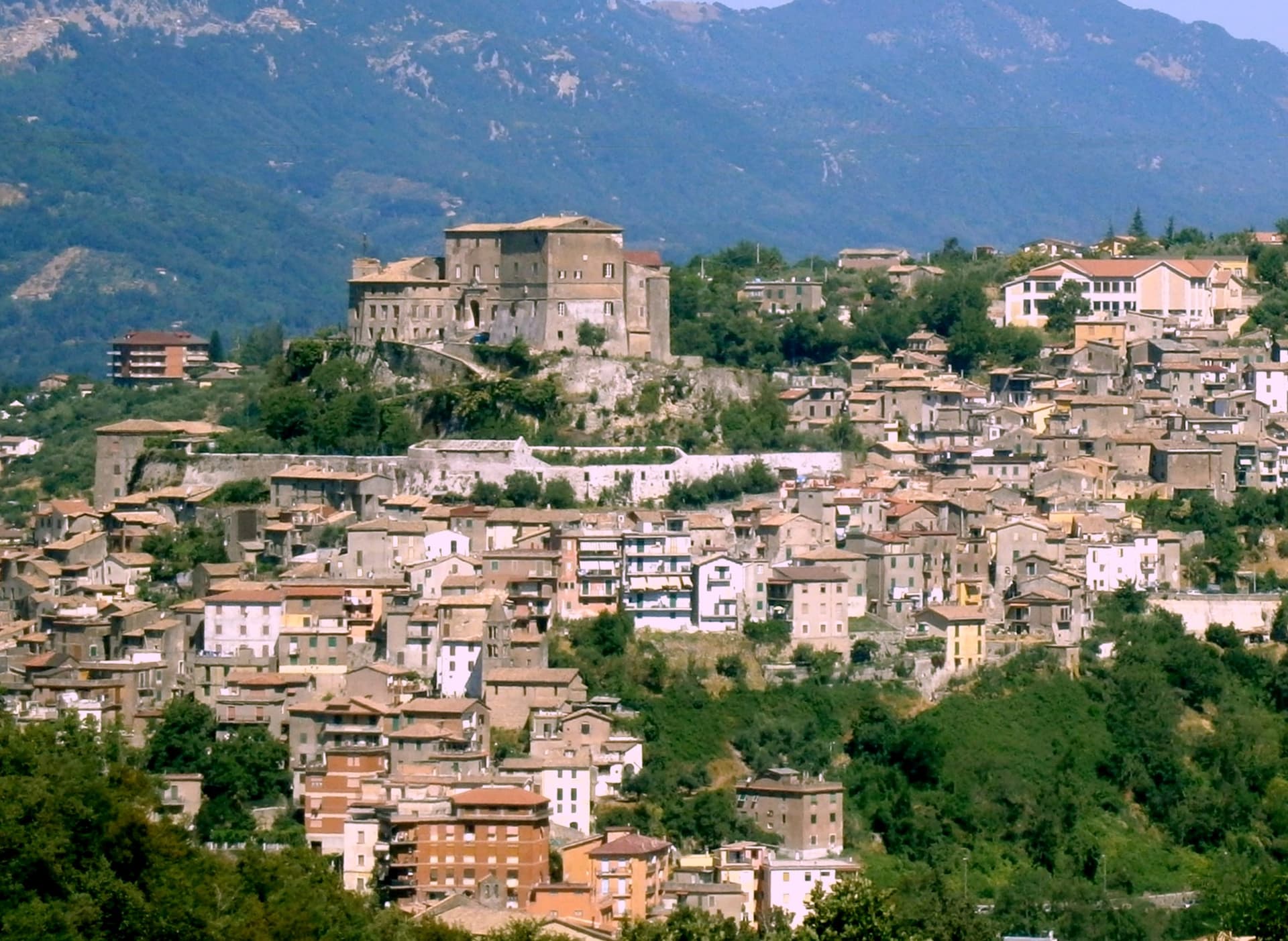
Subiaco sits at 408 meters along the upper Aniene, seventy-three kilometers east of Rome and forty from Tivoli. Nero built a villa here in the first century, damming the river into artificial lakes known as Sublaqueum, below the lake, and the name outlasted the villa and the emperor both.
The town that grew up here reads in layers going up the valley side: the river and the bridge at the bottom, the abbey partway up the hill, the fortress at the summit, and the cliff sanctuary further out along the cliff face that gave the hermit's cave its shelter, each one built at a different remove from the water and from the town center. What holds these layers together is a single life.
A man who came here as a young man to live alone in a cave gave his name to a monastery down the hill, and centuries later that same monastery's press put the first printed book on Italian soil into circulation. The fortress above answers to a different history, the abbots who ruled here as feudal lords, one of whom fathered a child who became one of the most written-about women of her age.
A river valley that supplied an emperor's pleasure lakes became, without much overlap, the ground where monastic life took its early shape.
What to see in Subiaco
- Monastero del Sacro Speco. Built into the cliff face of Monte Taleo, the sanctuary rises in tiers over the cave itself, and the frescoes by Conxolus and the school of Cimabue cover walls that follow the rock rather than a flat plan.
- Abbazia di Santa Scolastica. The only one of Benedict's twelve original monasteries still standing, sixth century in origin; its library holds three hundred manuscripts, including a copy of the Lactantius run off the abbey's own press.
- Rocca Abbaziale (Rocca dei Borgia). Set on the highest ground of the borgo, the fortress was raised by abbot Giovanni V in the twelfth century and later gave Lucrezia Borgia, daughter of the abbot Rodrigo Borgia, a birthplace in 1480.
How to get to Subiaco
There is a railway station in the town, so you can arrive without a car and never need one while you are here. Roma is roughly 70 minutes away by road.
Our tip
April through June and September through October are the months for Subiaco: the Aniene runs full, the cliff sanctuaries are open from morning, and the pilgrim road south fills with walkers on the Cammino di San Benedetto. July and August are warm in town and cool in the monasteries; the cave at the Sacro Speco holds twelve degrees year-round. November through March is the quiet pilgrim season, mist on the river and few coaches in the lots. Festa Madonna di Pompei Rione Colle falls in August.
Sermoneta
Why visit Sermoneta
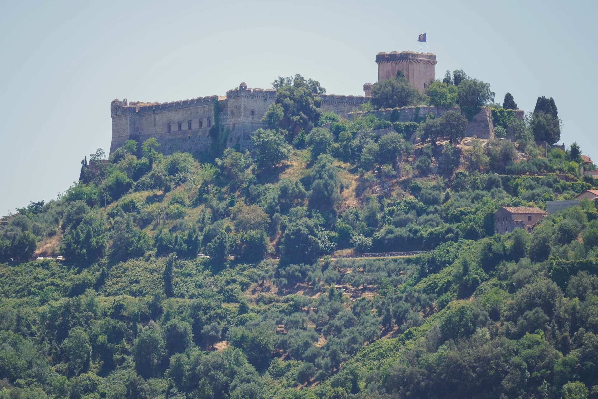
Sermoneta sits at 257 meters on a spur of the Monti Lepini, above what was once the Pontine Marshes and is now reclaimed plain. The Annibaldi held the site in the 13th century until 1297, when Pietro Caetani, nephew of Pope Boniface VIII, bought it and made it the seat of one of the great medieval Roman families.
The walled village climbs from the Porta Annibaldi up through narrow lanes to the fortress at its head, the two parts of the town, lower gate and upper stronghold, built as one continuous piece of Caetani-era stone. Below, in the valley, the family later turned an abandoned settlement into a garden, so the plain that emptied of people in the 17th century became, in the 20th, a cultivated ruin looked after by the same family that once ruled the hill above it.
The town on the spur and the garden in the plain are the same story told at two elevations: a family that built to hold ground in the medieval centuries, then returned centuries later to plant over what the land had reclaimed.
What to see in Sermoneta
- Castello Caetani. The Maschio tower stands beside the smaller Maschietto, and the Camere Pinte hold their frescoes from the 1470s. Charles V lodged here in April 1536 with 1,000 knights and 4,000 infantry.
- Giardino di Ninfa. The garden grows over stone that was once a working medieval town, abandoned in the 17th century after malaria emptied the plain; walls and a former church line survive among the planting.
- Cattedrale di Santa Maria Assunta. Romanesque collegiate church from the 13th century inside the walls, with a 14th-century panel of the Madonna by Benozzo Gozzoli.
How to get to Sermoneta
There is a railway station in the town, so you can arrive without a car and never need one while you are here. Latina is roughly 23 minutes away by road.
Our tip
April through June and September through October are when Sermoneta sits at its best. The Lepini spur catches a breeze the Pontine Plain below never gets in summer. April and May are also the months to see the Giardino di Ninfa in flower; the garden opens only on selected weekends from April to early November.
Isola del Liri
Why visit Isola del Liri
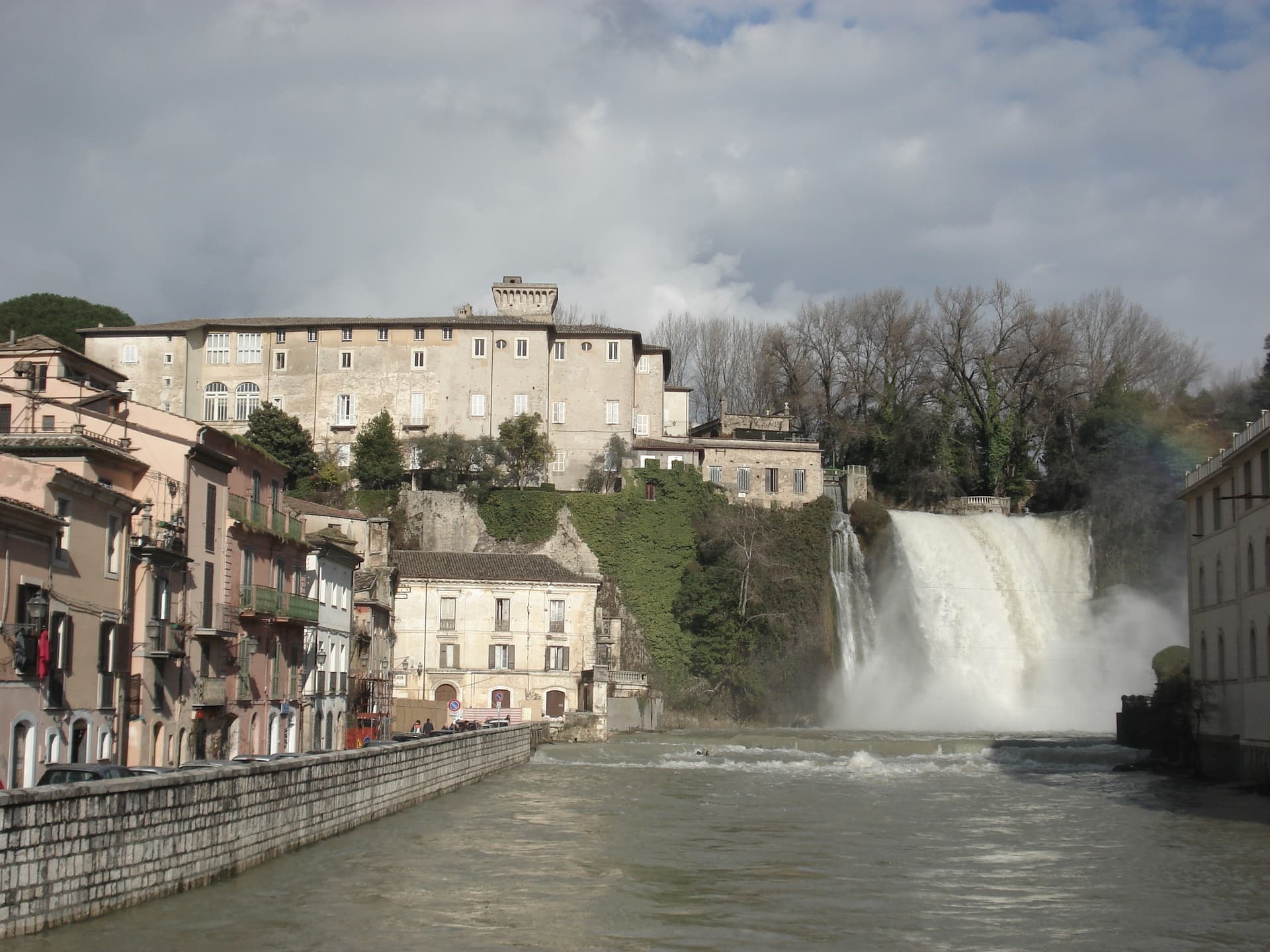
Isola del Liri is built on an actual island, where the Liri river splits into two arms and the two arms fall over a limestone shelf into the lower valley. The Cascata Grande is 27 meters high and lands inside the historic center, fifty meters from the Castello Boncompagni-Viscogliosi, the fortified palace above it.
The second fall, Cascata del Valcatoio, is partly diverted for hydropower. From the 19th century the river ran the paper mills, felt mills and wool mills that gave the town the name Manchester of Italy: the Fibreno-Lefebvre mill exported to North America.
The paper industry collapsed in the late 20th century. The town responded with the Liri Blues Festival, started in 1988 by a local businessman, Luciano Duro, to draw attention back to a place that had lost its trade; it became one of Europe's longer-running free blues festivals.
The Cammino di San Benedetto walking route passes through.
What to see in Isola del Liri
- Cascata Grande. 27-meter waterfall in the center of town, the Liri river dropping over a limestone shelf next to the castle.
- Cascata del Valcatoio. Second urban waterfall on the right arm of the Liri, partially diverted for hydroelectric production.
- Castello Boncompagni-Viscogliosi. Fortified palace from the 14th century above the Cascata Grande, residence of the Boncompagni-Ludovisi from the 16th century.
How to get to Isola del Liri
There is a railway station in the town, so you can arrive without a car and never need one while you are here. Latina is roughly 80 minutes away by road.
Our tip
April through June is when the Liri runs hardest after the spring melt and the Cascata Grande is at maximum volume. July is the festival month: the Liri Blues runs across several July evenings on stages in the centro storico and on the riverbanks. August stays hot in the Liri valley, the town thins out for the coast.
Montefiascone
Why visit Montefiascone
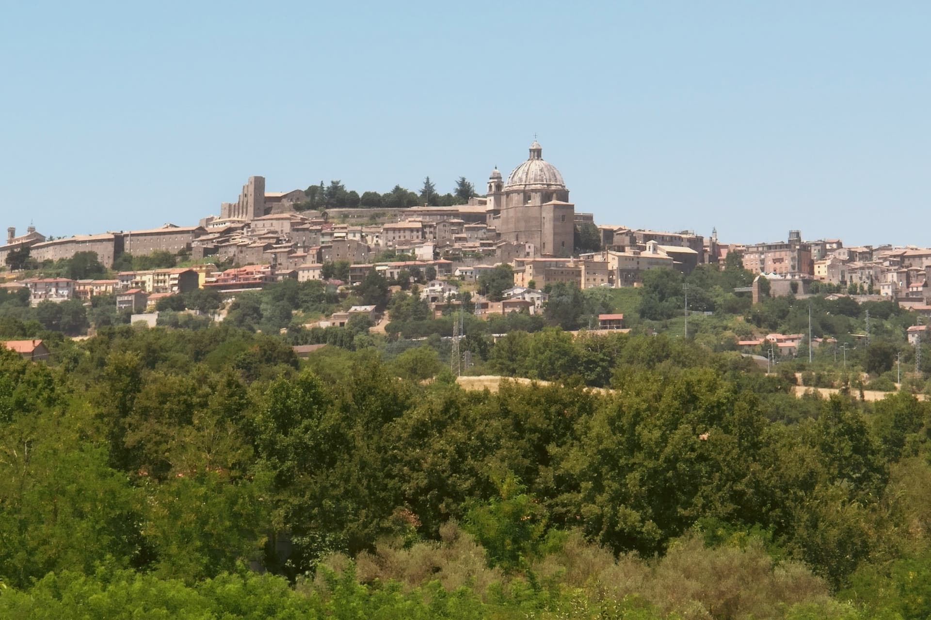
The town sits on the southeastern rim of a volcanic crater, about a hundred kilometers north of Rome, with the fortress at its highest point and the rest of the settlement built down the slope from there. The basilica stands just outside the walls at the lower end of that slope, separate enough from the fortress and the cathedral that the three read as three distinct centers of the town rather than one monument with satellites.
The wine takes its name from the same twelfth-century legend that put a German bishop's prelate on the road marking inn doors, and that bishop is the one buried in the basilica below, which ties the town's best-known export to a specific grave rather than to a floating story. The pilgrim route passes through on its way between Bolsena and Viterbo, so the hill that holds a papal summer residence and a wine legend was also, and still is, a stop on a much longer walk to Rome.
What the place adds up to is a small hill town where a fortress, a two-story church, and a road to somewhere else all sit within a short walk of one another, each one a different kind of stop on the same hill.
What to see in Montefiascone
- Rocca dei Papi. The fortress walls enclose the summit; the tower stair is narrow and gives out onto the panorama at once, the water filling the whole crater rim below.
- Basilica di San Flaviano. Two churches stacked on each other, the lower nave older and darker, the upper one built two centuries later and open to more light. The frescoes are original to the walls, not restored copies, and the German bishop Johannes Defuk is buried here.
- Cattedrale di Santa Margherita. The octagonal dome is 27 meters across, third largest in Italy by base diameter, finished in the late sixteenth century. It dominates the town's roofline the way the fortress dominates its summit.
How to get to Montefiascone
There is a railway station in the town, so you can arrive without a car and never need one while you are here. Terni is roughly 75 minutes away by road.
Our tip
April through June and September through October are the strong months. The hilltop position keeps Montefiascone cooler than Viterbo down the road, and the air over the lake is clearest in spring and autumn. July and August reach the low thirties; afternoons in the centro storico thin out between two and five. Fiera Del Vino falls in August.
Rieti
Why visit Rieti
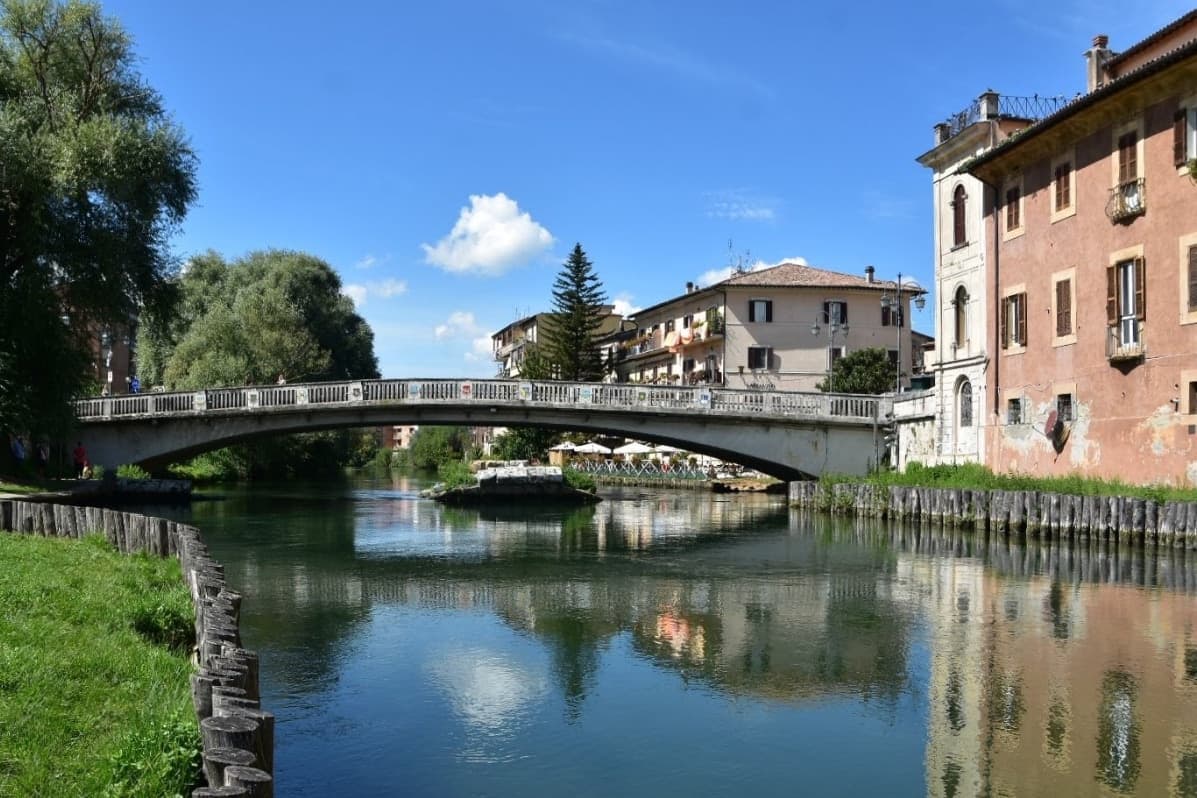
Rieti stands on a low rise at the edge of the Piana Reatina, the plain the Romans made when they drained the Lacus Velinus and sent its water over the cliff at Marmore. Medieval walls still close one side of the centro storico, and Via Roma runs down to the Velino and the stumps of the Roman bridge that carried the Via Salaria into town.
A marker in Piazza San Rufo stands for what Rieti has claimed for centuries: the umbilicus Italiae, the center of Italy. Popes stayed here often enough to build a palace beside the cathedral, and in 1234 Gregory IX canonized Saint Dominic inside it.
Saint Francis spent long stretches in the valley, which is why it is called the Valle Santa; the sanctuaries of Fonte Colombo and La Foresta are both in the comune. Above the plain, Monte Terminillo rises to 2,217 meters and is known as Rome's mountain.
In 2021 the town offered remote workers half their rent, up to 200 euros a month, to come and live here.
What to see in Rieti
- Cattedrale di Santa Maria Assunta. Romanesque outside and Baroque inside, built between 1109 and 1225 with a bell tower of 1252. Pope Gregory IX canonized Saint Dominic here in 1234.
- Palazzo Papale. The bishops' palace raised in 1283 for the papal court beside the cathedral, with a vaulted loggia at street level; it now holds part of the diocesan museum.
- Piazza San Rufo. A small square in the old town with a marker for the traditional center of Italy, the umbilicus Italiae.
How to get to Rieti
There is a railway station in the town, so you can arrive without a car and never need one while you are here. Terni is roughly 39 minutes away by road.
Our tip
April to October suits Rieti. Spring turns the plain green and fills the Velino; June is the Giugno Antoniano, which ends in the Processione dei Ceri, and late July brings the Palio della Tinozza, races in wooden tubs on the river. Summer is warm in town at 405 meters and cool on Terminillo, where the high trails open. Ottava de Santo Egidio falls in August.
More from Anywhere Italy
- The best towns with a serious restaurant that sit on a walking route in Lazio
 The 9 best hill towns with a serious restaurant in Lazio
 The best towns on a walking route in the province of Viterbo
 The prettiest villages on a walking route in Lazio
- The best towns on the Cammino di San Benedetto in Lazio
 The 8 best hill towns on a walking route within 90 minutes of Terni