
The 6 best wine towns in Lazio
Lazio wine is volcanic, most of it, grown on the black soil of collapsed craters south of Rome where the Castelli Romani press white grapes into something meant to be drunk young and cold. The cellars are cut into tufa, the same soft stone the houses and the retaining walls are built from, and in autumn the towns smell of must and roasting chestnuts. Further inland, towards the Ciociaria and the mountains, the reds get darker and the food heavier: porchetta carved on a plank, sheep's cheese, wild greens, bread baked without salt in the old country manner. The harvest festivals run from late summer through October, when the tables come out into the squares and the new wine is poured from jugs.
Almost everyone who tastes wine in Lazio does it in Frascati, which is close enough to Rome for a half-day trip and has built itself around that fact. The cellars there are well organised and the bottles travel, so the name has become shorthand for the whole region's white wine. On weekends the coaches arrive and the tasting rooms fill by midday. It is a good town, but it absorbs most of the region's wine tourism on its own.
The volcanic soil does not stop at the Frascati boundary. It runs round both lake craters and south along the Alban Hills, then east into the limestone valleys where different grapes do better, and the towns along that arc make wine on the same terms with a fraction of the visitors. Some sit above lakes, some on the plain behind the dunes, one high in a mountain valley near Cassino. All of them belong to the national association of wine-producing towns, which is the plainest available evidence that the vineyards are part of how the place works rather than a backdrop for it.
Of the 60 communes we have mapped in Lazio, 6 qualify as wine towns: each belongs to the national association of wine-producing towns. The smallest, Nemi, has 1,877 residents.
Elsewhere in the catalogue: The best towns inside a nature park in the province of Roma and The best towns you can reach by train within an hour of Rome.
Nemi
Why visit Nemi
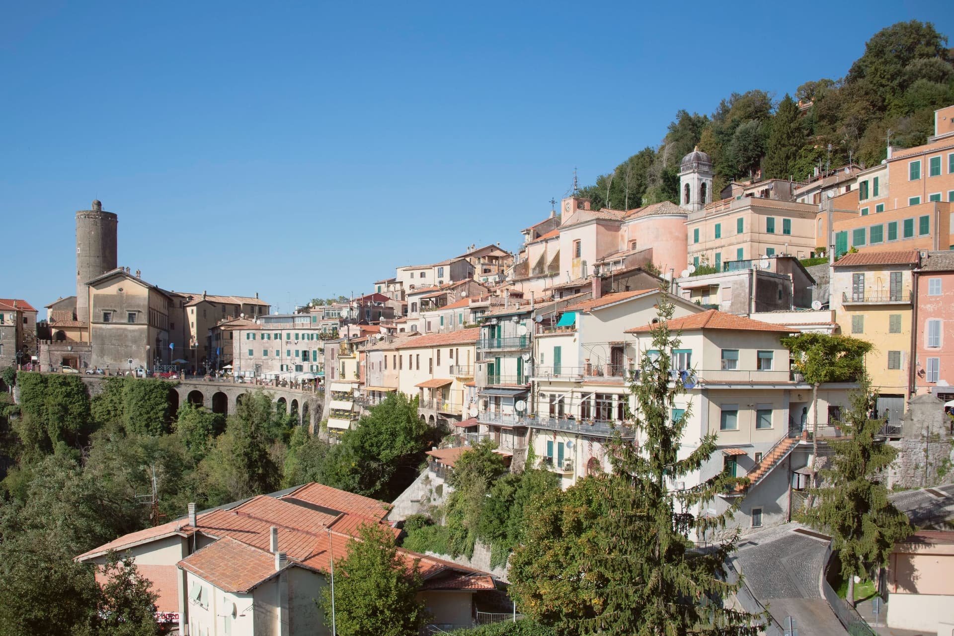
Nemi sits at 521 meters on the rim of a volcanic crater, the smallest of the Castelli Romani and thirty kilometers southeast of Rome. The lake below was the Speculum Dianae, the mirror of Diana, with a sanctuary on its northern shore that covered around 45,000 square meters and drew pilgrims from across Latium.
Emperor Caligula built two ceremonial ships on the lake, ninety meters of timber and bronze that sat on the water until they sank. Mussolini drained part of the lake between 1929 and 1932 to recover them.
They were destroyed by fire in 1944, almost certainly by retreating German troops. The Museo delle Navi Romane, built in 1940 to hold them, now shows scaled reconstructions and salvaged fragments.
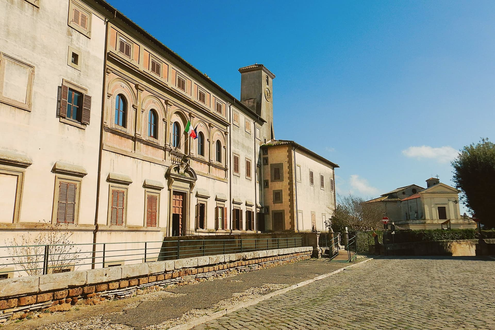
Palazzo Ruspoli, a ninth-century castle restored by Valadier, anchors the centro storico. The wild strawberries grown on the inner slopes of the crater are sold from stalls along Via Roma and celebrated each June at the Sagra delle Fragole.
The comune belongs to the national association of wine-producing towns.
What to see in Nemi
- Palazzo Ruspoli. Ninth-century castle of the Counts of Tuscolo, restored by Valadier, with cylindrical tower and hanging garden over the lake.
- Museo delle Navi Romane. Lakeshore museum built in 1940 for Caligula's two recovered ships, destroyed by fire in 1944, now housing scaled models and fragments.
- Santuario di Diana Nemorense. Remains of the federal sanctuary on the lake's northern shore, once 45,000 square meters of temple, porticoes and theater.
How to get to Nemi
Roma is roughly 52 minutes away by road.
Our tip
April through June and September into October are the dry months on the crater rim, when the wild strawberries ripen and the lake holds its color. The Sagra delle Fragole runs the first Sunday of June and draws thousands. July and August push the basin into the low thirties; the centro storico stays cooler at 521 meters than the coast or the city, but weekends fill with day-trippers from Rome. Borgo diVino in tour falls in September.
Atina
Why visit Atina
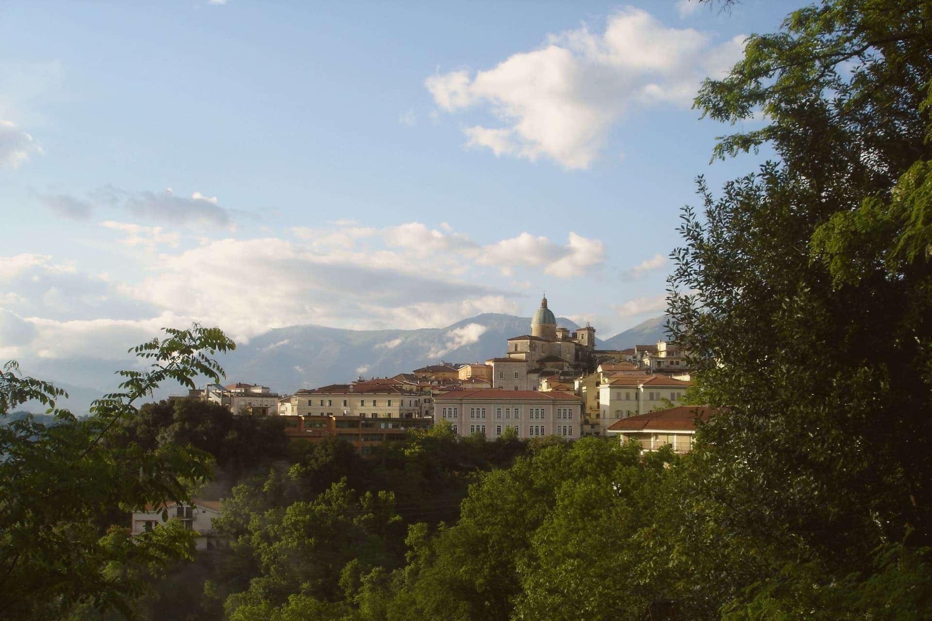
Atina sits at 500 meters in the province of Frosinone, at the foot of the Meta and Mainarde ranges. The Volsci held the ground first, then the Samnites built their defenses here, and Cicero, born fourteen kilometers away in Arpino, mentions the town in his De Lege Agraria.
The old town is built directly over that earlier settlement, its streets gathered around Piazza Garibaldi with the ducal palace on one side and the cathedral closing the other end. Below the hill, the Val di Comino opens toward the Mainarde and Ernici, the upper reach of the Liri-Garigliano valley.
Atina anchors the upper valley while the valley floor beneath it grows the Cabernet blend that carries the town's name as a DOC. Fifteen kilometers downhill, past the vineyards, the Lago di Posta Fibreno sits with its floating island, a detail Pliny the Elder recorded.
What holds this place together is the relation between height and floor: a fortified ridge that watched the routes from Cassino, and the valley bottom below it that now grows the grapes.
The comune belongs to the national association of wine-producing towns.
What to see in Atina
- Mura poligonali. The walls survive in stretches below the medieval ridge, massive uncut blocks fitted without mortar, still visible where the modern town has not built over them.
- Palazzo Cantelmo (Ducale). Faces Piazza Garibaldi at the center of the old town, the seat of the Cantelmo dukes now given over to municipal offices.
- Cattedrale di Santa Maria Assunta. Closes one end of the historic center, its current form the result of rebuilding after repeated earthquake damage.
How to get to Atina
Napoli is roughly 86 minutes away by road.
Our tip
April through October is the open season for Atina: vineyards in leaf in May, the Cabernet harvest in late September, mild dry air through October. July and August are warm in the valley below but cooler at 500 meters; the centro storico holds shade through the afternoon. November through March is quiet.
Ariccia
Why visit Ariccia
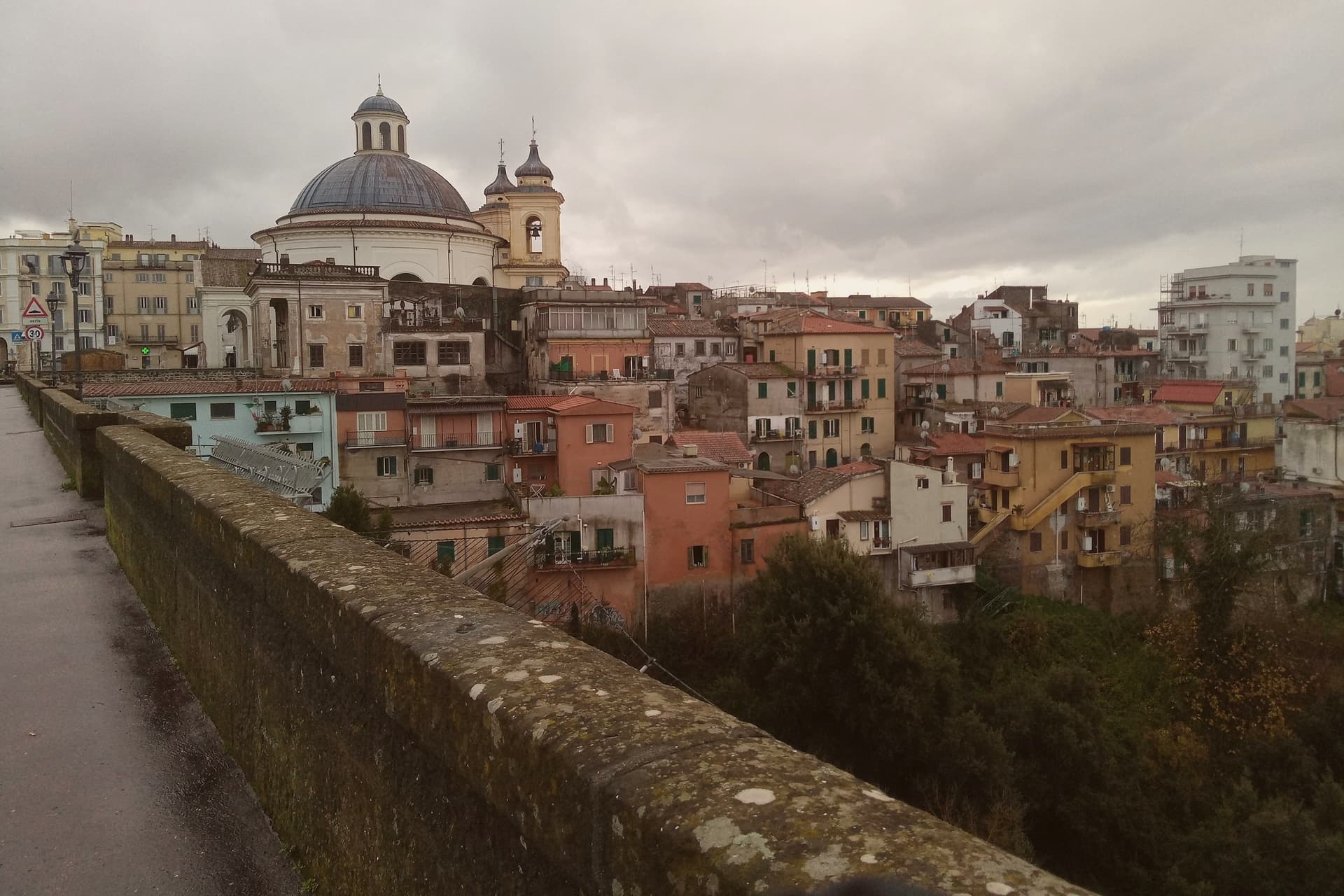
Ariccia sits on the rim of the Alban Hills volcanic complex, and the crater geography organizes everything about the place. The town centre occupies the ridge; below it on the eastern side the ground drops into the deep crater valley of Vallericcia, crossed by the viaduct linking the town to the next ridge.
The gorge itself became notorious after a series of suicides in the 1990s, now blocked with high railings. Further east and below, the volcanic lakes and the papal estate sit in a cluster within a few kilometres of the town centre, part of the same crater system that shaped Ariccia's position in the first place.
The Roman past predates the Baroque town by centuries: Aricia was the southern terminus of the original Via Appia, laid out in 312 BC, and the neighbouring lake was the site of the Latin League's federal sanctuary of Diana Aricina. The porchetta tradition is separate again: whole pork loin, deboned and seasoned with rosemary, garlic, pepper and wild fennel, slow-roasted on rotating spits in wood-fired ovens and served at room temperature in panini or by the etto.
The fraschette that serve it were originally outdoor wine vendors, marked with frasche, branches, as signs, and the town's status as a Città del Vino within the Frascati zone explains why the wine on the table is local rather than incidental. What makes Ariccia distinct among the Castelli towns is that these layers, Roman road terminus, crater rim settlement, unified Baroque set piece, and porchetta town, sit on top of each other in one small place rather than being scattered across the region.
The comune belongs to the national association of wine-producing towns.
What to see in Ariccia
- Palazzo Chigi + Piazza di Corte (Bernini). The Chigi family's Baroque summer residence. The palazzo, the piazza and the church facing it were designed as one ensemble. The palazzo is preserved as a 17th-c interior museum.
- Santa Maria dell'Assunzione (Bernini). Bernini's circular church, domed and modelled on the Pantheon: small, perfect, often empty.
- Ponte Monumentale. 1854 triple-tier brick viaduct spanning the 312m-deep Vallericcia crater. Walk across for the panoramic view; the gorge below is wooded and undeveloped.
How to get to Ariccia
There is a railway station in the town, so you can arrive without a car and never need one while you are here. Roma is roughly 41 minutes away by road.
Our tip
Ariccia is year-round — the Castelli Romani are Rome's cooler escape in summer (400m altitude buys 5-7 degrees off the city heat) and the porchetta is cold-served so it works in any weather. October–November is the Sagra dell'Uva and the Sagra della Porchetta (first weekend in September) — fraschette spill into the streets. Saturday lunch in any season is the locals' main event.
Sabaudia
Why visit Sabaudia
Sabaudia stands on what was malarial swamp until the 1930s. Work began on 5 August 1933, the town was inaugurated on 15 April 1934, and the whole construction took 253 days.
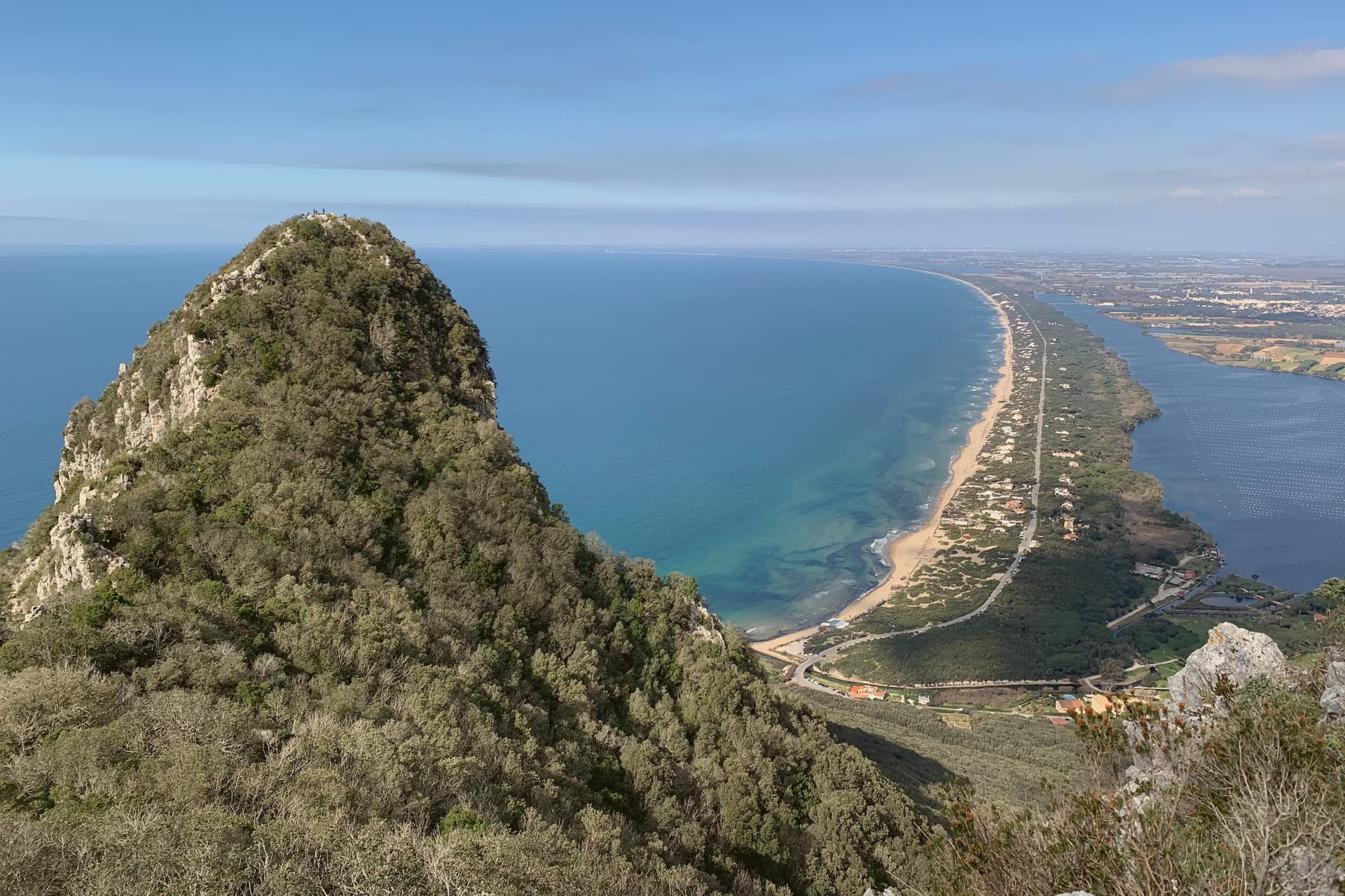
It was the fifth of the new Pontine towns built on land drained under Mussolini and was named for the Savoy dynasty then on the throne. Four architects, Gino Cancellotti, Eugenio Montuori, Luigi Piccinato and Alfredo Scalpelli, won the competition with a plan that placed the civic center on an axis between the dunes and Lago di Paola, the coastal lagoon also called Lago di Sabaudia.
The Torre Civica, the post office and the Chiesa della SS. Annunziata stand around Piazza del Comune as one of the cleanest examples of Italian rationalism still in use.
The Parco Nazionale del Circeo, which surrounds the town, protects the dune system, the lagoon, and the coastal forest behind Monte Circeo. Fifteen kilometers of open beach run south to San Felice, with a boardwalk along the dunes.
The comune belongs to the national association of wine-producing towns.
What to see in Sabaudia
- Torre Civica. Civic tower at the center of Piazza del Comune, the rationalist landmark visible from across the lagoon and the dunes.
- Piazza del Comune. Central square of the 1934 plan, lined by the Palazzo del Comune, the post office and the Chiesa della SS. Annunziata.
- Lago di Paola. Coastal lagoon of about 3.9 square kilometers, separated from the sea by the Sabaudia dunes and protected within the national park.
How to get to Sabaudia
Latina is roughly 41 minutes away by road.
Our tip
May through September is the season on the dunes. June and September are the best swimming months, with warm sea and emptier beaches than the peak. July and August fill with Roman weekenders and the town doubles in population; the boardwalk above the dunes stays the cleanest stretch.
Anagni
Why visit Anagni
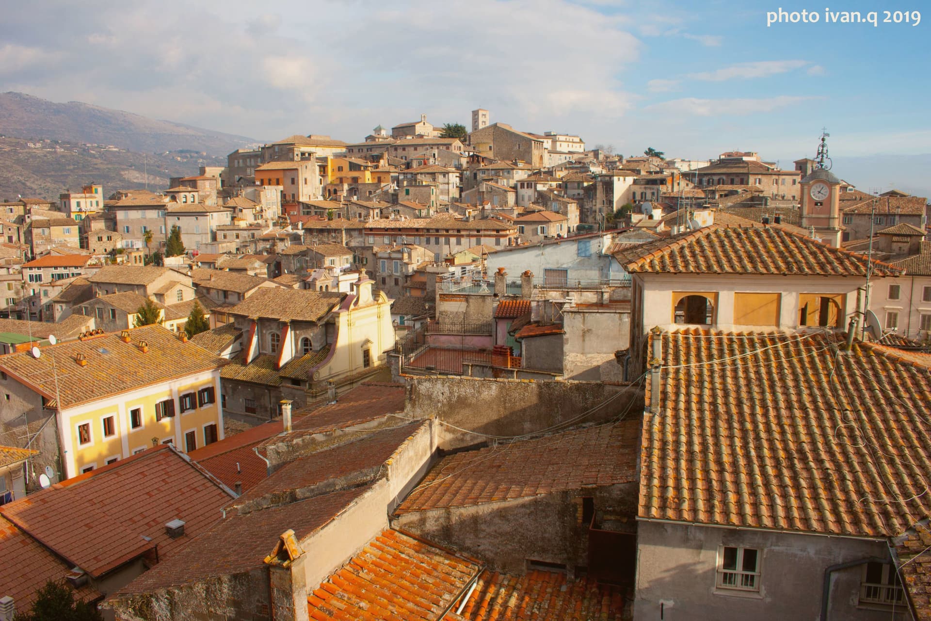
Anagni sits on a hilltop at 424 meters in Ciociaria, fifty-five kilometers southeast of Rome, looking over the Sacco valley and the Hernici mountains. It is one of four communes called the Città dei Papi, the others being Segni, Ferentino, and Veroli; four medieval popes were born here, Innocent III, Gregory IX, Alexander IV, and a fourth who would later be attacked in his own palace.
Agents of Philip IV of France, acting on his orders, stormed that palace on the hill and physically assaulted the reigning pope inside it. The centralized medieval papacy died with him within the month, and within five years the papal court had moved to Avignon.
The town's medieval fabric runs along Via Vittorio Emanuele, where the communal loggia, a frescoed church, and a house layered with nineteenth-century inscriptions sit within walking distance of each other on the same climb up from the lower town to the cathedral above. A single event inside a single palace on this hill is the reason the town's name outgrew its size: four popes were born here, but it is one pope's injury, not birth, that historians still date the end of an era to.
The comune belongs to the national association of wine-producing towns.
What to see in Anagni
- Cattedrale di Santa Maria. Romanesque cathedral on the highest point of the hill, with Gothic additions, a campanile, and a Cosmati pavement underfoot.
- Cripta di San Magno. The crypt beneath the cathedral floor, walls covered edge to edge in painting, dim enough that the colors need a moment to settle into view.
- Palazzo di Bonifacio VIII. The papal palace where Sciarra Colonna struck Boniface VIII during the Outrage of Anagni, its thirteenth-century rooms still standing on the hill.
How to get to Anagni
There is a railway station in the town, so you can arrive without a car and never need one while you are here. Roma is roughly 55 minutes away by road.
Our tip
April through June and September through October are the strong months. The hilltop position keeps Anagni cooler than the Sacco valley below, and the cathedral and crypt are best seen in the soft light of spring and autumn. July and August push past thirty-two degrees and the centro storico empties between two and five in the afternoon. Sagra dei Maltagliati falls in July.
Velletri
Why visit Velletri
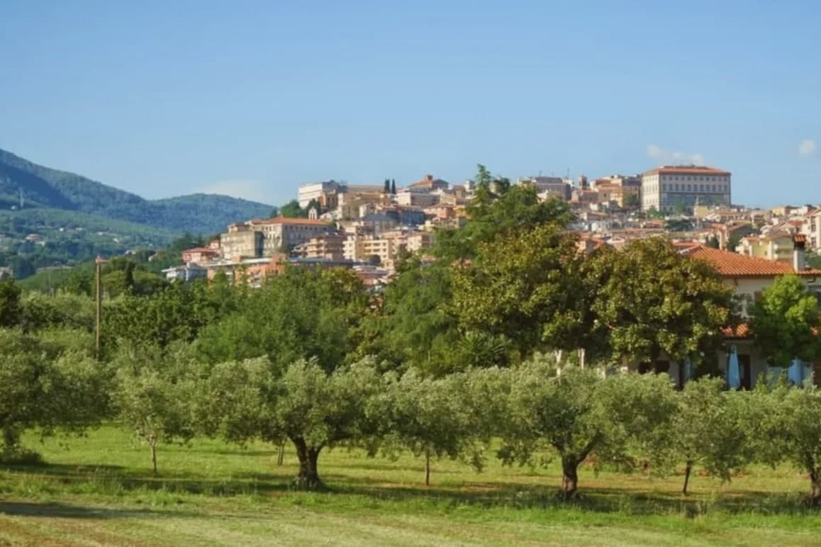
The town sits at 332 meters, thirty-five kilometers from Rome, on the southeastern rim of a volcanic ring of craters and lakes. Before it was a papal possession and a diocesan seat, it was a Volscian stronghold, and before that the home ground of the Octavii, the paternal family of the man who became Augustus: Suetonius records a street here called Octavian and an altar consecrated by an Octavius, and the future emperor passed his childhood in the town under its old name, Velitrae.
That layering, Volscian settlement, imperial family seat, papal diocese, is what the center still shows once the war is accounted for: an army broke through a German defensive line here in May 1944, and much of the town was destroyed in the process. What stands now above the old piazza and around the rebuilt town hall is largely reconstruction fitted around what survived, with a wine trade going back to the volcanic soil that predates all of it.
A town whose name changed twice, whose family produced an emperor, and whose center was rebuilt from a battle line, but whose vineyards on the same slopes never stopped being the constant.
The comune belongs to the national association of wine-producing towns.
What to see in Velletri
- Torre del Trivio. 50-meter Romanesque bell tower from the 14th century, the only structure to come through the 1944 bombing intact, still the shape by which the town is recognized from a distance.
- Palazzo Comunale. Renaissance town hall designed by Giacomo Della Porta, rebuilt after wartime damage, facing the piazza named for the emperor born to the town.
- Cattedrale di San Clemente. Cathedral seat of the suburbicarian Diocese of Velletri-Segni, a title held today by the Dean of the College of Cardinals.
How to get to Velletri
There is a railway station in the town, so you can arrive without a car and never need one while you are here. Latina is roughly 35 minutes away by road.
Our tip
April through June brings the Alban Hills at their greenest, vineyards in leaf, and mild evenings on the piazzas. September and October are the wine months: the Festa dell'Uva, one of the oldest grape festivals in Italy, runs in the first week of September. July and August are hot in the lower town and at their best after sunset, when the volcanic slopes hold the breeze. Calici sotto le stelle falls in August.
More from Anywhere Italy
 The best towns inside a nature park in the province of Roma
 The best towns you can reach by train within an hour of Rome
- The best hill towns inside a nature park in Lazio
 The best hill towns with a food festival in Lazio
 The best towns with a food festival that you can reach by train in Lazio
 The best hill towns in the province of Frosinone