The best olive oil towns in Lazio
Lazio's olive country runs from the grey-green terraces of the Sabina hills down through the Ciociaria and out to the volcanic soil above the coast, and the harvest sets the calendar. Late autumn is when the mills open, the fruit comes in under nets, and the new oil goes out cloudy and peppery enough to catch at the back of the throat, poured over bruschetta and white beans and boiled chicory. The villages here are built of local limestone and tufa, tight lanes climbing to a piazza with a bar, a war memorial and a view over the groves. Bring an empty bottle and a cool bag: the oil is sold at the frantoio, in tins, by people who will explain which cultivar you are buying.
Almost everyone who eats well in Lazio eats in Rome, and the city has become the region's olive oil shop as much as its kitchen. The market stalls at Testaccio and the delicatessens in Monti sell Sabina oil under a designation of origin label, and the tasting rooms fill up on wet weekends in November. It is good oil and the crowds are earned, but you are tasting the region at several removes, at Roman prices, in a queue.
The groves themselves carry on well past the edge of the Roman hinterland. They climb the Sabine ridges, spread across the plain of the Liri, hold the slopes above Lake Bolsena and reach almost to the sand south of Terracina, and the towns below are where the presses actually stand. All of these belong to the national association of olive-oil towns, which is a working commitment rather than a slogan, and fewer travellers make the turn off the main road to reach them.
Of the 60 communes we have mapped in Lazio, 8 qualify as olive oil towns: each belongs to the national association of olive-oil towns. The smallest, Casperia, has 1,178 residents.
If you are still choosing, we have also written The 6 best hill towns within 90 minutes of Latina and The 9 best olive oil towns within 90 minutes of Terni.
Casperia
Why visit Casperia
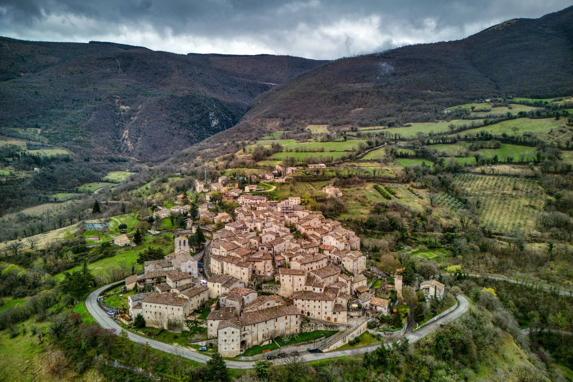
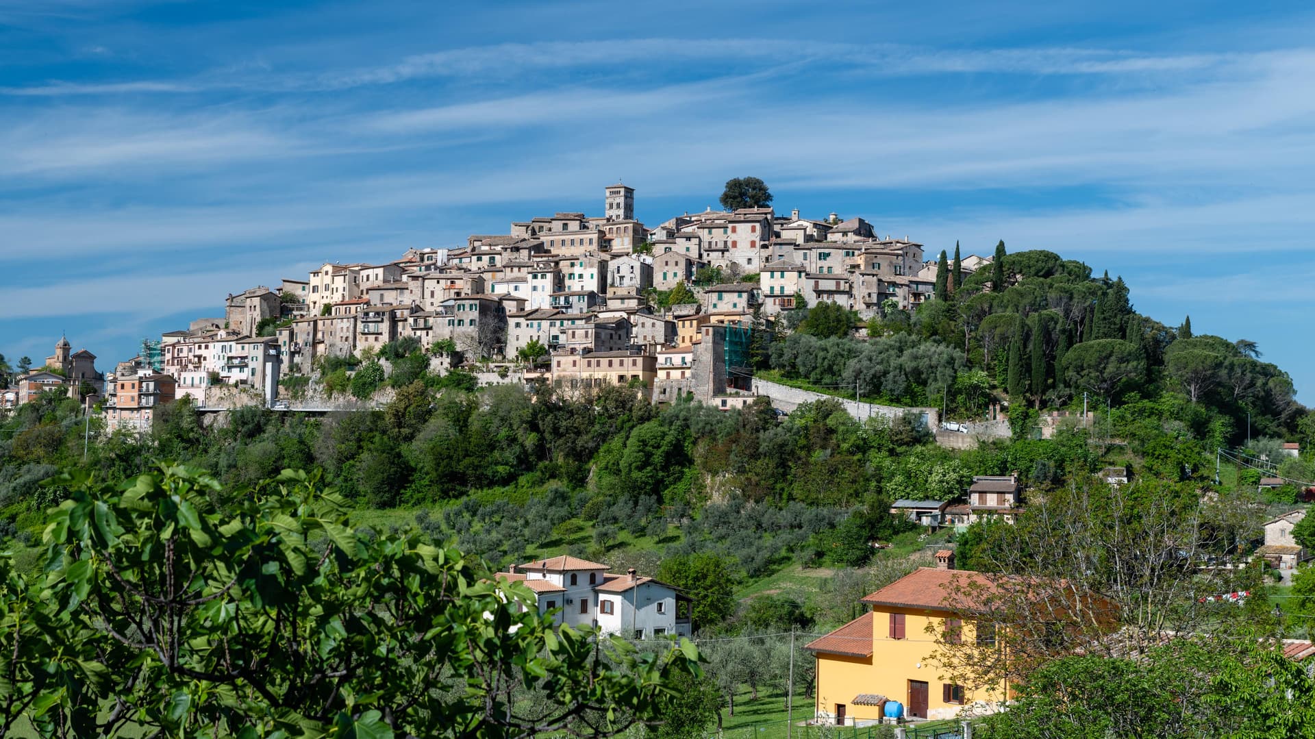
Casperia sits at 397 meters on the western slope of the Monti Sabini, fifty kilometers northeast of Rome. Its two gates face opposite directions on the hillside, one toward the lower road on the west, the other toward the valley on the east, and both feed into the same climbing street pattern that rings the hill in concentric bands up to the church at the summit.
No vehicles pass the gates, so the interior keeps its medieval scale intact, lane by lane, without the intrusions that have altered plenty of comparable towns. Below the walls the slope opens into olive country, part of a protected-origin appellation, in the localities of Paranzano, Santa Maria in Legarano and San Vito.
The relationship between the two levels, hilltop settlement above and working groves below, is the shape of the place: a defended village that never spread past its walls, sitting over land that has been worked continuously and given a name and a boundary of its own.
What to see in Casperia
- Centro storico. Concentric lanes climb from the gates to the parish church at the summit, laid out with no space for vehicles, a compact plan that reads clearly from any of the approaches below.
- Chiesa di San Giovanni Battista. Parish church on the highest point of the village, baroque interior on medieval foundations, with works by Vincenzo Manenti.
- Porta Romana. Western gate of the wall circuit, the main entry point on foot from the lower road.
How to get to Casperia
Terni is roughly 43 minutes away by road.
Our tip
April through June and September through October are the best months in the Sabina hills. The olive harvest runs from mid-October into November; the new oil is pressed in the cooperatives around the village and the town fills on autumn weekends for tastings. July and August are hot in the lower valley; the village at 397 meters is several degrees cooler and the lanes hold shade. Sagra dei Stringozzi Aspresi falls in July.
Capodimonte
Why visit Capodimonte
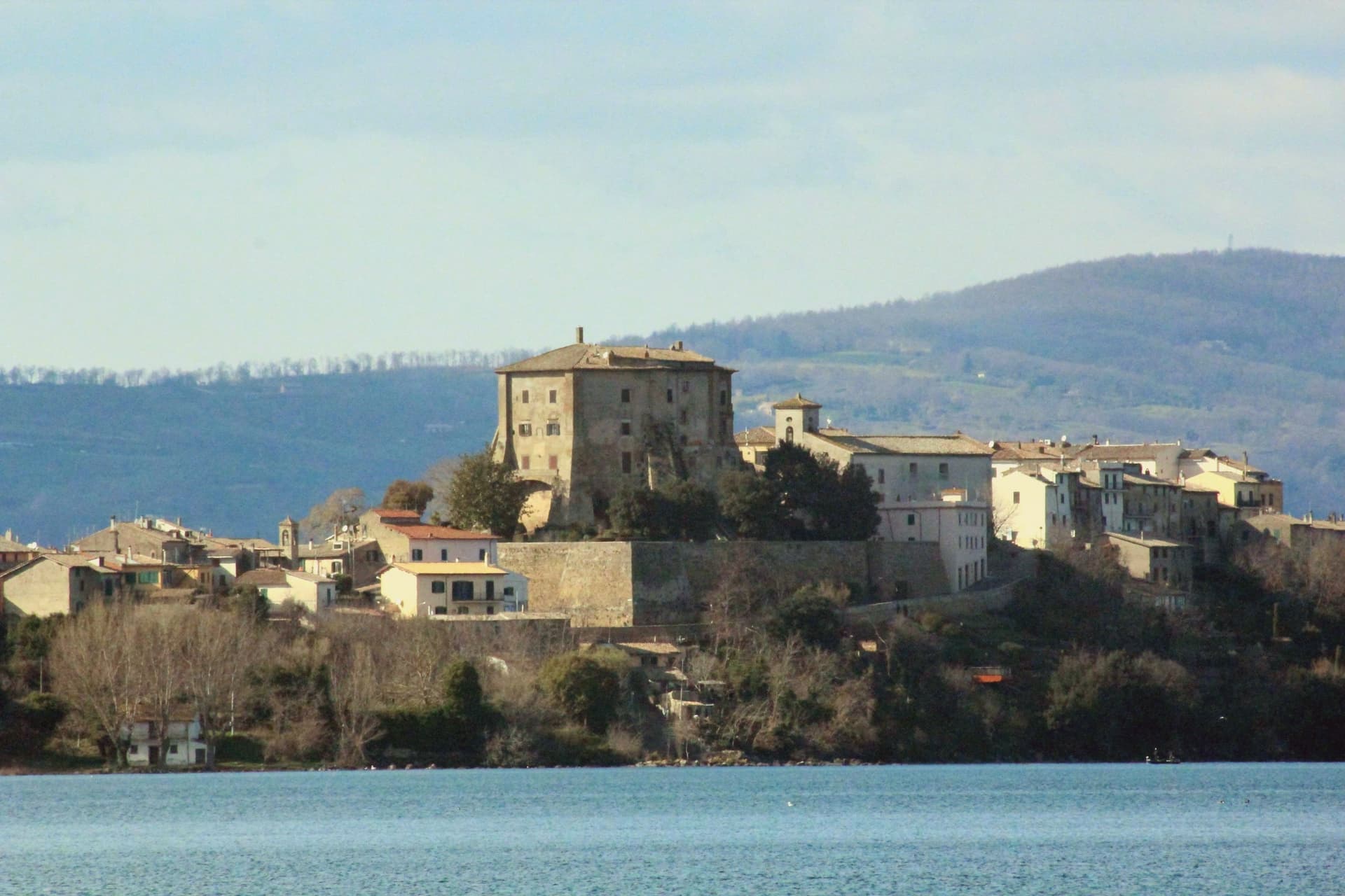
Capodimonte is a 1,700-resident lakeside borgo on the southwestern shore of the lake, formed 370,000 years ago when the Vulsini volcanic complex collapsed inward. The town sits on a low peninsula that juts into the water, and the centro is built around that geography: the fortress anchors the point of land, the gardens run beside it, and the shore curves away on both sides into the pebble beaches used for swimming.
From the peninsula's tip the view opens across the water toward the larger of Bolsena's two islands, still privately owned but open for guided visits, while the smaller Isola Martana nearby is uninhabited. Capodimonte is also a Città dell'Olio, and the Tuscia hills behind the town produce a DOP Sabina-style olive oil pressed in small frantoi within 10 km.
The lake itself is deep and clean, warm enough for swimming from May to October, and bream and coregone from its water turn up on every local table. The Via Francigena pilgrimage route passes 8 km east.
The Etruscan necropolis at Vulci is 30 minutes west, and the painted tombs of Tarquinia an hour southwest, both UNESCO sites, while Civita di Bagnoregio, the dying city on its tufa pinnacle, lies 25 km north. The town's identity comes from that position on the water: a fortified point of land looking out at an island that was once its own private world, with the surrounding hills supplying the oil that still runs through the local economy.
Pepe Nero have been named by a guide.
What to see in Capodimonte
- Palazzo Farnese (Rocca Farnese). The fortress built for Pope Paul III's family stands over formal Italian gardens, partially open for visits. Its octagonal plan is unusual among lakeside strongholds of the period.
- Isola Bisentina. Reached from the peninsula's tip, the island holds seven Renaissance chapels, a Franciscan convent and the Farnese tombs, a quiet cluster of buildings for a place that was long the only inhabited island on the lake.
- Lago di Bolsena swimming + beaches. Clean and warm from May to October, with short pebble strands on either side of the Capodimonte peninsula.
How to get to Capodimonte
Terni is roughly 74 minutes away by road.
Our tip
Capodimonte is best May through October — the lake is swimmable and the Isola Bisentina ferries run. June and September are the sweet spot (warm water, no crowds). July–August fills with Roman families on weekends and at ferragosto.
Castro dei Volsci
Why visit Castro dei Volsci
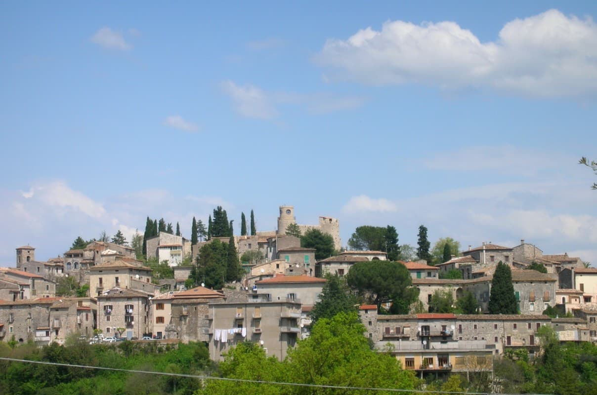
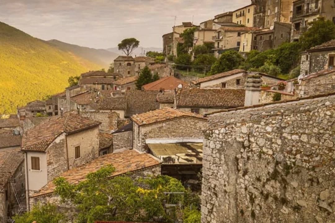
Castro dei Volsci sits at 385 meters on a ridge above the Sacco river valley, ninety kilometers southeast of Rome and fourteen from Frosinone. The Volsci, an Italic tribe Rome spent two centuries subduing, held this hill before the Latins took it; the name preserves both occupants, Castrum and Volsci, castle and people.
After the year 1000 the village fell to the Papal States and stayed inside that orbit until unification. The valley floor below the ridge holds Roman-era foundations and mosaics, remains of a settlement separate from the hill village above it.
The slopes between the two carry the olive groves that still supply the town's oil. The upper village, where the clock tower and castle ruins stand, is where Nino Manfredi was born in 1921 before the family's path led him to Rome and to postwar cinema; the town he left behind kept its stacked houses, its gates and its position over the valley, and it is that unbroken layout, hill above, groves on the slope, valley floor beneath, that the Borghi più belli d'Italia listing recognizes.
Locanda del Ditirambo have been named by a guide.
What to see in Castro dei Volsci
- Torre dell'Orologio. Medieval clock tower in the upper village. Inside, a permanent exhibition holds Nino Manfredi's films, scripts and personal effects.
- Castello. Ruins of the medieval fortress at the top of the borgo, with a panorama over the Sacco valley and the Monti Ausoni.
- Centro storico. Stacked stone houses, vaulted passages and medieval gates that earned the borgo its Borghi più belli d'Italia membership.
How to get to Castro dei Volsci
There is a railway station in the town, so you can arrive without a car and never need one while you are here. Latina is roughly 71 minutes away by road.
Our tip
April through June and September through October are the best windows. The Sacco valley is green in spring and the panoramas from the castle ruins open clean once the haze burns off. July and August push past thirty-five degrees; the centro storico empties between two and five in the afternoon, and the olive groves on the slopes go silent until evening.
Boville Ernica
Why visit Boville Ernica
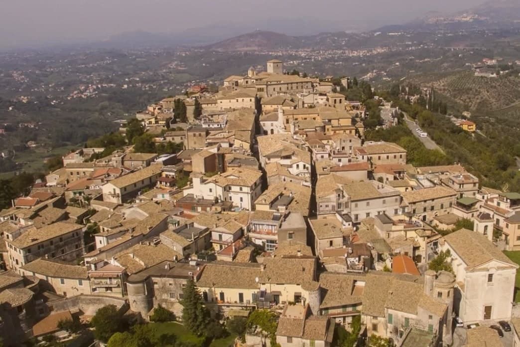
Boville Ernica sits at 450 meters above the Sacco and Liri valleys in Ciociaria, in the province of Frosinone. The Ernici, an Italic tribe contemporary with the Volsci, gave the place its second name, added in 1900 to distinguish it from another Bauco.
That name links the town's two layers: the polygonal walls at Monte Fico above the centro storico, built by the Ernici to defend a hill village and its place of worship, and the medieval circuit below, raised centuries later over the same defensive instinct after the Saracen and Hungarian raids. The borgo itself grew around that walled core.
Cardinal Ennio Filonardi, a sixteenth-century papal nuncio born in Boville, built his palace over the medieval castle and reorganized the urban plan around it, so the renaissance layer sits inside the medieval one rather than beside it. The abbey holding the Angelo del Navicella occupies the same historical register, a twelfth-century structure raised over a saint's cave, carrying inside it a mosaic fragment centuries older than the building itself.
The hills above town, signed Città dell'Olio, are the one part of the landscape still doing what it has always done. Put together, the town reads as a single hill continuously fortified and rebuilt, each century adding a layer without erasing the one beneath it.
What to see in Boville Ernica
- Abbazia di San Pietro Ispano. Twelfth-century abbey built over a grotto associated with the saint. The Angelo del Navicella is kept inside, a small mosaic fragment set against the scale of the building raised to house it.
- Mura medievali. The circuit is walkable and complete, tower after tower in the round-then-square rhythm, a rebuilding that answered the Saracen and Hungarian raids of the tenth century.
- Palazzo Filonardi. Sixteenth-century palace built by Cardinal Ennio Filonardi over the medieval castle, anchor of the renaissance reorganization of the centro storico.
How to get to Boville Ernica
Latina is roughly 74 minutes away by road.
Our tip
April through June and September through October are the months for Boville Ernica. The Sacco valley clears, the hill groves stay cool, and the eighteen-tower walls hold light in the late afternoon. July and August touch thirty-three on the valley floor but moderate on the hilltop.
Isola del Liri
Why visit Isola del Liri
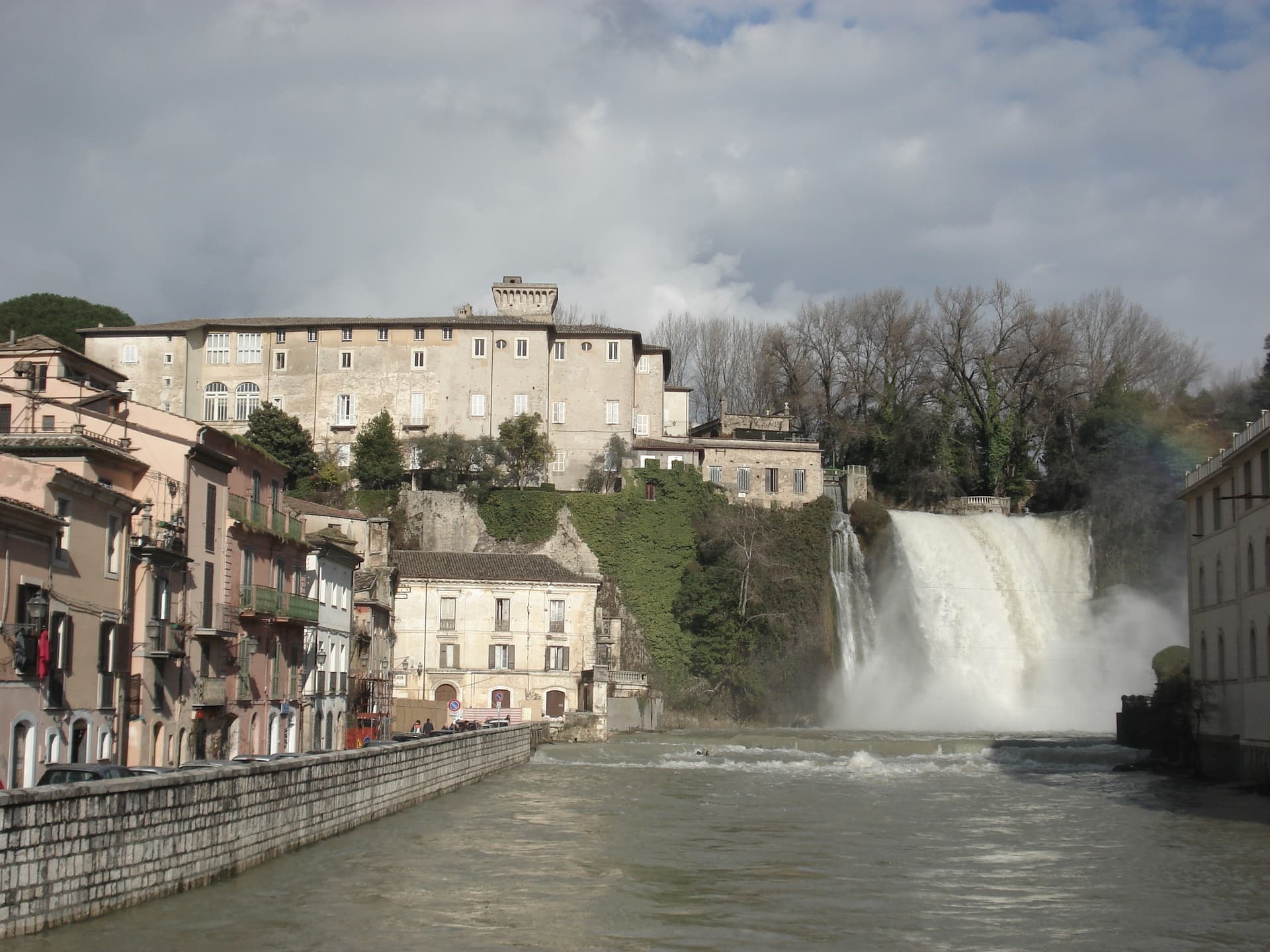
Isola del Liri is built on an actual island, where the Liri river splits into two arms and the two arms fall over a limestone shelf into the lower valley. The Cascata Grande is 27 meters high and lands inside the historic center, fifty meters from the Castello Boncompagni-Viscogliosi, the fortified palace above it.
The second fall, Cascata del Valcatoio, is partly diverted for hydropower. From the 19th century the river ran the paper mills, felt mills and wool mills that gave the town the name Manchester of Italy: the Fibreno-Lefebvre mill exported to North America.
The paper industry collapsed in the late 20th century. The town responded with the Liri Blues Festival, started in 1988 by a local businessman, Luciano Duro, to draw attention back to a place that had lost its trade; it became one of Europe's longer-running free blues festivals.
The Cammino di San Benedetto walking route passes through.
What to see in Isola del Liri
- Cascata Grande. 27-meter waterfall in the center of town, the Liri river dropping over a limestone shelf next to the castle.
- Cascata del Valcatoio. Second urban waterfall on the right arm of the Liri, partially diverted for hydroelectric production.
- Castello Boncompagni-Viscogliosi. Fortified palace from the 14th century above the Cascata Grande, residence of the Boncompagni-Ludovisi from the 16th century.
How to get to Isola del Liri
There is a railway station in the town, so you can arrive without a car and never need one while you are here. Latina is roughly 80 minutes away by road.
Our tip
April through June is when the Liri runs hardest after the spring melt and the Cascata Grande is at maximum volume. July is the festival month: the Liri Blues runs across several July evenings on stages in the centro storico and on the riverbanks. August stays hot in the Liri valley, the town thins out for the coast.
Minturno
Why visit Minturno
Minturno sits on a hill at 140 meters above the right bank of the Garigliano, with the Scauri and Marina coast running down from it to the Tyrrhenian. The two halves of the comune answer different needs and different centuries: the river mouth held the Roman colony and its flat, engineered plain, while the hill above took over as the medieval settlement once malaria and Saracen raids made the lowland unsafe to live on.
The castle at the center of the upper town carries that shift in its own fabric, with a ninth-century core built up over time by later lords. The coast has its own separate history again, flattened in 1943-44 as a battlefield on the German defensive line and rebuilt afterward around the bathing village of Scauri.
Olive country runs inland behind all of this, and the comune belongs to the Città dell'Olio network. What the town amounts to, then, is three settlements stacked in time rather than one: a Roman river port, a medieval hill town built in retreat from it, and a rebuilt postwar coast, each still legible in its own part of the comune.
What to see in Minturno
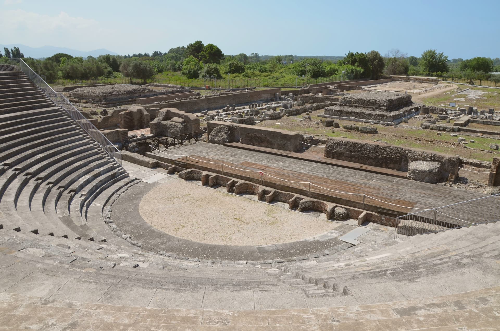
- Parco Archeologico di Minturnae. Theater, forum, aqueduct and amphitheater standing together at the river mouth, on the stretch of the Via Appia that once ran through the colony.
- Castello Baronale. Hilltop castle in the centro storico, its core built in the ninth century and expanded in stages by the Caetani and the Carafa through the medieval period.
- Basilica di San Pietro Apostolo. Basilica in the upper town holding a cosmatesque pulpit and Easter candlestick, both worked in the twelfth and thirteenth centuries.
How to get to Minturno
There is a railway station in the town, so you can arrive without a car and never need one while you are here. Napoli is roughly 79 minutes away by road.
Our tip
May through September is the season on the Garigliano coast. June and September give the best balance of warm sea and emptier beaches; July and August fill with Roman and Neapolitan weekenders and the seaside road slows. October is still warm enough to swim on calm days, and the inland olive harvest in late October and November is the busiest moment in the upper town.
Terracina
Why visit Terracina
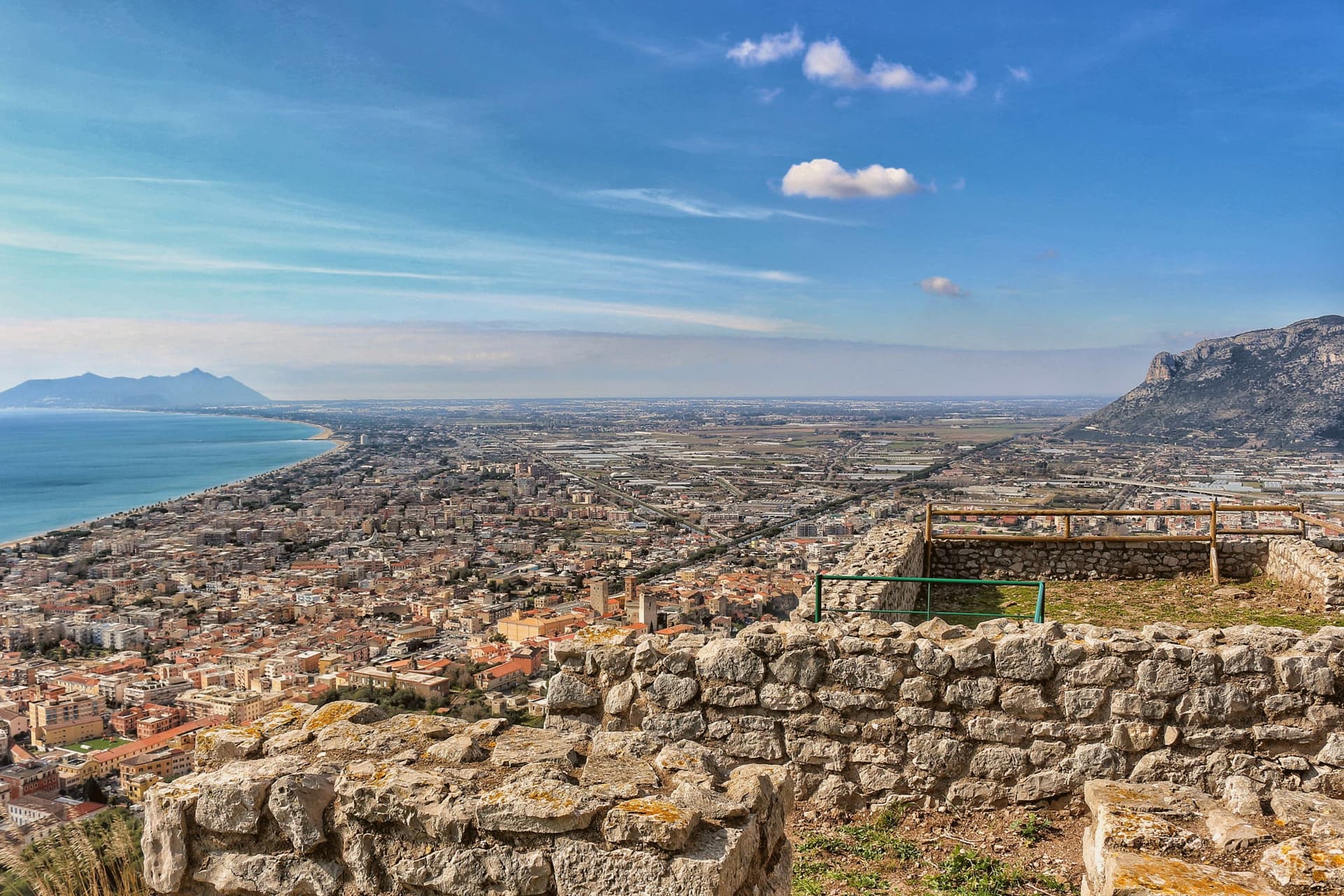
Terracina sits where the Lepini mountains meet the Tyrrhenian Sea, a hundred kilometers south of Rome. The Volsci called it Anxur, the name of the youthful Jupiter who was its tutelary god, and the temple crowning the summit above the port carries that name still.
Below it the Roman town spread out along the coast road, its forum paved by a magistrate whose inscription remains underfoot, its capitolium later built over by the co-cathedral. Where the road met a headland it could not go around, the rock itself was cut away to let it pass, a shelf sliced through stone rather than a path found around it.
The upper town, on the mountain, and the lower town, on the plain and shore, read as two different solutions to the same site: one held the god and looked down, the other held the forum, the road, and eventually the harbor. What survives today, the beach, the working fishing port, the olive groves signed for their oil, is the plain continuing to do what it always did, at sea level, while the temple keeps its distance above.
Locanda Altobelli, Il Granchio, Locanda Ruggieri have been named by a guide.
What to see in Terracina
- Tempio di Giove Anxur. The temple on Monte Sant'Angelo stands on a vaulted substructure, thirty-five by twenty meters, the arcading still visible from below and, on clear days, the view running out past the port to the sea.
- Foro Emiliano. Original limestone-paved Roman forum, bronze-letter inscription of Aulus Aemilius still legible, eleventh forum along the Via Appia from Rome.
- Cattedrale di San Cesareo. Co-cathedral consecrated 1074 on the ancient capitolium, Cosmatesque pulpit and pavement, twelfth-century bell tower and portico.
How to get to Terracina
Latina is roughly 41 minutes away by road.
Our tip
May through September brings the beach and the port to full life: Bandiera Blu water, ferries to Ponza and Ventotene, fishermen unloading at the eastern mole. June and September are the calmer months. July and August fill with Roman day-trippers and touch thirty-five degrees on the seaward slopes.
Velletri
Why visit Velletri
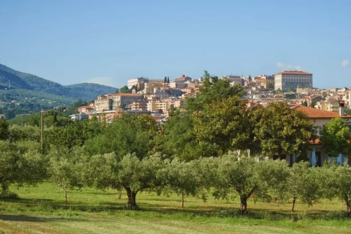
The town sits at 332 meters, thirty-five kilometers from Rome, on the southeastern rim of a volcanic ring of craters and lakes. Before it was a papal possession and a diocesan seat, it was a Volscian stronghold, and before that the home ground of the Octavii, the paternal family of the man who became Augustus: Suetonius records a street here called Octavian and an altar consecrated by an Octavius, and the future emperor passed his childhood in the town under its old name, Velitrae.
That layering, Volscian settlement, imperial family seat, papal diocese, is what the center still shows once the war is accounted for: an army broke through a German defensive line here in May 1944, and much of the town was destroyed in the process. What stands now above the old piazza and around the rebuilt town hall is largely reconstruction fitted around what survived, with a wine trade going back to the volcanic soil that predates all of it.
A town whose name changed twice, whose family produced an emperor, and whose center was rebuilt from a battle line, but whose vineyards on the same slopes never stopped being the constant.
Benito al Bosco have been named by a guide.
What to see in Velletri
- Torre del Trivio. 50-meter Romanesque bell tower from the 14th century, the only structure to come through the 1944 bombing intact, still the shape by which the town is recognized from a distance.
- Palazzo Comunale. Renaissance town hall designed by Giacomo Della Porta, rebuilt after wartime damage, facing the piazza named for the emperor born to the town.
- Cattedrale di San Clemente. Cathedral seat of the suburbicarian Diocese of Velletri-Segni, a title held today by the Dean of the College of Cardinals.
How to get to Velletri
There is a railway station in the town, so you can arrive without a car and never need one while you are here. Latina is roughly 35 minutes away by road.
Our tip
April through June brings the Alban Hills at their greenest, vineyards in leaf, and mild evenings on the piazzas. September and October are the wine months: the Festa dell'Uva, one of the oldest grape festivals in Italy, runs in the first week of September. July and August are hot in the lower town and at their best after sunset, when the volcanic slopes hold the breeze. Calici sotto le stelle falls in August.