
The best hidden towns inside a nature park in Emilia-Romagna
Emilia-Romagna keeps its wild country in the south, along the Apennine spine, where the plain gives out and the roads start to climb through chestnut and beech. The regional nature parks here protect gypsum outcrops that glitter after rain, sandstone spurs, high pasture and cold rivers full of trout. Villages inside their boundaries are built of the local stone, dark grey or honey depending on the valley, with slate roofs and porticoes deep enough to shelter a market. Autumn is the strongest season: chestnut flour, borlotti beans, porcini, new wine, and mist sitting in the valleys until noon. Winter brings snow to the higher parishes, and spring brings orchids to the meadows.
The region's fame is edible and urban, so most visitors trace the Via Emilia and stop at Bologna, Parma and Modena for tortellini, prosciutto and balsamic, then drive on to the Adriatic beaches at Rimini. The city food halls and the museum queues fill up from Easter to October, and the coastal strip in August is a wall of umbrellas. It is good food and real history, honestly earned. It is also flat, hot and busy, and the ridge visible from the ring roads goes unclimbed by nearly everyone who eats there.
The same pork, the same cheese, the same wine culture continues up those valleys, and it gets better as the ground steepens, because the pigs and the sheep and the chestnuts came from up there in the first place. The parks are threaded with waymarked paths, thermal springs and Romanesque parish churches, and the towns inside them keep grocers and osterie rather than souvenir shops. These are the smaller places, reached on provincial roads with hairpins, and fewer people go. Each of the towns below sits inside a regional nature park, which is the reason the country around it still looks the way it does.
Of the 45 communes we have mapped in Emilia-Romagna, 15 qualify as towns inside a nature park: each sits inside a regional nature park. This list is the hidden ones, 10 in all, ordered smallest first. The smallest, Fiumalbo, has 1,175 residents.
Elsewhere in the catalogue: The best towns inside a nature park that eat well in Emilia-Romagna and The 7 best towns inside a nature park that you can reach by train in Emilia-Romagna.
Fiumalbo
Why visit Fiumalbo
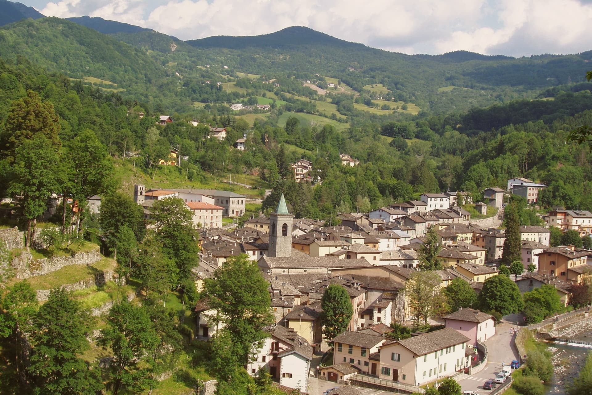
Fiumalbo sits at 935 meters in the upper Frignano, at the confluence of the Rio Acquicciola and the Rio delle Pozze, which join here to form the Scoltenna. The village is the last Modenese commune before the Tuscan border at the Foce a Giovo pass, and the territory rises from 800 meters at the river to the 2,165 meters of Monte Cimone, the highest peak in the northern Apennines.
The medieval centro storico is built almost entirely in local sandstone, the houses packed tight along the narrow streets that drop from the parish church of San Bartolomeo to the river. The town has been documented for almost a thousand years; the older history is lost.
The Oratorio dei Bianchi, the small fifteenth-century lay-confraternity oratory with its painted wooden ceiling, is the artistic anchor of the village. Population 1,175.
The municipality falls inside the Parco del Frignano and holds Borghi più belli and Bandiera Arancione status.
What to see in Fiumalbo
- Chiesa di San Bartolomeo. Parish church on the upper part of the village, with a Romanesque core, a fifteenth-century rebuilding and a baroque interior.
- Oratorio dei Bianchi. Small fifteenth-century oratory of the lay confraternity of the Bianchi, with a painted wooden coffered ceiling and Renaissance frescoes.
- Borgo di Fiumalbo. Sandstone medieval village built tight along narrow streets between the parish church and the river, almost entirely intact.
How to get to Fiumalbo
Prato is roughly 93 minutes away by road.
Our tip
May through October is the working window for Fiumalbo. The snow clears off the high trails toward Monte Cimone by late May, the rivers run loudest in June, and the chestnut and porcini weeks in September and October bring the village its strongest visitor period. July and August stay cool, rarely above twenty-five degrees, which is why families from the Emilian plain come up.
Corniglio
Why visit Corniglio
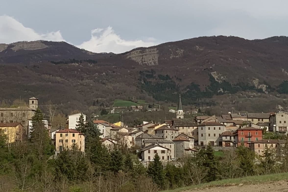
Corniglio sits in the upper Parma valley, forty kilometers southwest of Parma. The municipality covers 165 square kilometers, mostly forest and high pasture, climbing from the village floor to the watershed ridge at Monte Sillara, 1,861 meters, on the Tuscan border.
The village itself, the plateau above it, and the ridge beyond form a single climb in altitude: borgo, then Lagdei, then the peaks, each a stage further from the valley floor. Population has fallen below 1,800, and most frazioni scattered through the municipality hold fewer than fifty residents each, a thin scatter of settlement across a large forested territory.
The Prosciutto di Parma curing rooms reach this far up the valley, where the air pulls salt out of the meat in a particular way, a reminder that this high ground still answers to the plain below it even as it empties of people. What the valley adds up to is a place organized less around the village than around the ascent behind it, from settled floor to near-empty ridge.
What to see in Corniglio
- Castello di Corniglio. The castle stands on the ridge above the borgo, its sandstone walls facing down the valley toward the village roofs below.
- Lago Santo Parmense. Reached by trail from Lagdei, the lake sits under the ridge in a glacial basin, the water cold and still against the rock walls above it.
- Monte Marmagna. 1,851-meter peak on the Tuscan-Emilian watershed, the southern boundary of the municipality and a four-hour climb from Lagdei.
How to get to Corniglio
Parma is roughly 61 minutes away by road.
Our tip
May through October is the working calendar in Corniglio. The Lagdei road opens in May once the snow clears; June and September give the best light on the ridge and the clearest water in Lago Santo. July and August fill the rifugi above the village and bring cool nights even when Parma touches thirty-six degrees.
Vernasca
Why visit Vernasca
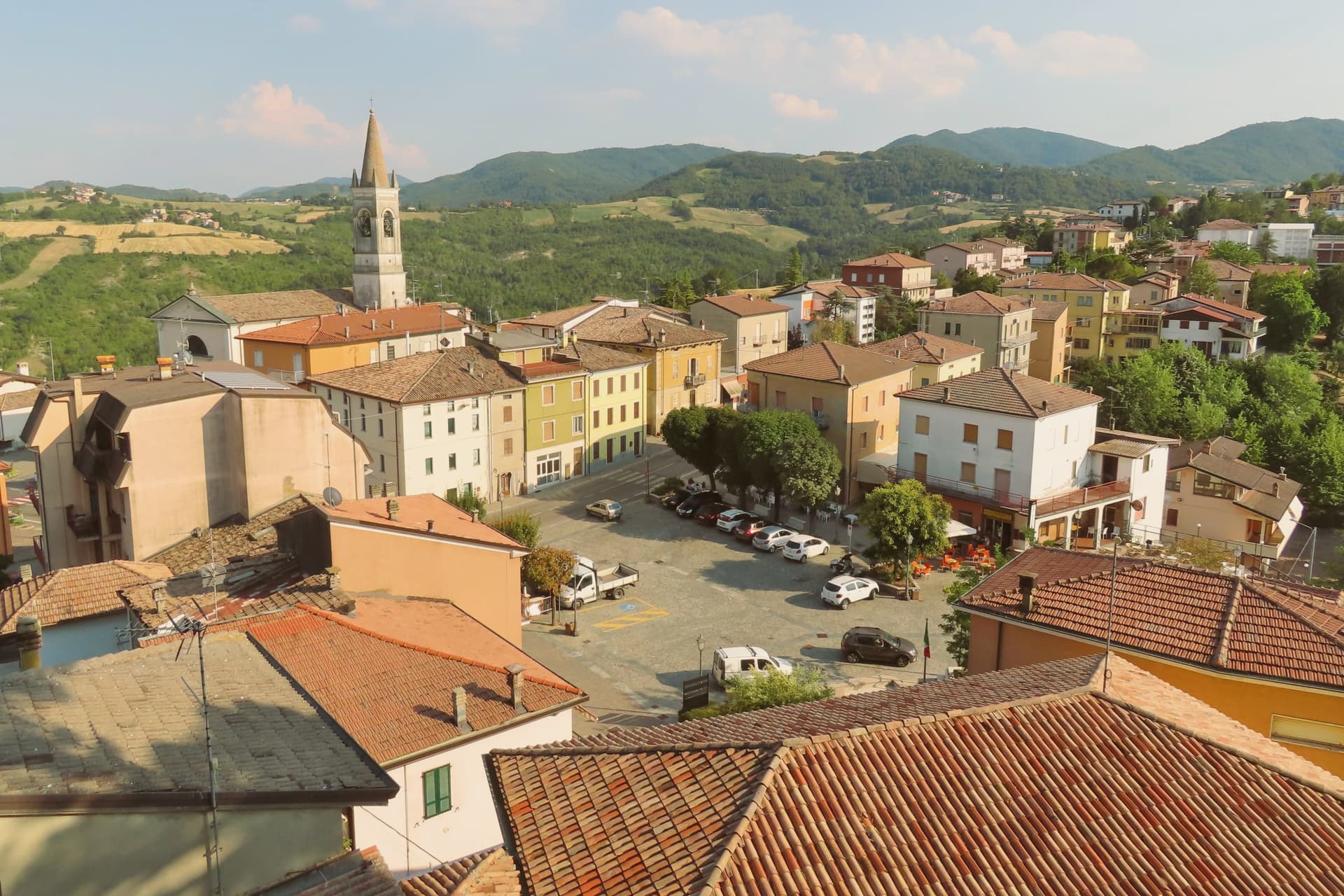
Vernasca sits at 457 meters in the upper Val d'Arda, in the Piacenza Apennines forty kilometers southeast of Parma. The commune carries both its institutional signals through its frazione Vigoleno, a walled village on a 350-meter ridge between the Ongina and Stirone valleys whose castle is documented from 1141 and whose current quadrangular plan dates from the early fifteenth century.
The Scotti Douglas family, granted the county of Vigoleno in 1404 by the Visconti of Milan, rebuilt the keep, mastio and circuit walls after Visconti troops dismantled it in 1373. Vigoleno was an autonomous commune until 1815, when it was absorbed into Vernasca.
The Val d'Arda below produces Gutturnio and Ortrugo wines under the Colli Piacentini DOC. The territory holds the Riserva Naturale del Piacenziano, a fossil-bearing badlands site referenced in the geological epoch named for the Piacenza area.
What to see in Vernasca
- Castello di Vigoleno. Walled medieval village and Scotti Douglas keep on a 350-meter ridge, with a circuit of walls and a mastio rebuilt in the early fifteenth century.
- Pieve di San Giorgio. Twelfth-century Romanesque pieve inside the Vigoleno walls, with fifteenth-century frescoes by the school of the Pordenone.
- Riserva Naturale del Piacenziano. Pliocene fossil-bearing badlands and clay outcrops within the commune, type-locality of the Piacenzian geological age named for the province.
How to get to Vernasca
Piacenza is roughly 52 minutes away by road.
Our tip
April through October are the working months in the upper Val d'Arda. May and June bring green hills and clear views from the Vigoleno walls south to the Apennine ridge. September and October are the dry, gold months and the start of the Colli Piacentini harvest.
Sestola
Why visit Sestola
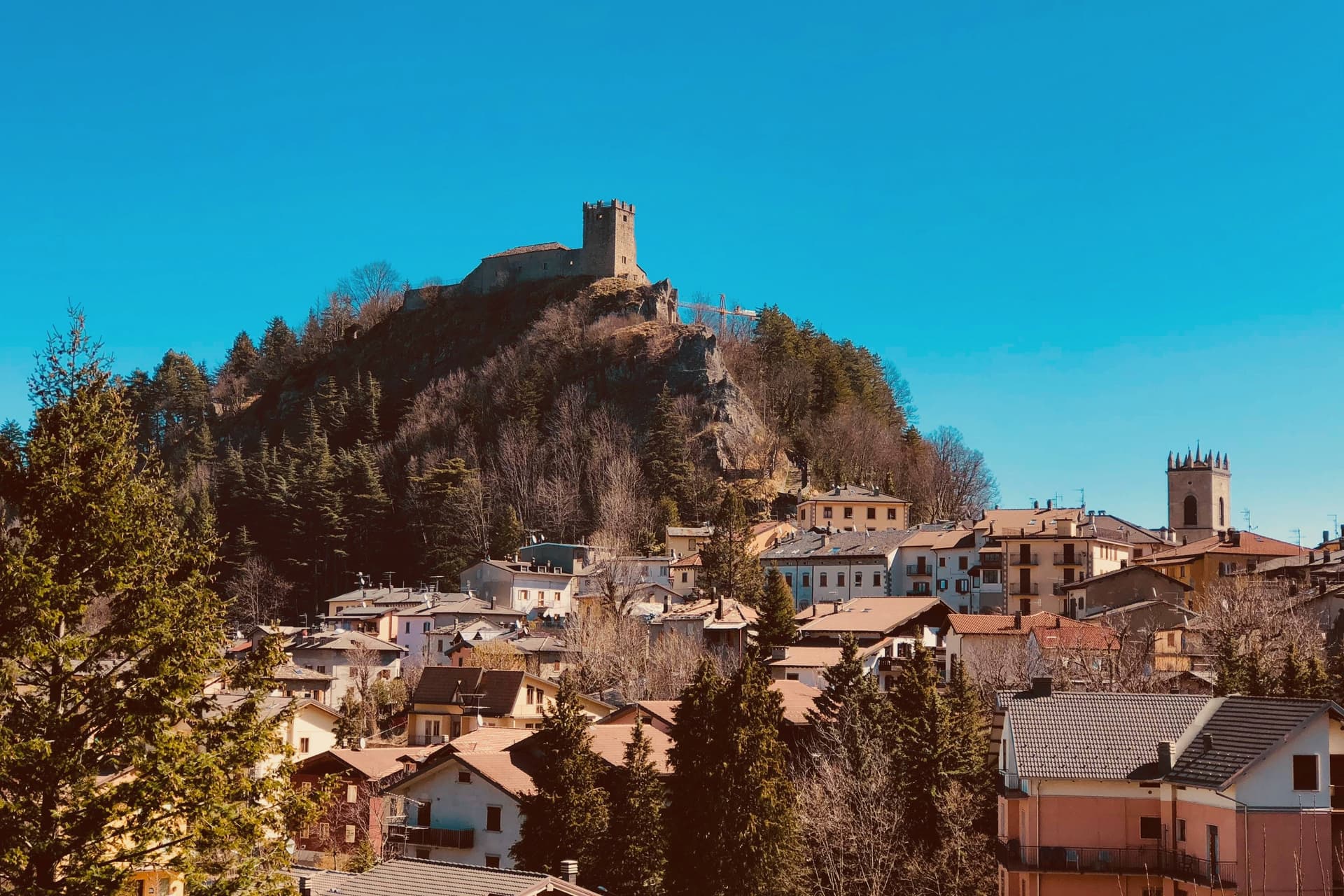
Sestola sits fifty kilometers southwest of Bologna, at the head of the Scoltenna valley, on the southern slope of the mountain that dominates the Frignano. The castle above the town began as a donation, made by the Lombard king Astolfo to the Abbey of Nonantola, before passing to the Este of Modena, who turned it into their most important garrison in the district.
That layered ownership, monastic then military, is why the same rock now holds museums of mechanical instruments, local civilisation and military history under one roof. The mountain itself is shared ground, its slopes and the ski domain across them spilling over into the neighboring communes rather than belonging to Sestola alone.
Below the peak, the character of the place shifts with the season: the same slopes that carry skiers in winter turn over to hikers in summer, and the small glacial lake above town trades snowshoe trails for paddle-boats. The town, in effect, is a fixed point of stone and governance at the foot of a mountain whose use keeps changing with the calendar.
What to see in Sestola
- Rocca di Sestola. Castle first documented in 753, granted to Nonantola by King Astolfo, taken by the Este in 1337 and held as their main military garrison in the Frignano. It still rises above the centro storico.
- Museo degli Strumenti Musicali Meccanici. Collection of mechanical music instruments inside the castle, from barrel organs to early phonographs, one of three small museums housed there.
- Monte Cimone. Highest peak of the northern Apennines at 2,165 meters, shared with Fanano, Fiumalbo and Riolunato.
How to get to Sestola
Modena is roughly 79 minutes away by road.
Our tip
Sestola runs on two seasons. December through March is ski country: the Cimone lifts open around late November and run to mid-April depending on snow, and the centro storico fills on weekends with visitors from Bologna and Modena. June through September is hiking season, with Lago della Ninfa accessible by chairlift from town and the trails to the Cimone summit open into October.
Pennabilli
Why visit Pennabilli
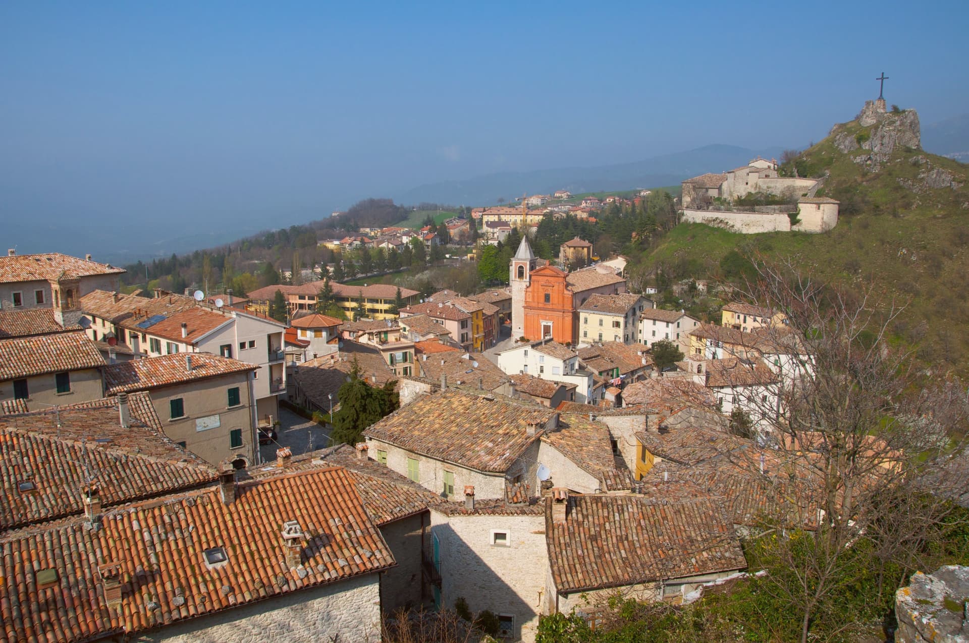
Pennabilli sits at 629 meters on the western slope of Monte Carpegna, at the head of the upper Marecchia valley, forty-five kilometers south of Rimini, inside the historic Montefeltro region. The town grew from the union of two hilltop castles, Penna on the Roccione and Billi on the Rupe, formally joined in 1350 by a stone of peace placed in the marketplace between them.
It has been the episcopal seat of the Diocese of Montefeltro since 1572, a status transferred from the older seat of San Leo. Tonino Guerra, long-time collaborator of Fellini, Antonioni and Tarkovsky, settled here in 1989 and spread his outdoor museum, I Luoghi dell'Anima, across both the town and the valley below it, linking the two former castles and their surroundings into a single walked route.
The garden of forgotten fruits opened the following year, and the antiques fair has continued each July since 1970, older than either. What the place adds up to is a town built twice: once by the stone that joined two castles into one commune, and once by the poet who joined the whole valley into a single museum without walls.
What to see in Pennabilli
- Orto dei Frutti Dimenticati. Walled garden below the Roccione, its paths lined with sculptures and installations set among the rescued fruit varieties.
- I Luoghi dell'Anima. Network of seven outdoor installations across Pennabilli and the Marecchia valley, conceived by Tonino Guerra between 1989 and 2012.
- Roccione and Rupe. Two rocky outcrops that carried the medieval castles of Penna and Billi, joined into a single commune in 1350.
How to get to Pennabilli
Rimini is roughly 55 minutes away by road.
Our tip
May through October is the open season in Pennabilli. The Marecchia valley turns green in late spring; the air at 629 meters stays cooler than the Rimini coast forty-five kilometers downstream. July is the busiest month, with the Mostra Mercato d'Antiquariato pulling crowds into the centro storico and the Carpegna trails open for hikers. Food Garden falls in August.
Fanano
Why visit Fanano
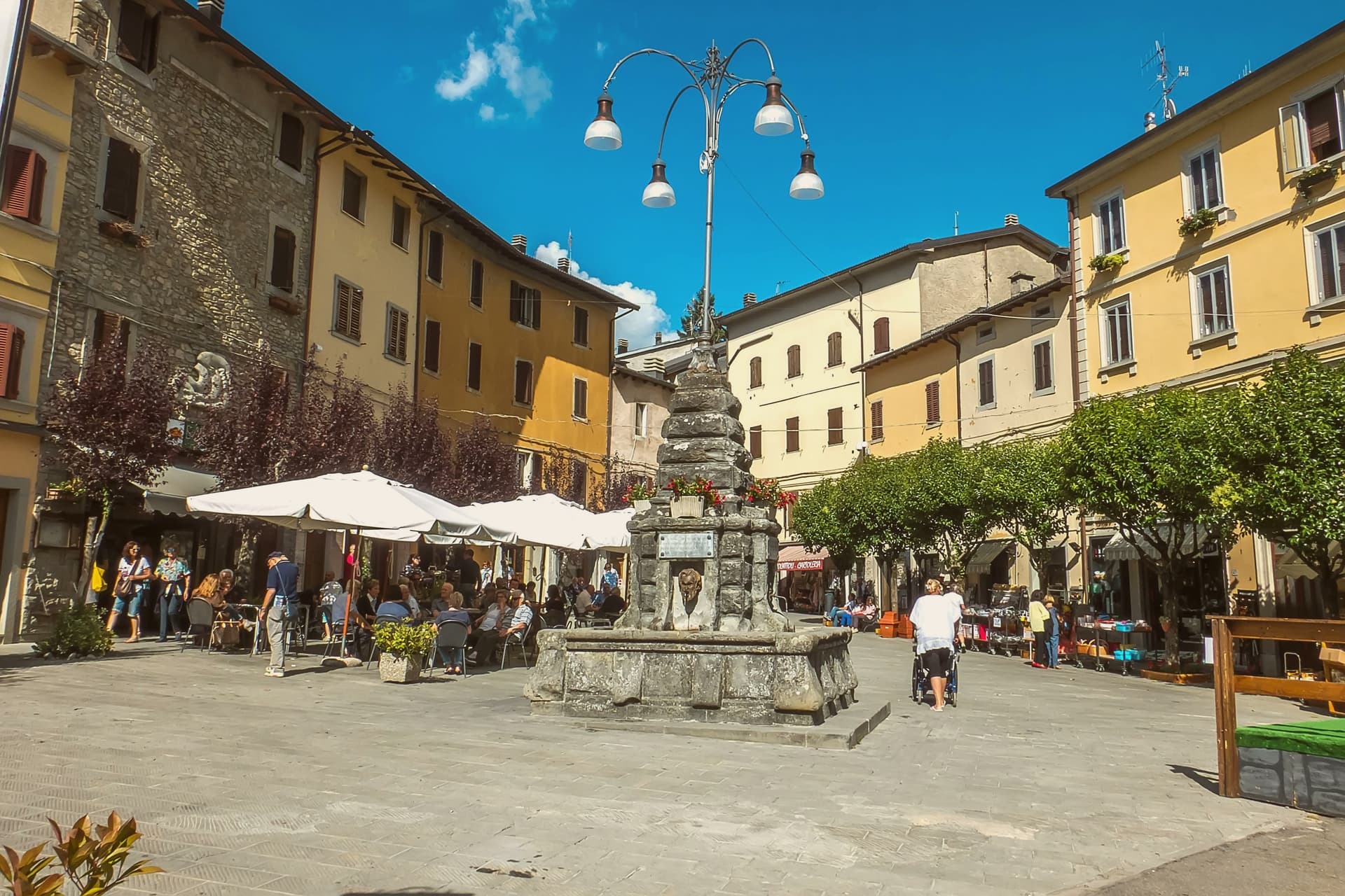
The town sits in the upper Frignano district, fifty-five kilometers southwest of Bologna and inside the Parco del Frignano. It was founded in the eighth century by Anselmo, brother-in-law of the Lombard king Aistulf, who built the Monastero del Santissimo Salvatore and a Benedictine hospice on the trade route linking Modena and Tuscany.
The Este family ruled from the eleventh century and expanded the cross-Apennine commerce that had shaped the settlement from its founding. That commerce is bound up with the stone: Fanano is known as the città della pietra, and its sandstone workshops, still active today, grew out of a place that existed to move goods and people across the mountains rather than to sit apart from them.
The centro storico, the churches, and the clock tower cluster together at 640 meters, while the territory climbs to Monte Cimone and the ridges shared with the neighbouring communes of the Modenese Apennines. A monastic foundation on a trade route became, over centuries, a stone-carving town ringed by the highest peaks of the northern Apennines.
What to see in Fanano
- Chiesa di San Giuseppe. The interior, worked on from the early seventeenth century, carries the ornament in wood and stucco through the nave and side altars.
- Chiesa di San Silvestro Papa. Romanesque parish church with a stone façade and fourteenth-century frescoes in the interior.
- Museo della Pietra Scolpita. The sculptures sit directly in the streets and squares of the centro storico rather than behind walls, the result of decades of the stone symposium adding to the collection piece by piece.
How to get to Fanano
Modena is roughly 104 minutes away by road.
Our tip
May through October is the working season in Fanano. Late spring brings the high meadows into flower; June and July are hiking months on the Cimone trails, with the centro storico cool even when the Po valley below touches thirty-five degrees. September and October bring chestnut and porcini, the two products that drive the autumn sagre.
Castell'Arquato
Why visit Castell'Arquato
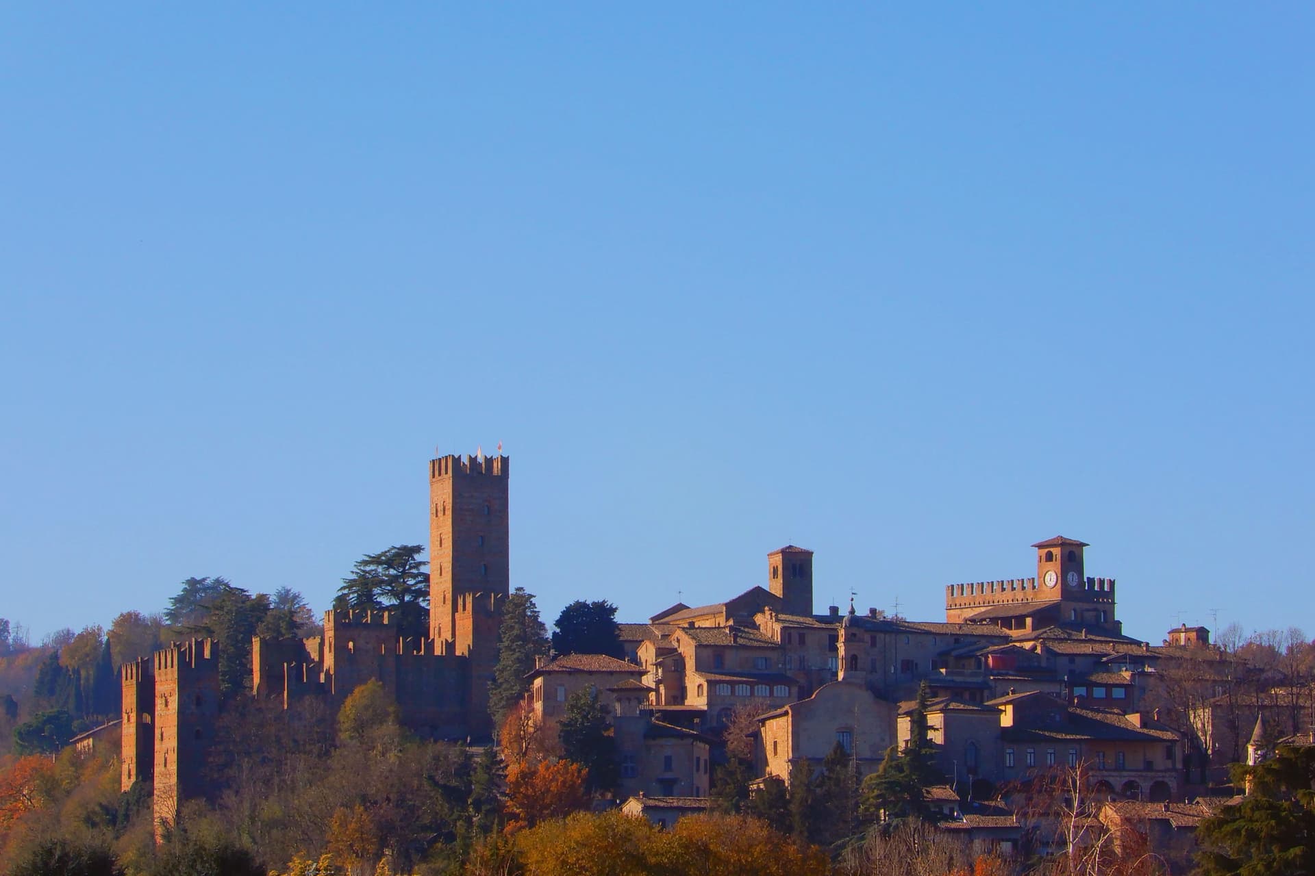
Castell'Arquato sits on the first hills of the Val d'Arda at 224 meters, thirty kilometers from Piacenza, the medieval borgo arranged in tight concentric levels around the old rock. The Collegiata di Santa Maria, founded by the noble Magnus in the eighth century, was rebuilt in 1122 after the 1117 earthquake destroyed the earlier church and is one of the finest Romanesque buildings in the Piacentino.
The Rocca Viscontea, with its thirty-five-meter tower, was begun in 1342 by Luchino Visconti, lord of Milan, to lock down the valley for Piacenza. The Palazzo del Podestà next door dates from 1292 and still anchors the Piazza Monumentale.
Luigi Illica, the librettist of Tosca, Madama Butterfly, La bohème and Andrea Chénier, was born in town in 1857; the museum dedicated to him sits in the house next to his birthplace. The Val d'Arda hills around the town produce the white wines that earned Castell'Arquato Città del Vino status.
What to see in Castell'Arquato
- Rocca Viscontea. Fortress begun in 1342 by Luchino Visconti for the municipality of Piacenza, with a thirty-five-meter tower at the highest point of the borgo.
- Collegiata di Santa Maria Assunta. Romanesque collegiate church, founded in the eighth century and rebuilt in 1122 after the 1117 earthquake destroyed the earlier structure.
- Palazzo del Podestà. Civic palace from 1292 facing the Collegiata, with the original ghibelline merlons and a fourteenth-century loggia along its lower level.
How to get to Castell'Arquato
Piacenza is roughly 38 minutes away by road.
Our tip
April through June is the best season for the Val d'Arda hills: the vineyards on the slopes below the borgo are green and the air clear enough to see across to the Appennino Piacentino. September and October bring the white-wine harvest and the chestnut weeks. July and August touch thirty-three degrees and the unshaded Piazza Monumentale becomes uncomfortable between noon and four.
Brisighella
Why visit Brisighella
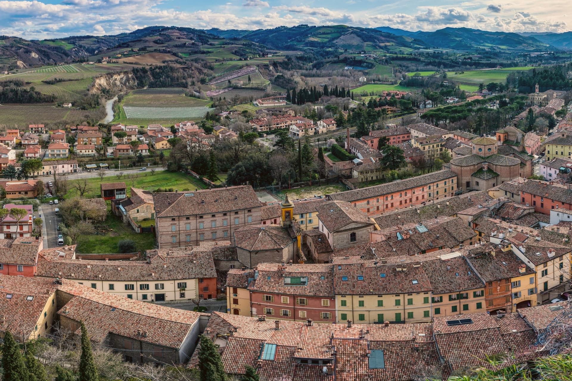
Brisighella sits in the Lamone valley at 115 meters, forty-five kilometers southeast of Bologna, on the Apennine slope where Romagna meets the gypsum vein the UNESCO list added in 2023. Three selenite hills rise above the rooftops, each carrying a building: the Rocca Manfrediana, built in 1310 by Francesco Manfredi and reinforced by the Venetians after 1503; the Torre dell'Orologio, rebuilt in 1850 with a six-hour dial instead of twelve; and the Santuario del Monticino above the town.
The Via degli Asini runs through the centro storico as a covered elevated street, originally a fourteenth-century patrol walkway, later excavated into stables for the donkeys that hauled gypsum down from the quarries. The Nostrana di Brisighella olive, grown on the same hills, makes the Brisighello DOP oil that has carried European protection since 1996.
The town holds four institutional signals at once: Borghi più belli, Bandiera Arancione, Cittaslow, Città dell'Olio.
What to see in Brisighella
- Rocca Manfrediana. Hilltop fortress begun in 1310 by Francesco Manfredi of Faenza, reinforced by Astorgio II in the 1460s and held by Venice after 1503.
- Torre dell'Orologio. Clock tower rebuilt in 1850 on an earlier defensive structure, with a dial that marks six hours rather than the usual twelve.
- Santuario del Monticino. Eighteenth-century sanctuary on the third selenite hill, overlooking the town and the Lamone valley below.
How to get to Brisighella
There is a railway station in the town, so you can arrive without a car and never need one while you are here. Forlì is roughly 55 minutes away by road.
Our tip
April through June and September through October are the working months in Brisighella. The hills around the Lamone valley turn green in spring and gold in autumn; the olive harvest in November fills the frantoi along the road to Faenza. July and August touch thirty-five degrees and the centro storico empties between two and five. Sagra Della Collina E Del Cinghiale falls in July.
Castelvetro di Modena
Why visit Castelvetro di Modena
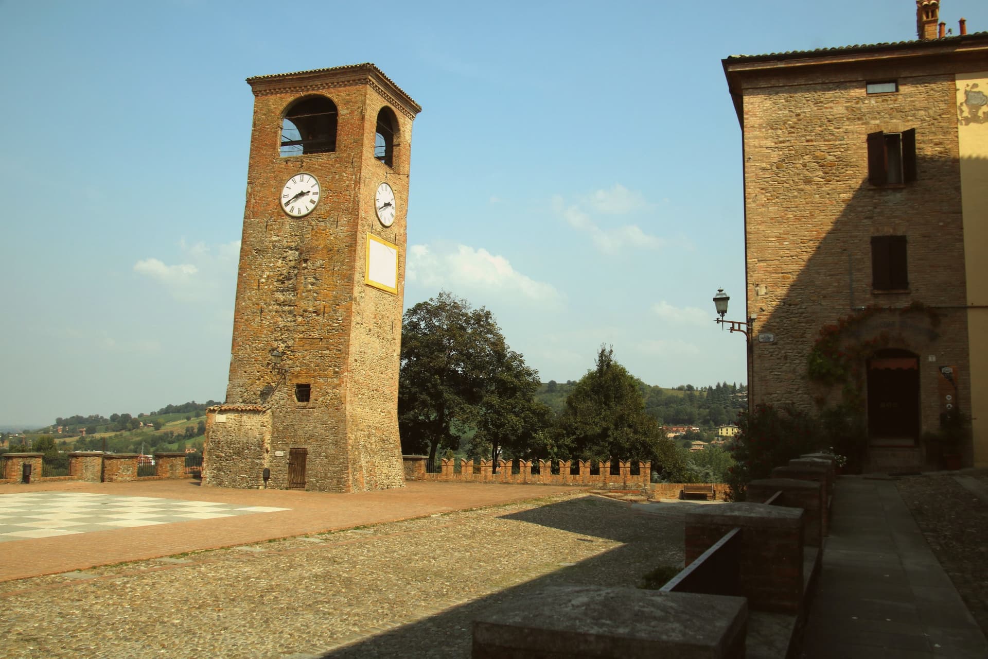
Castelvetro di Modena sits on a hill at 152 meters, eighteen kilometers southeast of Modena and at the northern edge of the Apennine foothills. The medieval centro storico rises around the Piazza Roma, paved in alternating white and black stones that earned it the name Piazza della Dama, the checkerboard piazza, framed by the four surviving towers of the old castle.
The Grasparossa grape grows on the clay slopes around the town, the sandy soil and the south-facing aspect producing the deepest, most tannic of the three main Lambruschi; Lambrusco Grasparossa di Castelvetro received DOC status in 1970. Above the piazza, the Palazzo Rinaldi houses the Museo del Vino and the Museo dell'Aceto Balsamico, the second tracing the same Modenese tradition that nearby Spilamberto codifies.
The municipality holds three institutional signals: Borghi più belli, Bandiera Arancione, Città del Vino. The Sagra dell'Uva e del Lambrusco runs the last weekend of September, when the streets fill with the chess players from the surrounding Lambrusco towns dressed as living pieces on the piazza.
What to see in Castelvetro di Modena
- Piazza Roma. Checkerboard piazza paved in alternating white and black stones, framed by the four surviving towers of the medieval castle.
- Castello di Levizzano Rangone. Tenth-century fortified frazione four kilometers north, with a tower built in the 990s and a fully preserved medieval village.
- Museo del Vino. Wine museum inside the Palazzo Rinaldi, tracing the Grasparossa production cycle and the DOC zone established in 1970.
How to get to Castelvetro di Modena
There is a railway station in the town, so you can arrive without a car and never need one while you are here. Modena is roughly 28 minutes away by road.
Our tip
April through June and September through October are the Castelvetro months. The hills around the borgo turn green in spring and red in autumn when the Grasparossa vines colour up before the harvest. July and August are hot, thirty-five degrees in the valley, less in the hills above, and the cantine slow down. Sagra dell'Uva e del Lambrusco Grasparossa di Castelvetro falls in September.
Collecchio
Why visit Collecchio
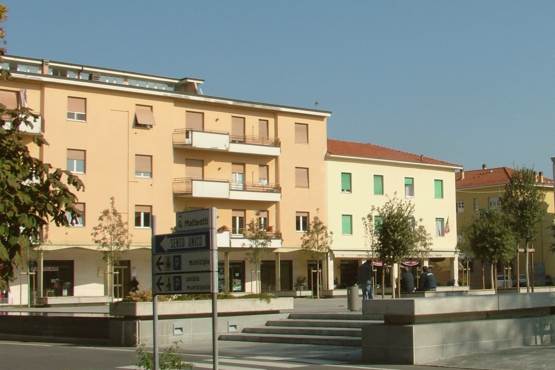
Collecchio sits at 112 meters on the right bank of the Taro, thirteen kilometers southwest of Parma, where the Via Emilia and the Via Francigena run together. In medieval documents the town appears as Colliculum, a possession of the bishops of Parma.
The centro lies on the flat valley floor, with the parish church set apart on the hill above it, and the two industrial sites, the dairy headquarters and the football training ground, occupying the built-up town rather than the countryside around it. The southern half of the municipality is given over to parkland: a municipal riverside park along the Taro and, further out, the wooded former hunting reserve of the Dukes of Parma.
A town shaped by a bishop's holding and a pilgrim road has ended up defined by a milk company and a football club, with its church and its woods left to mark what came before.
What to see in Collecchio
- Pieve di San Prospero. The three-nave interior is reached by climbing the hill above the centro; the walls show the masonry seams of construction stretched across two centuries.
- Via Francigena. The Taro variant is marked with waystones through the centro, following the line pilgrims once walked toward the Cisa pass.
- Parco Boschi di Carrega. Wooded grounds once reserved for ducal hunting, now open with trails through the trees across the southern municipality.
How to get to Collecchio
There is a railway station in the town, so you can arrive without a car and never need one while you are here. Parma is roughly 18 minutes away by road.
Our tip
April through June and September through October are the working months on the Parma plain. The Taro valley is green in spring and dry-gold in autumn, the months when the Via Francigena fills with pilgrims walking the Parma to Fornovo stage. July and August touch thirty-five degrees with high humidity, and the centro empties between two and five.
More from Anywhere Italy
- The best towns inside a nature park that eat well in Emilia-Romagna
- The 7 best towns inside a nature park that you can reach by train in Emilia-Romagna
 The best hidden towns with a food festival in Emilia-Romagna
 The best hidden towns you can reach by train in Emilia-Romagna
 The best small towns that eat well in Emilia-Romagna
 The prettiest small villages in Emilia-Romagna