
The best small towns that eat well in Emilia-Romagna
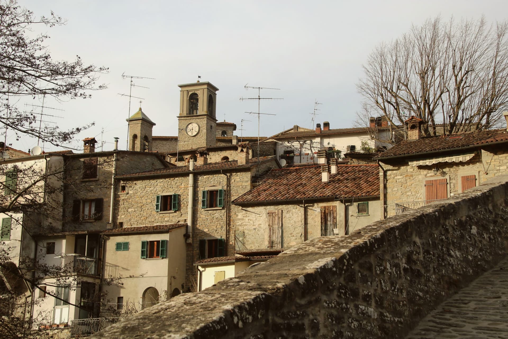
Emilia-Romagna eats better than almost anywhere in Italy, and the good part is that the cooking does not thin out once you leave the cities. In the hill towns the pasta is still rolled by hand in the morning, tortelli filled with ricotta and herbs or with potato in the higher valleys, tagliatelle cut wide, cappelletti in broth when the weather turns. Autumn brings porcini and chestnuts down from the Apennines, and the salumi counters run to culatello, coppa piacentina, mortadella still warm. Houses here are built of river stone and sandstone, roofs in heavy slabs, and the piazza is usually just wide enough for the market van and the bar tables.
The pilgrimage everyone makes is Bologna, then Modena and Parma: the porticoes, the Osteria Francescana waiting list, the balsamic cellars and the Parmigiano dairies booked out by coach groups. It is a fine circuit and the food justifies it, which is exactly why the tables are full from Thursday to Sunday and the trattorie near Piazza Maggiore have queues before opening. Prices in the centre have risen to match the attention. The famous kitchens are famous for good reason, but they are no longer quiet places to eat.
The same larder continues south and west into the hills, and that is where these towns are. The Trebbia and Arda valleys, the ridge above Sestola, the Montefeltro border country where Emilia runs into the Marche, all have villages with a guide-listed kitchen and no coach park. Fewer people go, which usually means the dining room seats a few dozen, the wine is from the next valley, and the cook comes out to explain what came in that week.
Of the 45 communes we have mapped in Emilia-Romagna, 22 qualify as towns that eat well: a national or international dining guide has named a table in each. This list is the small ones, 7 in all, ordered smallest first. The smallest, Portico e San Benedetto, has 723 residents.
If you are still choosing, we have also written The best hill towns that eat well in Emilia-Romagna and The prettiest villages that eat well in Emilia-Romagna.
Portico e San Benedetto
Why visit Portico e San Benedetto
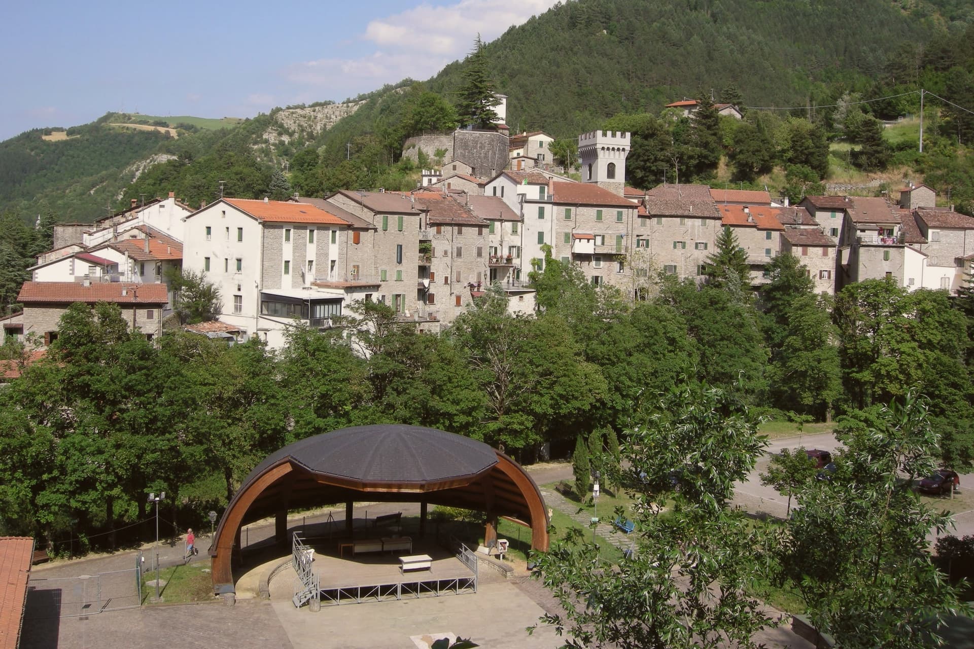
The Tuscan-Romagnolo Apennines place the borgo forty-five kilometers north of Florence and sixty southeast of Bologna, on the Montone river. The upper part holds the castle and the parish church, the middle the noble palazzi along Via Roma, the lower the artisan houses built vertically over four floors: a layout that follows the slope down from fortress to workshop.
Twelve kilometers upriver, the frazione of San Benedetto in Alpe holds the ruins of the abbey and the waterfall, joining the seat of Florentine administration to a stretch of the same valley given over to monastic settlement and to the poem that named its sound. The municipality lies inside the Parco Nazionale delle Foreste Casentinesi and carries the Bandiera Arancione.
What holds the two ends of the valley together is the Montone itself: one town built in tiers to govern the river's lower course, one abbey and one waterfall marking its upper reaches, twelve kilometers and several centuries apart but read here as a single territory.
Al Vecchio Convento have been named by a guide.
What to see in Portico e San Benedetto
- Centro storico di Portico. The slope divides into castle quarter above, noble palazzi along Via Roma at mid-level, and artisan houses built vertically below.
- Palazzo Portinari. Fourteenth-century palace on Via Roma, by tradition the residence of Folco Portinari's family.
- Cascata dell'Acquacheta. The torrent falls among rocks near San Benedetto in Alpe, the muffled roar the detail Dante fixed in Inferno XVI.
How to get to Portico e San Benedetto
Forlì is roughly 40 minutes away by road.
Our tip
April through June brings water in the Acquacheta and green on the Apennine ridges, the best months for the walk up from San Benedetto in Alpe. September and October give the chestnut harvest and the porcini in the Foreste Casentinesi; the Montone valley turns copper into November. July and August touch thirty degrees and the centro storico empties between two and five, though the river pools below the Ponte della Maestà are cold. Sagra della Tagliatella falls in August.
Montegridolfo
Why visit Montegridolfo
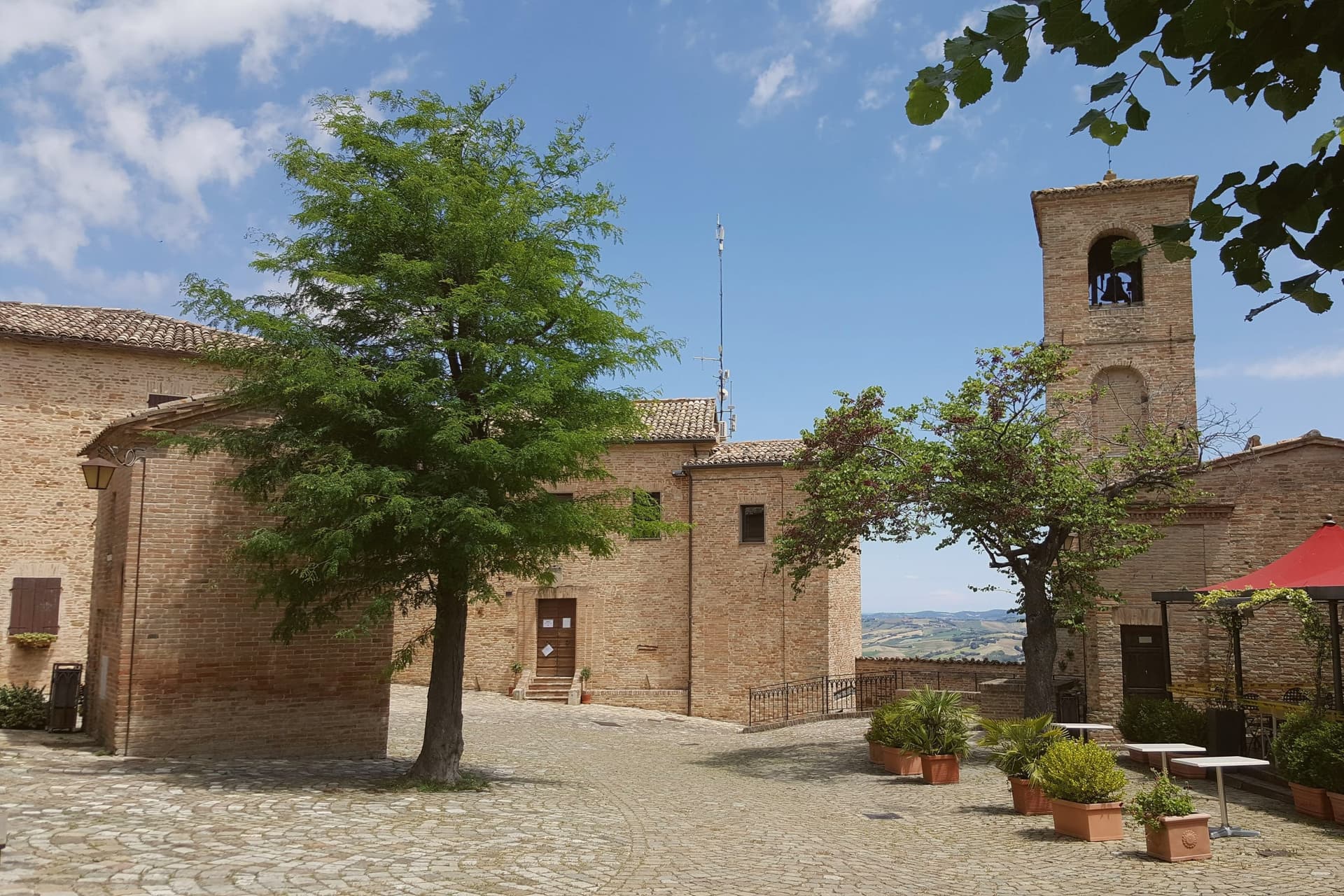
Montegridolfo sits at 290 meters on the Romagna-Marche border ridge, twenty kilometers south of Rimini and just inland from the Adriatic. A first castle is documented here in 1148, belonging to the Abbey of San Pietro of Rimini; the village took its name from the Gridolfi, a Rimini Guelph family that settled here during the conflicts with the Ghibellines.
After a sack in 1288, the Malatesta rebuilt the walls in 1337 with four corner towers. One tower survives, plus the bell tower over the gate.
The borgo passed back and forth between Malatesta and Montefeltro through the fifteenth century, fell briefly to Cesare Borgia in 1502, then to Venice, then to the Papal States in 1509. The walled nucleus today holds barely 200 of the commune's 994 residents, with the rest in Trebbio, San Pietro, and Cabaldo.
Olive oil from the surrounding ridges carries the Colli di Romagna DOP designation; the town joined the Città dell'Olio network on that basis.
Osteria dell'Accademia have been named by a guide.
What to see in Montegridolfo
- Castello di Montegridolfo. Walled fourteenth-century burg built by the Malatesta in 1337 with four corner towers, of which one survives along with the bell tower over the original gate.
- Chiesa di San Rocco. Fifteenth-century church inside the walls, built in thanks after the village was spared a plague outbreak, with frescoes attributed to the school of the Marchigiana.
- Borgo murato. Compact walled nucleus of stone houses, narrow streets and a single piazza, restored in the 1990s and inhabited by artisans and a small permanent population.
How to get to Montegridolfo
Rimini is roughly 42 minutes away by road.
Our tip
April through October are the months that work in Montegridolfo. Spring brings clear views from the walls down to the Conca valley; September and October are the dry, gold months with the olive harvest beginning at the end of October. July and August are hot but the ridge catches the Adriatic breeze and the walled nucleus stays cool in shade.
Montefiore Conca
Why visit Montefiore Conca
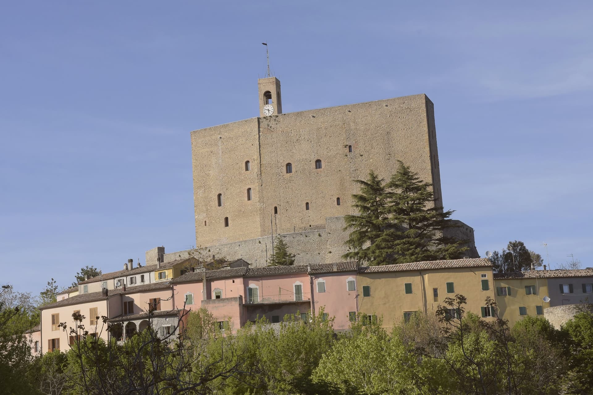
Montefiore Conca sits above the Conca river valley, twenty kilometers south of Rimini, on a hill the Malatesta chose for both military and seasonal reasons: high enough to anchor a defensive ring, mild enough for a residence to be built alongside the garrison. The fortress and the walled borgo that grew around it form a single hilltop nucleus, with the Porta Curina gate marking the point where, after Federico da Montefeltro's troops took the town in the late fifteenth century, control reverted to the Holy See, a shift the villagers recorded by carving the arms of Pope Pius II into the stone themselves.
The commune extends beyond that nucleus into the frazioni of Serbadone and Marazzano and out to the ridge holding the Santuario della Bonora, spreading the settlement from a single fortified point into the surrounding hills. Recognition is double: Borghi più belli d'Italia and Bandiera Arancione, a pairing that reads less as decoration than as confirmation that the hill the Malatesta picked for defense and comfort still functions, centuries on, as both a place to look out from and a place worth looking at.
La Cerqua have been named by a guide.
What to see in Montefiore Conca
- Rocca Malatestiana. Mid-fourteenth-century fortress built under Malatesta Ungaro, combining military bulk with a residential wing whose frescoed halls received Pope Gregory XII and Louis I of Hungary.
- Santuario della Madonna di Bonora. Sanctuary reached on a wooded ridge two kilometers from the centro storico, with a venerated fresco of the Madonna and Child still the object of the pilgrimage traffic it draws.
- Borgo medievale. Walled hilltop nucleus around the fortress, with the Porta Curina gate carrying the Piccolomini arms of Pope Pius II carved by the villagers in the late fifteenth century, after control of the town reverted to the Holy See.
How to get to Montefiore Conca
Rimini is roughly 35 minutes away by road.
Our tip
April through June and September through October are the strongest months, with mild evenings on the hill and clear views to the coast. July and August are hot in the Conca valley but the Rocca terrace catches the breeze that the riviera below does not. The fortress opens daily in summer, weekends only from November through March.
Sestola
Why visit Sestola
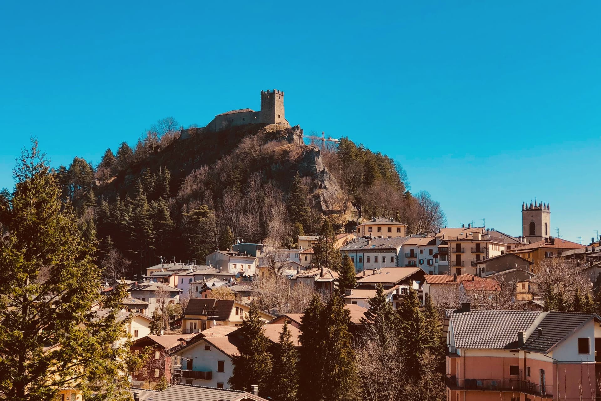
Sestola sits fifty kilometers southwest of Bologna, at the head of the Scoltenna valley, on the southern slope of the mountain that dominates the Frignano. The castle above the town began as a donation, made by the Lombard king Astolfo to the Abbey of Nonantola, before passing to the Este of Modena, who turned it into their most important garrison in the district.
That layered ownership, monastic then military, is why the same rock now holds museums of mechanical instruments, local civilisation and military history under one roof. The mountain itself is shared ground, its slopes and the ski domain across them spilling over into the neighboring communes rather than belonging to Sestola alone.
Below the peak, the character of the place shifts with the season: the same slopes that carry skiers in winter turn over to hikers in summer, and the small glacial lake above town trades snowshoe trails for paddle-boats. The town, in effect, is a fixed point of stone and governance at the foot of a mountain whose use keeps changing with the calendar.
San Rocco have been named by a guide.
What to see in Sestola
- Rocca di Sestola. Castle first documented in 753, granted to Nonantola by King Astolfo, taken by the Este in 1337 and held as their main military garrison in the Frignano. It still rises above the centro storico.
- Museo degli Strumenti Musicali Meccanici. Collection of mechanical music instruments inside the castle, from barrel organs to early phonographs, one of three small museums housed there.
- Monte Cimone. Highest peak of the northern Apennines at 2,165 meters, shared with Fanano, Fiumalbo and Riolunato.
How to get to Sestola
Modena is roughly 79 minutes away by road.
Our tip
Sestola runs on two seasons. December through March is ski country: the Cimone lifts open around late November and run to mid-April depending on snow, and the centro storico fills on weekends with visitors from Bologna and Modena. June through September is hiking season, with Lago della Ninfa accessible by chairlift from town and the trails to the Cimone summit open into October.
Pennabilli
Why visit Pennabilli
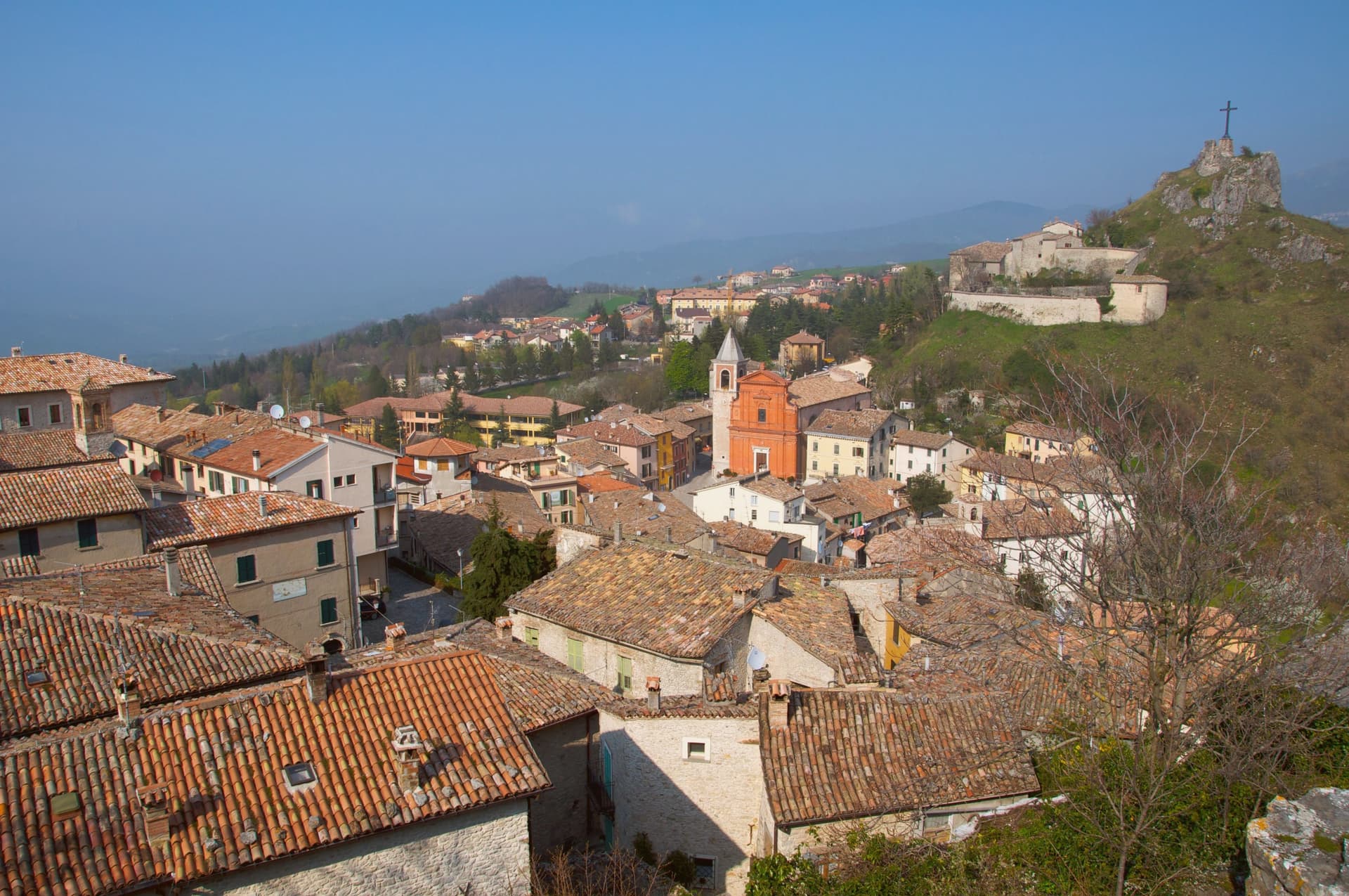
Pennabilli sits at 629 meters on the western slope of Monte Carpegna, at the head of the upper Marecchia valley, forty-five kilometers south of Rimini, inside the historic Montefeltro region. The town grew from the union of two hilltop castles, Penna on the Roccione and Billi on the Rupe, formally joined in 1350 by a stone of peace placed in the marketplace between them.
It has been the episcopal seat of the Diocese of Montefeltro since 1572, a status transferred from the older seat of San Leo. Tonino Guerra, long-time collaborator of Fellini, Antonioni and Tarkovsky, settled here in 1989 and spread his outdoor museum, I Luoghi dell'Anima, across both the town and the valley below it, linking the two former castles and their surroundings into a single walked route.
The garden of forgotten fruits opened the following year, and the antiques fair has continued each July since 1970, older than either. What the place adds up to is a town built twice: once by the stone that joined two castles into one commune, and once by the poet who joined the whole valley into a single museum without walls.
Il Piastrino have been named by a guide.
What to see in Pennabilli
- Orto dei Frutti Dimenticati. Walled garden below the Roccione, its paths lined with sculptures and installations set among the rescued fruit varieties.
- I Luoghi dell'Anima. Network of seven outdoor installations across Pennabilli and the Marecchia valley, conceived by Tonino Guerra between 1989 and 2012.
- Roccione and Rupe. Two rocky outcrops that carried the medieval castles of Penna and Billi, joined into a single commune in 1350.
How to get to Pennabilli
Rimini is roughly 55 minutes away by road.
Our tip
May through October is the open season in Pennabilli. The Marecchia valley turns green in late spring; the air at 629 meters stays cooler than the Rimini coast forty-five kilometers downstream. July is the busiest month, with the Mostra Mercato d'Antiquariato pulling crowds into the centro storico and the Carpegna trails open for hikers. Food Garden falls in August.
Bobbio
Why visit Bobbio
Bobbio sits on the left bank of the Trebbia at 272 meters, at the foot of Monte Penice in the Piacentine Apennines. The land was granted to Saint Columbanus by the Lombard king Agilulf in 614, and the monastery he raised on it grew, by the eighth century, into one of the principal libraries north of Rome, copying Greek, Latin, and Irish manuscripts that survived nowhere else.
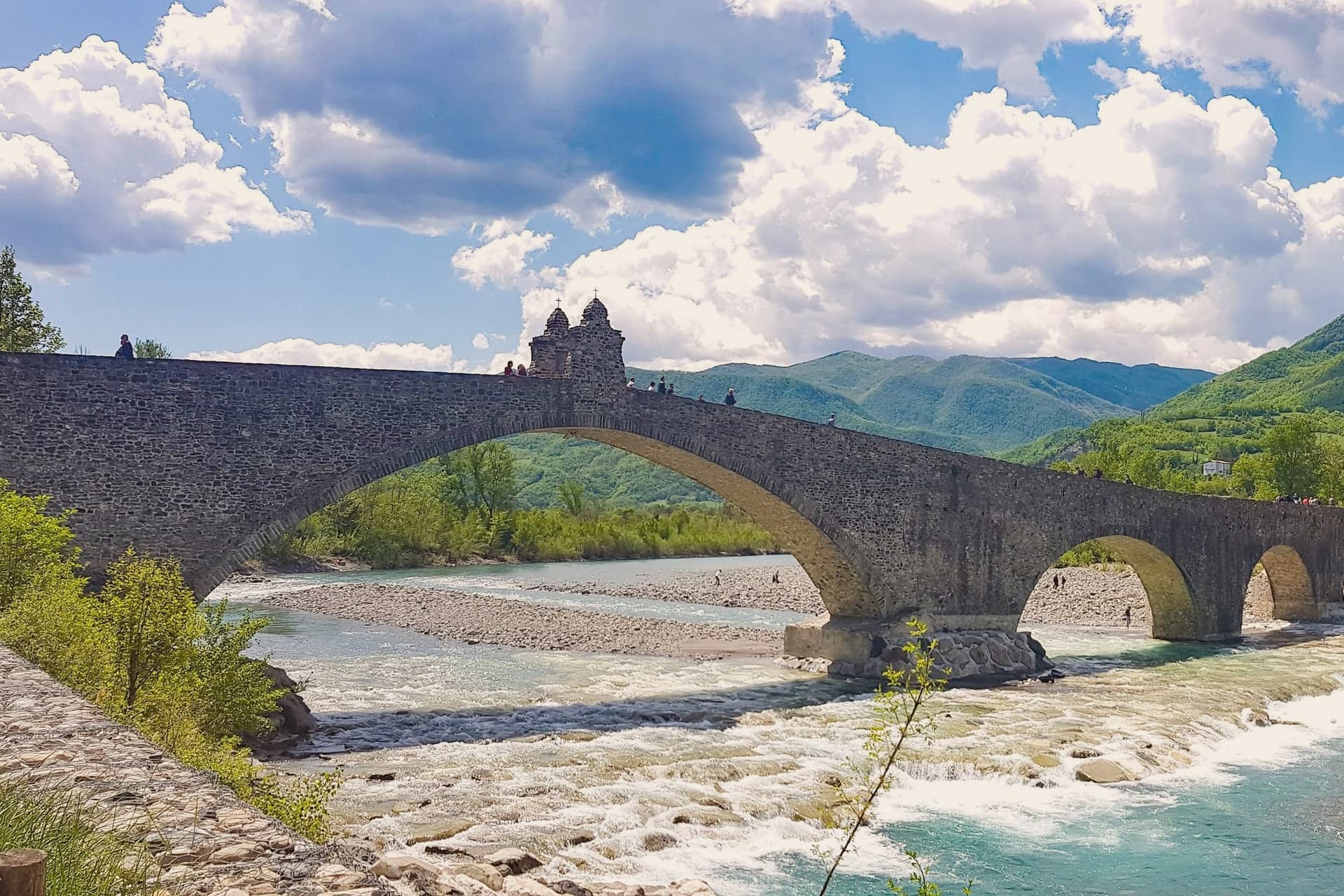
The French suppressed the monastery in 1803; what the scriptorium and library once held now lives in fragments, kept in the basilica and its museum. The town below the abbey is crossed by the Trebbia on the Ponte Gobbo, its eleven irregular arches stretching 273 meters, a shape that gave rise to the story of the Devil and the saint dividing the bridge between them.
Bobbio still carries the Borghi più belli and Bandiera Arancione designations alongside the 2019 RAI title. A river crossing, a hill fortress, and a monastery ruin sit within reach of one another here, each holding a different piece of the same long settlement, one built by faith, one by feudal power, and one by the river itself.
Enoteca San Nicola, Piacentino have been named by a guide.
What to see in Bobbio
- Abbazia di San Colombano. The basilica and grounds where Saint Columbanus settled still stand; the scriptorium he founded is gone but its output is documented in surviving manuscripts held elsewhere.
- Ponte Gobbo. The eleven arches sit unevenly across the riverbed, the irregularity of their spacing the source of both the Devil's Bridge name and the Columbanus legend attached to it.
- Duomo di Bobbio. Romanesque cathedral begun in 1075, dedicated to Santa Maria Assunta, with a fifteenth-century fresco cycle in the apse.
How to get to Bobbio
Piacenza is roughly 63 minutes away by road.
Our tip
April through June brings the green Val Trebbia season, when the river runs clear enough for swimming holes downstream. September and October are the working months for chestnuts, mushrooms, and the maccheroni alla bobbiese the town fills its trattorie with. July and August can hit thirty-three degrees in the valley, and the 2019 Borgo dei Borghi win still draws weekend crowds that fill the Ponte Gobbo. La Festa del Pinolo falls in August.
Castell'Arquato
Why visit Castell'Arquato
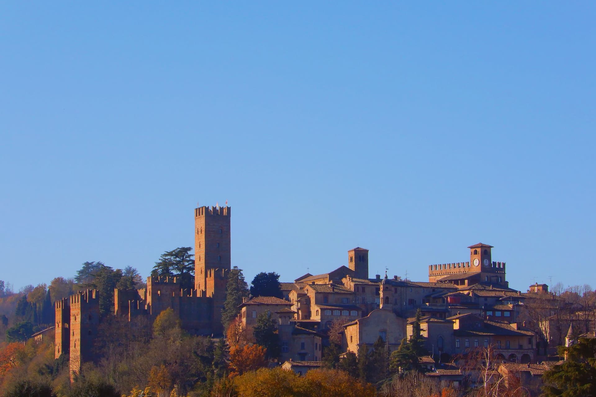
Castell'Arquato sits on the first hills of the Val d'Arda at 224 meters, thirty kilometers from Piacenza, the medieval borgo arranged in tight concentric levels around the old rock. The Collegiata di Santa Maria, founded by the noble Magnus in the eighth century, was rebuilt in 1122 after the 1117 earthquake destroyed the earlier church and is one of the finest Romanesque buildings in the Piacentino.
The Rocca Viscontea, with its thirty-five-meter tower, was begun in 1342 by Luchino Visconti, lord of Milan, to lock down the valley for Piacenza. The Palazzo del Podestà next door dates from 1292 and still anchors the Piazza Monumentale.
Luigi Illica, the librettist of Tosca, Madama Butterfly, La bohème and Andrea Chénier, was born in town in 1857; the museum dedicated to him sits in the house next to his birthplace. The Val d'Arda hills around the town produce the white wines that earned Castell'Arquato Città del Vino status.
Da Faccini have been named by a guide.
What to see in Castell'Arquato
- Rocca Viscontea. Fortress begun in 1342 by Luchino Visconti for the municipality of Piacenza, with a thirty-five-meter tower at the highest point of the borgo.
- Collegiata di Santa Maria Assunta. Romanesque collegiate church, founded in the eighth century and rebuilt in 1122 after the 1117 earthquake destroyed the earlier structure.
- Palazzo del Podestà. Civic palace from 1292 facing the Collegiata, with the original ghibelline merlons and a fourteenth-century loggia along its lower level.
How to get to Castell'Arquato
Piacenza is roughly 38 minutes away by road.
Our tip
April through June is the best season for the Val d'Arda hills: the vineyards on the slopes below the borgo are green and the air clear enough to see across to the Appennino Piacentino. September and October bring the white-wine harvest and the chestnut weeks. July and August touch thirty-three degrees and the unshaded Piazza Monumentale becomes uncomfortable between noon and four.
More from Anywhere Italy
- The best hill towns that eat well in Emilia-Romagna
- The prettiest villages that eat well in Emilia-Romagna
- The prettiest small villages in Emilia-Romagna
- The best towns inside a nature park that eat well in Emilia-Romagna
 The best hidden towns inside a nature park in Emilia-Romagna
 The best towns with a food festival in Emilia-Romagna