
The best hidden towns with a serious restaurant in Emilia-Romagna
Emilia-Romagna cooking is built on butter, pork and patience. The plains give you Parmigiano Reggiano scraped off the wheel in flakes, culatello aged in damp cellars near the Po, and pasta rolled by hand into tortelli, cappelletti, tagliatelle cut wide. Up in the Apennines the register changes: chestnut flour, wild boar, mushrooms in autumn, tortelli filled with potato and dressed with a ragù that has been on the stove all morning. The towns themselves are sandstone and brick, with porticoes for the wet months and stone bridges over rivers that run hard in spring. Winter is when the food makes most sense, and when the dining rooms are warmest.
People eat in Bologna, and with reason. The market streets behind Piazza Maggiore, the mortadella counters, the trattorie that have been serving tagliatelle al ragù since before the war, all of it is worth the queue at least once. But Bologna is now one of the most heavily booked food cities in Italy, and the good tables in the centre want reserving weeks out. Modena adds to the pressure, with a waiting list that has become a story in itself.
The cooking does not stop at the ring road. It runs south into the Apennines and east towards the Adriatic hills, and the same regional larder feeds kitchens in towns where nobody is standing in line. The places on this list each hold a restaurant that the most demanding of the dining guides has thought worth listing, in towns small enough that the chef may well be shopping in the same square you parked in. Some sit on thermal water, some on a hilltop with walls, some on a river valley road that most drivers use only to get somewhere else.
Of the 45 communes we have mapped in Emilia-Romagna, 16 qualify as towns with a serious restaurant: each holds a restaurant listed by the most demanding of the dining guides. This list is the hidden ones, 7 in all, ordered smallest first. The smallest, Montegridolfo, has 994 residents.
Elsewhere in the catalogue: The best hill towns that eat well in Emilia-Romagna and The prettiest villages that eat well in Emilia-Romagna.
Montegridolfo
Why visit Montegridolfo
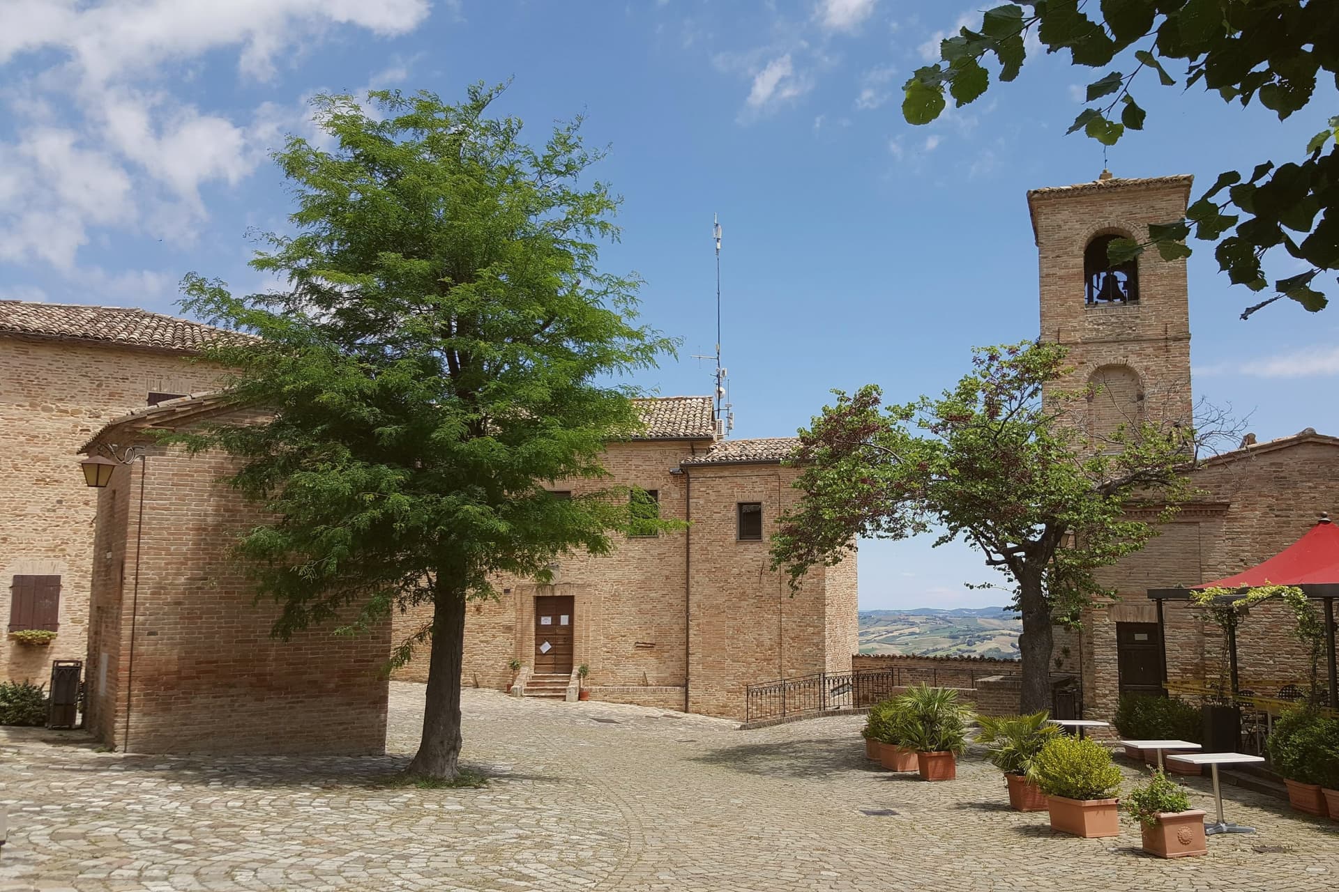
Montegridolfo sits at 290 meters on the Romagna-Marche border ridge, twenty kilometers south of Rimini and just inland from the Adriatic. A first castle is documented here in 1148, belonging to the Abbey of San Pietro of Rimini; the village took its name from the Gridolfi, a Rimini Guelph family that settled here during the conflicts with the Ghibellines.
After a sack in 1288, the Malatesta rebuilt the walls in 1337 with four corner towers. One tower survives, plus the bell tower over the gate.
The borgo passed back and forth between Malatesta and Montefeltro through the fifteenth century, fell briefly to Cesare Borgia in 1502, then to Venice, then to the Papal States in 1509. The walled nucleus today holds barely 200 of the commune's 994 residents, with the rest in Trebbio, San Pietro, and Cabaldo.
Olive oil from the surrounding ridges carries the Colli di Romagna DOP designation; the town joined the Città dell'Olio network on that basis.
Osteria dell'Accademia have been named by a guide.
What to see in Montegridolfo
- Castello di Montegridolfo. Walled fourteenth-century burg built by the Malatesta in 1337 with four corner towers, of which one survives along with the bell tower over the original gate.
- Chiesa di San Rocco. Fifteenth-century church inside the walls, built in thanks after the village was spared a plague outbreak, with frescoes attributed to the school of the Marchigiana.
- Borgo murato. Compact walled nucleus of stone houses, narrow streets and a single piazza, restored in the 1990s and inhabited by artisans and a small permanent population.
How to get to Montegridolfo
Rimini is roughly 42 minutes away by road.
Our tip
April through October are the months that work in Montegridolfo. Spring brings clear views from the walls down to the Conca valley; September and October are the dry, gold months with the olive harvest beginning at the end of October. July and August are hot but the ridge catches the Adriatic breeze and the walled nucleus stays cool in shade.
Pennabilli
Why visit Pennabilli
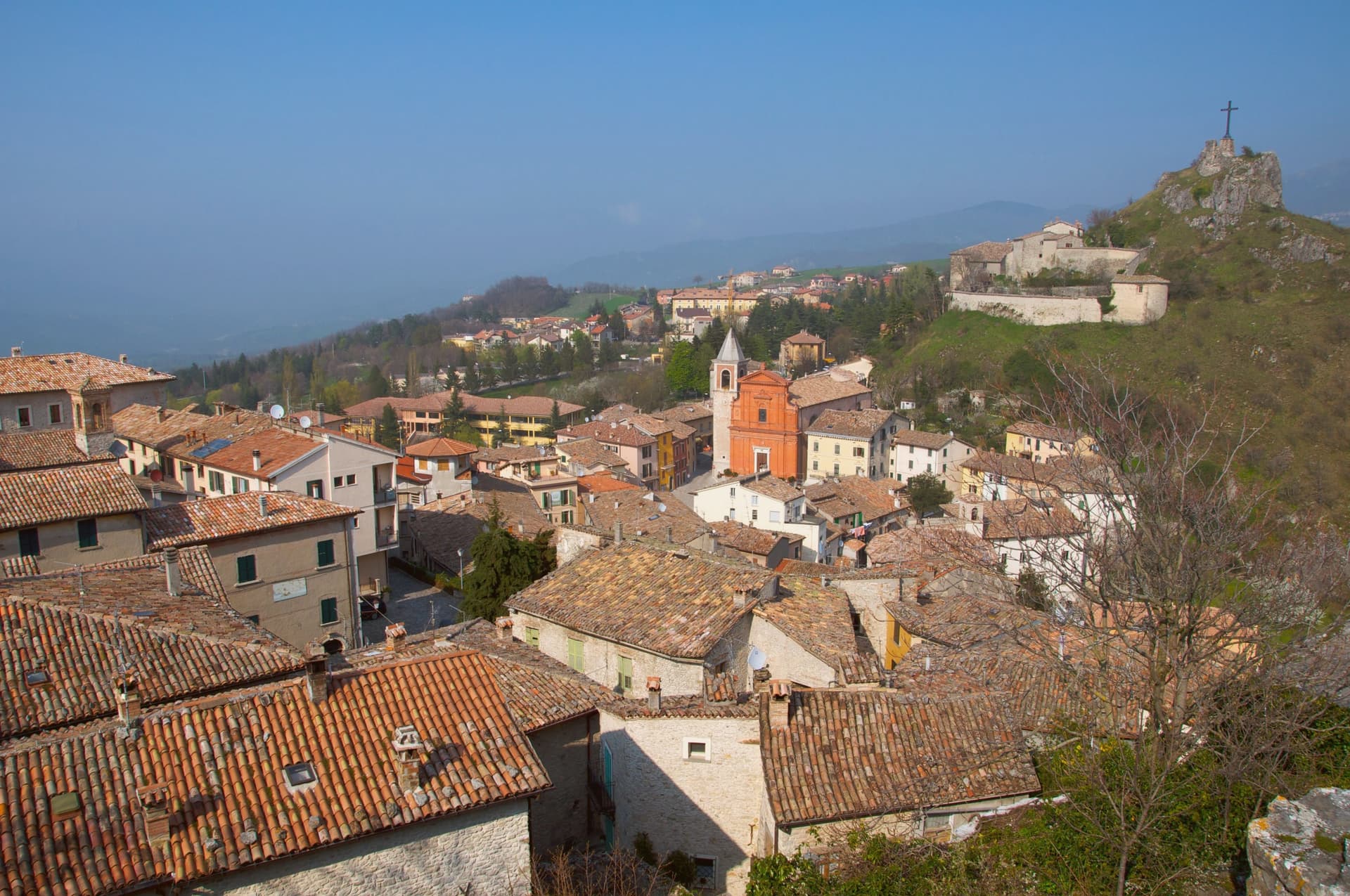
Pennabilli sits at 629 meters on the western slope of Monte Carpegna, at the head of the upper Marecchia valley, forty-five kilometers south of Rimini, inside the historic Montefeltro region. The town grew from the union of two hilltop castles, Penna on the Roccione and Billi on the Rupe, formally joined in 1350 by a stone of peace placed in the marketplace between them.
It has been the episcopal seat of the Diocese of Montefeltro since 1572, a status transferred from the older seat of San Leo. Tonino Guerra, long-time collaborator of Fellini, Antonioni and Tarkovsky, settled here in 1989 and spread his outdoor museum, I Luoghi dell'Anima, across both the town and the valley below it, linking the two former castles and their surroundings into a single walked route.
The garden of forgotten fruits opened the following year, and the antiques fair has continued each July since 1970, older than either. What the place adds up to is a town built twice: once by the stone that joined two castles into one commune, and once by the poet who joined the whole valley into a single museum without walls.
Il Piastrino have been named by a guide.
What to see in Pennabilli
- Orto dei Frutti Dimenticati. Walled garden below the Roccione, its paths lined with sculptures and installations set among the rescued fruit varieties.
- I Luoghi dell'Anima. Network of seven outdoor installations across Pennabilli and the Marecchia valley, conceived by Tonino Guerra between 1989 and 2012.
- Roccione and Rupe. Two rocky outcrops that carried the medieval castles of Penna and Billi, joined into a single commune in 1350.
How to get to Pennabilli
Rimini is roughly 55 minutes away by road.
Our tip
May through October is the open season in Pennabilli. The Marecchia valley turns green in late spring; the air at 629 meters stays cooler than the Rimini coast forty-five kilometers downstream. July is the busiest month, with the Mostra Mercato d'Antiquariato pulling crowds into the centro storico and the Carpegna trails open for hikers. Food Garden falls in August.
Bobbio
Why visit Bobbio
Bobbio sits on the left bank of the Trebbia at 272 meters, at the foot of Monte Penice in the Piacentine Apennines. The land was granted to Saint Columbanus by the Lombard king Agilulf in 614, and the monastery he raised on it grew, by the eighth century, into one of the principal libraries north of Rome, copying Greek, Latin, and Irish manuscripts that survived nowhere else.
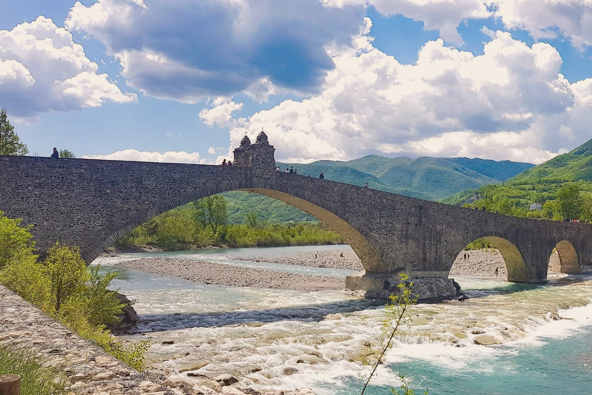
The French suppressed the monastery in 1803; what the scriptorium and library once held now lives in fragments, kept in the basilica and its museum. The town below the abbey is crossed by the Trebbia on the Ponte Gobbo, its eleven irregular arches stretching 273 meters, a shape that gave rise to the story of the Devil and the saint dividing the bridge between them.
Bobbio still carries the Borghi più belli and Bandiera Arancione designations alongside the 2019 RAI title. A river crossing, a hill fortress, and a monastery ruin sit within reach of one another here, each holding a different piece of the same long settlement, one built by faith, one by feudal power, and one by the river itself.
Enoteca San Nicola, Piacentino have been named by a guide.
What to see in Bobbio
- Abbazia di San Colombano. The basilica and grounds where Saint Columbanus settled still stand; the scriptorium he founded is gone but its output is documented in surviving manuscripts held elsewhere.
- Ponte Gobbo. The eleven arches sit unevenly across the riverbed, the irregularity of their spacing the source of both the Devil's Bridge name and the Columbanus legend attached to it.
- Duomo di Bobbio. Romanesque cathedral begun in 1075, dedicated to Santa Maria Assunta, with a fifteenth-century fresco cycle in the apse.
How to get to Bobbio
Piacenza is roughly 63 minutes away by road.
Our tip
April through June brings the green Val Trebbia season, when the river runs clear enough for swimming holes downstream. September and October are the working months for chestnuts, mushrooms, and the maccheroni alla bobbiese the town fills its trattorie with. July and August can hit thirty-three degrees in the valley, and the 2019 Borgo dei Borghi win still draws weekend crowds that fill the Ponte Gobbo. La Festa del Pinolo falls in August.
Bagno di Romagna
Why visit Bagno di Romagna
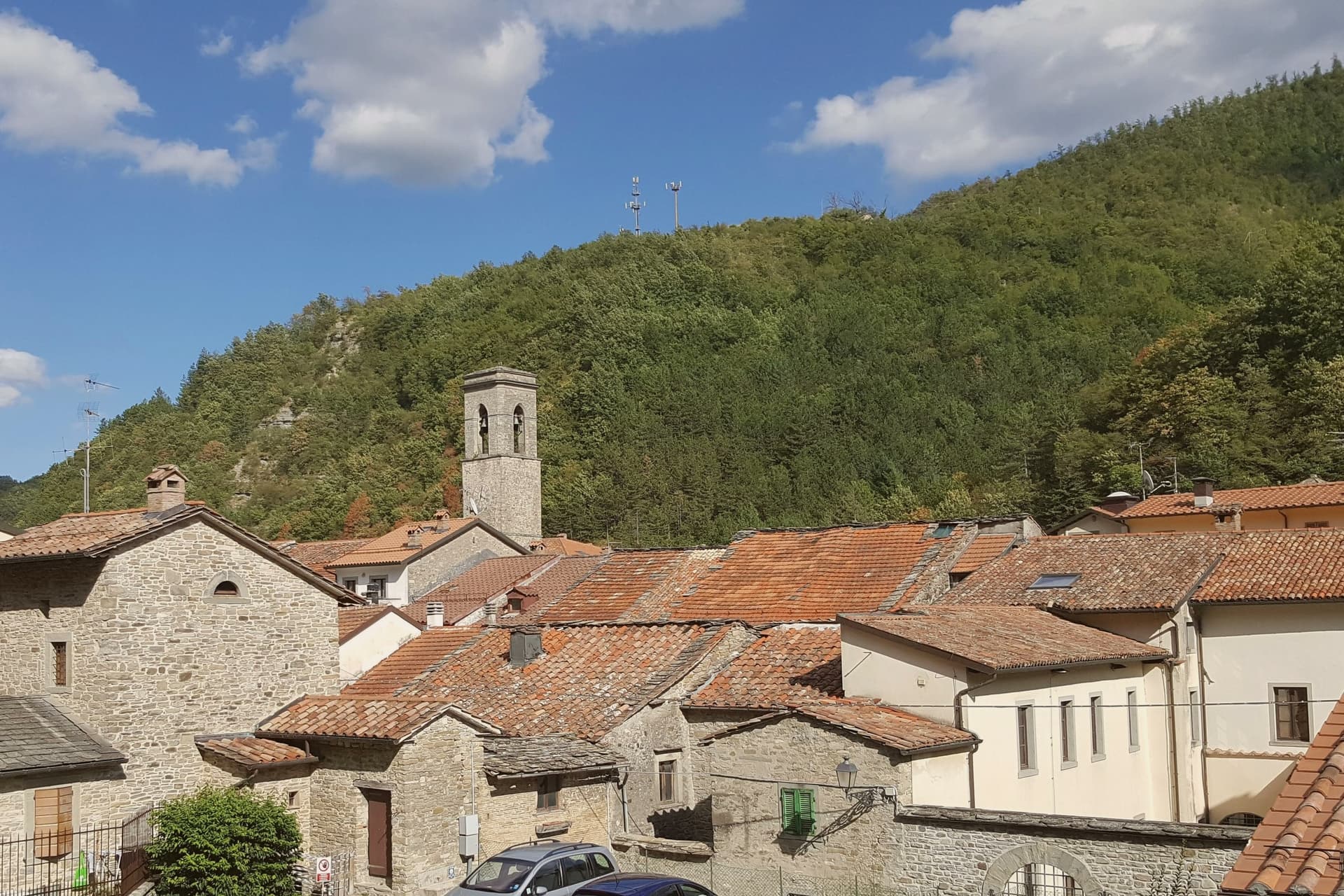
Bagno di Romagna sits at 491 meters at the head of the Savio valley, on the Apennine ridge that separates Romagna from Tuscany. The town belonged to Tuscany until 1923, when Mussolini moved the provincial border so the source of the Tiber would fall inside his native Forlì.
Its name comes from the thermal springs that surface at 47 degrees, rich in sodium-carbonate-sulphur, used by the Romans and continuously since. Two thermal complexes still operate in the centro storico.
The municipality reaches into the Parco Nazionale delle Foreste Casentinesi, the largest old-growth beech and silver-fir forest in central Europe, where the Ridracoli reservoir holds the drinking water for most of Romagna. San Piero in Bagno, the larger frazione four kilometers down the road, was made the administrative seat by royal decree in 1865 while the older Bagno kept the name and the springs.
The town carries Borghi più belli, Bandiera Arancione, and Parco Nazionale recognition.
Da Gorini, Ristorante del Lago, Paolo Teverini and 1 more have been named by a guide.
What to see in Bagno di Romagna
- Terme di Sant'Agnese. Sulphurous thermal complex in the centro storico, drawing on springs that surface at 47 degrees and have been in continuous use since Roman times.
- Basilica di Santa Maria Assunta. Twelfth-century church with a fifteenth-century Della Robbia terracotta and a wooden crucifix attributed to the school of Brunelleschi.
- Parco Nazionale delle Foreste Casentinesi. Old-growth beech and silver-fir forest spanning the Apennine ridge, the largest continuous protected forest in central Europe.
How to get to Bagno di Romagna
Forlì is roughly 78 minutes away by road.
Our tip
Bagno di Romagna runs all twelve months because the thermal water does. June through August brings hiking weather in the Foreste Casentinesi and crowds at Ridracoli; July and August can touch thirty-two degrees in the centro storico, though the valley cools sharply after sunset. September and October bring the chestnut and porcini season, and the forest changes colour into November. I giorni del Capitano falls in July.
Longiano
Why visit Longiano
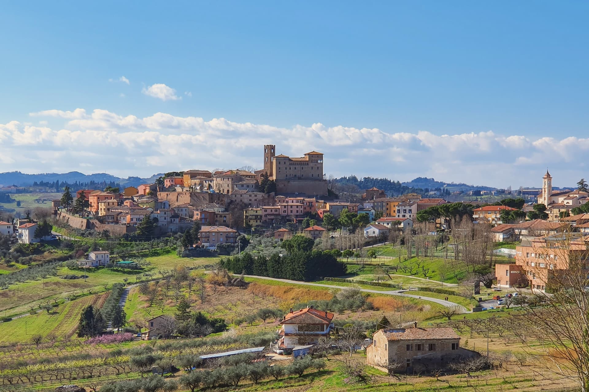
Longiano sits at 179 meters on the first hill line between Cesena and Rimini, eleven kilometers inland from Cesenatico and within sight of the Adriatic. The town shifted from the plain to the hill in the seventh and eighth centuries, when the local population moved up to escape Lombard raids, and the settlement that resulted is the hilltop borgo still walled today, with the castle at its center and the theater just below it.
Longiano passed to the Church in 1581 and stayed under papal rule until unification, before the castle came to the commune in 1989. The sanctuary stands apart from this hilltop cluster, built around its painted crucifix and held by Franciscan presence for over seven centuries, a separate thread of the town's history running alongside the Malatesta line and the civic one.
What ties the parts together is the hill itself: a defensive move made in the seventh and eighth centuries left Longiano with a compact center where a former ruling family's fortress, a nineteenth-century theater and a walled medieval borgo all sit within reach of each other, while the sanctuary's much older devotional history runs on its own separate track nearby.
Magnolia, Dei Cantoni, Terre Alte have been named by a guide.
What to see in Longiano
- Castello Malatestiano. Fortified hilltop seat of the Malatesta of Rimini, later passing to the Church and then the commune. Its rooms now hold the Fondazione Tito Balestra, so the walls that once housed a ruling family now hold paintings, drawings and sculpture.
- Teatro Petrella. Sits just below the castle. Restored in 1986, it is known today for its acoustics inside the horseshoe-shaped hall.
- Santuario del Santissimo Crocifisso. Franciscan sanctuary built around a thirteenth-century painted crucifix on oak panel, with continuous Franciscan presence for over seven centuries.
How to get to Longiano
There is a railway station in the town, so you can arrive without a car and never need one while you are here. Rimini is roughly 30 minutes away by road.
Our tip
April through June and September through October are the months for Longiano. The hilltop catches a breeze the coastal plain below does not, and the views run from the Apennines to the Adriatic on clear days. July and August touch the low thirties and the centro storico empties between two and five; many visitors come up from Cesenatico and Cervia in the late afternoon for the cooler air and the castle. Crocetta 30 in Festa falls in August.
Castelvetro di Modena
Why visit Castelvetro di Modena
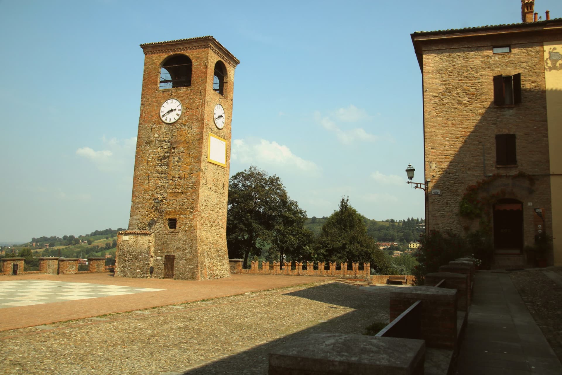
Castelvetro di Modena sits on a hill at 152 meters, eighteen kilometers southeast of Modena and at the northern edge of the Apennine foothills. The medieval centro storico rises around the Piazza Roma, paved in alternating white and black stones that earned it the name Piazza della Dama, the checkerboard piazza, framed by the four surviving towers of the old castle.
The Grasparossa grape grows on the clay slopes around the town, the sandy soil and the south-facing aspect producing the deepest, most tannic of the three main Lambruschi; Lambrusco Grasparossa di Castelvetro received DOC status in 1970. Above the piazza, the Palazzo Rinaldi houses the Museo del Vino and the Museo dell'Aceto Balsamico, the second tracing the same Modenese tradition that nearby Spilamberto codifies.
The municipality holds three institutional signals: Borghi più belli, Bandiera Arancione, Città del Vino. The Sagra dell'Uva e del Lambrusco runs the last weekend of September, when the streets fill with the chess players from the surrounding Lambrusco towns dressed as living pieces on the piazza.
Locanda del Feudo, Opera|02 have been named by a guide.
What to see in Castelvetro di Modena
- Piazza Roma. Checkerboard piazza paved in alternating white and black stones, framed by the four surviving towers of the medieval castle.
- Castello di Levizzano Rangone. Tenth-century fortified frazione four kilometers north, with a tower built in the 990s and a fully preserved medieval village.
- Museo del Vino. Wine museum inside the Palazzo Rinaldi, tracing the Grasparossa production cycle and the DOC zone established in 1970.
How to get to Castelvetro di Modena
There is a railway station in the town, so you can arrive without a car and never need one while you are here. Modena is roughly 28 minutes away by road.
Our tip
April through June and September through October are the Castelvetro months. The hills around the borgo turn green in spring and red in autumn when the Grasparossa vines colour up before the harvest. July and August are hot, thirty-five degrees in the valley, less in the hills above, and the cantine slow down. Sagra dell'Uva e del Lambrusco Grasparossa di Castelvetro falls in September.
Sasso Marconi
Why visit Sasso Marconi
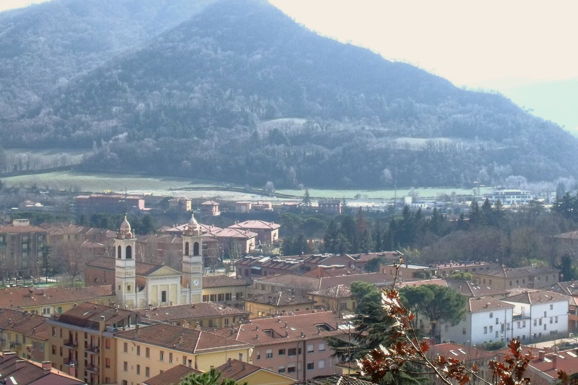
The Setta and Reno rivers meet below the rock that gives the town its name, at the point where the pre-Apennine hills begin their climb south of Bologna. The Sasso della Glosina dominates the bend, a Pliocene formation old enough to have shaped how the crossing below it was used long before the valley took its modern name.
The town itself was called Sasso Bolognese until 1938, when it was renamed for the family whose estate lies in the frazione of Pontecchio, on the valley floor rather than on the rock itself. The territory reaches from that river confluence up into the Apennine slopes, and the change in elevation shows in what the land produces: white truffle from the valley floor near the Reno, and vineyards on the hills around Pieve del Pino and Mongardino, recognition earned on two different registers of the same ground.
The lower town, built around the rivers and the old road to Pistoia, and the upper slopes, given to woods and terraced vines, read as one territory doing two different kinds of work.
Casa Mazzucchelli, Antica Trattoria la Grotta dal 1918 have been named by a guide.
What to see in Sasso Marconi
- Villa Griffone - Museo Marconi. Marconi family villa in the frazione of Pontecchio. The mausoleum sits alongside the attic laboratory, and the museum holds working reproductions of his early apparatus.
- Sasso della Glosina. The rock rises directly over the river bend, its bulk visible from the crossing below and from much of the surrounding valley.
- Confluenza Setta-Reno. Meeting of the two valleys at the foot of the rock, with the historic crossing of the Via Porrettana toward Pistoia.
How to get to Sasso Marconi
There is a railway station in the town, so you can arrive without a car and never need one while you are here. Bologna is roughly 26 minutes away by road.
Our tip
April through October is the working season in Sasso Marconi. Spring and early autumn are best on the Reno valley trails and at Villa Griffone, with mild temperatures and the Apennine foothills green or autumn-coloured. July and August can touch thirty-five degrees in the valley, though the higher frazioni stay cooler; many visitors come up from Bologna for a day on a weekend. Fira di Sdaz di Sasso Marconi falls in September.
More from Anywhere Italy
 The best hill towns that eat well in Emilia-Romagna
- The prettiest villages that eat well in Emilia-Romagna
 The best hidden towns with a food festival in Emilia-Romagna
 The best hidden towns you can reach by train in Emilia-Romagna
- The best hill towns you can reach by train in Emilia-Romagna
- The best small towns that eat well in Emilia-Romagna