
The prettiest small villages in Emilia-Romagna
Emilia-Romagna builds in two materials, and the villages show it plainly. Along the plain and the lower hills the walls are brick, warm red and pinkish where the render has gone, with arcades running the length of a main street so the market keeps going in the rain. Climb towards the Apennine watershed and the brick gives way to grey sandstone, slate roofs, chestnut woods and cold streams that feed the Po. Autumn is the season the region cooks for: chestnuts, porcini, tortelli filled with pumpkin or ricotta, culatello aged in damp cellars near the Parma flatland, and Colli Piacentini wine poured young and slightly fizzing.
Most people meet the region through its cities, and understandably. Bologna's porticoes, Modena's cathedral, Parma's ham and Ravenna's mosaics carry the reputation, and the Via Emilia strings them together on a fast train line so a visitor can do the lot in a week. In high summer and on festival weekends the historic centres are dense, restaurant tables are booked out, and the queue for the Basilica di San Vitale stretches into the courtyard. The food is still very good. There are simply a great many people eating it.
The hills either side of that corridor are where the smaller places sit, and fewer people go. Southwest towards Piacenza the Val Trebbia and Val d'Arda run up into stone villages with Visconti and Farnese castles above them, and further along the ridge the Modenese Apennines hold slate hamlets under the Cimone. East, in Romagna, fortresses on isolated rock stare across at each other above the Conca and Marecchia valleys. The villages below have all passed the assessment of the national association of Italy's most beautiful villages, which is a reasonable place to start.
Of the 45 communes we have mapped in Emilia-Romagna, 18 qualify as prettiest villages: each has passed the assessment of the national association of Italy's most beautiful villages. This list is the small ones, 9 in all, ordered smallest first. The smallest, Montegridolfo, has 994 residents.
Elsewhere in the catalogue: The best small towns that eat well in Emilia-Romagna and The prettiest villages that eat well in Emilia-Romagna.
Montegridolfo
Why visit Montegridolfo
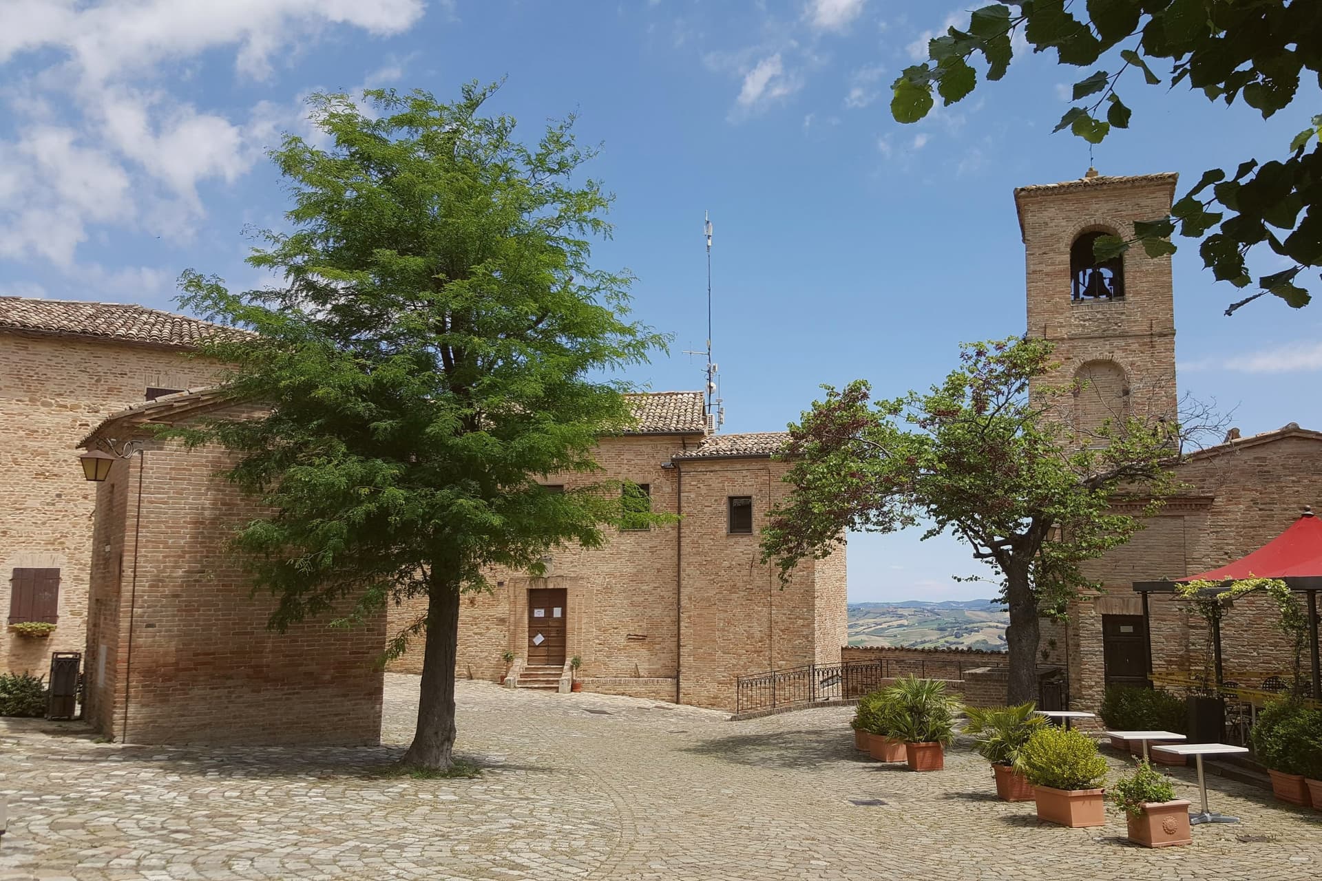
Montegridolfo sits at 290 meters on the Romagna-Marche border ridge, twenty kilometers south of Rimini and just inland from the Adriatic. A first castle is documented here in 1148, belonging to the Abbey of San Pietro of Rimini; the village took its name from the Gridolfi, a Rimini Guelph family that settled here during the conflicts with the Ghibellines.
After a sack in 1288, the Malatesta rebuilt the walls in 1337 with four corner towers. One tower survives, plus the bell tower over the gate.
The borgo passed back and forth between Malatesta and Montefeltro through the fifteenth century, fell briefly to Cesare Borgia in 1502, then to Venice, then to the Papal States in 1509. The walled nucleus today holds barely 200 of the commune's 994 residents, with the rest in Trebbio, San Pietro, and Cabaldo.
Olive oil from the surrounding ridges carries the Colli di Romagna DOP designation; the town joined the Città dell'Olio network on that basis.
What to see in Montegridolfo
- Castello di Montegridolfo. Walled fourteenth-century burg built by the Malatesta in 1337 with four corner towers, of which one survives along with the bell tower over the original gate.
- Chiesa di San Rocco. Fifteenth-century church inside the walls, built in thanks after the village was spared a plague outbreak, with frescoes attributed to the school of the Marchigiana.
- Borgo murato. Compact walled nucleus of stone houses, narrow streets and a single piazza, restored in the 1990s and inhabited by artisans and a small permanent population.
How to get to Montegridolfo
Rimini is roughly 42 minutes away by road.
Our tip
April through October are the months that work in Montegridolfo. Spring brings clear views from the walls down to the Conca valley; September and October are the dry, gold months with the olive harvest beginning at the end of October. July and August are hot but the ridge catches the Adriatic breeze and the walled nucleus stays cool in shade.
Compiano
Why visit Compiano
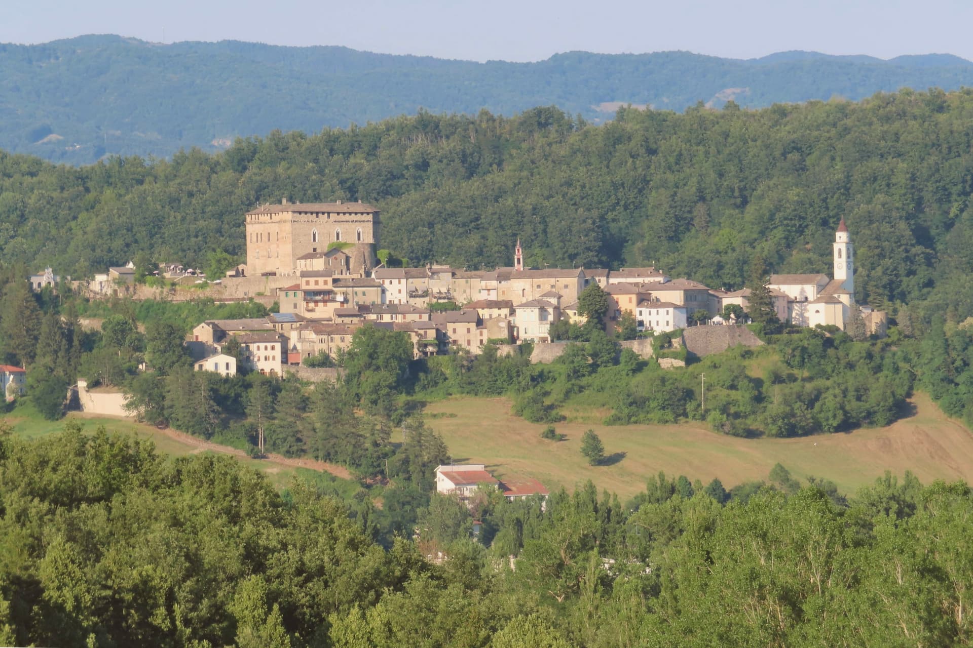
Compiano sits on a rocky spur at 519 meters above the Taro river, in the Parma Apennines on the road that links Emilia to Liguria. The fortress there was raised by the Lombards in the early Middle Ages as a Carolingian stronghold defending the Val di Taro, and it passed in turn to the Malaspina, to the Comune di Piacenza, and from the late thirteenth century to a single ruling family who held the fief for 425 consecutive years.
Under that rule the borgo coined its own money, opened state schools and ran a pawn-shop system, an administrative independence unusual for a settlement this size. In the eighteenth century Compiano passed from the Farnese to the Bourbons.
The walled nucleus that grew up around the castle has kept to a single main street of stone houses, with the Taro below on one side and the Ligurian Apennines visible across the valley. A rocky perch, a long single-family rule, and a fortress later repurposed as a prison and now a museum: the town's history reads as a series of the same walls changing hands and functions while the shape of the place itself barely moved.
What to see in Compiano
- Castello di Compiano. The fortress stands on its rocky spur above the river, last privately owned by Marchesa Gambarotta before passing to the commune. Maria Luigia's Carbonari cells can still be seen inside.
- Museo Internazionale Massonico. Masonic museum inside the castle, opened in 2002 in the Orizzonti Massonici collection, the only public museum on Freemasonry in Italy.
- Borgo di Compiano. Walled medieval nucleus around the castle, with a single main street, stone houses, and views down to the Taro and across to the Ligurian Apennines.
How to get to Compiano
Parma is roughly 85 minutes away by road.
Our tip
April through October are the months that work in Compiano. May and June bring green Apennine slopes and clear views down the Taro toward Liguria; September and October are the porcini months, with the surrounding chestnut and beech woods producing the Fungo di Borgotaro IGP. July and August can touch thirty degrees in the valley but the spur stays cooler in shade.
Fiumalbo
Why visit Fiumalbo
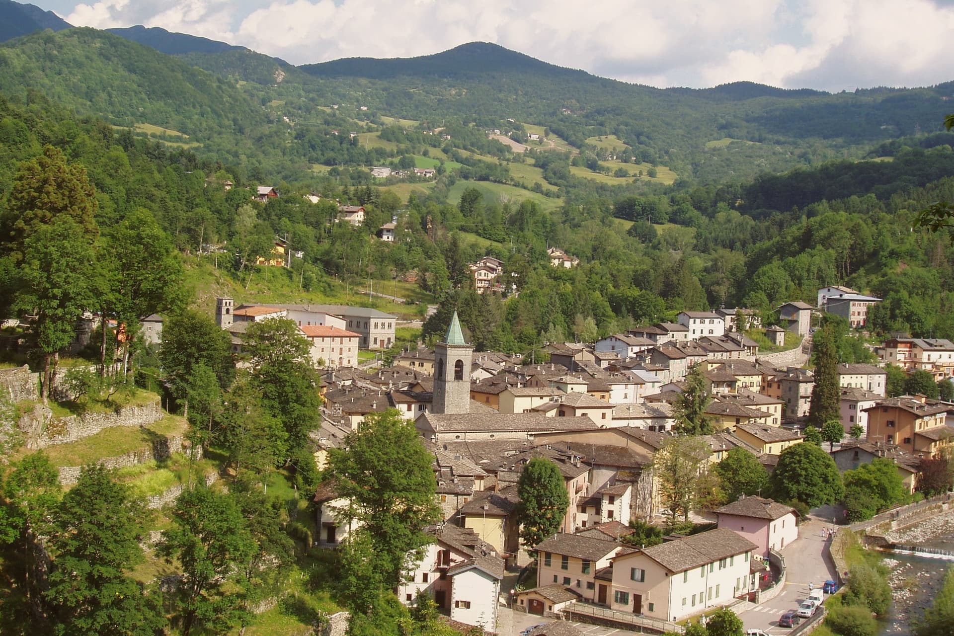
Fiumalbo sits at 935 meters in the upper Frignano, at the confluence of the Rio Acquicciola and the Rio delle Pozze, which join here to form the Scoltenna. The village is the last Modenese commune before the Tuscan border at the Foce a Giovo pass, and the territory rises from 800 meters at the river to the 2,165 meters of Monte Cimone, the highest peak in the northern Apennines.
The medieval centro storico is built almost entirely in local sandstone, the houses packed tight along the narrow streets that drop from the parish church of San Bartolomeo to the river. The town has been documented for almost a thousand years; the older history is lost.
The Oratorio dei Bianchi, the small fifteenth-century lay-confraternity oratory with its painted wooden ceiling, is the artistic anchor of the village. Population 1,175.
The municipality falls inside the Parco del Frignano and holds Borghi più belli and Bandiera Arancione status.
What to see in Fiumalbo
- Chiesa di San Bartolomeo. Parish church on the upper part of the village, with a Romanesque core, a fifteenth-century rebuilding and a baroque interior.
- Oratorio dei Bianchi. Small fifteenth-century oratory of the lay confraternity of the Bianchi, with a painted wooden coffered ceiling and Renaissance frescoes.
- Borgo di Fiumalbo. Sandstone medieval village built tight along narrow streets between the parish church and the river, almost entirely intact.
How to get to Fiumalbo
Prato is roughly 93 minutes away by road.
Our tip
May through October is the working window for Fiumalbo. The snow clears off the high trails toward Monte Cimone by late May, the rivers run loudest in June, and the chestnut and porcini weeks in September and October bring the village its strongest visitor period. July and August stay cool, rarely above twenty-five degrees, which is why families from the Emilian plain come up.
Vernasca
Why visit Vernasca
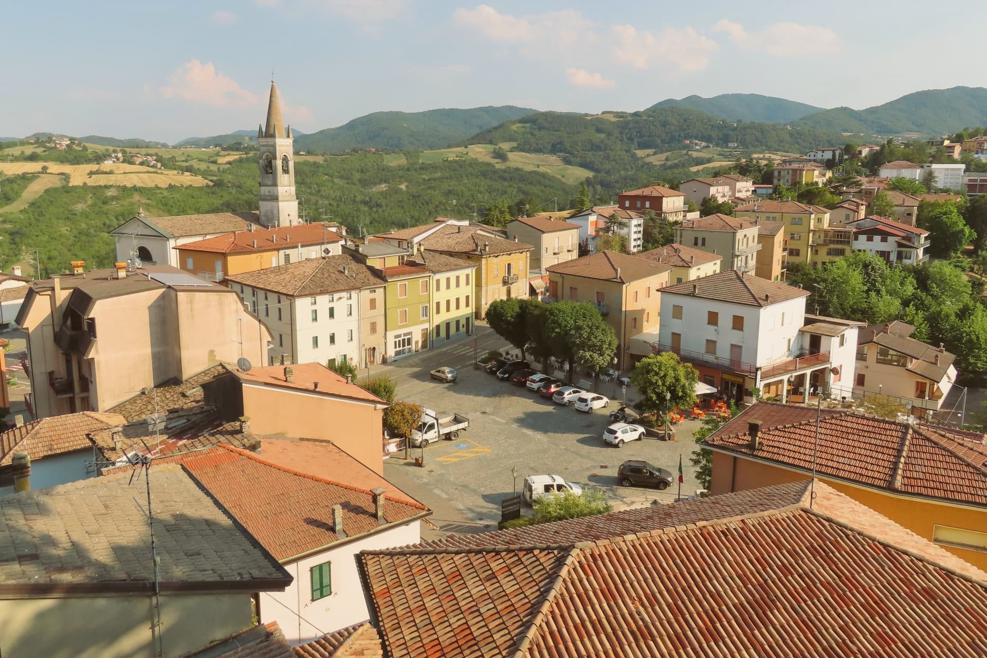
Vernasca sits at 457 meters in the upper Val d'Arda, in the Piacenza Apennines forty kilometers southeast of Parma. The commune carries both its institutional signals through its frazione Vigoleno, a walled village on a 350-meter ridge between the Ongina and Stirone valleys whose castle is documented from 1141 and whose current quadrangular plan dates from the early fifteenth century.
The Scotti Douglas family, granted the county of Vigoleno in 1404 by the Visconti of Milan, rebuilt the keep, mastio and circuit walls after Visconti troops dismantled it in 1373. Vigoleno was an autonomous commune until 1815, when it was absorbed into Vernasca.
The Val d'Arda below produces Gutturnio and Ortrugo wines under the Colli Piacentini DOC. The territory holds the Riserva Naturale del Piacenziano, a fossil-bearing badlands site referenced in the geological epoch named for the Piacenza area.
What to see in Vernasca
- Castello di Vigoleno. Walled medieval village and Scotti Douglas keep on a 350-meter ridge, with a circuit of walls and a mastio rebuilt in the early fifteenth century.
- Pieve di San Giorgio. Twelfth-century Romanesque pieve inside the Vigoleno walls, with fifteenth-century frescoes by the school of the Pordenone.
- Riserva Naturale del Piacenziano. Pliocene fossil-bearing badlands and clay outcrops within the commune, type-locality of the Piacenzian geological age named for the province.
How to get to Vernasca
Piacenza is roughly 52 minutes away by road.
Our tip
April through October are the working months in the upper Val d'Arda. May and June bring green hills and clear views from the Vigoleno walls south to the Apennine ridge. September and October are the dry, gold months and the start of the Colli Piacentini harvest.
Montefiore Conca
Why visit Montefiore Conca
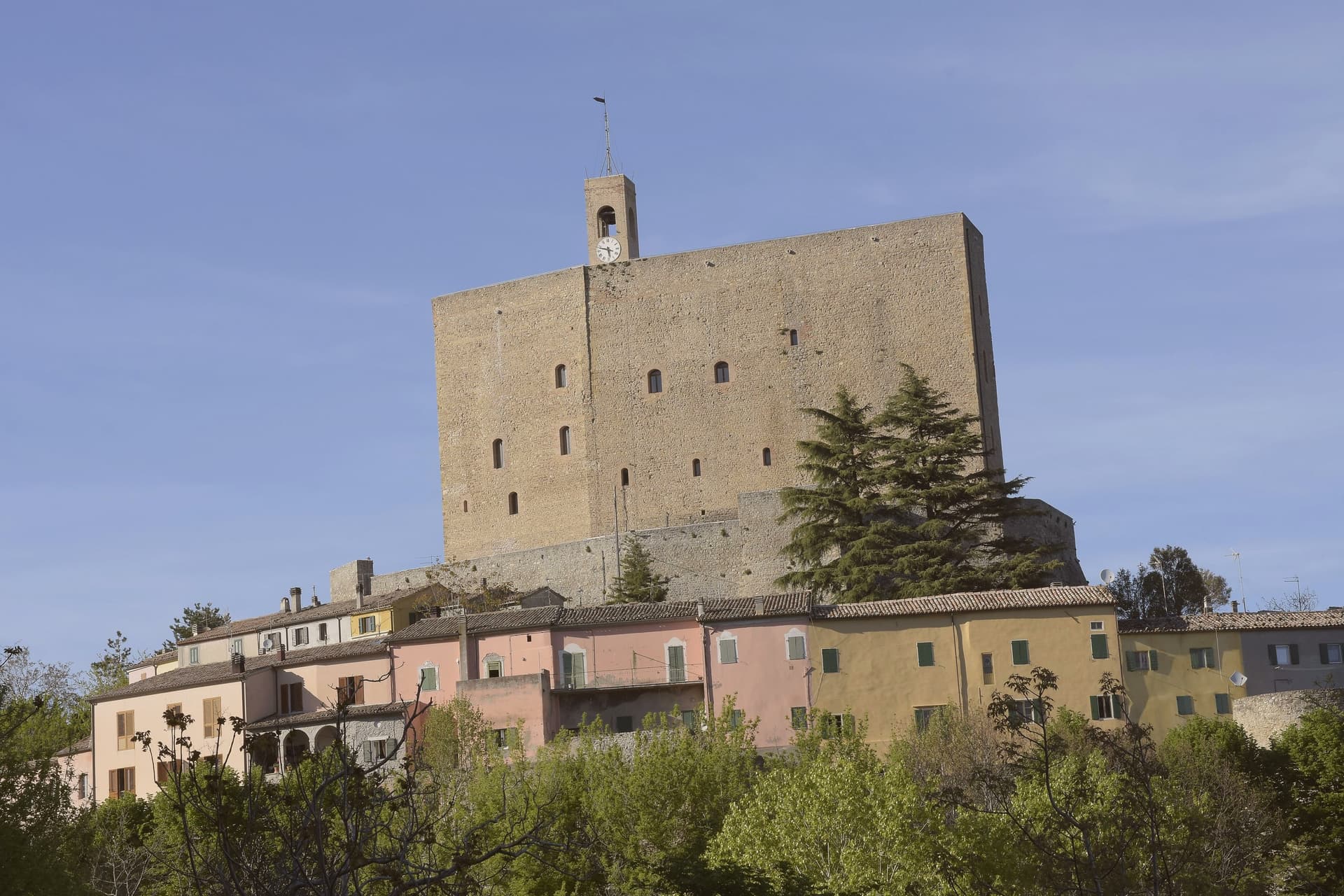
Montefiore Conca sits above the Conca river valley, twenty kilometers south of Rimini, on a hill the Malatesta chose for both military and seasonal reasons: high enough to anchor a defensive ring, mild enough for a residence to be built alongside the garrison. The fortress and the walled borgo that grew around it form a single hilltop nucleus, with the Porta Curina gate marking the point where, after Federico da Montefeltro's troops took the town in the late fifteenth century, control reverted to the Holy See, a shift the villagers recorded by carving the arms of Pope Pius II into the stone themselves.
The commune extends beyond that nucleus into the frazioni of Serbadone and Marazzano and out to the ridge holding the Santuario della Bonora, spreading the settlement from a single fortified point into the surrounding hills. Recognition is double: Borghi più belli d'Italia and Bandiera Arancione, a pairing that reads less as decoration than as confirmation that the hill the Malatesta picked for defense and comfort still functions, centuries on, as both a place to look out from and a place worth looking at.
What to see in Montefiore Conca
- Rocca Malatestiana. Mid-fourteenth-century fortress built under Malatesta Ungaro, combining military bulk with a residential wing whose frescoed halls received Pope Gregory XII and Louis I of Hungary.
- Santuario della Madonna di Bonora. Sanctuary reached on a wooded ridge two kilometers from the centro storico, with a venerated fresco of the Madonna and Child still the object of the pilgrimage traffic it draws.
- Borgo medievale. Walled hilltop nucleus around the fortress, with the Porta Curina gate carrying the Piccolomini arms of Pope Pius II carved by the villagers in the late fifteenth century, after control of the town reverted to the Holy See.
How to get to Montefiore Conca
Rimini is roughly 35 minutes away by road.
Our tip
April through June and September through October are the strongest months, with mild evenings on the hill and clear views to the coast. July and August are hot in the Conca valley but the Rocca terrace catches the breeze that the riviera below does not. The fortress opens daily in summer, weekends only from November through March.
Bagnara di Romagna
Why visit Bagnara di Romagna
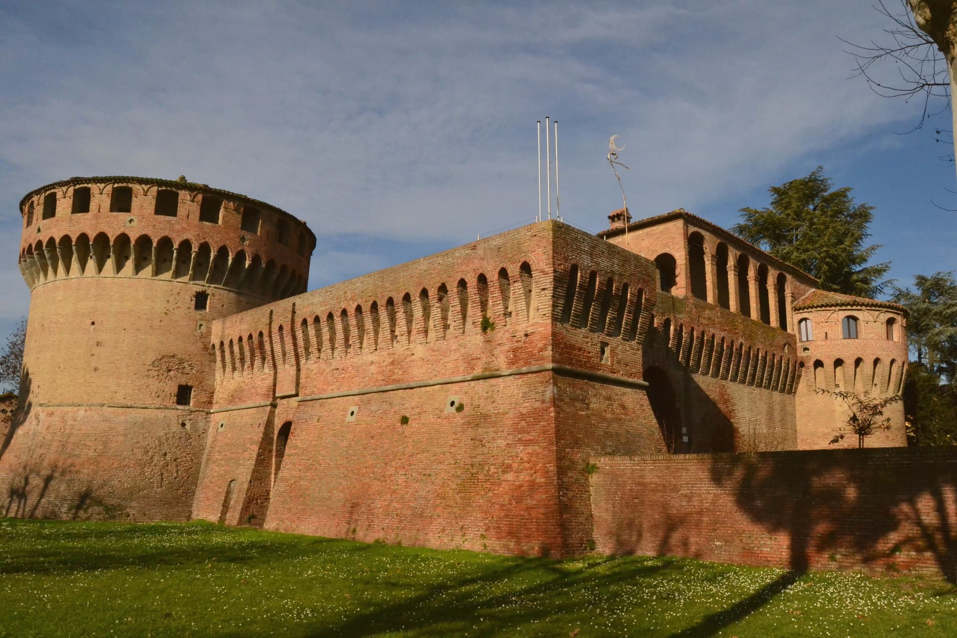
Bagnara di Romagna sits at 22 meters on the plain between Imola and Faenza, forty kilometers southeast of Bologna in the Bassa Romagna. The borgo is the only castrum surviving intact in the Romagna lowlands, with its full circuit of medieval walls, moats, civic gate, raised pathways and the Rocca Sforzesca at the centre.
Barnabò Visconti raised the first stone castle here in 1354; the Riario-Sforza lords of Imola rebuilt it in the late fifteenth century on the older foundations, giving the fortress its current Renaissance form. Caterina Sforza, who ruled Imola and Forlì for the Riario, used the rocca as a residence.
The municipality joined Borghi più belli d'Italia on the strength of the intact castrum layout, the only one of its kind on the Romagna plain. Beyond the walls, the commune is given over to fruit orchards and Sangiovese vineyards under the Romagna DOC.
What to see in Bagnara di Romagna
- Rocca Sforzesca. Late-fifteenth-century Riario-Sforza fortress built on the foundations of a 1354 Visconti castle, with a central keep and four corner towers in Renaissance form.
- Castrum medievale. Intact medieval walled nucleus with circuit walls, moats, civic gate and raised pathways, the only fully preserved castrum on the Romagna plain.
- Chiesa di San Giovanni Battista. Parish church inside the walls, rebuilt in the eighteenth century on the site of the earlier pieve, with a fifteenth-century terracotta relief.
How to get to Bagnara di Romagna
Ravenna is roughly 34 minutes away by road.
Our tip
Bagnara di Romagna runs on the Po-plain calendar. April through June and September through October are the working months, with mild air and clear days over the orchards. July and August can touch thirty-six degrees on the flat; the walled nucleus holds the heat into the evening.
San Leo
Why visit San Leo
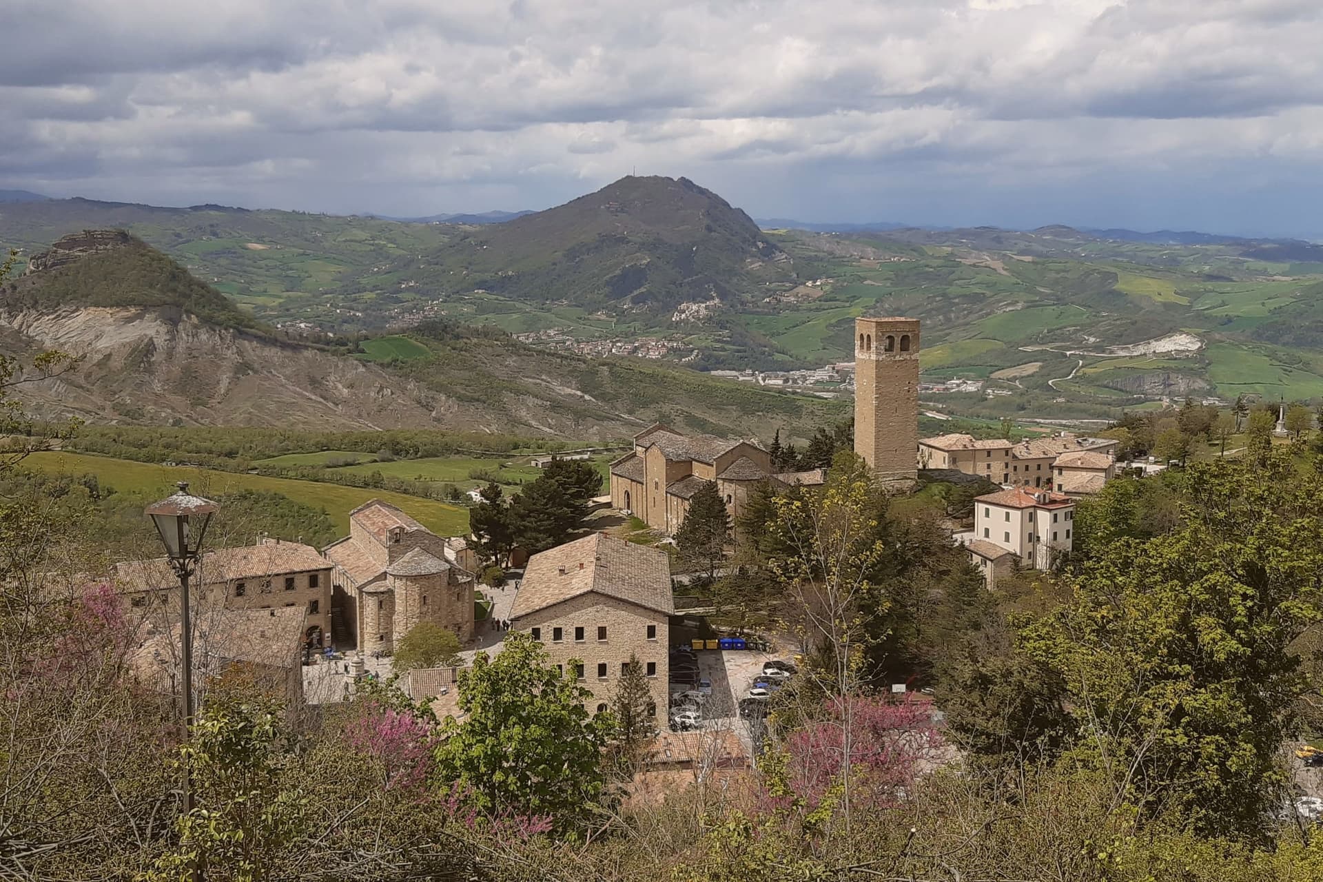
San Leo does not look quite real from below: a medieval town built on a single limestone outcrop rising straight out of the rolling Montefeltro hills southwest of Rimini, reached by one switchback road carved into the cliff face. The geography is the entire historical reason the town exists in its present form.
Saint Francis came in 1213 and received the gift of Mount La Verna from Count Orlando Cattani as a hermitage. The Hohenstaufen rebuilt an earlier fortress on the same rock in the 13th century, before the Renaissance-era rebuild that stands today, the work of Federico da Montefeltro's military architect between 1479 and 1502.
The fortress's notoriety came in 1791, when the Papal States turned it into a high-security prison for political dissidents. The most famous of them was an alchemist, occultist and Freemason who was the talk of late-Enlightenment Europe: held here by the Holy Office from 1791, he was dead in his cell by 1795 under circumstances never fully explained, and the cell itself still stands, windowless, with a single opening high above the floor once used to pass in food and remove waste.
Beyond the fortress on its rock, the town's religious core sits on the central piazza below: a 9th-century parish church, the oldest Romanesque building in Romagna, raised on reused Roman columns, stands beside a 12th-century sandstone Duomo built over a Lombard crypt. Together they anchor the lower town the way the fortress anchors the outcrop above it.
A 12th-century bell tower nearby gives the same panoramic sweep the fortress does, across the Montefeltro toward the Adriatic and toward San Marino, 12 km east and visible from both terraces. This is borderland: Emilia-Romagna, Marche and the Republic of San Marino meet here, and the kitchen mixes all three, piadina romagnola, passatelli in brodo, gnocchi al sugo di lepre and cappelletti, washed down with Sangiovese di Romagna or the local Albana DOCG white.
The town holds both the Borghi più belli d'Italia inscription and the Bandiera Arancione mark, and as with other hilltop fortress towns, the population has thinned with time, from 5,500 residents in 1951 to 2,820 today. What the rock has always offered, defensibility, isolation, a commanding view, is also what has slowly emptied it: the same vertical geography that made San Leo impossible to take is what makes it hard to keep living in.
What to see in San Leo
- Forte di San Leo (Francesco di Giorgio Martini, 1479–1502). Rebuilt by Federico da Montefeltro's military architect directly on top of the outcrop, reached by the single switchback road cut into the cliff. Cagliostro's cell is visitable inside. The defining sight of the town.
- Pieve di Santa Maria Assunta + Duomo. The parish church and the adjacent Duomo sit side by side on the central piazza, the older building raised on reused Roman columns, the Duomo built in sandstone over a Lombard crypt with a single nave.
- Torre Civica + panorama. 12th-c bell tower with the panoramic view across the Montefeltro toward the Adriatic + San Marino (12 km east, visible from the same terrace).
How to get to San Leo
Rimini is roughly 37 minutes away by road.
Our tip
San Leo is best April–June and September–October — the Forte and the Pieve are open year-round, but the single switchback road up the cliff is unpleasant in heavy rain and can close briefly in winter snow. October is the harvest in the Sangiovese hills around the Montefeltro. Summer is dry and the panoramic view at sunset toward San Marino is the season's highlight.
Bobbio
Why visit Bobbio
Bobbio sits on the left bank of the Trebbia at 272 meters, at the foot of Monte Penice in the Piacentine Apennines. The land was granted to Saint Columbanus by the Lombard king Agilulf in 614, and the monastery he raised on it grew, by the eighth century, into one of the principal libraries north of Rome, copying Greek, Latin, and Irish manuscripts that survived nowhere else.
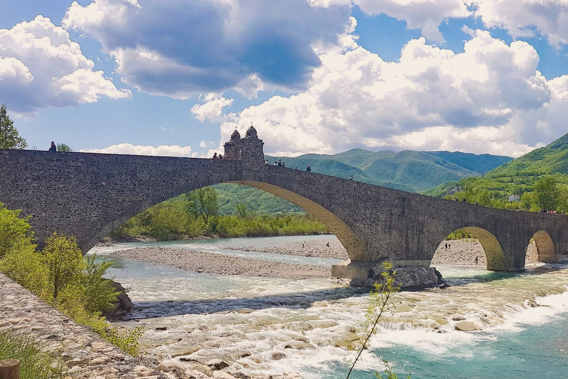
The French suppressed the monastery in 1803; what the scriptorium and library once held now lives in fragments, kept in the basilica and its museum. The town below the abbey is crossed by the Trebbia on the Ponte Gobbo, its eleven irregular arches stretching 273 meters, a shape that gave rise to the story of the Devil and the saint dividing the bridge between them.
Bobbio still carries the Borghi più belli and Bandiera Arancione designations alongside the 2019 RAI title. A river crossing, a hill fortress, and a monastery ruin sit within reach of one another here, each holding a different piece of the same long settlement, one built by faith, one by feudal power, and one by the river itself.
What to see in Bobbio
- Abbazia di San Colombano. The basilica and grounds where Saint Columbanus settled still stand; the scriptorium he founded is gone but its output is documented in surviving manuscripts held elsewhere.
- Ponte Gobbo. The eleven arches sit unevenly across the riverbed, the irregularity of their spacing the source of both the Devil's Bridge name and the Columbanus legend attached to it.
- Duomo di Bobbio. Romanesque cathedral begun in 1075, dedicated to Santa Maria Assunta, with a fifteenth-century fresco cycle in the apse.
How to get to Bobbio
Piacenza is roughly 63 minutes away by road.
Our tip
April through June brings the green Val Trebbia season, when the river runs clear enough for swimming holes downstream. September and October are the working months for chestnuts, mushrooms, and the maccheroni alla bobbiese the town fills its trattorie with. July and August can hit thirty-three degrees in the valley, and the 2019 Borgo dei Borghi win still draws weekend crowds that fill the Ponte Gobbo. La Festa del Pinolo falls in August.
Castell'Arquato
Why visit Castell'Arquato
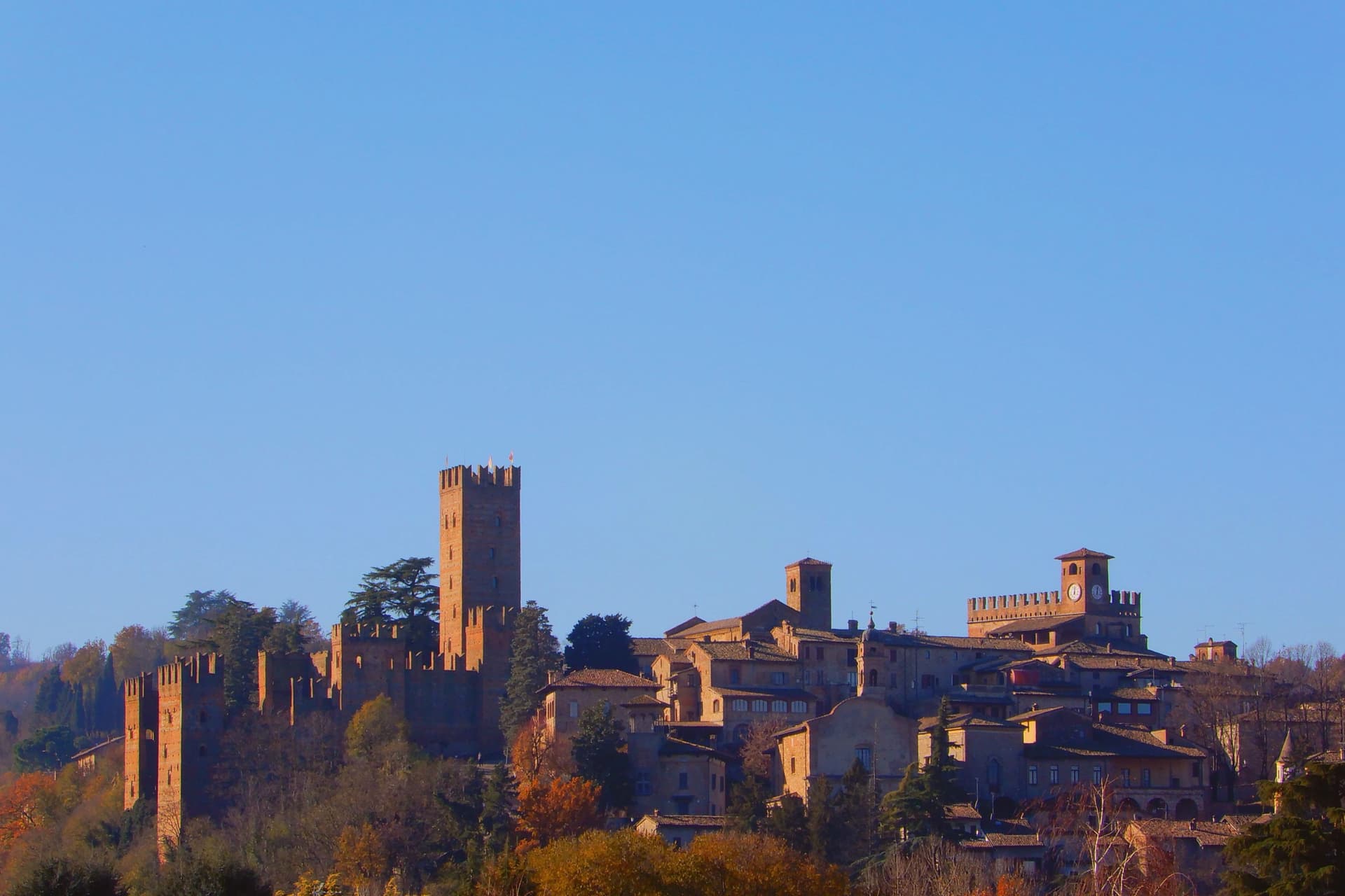
Castell'Arquato sits on the first hills of the Val d'Arda at 224 meters, thirty kilometers from Piacenza, the medieval borgo arranged in tight concentric levels around the old rock. The Collegiata di Santa Maria, founded by the noble Magnus in the eighth century, was rebuilt in 1122 after the 1117 earthquake destroyed the earlier church and is one of the finest Romanesque buildings in the Piacentino.
The Rocca Viscontea, with its thirty-five-meter tower, was begun in 1342 by Luchino Visconti, lord of Milan, to lock down the valley for Piacenza. The Palazzo del Podestà next door dates from 1292 and still anchors the Piazza Monumentale.
Luigi Illica, the librettist of Tosca, Madama Butterfly, La bohème and Andrea Chénier, was born in town in 1857; the museum dedicated to him sits in the house next to his birthplace. The Val d'Arda hills around the town produce the white wines that earned Castell'Arquato Città del Vino status.
What to see in Castell'Arquato
- Rocca Viscontea. Fortress begun in 1342 by Luchino Visconti for the municipality of Piacenza, with a thirty-five-meter tower at the highest point of the borgo.
- Collegiata di Santa Maria Assunta. Romanesque collegiate church, founded in the eighth century and rebuilt in 1122 after the 1117 earthquake destroyed the earlier structure.
- Palazzo del Podestà. Civic palace from 1292 facing the Collegiata, with the original ghibelline merlons and a fourteenth-century loggia along its lower level.
How to get to Castell'Arquato
Piacenza is roughly 38 minutes away by road.
Our tip
April through June is the best season for the Val d'Arda hills: the vineyards on the slopes below the borgo are green and the air clear enough to see across to the Appennino Piacentino. September and October bring the white-wine harvest and the chestnut weeks. July and August touch thirty-three degrees and the unshaded Piazza Monumentale becomes uncomfortable between noon and four.
More from Anywhere Italy
 The best small towns that eat well in Emilia-Romagna
- The prettiest villages that eat well in Emilia-Romagna
- The best hill towns that eat well in Emilia-Romagna
- The best hidden towns inside a nature park in Emilia-Romagna
- The prettiest small villages within 90 minutes of Rimini
- The 9 prettiest villages within 90 minutes of Rimini