
Emilia-Romagna · Parma
Collecchio
A Parma-cintura town on the Via Francigena, known today for a dairy multinational's headquarters and a football club's training ground.
- Best time
- Apr–Jun, Sep–Oct
- By car
- 18 min from Parma
- By train
- Station in the comune
- Population
- 14,684
Known for
PARMALAT
Headquarters of the dairy multinational founded by Calisto Tanzi in 1961, still the largest employer and a defining presence in town.
VIA FRANCIGENA
Medieval pilgrim route between Parma and Fornovo passes through the centro, with the Pieve di San Prospero on the hill above.
PARMA F.C. TRAINING
The Centro Sportivo di Collecchio is the training base of Parma Calcio 1913 and home to the club's youth academy.
When to visit
Best · Apr–Jun, Sep–Oct
- J7°
- F12°
- M14°
- A18°
- M22°
- J28°
- J31°
- A31°
- S25°
- O19°
- N12°
- D7°
- Best
- Hot or crowded
- Quiet
- Mostly closed
Daytime averages, 2020–2024. Weather data by Open-Meteo.com.
The festa: Prospero di Reggio Emilia, 24 November
Why come
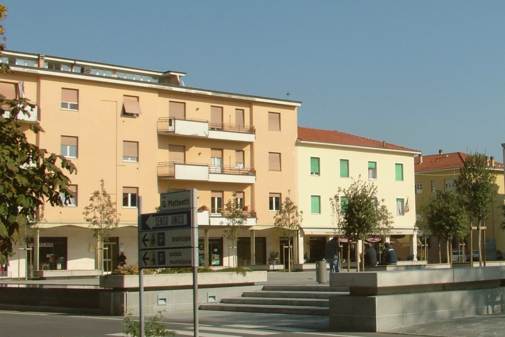
Collecchio sits on the right bank of the Taro, thirteen kilometers southwest of Parma, where the Via Emilia and the Via Francigena run together. In medieval documents the town appears as Colliculum, a possession of the bishops of Parma. The centro lies on the flat valley floor, with the parish church set apart on the hill above it, and the two industrial sites, the dairy headquarters and the football training ground, occupying the built-up town rather than the countryside around it.
The southern half of the municipality is given over to parkland: a municipal riverside park along the Taro and, further out, the wooded former hunting reserve of the Dukes of Parma. A town shaped by a bishop's holding and a pilgrim road has ended up defined by a milk company and a football club, with its church and its woods left to mark what came before.
The Sunday letter
Collecchio is on our list. Its letter is still to come.
We are writing about all 1,000 of these towns, one at a time, in a free letter every Sunday: the photo, the food, the festa. That is our mission. Sign up and you will be there when Collecchio comes up. By Peter & Sophia, from Pietrasanta.
Read on
Collecchio in our articles
 The 7 best towns inside a nature park that you can reach by train in Emilia-Romagna7 towns, Collecchio among them.
 The best hidden towns inside a nature park in Emilia-Romagna10 towns, Collecchio among them.
 The best hidden towns you can reach by train in Emilia-Romagna10 towns, Collecchio among them.
 The best towns you can reach by train within 75 minutes of Parma10 towns, Collecchio among them.
How to get there
From Bologna (BLQ), about 1h 19m by car.
Milan (BGY) is about 2 hours away.
By car from the centre of Parma 18 minutes or Brescia 1h 29m.
There is a railway station in the comune, so you can arrive without a car.
Coming from Bologna, Milan or Verona?
Coming by train into Parma? Collecchio is about 19 minutes away by road.
What to see
Pieve di San Prospero
The three-nave interior is reached by climbing the hill above the centro; the walls show the masonry seams of construction stretched across two centuries.
Via Francigena
The Taro variant is marked with waystones through the centro, following the line pilgrims once walked toward the Cisa pass.
Parco Boschi di Carrega
Wooded grounds once reserved for ducal hunting, now open with trails through the trees across the southern municipality.
Parco Nevicati
A riverside stretch of old oaks along the Taro, with jogging paths and a section set aside for native Apennine fauna.
Centro Sportivo di Collecchio
The training ground has drawn Parma Calcio 1913's first team and youth academy to Collecchio since the 1990s.
The slow-trip planner
Building a trip? Find where Collecchio fits in a slow Italy circuit.
Answer five questions. We will shape a geographically coherent slow trip from the 1,000 Italian towns most travelers skip. Yours to save and share.
Living here
- Population 14,684
- Commuter belti
- Pharmacy in town
- High school within a 30-minute drive
- Train station in the comune
- Nearest airport Bologna, 1 h 19 min drive
- Regional capital Bologna, 1 h 23 min drive
Common questions
- What is Collecchio known for?
- Collecchio is a Parma-cintura town on the Via Francigena, known today for a dairy multinational's headquarters and a football club's training ground.
- Where is Collecchio?
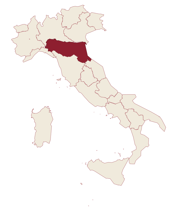
- Collecchio is a comune in the province of Parma, in Emilia-Romagna, at 112 meters above sea level.
- What is the nearest airport to Collecchio?
- Bologna (BLQ), about 1h 19m by car.
- Can you get to Collecchio without a car?
- Yes. There is a railway station in the comune, so you can arrive by train.
- How long is the drive from Parma to Collecchio?
- About 18 minutes by car.
- When is the best time to visit Collecchio?
- Best in Apr–Jun, Sep–Oct. July is the warmest month, averaging 31 degrees, and May the wettest, with about 14 rain days.
- Is there a sagra or a festival in Collecchio?
- The town keeps its patron saint's day: Prospero di Reggio Emilia, 24 November.
- Which other towns are like Collecchio?
- Santarcangelo di Romagna, Gorgonzola and Spilamberto.
- How many people live in Collecchio?
- 14,684 at the 2023 count.
Tags & datadesignations · numbers · sources
Recognised as
The numbers
- Elevation: 112 m
- Population: 14,684
- Surface area: 58.83 km²
These figures were compiled from public directories: ISTAT, OpenStreetMap and Wikidata, and from the official listings of the guides named on this page. Town details change; verify with official sources before you travel.
Similar
Towns like Collecchio
Santarcangelo di Romagna
Province: Rimini
both in the Po valley · both over 10,000 people
Gorgonzola
Province: Milano
both in the Po valley · both over 10,000 people
Spilamberto
Province: Modena
both in the Po valley · both over 10,000 people
Faenza
Province: Ravenna
both in the Po valley · both over 10,000 people
Imola
Province: Bologna
both in the Po valley · both over 10,000 people
Casale Monferrato
Province: Alessandria
both in the Po valley · both over 10,000 people
🌳 Parco Regionale
More Parco Regionale towns in Emilia-Romagna
Brisighella
Province: Ravenna
A Lamone-valley borgo at 115 meters under three selenite hills crowned by a fortress, a clock tower, and a sanctuary.
Castell'Arquato
Province: Piacenza
A 224-meter hilltop borgo in the Val d'Arda, kept intact since the tenth century and crowned by Luchino Visconti's 1342 fortress.
Castelvetro di Modena
Province: Modena
A 152-meter hill borgo south of Modena whose checkerboard piazza sits above the slopes that grow Lambrusco Grasparossa.
Cervia
Province: Ravenna
The Adriatic salt town with 827 hectares of working saline, planned in 1697 around a grid of salt workers' houses.
Comacchio
Province: Ferrara
A canal town on thirteen islets, with brackish lagoons that hold three hundred bird species.