
The 7 best towns inside a nature park that you can reach by train in Emilia-Romagna
The nature parks of Emilia-Romagna are working landscapes rather than wilderness. Salt pans on the Adriatic where flamingos feed and fleur de sel is still raked by hand, umbrella pines behind the dunes, then inland the gravel beds of the Taro where the river spreads wide and shallow, and higher again the strange white gypsum outcrops of the Vena del Gesso, riddled with caves and lined with terraced vines. The stone shows in the buildings: pale chalk and river cobble on the hill towns, brick and Istrian marble down on the plain. Spring brings cherry blossom across the Modena hills and asparagus onto every menu, autumn brings the truffle, the new lambrusco and the first hard frost in the cellars where parmigiano and culatello sit out the winter. The regional trains run through all of it, unhurried and cheap.
Most people arrive in the region for Bologna, and stay there. The porticoes, the ragù, the food markets around the Quadrilatero and the day trip to Modena for balsamic vinegar fill a long weekend easily, and in high summer the queues outside the famous osterie run down the street. It is a good city and it earns the crowd. It also means a great deal of Emilia-Romagna is looked at only through a train window on the way somewhere else.
The parks do not stop at the city limits. The same rivers, the same ridges, the same cherry orchards and salt marshes carry on well past the last stop most visitors take, and there are towns sitting inside those protected boundaries with a station of their own. Fewer people get off there. That is where this list goes.
Of the 45 communes we have mapped in Emilia-Romagna, 7 qualify as towns inside a nature park you can reach by train: each sits inside a regional nature park, and we have confirmed each is reachable without a car. The smallest, Brisighella, has 7,186 residents.
If you are still choosing, we have also written The best towns inside a nature park that eat well in Emilia-Romagna and The best hidden towns inside a nature park in Emilia-Romagna.
Brisighella
Why visit Brisighella
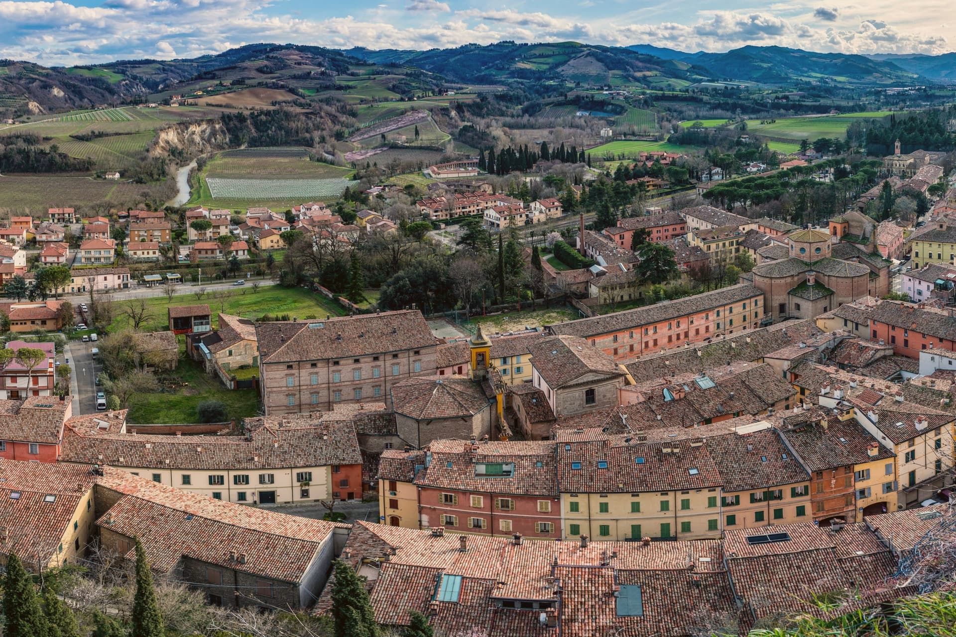
Brisighella sits in the Lamone valley at 115 meters, forty-five kilometers southeast of Bologna, on the Apennine slope where Romagna meets the gypsum vein the UNESCO list added in 2023. Three selenite hills rise above the rooftops, each carrying a building: the Rocca Manfrediana, built in 1310 by Francesco Manfredi and reinforced by the Venetians after 1503; the Torre dell'Orologio, rebuilt in 1850 with a six-hour dial instead of twelve; and the Santuario del Monticino above the town.
The Via degli Asini runs through the centro storico as a covered elevated street, originally a fourteenth-century patrol walkway, later excavated into stables for the donkeys that hauled gypsum down from the quarries. The Nostrana di Brisighella olive, grown on the same hills, makes the Brisighello DOP oil that has carried European protection since 1996.
The town holds four institutional signals at once: Borghi più belli, Bandiera Arancione, Cittaslow, Città dell'Olio.
We confirmed you can reach this one by train.
What to see in Brisighella
- Rocca Manfrediana. Hilltop fortress begun in 1310 by Francesco Manfredi of Faenza, reinforced by Astorgio II in the 1460s and held by Venice after 1503.
- Torre dell'Orologio. Clock tower rebuilt in 1850 on an earlier defensive structure, with a dial that marks six hours rather than the usual twelve.
- Santuario del Monticino. Eighteenth-century sanctuary on the third selenite hill, overlooking the town and the Lamone valley below.
How to get to Brisighella
There is a railway station in the town, so you can arrive without a car and never need one while you are here. Forlì is roughly 55 minutes away by road.
Our tip
April through June and September through October are the working months in Brisighella. The hills around the Lamone valley turn green in spring and gold in autumn; the olive harvest in November fills the frantoi along the road to Faenza. July and August touch thirty-five degrees and the centro storico empties between two and five. Sagra Della Collina E Del Cinghiale falls in July.
Castelvetro di Modena
Why visit Castelvetro di Modena
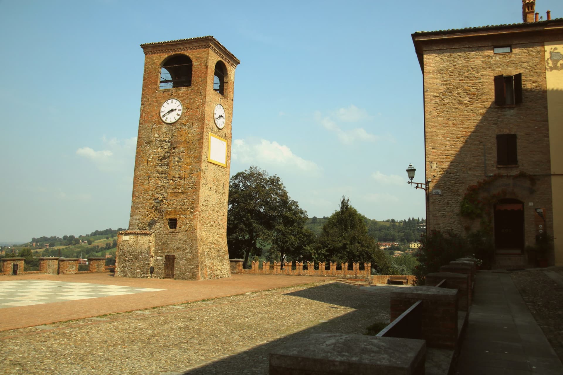
Castelvetro di Modena sits on a hill at 152 meters, eighteen kilometers southeast of Modena and at the northern edge of the Apennine foothills. The medieval centro storico rises around the Piazza Roma, paved in alternating white and black stones that earned it the name Piazza della Dama, the checkerboard piazza, framed by the four surviving towers of the old castle.
The Grasparossa grape grows on the clay slopes around the town, the sandy soil and the south-facing aspect producing the deepest, most tannic of the three main Lambruschi; Lambrusco Grasparossa di Castelvetro received DOC status in 1970. Above the piazza, the Palazzo Rinaldi houses the Museo del Vino and the Museo dell'Aceto Balsamico, the second tracing the same Modenese tradition that nearby Spilamberto codifies.
The municipality holds three institutional signals: Borghi più belli, Bandiera Arancione, Città del Vino. The Sagra dell'Uva e del Lambrusco runs the last weekend of September, when the streets fill with the chess players from the surrounding Lambrusco towns dressed as living pieces on the piazza.
We confirmed you can reach this one by train.
What to see in Castelvetro di Modena
- Piazza Roma. Checkerboard piazza paved in alternating white and black stones, framed by the four surviving towers of the medieval castle.
- Castello di Levizzano Rangone. Tenth-century fortified frazione four kilometers north, with a tower built in the 990s and a fully preserved medieval village.
- Museo del Vino. Wine museum inside the Palazzo Rinaldi, tracing the Grasparossa production cycle and the DOC zone established in 1970.
How to get to Castelvetro di Modena
There is a railway station in the town, so you can arrive without a car and never need one while you are here. Modena is roughly 28 minutes away by road.
Our tip
April through June and September through October are the Castelvetro months. The hills around the borgo turn green in spring and red in autumn when the Grasparossa vines colour up before the harvest. July and August are hot, thirty-five degrees in the valley, less in the hills above, and the cantine slow down. Sagra dell'Uva e del Lambrusco Grasparossa di Castelvetro falls in September.
Collecchio
Why visit Collecchio
Collecchio sits at 112 meters on the right bank of the Taro, thirteen kilometers southwest of Parma, where the Via Emilia and the Via Francigena run together. In medieval documents the town appears as Colliculum, a possession of the bishops of Parma.
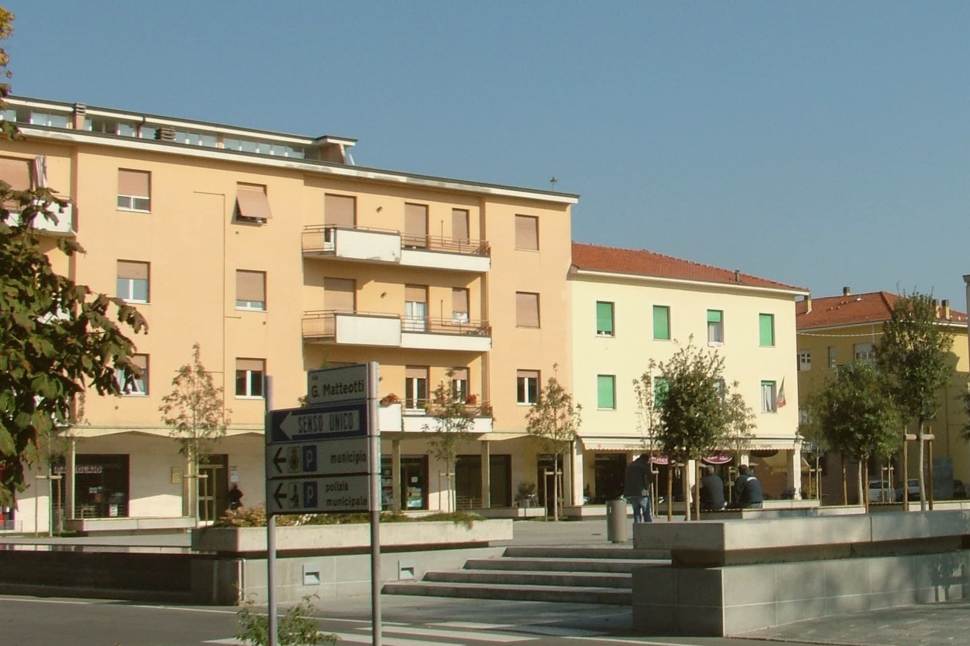
The centro lies on the flat valley floor, with the parish church set apart on the hill above it, and the two industrial sites, the dairy headquarters and the football training ground, occupying the built-up town rather than the countryside around it. The southern half of the municipality is given over to parkland: a municipal riverside park along the Taro and, further out, the wooded former hunting reserve of the Dukes of Parma.
A town shaped by a bishop's holding and a pilgrim road has ended up defined by a milk company and a football club, with its church and its woods left to mark what came before.
We confirmed you can reach this one by train.
What to see in Collecchio
- Pieve di San Prospero. The three-nave interior is reached by climbing the hill above the centro; the walls show the masonry seams of construction stretched across two centuries.
- Via Francigena. The Taro variant is marked with waystones through the centro, following the line pilgrims once walked toward the Cisa pass.
- Parco Boschi di Carrega. Wooded grounds once reserved for ducal hunting, now open with trails through the trees across the southern municipality.
How to get to Collecchio
There is a railway station in the town, so you can arrive without a car and never need one while you are here. Parma is roughly 18 minutes away by road.
Our tip
April through June and September through October are the working months on the Parma plain. The Taro valley is green in spring and dry-gold in autumn, the months when the Via Francigena fills with pilgrims walking the Parma to Fornovo stage. July and August touch thirty-five degrees with high humidity, and the centro empties between two and five.
Vignola
Why visit Vignola
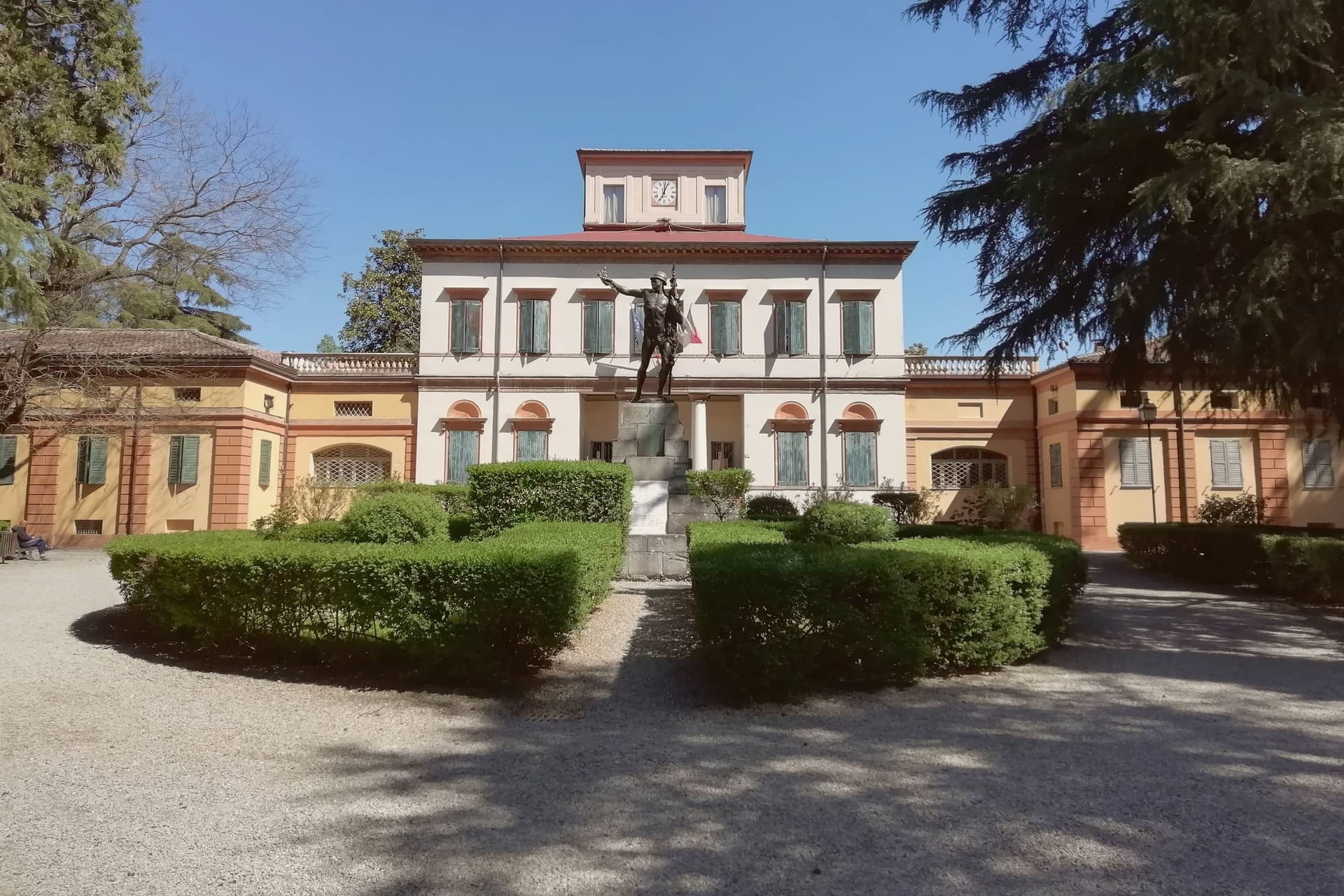
Vignola sits at 125 meters on the right bank of the Panaro, twenty-five kilometers south of Bologna and twenty east of Modena, where the Modenese plain meets the Apennine foothills. The fortress there is documented from the eighth century, raised by the Abbot of Nonantola to guard the abbey's lands before the Contrari family rebuilt it in the fifteenth century as a fortified residence; in 1577 it passed to the Boncompagni-Ludovisi, who held it until 1965.
The palace beside it takes its second name from the family that acquired it, and from the architect born in the town in 1507, who died in 1573 after a career among the leading figures of late Renaissance architecture. The cherries that carry the town's name upriver and down are IGP-protected across twenty-eight communes stretching from Modena to Bologna, and the blossom that precedes the fruit each spring fills the Panaro valley below the walls.
A disused railway, now a greenway, threads through the same ground on its way between Mirandola and Bologna. The town's identity rests on this pairing of a fortified height above the river and an agricultural valley beneath it, one lineage of stone, one of orchards, both still legible in the place today.
We confirmed you can reach this one by train.
What to see in Vignola
- Rocca di Vignola. Eighth-century origin, built to guard the lands of an abbey and later rebuilt as a fortified residence. The frescoed interiors and four corner towers stand over the river much as the rebuilding left them.
- Scala a Chiocciola di Palazzo Barozzi. The 106 steps rise with no central support, an engineering feat as much as a decorative one, tucked inside the palace next to the fortress.
- Palazzo Boncompagni. The palace passed to the family that gives it its name in the late sixteenth century and held the fortress until 1965. Its reception rooms carry frescoes alongside the staircase it is best known for.
How to get to Vignola
There is a railway station in the town, so you can arrive without a car and never need one while you are here. Modena is roughly 34 minutes away by road.
Our tip
April through June and September through October are the working months on the Panaro foothills. The first two weekends of April fill the centro with the Festa dei Ciliegi in Fiore, when the orchards along the river bloom. June brings cherries to market and the Panaro at high water.
Cervia
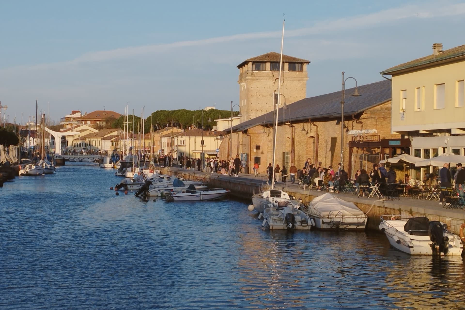
Why visit Cervia
Cervia sits at sea level on the Adriatic, twenty kilometers south of Ravenna, between the pine forest of Milano Marittima and the salt pans that have given the town its identity since Roman times. The original settlement, Ficocle, stood inside the saline itself; the move to the coast in 1697 put the grid of workers' housing where it now stands, closer to the water and to the canal port that the tower on its north side was built to guard.
The two halves of the municipality read as a pairing of extraction and leisure: the saline and the old grid town to the south, worked continuously and still yielding salt by hand at one basin, and the planted pine forest to the north, laid out as a garden-city resort in the following century. The museum inside the old salt warehouse holds two thousand years of the tools and records that connect the two eras.
The beach carries Bandiera Blu recognition along nine kilometers of coast. What holds the town together is that its shape was dictated by salt long before tourism arrived: the grid, the tower, the canal and even the forest to the north all trace back to the working of the saline, with the resort at Milano Marittima grown from land the salt industry had left standing.
We confirmed you can reach this one by train.
What to see in Cervia
- Saline di Cervia. Working salt pans covering 827 hectares, the northernmost in Italy, with the Camillone basin still harvested by hand using nineteenth-century methods.
- Torre San Michele. Defensive tower built in 1691 to protect the salt warehouses and control the canal port, on the north side of the harbor.
- MUSA - Museo del Sale. Salt museum inside the Magazzino del Sale Torre, with tools, documents and photographs gathered from former salt workers.
How to get to Cervia
There is a railway station in the town, so you can arrive without a car and never need one while you are here. Forlì is roughly 29 minutes away by road.
Our tip
May through September is the Cervia season. Late May and June hold the best balance of warm sea and quiet beach, before the Italian holiday peak. July and August bring full beach and full pine forest, with thirty-degree afternoons broken by the evening sea breeze. Festa di San Lorenzo falls in August.
Ravenna
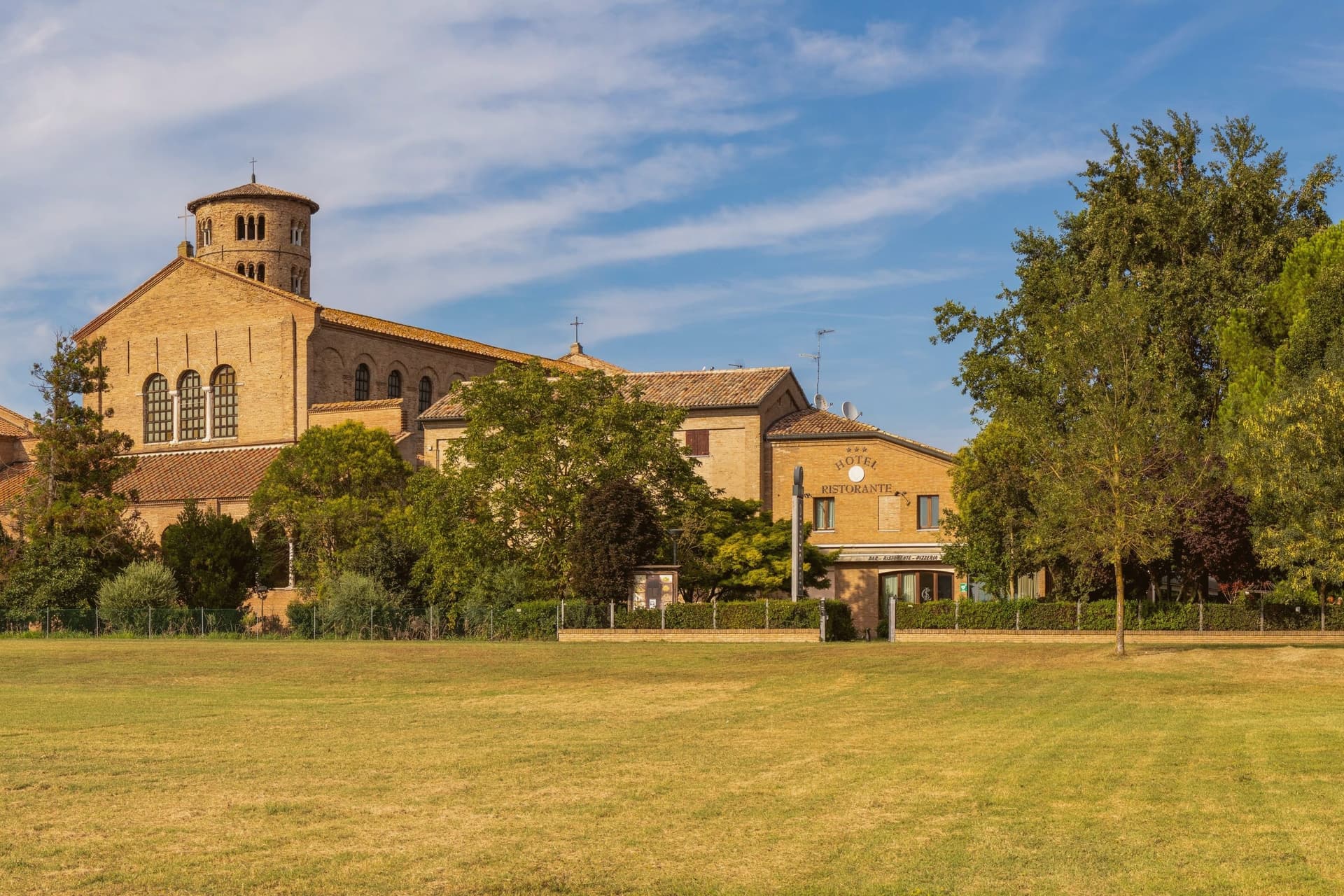
Why visit Ravenna
Ravenna sits four meters above sea level on the Adriatic coastal plain, ten kilometers from the sea and 105 kilometers east of Modena. Its position, low, flat, and close to the coast but not on it, made it defensible in a way landlocked cities were not: the surrounding marsh and lagoon kept armies at a distance while boats could still reach it.
That is why Honorius moved the Western Roman capital here in 402, why Theoderic kept it as his Ostrogothic seat, and why the Byzantine Exarchate held it for Constantinople until 751 as the last piece of imperial territory in northern Italy. Each of the three regimes built churches and paid for mosaic to decorate them, which is why the city's monuments read as a sequence rather than a single style: Roman, Gothic and Byzantine hands working in the same medium across a century and a half.
The municipality itself is split between this historic center and a stretch reaching the Adriatic, where Marina di Ravenna and Punta Marina hold Bandiera Blu beaches, so the same town that holds the fifth-century mausoleums also runs a public coastline. Population is 155,751.
What the churches add up to is less a city of monuments than a record of power changing hands, with each occupant leaving its faith in glass and gold on the walls rather than tearing down what came before.
We confirmed you can reach this one by train.
What to see in Ravenna
- Basilica di San Vitale. Octagonal basilica holding the imperial mosaics of Justinian and Theodora in the presbytery and apse, the throne room of the sequence in gold and purple.
- Mausoleo di Galla Placidia. Small mausoleum next to the basilica, vaulted in a starry blue mosaic sky with gold cross and the symbols of the Evangelists, dim enough that the gold seems to generate its own light.
- Basilica di Sant'Apollinare Nuovo. Built by Theoderic as his palace chapel, the nave walls lined with continuous mosaic processions of saints and martyrs facing each other the full length of the church.
How to get to Ravenna
There is a railway station in the town, so you can arrive without a car and never need one while you are here. Ravenna is roughly 3 minutes away by road.
Our tip
May through September is the working window for Ravenna. The Adriatic warms enough for the beaches at Marina di Ravenna and Punta Marina to fill from late May through August, and the centro storico stays open for the Ravenna Festival in June and July. The mosaics need no weather, but July and August touch thirty-three degrees and the basilica interiors hold their heat. Antica Sagra del Monticino falls in September.
Parma
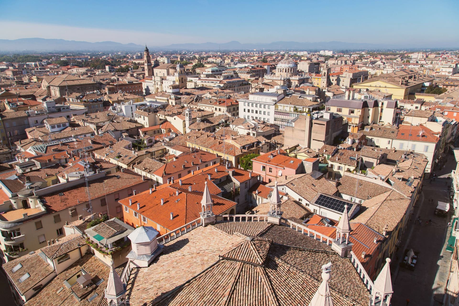
Why visit Parma
Parma sits on the Via Emilia at 57 meters, halfway between Bologna and Piacenza, the Po Valley reaching north and the Apennine foothills closing in fifteen kilometers south. Under the Farnese in the sixteenth century and Marie Louise of Habsburg in the nineteenth, the city ran its own duchy and built the institutions that still define it: the Palazzo della Pilotta, the Teatro Farnese, the Teatro Regio of 1829.
The Cathedral of Santa Maria Assunta, consecrated in 1106, holds Correggio's Assumption fresco in the dome, painted between 1526 and 1530 with a vortex of figures that read as a single rotating body. The Battistero, octagonal in pink Veronese marble, was designed and carved by Benedetto Antelami from 1196.
Arturo Toscanini was born here in 1867; the Teatro Regio still treats his recordings as house standard. The city's two food appellations, Parmigiano Reggiano and Prosciutto di Parma, carry European protected status; UNESCO named the city a Creative City of Gastronomy in 2015.
The population is 196,764.
We confirmed you can reach this one by train.
What to see in Parma
- Duomo di Parma. Cathedral consecrated 1106, holding Correggio's Assumption fresco in the dome, painted 1526 to 1530 as a single rotating vortex of figures.
- Battistero. Octagonal baptistery in pink Veronese marble, 35 meters tall, designed and sculpted by Benedetto Antelami from 1196, completed in 1270.
- Palazzo della Pilotta. Sixteenth-century Farnese palace housing the National Gallery, the Archaeological Museum and the wooden Teatro Farnese of 1618.
How to get to Parma
There is a railway station in the town, so you can arrive without a car and never need one while you are here. Parma is roughly 4 minutes away by road.
Our tip
April through June and September through October are the working months in Parma. The Po Valley clears, the colonnaded streets behind the Pilotta hold their light, and the food calendar lines up: asparagus in May, prosciutto festivals in June, Parmigiano openings into the autumn. July and August bring thirty-five degrees and the humidity that comes with the plain; the city empties in the second half of August. Palio di Parma falls in September.
More from Anywhere Italy
 The best towns inside a nature park that eat well in Emilia-Romagna
 The best hidden towns inside a nature park in Emilia-Romagna
 The best hidden towns you can reach by train in Emilia-Romagna
- The best hill towns you can reach by train in Emilia-Romagna
- The best towns you can reach by train within 75 minutes of Parma
 The best hidden towns with a food festival in Emilia-Romagna