
The 6 best towns inside a nature park in the province of Ancona
The province of Ancona keeps its wild land close to its villages. Inland, the Esino cuts through limestone in gorges where holm oak and beech climb straight up from the river, and the paths run past abandoned mills and hermitages built from the same pale stone as the houses above them. On the coast, Monte Conero drops into the Adriatic in white cliffs, with the water going a hard green over the shingle below. Spring brings orchids and wild asparagus on the ridges, autumn brings truffles, mushrooms and the province's own cured meats, and in every season there is verdicchio, drunk cold in bars where the barman has known the grower since school.
Most travellers who come to this part of the Marche head for Senigallia, where the long flat sand known as the velvet beach fills with Italian families through July and August and the town's famous restaurants book out months ahead. Ancona itself takes the ferry traffic bound for Croatia and Greece, and the coast road between the two moves slowly for weeks at a time. The beaches are good and the seafood is worth the queue. It is simply where everyone already is.
The parks continue behind and around all of that. The same limestone that makes the Conero cliffs runs inland through the gorges of the Gola della Rossa and the Frasassi karst, and the towns inside those park boundaries see far fewer visitors than the resorts an hour away. They are walled hill towns, paper towns, cliffside fishing villages, all with protected land beginning where the last house ends. These are the ones worth the detour.
Of the 13 communes we have mapped in the province of Ancona, 6 qualify as towns inside a nature park: each sits inside a regional nature park. The smallest, Genga, has 1,682 residents.
Elsewhere in the catalogue: The 9 best towns inside a nature park in Marche and The 9 best hill towns in the province of Ancona.
Genga
Why visit Genga
Genga sits at 322 meters on the Sentino river in the Apennine foothills of the Marche, seven kilometers downstream from Sassoferrato and twelve north of Fabriano. The commune is the ancestral seat of the della Genga, the noble family that gave the Catholic Church Pope Leo XII, born at the Castello della Genga in 1760.
The territory is best known for the Grotte di Frasassi, a thirteen-kilometer karst system whose entrance was found in 1971 and opened to visitors in 1974. The Abisso Ancona, a single chamber roughly 180 by 120 meters and nearly 200 tall, is large enough to hold the Milan cathedral.
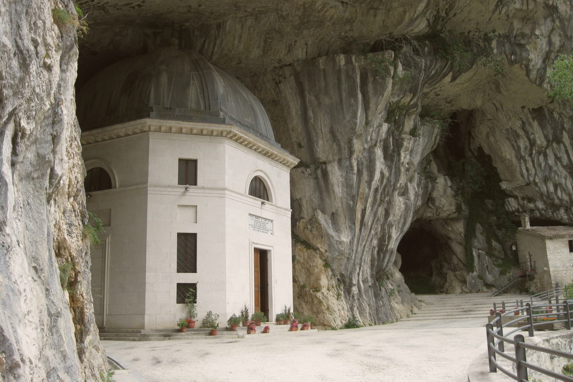
Above the cave entrance, the Tempio del Valadier, an octagonal neoclassical chapel set into a cliff wall, was commissioned by Leo XII from Giuseppe Valadier in 1828. The Abbazia di San Vittore alle Chiuse, a Romanesque Benedictine church on a Greek-cross plan, stands at the gorge mouth and dates to before 1080.
What to see in Genga
- Grotte di Frasassi. Thirteen kilometers of karst passageways found in 1971 and opened in 1974, with the Abisso Ancona chamber 180 by 120 meters wide and 200 meters tall.
- Tempio del Valadier. Octagonal neoclassical chapel commissioned by Pope Leo XII from Giuseppe Valadier in 1828, built of travertine and set into the cliff above the gorge.
- Abbazia di San Vittore alle Chiuse. Romanesque Benedictine church on a Greek-cross plan with four columns, built of local limestone, attested before 1080 at the mouth of the Frasassi gorge.
How to get to Genga
There is a railway station in the town, so you can arrive without a car and never need one while you are here. Ancona is roughly 62 minutes away by road.
Our tip
April through June and September into October are the best months for Genga. The Sentino valley turns green from April, the limestone gorges hold the cool, and the woodland trails through the Gola della Rossa park stay open through autumn. The Frasassi caves run at a constant fourteen degrees year-round; a light jacket is needed even in August.
Serra San Quirico
Why visit Serra San Quirico
Serra San Quirico sits at 409 meters on the left bank of the Esino river, at the foot of Monte Murano and the entrance to the Gola della Rossa, forty-five kilometers from Ancona. Etruscan, Picene and Roman remains have been found in the area; the Romans established a military garrison that grew into the original village.
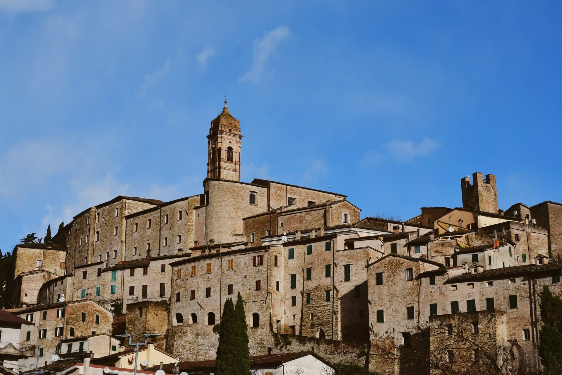
The medieval town is built almost entirely in stone and rock, ringed by walls dating to around 1300. Above those walls run the Copertelle, covered passageways that line the outer circuit, the true visual signature of the borgo.
The Santa Lucia complex, the former monastery in the centro storico, houses the headquarters of the Parco Naturale Regionale della Gola della Rossa e di Frasassi, the 9,167-hectare regional park that runs from Serra south to the Frasassi caves. The Chiesa di Santa Lucia, baroque inside with marble decoration and gold-leaf stucco, sits next door.
The Festa del Centro Storico in late July fills the stone lanes with theatrical reenactments.
What to see in Serra San Quirico
- Le Copertelle. Covered passageways running above the medieval outer walls from around 1300, the true visual signature of the stone borgo.
- Chiesa di Santa Lucia. Baroque church in the centro storico, with marble decoration, gold-leaf stucco and a Pasqualino Rossi seventeenth-century altarpiece.
- Parco Naturale Gola della Rossa e di Frasassi. 9,167-hectare regional park with headquarters at the Santa Lucia complex in the centro storico, running south to the Frasassi caves.
How to get to Serra San Quirico
There is a railway station in the town, so you can arrive without a car and never need one while you are here. Ancona is roughly 49 minutes away by road.
Our tip
April through June and September into October are the best months for Serra San Quirico. The Esino valley turns green from April, the Gola della Rossa runs cool through the limestone walls, and the autumn light brings out the stone of the Copertelle along the outer ring. July and August touch the high twenties at 409 meters; the gorge stays cooler than the valley floor and the centro storico catches afternoon breezes off the ridge. Sagra del Coniglio in Porchetta falls in July.
Numana
Why visit Numana
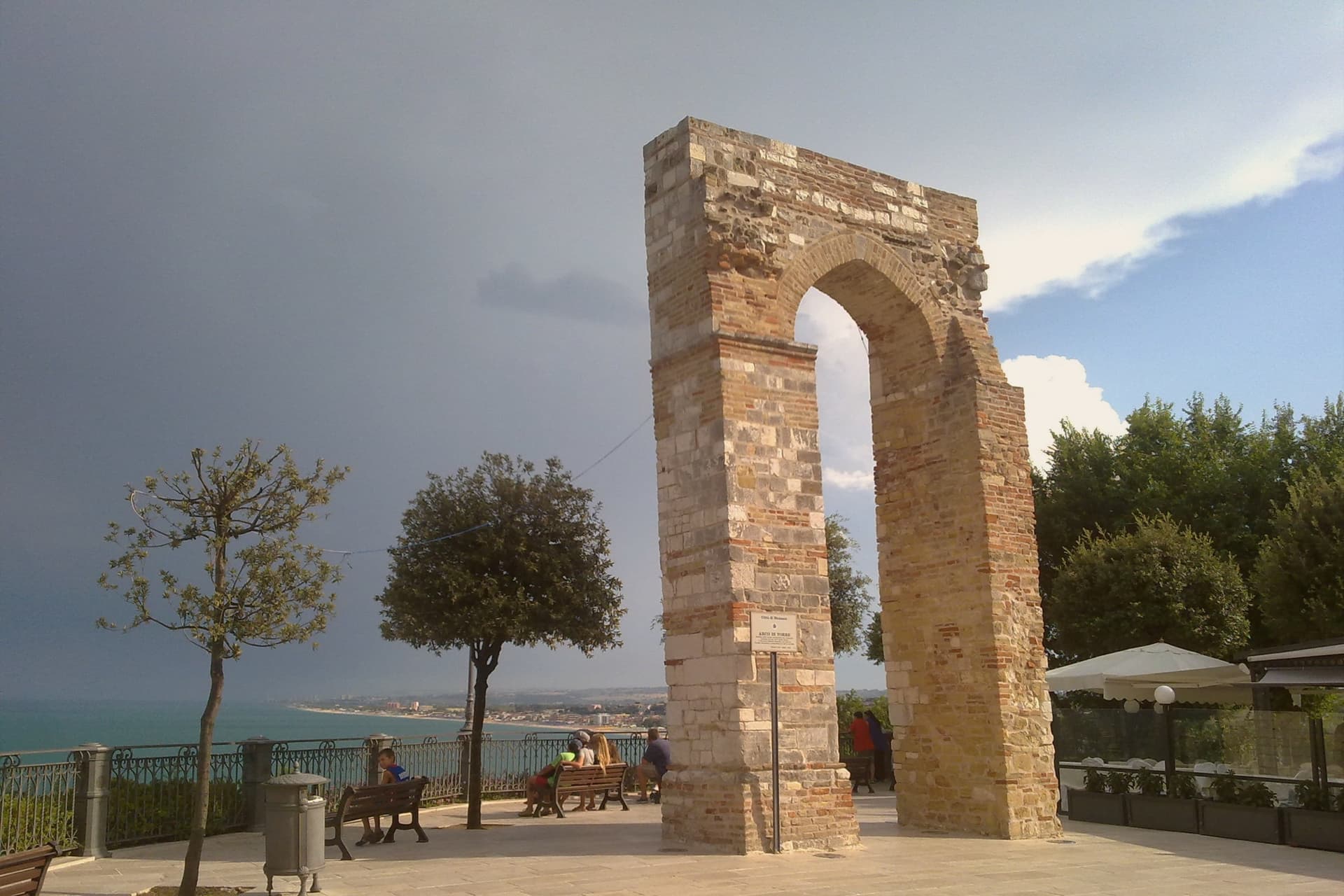
Numana sits fifteen kilometers south of Ancona, on a cliff overlooking the Adriatic at the foot of the promontory that shapes this stretch of coast. The old town, Numana alta, runs along the ridge in continuity with Sirolo, while Numana bassa wraps around the port below, so the visitor moves between two settlements joined by a single slope rather than one town with two names.
The place was a Picene harbour that traded with Greek and Etruscan ships from the sixth century BC, and a major centre of pre-Roman Italy before the rise of Ancona pushed it into decline around 500 BC. That decline is what left the burial grounds undisturbed long enough to be excavated centuries later, and it is also why the town's oldest identity is archaeological rather than architectural: a harbour that mattered, stopped mattering, and was rediscovered through what it buried.
What to see in Numana
- Antiquarium Statale di Numana. Opened 1974, holding more than five hundred Picene burials from the Conero necropolises, plus a sixth-century BC limestone warrior's head found on a Numana beach in 1892.
- Santuario del Crocifisso. Rebuilt in 1969 on a 1566 foundation, the current structure standing on a sanctuary site with roots three centuries older than the rebuild itself.
- Porto di Numana. Working fishing and pleasure port at the foot of the cliff, with daily boat services along the Conero cliffs to the otherwise inaccessible Due Sorelle beach.
How to get to Numana
Ancona is roughly 30 minutes away by road.
Our tip
May through September are the months for Numana. The Conero water clears from late May and stays warm through September, with the port's daily boats running to Due Sorelle and the other Conero cliff beaches. July and August are the busiest weeks of the Marche coast: parking is metered into the late evening and the Numana bassa restaurants book ahead.
Sirolo
Why visit Sirolo
Sirolo sits at 125 meters, twenty kilometers from Ancona, on ground that belonged to the Conti Cortesi family. The medieval village kept one of the two original castle towers, folded now into the parish church, and the belvedere above Piazza Vittorio Veneto looks out across the bay.
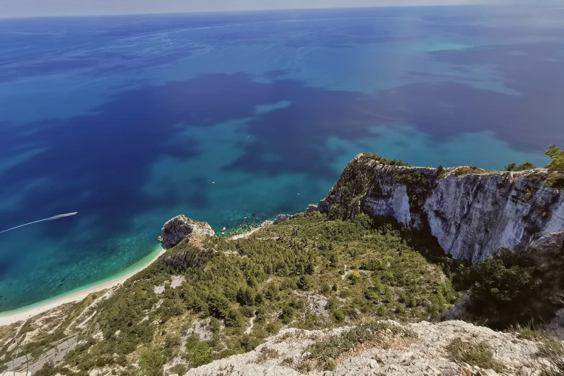
Below town, the ridge drops toward the Picene necropolis of I Pini, and further down still toward the water. The mountain above the village and the water below it are the same geology: limestone that falls straight into the sea rather than tapering through a coastal plain, which is why the village sits on a clifftop rather than a shoreline.
Upper Sirolo is the castle, the church and the theatre, all cut from the same pale stone. Lower Sirolo is reached by boat or by trail, down through the park to the cove where the sea stacks stand.
The grave goods from the necropolis have left town entirely, kept at the Antiquarium in neighbouring Numana, so what remains above ground here is the tomb site itself rather than its contents. The town doubles in summer and empties again in October: a place shaped less by what happens in it than by the drop between its two levels, the built one and the wild one.
What to see in Sirolo
- Centro storico. Medieval village on the clifftop with the Arco Gotico from around the year 1000, the Piazzetta and a belvedere looking out across the Adriatic.
- Chiesa di San Nicolò di Bari. Eighteenth-century parish church built over a thirteenth-century structure, incorporating one of the two surviving towers of the medieval Sirolo castle.
- Teatro Cortesi. Municipal theatre inaugurated in 1875, built in white Conero stone, restored and reopened in 1989.
How to get to Sirolo
Ancona is roughly 31 minutes away by road.
Our tip
May through September is the window for Sirolo. The water warms enough for the Conero beaches from late May, the boat shuttle to the Due Sorelle runs daily through summer, and the belvedere stays cool when the Adriatic plain below is hot. July and August are the busiest weeks: parking limits in the centro storico, queues for Spiaggia Urbani and Sassi Neri, evening passeggiate spilling out of every trattoria.
Arcevia
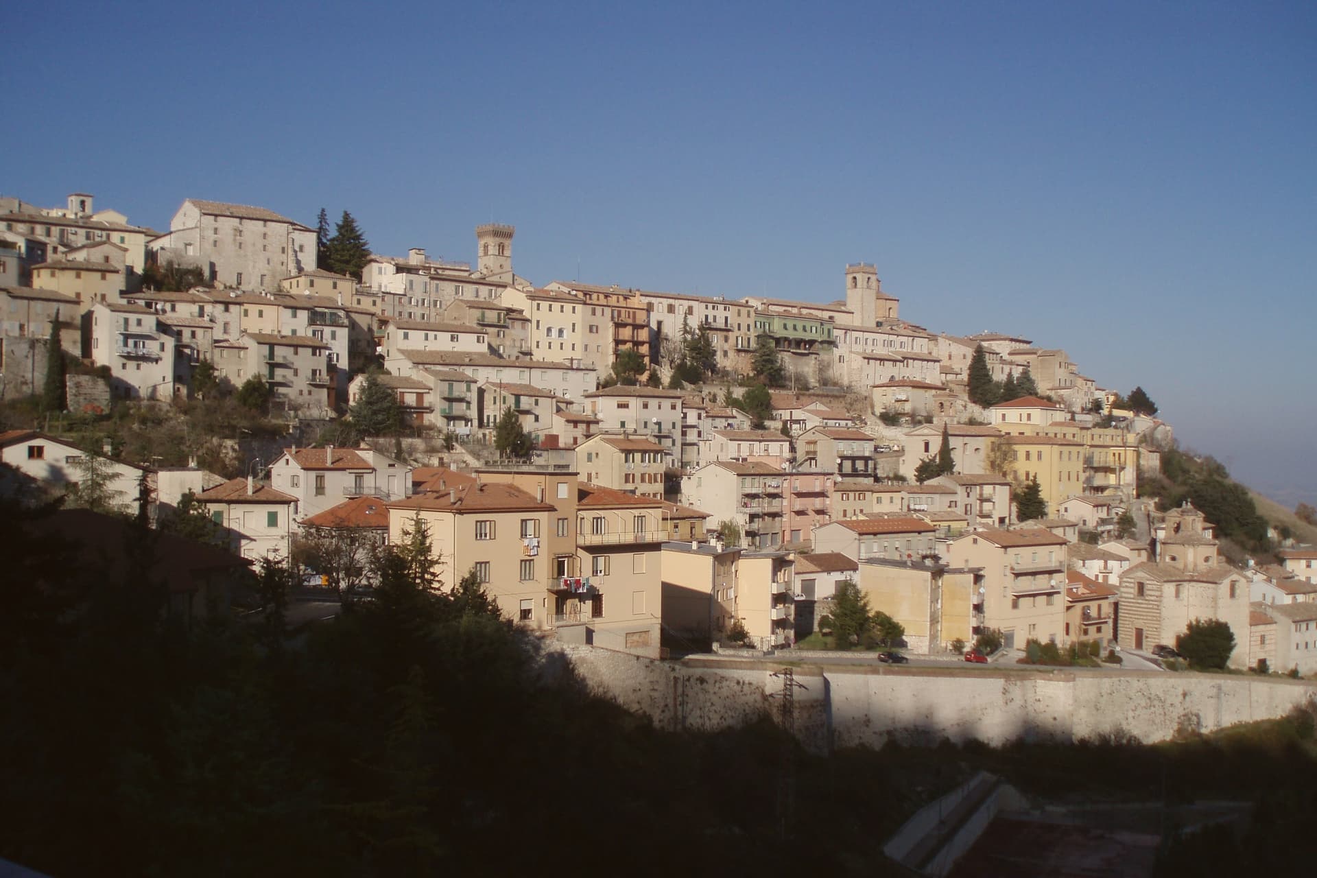
Why visit Arcevia
Arcevia sits at 535 meters between the Misa and Nevola valleys, forty-five kilometers from Ancona and inside the Parco Naturale Regionale della Gola della Rossa e di Frasassi. The town was the medieval seat of a free commune that built nine fortified satellite villages on the surrounding ridges between the thirteenth and fifteenth centuries to defend its territory against Serra San Quirico and other rivals: Avacelli, Castiglioni, Caudino, Loretello, Montale, Nidastore, Palazzo, Piticchio and San Pietro.
Loretello, the oldest, was founded in 1072 by the monks of Fonte Avellana. Each of the eight surviving castles retains its original layout, defensive walls and watchtower; together they form one of the most coherent medieval fortified networks in central Italy.
The Collegiata di San Medardo, in the capoluogo, holds a Luca Signorelli polyptych and a Giovanni della Robbia terracotta altarpiece. The Misa valley wines and the cooperative-pressed olive oil carry the local table.
What to see in Arcevia
- I Nove Castelli. Avacelli, Castiglioni, Caudino, Loretello, Montale, Nidastore, Palazzo, Piticchio and San Pietro: medieval fortified villages on the ridges around the capoluogo.
- Castello di Loretello. Oldest of the nine, founded 1072 by the monks of Fonte Avellana, expanded in the late fourteenth century, intact circuit of walls.
- Collegiata di San Medardo. Capoluogo's main church, holding a Luca Signorelli polyptych of 1507 and a Giovanni della Robbia terracotta altarpiece.
How to get to Arcevia
Ancona is roughly 69 minutes away by road.
Our tip
April through June and September into October are the best months for Arcevia. The Misa and Nevola valleys turn green from April, the vineyards on the surrounding ridges color from late August, and the woodland trails to the satellite castles stay open through autumn. July and August touch the high twenties at 535 meters; the ridge breeze keeps the centro storico cooler than the valley floor. Festa del Tartufo Nero Estivo falls in August.
Fabriano
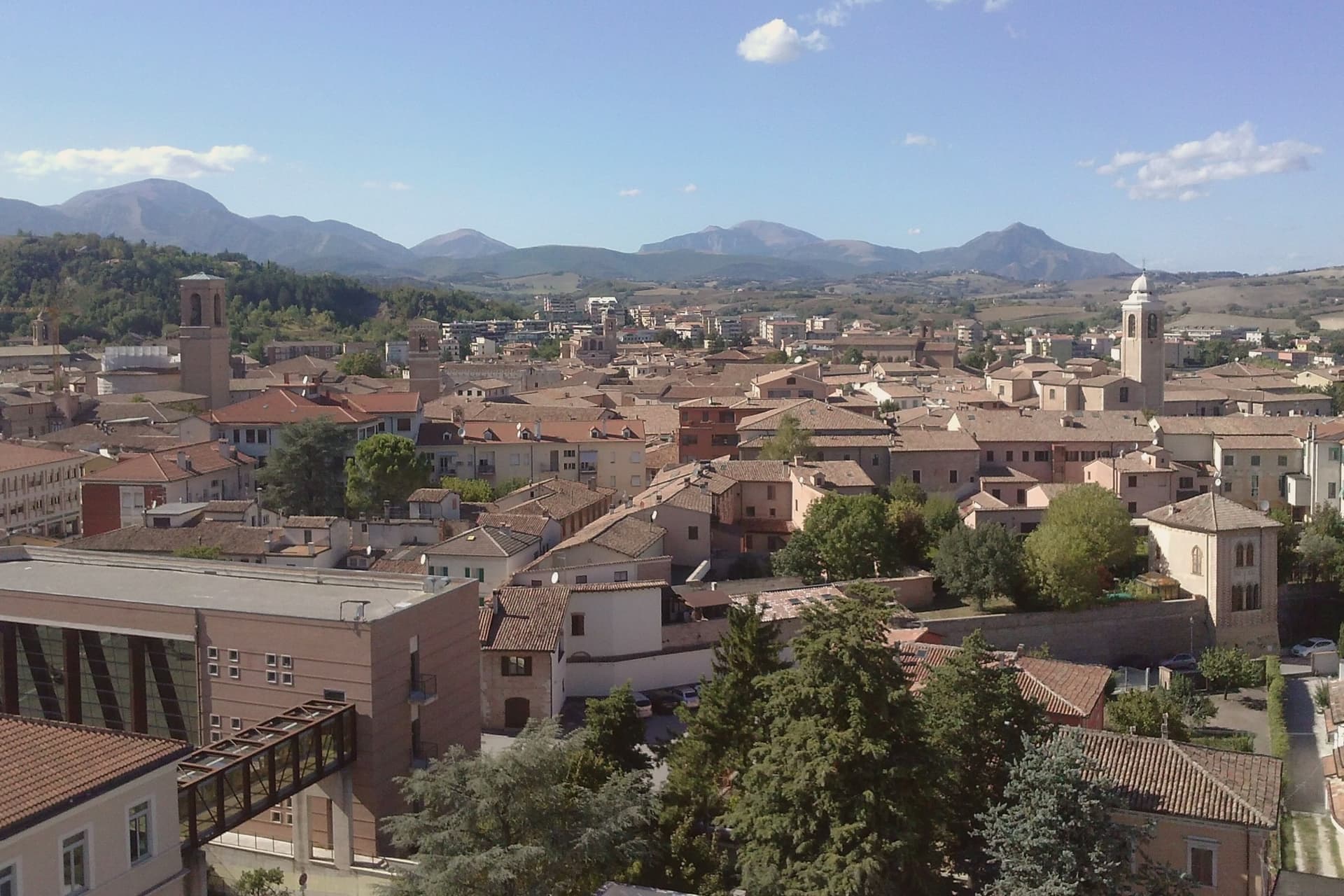
Why visit Fabriano
Fabriano sits at 325 meters on the Apennine watershed in inland Ancona province, fifty kilometers from Perugia and the Umbrian border. An Amalfi-style document held today in Matelica records paper production here from 1264, and by 1276 Fabriano was one of the earliest centers of European paper.
Its status as a UNESCO Creative City of Crafts and Folk Art rests on that continuous tradition rather than on any single building. The town's medieval wealth shows in the stone of its square, where the civic palace and fountain were both built in white Vallemontagnana stone within thirty years of each other, and in the cathedral, begun in the thirteenth century and carried through a seventeenth-century rebuilding without losing its fourteenth-century fresco cycle.
Paper, stone and paint all trace back to the same span of medieval prosperity, and what remains in Fabriano today is less a single monument than the accumulated evidence of one town's long specialization in making things by hand.
What to see in Fabriano
- Museo della Carta e della Filigrana. Paper and watermark museum in a former convent, with reproduced medieval workshops, working vats and the largest documented watermark collection.
- Piazza del Comune. Main square where the civic palace and the stone fountain still stand together as laid out in the thirteenth century.
- Cattedrale di San Venanzio. Thirteenth-century cathedral rebuilt 1607 to 1617, preserving the Cappella di San Lorenzo frescoes from the 1360s.
How to get to Fabriano
There is a railway station in the town, so you can arrive without a car and never need one while you are here. Perugia is roughly 58 minutes away by road.
Our tip
April through June and September into October are the months for Fabriano. The Apennine valley around the town runs green into May, the paper museum and pinacoteca are open without queues, and the surrounding mountains hold their snow into late spring at higher altitudes. July and August touch the high twenties in the valley; the centro storico stays cool in the stone-paved streets. Festa di Castelletta falls in September.
More from Anywhere Italy
 The 9 best towns inside a nature park in Marche
- The 9 best hill towns in the province of Ancona
 The 6 best towns that eat well in the province of Ancona
- The best coastal towns within 90 minutes of Ancona
- The best hill towns with a food festival within 90 minutes of Ancona
- The best hill towns you can reach by train within 90 minutes of Ancona